 ">
">
Hello from Lone Pine
Kennedy Meadows to Lone Pine
Hey guys! We did the Trail from Kennedy Meadows to Lone Pine. As we are just resupplying here, I wanna give you a short update about conditions!

Beautiful and snowy!
Long story short: It is beautiful!
Follow our journey on Instagram!We started on Tuesday, the 23rd of May, and had a mild start. The desert heat was still there. The ascent into the Sierra is not steep at all and already beautiful.

So far, the crossings were mild. Eventually we’ll have to turn around?
Here’s about the conditions:
We made my mother-in-law send us additional quilts for the cold night, that we put on top of our sleeping bags. Much needed, as the first night without snow was already cold. Last night, when we camped at trail pass, the temp got down
To 23° F. The whole tent was frozen from the inside.

Snow camp at Trail Pass
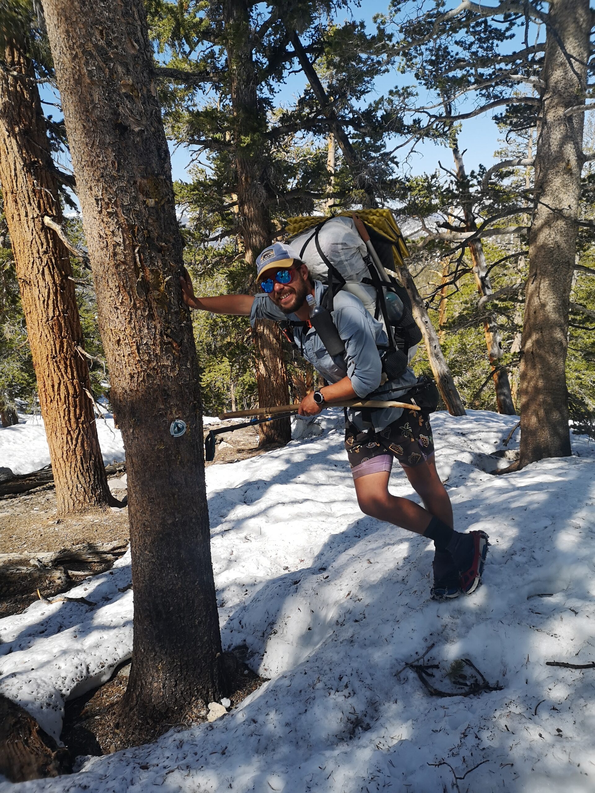
The snow was no problem at all. “Yogi,” said in here Videos: “you’ll just walk a bit higher”. The trail is easy to find, as there are many tracks from those brave souls before us. We carry micro spikes AND crampons, but till now just needed spikes. So far, we did early starts at 4 / 5 AM and could get in 2-3 miles per hour that way. We could make 14-15 miles per day that way. You can expect the closed snowcap to start at around 9600 ft on the south face and around 9100 ft on the north face.
Expect snow camping, so be prepared for that!
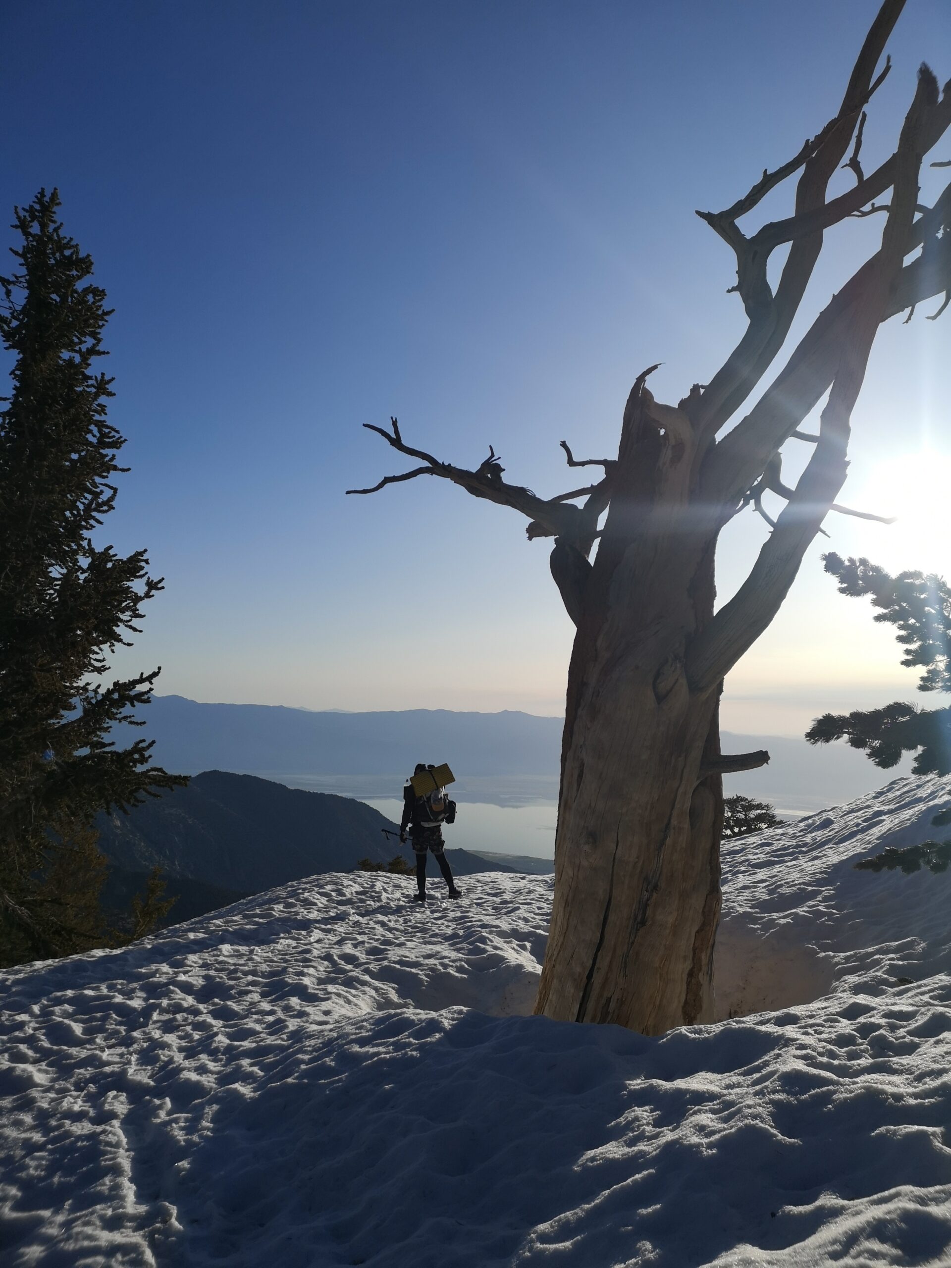
The view over Owens Valley
The resupply in Lone Pine will take
us 2 additional days. The road to the Cottonwood Campground is cleared from the snow but still closed, so we had to walk 15 miles in and out.
What of course concerns us the most is the heavy melt. The water almost touched the Bridge across the kern river at MM 707.8. The water at the Bridge at MM 717.7 is already flowing around the foundations, so as a civil engineer, I am really afraid, that these bridges won’t survive the next month, as there is so much more snow to melt up here.
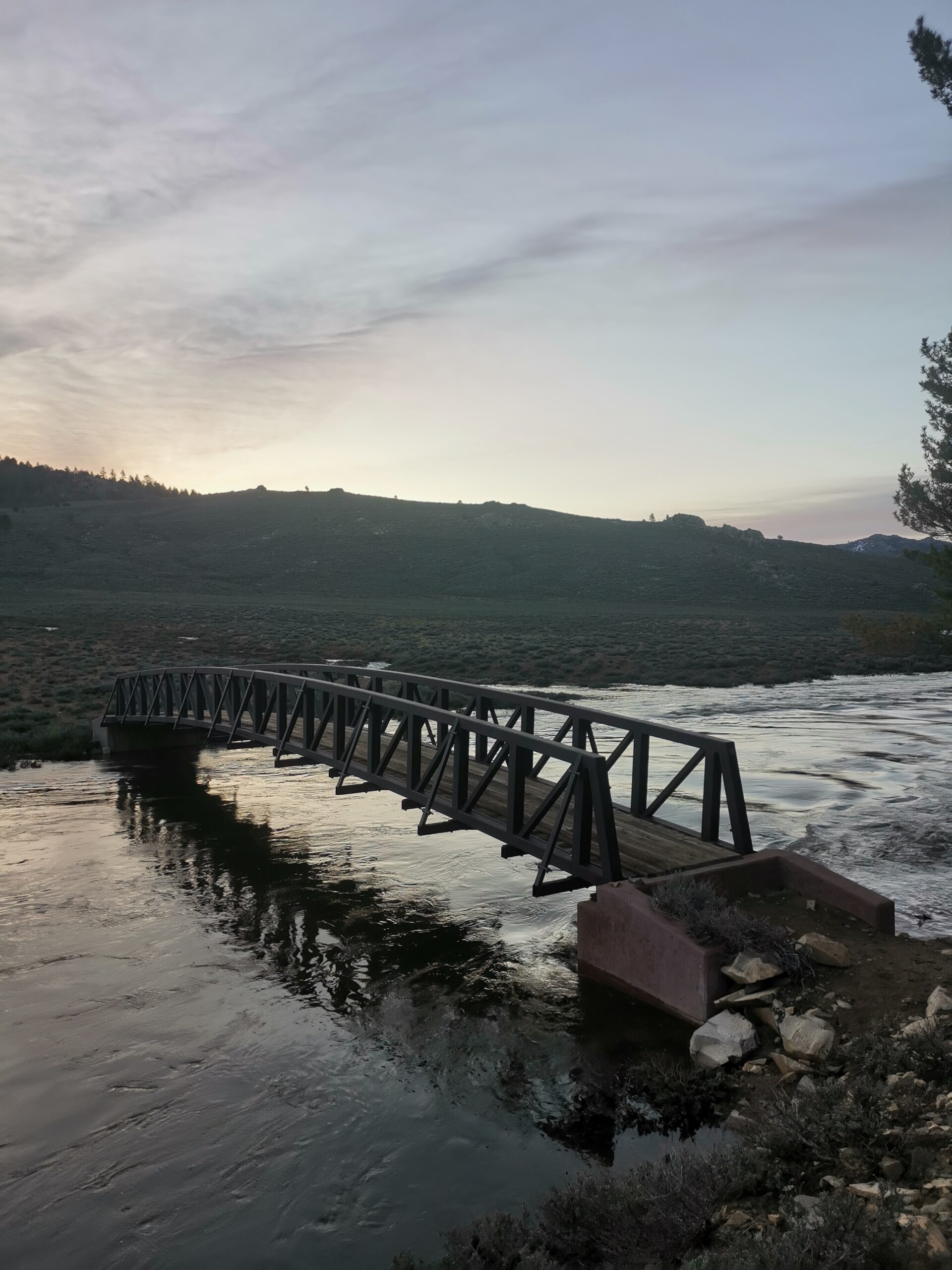
The bridge at MM 717. The water floats around the foundations
So much so far! Be sure that these are just conditional updates and no recommendation for you to go into the Sierra. It can be dangerous out there really quick and you should know what you are doing. You and no one else is responsible for what you are doing. Make sure that you know how to navigate and find tracks. Make sure you know as much as possible about avalanche risks.
If you know what you are doing, you can have fun (type one and/or type 2) and see beautiful views out there.
PCT-sign too low, or snow too high?
After the resupply, we are going back in on Saturday, and hope to get out Bishop Pass 7 days later.

This website contains affiliate links, which means The Trek may receive a percentage of any product or service you purchase using the links in the articles or advertisements. The buyer pays the same price as they would otherwise, and your purchase helps to support The Trek's ongoing goal to serve you quality backpacking advice and information. Thanks for your support!
To learn more, please visit the About This Site page.

Comments 4
With all the bridges wrecked by snow load I did not think about bridge wash outs by high water flow. Yikes!
Yeah, that concerned me as well. So many people commented on Instagram, that they camped under that thing in other years!
Amazing how quickly you go from desert to feet of snow out west. Don’t see that on the east coast. Great pics !!! How do you feel about Dortmund blowing their chance……Buyern winning again ??
It changed so quick! Within a day, we were in a complete different area! I come from Kiel, so the only Club I am interested in is “Holstein Kiel”! 😀