 ">
">
Pacific Crest Trail Section Profile: Washington
512 miles, 111,000 feet of elevation gain, and 107,450 feet of elevation loss. And you thought the Sierra were hard! Due to the south-to-north trend of hiking the Pacific Crest Trail, Washington seldom gets the praise it’s due as hikers hurry to get through before the winter storms. However, this state has such a wide variety of terrain and such incredible beauty that it’s worth hiking all by itself in the prime summer months.

The trail travels along the Cascade Range and circumnavigates three of the five major volcanoes in Washington. Four of the top ten PCT sections with the largest elevation changes are in Washington. Thankfully, you won’t have to worry about loss of breath due to altitude—most of the trail is between 4,000 and 7,000 feet of elevation. You can, however, expect to have your breath taken away by the panoramic views of mountains in every direction or by mountain goats showing their prowess at rock climbing, or even by the small and colorful wildflowers alongside the trail.
Terrain and Climate

The Cascades are extremely rugged, with steep, glaciated peaks. The river valleys are surprisingly low, creating significant elevation gains and losses throughout the trail. Due to its proximity to the Pacific Ocean, the western side of the range tends to receive a substantial amount of precipitation. Most storms will blow in from the west and get trapped around the high peaks. In Northern Washington the trail tends toward the east side of the Cascades, which are significantly drier thanks to the rain shadow effect.
Flora and Fauna
At lower elevations you’ll find yourself in lush, mixed coniferous and deciduous forest. The most famed of the trees is the Western red cedar, which has served as the backbone for the Coast Salish peoples of Washington and British Columbia. It often stands alongside the large Douglas fir and Western hemlock. The best berry-picking is in the dense river valleys, where you’ll find wild huckleberries, blackberries, blueberries, raspberries, salmon berries, and thimble berries. These forests and valleys are home to deer, black bear, cougars, and bobcats.

The subalpine and alpine areas of Washington are home to marmots, pika, mountain goats, black bear, bald eagles, and grouse. You’ll walk through fir forests and past wildflower-filled meadows.
Highlights
Mile 2,144: Bridge of the Gods
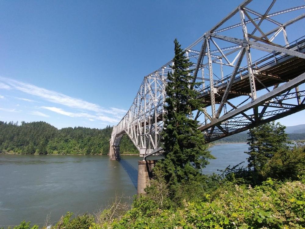
Start in Cascade Locks at the lowest point on the Pacific Crest Trail. Give the brand new PCT Monument a rub for good luck before making your way to Washington across the Bridge of the Gods. Try not to look down as you walk over the open steel grating with the Columbia River rushing by 140 feet below.
Miles 2,198-2,211: Indian Heaven Wilderness
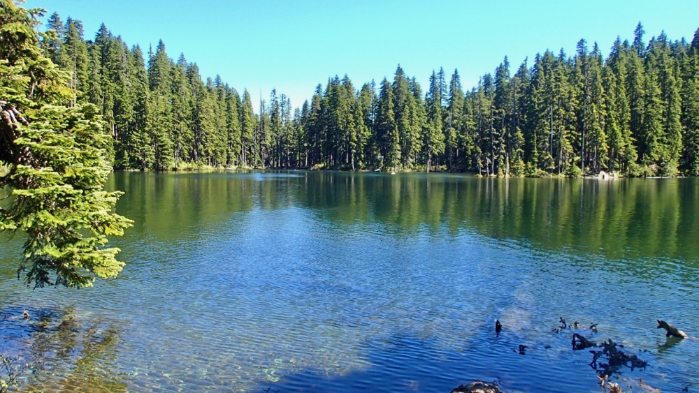
Gorge on huckleberries and enjoy a cool swim in one of the many lakes of this traditional hunting and gathering land of local native tribes.
Mile 2,226: Trout Lake
The small, hiker-friendly town of Trout Lake, about 14 miles southeast of the PCT, has a restaurant, some lodging, and a grocery store that accepts resupply packages.
Mile 2,233: Mount Adams
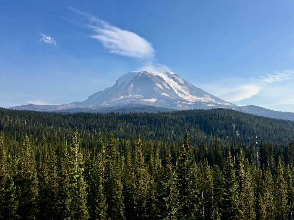
The trail passes along the western flank of Mount Adams, giving you a close-up view of the 12,281-foot peak. This is the closest hikers come to one of the five potentially active volcanoes in Washington.
Miles 2,254-2,288: Goat Rocks Wilderness

Hike for miles above treeline under the jagged peaks of an ancient volcano. One of the most famed parts of the entire PCT is Knife’s Edge at the north end of this wilderness corridor. This area has one of the best close-up views of Mount Rainier.
Mile 2,294: White Pass
Walk half a mile west along Hwy 12 to reach the small White Pass Ski Resort. The Kracker Barrel convenience store accepts resupply packages and has a decent assortment of fresh food. The White Pass Village Inn is hiker friendly and offers laundry and loaner clothes, a hiker box, and outdoor decks to relax at.
Mile 2,321: Mount Rainier National Park

The trail flirts with the eastern boundary of Mount Rainier National Park and passes right over the historic entrance arch for the eastern portal of the park at Chinook Pass on Hwy 410. Hikers often hitch a ride into the park at this junction.
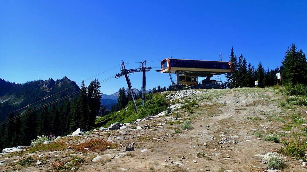
Mile 2,390: Snoqualmie Pass

Hike under the lift chairs and down part of the ski slope at Snoqualmie Pass ski resort to reach a junction with Interstate 90. Catch a ride west to visit Seattle or pick up your resupply from the Summit Inn or the post office in the Chevron gas station.
Miles 2,392-2,458: Alpine Lakes Wilderness
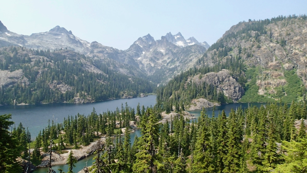
Enjoy a sliver of this 400,000-acre wilderness area, which encompasses soaring peaks and hundreds of alpine lakes.
Mile 2,461: Stevens Pass
The trail deposits hikers right at Stevens Pass Resort after a descent along a handful of ski runs. The resort accepts resupply packages and has a small cafe open daily. Dining options are only available on Fridays, Saturdays, and Sundays. Catch a hitch west to Gold Bar or east to Leavenworth for the nearest grocery store.
Miles 2,497-2,570: Glacier Peak Wilderness

Get views of 10,525-foot high Glacier Peak from many angles and vantages as the trail circumnavigates the volcanic mountain. One of the best views is on the descent from Red Pass at mile 2,504.
Mile 2,572: Stehekin Valley Road

Catch the Red Bus for the 50-minute drive along the Stehekin Valley Road. Hop off at the Stehekin Pastry Company or continue a few more miles to the town site of Stehekin.
Miles 2,572-2,585: North Cascades National Park

While in Stehekin visit the North Cascades National Park visitor center to get a free camping permit for the first night after Stehekin. This park was founded to help protect the peaks and valleys of the remote North Cascades mountains.
Mile 2,588: Rainy Pass
Cross Hwy 20 in Rainy Pass. The town of Mazama is 22 miles to the east with a store, an outfitter that accepts resupply packages, restaurants, and motels. Mazama is the home of trail angel Ravensong, who is the first known woman to have hiked the PCT solo.
Mile 2,625: Pasayten Wilderness

Enter the rugged and remote Pasayten Wilderness. Walk ridgelines and take in epic views of Mount Baker and Mount Shuksan to the west.
Mile 2,650: Canadian Border

The official end (or beginnning!) of the Pacific Crest Trail. The wooden monument was replaced just last year and stands in the middle of the Slash, a 20-foot-wide borderline cut in the forest.
Mile 2,659: Manning Park Lodge

Apply for the Canada PCT Entry Permit before you leave so you can hike on nine more miles through Manning Provincial Park to reach the lodge. Enjoy a free shower and get a fresh meal before catching a shuttle to Vancouver.
Check out the Rest of the Pacific Crest Trail Here

This website contains affiliate links, which means The Trek may receive a percentage of any product or service you purchase using the links in the articles or advertisements. The buyer pays the same price as they would otherwise, and your purchase helps to support The Trek's ongoing goal to serve you quality backpacking advice and information. Thanks for your support!
To learn more, please visit the About This Site page.

Comments 1