 ">
">
Palmetto Trail Day 24-26 – Capital City, Fort Jackson, Cook Mtn Passages
Capital City Passage
10 miles
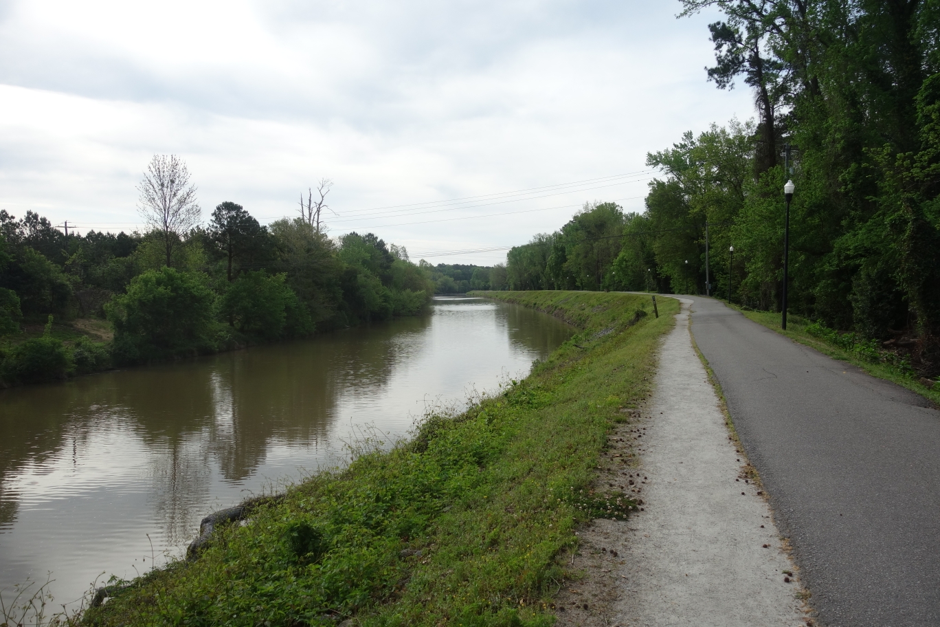
The Western edge of the Passage starts on the Columbia Canal – Riverfront Park. This is a two mile section with alot of runners and walkers following the river. Alot of interpretive signs are posted throughout the section. The canal was built in 1824 to allow trading along the river to come into Columbia as well as connect to Charleston. At this spot the Broad and Saluda River join forming the Congaree River. You can see the huge boulders that dot the river cause white water rapids, then turn around and see the calm waters of the canal. Currently the canal provides the city with its drinking water.
The trail then walks through downtown Columbia where there are historic signs posted at each street crossing explaining when and who the streets were named after. This continues all the way to the State Capitol building then it winds its way through the campus of South Carolina University. The day I walked through was a parade in honor of the SCU Women’s Basketball Team for winning March Madness this year.

Back while hiking the Foothills Trail I ran into a group who worked for the USC Recreational Department. The trail goes right in front of the gear shop, so I stopped in and had a nice chat. We talked about hiking and I got to see how they run there programs and prepare trips for students. And I was able to replenish water.

After leaving USC the trail enters residential neighborhoods. The HQ for the Palmetto Trail is 2 1/2 blocks North of the trail and I proceeded to make another stop. It was really cool to meet everyone that was there. Besides my terrible stench they were gracious hosts and allowed me the run of water and snacks. We talked about the trail and I got the scoop on the new Cook Mtn Passage. My detours in town did not allow me to finish, so I went to my Hotel and prepared for the parade.
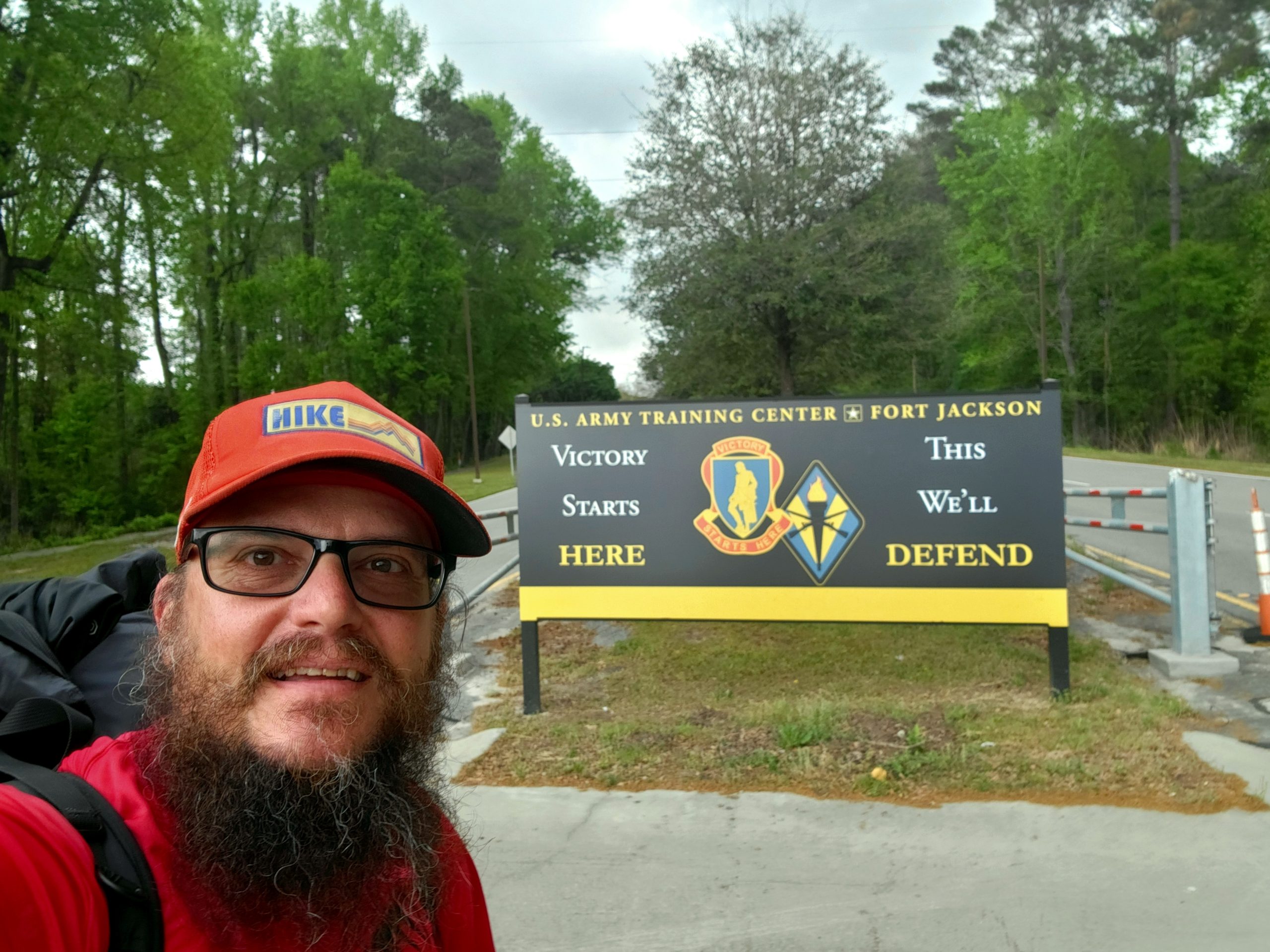
The following morning I got back on trail and continued the final three miles to Fort Jackson. I ran into a young girl selling lemonade and stopped for a glass. Her father came out and we talked about the trail that came right down his street. Then the neighbor came out and we talked about his shed being built in the backyard. Once we were done talking it was on toward the Army base.

Fort Jackson Passage
16 miles
For civilian hikers you must go to Gate 2 and get a background check completed for a pass. As a retiree I just showed my ID Card and went through the front gate. This is required for the first five miles of the Passage. Once the trail winds its way through the main part of base, it exits out gate 5.
Then the trail parallels the highway the final 11 miles. I was worried about what to do at the end of the day going through this section. But at the HQ yesterday I found out there is a Recreational Area on the base and as a retiree I was able to secure a tentsite. It was a short day today but I knew I have a long stretch after this so decided to call it by mid afternoon.

The following morning I start on the remaining six miles to the end of this Passage. The final 1/4 mile is a SCARNG nature trail. I did not follow the whole nature trail but there were interpretive signs placed for info on local animals.
Cook Mtn Passage
9 miles
Now this Passage is not complete. From what I understand the trail is marked in the Wateree Heritage Preserve & Wildlife Management Area. I followed Westvaco Rd across Highway 601 to the Northeast Sanitary Landfill on a sandy street. Luckily all the dump trucks that use the road go slow. Once at the landfill you turn right on Screaming Eagle Road for a few miles around the landfill. This land goes through some hunting club with alot of signs all over the place. I stayed on the main road and did not take any side roads that were blocked by gates.
Eventually I find the Wildlife Management Area and the road that goes up to Cook Mtn. The top has a huge building with a nice view of the area looking over the Wateree River and as far East as you can see. I meet a group of three who are part of the Midland Butterfly Club. Who helped me identify a butterfly I just took a picture of. The area here is very nice and know it’s going to be a beautiful area to come visit when the trail is complete.

This website contains affiliate links, which means The Trek may receive a percentage of any product or service you purchase using the links in the articles or advertisements. The buyer pays the same price as they would otherwise, and your purchase helps to support The Trek's ongoing goal to serve you quality backpacking advice and information. Thanks for your support!
To learn more, please visit the About This Site page.
