 ">
">
PCT Week 21: Back to California
We are now reconnecting where we left off to Washington because of the fires. This part of the trail, between Ashland and Etna was closed for a longer time due to the McKinney Fire. The PCT is now open again, allowing us to cross the border between Oregon and California. So we are finishing two states in a short time: Oregon and California. All the time we can see Mount Shasta looming in the distance, marking the end of our journey south.
PCT Day 126: Back to trail
Old Highway 99 (mile 1718) to mile 1702.6
25.8km (16mi) / 6.25h / elevation gain of 1,035m (3,395ft)
It’s an easy hitch out of Ashland. We don’t have to wait long in front of the onramp to the highway until somebody stops and takes us back to the trail. Stephanie is 85 years old and lived in the Ashland area for 30 years. She’s a sweet lady.
It’s a long climb up, 12 miles but mostly gentle. There are just a few steep parts, most of them in the beginning. Soon we have nice views of Mount Shasta towering in the distance. Later we can see back to Pilot Rock and some smoke not far away from that. Is it a new fire? It got really warm the last few days, today it’s even 91°F. It’s like summer again. The shorts and the sweat are back. Fortunately, there is enough water on the trail again as I need it today.

We get to a picnic table that has a faucet and even wifi from the nearby lodge. So nice of them to share it with us PCT hikers. Unfortunately, there are some biting flies here too. I thought we got rid of them. Apparently, there is a beehive at the side of the trail that I didn’t even see or hear. But they attack Popeye and he gets stung by one.

We are making good progress today despite the elevation and the heat. We arrive at the campsite just when it gets dark. Actually, we want to cowboy camp but after the visit of two spiders, I’m not so sure about that anymore. After three spiders I can’t take it anymore and pitch the tent. Never had an issue with spiders before on the PCT. I really don’t like them.
PCT Day 127: Reaching California, again
mile 1702.6 to mile 1679.3
38.5km (24mi) / 8:45h / elevation gain of 1,189m (3,900ft)
We slept well and free of spiders. The night was very warm and it’s already hot in the morning. It’s quite a climb today and the trail offers some pretty mountain views including Mount Shasta. Also, the trail is easy today. There are just a few blowdowns, but nothing else that slows us down. I meet two hunters, dad, and son and we see them again at a water source on a road. They know the area very well.

We are reaching the Oregon/California border for lunch. We finally finished a state. It will be a weird order. First Oregon, then it will be California, and then Washington (hopefully). It’s such a good feeling to be here.

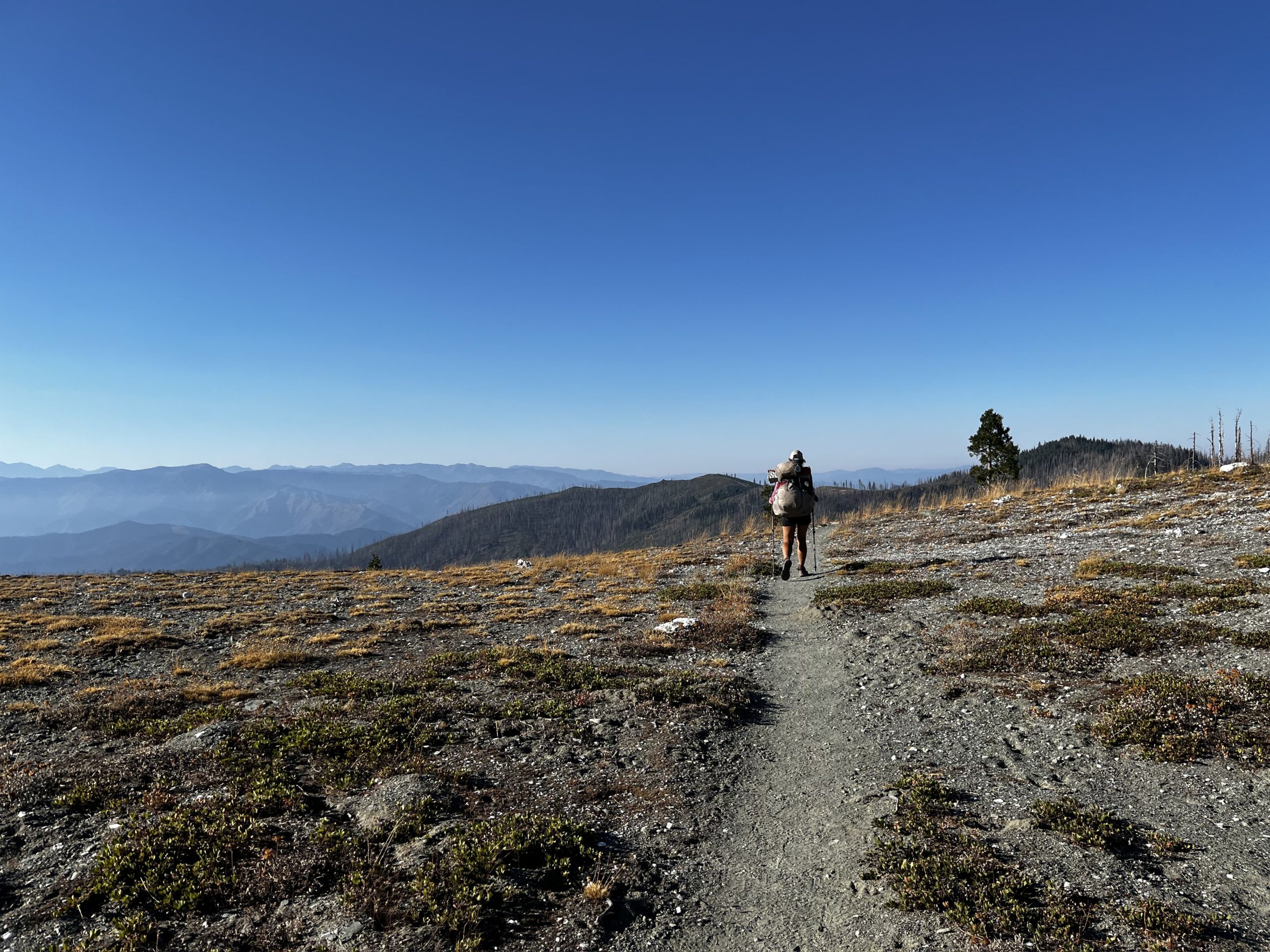
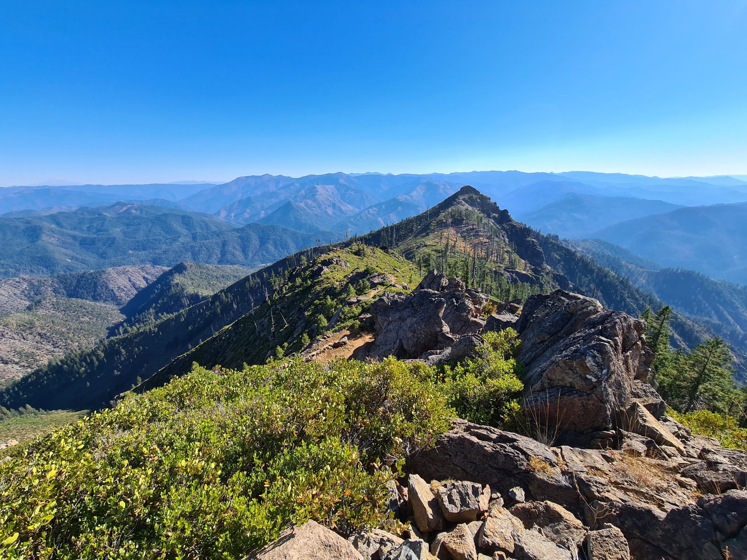
We climb up some pretty ridgelines with great views of the mountains. Most parts of Oregon were more single peaks that stood out but here it’s just mountains everywhere.

We reach the last water source where I have to go steeply down, but I don’t have enough water anymore, so I have to go. Not so bad after all, but the flow is slow and it takes a while to fill the bottle.

On the last miles, we get an amazing sunset until we reach our cowboy camping spot for tonight. We got quite boujie with food as we only had food carries for three days in the last weeks. So we got Nutella, tomato paste, oatmeal, and all sorts of nice stuff. Nutella goes into tortilla crepes together with cookie crumbles as a dessert after dinner.

PCT Day 128: Getting into Seiad Valley
mile 1679.3 to Seiad Valley (mile 1656.4)
38km (23.7mi) / 8:45h / elevation gain of 724m (2,375ft)
I get annoyed by a single fly that hovers over my head in the night but I tuck my head into the sleeping bag. It’s nice how there are still stars outside when you wake up but the sky gets brighter and gets ready for dawn.
When we start walking I get quite some scratches from bushwhacking through the overgrown trail. I also fall two times. The first time is because I roll my ankle and the second time I get stuck when trying to climb over a blowdown. But who am I to complain? Because Popeye gets stung by wasps three times shortly after another. I have no idea why they are so attracted to him. Nothing ever happened to me, I don’t even see many wasps. So yeah, we get quite beaten up today.

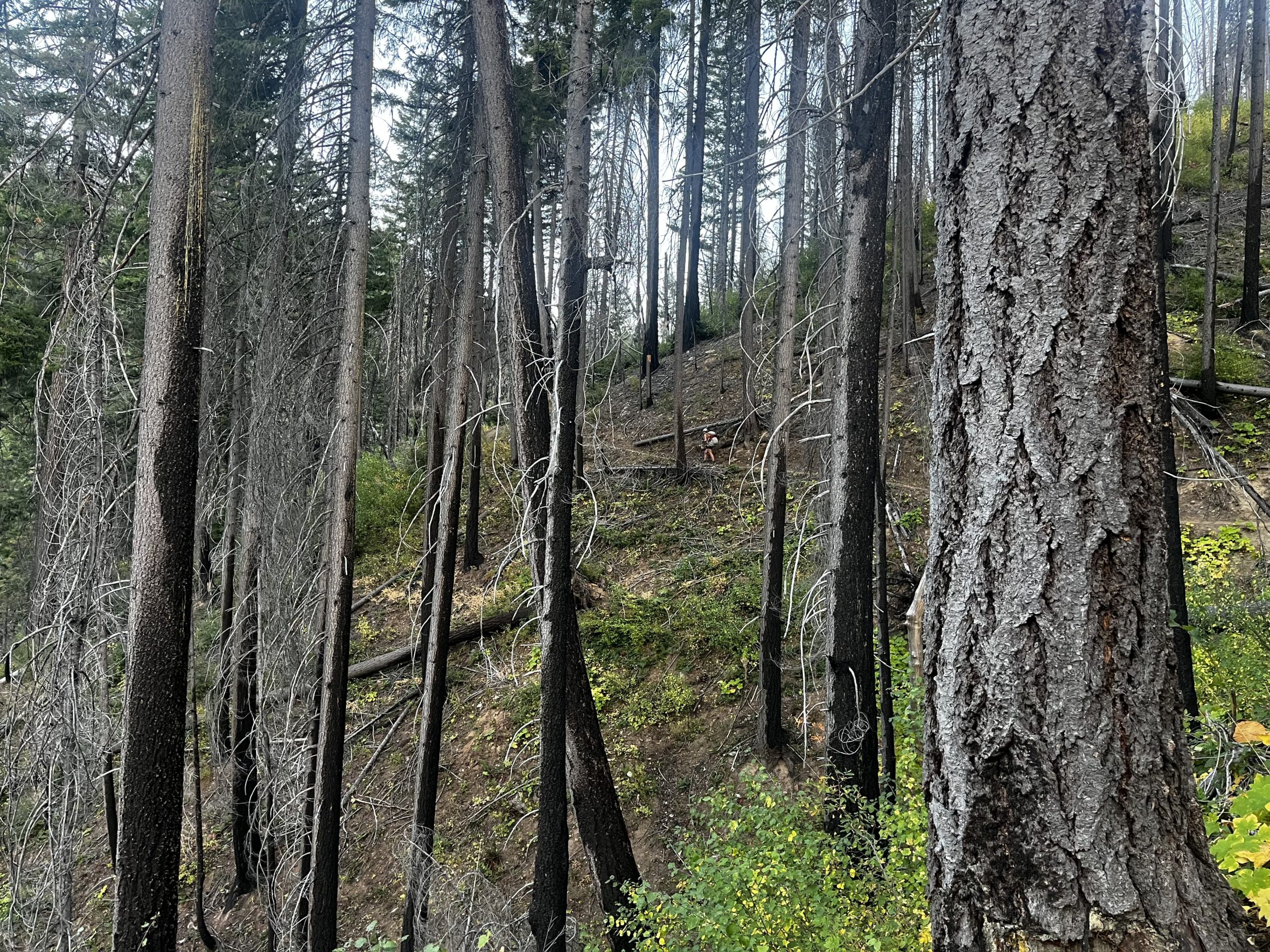
We get to a slow-flow spring by a road. Suddenly there are lots of people, day hikers, and quite some people who are doing trail maintenance which is badly needed on this part of the trail. We are heading uphill and it’s very exposed to the sun and therefore very hot. It got up to 90° Fahrenheit today, it’s like summer again. We take a lunch break at the top in the shade before we are continuing on a nice ridge walk followed by some more bushwhacking. It’s hard to find the trail in the overgrown, it goes steeply downhill for 1,400m (4,593ft) and it’s hot. I totally scratch up my legs here. I’m just happy that we don’t have to go up that shitty trail.
We finally hit the road and walk into the little settlement of Seiad Valley. We get to a campground where we can stay for 15$ for both of us, including an unlimited shower. And Bill and his wife one of the caretakers, are even offering to make us dinner as the Café is already closed. We quickly go to the general store up the road but it’s already closed when we get there. But the owner is still there and opens up the store for us so we can do a quick resupply. Back at the campground and after a shower, Bill’s wife gives us a large bag with ingredients for making burgers along with chips and fruit. Wow, we didn’t expect that at all. I’m stunned by this kindness. It’s perfect. What a lovely evening.

PCT Day 129: A long road walk
Seiad Valley (mile 1656.4) to mile 1639.4
27km (16.8mi) / 7h / elevation gain of 1,077m (3,533ft)
It’s really cold in the morning. Cherry, the owner, makes us some breakfast with yogurt and granola. Cherry went through a lot in her life. She made it through some hurricanes and the fire this summer which destroyed her house but somehow she’s still cheerful. We go and get second breakfast at the café. The lady there who cooks and serves is at first grumpy but then she opens up and is really nice. She is sad about her mom that passed away not too long ago and it’s sometimes hard for her to be here as they ran the restaurant together. That’s the reason why the opening hours are a little bit irregular at the moment. Also, this is the home of the pancake challenge. When you finish 5 huge pancakes in two hours you get them for free. This year one hiker accomplished it and he hiked out and up the mountain 1.5 hours after it. Astonishing. I’m struggling with eating only two smaller ones. But somehow my hiker hunger never returned after the time off trail.

Now we have a long road walk out of town ahead of us. It’s 6 miles in the sun and it’s hot and miserable. I got a tiny blister yesterday that hurts but for some reason I can’t pop it. Then a long climb starts but at least it’s mostly shaded in the trees and there is plenty of water on the way. But we rely too much on the last water source before the planned campsite and it’s barely flowing when we get there.

We manage to get water with some engineering that includes a rock, a leaf, and the closing bar of a cnoc bottle that serves as a little pipe. This takes a while so we have to do the last bit in the dark. We are lucky as this section just got cleared from lots of blowdowns and it was overgrown. People are complaining that it’s as bad as the obstacle run at Apache Peak back in Southern California.
We take the first campsite we see just next to the trail. Tonight we sleep at a concert of frogs. No idea where they come from as there appears to be no water but who knows? I like that much more than complete silence where every sound is suspicious and alerting.
PCT Day 130: A last big climb
Mile 1639.4 to mile 1618.5
34.2 km (21.3mi) / 8:45h / elevation gain of 1,570m (5,150ft)
We continue the climb from yesterday. In the morning it’s not too hot and the incline is gentle, so it’s not very hard. The pink flowers that used to grow especially in burned areas are now gone and turned into a white fluffy mess. We reach Buckhorn Spring where we refill our water and from here it’s not very far to the top anymore. But that’s not it for elevation for today. There is more, much more.

We are on a beautiful ridgeline with extensive views. Then the trail descends to a little lake just to go up again. We find some cows with bells peacefully grazing on the mountainside. I feel at home with that sound. It’s weird to hear it here but I guess it makes sense when you have your cows up here. You’ll never gonna find them again without the bells. We take our lunch break somewhere in the middle of nowhere.

Then we pass the last reliable water source on trail without knowing that the only one before the planned campsite is not just downhill and off trail but apparently also means some bushwhacking to get back to trail according to comments on FarOut. At least it’s a loop instead of just one way. We meet two hunters and ask them if they saw any other water but there apparently is nothing else. So, we have to bite the bullet and go down there. The way back to the trail is hard to find as it’s overgrown. We get lost and make our way cross-country. It’s just a short bushwhack but the first part is swampy and then there is a lot of stuff in the way like blowdowns and dead branches. But it’s short enough to be entertaining and not long enough to get us frustrated.

Up at the trail again we see an amazing sunset. It appears to be a bit smokey which makes the craziest sunset colors. But then it gets dark quickly and we have to do a bit of night hiking again. We are making the best of it with some music. Finally, we reach the tentsite with a view of the full moon. Popeye is getting hangry already, so it’s time for dinner.

PCT Day 131: Last townstop before finishing California
mile 1618.5 to Etna Summit Trailhead (mile 1599.7)
30.2km (18.8mi) / 7.5h / elevation gain of 800m (2,624ft)
We wake up in the dark and experience a beautiful sunrise when we start hiking at 7am. Early mornings are great once we manage to get out of the warm sleeping bags which is always the hardest part of the day. On one side of the mountain, the sun rises and on the other side, there is still night with the moon fully up.

We see a blue shimmering mountain lake below us that reminds me of the Sierra as it’s surrounded by sheer rock. It’s a beautiful mountain landscape with a mix of ridge crests and mountain slopes. Mount Shasta crowns the distant horizon again. There is also some burned forest offering views in between the trees. In summer this section must be dreadful. When the biggest hiker bubble reached it it was well over 100° F. Actually it’s perfect to hike this in fall. No heat, no mosquitoes, no people. It’s the way to go.

We take a lunch break at the side trail to a spring. Horses pass by as we sit there, the only people we see today. We don’t take long breaks in order to get to the road. We get there by 4pm but the road is very lonely. There are just 2 cars in 30 minutes but the second car takes us all the way to Etna. It’s two hunters who take us in the back of their pickup truck. I started to appreciate that Americans love pickups so there’s always space for us.

Etna is a great little town. It’s small enough that you can walk everywhere but they still have everything you might need: Grocery stores, laundry, accommodation, an outfitter, and an amazing French bakery that has the best bread I ever had on trail. Also, their pastries and sandwiches on crispy Foccacia bread are awesome.


This website contains affiliate links, which means The Trek may receive a percentage of any product or service you purchase using the links in the articles or advertisements. The buyer pays the same price as they would otherwise, and your purchase helps to support The Trek's ongoing goal to serve you quality backpacking advice and information. Thanks for your support!
To learn more, please visit the About This Site page.
