 ">
">
PCT Week 22: Finishing California
This is our last section in California and we are reconnecting footsteps at Mount Shasta. We are going through the rugged expanse of two wilderness areas, each studded with granite peaks and sparkling lakes until we reach Castle Crags and Mount Shasta.
PCT Day 132: On our way to finish the last section of California
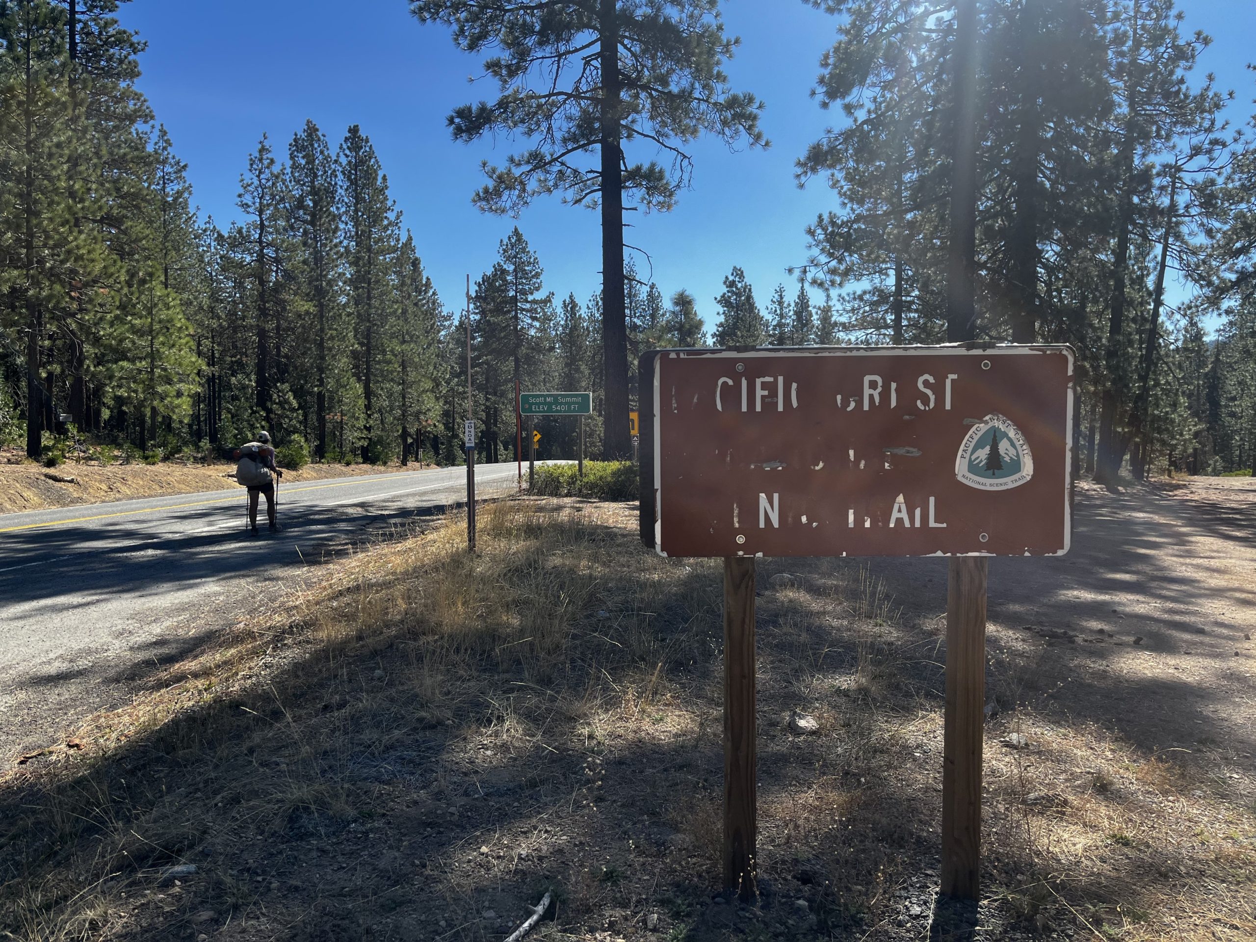
Etna Summit Trailhead (mile 1599.7) to mile 1590.8
15.6km / 4h / elevation gain of 742m
We have breakfast at the French bakery in Etna, it’s so good. I pack out bread but unfortunately, I didn’t get good cheese as the Gruyere was too expensive at the local supermarket. So, I just got Cheddar and hoped it would be decent. It’s not.

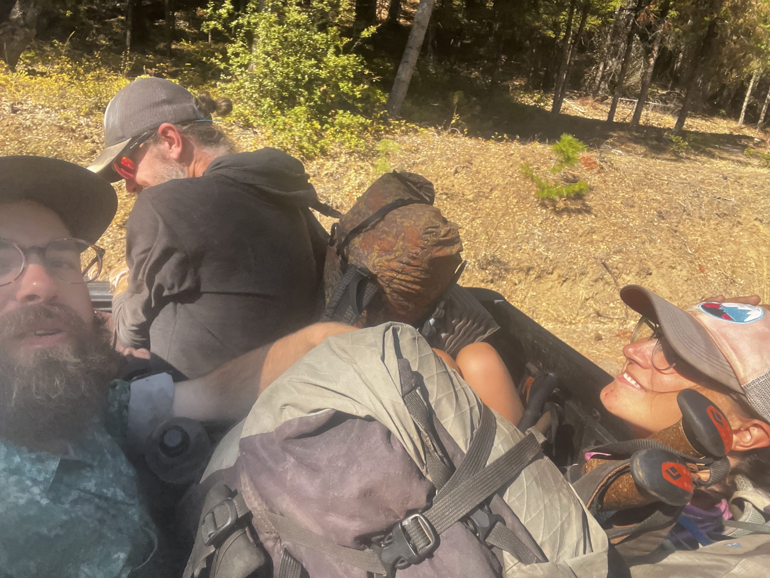
We start walking on the road out of town, together with Hippie, a fellow hiker we met at Diamond Lake in Oregon. It’s so hot down here and I really don’t like walking the road in the sharp sun. It looks like this gonna be a tough hitch. I stop in the shade and Gale stops for us but she is very grumpy. Gale really is one of a kind. She sounds like she doesn’t want to take us but she does it anyways. She calls us city slickers when the others ask her why the cows here have bells. Then she drops us off somewhere on the road to get us out of town, so every car that comes will go all the way up to the trailhead. Gale is definitely in the top 3 of the most interesting hitches we had. The second one was Shizzle who told us a lot of prison stories and claimed to be an alien. He took us from Bucks Lake to Quincy. The third one was Allan who took us on our way to San Francisco and drank quite some beer while he was driving. Mike comes by and takes us the rest of the way, he even gives us beer. He knows Gale and says she’s a tough one.
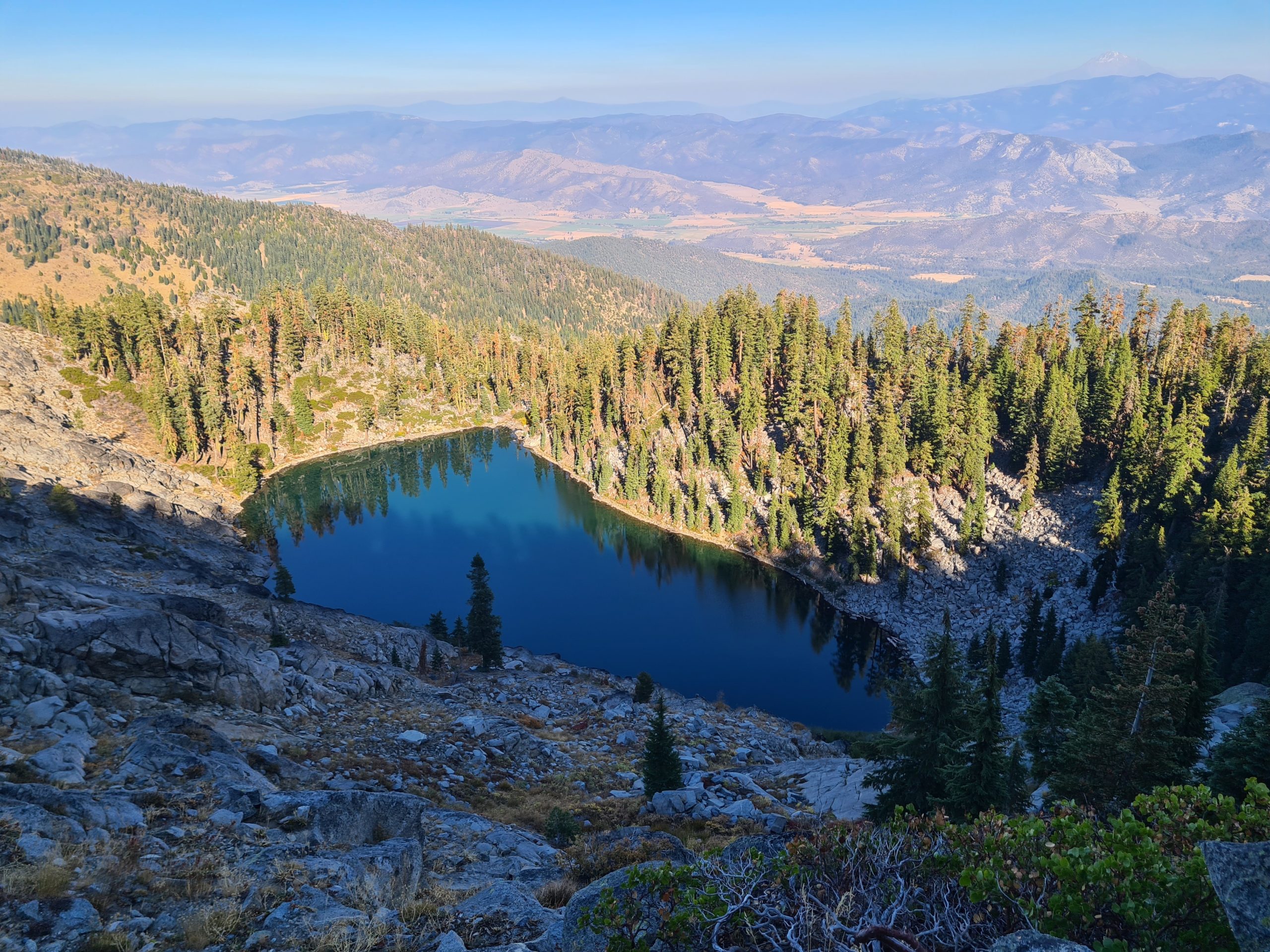
It’s a hard climb from the road and it’s hot. I feel tired and weak. But we have beautiful views of the valley and a mountain lake below us. Then the trail goes downhill to the first water source where we meet Hippie again who passed us earlier.
We get to a saddle and take a wrong turn. We follow the trail downhill instead of taking the trail straight. To me, it looked like somebody blocked it with branches. Sometimes people do that to show that this is not the right way. So I don’t even think about it and go downhill. I even thought to myself that I’m happy that we don’t have to go uphill with these tight switchbacks. Luckily Popeye looks at the map after a while and sees that we are off trail. We were already halfway down. So we turn around and have to go up all the switchbacks again.
On the way up we meet Hippie, he also took the wrong turn. So it was really easy to miss it. We lost some time on this one, so we just go 1 mile more to the next campsite. Unfortunately the water source there is dry, but we have enough water to make it to tomorrow morning. The next stream is not too far away but there are no campsites for the next miles, so we stay where we are. We spend the evening with Hippie until he pushes on to the next water. He’s doing thruhikes for 5 years now and is going for the triple crown. A deer is visiting us at night. Thankfully it’s always deer and never a bear or a mountain lion.

PCT Day 133: Last big climb
mile 1590.8 to mile 1572.2
30.1km / 7.25h / elevation gain of 1,042m
We continue our way to the next water source where we fill up. The sun just touches the tips of the mountains around us and lets them glow. There is a bit of reception at a little pass that I use to order new shoes. The fifth and last pair for the trail.
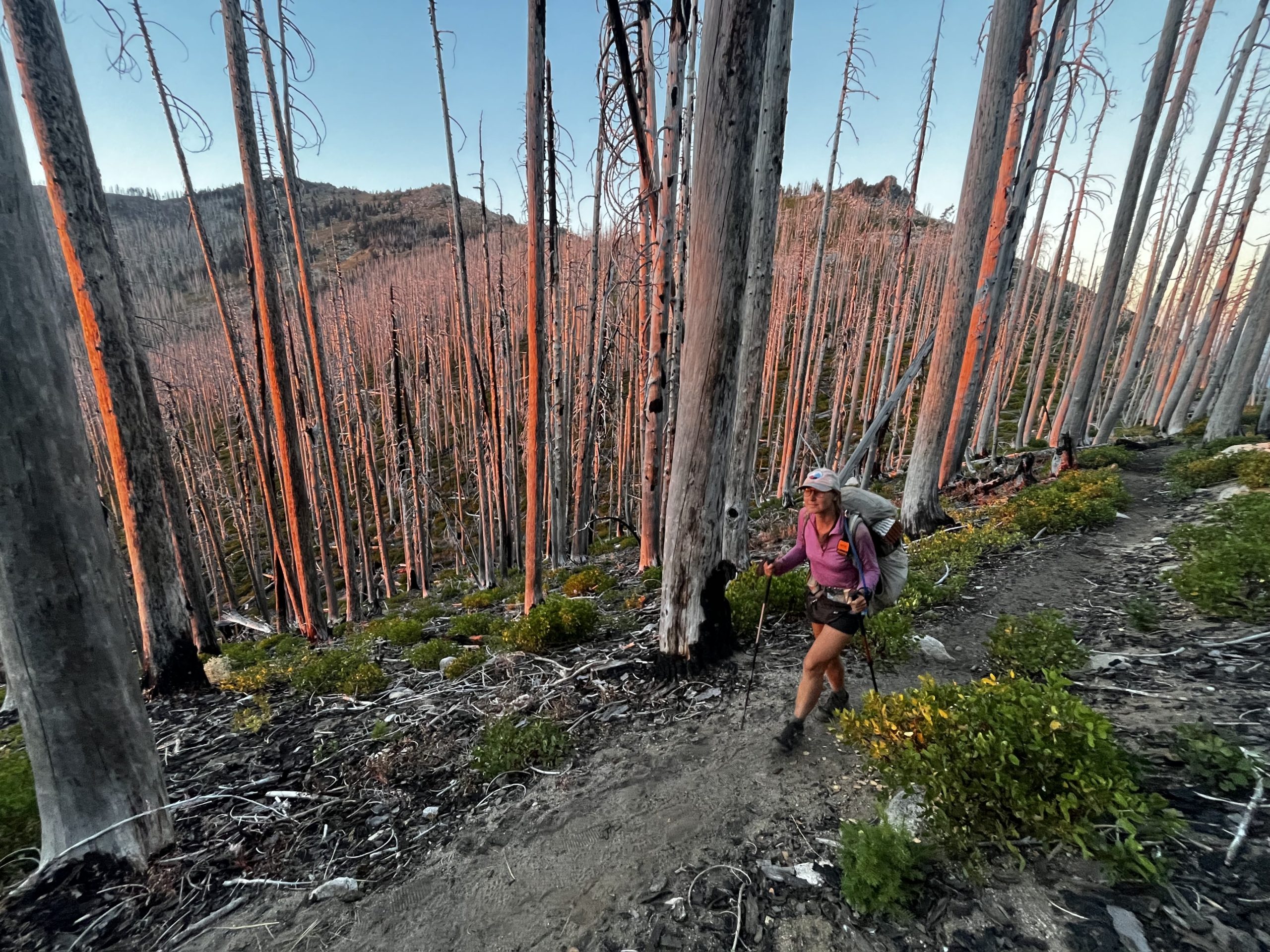
It’s quite some up and down today. Before we hit the road we take a lunch break. Unfortunately, a stomach ache slows me down after that. We hit the road and continue through an extensive burn area to the next spring. After a break here I feel better and can get back to my old pace. But still, we don’t make it very far today.

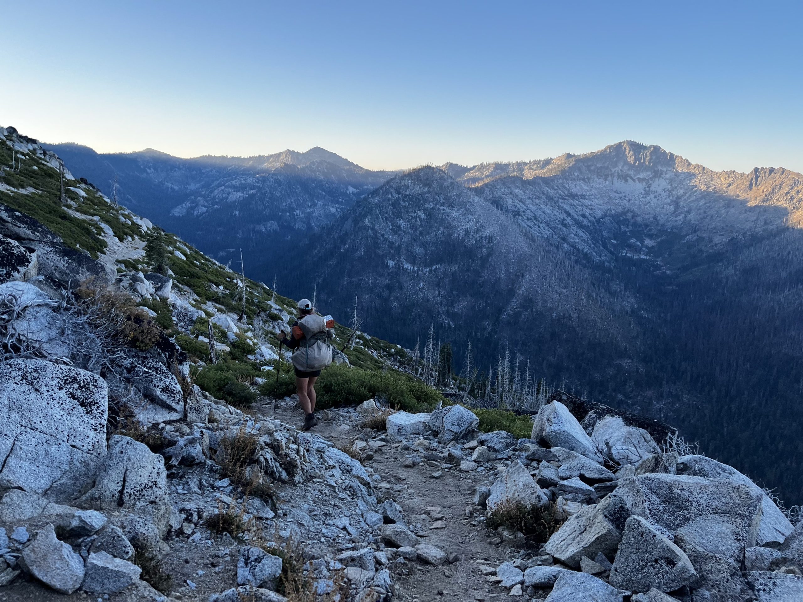
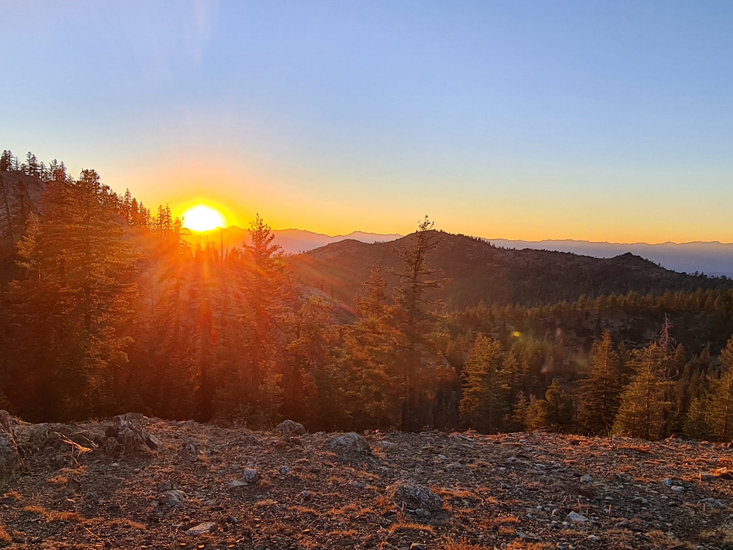
The last climb leads us up a ridge where we set camp for the night. At least we make it here before it gets dark and enjoy the sunrise. We have a pretty view into the valley below us. An owl flies by as we eat dinner. lIt’s a great site for cowboy camping and the starry night sky is jaw-dropping.

PCT Day 134: Now the easy part starts
mile 1572.2 to mile 1549.6|
36.4km / 8:15h / elevation gain of 766m
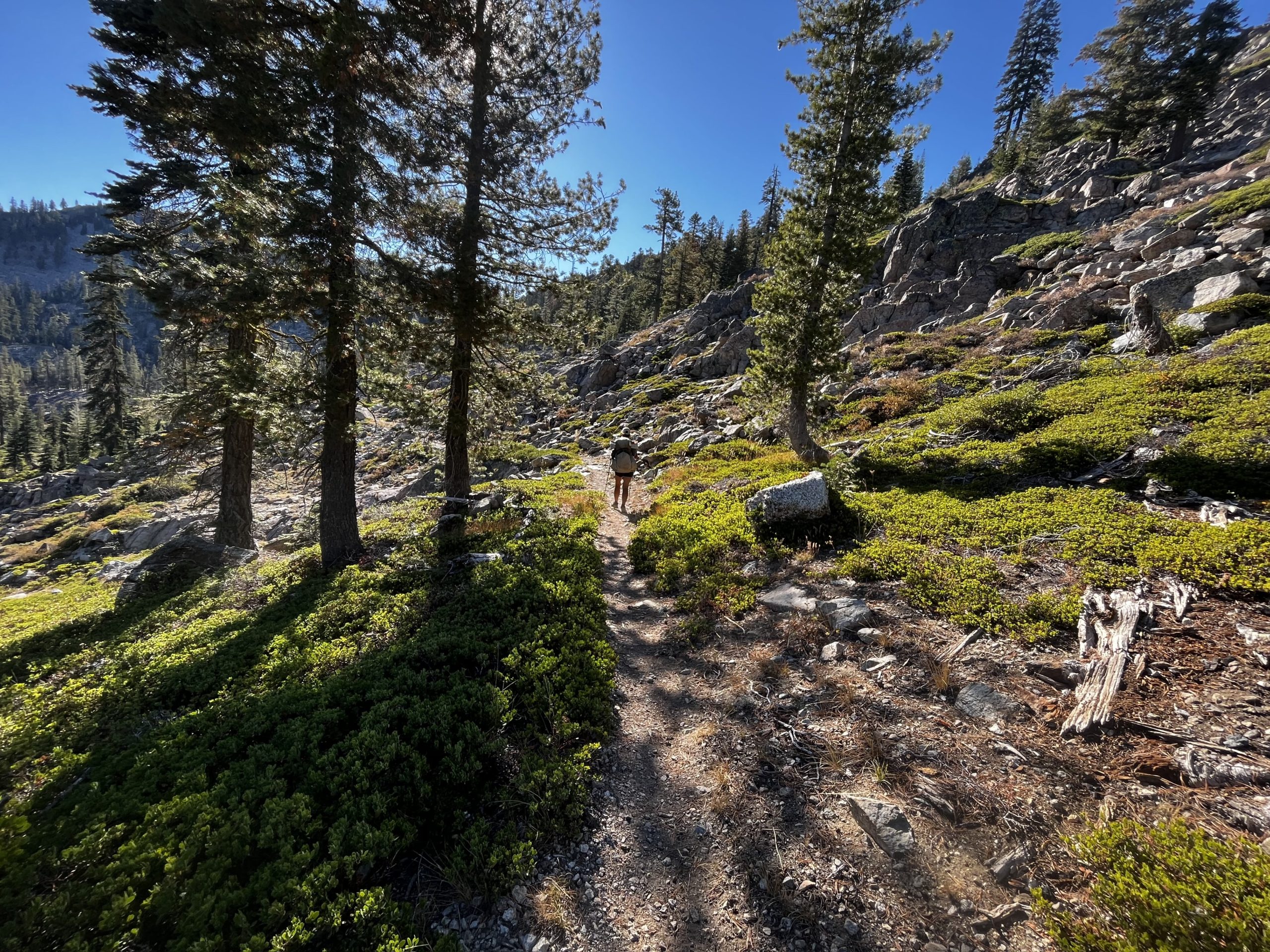
The hardest part regarding elevation is behind us. Now it’s an easy trail for the rest of our way through Northern California. Today’s climbs are just a few and very gentle, so we can cover some more distance. Also, the trail takes us north now for a lot of miles, making a big detour on our way south.

The morning starts with some amazing views of the valley below and the mountains around us. Then we get into the forest for most of the rest of the day. We do our lunch break near the highway. Not very wisely chosen as there is a dirt road nearby where logging trucks come down and lay a lot of dust on us.
From here it’s a gentle climb up to the next water source. It’s an easy walk to the last climb of the day which is also very gentle and hardly noticeable. The higher we get we can see more of the landscape around us. This morning we still had dramatic mountains around us and now it’s just forested hills. We get to a spring and a close-by campsite on the ridge with a great view. We arrive at the right time for the sunset. It’s nice to arrive again before it gets dark and have time to admire the sun going down. But it’s getting earlier every day now. The sun now goes down at 6.30pm and rises at 7:20am. That doesn’t leave us very much hiking time anymore. We have to be more efficient. Mostly we cut our lunch break much shorter now than we did in summer.
PCT Day 135: Mount Shasta is back
mile 1549.6 to mile 1525.5
39.5km / 8:45h / elevation gain of 584m
It was a little chilly last night, cowboy camping. Also, the zipper of my sleeping bag broke and I have to be very careful that it doesn’t open all the way.

We have an easy day ahead of us. It’s like a long stroll. We start the day as soon as the sun comes up and pass beautiful Bull Lake. We make a loop around another little lake until we hit the road. It’s the weekend and there are a lot of day hikers around. Also, there are bees. Finally, the direction of the trail turns south again now. We continue to our lunch spot at pretty Deadfall Lake. There are bees too. We can sit in peace for maybe 10 minutes after they spot and annoy us. At every place, we stop today there are bees. Luckily, no stings.

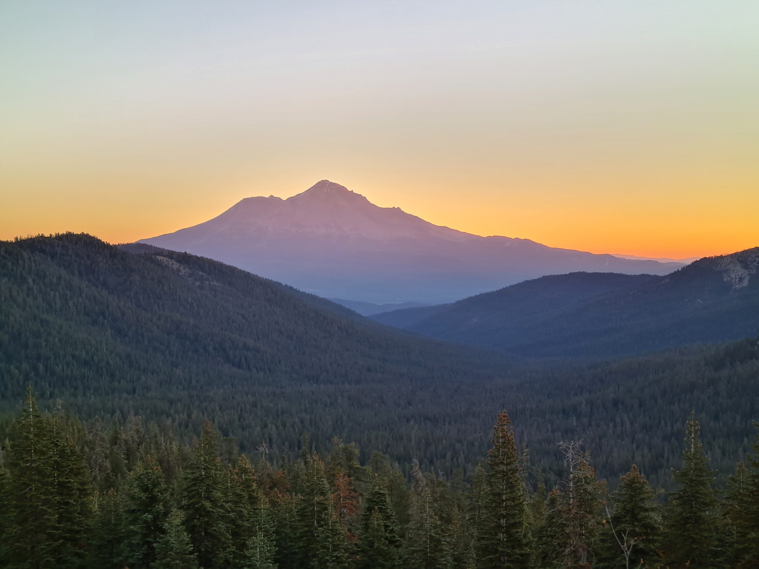
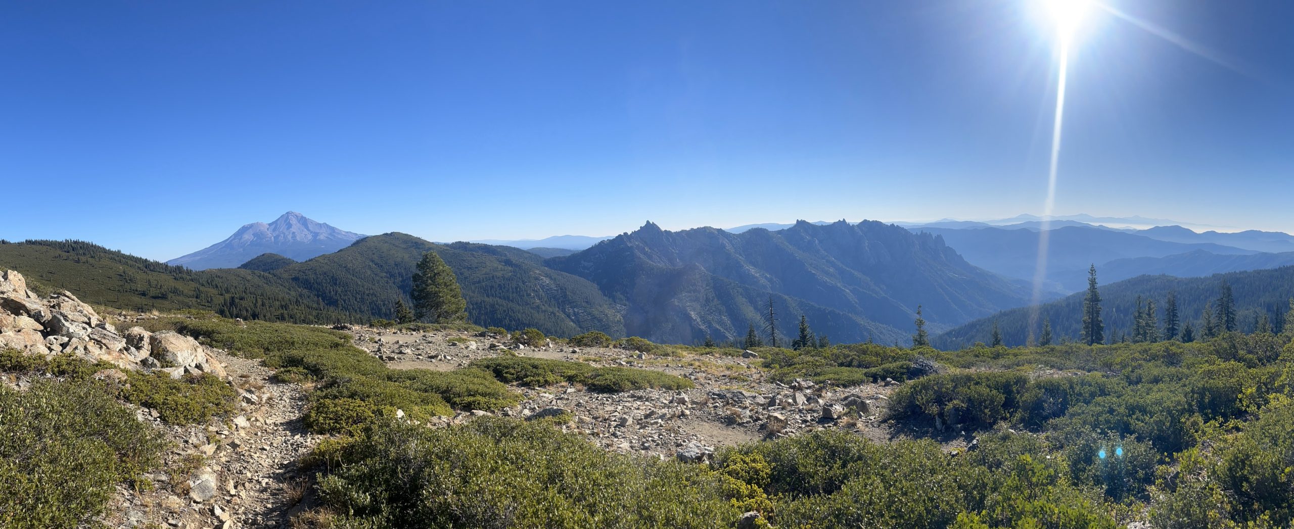
Soon Mount Shasta comes into sight again, standing tall in front of us as if it never disappeared. It’s always stunning to see that beast of a mountain. And we climbed that thing in August. Crazy.

We pass another pretty alpine lake until we approach a road where there is a spring. We have to go steeply downhill though to reach it. That is the only tough climb for today. But it’s good water. Tomorrow there will be no water for quite a while, so we make sure to get enough here. It’s not much further to the next road and from there to the planned campsite with a nice view of Mount Shasta that glows in the last sunlight. We’re running out of gas while we cook dinner. So, we either push tomorrow to get to town or there will be some cold soaking again. Let’s see where we will end up.
PCT Day 136: Reconnecting footsteps
mile 1525.5 to Castella (mile 1501.2)
42.6km / 9:45h / elevation gain of 551m
Today we make the most use of daylight. We start before the sun gets up and finish after it goes down. We want to make it all the way to the road to get to town.
Mount Shasta is glowing in the morning light as we hit the trail. The first part of the day follows the ridgeline with some amazing views. Then we get close to rugged Castle Crags, where we take a lunch break on a rock outcrop. We make 12 miles by 12pm. We can still do it. At least with not much elevation.

The rest of the day goes through the forest. We are just stopping by a spring and one other place before we get to the road. We make it in time but there is just the onramp to the freeway in the middle of nowhere with no cars at all. So we walk an additional 2 miles to Castella where there is a supermarket with a gas station and a post office. It’s an easy road walk. Only two cars drive by but no one stops for us. It’s already getting dark. We reach the supermarket where we get peanut butter, jelly, bread, tortilla chips, and a dip for dinner. We approach random strangers at the gas station and ask if they are going to Redding but we don’t have any luck. Finally, we decide to call it a day and try tomorrow again. We camp not far behind the supermarket right next to the trail. It’s noisy but it works.
Oh, and just like that, we finished California. Well, Popeye did, I actually still miss 139 miles between Bucks Lake and Burney that I skipped because of my foot injury. But it feels like a closure after reconnecting where we left off at the beginning of August.


This website contains affiliate links, which means The Trek may receive a percentage of any product or service you purchase using the links in the articles or advertisements. The buyer pays the same price as they would otherwise, and your purchase helps to support The Trek's ongoing goal to serve you quality backpacking advice and information. Thanks for your support!
To learn more, please visit the About This Site page.

Comments 1
Great pictures.