 ">
">
PCT Week 6: The relentless Mojave Desert
The section of the Mojave desert is the driest stretch of the PCT. It’s sun-exposed and there are long water carries, that make it quite challenging. The first part follows “The Aqueduct” and rows of windmills until the trail continues uphill through the Tehachapi mountains. And it’s here that I meet my new little trail family, so I finally enjoy some good company again. We get closer to the Sierras every day and we charge up for the last push there in the town of Ridgecrest.
PCT Day 31: Hiking along the Aqueduct and Wind Turbines
Hikertown (mile 517.6) to mile 540.3
36.2km (22.5mi) / 7.5h / elevation gain of 572m (1,876ft)
Today I leave Hikertown after 9am because I wait for a new gas can after breakfast. I didn’t see them yesterday at the store, but they had it in the back. Richard is so nice to organize that they bring one to me with the first shuttle that arrives at Hikertown. So, now I’m on the safe side with gas. It’s gonna be a hot day along the Aqueduct today which is infamous for heat and dryness, but it is what it is.

I walk towards a canal and along it until I hit a sandy dirt road that follows the Aqueduct. This morning it was very windy in Hikertown, but here there is no wind anymore and it gets warm very quickly. I follow the Aqueduct for 5km (3mi) and not much changes during that. To the left is the Aqueduct, in front of me are the mountains and around me some scattered Joshua Trees.

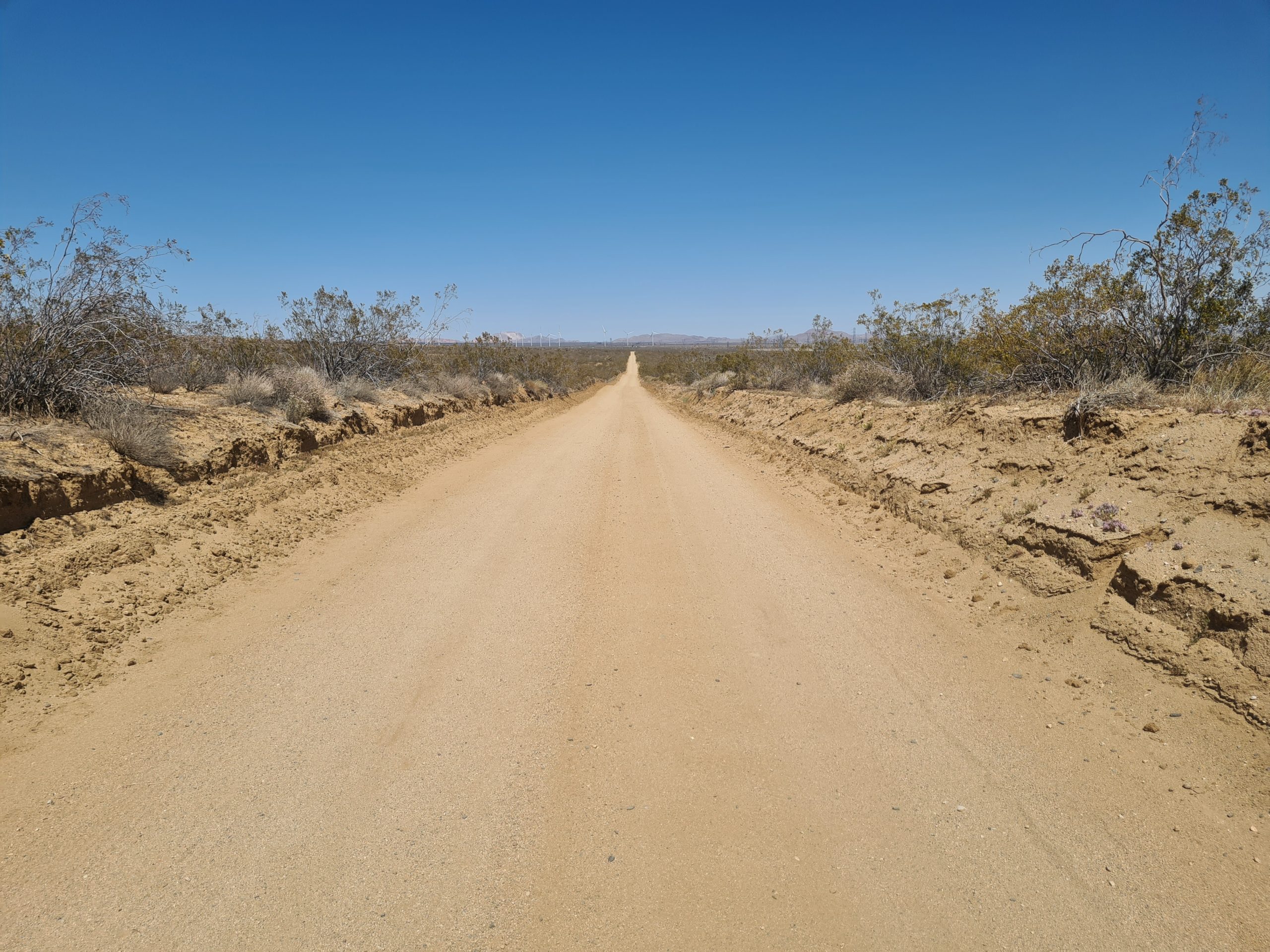
The road does a right turn and I leave the Aqueduct to follow another dirt road. It’s extremely hot now and there is no shade to find. This part of the PCT is especially challenging for the mind. The heat, no shade, and a monotonous landscape. The trail just goes straight for a lot of miles. I am in search of some piece of shade for a lunch break but it’s impossible. So I roast in the sun. I can’t take it for long until I continue. There are a lot of squirrels and lizards crossing the road, but apart from that, it’s pretty lonely out here. Just now and then a car drives by and the one or the other offers me water.
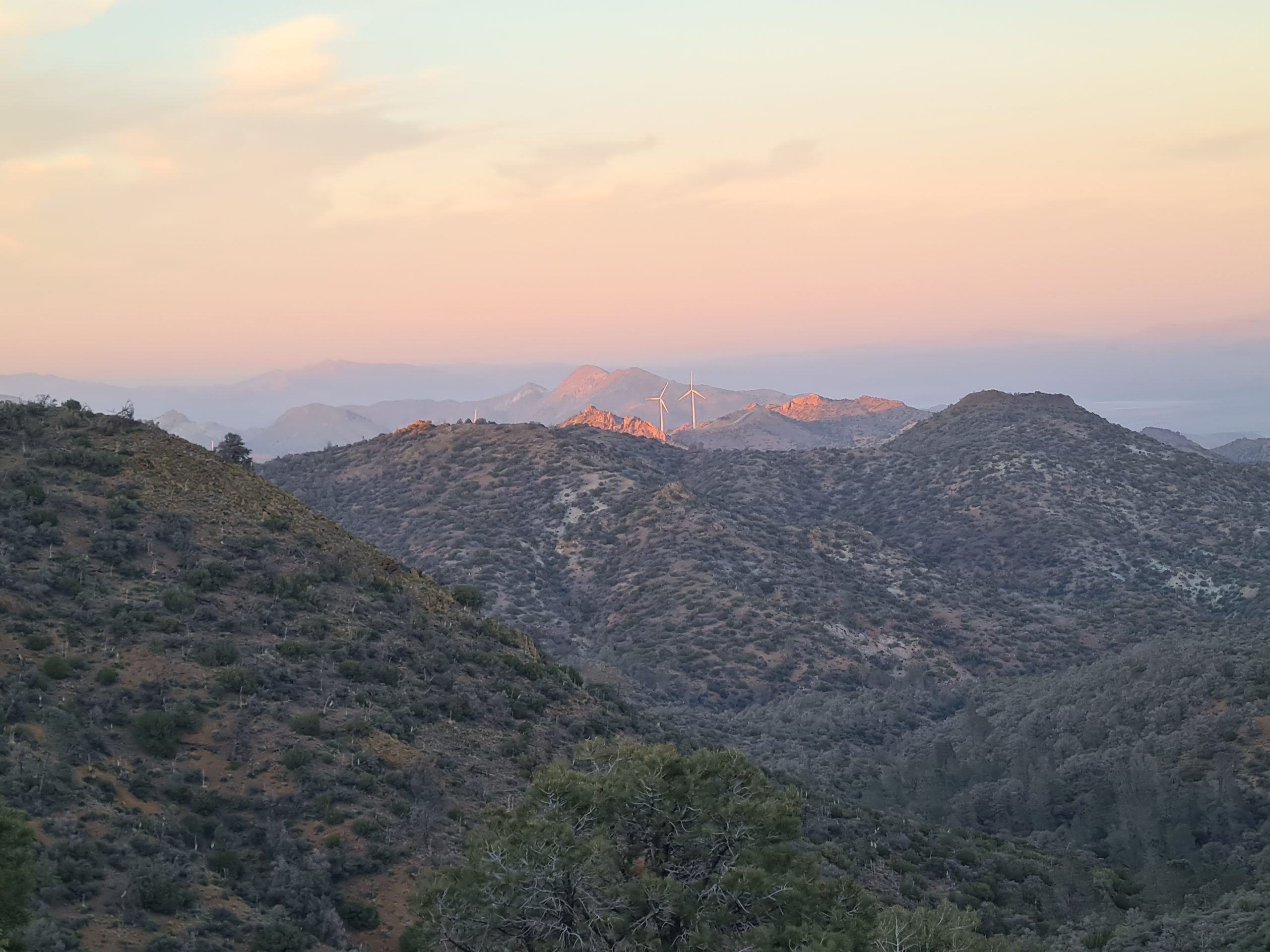
The trail leads me to wind turbines and here the wind starts to pick up a bit. I have blisters on my feet that torture me today and especially starting walking after a break is very nasty. This is for sure not the most beautiful part of the PCT. After 23km (14mi) I finally find shade under a Joshua Tree and I rest here for an hour until it cools down after 4pm. The wind picked up more and meanwhile, the wind turbines are turning. I walk through big wind farms up to a water cache, where I can get enough water for the next 23km (14mi) to the next water cache.

I keep walking through the wind turbines and the wind gets stronger until it even blows me my hat off my head. It’s hard to imagine that I will be able to find a sheltered camp spot here. Now the trail becomes a path again and goes uphill, towards the Tehachapi Mountains. The miles seem to be very long today, but shortly before it gets dark I reach a campsite that is quite wind protected.

PCT Day 32: Through the Desert Mountains into a Carpet of Flowers
Mile 540.3 to Tehachapi Willow Springs Road (mile 558.5)
29km (18mi) / 6.5h / elevation gain of 966m (3,169ft)
The wind dies out over the night and I am able to spend a pleasant quiet night. The trail goes straight uphill up to a Trail Register where I can find a lot of familiar names. There is a short part downhill to a small trickle of a creek and on the other side, I can already see all the switchbacks I have to go up for the next 7km (4.3mi). On the top, there is a little oasis with a water cache, a parasol, and chairs. I take a longer break, camel up, and enjoy the shade. Here I meet briefly Popeye and The Italian from Hikertown again.

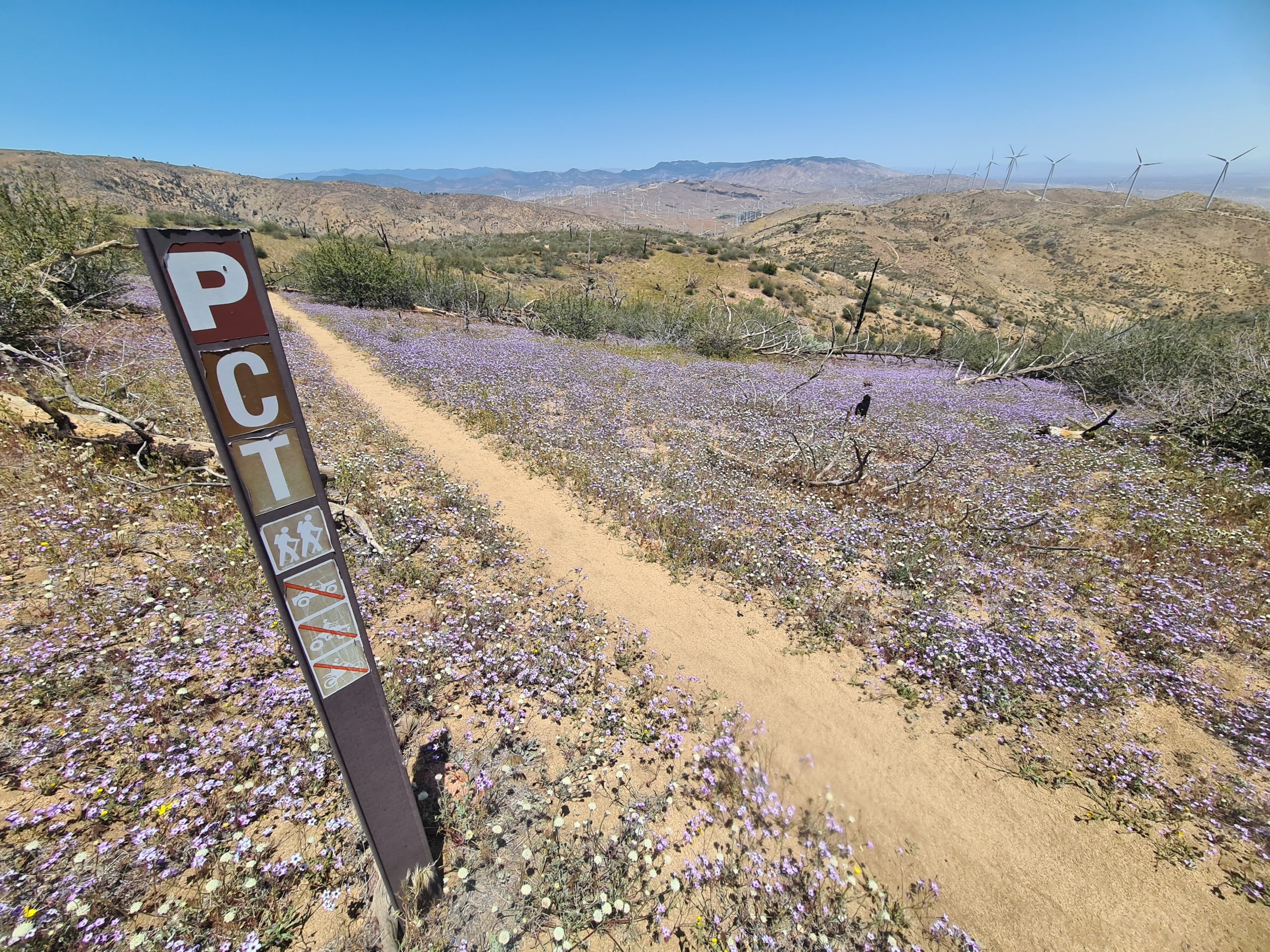
The continues a bit more uphill until it mostly goes downhill and suddenly I’m standing in the middle of a bed of flowers. The next wind turbines appear and I have to do some bushwhacking. I look out for a lunch spot, but only find one towards the end, again under a Joshua Tree. There are just a few kilometers left to the road. I was still not sure if I want to go to Mojave or Tehachapi or continue 12km (7.4mi) more to the next road, where hitching would be nearly impossible, but there would be a bus in the morning. The decision is taken from me because down at the road there is a Trail Angel, who just brought another hiker back on the trail and goes back to Tehachapi.
Here I also meet Popeye and The Italian again and we agree on sharing a hotel room, which is so much cheaper than being on my own in a hotel much worse than that. It’s such a good opportunity that I had to take it. We go out to eat typical American Barbecue and then to Walmart, which is overwhelming for me. It takes me so long to find everything I need and still didn’t get everything I wanted. I like the smaller stores more, it’s much easier and faster.
PCT Day 33: Dry and Hot, but in Good Company
Tehachapi Willow Springs Road (mile 558.5) to Golden Oaks Spring (mile 583.3)
40.4km (25mi) / 9h / elevation gain of 1,500m (4,921ft)
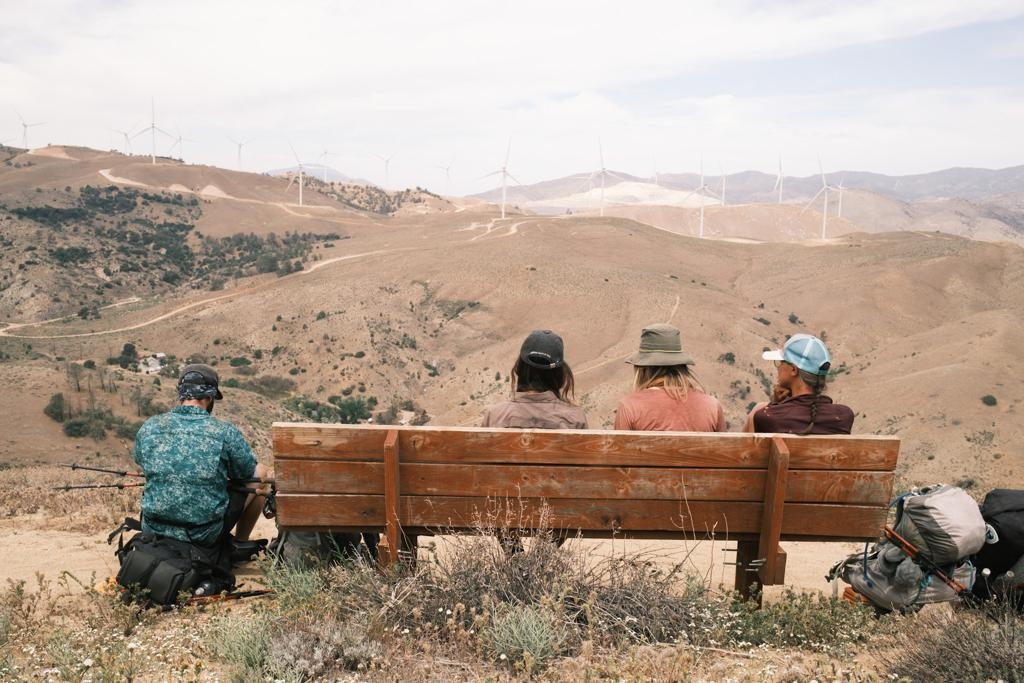
We have a big breakfast at the hotel and then Trail Angel Oblivious, who took us to town yesterday, brings us back to the trail. It goes uphill and through more wind turbines through the hills. It is for sure not the most spectacular part of the PCT and some people skip this 13km (8mi) between Willow Springs Road and Highway 58. For me, it’s all part of the deal. It can’t always be breathtaking, right? That way you appreciate the pretty sections even more. Before we go downhill to Highway 58 there is a perfectly placed bench, where we sit for a while and let our minds wander.
Then there are unbelievably long switchbacks down to the road that leads to the Overpass of the Highway. Here it’s possible to get a bus to Tehachapi and Mojave, but you have to call them to make them stop here. Hitching is nearly impossible here, as not many cars pull out to the overpass. That’s why it’s better to go to town from the Willow Springs Road like we did yesterday. There is a small water cache here and I’m thankful for that because there are 26km (16mi) to the next water source from here. This part is the driest of the PCT and it goes uphill. Oblivious happens to stop by just as we are sitting there and gives us cold Gatorades which I’m very happy about. I started loving Gatorade in the USA as we don’t have these in Germany. I also packed out a sandwich from the German bakery in Tehachapi that I’m enjoying now.
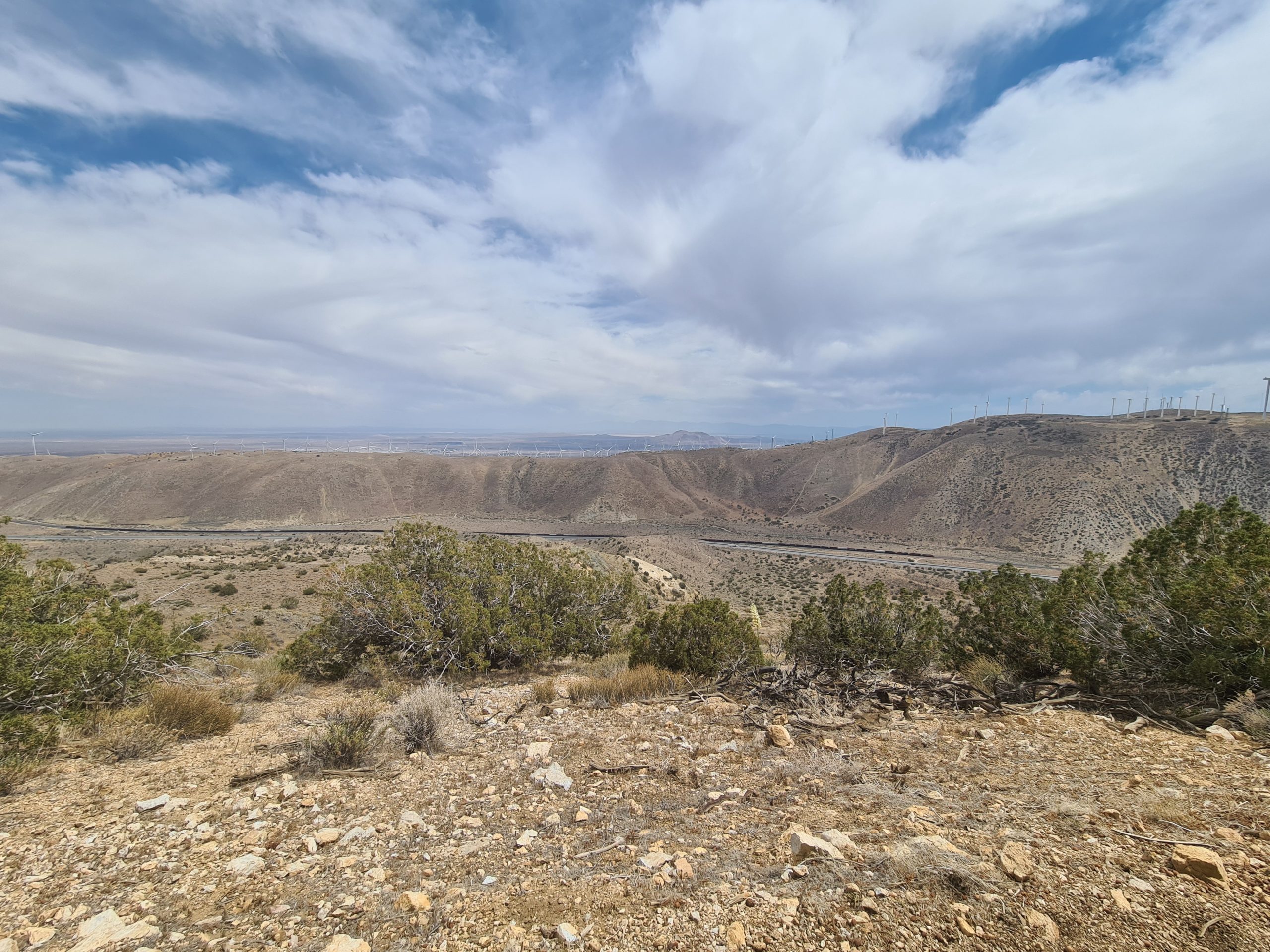
Now a long ascent starts. It got very hot, my backpack is heavy with water and food and slowly I start to realize that I might not have enough water while I’m huffing and puffing up the mountain. I take a break in the shade, look at the Highway, and a really long freight train, surely over 1km (0.6mi) long. On the other side, there are the hills with the wind turbines we came from, and then there is the valley floor with a few lakes.
Thankfully the sun starts hiding behind clouds and the hike gets way more pleasant. The higher I get the windier it gets, too. We reach the highest point at 1,880m (6,167ft) and I take a break after over 750m (2,460ft) of elevation gain. The trail descends a little, just to get back to the same height as before and then it goes down again. It continues on a dirt road that is quite shaded by trees. The sun came back but it’s not that hot anymore in the evening. I take another break with Popeye and another hiker before I start the last 12km (7.4mi) to the water source, where we want to stop tonight to have water for camp. The road gently goes uphill to finally drop down to the water source. On the way, we see three deer, that are not shy at all, so we can watch them really closely. That is quite magical to me as I love animal encounters and in Germany deer are so shy that they immediately run away as soon as you see them.

Meanwhile, the sun went down and the last rays let the mountains glow. And then there is a lunar eclipse going on. I make it to the water source just when it gets too dark to walk without a headlamp and then I look for a place for my tent because it’s quite crowded at the water source. Unfortunately, I don’t take much time in the dark to find a sheltered spot for my tent and the wind gusts strongly shake my tent at the night. It’s an exhausting night. At midnight I give up as it’s not possible to sleep with that wind. I pack up my tent and go cowboy camping in the bushes. That’s better but still windy. I don’t get much sleep, but at least it’s warm. Tomorrow it’s another 30km (18.6mi) to the next water source.
PCT Day 34: Long Water Carry
Golden Oaks Spring (mile 583.3) to mile 606.3
39.4km (24.5mi) / 9.5h / elevation gain of 1,400m (4,593ft)
Today I walk like I’m on autopilot because of the rough night. There are a lot of ups and downs, but no long ascents. They spread out on shorter 200 to 300m (650 to 980 ft) climbs. I need a break every 5km (3mi) today because my backpack feels heavy with the 30km (18.6mi) water carry. Before another ascent, I take a lunch break under a tree, and Popeye and The Italian join me.

The trail carries on and there are a few fallen trees that are mostly easy to climb over. It’s not that hot today and there is occasional wind, so my water lasts very well. The trail goes a lot through sparse forest and I start to ask myself if we finally left the desert behind (Spoiler: No, we didn’t). There is not much of a view today, just here and there is a view of forested hills and more wind turbines.

I reach the 600 mile-marker. Now it’s only 100 miles to Kennedy Meadows and the Sierras! We are all pretty excited about that. Shortly after there is a junction to the water source, where we get enough water for tomorrow. It’s just 7km (4.3mi) to the campsite in the forest, where we sleep softly on pine needles.
PCT Day 35: Beach Walk without Water
Mile 606.3 to Bird Spring Pass (mile 630.8)
30.5km (19mi) / 8.5h / elevation gain of 1,000m (3,280ft)
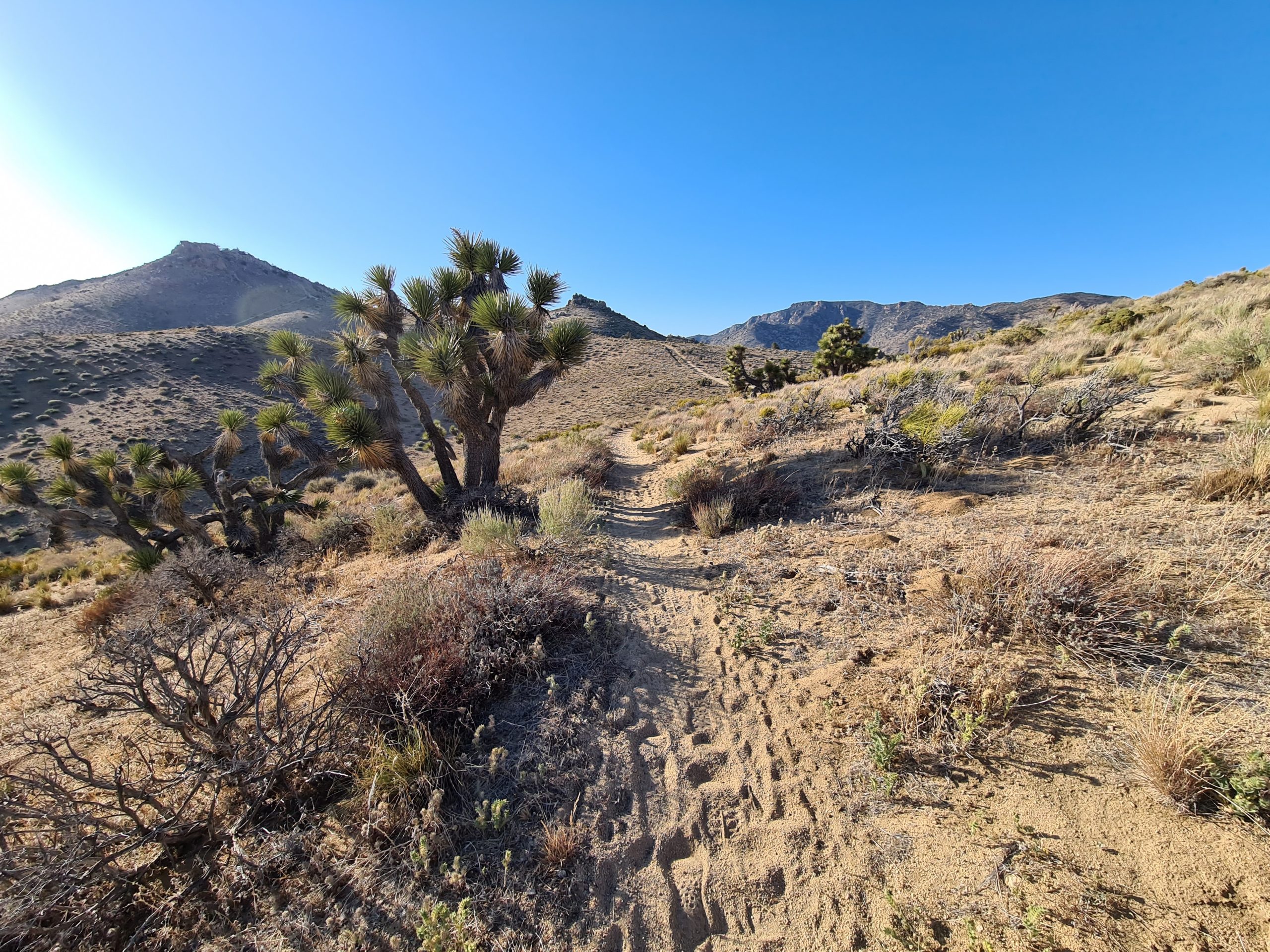
Last night was pleasant after the last sleepless one. The first part of the day leads through the forest until we reach the open area and the desert landscape again. After 19.5km (12mi) we get to a well-stocked water cache. Without these caches, these sections would be very difficult as it would be a 68km (42mi) long water carry. I don’t know how people did it before these caches were here. I take a longer break and wait for Popeye and The Italian. There is no shade, but wind, so it’s nice. Depending on how sheltered a spot is it’s either very pleasant or very hot. We take a lunch break under a Joshua Tree. Thank god for the Joshua trees as they are the only place in the desert that gives you shade.

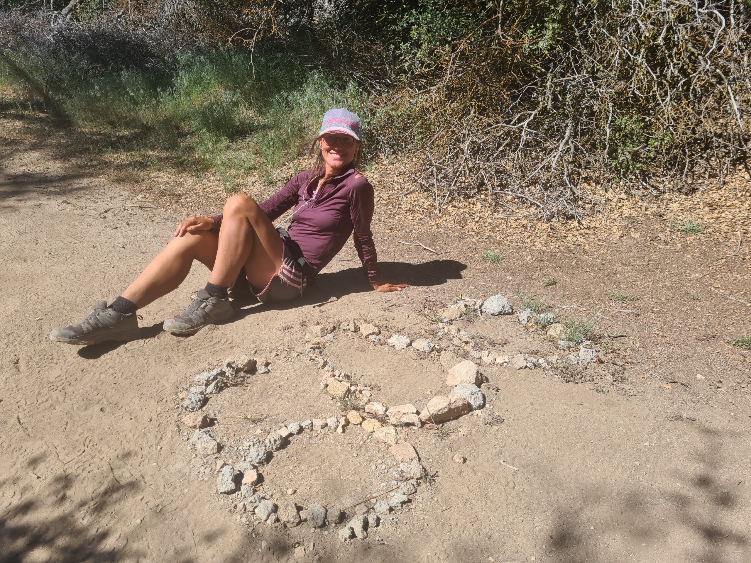
The trail gets very sandy and I get a feeling that I’m on the beach. Just that there is no water far and wide. We are in the Mojave desert, the driest stretch of the PCT. There is not much more than chaparral, Joshua Trees, and an occasional cactus. There are just desert hills as far as the eye can see. I take two more breaks in the shade of some trees and encounter a friendly rattlesnake, but unfortunately, no tortoises that are supposed to live here. I also reach the first 1,000km on the trail, which is not a big deal for my American friends, but for me it is.
It’s a lot of up and down today, but never long or steep. We reach the next water cache where we find a nice spot sheltered by Joshua Trees and a rock. Tonight there is no moon and it’s so dark that there are millions of stars in the night sky.

PCT Day 36: Fantasizing about Food
Bird Spring Pass (mile 630.8) to Walker Pass (mile 652.1)
34km (21mi) / 7.5h / elevation gain of 979m (3,211ft)
I’m so happy that the nights are so warm now. But still, it’s cold in the morning before I start moving. The day starts with an ascent where I get warm quickly. Suddenly, we are in the forest again and take a break after 13km (8mi). We are speculating about all the food we’re gonna have in town. Tonight we will reach Ridgecrest and spend a zero day there. Popeye and The Italian originally wanted to go all the way to Kennedy Meadows without stopping but decided to join me and I’m happy that we keep hiking together. It turned out that we fit well together and I guess I’m finally in a group now. The lonely wolf times are over. It was about time.

After the last days with continuous long miles, it feels well deserved to take a zero and my last zero was two weeks ago. The guys met a man at Agua Dulce, who offered them a ride from Walker Pass to Ridgecrest and he will pick us up later today. We already booked a hotel as well, which is much cheaper in Ridgecrest than anywhere else so far and for three people it’s even cheaper.
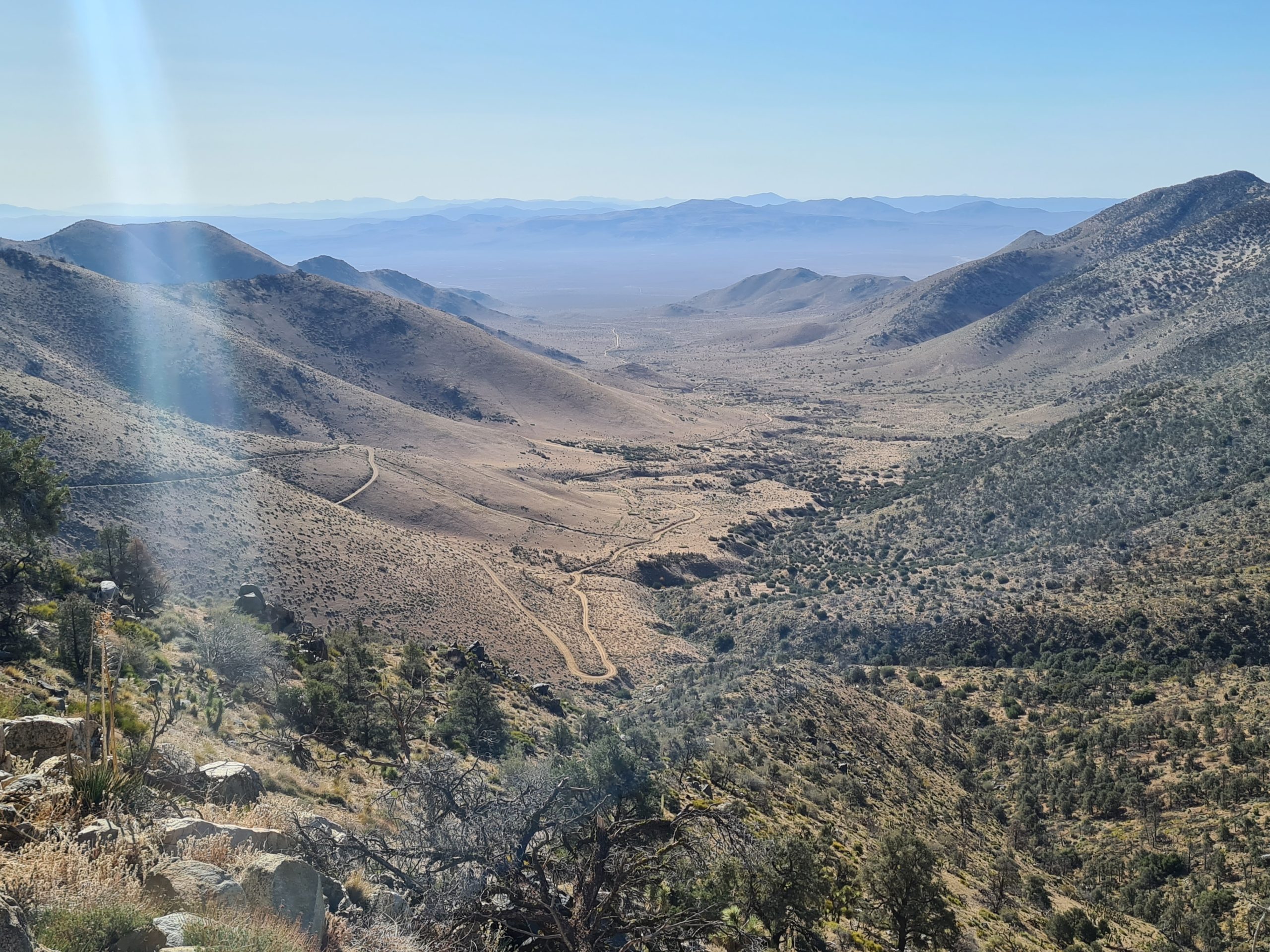
The trail continues uphill until we reach a bumpy dirt road that we follow for the next 3km (1.8mi). Now and then there is a tree giving some shade, but overall it’s quite hot today. After we leave the road we find a nice shaded place and take a lunch break and a little nap. We did well today, so we can afford a longer break until we get picked up at 5pm at Walker Pass.

We climb a bit further up and finally, the trail goes down to Walker Pass, where we arrive with perfect timing. Conrad picks us up and drives us to Ridgecrest, where we fill our bellies with a Chinese buffet. Now there are just 50 miles left to the Sierras! We are so stoked about that. We are ready for a change of scenery. Ridgecrest is a great town. The prices are the cheapest on the entire PCT so far, for accommodation and restaurants alike.

Just one thing doesn’t go in our heads: There is neither a ridge nor a crest, it’s actually a really hot desert town. But we love it, people are super friendly here. And I learned one more thing about the desert: Look before you sit down somewhere or you might end up sitting in a cactus, which is not very nice. Try to get the tiny cactus spikes out of your skin and clothes, it’s awful.

This website contains affiliate links, which means The Trek may receive a percentage of any product or service you purchase using the links in the articles or advertisements. The buyer pays the same price as they would otherwise, and your purchase helps to support The Trek's ongoing goal to serve you quality backpacking advice and information. Thanks for your support!
To learn more, please visit the About This Site page.
