 ">
">
PCT Week 2: From the Desert into the Mountains
From Mile 101 to mile 180 the landscape dramatically changes from desert to alpine environment at a higher altitude as I climbed into the San Jacinto mountains. I encountered the first snow, some extreme wind and together with a lot of elevation gain, it became the most challenging part so far.
Day 8: My first low
Barrel Spring to mile 118.5
27.8km (17mi) / 6h / elevation gain of 761m (2,496ft)
Last night I stayed at the Mountain Valley Retreat where we had hiker yoga in the morning. We did some good stretching of our legs, feet, and backs before we went to a good breakfast. I took the shuttle back to the trailhead at Barrel Spring. Rumor had it that there would be a big barbecue at lunchtime, but I continued to get some miles in. The trail then went through a lovely meadow with gently rolling hills like I haven’t seen them on the PCT so far. There were even some cows grazing peacefully in the distance. It’s quite fascinating as 50 people are starting the trail every day, but they actually spread out that I’m alone most of the time. In the evening at the tent sites, I’m usually with other people, but during the day I have a lot of time for myself. If you’re after some solitude you will get it, if you’re looking for some social interaction you will find that too.

Meadows around Warner Springs
I reached a lovely rock formation called “Eagle Rock” and you can easily see why. It looks like a soaring eagle and you can’t miss it. It’s a small detour from the trail but it’s absolutely worth it. There are a lot of day hikers in that area, I have never seen so many people on the PCT. The trail continued into a shaded forest along a little creek with the one or the other cow along the way until I reached the road to Warner Springs, which concludes Section A. At the moment there is just a gas station with limited resupply, the post office, and the community center, which offers Wi-Fi, water, shaded places, a hiker box and you can charge your devices. It makes a nice spot for a break. I did my resupply at the Mountain Valley retreat, where there was everything I needed for the next 5 days like ramen, trail mix, beef jerky, spam, bars, and freeze-dried meals. Lots of people send boxes to the Warner Springs post office but in my eyes, that’s not needed if you don’t have any special dietary requirements. Additionally, there is always food and useful stuff in the hiker boxes. Doesn’t matter if it’s meals, snacks, tape, ziplock bags, toothpaste, electrolytes, or even fuel canisters. You don’t need to worry about having not enough food as you’ll always find something to add.

Eagle Rock
I was chilling for a while at the community center. Today I experienced my first low on the trail. The blisters on my right foot hurt and the hike just felt arduous. I was not that motivated to hike on. But I finally did and reached another meadow where the trail went easy and flat. I reached a campsite where I taped over my blisters again and that helped. I got back to my flow and my usual pace. The trail started to go uphill on a sandy surface while following a stream, crossing it a couple of times. I took the last opportunity at that stream at mile 116.1 to fill up water for today before I hiked on for a few more miles until I found a spot with a nice view and amazing sunset. This evening I even ate two meals. Hiker hunger kicked in already! I’m not that worried about my weight loss anymore. There was just a German couple at the campsite, so it felt quite secluded.
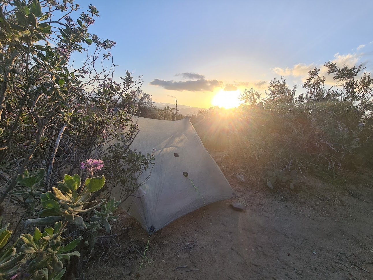
Beautiful tent site at mile 118.5
Day 9: Trail magic at Mike’s place
Mile 118.5 to Tule Spring
31km (19mi) / 7.5h / elevation gain of 869m (2,851ft)
Yesterday evening I had nice sunshine at my spot but this morning it still was in the shade and it was chilly. So it took me a while to get out of my sleeping bag. I usually take my time in the morning, even if I wake up early. I’m not one of those hikers who leave before the sun even rises. I started with a lot of clothes but as soon as I got into the sun it got nice and warm – a difference like day and night and I could get rid of some of my clothes. After 13.5km (8.3mi) through the desert hills, I reached the junction to Mike’s place. The first part goes steep uphill, but don’t be discouraged by that, as it’s short and meets a dirt road soon, that goes slightly downhill to the water tank. Here I found out that there’s gonna be food and beer at Mike’s place just a little bit further down the road. And indeed, Mike made us pizza and hot dogs and there were even watermelon and bananas. Also beer, but not for me. It was a hot day and I wanted to crush some more miles. I stayed for quite a long time with a bunch of other people. This place gets quite mixed reviews on FarOut but it was actually amazing. Those unexpected treats are always the best.

On the way to Mike’s place
After like two hours I continued and it got even hotter with not much shade. I continued for a few miles and then took a small detour up to Combs Peak which took me like 40 extra minutes and 200m (656ft) of elevation gain for the sake of a 360° view and punching above 6,000ft (1,878m). I left my backpack at the junction and it felt so easy going up without the weight on my back. The last part was quite steep and involved some scratchy bushwhacking. It didn’t look like much from down there, but somehow the summit went further and further away. On the top there even is a small trail register with entries that dated back to the year 2000. Not that many people come up here.
View from Combs Peak
On the way back down I found a cute horned toad, a spiny little creature. I retrieved my backpack which felt way too heavy after walking without it. Somehow I perform better in the late afternoon and I’m much faster than at the beginning of the day, it just feels less strenuous. Shouldn’t that be the other way around? The trail got a bit eroded in some parts and I paid careful attention to where to put my feet. I took a small break before going the last 7km (4.3mi) to the campsite. I wanted to make as many miles as possible today so that I was able to make it in time to Paradise Valley Café before closing time at 3 pm on the following day. I was really looking forward to that burger. I lost some time with the detour to the summit, so I arrived at the campsite at 6.30 pm. There already were a lot of people at the spot, so I decided to camp a little bit ahead of it where I was by myself, well, at least except for some mosquitoes. It was the first time I saw mosquitoes on the trail. I was cooking my dinner and then disappeared into my tent to get up early tomorrow.
Campsite at Tule Spring
Day 10: Burger stop at Paradise Valley Café
Tule Spring to mile 154
31km (19mi) / 7h / elevation gain of 969m (3,179ft)
I had a beautiful sunrise in the morning as I got up as soon as the first light arrived. I went a little bit down the dirt road to get some water from the small stream, which took quite some time with filtering. It was my first night “alone”, so I was quite alert to every sound around me. I had the irrational thought of a mountain lion visiting me at night. The other campers were just 300m (0.2mi) away from me, but it felt like I was by myself.

Sunrise at Tule Spring
The trail went up and down and it soon became apparent that it would be another hot day. In the distance, I could already see the San Jacinto mountains, which I was about to tackle the next days. I took a break at Angel Mary’s Oasis, where there is a water tank and I could sit in some shade with other hikers. My feet felt heavy today and I decided that I would take a zero day in Idyllwild two days ahead, so I called my hotel to extend for one night. It would be my first zero on the trail and it felt much needed. Meanwhile, all I could think about was food. I was rushing to reach the Paradise Valley Café in time. In the end, I had awesome views of a steep cliff in the middle of the desert. I made it to the road by 1.30 pm and went 1 mile off-trail to the café. I met a lot of familiar faces but I was actually the last to arrive. I had a burger and a salad and stayed quite a long time to recharge myself and my devices and even found some stuff in the hiker box. I got a bit worried that I was running low on snacks for the next two days in the mountains, but I was relieved that I could add some to my supply.

Cliff in the desert
In the evening I made my way back to the trailhead and suddenly I got shaky legs and experienced some kind of low blood sugar. A snickers helped with that right away. I went another 4km (2.4mi) to my chosen campsite with a stunning view of the sunset and nice rock formations around me. The only negative point about this campsite was that the ground was quite soft and I had to put some rocks on top of my tent stakes. Hopefully, they wouldn’t get ripped out during the night. I ate the rest of my food from the Paradise Valley Café. Later in the evening, a spider came to visit me and I was glad that I was not cowboy camping. In the night the wind was howling quite loud around the rocks, but luckily almost nothing of that reached me at my spot.

Another beautiful campsite
Day 11: Windy as hell and so much elevation
Mile 154 to mile 170
26.6km (16.5mi) / 6.5h / elevation gain of 1,855m (6,086ft)
The day began cloudily, but the night was the warmest I experienced so far on the trail. That’s how I like it. I filled up my water after 2km (1.2mi) and realized soon that I should have taken more water from here as all the next sources require quite a climb down and up again. Now I was about to climb into the ridge system extending south from San Jacinto Peak, itself holding several notable peaks along the crest. Somehow I was slow and weak this morning. Usually, I’m quite fast going uphill but today I was struggling. I felt exhausted and had to take a lot of breaks every 2.5km (1.5mi). I was really looking forward to that zero day. There was a nice view on a saddle, but it was so windy that it almost blew me from my feet, so I couldn’t even think of taking a picture. Little did I know that it would get way windier the higher I got. I finally had a snickers and – again – that helped a lot. Snickers are my new wonder weapon for everything. Unfortunately, that was my last one. It went straight to the shopping list.
Climbing into the San Jacinto mountains
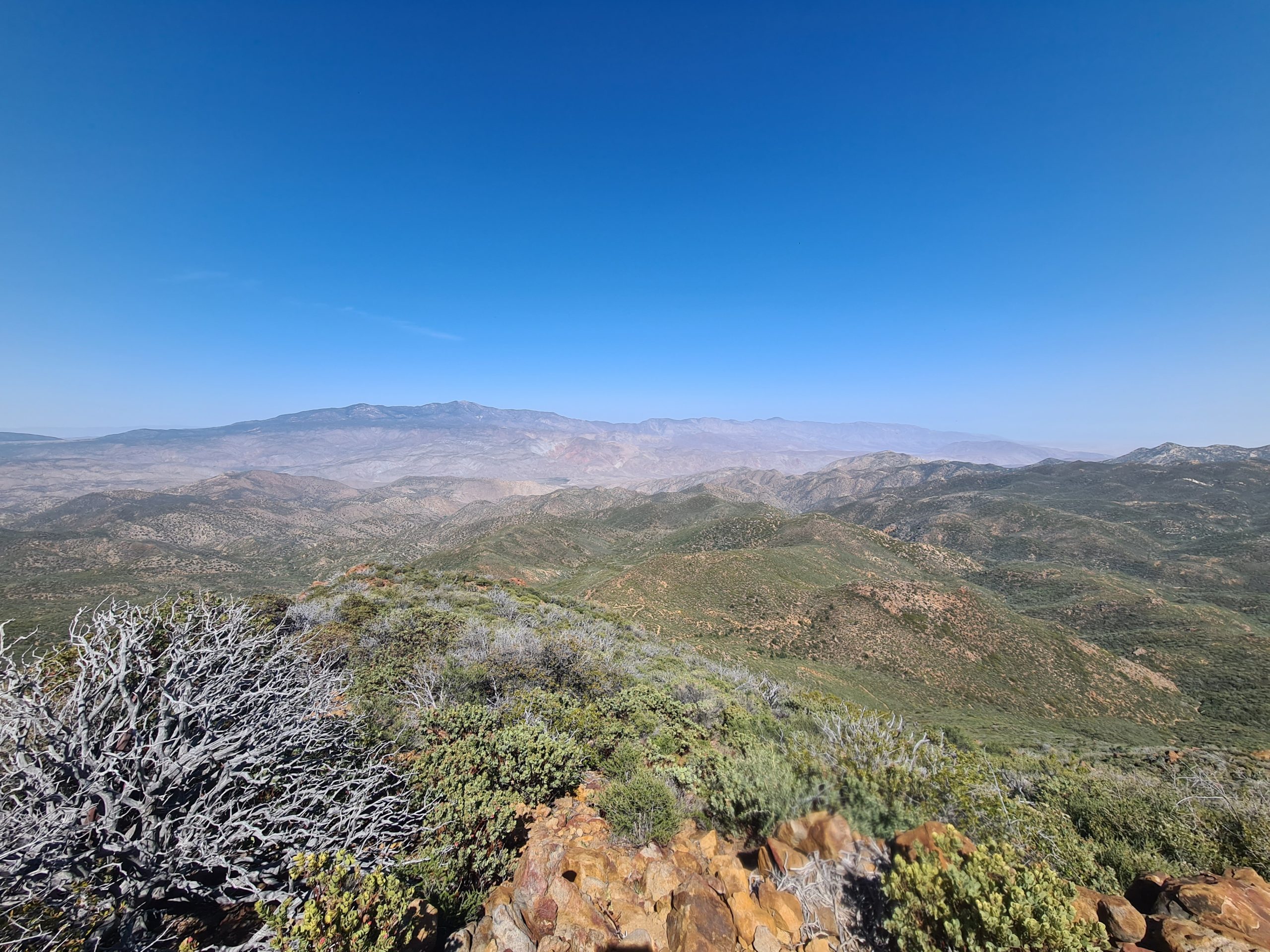
The trail steadily climbed up the mountainside and I was all by myself. I just met one snake and a hiker going southbound and had a small chat with her about the trail conditions. It was hard to imagine that there would be any snow on the trail higher up as it just seemed way too warm for that. The higher I got the windier it became and it almost blew me off the trail at least once. Luckily there was no steep slope at that moment next to me. I had great views of Lake Hemet that shimmered blue in the distance on one side and Palm Springs and some desert mountains on the other. I took a lunch break and devoured three tortillas.

View of Lake Hemet

View to Palm Springs
The trail then went steep downhill to Forbes Saddle and there were quite a lot of blowdown trees on the way, where I had to crawl under, climb over or go around. I already knew that the trail would go steep uphill again on the other side towards Apache Peak which was quite discouraging. On the climb up I suddenly met other people again, resting from the hard ascent. The PCT went around Spitler Peak and a little bit down again and reached a campsite, that was as sheltered as possible at this altitude and had a nice view of Palm Springs. But after a short break, I decided to hike on for another 4km (2.4mi) to the next spot. I needed to make a last climb to the highest point for today at 2,240m (7,347ft) to reach that one. Here it was possible to climb 200m (656ft) down to a water source but I decided not to do that but to try and make it with the water I had left to the next source tomorrow. Luckily it wasn’t hot today so I didn’t need much water. Or you could also climb Apache Peak.
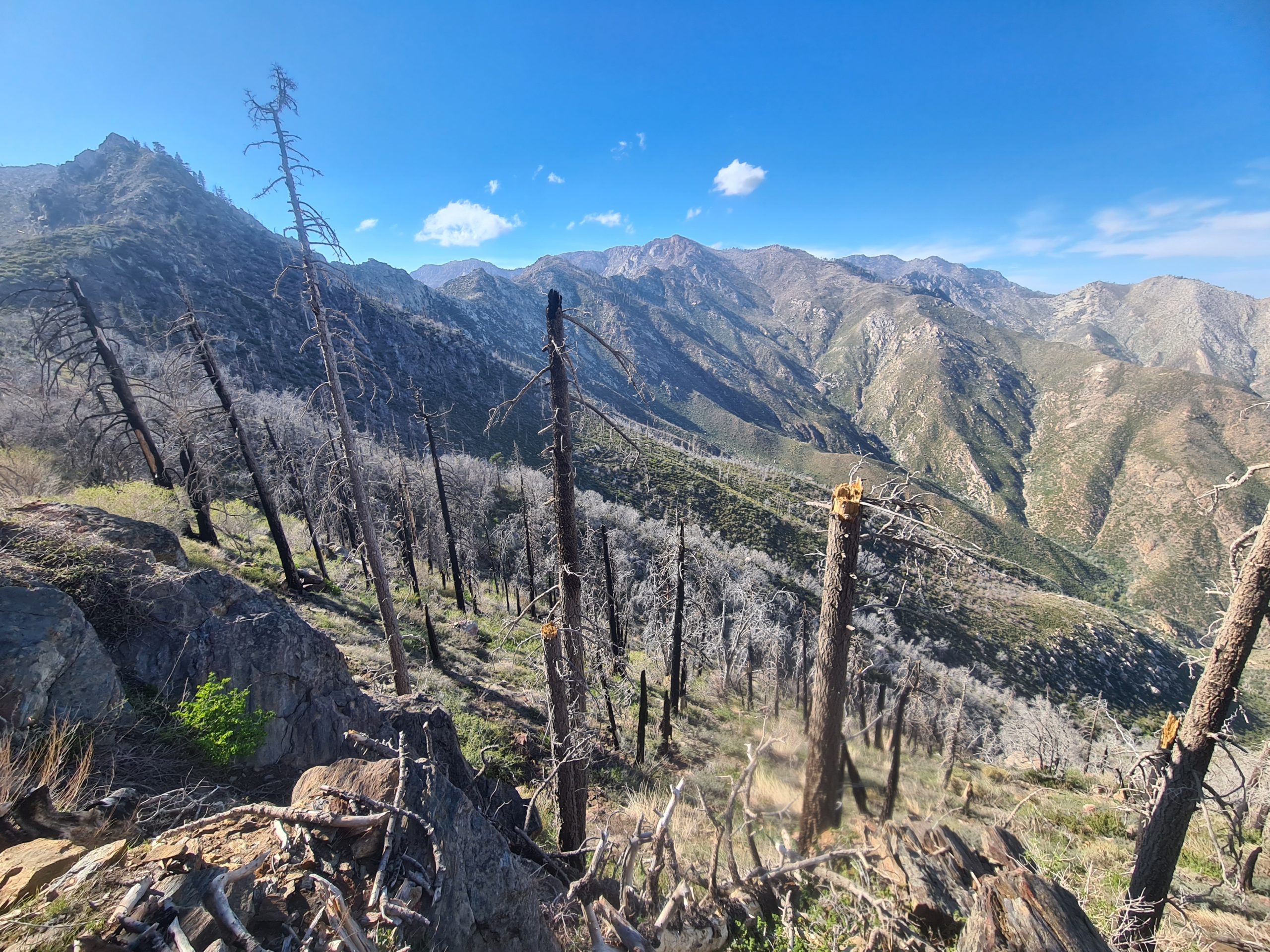
Getting into higher elevations
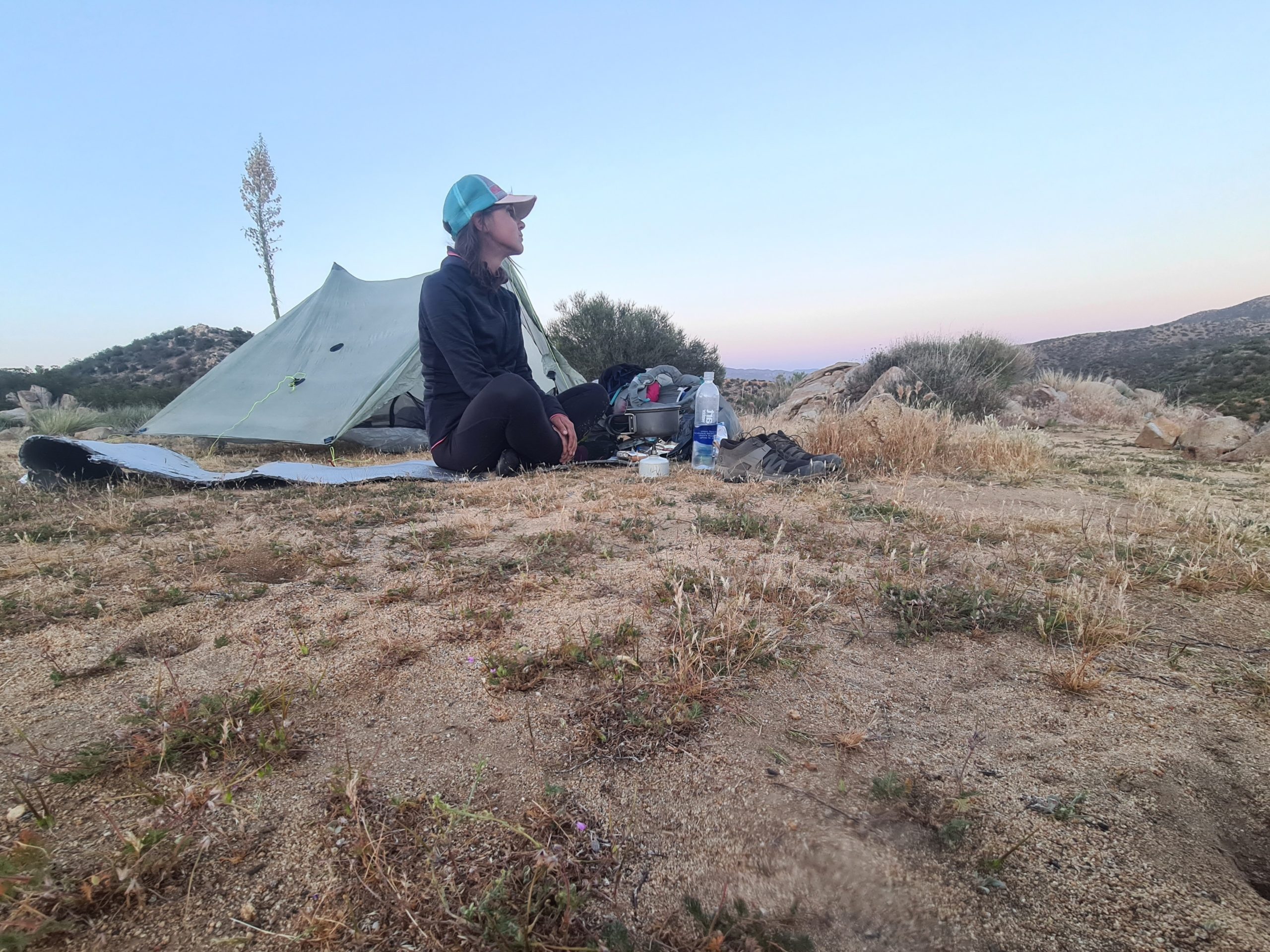
There was a long traverse following and it was extremely windy. Fortunately, the wind blew me in the direction of the mountain and not the abyss, otherwise, it wouldn’t have been possible to make it safely to the other side. Finally, I went down again, now in the slipstream of the mountain and the campsite came up with several spots between small trees that gave some shelter from the wind. I met some familiar people and we sat together and munched on an unopened bag of chips I found on the side of the trail earlier. This also was some kind of trail magic, thanks to anonymous who lost it on his or her way. The next water source is 10km (6.2mi) ahead and I was trying to use as little water as possible that evening although I got quite thirsty. The sand here is a bit soft again and I was having trouble keeping the stakes in the ground with that wind gusts. When I put one side in, the other ripped out again. It took a while until I had it figured out by putting stones on top of the stakes. There was a lot of fine black sand that covered everything, my hands got super dirty – it was about time for a shower! The wind that night was extremely loud but I managed to do okay at night. I had to get up only one time to put one of the stakes back into the ground.

View from the campsite to Lake Hemet
Day 12: To the highest point so far and then down to Idyllwild for a Zero
Mile 170.9 to Idyllwild
19.8km (12.3mi) / 5.5h / elevation gain of 988m (3,241ft)
The wind last night blew a lot of sand into my tent and covered everything in it. Learning: When it’s sandy and windy put everything in your backpack that you don’t want to get dirty, especially electronics. Also, my face got covered in black sand. When I packed up all my stuff the thin fabric of my backpack ripped apart and left a big hole behind. I really love this backpack as this is the most comfortable I’ve ever had, never experienced any pain with it, but the fabric is so fragile that it easily breaks. I will try to sew it in Idyllwild and then take it from there.

Morning view towards Palm Springs
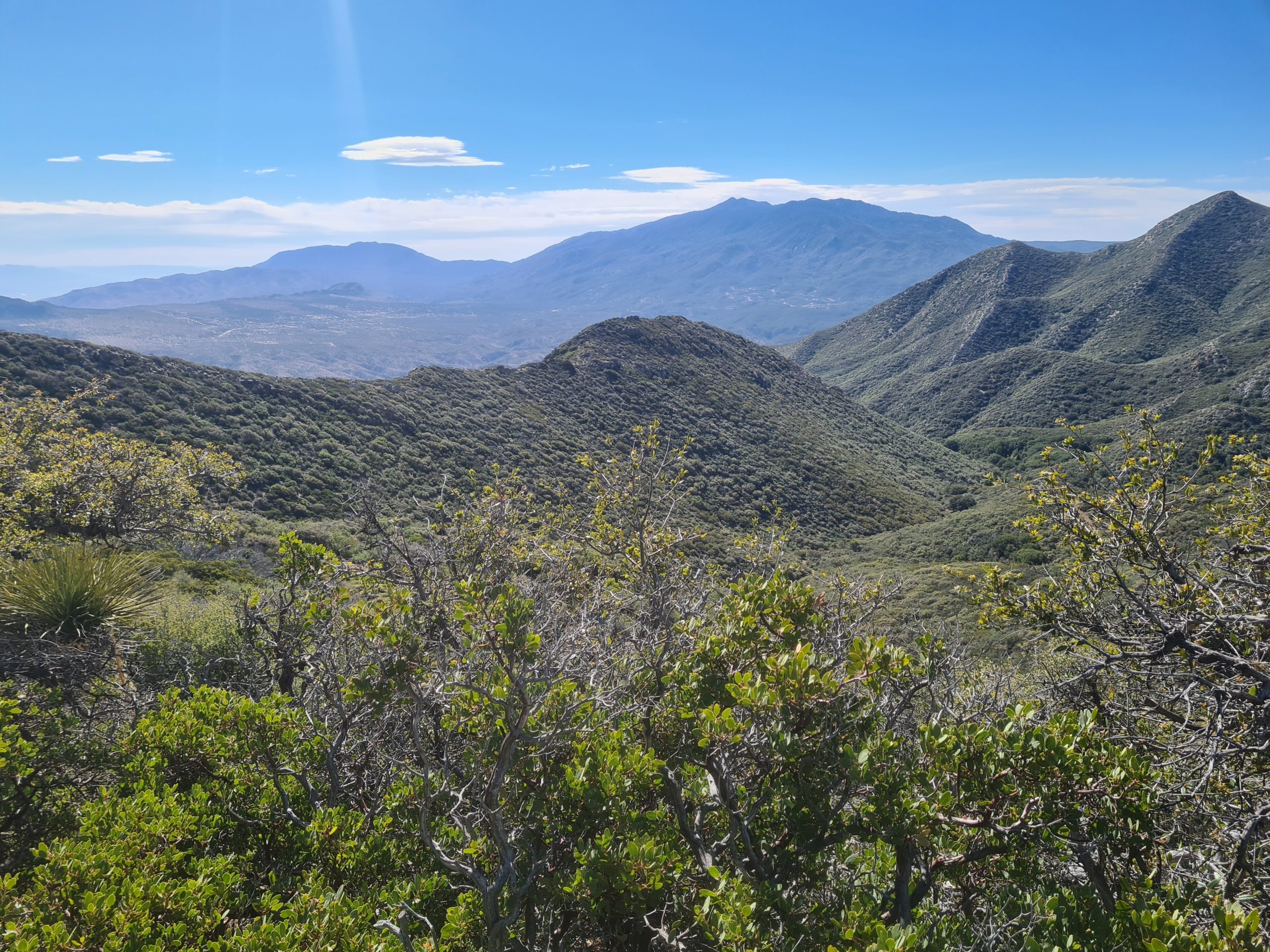
Today I just had 13,6km (8.4mi) ahead of me to the junction to Idyllwild, then some additional 4km (2.4mi) and 500m (1,640ft) down to the parking lot, from where I hopefully would get a hitch to town. The wind was strong again today, but not as bad as yesterday. It just blew on the left side of the mountain, on the right side it was nice and warm. I had a great view into the valleys below me, on the left side there were clouds rolling through, on the right side there was the sunrise over Palm Springs. The path meandered uphill along a rocky ridgeline, among skeletal trees of a burned forest, and became more like an obstacle run as there were lots of fallen trees. I even had to crawl under one of them which wasn’t easy with the backpack. It was quite time-consuming. Once the direction of the trail got so unclear because of a blowdown tree that I got lost. I knew that there was a switchback but just couldn’t find it. I went through scratchy bushes until I found the trail right underneath me. The GPS came in very handy to find it.
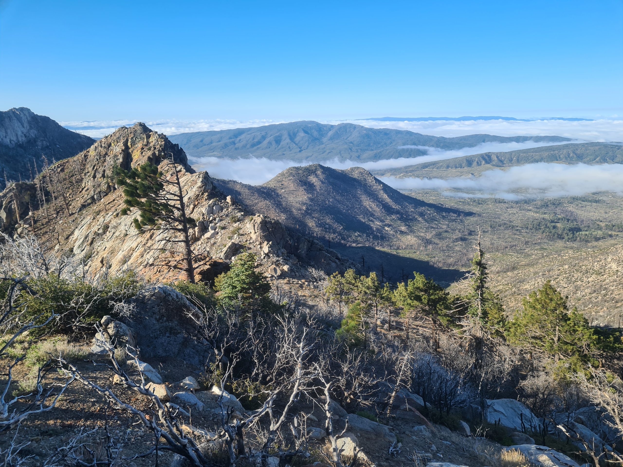
Rugged mountain landscape
I encountered the first snowfields, where I sometimes lost the way again but got back to it very fast. I reached the highest point for now and then went downhill through the forest to the water source. I just made it with the water I had left. I recommend filling up enough at mile 155.4 to not have to go down for water and up again. There were no alpine landscapes anymore and suddenly life came back. A lot of squirrels crossed my path and I heard birds chirping in the trees.

The first snowfields
The quantity of the snowfields increased, but there were no dangerous parts and no microspikes were needed. The last time for today the trail went uphill to the highest point of the tour so far at 2,627m and it just went downhill from there to the junction to the Devils Slide Trail into Idyllwild. The further I got down the warmer it got and my warm clothing was not needed anymore. There were a lot of day hikers on that trail and I experienced the well-known phenomenon that people smelled so clean of detergent and soap. I wonder what I was smelling like, not like roses, that’s for sure. After almost one hour I arrived at the parking lot and after a short break, I began walking down the road to town. I raised my thumb in the air as soon as a car was coming and after a while I was lucky and someone gave me a ride. I really appreciated that as it would have been a long walk of 3 more kilometers (1.8mi) into Idyllwild. I reached town at 1 pm and could already go into my room in the Idyllwild Inn. I spent the rest of the afternoon showering, making phone calls, discovering the town, shopping, eating pizza, and repairing my backpack by sewing and with tape. I hope that this will last. I now know that I need to be careful with the backpack.
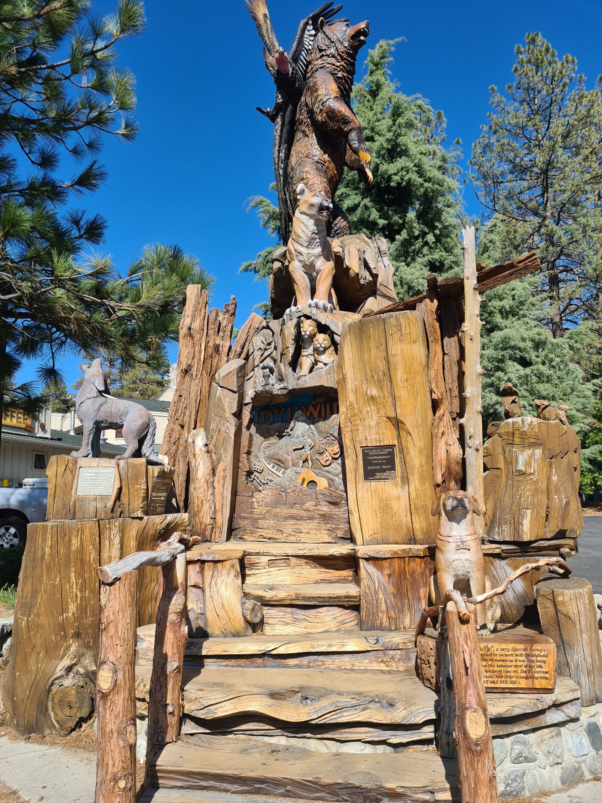
Idyllwild
Meanwhile, the weather forecast was up to no good. Friday there’s a storm with rain and even snow coming. I was planning just one zero day on Thursday, but now it will be two days unintentionally. Unfortunately, everything in town is booked out, but I will definitely don’t go up that mountain on Friday. But my former hiking buddy Nathalie also happened to arrive today from Paradise Valley Café and she will make room for me on the third night at her holiday home. So I don’t have to camp outside in the cold, I’m very relieved about that. We met for dinner at her house and talked about the lasts days we spent apart. Idyllwild is a cute little town and there are worse places to get stuck I guess. There are several places to get food, gear, and resupply, all within a short distance of each other. There even is a public library where you can use the computers for free which makes publishing much easier.

Resupply for the next 6 days to Big Bear

This website contains affiliate links, which means The Trek may receive a percentage of any product or service you purchase using the links in the articles or advertisements. The buyer pays the same price as they would otherwise, and your purchase helps to support The Trek's ongoing goal to serve you quality backpacking advice and information. Thanks for your support!
To learn more, please visit the About This Site page.
