 ">
">
Stevens Pass to Bridge of the Gods: In Which I Finish Washington
I took a lot of pride in how consistently and diligently I blogged on the AT. It’s really not easy to find the time to sit in front of your phone screen for the couple of hours it takes to make these happen. I also knew blogging on the PCT was going to be harder; I was going to have to hike faster and hiking faster meant less time off in towns to sit in front of a phone screen. But I’m possibly more determined this time, maybe because I do know how often I looked back through my AT blog over the last year or so. But it’s definitely harder.
This has been your State of the Blog address. Not sure why I always feel so compelled to start blog posts with them.

Miles hiked: 505
Miles left: 2,145
Milestones: For those who know their SOBO PCT mile markers, yes, I did finish Washington! One of three states down. The “third of the way done” jokes have been used.
As you’ll recall, it was raining when I rolled into Skykomish at the end of my last blog. There was more where that came from.
Stevens Pass to Snoqualmie Pass
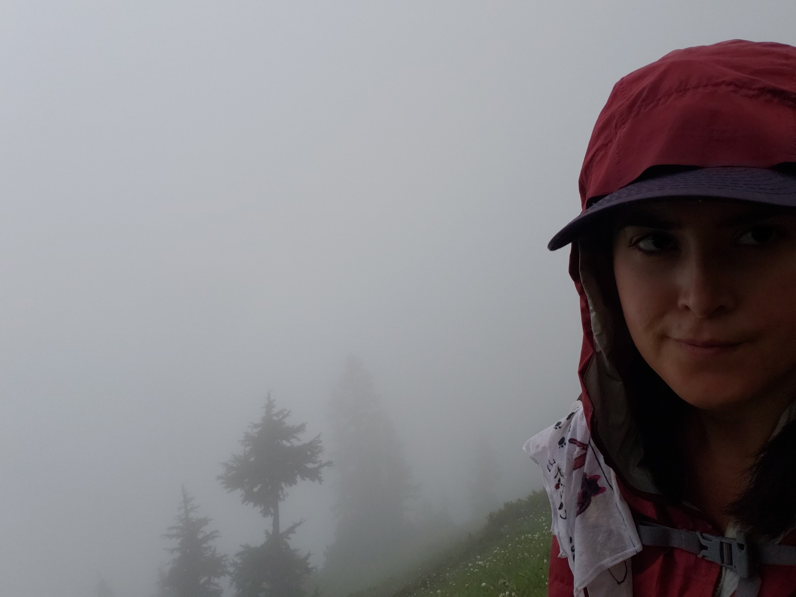
We got about two days of clear skies—to really see how lovely Washington is when you can actually see it—before another weeklong stretch of rain started. I really only have memories of this section from before the rain started. There’s very little memorable about a day of hiking in the rain. It felt early, but I ended up zeroing in Snoqualmie to dodge at least one of the rain days, although I didn’t feel like I could sit out all of it. I am very aware of my smaller time window for this trail. I’m less concerned about my miles per day than my days in town since I know that’s the real time suck, but I was going to have to zero at some point and I wasn’t interested in zeroing on a day of good weather when I was still feeling good physically. I almost exclusively ate the curry bowls at Aardvarks (the food truck in front of the Chevron). The PCT is already miles ahead of the AT in the amount of curry I’ve been able to eat.
Snoqualmie Pass to White Pass
The day I hiked out also happened to be the worst day of weather in the bunch, which made for a really lonely stretch. I suspect no one in Snoqualmie could muster themselves to hike out that day and I only saw northbounders until I had essentially reached White Pass. Said northbounders confirmed that I was in my own bubble. I wasn’t really worried about being on my own very often as a SOBO this year with so many flippers around and I generally don’t mind hiking on my own anyway, but I did rely hard on the northbounders at camp to chat with me and get me out of the inevitable funk that comes from such a long stretch of uninterrupted rain.
I pondered my experience with rain quite a bit during this stretch. I realized that I’ve never once experienced two weeks’ worth of backpacking without rain. I certainly never went that long without rain on the AT and two of the last three years have had abnormally wet winters in California, making for some strangely rainy backpacking at home. It rained and snowed during my first desert backpacking experience in Joshua Tree. The driest trip I’ve ever taken was when I hiked the Tahoe Rim Trail last summer, but that did not last two weeks and even then included one morning of rain on day five.

It occurred to me that it’s probably possible to miss rain if it would actually go away long enough for me to stop being sick of it. At some point in the depths of August in Northern California, covered in dust and sick of the sun beating down directly overhead, I’m probably going to think some rain would be nice. I’ve just never experienced that feeling because the rain has never been absent from my backpacking life long enough for me to miss it. It got me wondering if maybe this thru-hike is going to change the way I think about rain—currently I think of it as my own personal backpacking super villain. Or maybe I was just working really hard to convince myself that two weeks of wet socks wasn’t as absolute crap as I felt it was.

Mount Ranier, in all its glory.
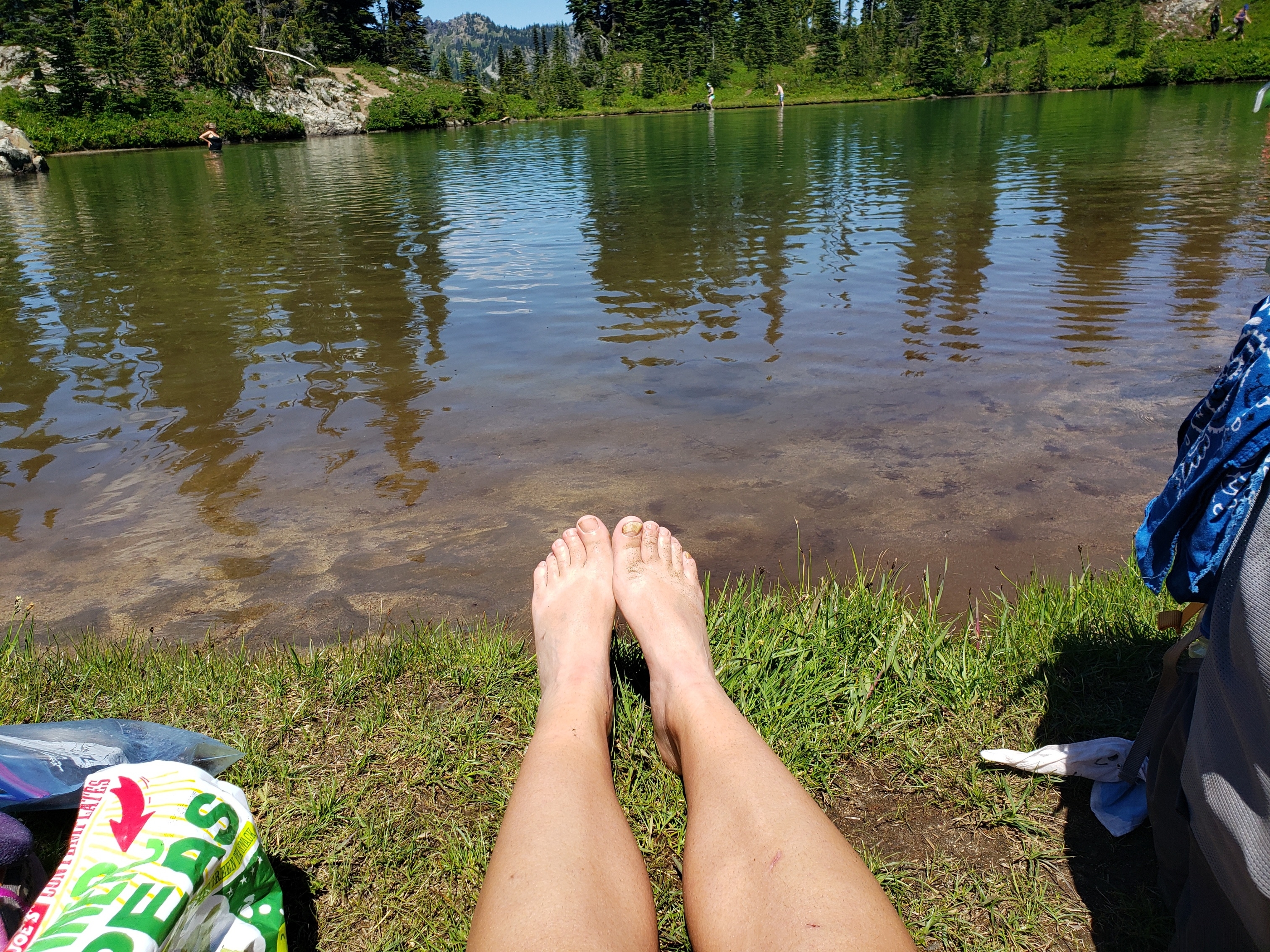
A day out of White Pass, the sun finally came out. Like, really came out. Mount Rainier, which should have been visible to us for miles, finally appeared the day I hiked into Rainier National Park. A humongous mountain suddenly materializing in front of you is as amazing as you would expect it to be. Chinook Pass, which isn’t a thru-hiker stop but is a hotbed of day-hiker activity, was teeming with people also enjoying the elusive sunshine.
I’ve been passing lakes with disinterest for the entirety of Washington, but I waded into the bluest lake two miles out from Chinook Pass and let all the frustration of two weeks of rain float away, not caring that I was sharing the lake with about 50 other men, women, children, and dogs. From now on, I won’t rate my personal scale of happiness from one to ten, just from Becky-in-Washington-after-two-weeks-of-rain to Becky-in-Washington-after-one-day-of-sunshine.
White Pass to Trout Lake
I decided to skip over the trip into Packwood since it was a Sunday and I had a dire need that my next town stop include an open post office. I’d been carrying my ice axe for several hundred snow-less miles due to a comedy of post office-related errors centering around a lack of large enough shipping boxes to hold it, plus the fact that I think July had like 14 Sundays in it. I was pretty eager to both stop having to carry the unnecessary weight and having to explain to people that yes, I was still carrying it and no, I was not still worried about the snow.
Instead I charged up the climb to Goats Rocks and Mount Adams Wilderness, which is routinely listed as a PCT highlight. As I approached the Knife’s Edge and Old Snowy, I began encountering some very unlike-the-PCT elevation gains. The rocks made a strangely pleasant sound while I was walking over them, far more musical than the-chewing-potato-chips-with-your-mouth-open sound they usually produce.
Every incline still has the backdrop of my AT experience as a comparison, so what is a difficult climb mostly doesn’t faze me. There’s an alternate route that runs along the side of the mountain that’s supposed to be a little easier, flatter, and safer in bad weather, but the sun shone gloriously so I was planning to stick to the high route. As I approached the split, though, I began running into northbounders. There’s an unfortunate amount of fear-mongering in backpacking and hikers I passed grumpily gave me a detailed (and unasked for) breakdown of the difficulty of both routes. The low route still had some snow but the high route was treacherous, not for the faint of heart and could take hours.
I shouldn’t have let it faze me, but it did. I couldn’t stop thinking back to falling ten feet in Southern Maine and sobbing my way through the Mahoosucs. My heart was pounding pretty hard when I got to the split and chose the high route.

I kept waiting for the other shoe to drop. Sure, the trail had sharp dropoffs, but it was wide and footing was easy and there weren’t any of the slick vertical rock faces I still have nightmares about. It was steep but took far less than an hour. I didn’t take pictures because I rarely do when I’m focused on climbs, but it was clear and gorgeous and once I was over the top I couldn’t stop laughing with delight at the sudden absence of my own fear. As I said on my Instagram, with nearly 3,000 miles of thru-hiking under my belt, it’s probably time to chill with the moments of self-doubt.
I’ve been waiting to see when I would finally cry on this trail and this was the moment, born out of pure happiness on top of Old Snowy as the sun beamed down on me and I felt like I could see the entirely of Washington spread out around me in every direction.

Wildflowers bloomed everywhere and I felt like my legs would never be able to stop walking again. I crossed over what was likely my last long snow patch (my ice axe was highly necessary for the entirely horizontal traverse).
I finally rolled into my favorite campsite of the whole hike, right next to a waterfall tucked along the side of a nearly treeless mountain.

There also happened to be seven people at that campsite, all of them women, which I feel has almost certainly never happened before in the history of thru-hiking.
I rolled into Trout Lake a couple of days later, hiking 20 miles by 1:30 to catch the 2:30 shuttle to town, which pleased me. After asking a lot of people what huckleberries were during this stretch, I got a huckleberry roll at the diner in town. It was bomb.
Trout Lake to Bridge of the Gods
This wasn’t the most interesting section of trail in the whole world, but my good mood continued along with the weather. My favorite bit was the trees by Trout Creek, which were so covered in moss that the whole place looked furry.

I also hiked my longest day so far at 27 miles which, to be totally honest, was because I couldn’t find a tent spot that wasn’t rock so I could properly stake out my tent. I’m still adapting to not having a freestanding tent. Since I also left the sunglasses I had just bought at White Pass at one of the rock filled sites, I rolled into camp in a pretty sour mood, but I’m retroactively pleased my miles are approaching 30. (As an aside, I’m on my third pair of sunglasses just for this trail, and losing them frequently is a long-standing backpacking problem I have. If you have any tips for keeping them for even 100 miles at a time, I’d really appreciate hearing them.)
Technically I didn’t cross Bridge of the Gods and the border when I got into town because I was staying on the northern side of the river in Stevenson. I was really trying to be efficient with my time since I knew I wanted to blog and hike out the next morning. That meant steering clear of the breweries on the Cascade Locks side of the bridge, even though I heard they offered free beer to thru-hikers. I took my shower and prepped my laundry and tried hard to ignore the texts from other thru-hikers who don’t blog and therefore had the time to head straight to the breweries.
Except then I got a message from Lotus, a friend from the AT who’s not thru-hiking this year but who happened to be at Thunder Island Brewing in Cascade Locks and was wondering if I was around. Blogging and laundry and hiking out early the next morning went out the window. I forget who it was that told me the world is big but the thru-hiking world is tiny, but pretty soon I was at Thunder Island with Lotus and her friend from the Arizona Trail and my friends from this year’s trail, thinking that the thru-hiking world is so freaking tiny.

Pictured: Lotus. Not pictured: free beer.
As I descended into Cascade Locks, I told all the NOBOs I passed to enjoy Washington. I was genuinely excited at the idea that all these people were going to get to experience some of the amazingness I’d experienced over the last few weeks. They would then tell me to enjoy Oregon and I’d think they were probably feeling the same thing. So after spending more time by Bridge of the Gods than I really meant to, I’m excited to hit the ground running and see what trail legs can do in Oregon. And what a trail stomach can do at Timberline Lodge’s breakfast buffet.

My final morning in Washington.

This website contains affiliate links, which means The Trek may receive a percentage of any product or service you purchase using the links in the articles or advertisements. The buyer pays the same price as they would otherwise, and your purchase helps to support The Trek's ongoing goal to serve you quality backpacking advice and information. Thanks for your support!
To learn more, please visit the About This Site page.
