 ">
">
The Hundred-Mile Fire-Pit
The night before I was due to reach Sierra City, conditions were hot and humid, so I stopped at a water source early the next morning. Soon afterwards, I caught up with a solo female hiker who I hadn’t seen before. She stepped aside to let me pass, and I had a decision to make.
- Stop and break the ice. Trying to demonstrate that I’m not some sort of backcountry stalker might make things uncomfortable.
- Just smile, say hello, and keep moving. That might come across as standoffish.
When in doubt, I think option two is preferable. That’s what I chose.
Least-favorite game
As I continued downhill, I realized I had a water leak. There was a cold, wet patch forming at the bottom of my backpack, so I stopped to investigate. I found that I hadn’t screwed the cap of my Dromedary on properly. My jacket was soaked, so I pulled it out and draped it across the top of my pack. Then I secured the jacket (or so I thought) using the lid of the pack. As I was getting ready to set off again, the same hiker (whose name I would later learn was Wingspan) reappeared and squeezed by. She soon stopped and stepped aside for the second time.
Again, I slowly put some distance between us.
Where the trail crosses Wild Plum Road, I left the PCT and took the road to Sierra City. About a mile later, I realized my jacket was slipping out from under the lid of my pack. I stopped to rearrange it. Again, Wingspan appeared just as I was preparing to get going. This time, we were on a dirt road, so she had plenty of room to get past. There was also no need for her to step aside for a third time.
Once I started catching up with her, the best I could do was try and overtake as quickly as possible. I judged that by now, the ice was basically unbreakable. However, I wasn’t travelling much faster than she was, and it took me forever to get ahead. As I drew alongside, I breathlessly exclaimed, “See you in town!” instead of the much, much worse alternative, “I’m not stalking you, honest!”
Awkward leapfrog: my new least-favorite game.
Nice Buttes
My resupply box was waiting at Sierra Country Store, and I took it around the corner to the picnic area. I charged my phone while repacking my bear canister, then returned to the store for a cold drink and an ice cream. Wingspan was standing outside. I introduced myself, she did likewise, and then I tried to make amends for having triggered a new ice age.
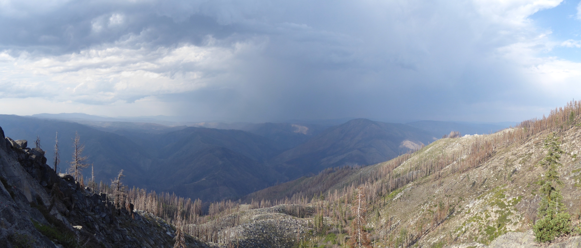
I was in town for less than 90 minutes, which is the thru-hiking equivalent of a Formula One pitstop. After a short walk along the highway back to the trail, I was rewarded with what might be my favorite climb on the PCT: Sierra Buttes. You’re among the trees for the first part of the ascent, but the trail is smooth, and it has the perfect gradient. It’s steep enough that you gain elevation quickly, but not so steep that it takes a massive effort. It’s a “maximum efficiency” climb. And once the trail gets a little steeper and rockier, you’re out of the trees and distracted by the view. I really enjoyed it. The sky was slightly overcast, and that helped too.

The Sierra Buttes ascent.
At the top of the climb, rather than follow the PCT, I filtered enough water to dry-camp, then took the alternate route shown in Farout. I passed a sign that called it the “Gold Valley Rim Trail,” and everyone I spoke to that day planned to take it.
- Pros: the alternate saves you about 3 miles, you won’t have to lose much elevation, and you won’t be pestered by mosquitoes.
- Cons: the trail is open to mountain bikes, some sections are dirt road, and you won’t be near water.
Heating up
The Dixie Fire burned across more miles of the Pacific Crest Trail than any other fire in memory. Approximately 85 miles of the PCT burned from Bucks Lake north to Old Station, a distance of 106 miles.
Per the PCTA website, I was close to the burned area left by 2021’s Dixie Fire. Before that, I’d have to cross the scar left by 2020’s Bear Fire. Southbound hikers I’d spoken to described these areas in apocalyptic terms. Several NOBO’s were planning to skip the section.
I was surprised that the Dixie Fire closure had been lifted so soon. I pictured a blackened, desolate wasteland, completely devoid of trees. A sunbaked, windswept, sooty place where the only remaining features were the craters left behind when tree-roots turned to ash. I’d spend six days crossing this potential hellscape, and I was a little apprehensive.
Things started innocuously enough. The trail went up and over a dirt mound, and I found myself in a firebreak which was several-bulldozers wide. Dead trees to the north, green trees to the south. The PCT followed the firebreak for five miles before heading deeper into the Bear Fire burn area. Honestly, given my low expectations, it could have been much worse. Almost all the trees were dead, but still standing. Their trunks were charred and their lower branches gone. However, there was still a tiny amount of shade from the upper branches, even though they were brown, limp, and lifeless.
The trail heated up as it descended to the Middle Fork of the Feather River, and every hiker had the same idea: swim. At one point, there were 15 of us cooling off before starting the ascent to Lookout Rock.

Left: camping at Lookout Rock. Right: five minutes later, sunrise.
Dixie Fire
The unburnt area between the Bear and Dixie Fires took a half-day to cross, and all of yesterday’s hikers disappeared. They left the trail to resupply or skip ahead, so I had the Dixie burn area to myself.
Again, the scene wasn’t quite as apocalyptic as I imagined. Some trees had burned completely, leaving only a crater that was half-filled with charcoal. Most trees were dead but still standing. Any surviving trees were typically clustered around creeks or streams, although there were also pockets of green elsewhere. It looked like the fire had swept through so quickly that it hadn’t had time to burn everything completely. It had done just enough damage to each tree to ensure that it would die. An inch-thick layer of ash covered the trail, and each of my footsteps produced a small puff of fine dust. Essentially, I’d be hiking through a 100-mile-long fire-pit for the next few days.
It took me some time to realize that everywhere was eerily quiet. There were no insects buzzing or birds singing, just the occasional crash of a falling branch. I also suspected that when the USFS did its Burned Area Emergency Response, one of their tasks had been to turn up the volume of each burbling creek.
After traversing a hot hillside, I decided I’d found my campsite: a saddle on the ridgeline south of Belden. If I hiked any farther, I wouldn’t be able to camp until I’d completed the descent to the valley floor. I’d gone as far as I needed to for the day.
Five-second rule
Even before the Dixie Fire, there wouldn’t have been much shade on my chosen ridge. All that now remained were a few sandy patches of bare earth separated by the silver-gray skeletons of manzanita bushes. It was mid-afternoon, so I positioned myself behind a nearby rock that cast a shadow large enough to hide in. As my patch of shade lengthened, the wind picked-up out of the south, and the thickening clouds to the northeast became more ominous. I continued reading my book until I was distracted by a flicker of lightning in my peripheral vision. It was time to take the incoming weather more seriously.
The leading edge of the cloud-bank cast a shadow that fell on the other side of the valley, several miles away. A few miles beyond that, there existed a different world from the one I was in. The depths of the storm were dark, with bands of rain and intermittent lightning. I counted the seconds until I heard thunder, but something didn’t add up. The sound reached my ears about a minute after each flash of lightning. If the “1 second = 1 mile” rule that I’d been taught as a kid was actually true, the storm was about 60 miles away. It was obviously much closer than that.
A quick calculation confirmed it: the actual rule is “5 seconds = 1 mile”. The lightning was only 12 miles away, and getting closer. The shadow cast by the leading edge of the storm had crossed the North Fork of the Feather River, and was moving in my direction.
A thunderstorm, northeast of Belden.
Red Alert!
A shaft of sunlight swept across the summit of Red Hill, about five miles away, and highlighted a radio antenna. Or perhaps a cell tower. Pulling out my phone, I switched off “Airplane Mode” and waited to see if the phone acquired a signal. It immediately sprang to life, sounding an “Emergency Alert” at maximum volume. It was the loudest thing I’d heard all day, and I almost dropped the phone. I read the text.
National Weather Service: A FLASH FLOOD WARNING is in effect for this area until 10:30 PM. This is a dangerous and life-threatening situation. Do not attempt to travel unless you are fleeing an area subject to flooding or under an evacuation order.
So, if I stayed where I was, there might be lightning. If I hiked the six miles down to Belden, there might be flooding. It was still warm and sunny up on my side of the valley, so I decided to stay put.
Fortunately, the storm altered course slightly, its direction changing from southwesterly to westerly. The lightning never came any closer than about five miles, and I eventually decided to put up my tent and eat dinner.
Bassline
Just after six the next morning, I started the descent. At 7:30 AM, I was still about 2000 feet above the valley floor when I began hearing music. Or more precisely, a thumping bassline. It sounded like someone in Belden had a powerful car stereo with a giant subwoofer.
About 45 minutes later, I reached the trailhead to find a full parking lot. There were also cars parked along the roadside for a quarter mile in the direction of Belden. Some of the cars contained sleeping occupants, and the area between the road and the river was dotted with tents. The music was much louder now, but strangely, still mostly bass. I guessed I was looking at the aftermath of a massive Saturday-night party.
Apparently, only one partygoer was awake. He was standing beside his car, bleary-eyed and shirtless. At least, I hoped his shirt was the only missing item of clothing. I couldn’t be sure, so I didn’t hang around. Halfway along Belden Town Road, I discovered the source of the music. There was a soundstage in an open area by the river, and a shirtless DJ was standing behind his mixing desk. Was he wearing pants? I hoped so. The more pressing question was why this lonely DJ was still awake after everyone else had gone to bed. Maybe a clause in his contract made him promise to keep the party going until a PCT hiker had walked by.
Quiet time
I continued past the Lodge, waved to the old guys sitting on the porch, and walked across the bridge to the trailhead. Then I began the climb that would take the rest of the day. A few minutes later, the music stopped, and I looked across the river to see an unmanned mixing desk. Presumably, the DJ had fulfilled the terms of his contract. He’d had promises to keep. And I had miles to go before I could sleep.
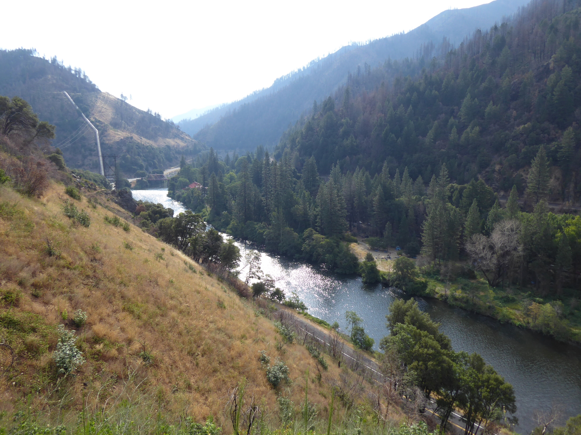
A quiet Sunday morning in Belden.

This website contains affiliate links, which means The Trek may receive a percentage of any product or service you purchase using the links in the articles or advertisements. The buyer pays the same price as they would otherwise, and your purchase helps to support The Trek's ongoing goal to serve you quality backpacking advice and information. Thanks for your support!
To learn more, please visit the About This Site page.

Comments 2
This is an interesting blog post.