
 ">
The PCT’s Northern Terminus Is Closed. Here’s One Way You Can Still Hike to Canada
It’s a gut punch few outside the trail community can understand: You’ve been working your way north on the PCT for months, the iconic image of the Northern Terminus calling you like the source to the salmon. You’ve overcome pain and fear, kept grinding when things got tough. And then comes the dreaded news: Fire closure. Not just any random trail miles, but the last stretch to Canada.
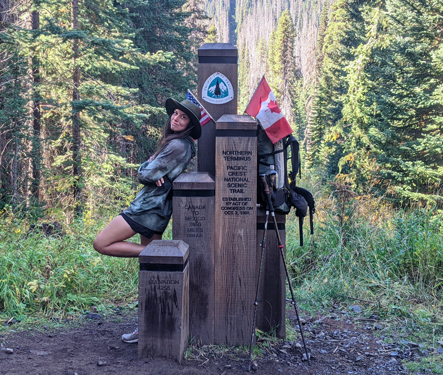
It happened to me when I thru-hiked the PCT in 2022 and wildfires shuttered the final stretch of the trail leading to the Northern Terminus at Monument 78. Now in 2026, it’s happening again. But as I found in 2022, just because the official Northern Terminus is off-limits doesn’t mean you can’t still walk to Canada and end your hike at a different border monument.
I followed the PCTA’s (at the time) recommended alternate route through the Pasayten Wilderness and then detoured to a little-known border marker — Monument 90 — for a connected footpath to Canada that minimized frontcountry road walking, was only slightly longer than the official route of the PCT to the terminus and back to Harts Pass, and still ended in a scenic spot with a shiny landmark to crown the end of the trek.
Ed. note: The Pacific Crest Trail association is not currently recommending alternate routes around the Ptarmigan Fire closure. This route is presented as an independently researched option for hikers who want to reach the Canadian border, and as Caitlin said, hikers should verify current fire conditions, closures, and access restrictions before attempting it.
In this post I’ll describe that route and the available beta for it, plus some other creative alternates thru-hikers have found to the Canadian border. First, though, a disclaimer: As always, make an independent assessment with current information regarding conditions and closure status before embarking into the wilderness. As of this writing, the route described in this post is open. More on this below.
The Journey … and the Destination
They say it’s about the journey, not the destination. That’s true, but when you’ve given everything to the journey and the final triumph is withheld, it’s a tough pill to swallow. Many make their peace with it and end their hikes when they run out of official open PCT miles, and that’s completely fine.
But hikers who want, more than anything, to walk all the way from Mexico to Canada have often found alternate routes to the Canadian border, even if not to the official Northern Terminus. Washington alone hosts 427 miles of international border and 195 border monuments.
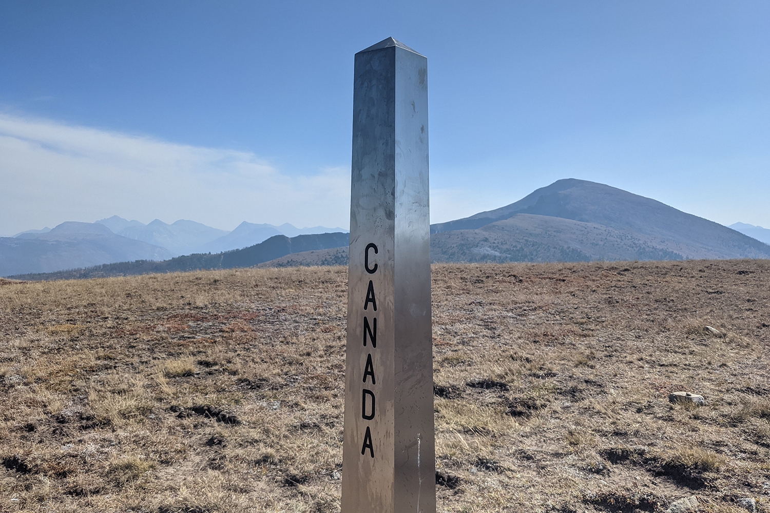
Monument 90 — she’s a beauty. Here pictured in September 2022.
Back in 2022, thru-hikers did all sorts of creative things to complete their journey to Canada while respecting the closure. Some paddled to Monument 72 on the east shore of Ross Lake (currently closed). Others hopped over to the CDT to hike a mileage equivalent and finish at the Waterton monument. My buddy Lucky Feather thrashed his way through a bit of trailless, scrambly bushwhack to a spot on the border that didn’t even have a monument marker.
Lucky Feather notwithstanding, most of us appreciate some sort of marker to define the end of the journey. If you’re on trail and seeking a footpath to the border that avoids fire closures, preferably one close to the PCT corridor and with a maximum of attractive wilderness singletrack, let me break a lance for a compelling alternate: hiking to Park Pass and Monument 90 via the Larch Creek Trail.
Check Conditions and Closure Status
Again: independently confirm that all parts of this route remain open and safe to hike before tackling it yourself. At time of publication, both the Methow Valley Ranger District and the Ptarmigan Fire hotline have recently confirmed that the Billy Goat Trailhead and the Larch Creek Trail to Park Pass are open.
Confusion has arisen because the other trail leaving from that trailhead, the Hidden Lakes Trail, is closed, and the Larch Creek Trail and Peeve Pass denote the edge of the closure boundary on official maps, but are themselves open.
Current closure information can be found on the USFS page for the Ptarmigan Fire, and daily updates from the fire management team are available on Facebook. Calls to confirm open status may be directed to the Ptarmigan Fire information hotline at (509) 215-8214 and the local ranger office at (509) 996-4000 (limited phone availability Monday-Friday, 8 a.m. to 4 p.m. with a lunch break). These numbers and the Facebook page can also provide insight into the smoke, wind and weather forecast before heading into the backcountry.
One more clarification: Although there is no formal closure at this time, official Facebook updates have requested that the public avoid forest service road 5200 while work crews conduct operations. FSR 5200 is not just one road, but a network of roads in the area. Hotline personnel confirmed that work was mostly happening elsewhere in the network and winding down, that the request to avoid was aimed at vehicles, and that hikers were allowed to traverse the roads of the alt route to the trailhead but should maintain good situational awareness and keep their eyes up for any vehicle traffic.
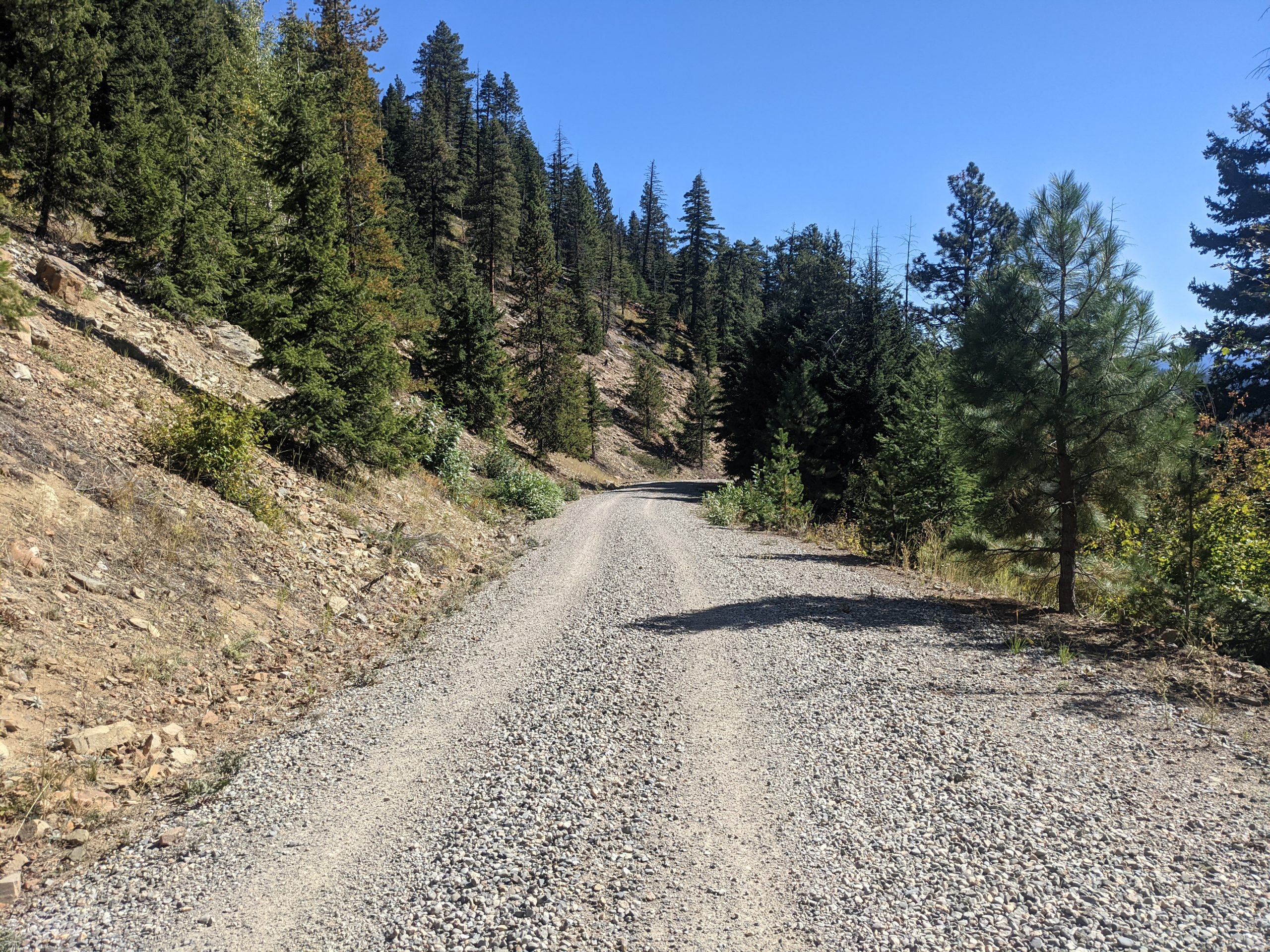
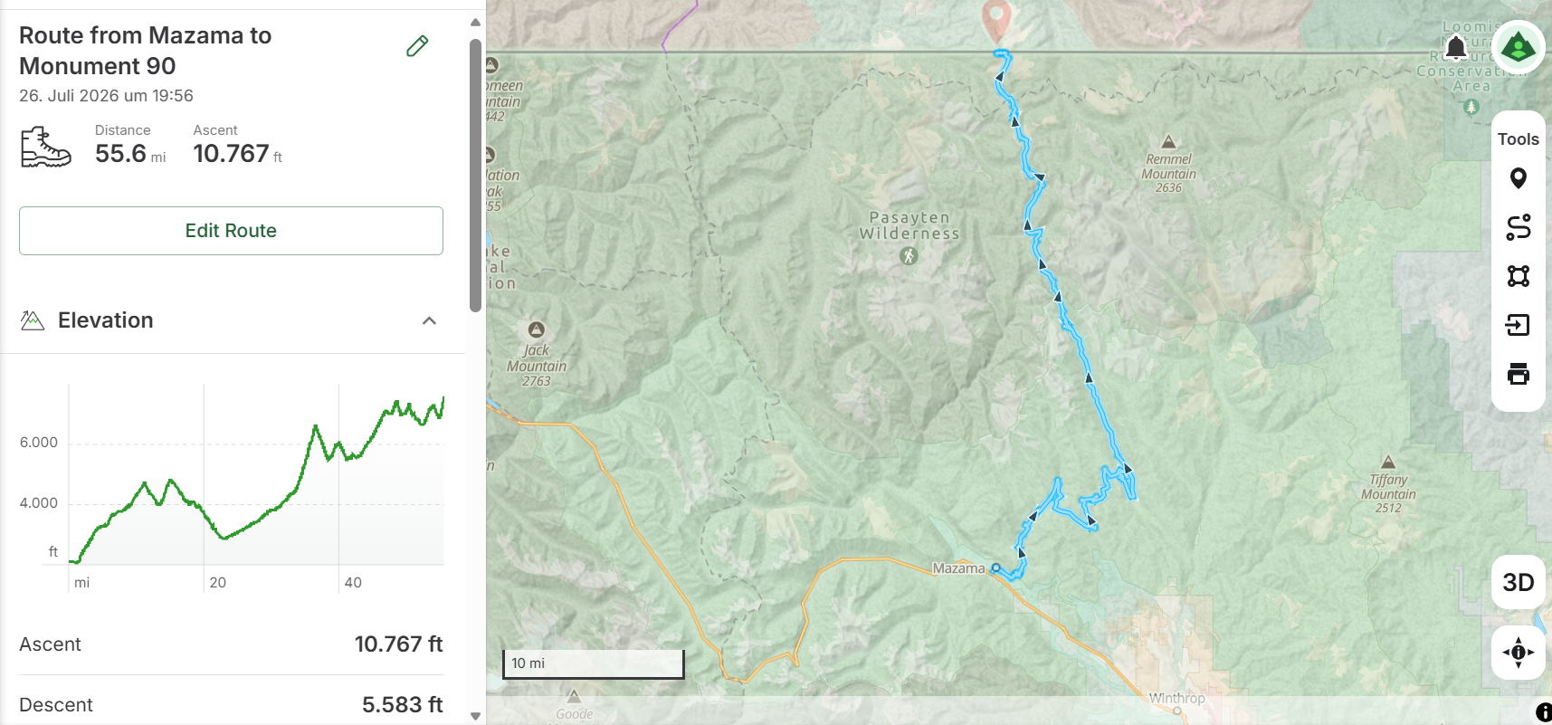
The alt route traces forest service roads between Mazama and the Billy Goat Trailhead.
The Monument 90 Alternate
The route goes basically like this:
- Walk from Rainy Pass to Mazama via Highway 20 or a DIY route connecting trails adjacent to the road (Edit: the Ptarmigan Fire closure has now been modified; the PCT has reopened between Rainy Pass and Harts Pass. Hikers can continue on the PCT as far as Harts Pass, roadwalk from there to Mazama and follow the rest of the route described below.)
- Follow forest service roads from Mazama to the Billy Goat Trailhead
- Hike the Larch Creek Trail to Park Pass
- Find Monument 90 just up the hill from the pass
If hiking a continuous footpath from Rainy Pass, this route begins with just over 22 miles of highway walking to Mazama. Alternately, hikers keen to avoid Highway 20 can see the available trail options on the free version of the Gaia GPS app and cobble together a zigzagging route on trails to the southeast of the road. (See above update: Hikers can now hike as far as Harts Pass before splitting off towards Mazama.)
If a connected footpath isn’t a top priority, hikers can also hitch to Mazama or all the way to the Billy Goat trailhead before hiking onward.
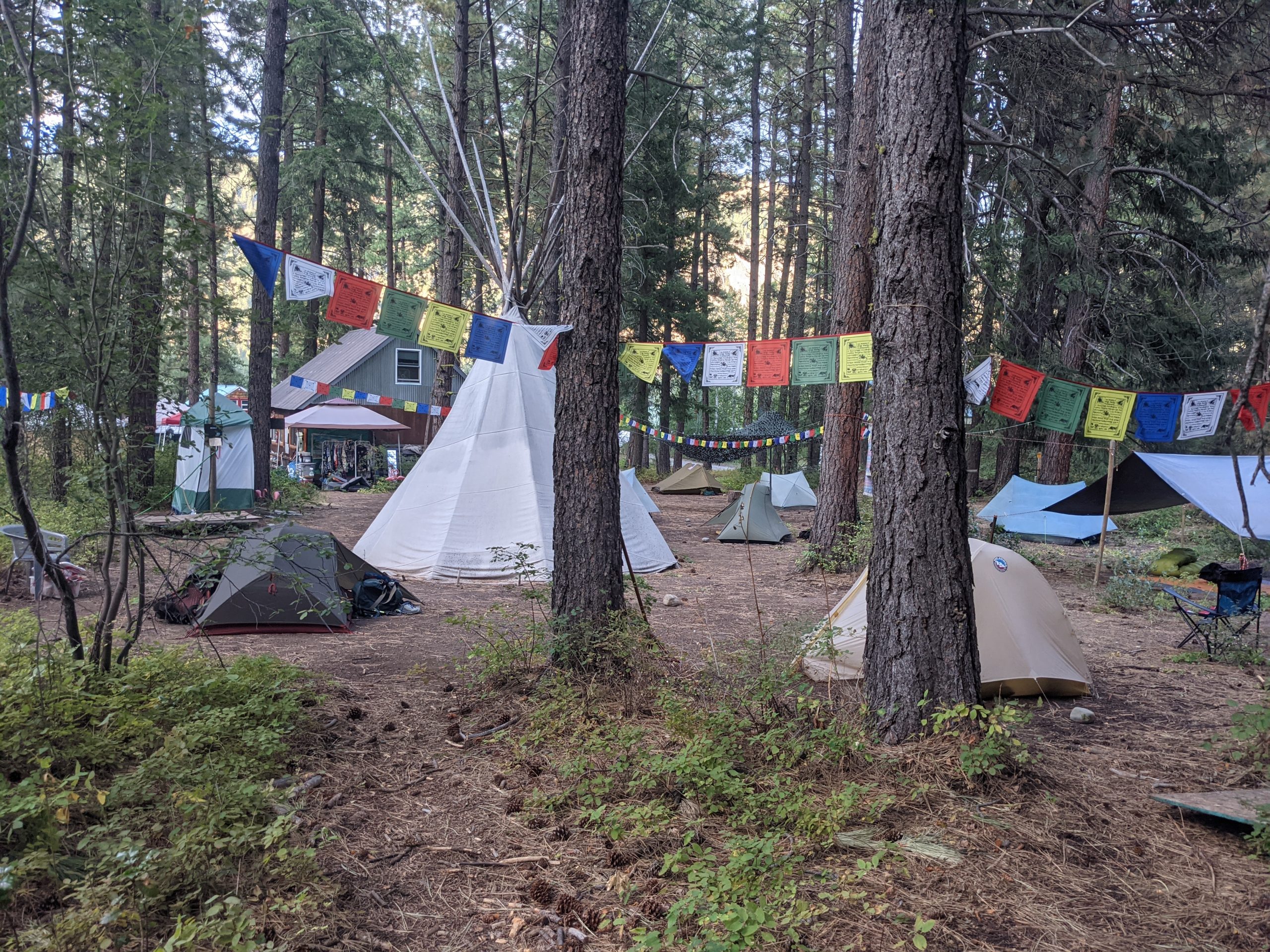
Peace and community at The Lion’s Den in Mazama, Washington.
Once in Mazama, the logical base for chores and planning logistics is the legendary hiker haven, The Lion’s Den (formerly Ravensong Roost). Trail angel Lion (aka Mary) is also offering trailhead shuttle rides for the alt.
Note: Those hiking a continuous footpath would still be well-advised to coordinate a pickup for once they finish, so as not to repeat the miles from the trailhead back to Mazama; it’s a remote trailhead and organic hitches are a rarity.
It’s a good idea to download the Gaia GPS app for navigation (tenting icons, creeks and springs are also shown along this alt) and to make use of the fire layer available in the free version. And for your convenience: Here is the GPS track for the alt from Mazama to Monument 90.
Now onward to the mysteries of the remote, wild Pasayten.
Why Do This Alt?
This year, hikers have once again shown remarkable creativity and tenacity in the face of setbacks, embarking upon all sorts of alternate routes to snag themselves a piece of Canada in the form of one border monument or another.
The spirit of Hike Your Own Hike has sent some hikers questing to Monument 47 out in the west, and others on an epic, 130-mile reroute to connect their footsteps all the way to the border crossing at Sumas.
These hikers have helpfully shared details in this year’s PCT class group on Facebook (see above links). In a year without the Sinlahekin Fire, one could also roadwalk east to the border at Nighthawk. There are advantages to routes with a lot of frontcountry — namely resupply, amenities, the option of hitching partway for hikers less married to their footpaths, and the ability to bail quickly if fire or smoke conditions change.
However, all of these routes involve substantial mileage on pavement, and in the first two cases, a bit of bushwhacking. Unless the smoke in the central Pasayten significantly worsens again or the closure boundaries shift, I’d argue that Monument 90 is a far easier, more scenic, and more pleasant option.
Even for hikers roadwalking from Rainy Pass to the Billy Goat Trailhead, the total length of the reroute to Canada and back to the trailhead is just over 100 miles — barely 10 miles more than what hikers would normally do on the PCT to Canada and back to Harts Pass.
It’s close enough to still see the peaks of the Crest, while also offering scenic views into Canada and east into the Pasayten, including the enticingly wild-looking gate of Cathedral Pass over on the PNT.
And upon finishing, hikers can return to Mazama to celebrate, process their achievement, feast on baguettes at the bakery, and unwind in the comfort of hikertrash company.
An Uncommon Twist on a Common Alternate
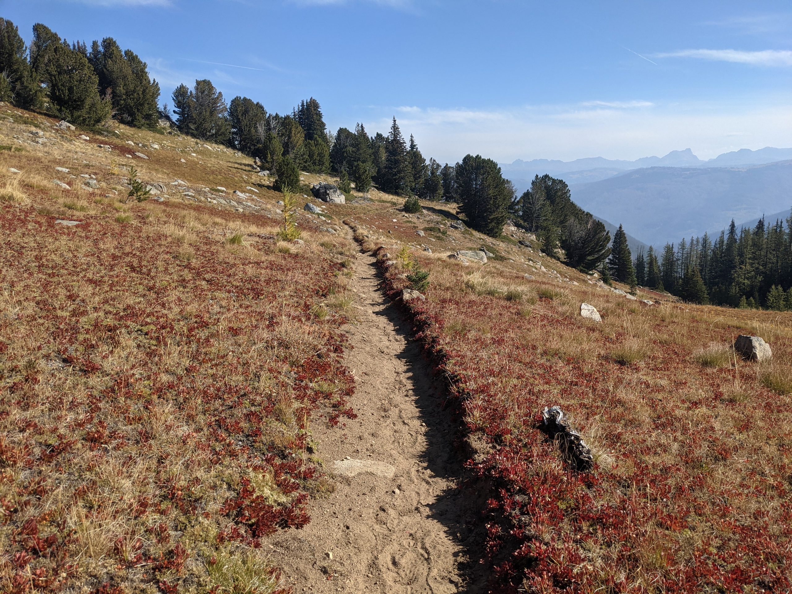
The Larch Creek Trail towards Park Pass, Cathedral Pass visible to the east.
People familiar with the Pasayten Wilderness know all about the Billy Goat Trailhead and the Larch Creek Trail towards Canada: it’s an increasingly common reroute for both the PCT and the Pacific Northwest Trail when fires snarl up their shared track between Castle Pass and Holman Pass.
Yet Monument 90, which marks the US-Canadian border a few miles beyond the PNT’s intersection with the Larch Creek Trail at Peeve Pass, is a less common destination. The trail curves onward north of Peeve Pass, contouring the western slope of Sheep Mountain, until it reaches Park Pass — a nondescript bit of meadow where the boundary cutline through the trees disappears into the open grasses. When the PCTA endorsed the route to Park Pass as their official alt in 2022, they did not include the border monument.
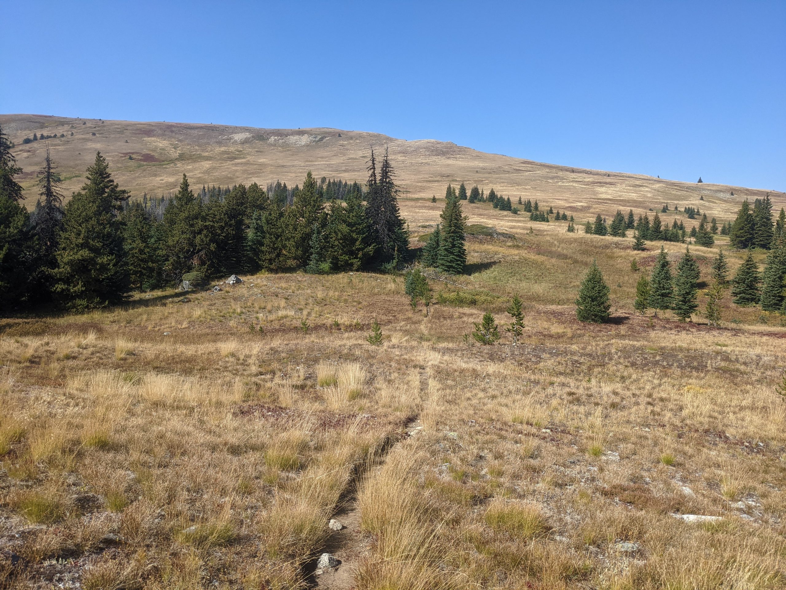
Park Pass. Monument 90 is perched atop the hill.
Fortunately for myself and my fellow hikers, my parents had come to meet me that year for a day of R&R in Mazama before I hiked on. As I fretted over maps and alternate options, my dad browsed through an old guidebook in the rental cabin. And in its pages, he discovered a hand-drawn map of the area around Park Pass — with Monument 90 just up the hill.
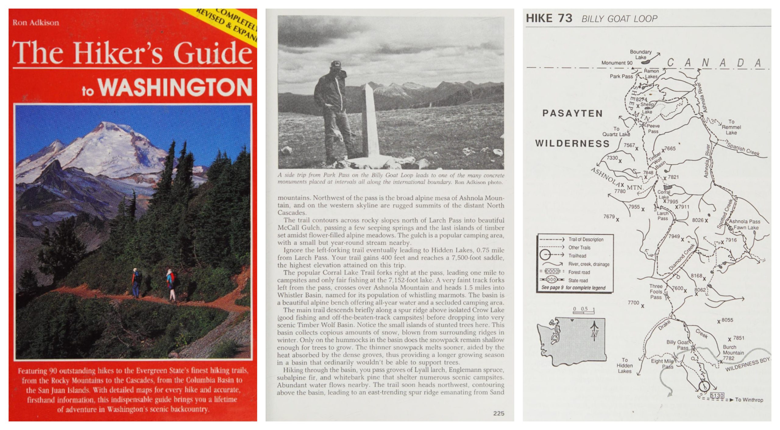
The Hiker’s Guide to Washington, 1993 edition, copyright Ron Adkison.
My first move was to google it and attempt to confirm the monument’s continued presence and exact location. I found next to no information online. In the interim, I’ve unearthed old WTA trip reports on the border marker, plus the various reports from those of us in 2022 who visited Monument 90, but at the time I felt like I was heading into the void.
What’s the Beta?
Exact distances vary between mapping services — if anyone takes a tracking watch and wants to report back, that would be welcome. The track in Gaia, which used its snap-to-trail feature to map, shows about 34 miles on the pronged, twisting forest service roads between Mazama and the trailhead. Google Maps walking directions for the same distinctive pincer-shaped route clocks it at about 36 miles.
When I walked it in 2022, FarOut had provided an in-app track for the same alt, and I remember my mileage for the first day from Mazama to Ruffed Grouse campground being about 27 miles, with around 8.5 miles the next day to the trailhead, and then continuing on for just over 10 miles to my next camp spot nestled south of Larch Pass, which is marked with a little tenting icon in Gaia when you zoom in.
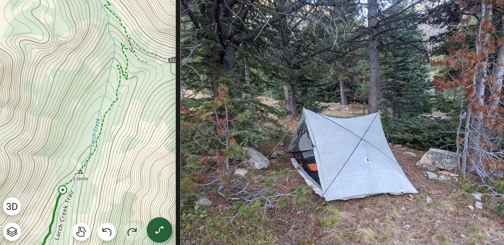
From that spot, it’s about a 22.5 mile out-and-back day to hit Monument 90, come back and camp again in the cozy patch of trees by Larch Creek. The next day, return to the trailhead, where Lion or another angel might be able to assist with a ride out. Et voilà.
There are alternate tenting options for big-mile crushers — not everywhere in this partially burned section of the Pasayten is suitable for camping, but with the developed campgrounds on the road before the trailhead, numerous options between Billy Goat Pass, Three Fools Pass and Larch Pass, and a few windy exposed places after Larch Pass, there should be something for everyone.
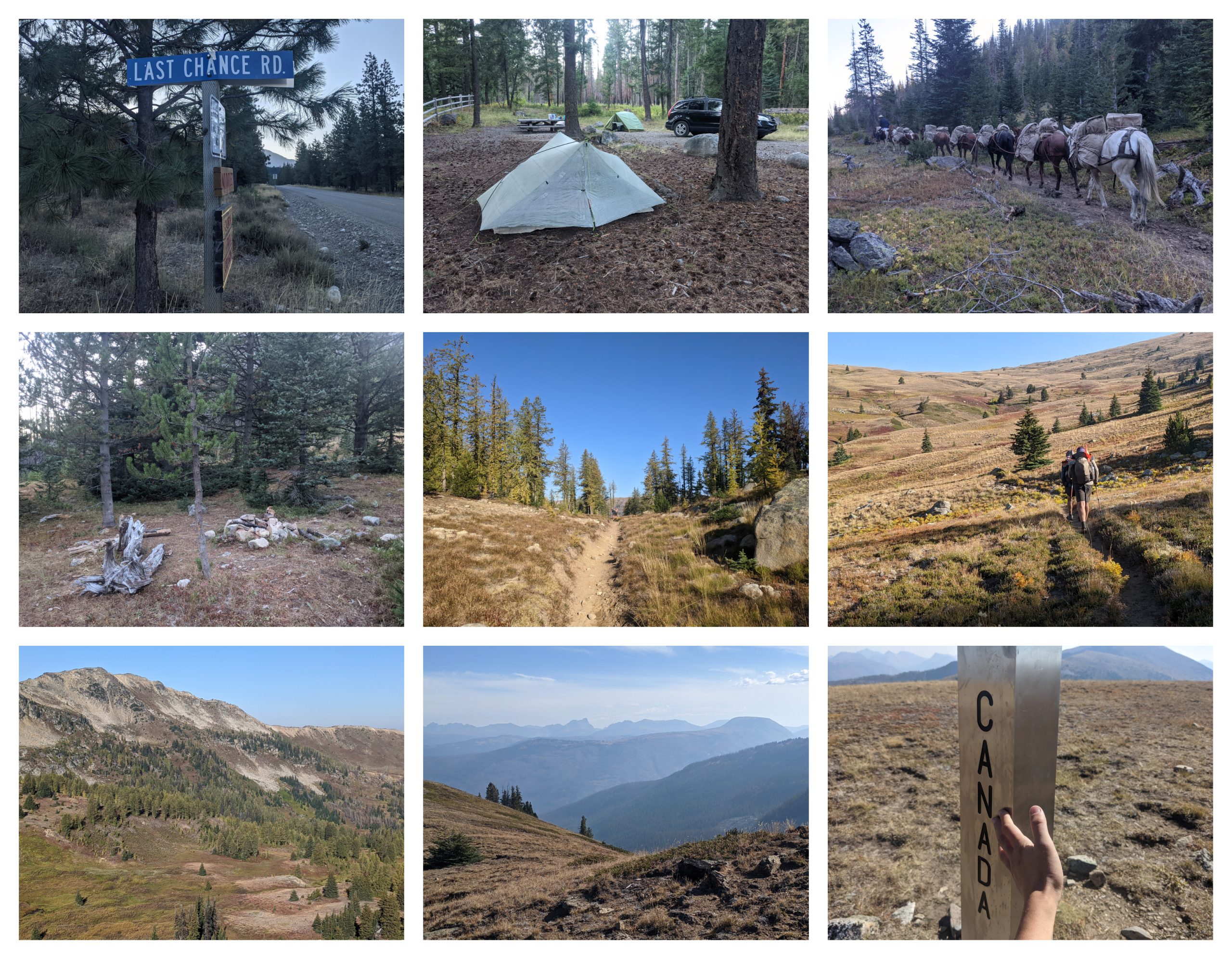
Route views: Last Chance Road out of Mazama, Ruffed Grouse campground, horse string in Three Fools Pass, cozy tenting, morning light in Larch Pass, ascending McCall Gulch, Sand Ridge, eastern Pasayten, tagging Canada.
For water sources, the Gaia app is again a good source of intel. The marked spring south of Billy Goat Pass was flowing for me in September 2022, but it might be wise to carry some extra from Eightmile Creek, which parallels the road approach to the trailhead. I have no personal memory of whether Drake Creek was flowing or not in 2022, but hikers who have been on the alt this season may be able to provide details. Larch Creek should certainly be flowing, adding to its attractiveness as a camp spot.
After Larch Pass, you enter an arid, sparse landscape with a raw, strange beauty. The land opens up and there’s little water available along the alt, though there’s at least one small source not far from Peeve Pass that should hopefully be flowing. If you get in trouble out there for water, it would theoretically also be possible to hit Park Pass and then contour around the eastern back side of Sheep Mountain to access the small lakes that lie in its far shadow, though it would add miles and effort. Best to carry generously.
Recent Trip Reports
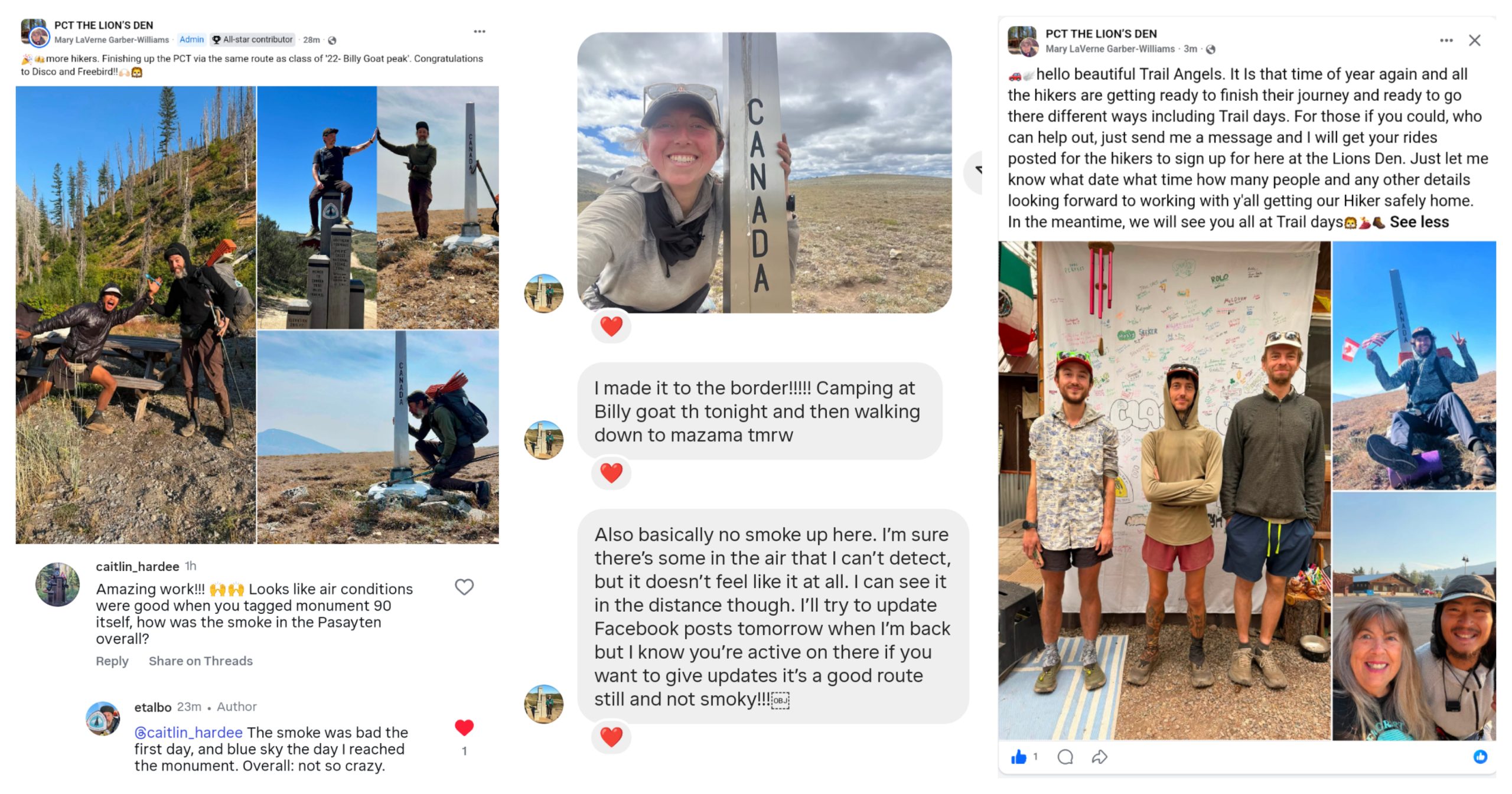
A few intrepid hikers have made the trek to Monument 90 in 2026, helpfully reporting back on conditions. My buddy Rachel “Bubble Wrap” Pinsker, who tagged the monument at the end of July, had a good window with favorable winds blowing the smoke away from the route. “It’s a good route still and not smoky,” she summarized.
Etienne Talbot, who completed the alt a couple weeks later in August, reported: “The smoke was bad the first day, and blue sky the day I reached the monument. Overall: not so crazy.” A third hiker, Austin Oetinger, also posted a happy shot with the steel obelisk.
What’s With the Border Monuments Anyway?
The obelisks placed along the massive US-Canada land border have a long and fascinating history. Surveyed and demarcated in the 1800s, the maintenance of the border swath and its many markers falls under the purview of the International Boundary Commission. Folks have made interesting projects out of visiting numerous monuments, and fantasized about a theoretical (and heinous) hike that would connect them.
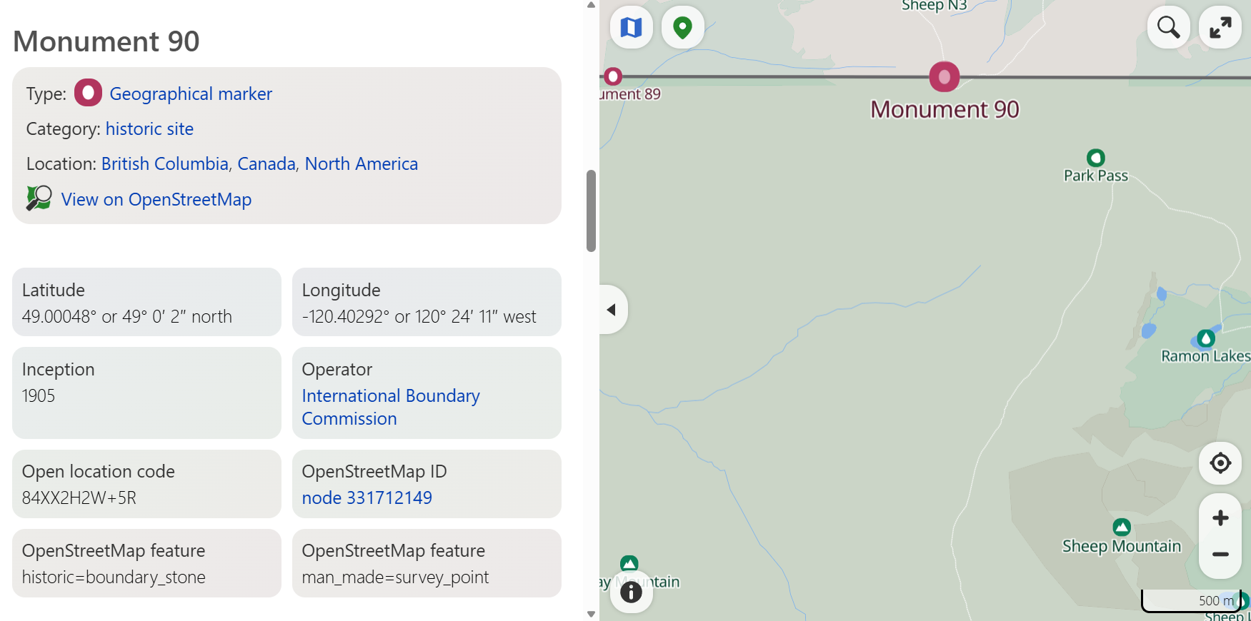
Within the Pasayten alone, notable monuments are located in such scenic spots as atop Armstrong Mountain (#104), or next to the lookout tower on Holdover Peak (#83). But there are oodles more obelisks that probably never get visited, except by their custodians. The one digital map that I’ve found which shows them all (if you zoom in far enough) is MapCarta. Behold:
And for a blast from the past, the historical surveying map archived by the IBC:
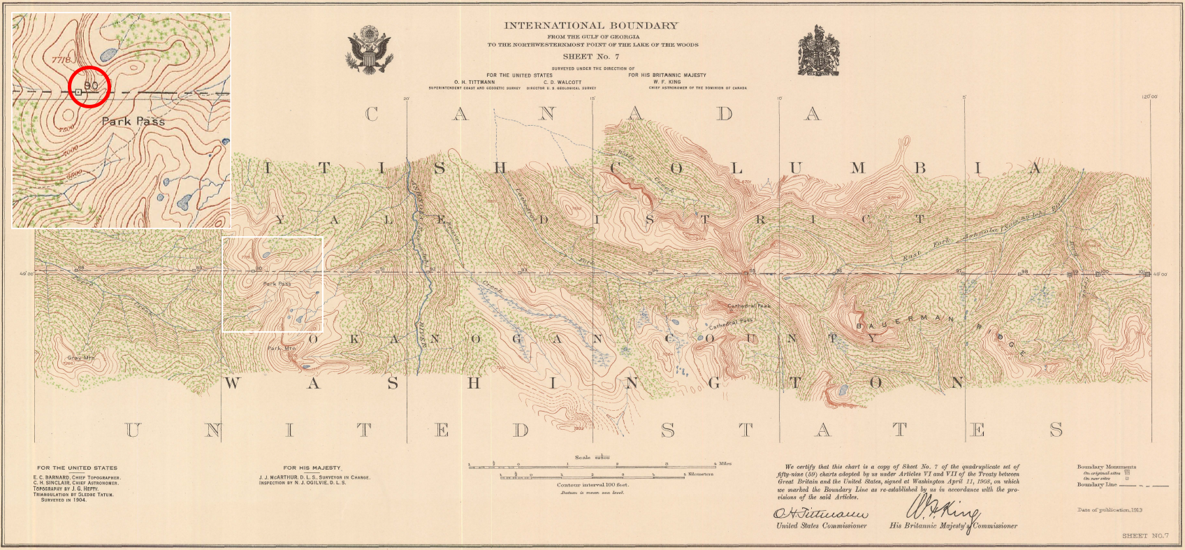
Imagine surveying all that remote country, nary a GPS app nor an audiobook nor a bag of dill pickle chips to keep you company.
What About All the Other Closures in Washington?
Unfortunately, the class of 2026 has their work cut out for them. Aside from the Ptarmigan Fire closure in the Pasayten (mile 2626.2 to the terminus), the Three Queens Fire and the Miner’s Fire have closed stretches of trail in the sections between Snoqualmie and Rainy Pass (miles 2396.5 – 2446 and 2524 – 2555, respectively). Current closure information is available on the PCTA website.
Trail angels and hikers in the Pacific Crest Trail Class of 2026 Facebook group (public) and the PCT Washington group (private) have been busily gathering research on possible workarounds for these closures. The caveat is that many of these routes are theoretical and may not have been test-hiked this season or had open status verified with land managers. If you choose to tackle one of these alts or make your own, double check the info and form your own assessment of conditions and feasibility.
Whether you string together a wildly stubborn footpath or choose a patchwork journey to make the best of open miles: Be proud of your adventure, cherish the wild places, stay safe and HYOH.
Update: The PCTA has now provided a potential walking detour for the Three Queens Fire.
Second update: The PCT has reopened to mile 2626.2, allowing hikers to start the alt from Harts Pass instead of Rainy Pass.

This website contains affiliate links, which means The Trek may receive a percentage of any product or service you purchase using the links in the articles or advertisements. The buyer pays the same price as they would otherwise, and your purchase helps to support The Trek's ongoing goal to serve you quality backpacking advice and information. Thanks for your support!
To learn more, please visit the About This Site page.

Comments 4
So according to the coordinates given, hikers would have to bushwhack 0.6 mi (as the crow flies) to get to this monument OR cross into Canada and follow a trail. My understanding is you’re not allowed to cross into Canada.
Hi Colin, yes there’s no trail to monument 90, but also no bushes to whack, it’s open grasses up the hill. 🙂 Included the GPS track so people can follow it with confidence.
I remember watching a YouTuber (Twiggy) finish her hike there. Honestly, I think it’s a prettier location then the actual terminus.
Linked her video above. 🙂 We had met back in 2022 at the Methow River and compared notes on the alt. Super cool and emotional to see everyone’s finishing posts and videos from that year. Pretty neat adventure! The real terminus holds such emotional weight, but Monument 90 is a pretty cool side quest / alt finish, even on its own merits. The Pasayten is so wild and interesting.