 ">
">
The Section of Passes
788.5-801.2
Kearsarge and Glen Pass
I awoke for the second time on this trip from the comfort of a pit toilet. Debbie, a trail angel in Bishop, had given us a ride to the trailhead the night before. Lightning and hail greeted us there, and we quickly threw out the idea to do any hiking that night. So we piled into the bathroom and set up our sleeping gear.
That meant, in order to do the two passes we had planned that day, we would have to wake up at 1 a.m. to get to both before the snow got slushy. We start hiking under the nearly full moon. We climb to the top of Kearsarge Pass, an easy feat after having already done it on the way out.
Deer tracks followed the boot pack over the pass, so the trail gets plenty of use besides us hikers. After nine miles, we finally make it back on the PCT as the sky was getting lighter. We would have to hurry to get to Glen Pass before sunrise.
And so, we climbed. Up through valleys, peaks, and flats. And then, when we think we’re close, we see the boot pack climb straight up a 200-foot wall of snow. Great.
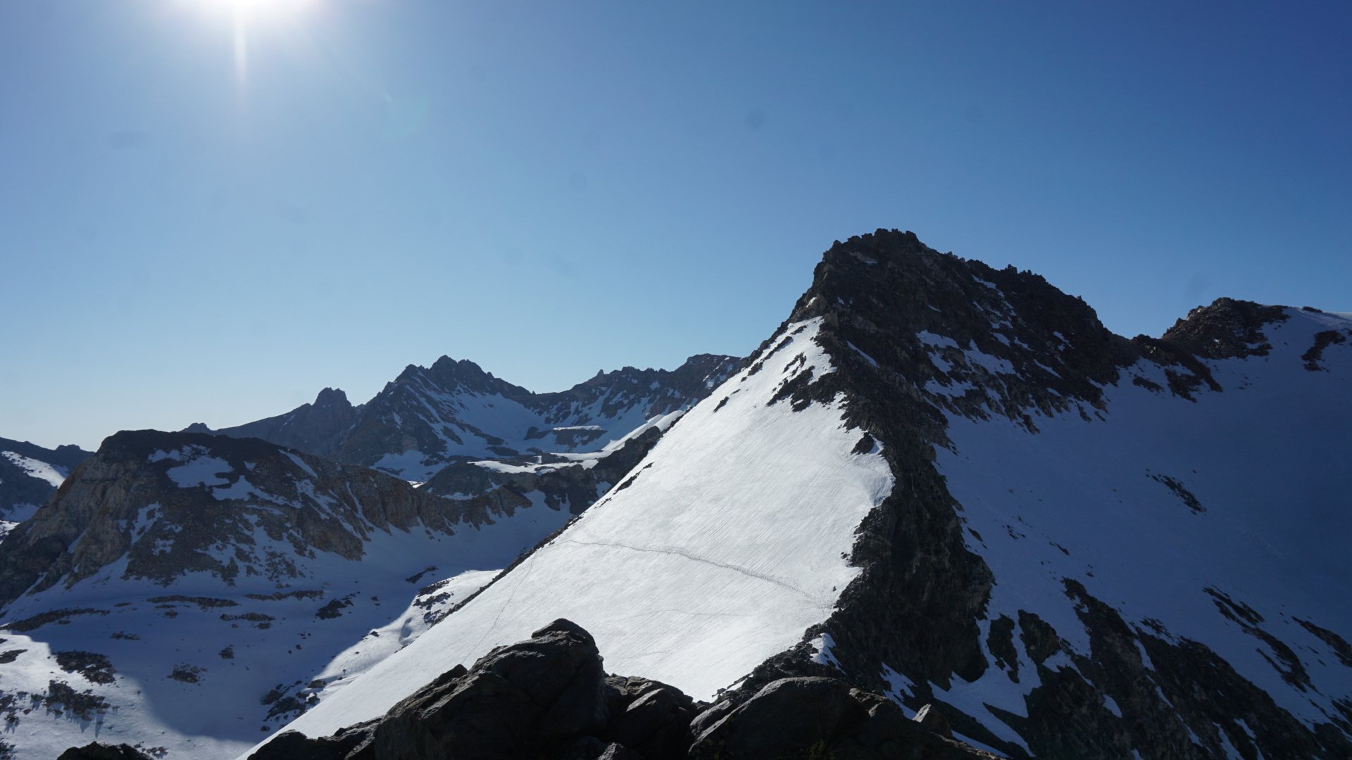
From the summit of Glen Pass.
I pull out my ice axe, tighten my crampons, and the five of us start the climb. I only focus on the steps directly in front of me. After an eternity, we reach the rock scramble on top. This is arguably harder to walk on, especially with crampons.
At the summit, we see the horrible route down right under and over avalanche dangers. We don’t hang around, and start descending. There’s about 50 feet of loose rock between me and the snow. I scramble down, and when someone sends a rock down the path behind me, I hit my mouth with my ice axe to avoid it. I think my tooth is surely cracked, but I check and it is intact.
The snow is slushy, but only slightly by the time we reach it. We slowly make our way down the initial, steep descent. At the bottom, we look back and cringe at the wall of snow we just came down. After a brief rest, we continue on.

At the bottom of Glen. Yikes!
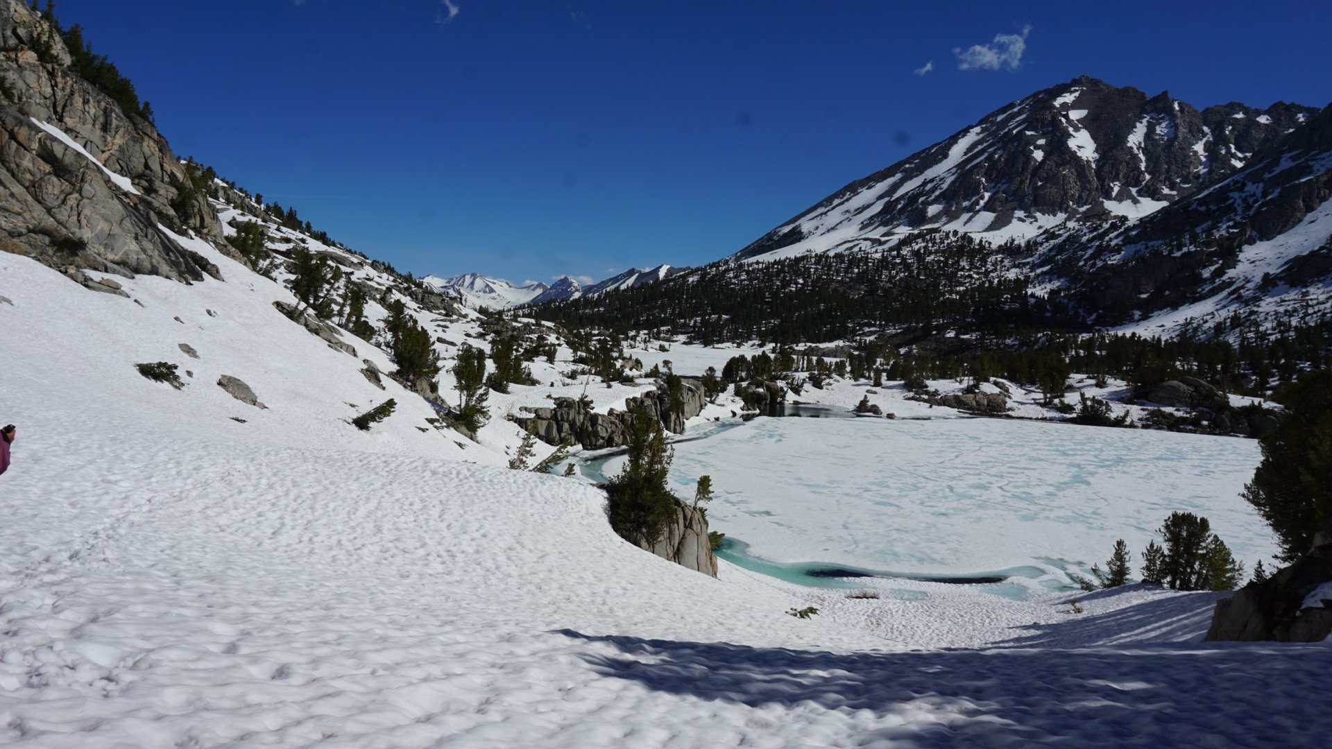
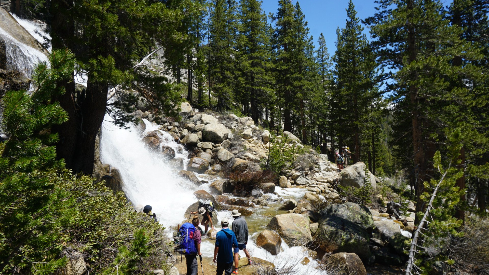
The snow is soft and the hiking is hard, but we make our way through beautiful Rae Lakes. We break for lunch after a deep but slow lake outlet crossing. A couple alerts us to the upcoming deep creeks, and we sigh. What more can this day throw our way?
After a few glissades and miles, we reach the first crossing. It looks impassible, but the same couple and two others teamed up with us and we make it over. We then hike to a suspension bridge, and then decide to finish the last creek crossing before Pinchot Pass.
Continuing down Glen.
This creek required us to hike a half mile upstream and up, till we finally found a snow bridge across. A gamble, but safer than the raging torrent. Luckily the bridge held for all of us. We camp there, exhausted from the 15 hours, two passes, and nearly 23 miles of hiking.
801.2-811.9
Pinchot Pass
With six miles to go before the summit of Pinchot Pass, we wake before the sun and start our hike. The trail is, as usual, buried under snow after a few miles of climbing. But this time, the footprints are nowhere to be found.
I pull out Guthook and, after a few mistakes, we make our way to the day’s pass. We heard this was an easy one, and for the most part it was. I’m getting used to being on the side of steep snowbanks, and with crampons now the ice seems less scary.

From the top of Pinchot.
I got stuck behind a slow hiker going up the final, scariest part. I understand taking your time, but I was ready to be off this pass. The sun was hitting the cornice above me, ripe for the falling. Eventually, we reach the top, Pavlov waiting. We snap some photos, then continue down to beat the slushy snow.

Home for the night.
The descent was easy, and we make it to the bottom of the valley before the next pass before 1. We decide after a day like the day before, we would stop there. There wasn’t much point continuing on to Mather, as we would need to climb that early in the morning. We find a dry spot amid the snow, and set up camp. For the rest of the day, I meditate on the Sierra and congratulate myself on how far I’d come.
811.9-833.8
Mather Pass
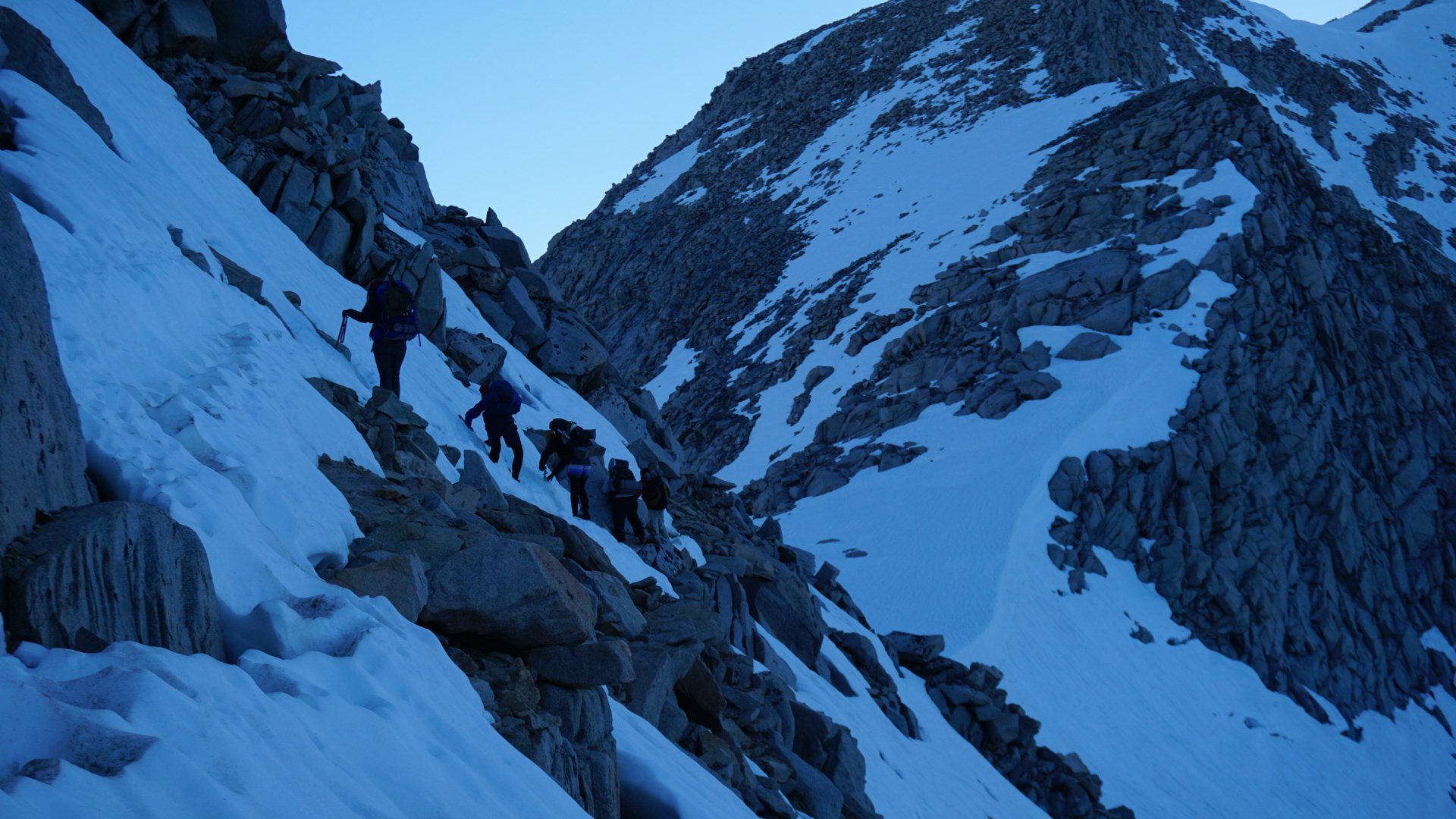
We knew before the climb that this would be a difficult pass. Comments and stories online warned us of the rock scramble at the top, but we push on.
It’s earlier than normal when we hit the approach. The sky is far from brightening, which is good because this would be a long attack.

At the bottom, looking up.
There are about ten headlamps ahead of us, and we follow them with minimal hesitation. We climb up about halfway through snow and some rocks. Eventually, the snow turns almost entirely to rock, and the large group has to make a decision. There’s a sketchy way back down to the snow, and an obvious bootpack in between the rocks above.
Some go below, which means the rest of us must wait for them so we don’t accidentally send rocks down on them. All the while the sun is starting to kiss the sky, and our time is running out.
I just want to be at the top, man.
The lower group eventually gets far enough for us to start, and up we go. The last time I did any rock climbing, I dislocated my shoulder. I’m not ready for this, but I go anyway.
About 30 minutes later we reach the summit. Again, we don’t hang out long. The way down is easy, and soon we reach the bottom. We set up camp, with plans of hiking Muir early the next day.
833.8-858.8
Muir Pass and Evolution Creek
We follow a similar routine going up Muir. Early in the morning we follow the meandering bootpack to the summit. At the top, before the sun had risen, we make hot chocolate and sit in the shelter.
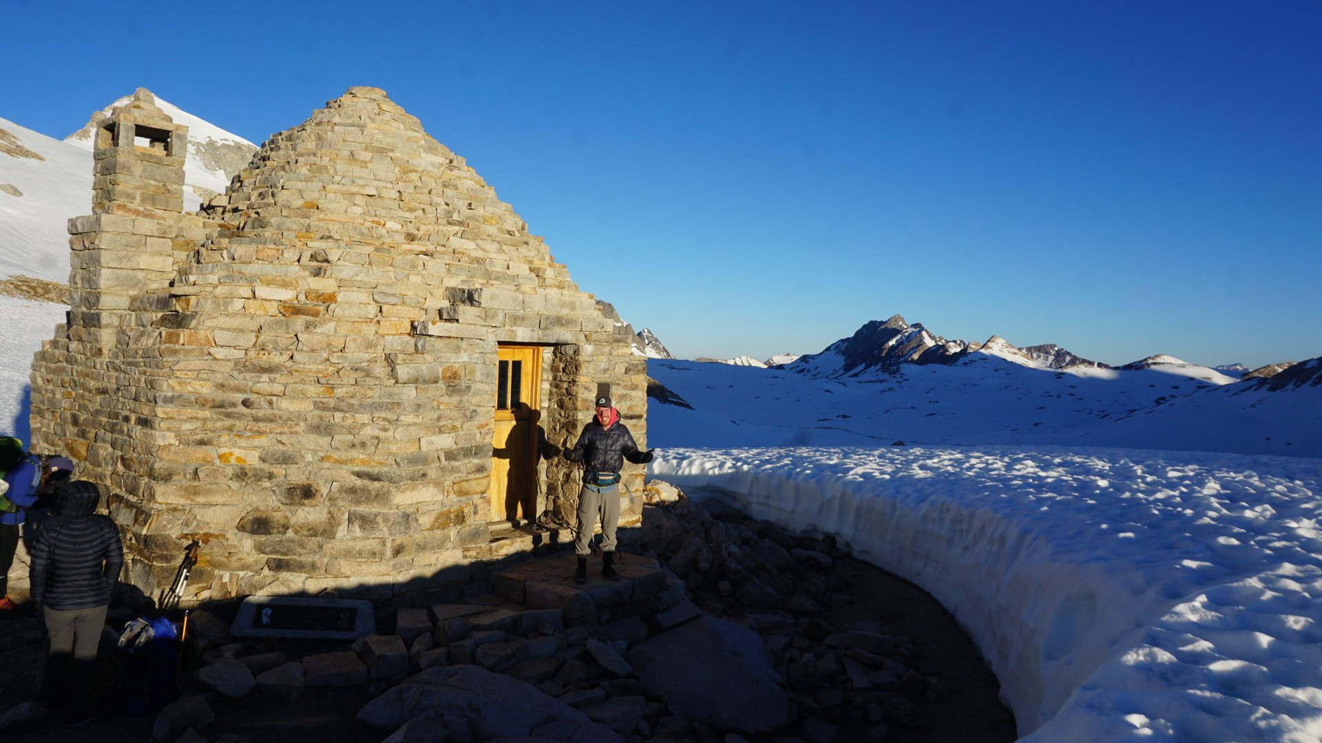
The shelter on Muir.
Our toes are cold from the long slog through snow, so the shelter gives us a good place to warm up. We hang out for almost 45 minutes before we start the climb down.
It’s a gradual climb, and four of us walk in a line and chat as we go (cheers Molasses, Bones, and Pavlov). It’s a beautiful walk along frozen lakes and vast snowfields. We know we have to hit Evolution Creek early, though, so we hike faster.
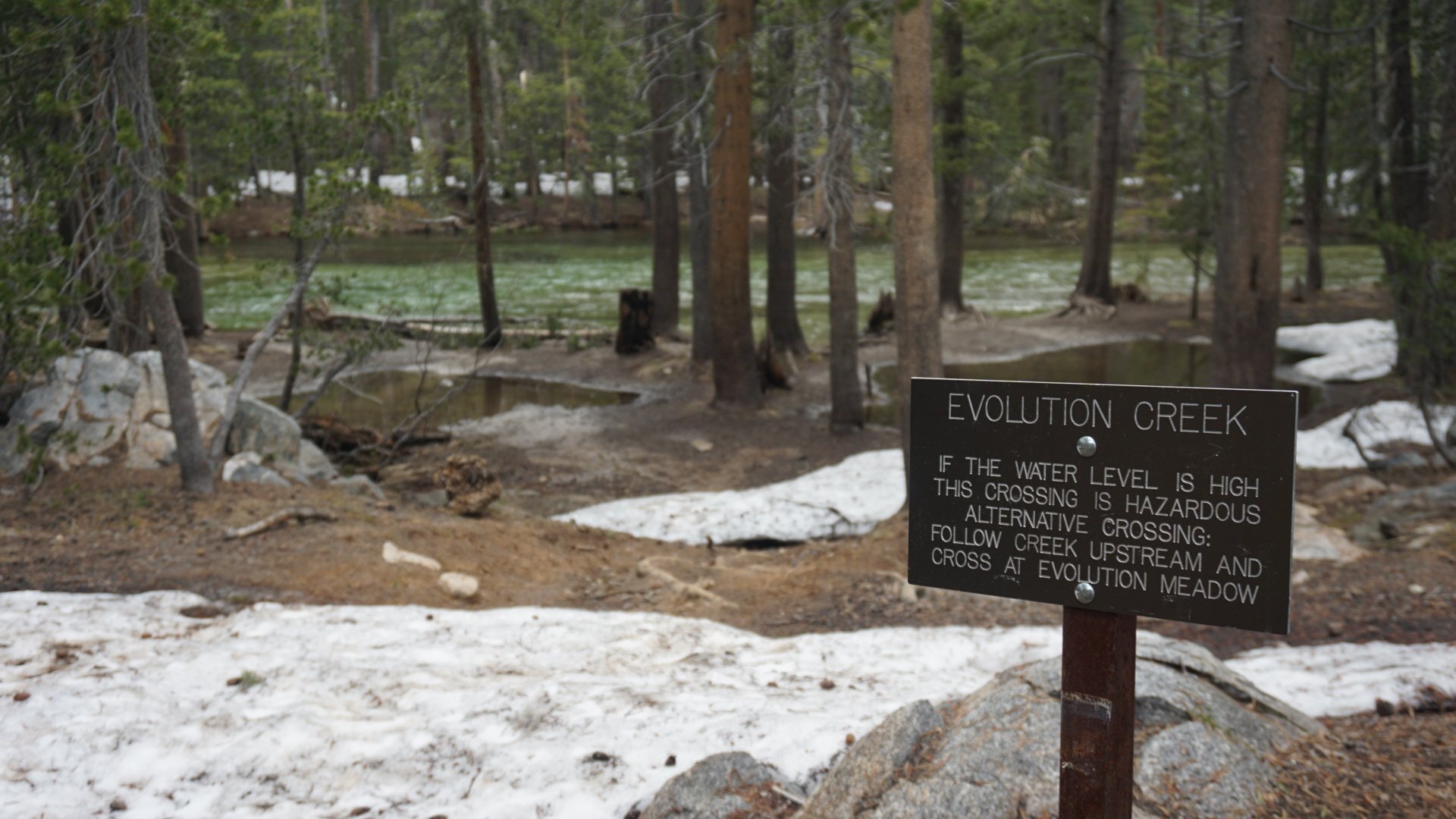
The water level was high, so we took the reroute.
We chat with a ranger a few miles before the large creek, and he gives us intel on the crossing. It should be doable before noon, he says. It’s 11, so we rush through the two snow-free miles.
When we reach the creek it’s not too bad. We cross without any hitches, and are soon warming our feet on the other side. After about an hour we decide to push on.
We reach a beautiful site, and after the long day I fall asleep mid sentence with Pavlov.
Mile 858.8-874.5 + 7.5-Mile Side Trail
Selden Pass
Another day, another pass. We know this one should be easy after the last five passes, so we don’t rush in the morning. The climb is gradual, and as the sun is rising we reach the summit.
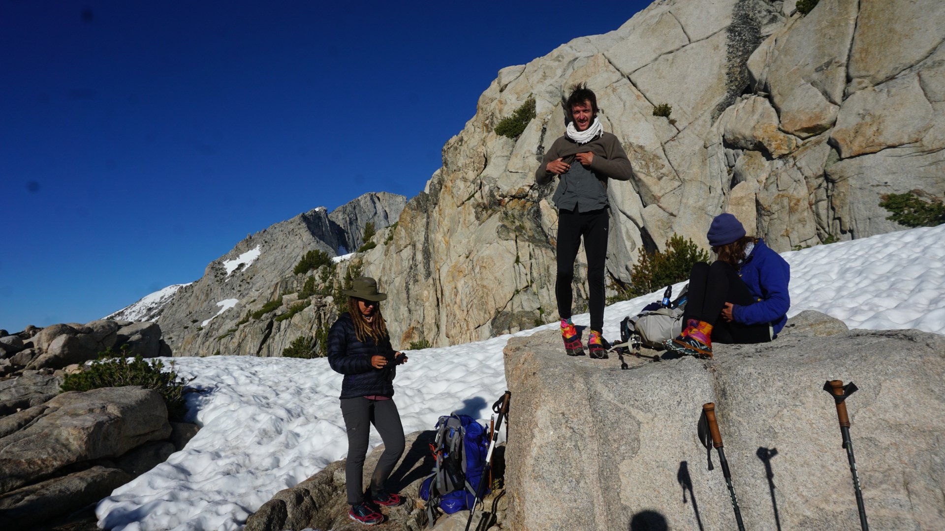
Hanging at Selden.
We take our time at the top, soaking in sun and views. We gather intel from some section hikers and prepare ourselves for the day’s stream crossings. We would have to do Bear Creek and a few others.
There’s a detour around Bear Creek, allowing us to cross two smaller streams instead of the deadly one. The two crossings are pretty easy, and soon we were back on trail.
One of the two crossings.
After this crossing we realize that we can make it Vermillion Valley Resort, where Pavlov and I had a package waiting. With that in mind, we hike to the bear ridge turnoff and take it. The 7.5-mile side trail brings us to VVR, where we drink beer, eat burgers, and replenish our bear canisters with food. We camp here for the night, trying to tune out the thru-hiker party happening nearby.
878.7-889
Silver Pass
We catch the ferry back to the trail late in the morning (9 a.m. is apparently late now). Our stomachs are full, and things are good.
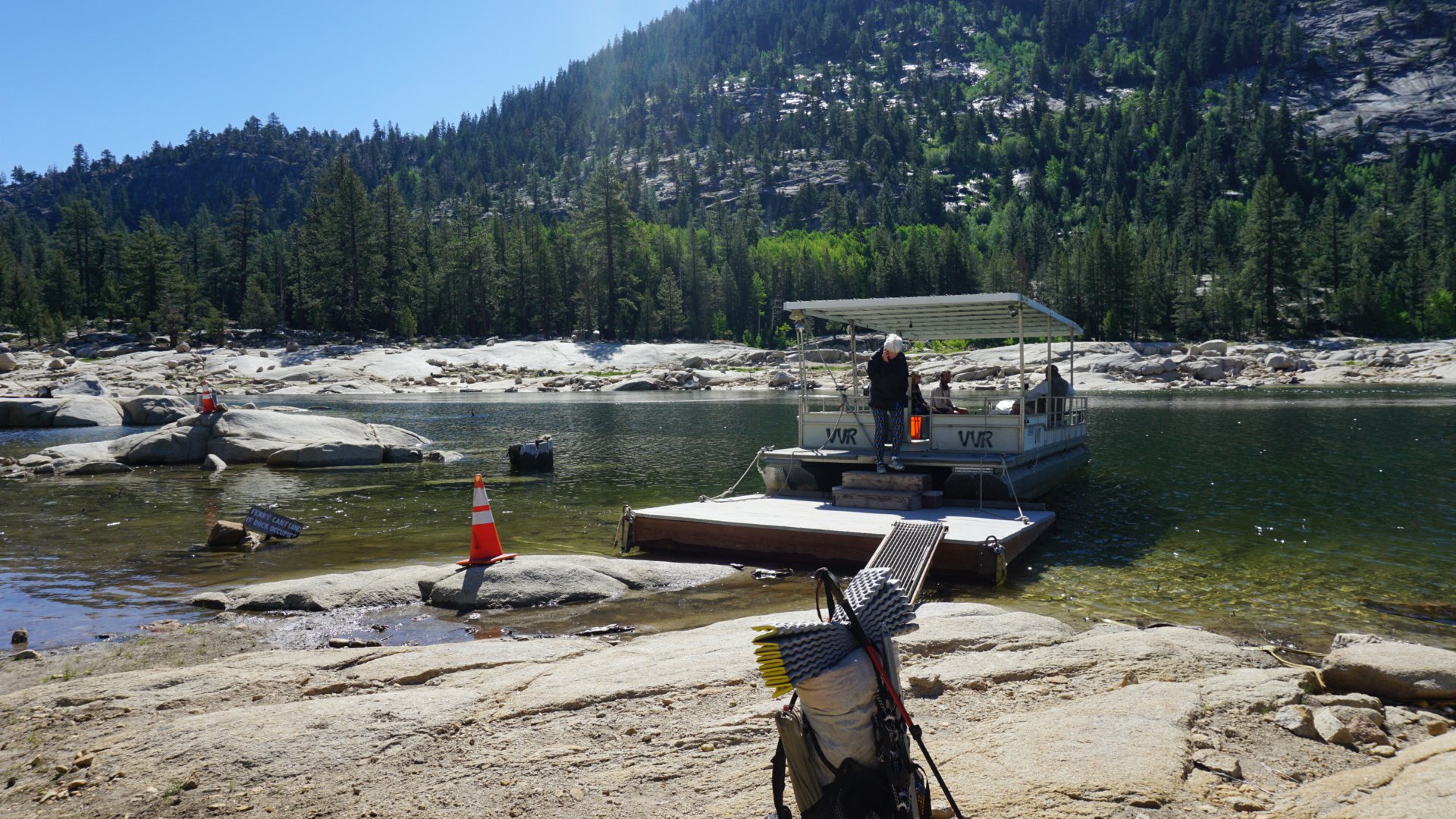
The ferry!
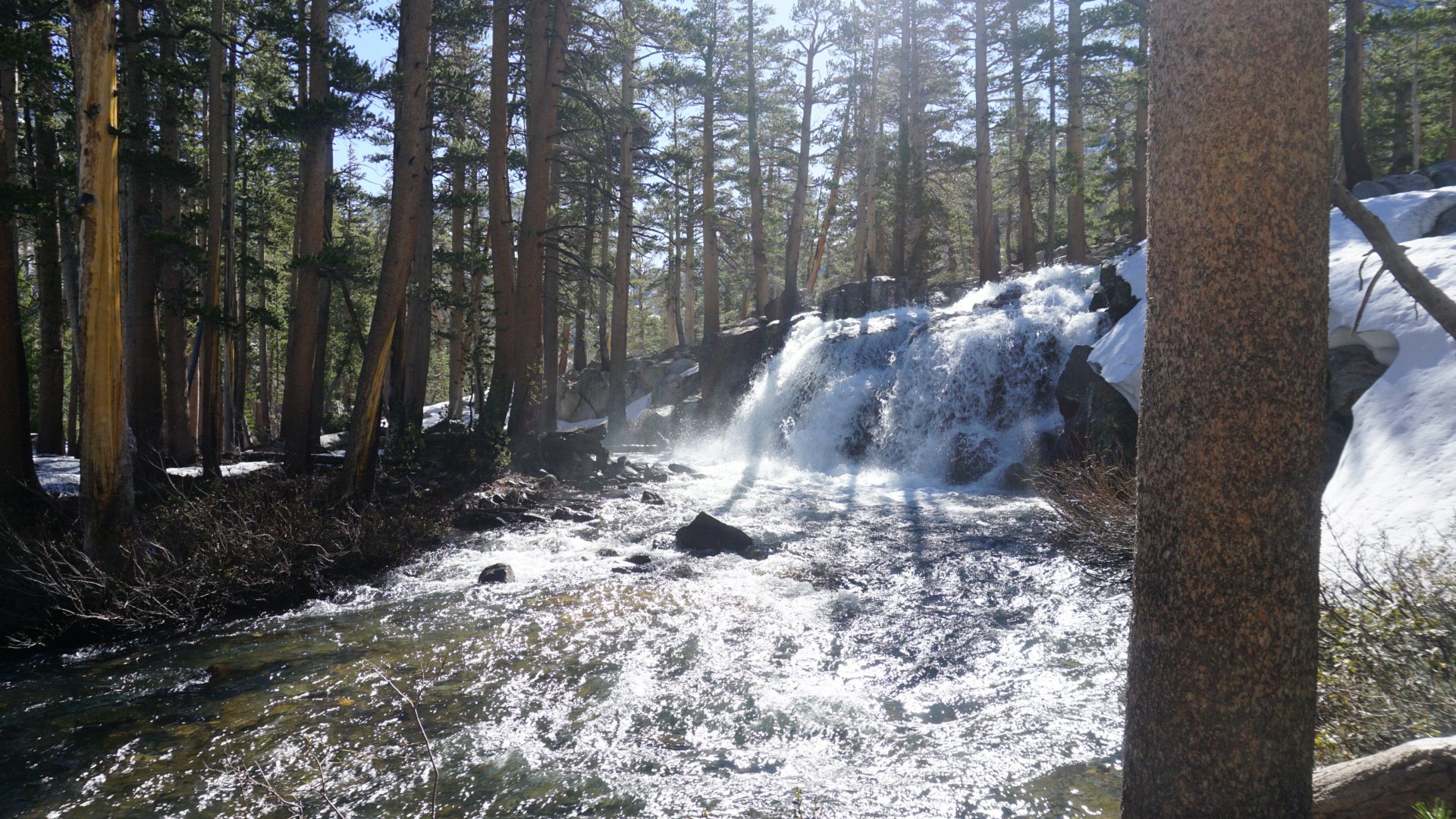
The climb up Silver is hard, as we posthole through the woods. It shouldn’t be a tough climb, but the snow is slushy.
This crossing was at the base of a waterfall. Cool.
We cross a few creeks along the way, and when we reach the top we take a long break.
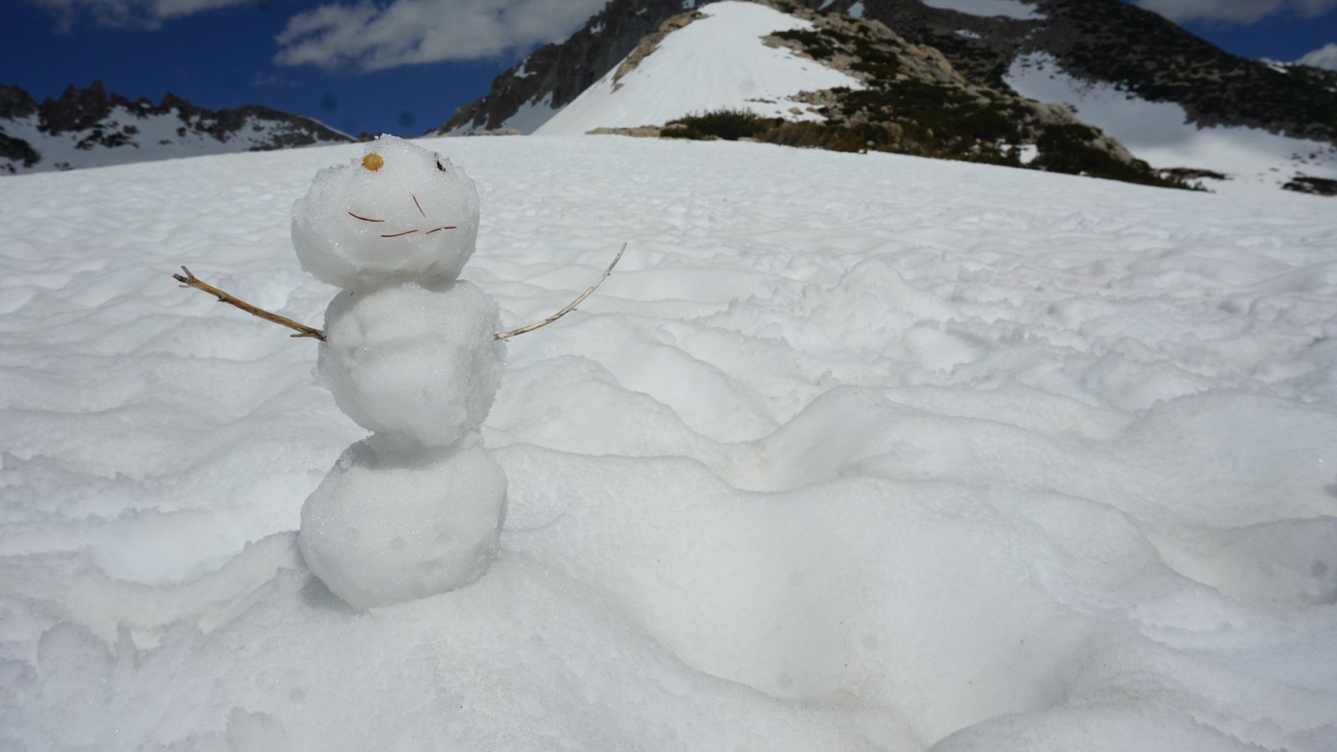
I had enough time at the top to make a little snowman.
The way down is joyous, filled with glissading and laughter. We had joined another group at this point, so seven of us did the pass together.
As we continue down, the going gets tougher. I’m tired, and at one point I slide hard from about a meter up on slippery snow directly on my ankle. I hear a pop, and immediately check to make sure I can still move it.
I can, though it’s tender. I hike another five miles on it, and when we reach a beautiful site along a river I jump at the chance to ice it and rest.

Yeah, I think I’ll camp here.
We build a fire for the first time on trail, and our large group jokes and chats well past hiker midnight. Tomorrow, we would be in Mammoth Lakes.
889-903.3
No Pass!!!
For the first time in a week, we don’t have to climb a pass. However, our tents are covered in ice from the cold night before. The day is easy (ignoring the aching ankle) and before we know it we’re in Mammoth Lakes.
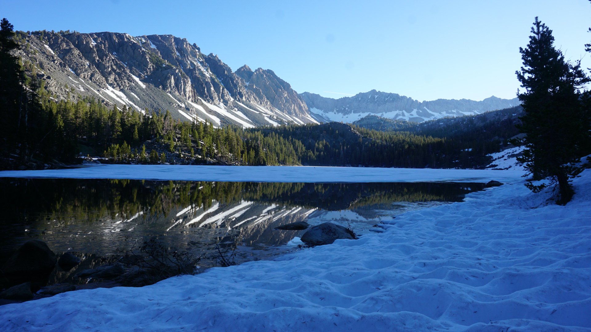
One of the many lakes this day.
A kind couple gives us ride into town from the trailhead that had opened the same day. They offer us money for dinner, and despite our protests we leave with $40 that will be spent on pizza.
With a bed to myself, I sleep like a baby. In the morning, we resupply and gather our wits for a 190-mile section we plan on doing with no stops. Next stop, South Lake Tahoe and the end of the Sierra!

This website contains affiliate links, which means The Trek may receive a percentage of any product or service you purchase using the links in the articles or advertisements. The buyer pays the same price as they would otherwise, and your purchase helps to support The Trek's ongoing goal to serve you quality backpacking advice and information. Thanks for your support!
To learn more, please visit the About This Site page.
