Training in the Pacific Northwest, Summit to Summit
I’ll be honest—I don’t think I’ll be training specifically for the PCT.
I won’t be carrying a 100-pound pack four times a week on my daily commute. I’m also not going to hike 50 miles every weekend. Furthermore, I really doubt I’m going to practice different methods of pooping in the woods.
But I do like hiking.
Because I live in the Pacific Northwest (one of the best places in the world, in my totally 100% unbiased opinion), I am surrounded by alpine mountains, evergreen trees, and incredible trails year-round.
Here are just some of my favorite and/or most memorable summit hikes from this last year—not only the ones I consider training for the PCT, but the ones that convinced me I could do something like thru-hike the PCT—and why they’re so important to me. (Keep an eye out for a separate blog post of my favorite PNW lake hikes later.) This is by no means an exhaustive list—it’d take me ten blog posts to share all of my favorite hikes. And for the record, any and all of these would be great off-shoot day hikes for the PCT hiker in Washington 😉
(Pictured up top: Mount St. Helens from Lunch Counter on Mount Adams.)
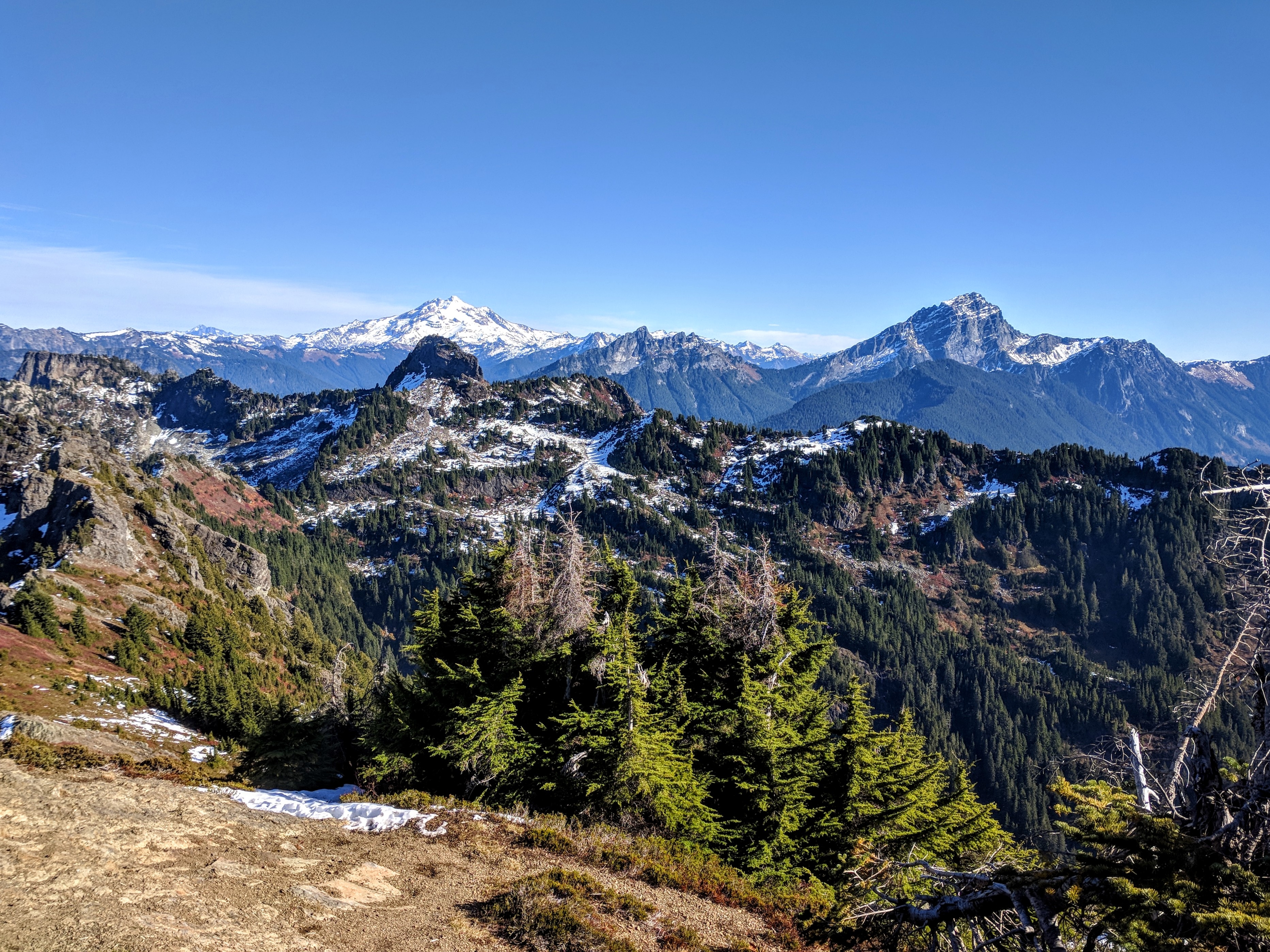
Mount Dickerman
Elevation gain: 3,950 feet
Distance: 8.2 miles
If you love switchbacks, Dickerman’s your guy—most of the trail is long switchbacks in dense forest.
Of course, all of that negative talk goes out the window once the trail opens up to views of the Cascades. There’s also a clear view of Glacier Peak, one of Washington state’s active volcanoes. In fact, you get one of those special 360-degree views.
This was the first summit I walked to and the first summit I stood on. It was also the first summit I cried on.
Mount Adams, South Climb
Elevation gain: 6,700 feet
Distance: 12.0 miles

Mount Hood, as seen from Mount Adams summit; taken by my favorite hiking buddy, Matt.
After this hike, I started calling myself a “hiker.”
It was the first hike I went on where I needed crampons; the first hike I ever glissaded on; the first time I breathed air at over 10,000 feet.
I still don’t know how I carried my full backpacking pack with me halfway up the mountain. Like most hikers, we camped one night at Lunch Counter, with unbelievable views of Mount Hood and Mount St. Helens. (The photo up top was what we saw while setting up camp—if I didn’t have the photos, I wouldn’t believe it myself.) Unfortunately, since it’s a south climb of Adams, and Rainier is to the north, you can’t actually see Rainier until you summit.
Seeing Mount Rainier hit me like a punch to the stomach. When I finally saw the tip of Rainier as I reached the summit, I broke down. I staggered up the last bit, seeing more of Rainier over the summit, and I could barely stand at the top through my tears. In that moment, I forgot just how painful every (difficult, painful, seemingly impossible) step was.
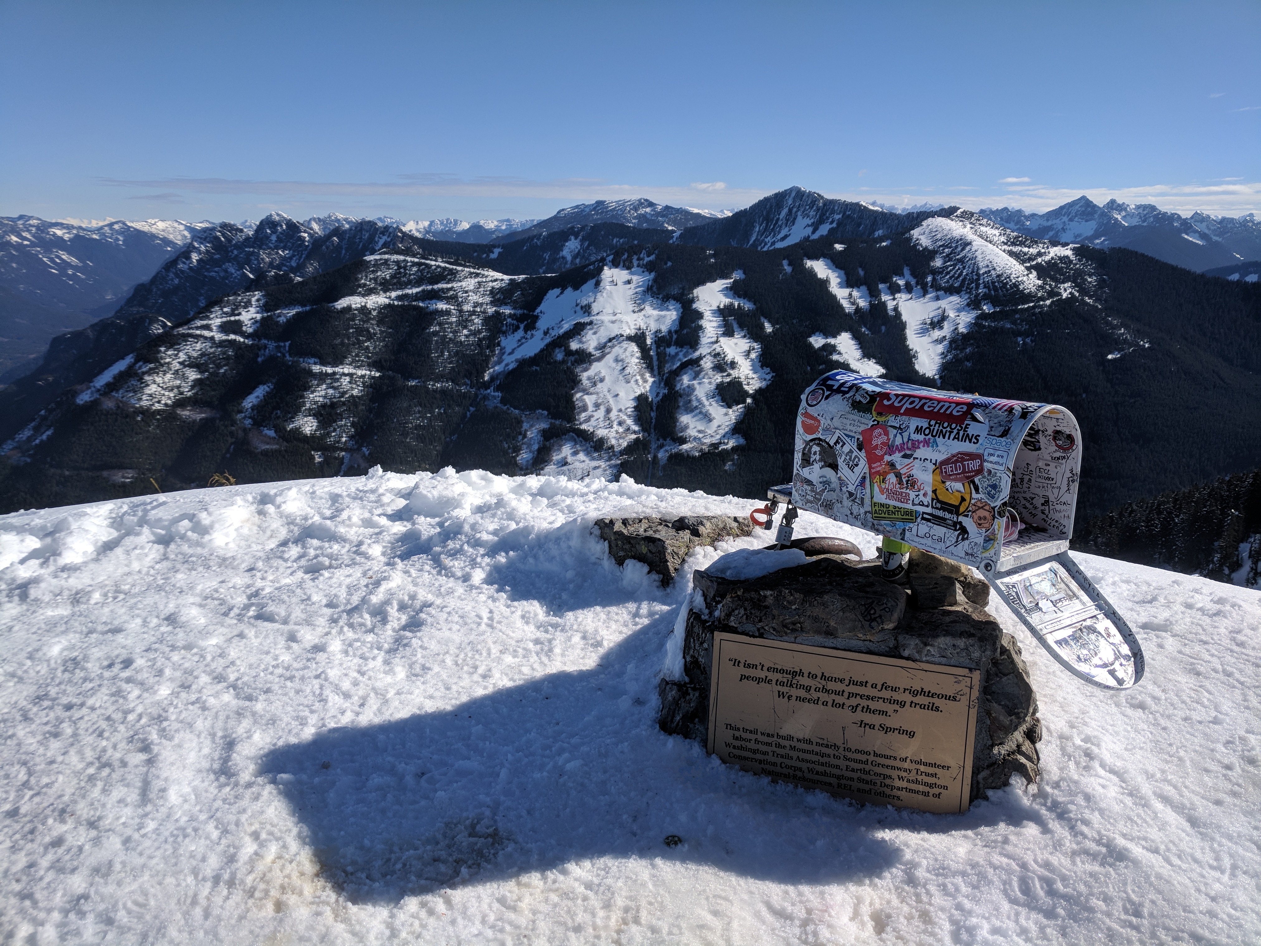
Mailbox Peak
Elevation gain: 4,000 feet
Distance: 9.2 miles
Usually, I just have to walk down a flight of stairs to the mailroom to check the mail. Sometimes, though, I decide it’s worth it to walk uphill about 4,000 feet to do it.
Mailbox Peak has an actual mailbox at the summit, which has an unwritten “take something, leave something” rule. Consequently, I see some interesting things in the mailbox. I’ve seen bags of chips, written letters, chocolate, vodka, and even a vape pen left in there.
It’s not an easy hike, and there are two trails you can take: one is over nine miles round trip, the other is just over five. In other words, you can decide if you want to kill your whole day or both of your calves. No matter which trail you choose, you have to hike the final part, a steep rocky scramble up to the mailbox. It provides clear views of everything around the mountain, as well as vertigo because that’s a damn sheer drop.
Mount St. Helens, Monitor Ridge
Elevation gain: 4,500 feet
Distance: 10.0 miles
Without a doubt, Mount St. Helens is one of the most famous mountains in Washington state.
The Monitor Ridge route is the summer route. It starts out pretty easy; just a nice stroll through forest. Then it becomes a boulder field where many wear gardening gloves to climb over jagged rocks. The last part was the worst because the scree causes you to slide back one step with every two steps you take. The crater rim is in sight, teasing you the whole time.
But when I reached the crater rim, it was like meeting a celebrity.
As a kid, I had learned about the 1980 eruption, and the devastation it caused. At no point did I ever consider whether or not it was hikeable, and even if I had, I doubt I would have ever thought about doing it myself.
But hey, check out this cool photo I took after I did just that.
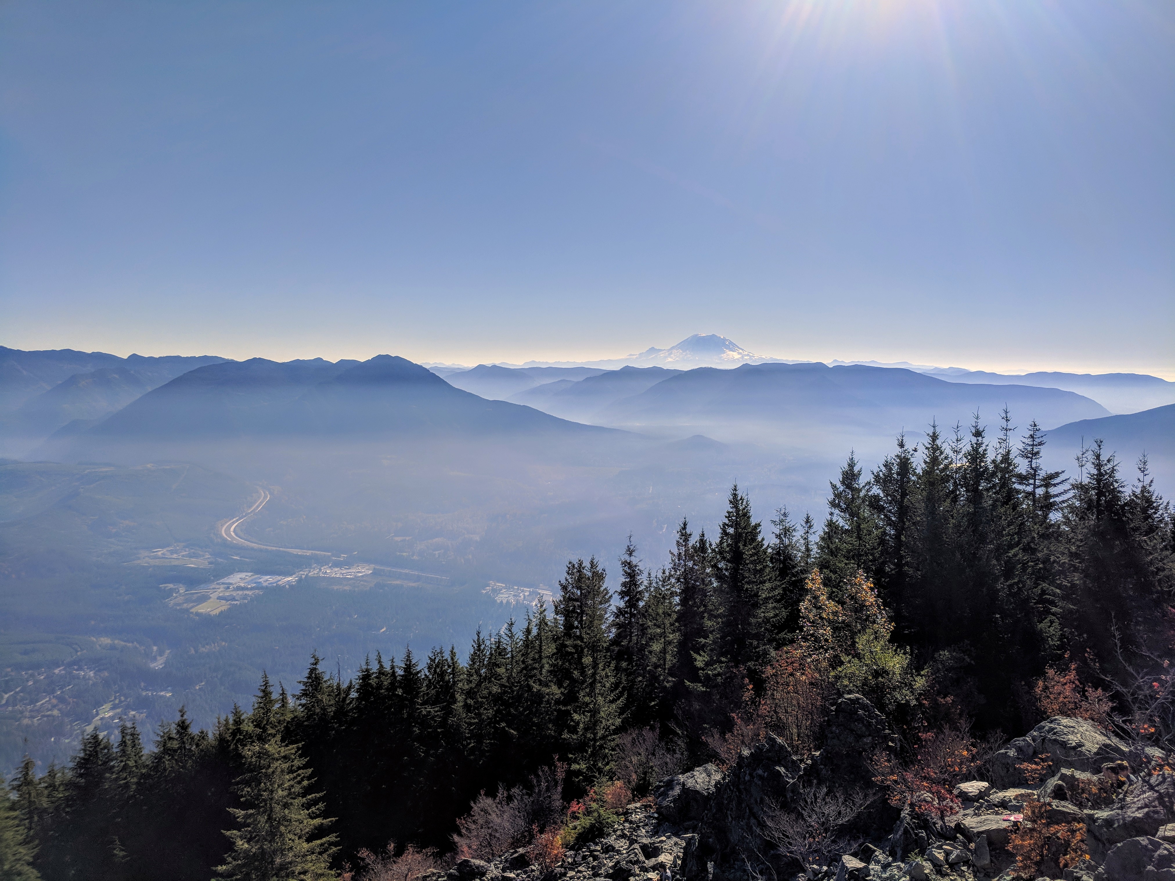
Mount Si
Elevation gain: 3,150 feet
Distance: 8.0 miles
First of all, this was my first solo hike. It was snowy and cloudy that day, with little to no visibility from the top. I didn’t know you were supposed to see Rainier on a clear day; I was unaware you could look down on I-90 and see the cars driving on it, looking like specks; and I definitely had no idea I could do something like climb a mountain by myself.
And it’s kind of a cool one because you can see the entire mountain from top to bottom in North Bend.
Since then, Si has become my go-to hike when I want to get a good workout. I’ve done it almost a dozen times in this year alone; as a result, I’ve almost memorized the trail.
One of the things I’m most proud of doing this year was a car-to-car-to-car-to-car on Mount Si—that is, three summits in one go. It was a long 12-hour day, a long 9,000-foot climb, a long 24 miles… you better believe I let myself sleep in late the next morning.
Navaho Peak
Elevation gain: 4,223 feet
Distance: 13.7 miles
In Western Washington, it’s difficult to find trails that aren’t entirely under heavy tree cover. It’s when you drive out to Central or Eastern Washington that things open up to blue (or gray—after all, we are still in Washington state) skies.
This was my first solo backpacking trip. At first, the trail winds around trees and wildflowers (in the right season). Then, when you get out of the tree cover and close to the sandy Navaho Pass, you hit a meadow of green, a popular place for people to set up camp. It’s flat, there are plenty of trees to tie food bags to, and it’s just plain gorgeous.
I found solitude past the meadow. That evening, before nodding off, I decided to summit since there was still daylight left. I got the peak to myself. The wind was blowing my hair all over my face, but I could see everything. Even with the winds screaming in my ears, it was one of the most peaceful moments I can remember.
Camp Muir
Elevation gain: 4,640 feet
Distance: 8.0 miles
While not a summit hike, it’s about as close to a Rainier summit as most of us ever get. Camp Muir is Mount Rainier’s base camp and the highest point hikers can reach without a climbing permit. The “trail” is entirely exposed, and I tripped over my feet every time I turned around to see Mount Hood, St. Helens, and Adams.
Above all, the reason this hike means so much to me is that it was my 52nd hike in my 2018 52-Hike Challenge.
On the day I went, I saw hundreds, if not thousands, of migrating butterflies. I tried to get it caught on video, but it was too difficult to get a good shot. Luckily, my eyes still worked, and the scene is burned into my brain. I doubt I’ll ever forget it.
Honorable Mentions
Unfortunately, I don’t have enough space to share stores and photos of all of the amazing summits I’ve been lucky enough to stand on. But here are some other hikes that I’ll never forget.
Mount Pugh

It was a stupid amount of elevation gain in a single push (5,300 feet?), and we got vertigo from all of those sheer drops. But just look at that view (photo taken by my fabulous hiking friend, Chris).
Poo Poo Point, Chirico Trail
Paragliders often obscure the view of nearby Issaquah, but I don’t think anyone really minds.
Artist Point
Slapping on snowshoes for the first time brought me here.
Mount Pilchuck
It’s one of the most popular lookout hikes in Western Washington (if not the whole state), and apparently for good reason.
Sauer’s Mountain
Mr. Sauer built a trail himself on his private land and has graciously opened it up to hikers; he’s oft sitting by the trailhead to greet them.
Mount Washington
Need I say more?
This website contains affiliate links, which means The Trek may receive a percentage of any product or service you purchase using the links in the articles or advertisements. The buyer pays the same price as they would otherwise, and your purchase helps to support The Trek's ongoing goal to serve you quality backpacking advice and information. Thanks for your support!
To learn more, please visit the About This Site page.


