
 ">
Pinhoti Trail Day 1: Southern Terminus to 13.1 Camp
Making Friends, Not Miles
Shortly after starting the trail, we came across our first trail log. It was a small forest-green box with roof shingles on top. Inside was a grade school-style notebook and four pens in a ziplock. I eagerly took it out to sign it so we could declare our start to the hike. This had me dreaming of when I could use a trail name instead of my real name.
After half a mile of mild ups and downs, shuffling through the leaves of last fall, we took a turn up Flagg Mountain. The loose rock ascent rewarded us with our first expansive views of the trail and a stoic stone lookout tower. This is now the new southern terminus of the trail. Miranda and I, along with one other hiker, would be the last to hike this section of the Pinhoti. This summit we now stand at is the new dramatic end to the trail. This section is now part of the ECT connector trail connecting the Florida Trail to the Pinhoti.
Though we had only hiked a mile, we decided to stop and stretch, eat a second breakfast of half-frozen protein bars, and dry out the tent. Acting like I didn’t have 12 more miles for the day to go, I decided to wait for the tower to open at 9 am. As soon as I was ready to give up my time wasting, a ranger and her pup sauntered up to the tower to unlock it.
We talked with her about her time as a ridge runner on the AT. She regaled us with tales about the frustrations of having to clean up after inexperienced hikers near the southern terminus of the AT. She lifted the veils from our eyes, going into great detail about the often-overlooked hard work that goes along with being a ridge runner. I could have stayed there all day, but my partner gave me a look that communicated, “Dude, WE GOTTA GO.”
The Loose Rocks of Weogufka Canyon
Shortly after leaving the tower, we started kicking ourselves for not planning to stay at the CCC cabins just 1.2 miles from the terminus. Sure, we had peace of mind knowing our winter gear would work, but nothing sounded better than a shitty cup of instant coffee on the cabin porch.
We then dove down from the cabins into one of the many densely wooded canyons we would experience on the trail. Once we made it to the bottom, we were greeted by the quaint Weogufka Shelter. Our eyes sparkled with envy at the nice flat camping by the creek and the appropriately sized communal fire ring. If we were to do this section again, I’d get to the trail with just enough daylight left on the first day so I could make it here.
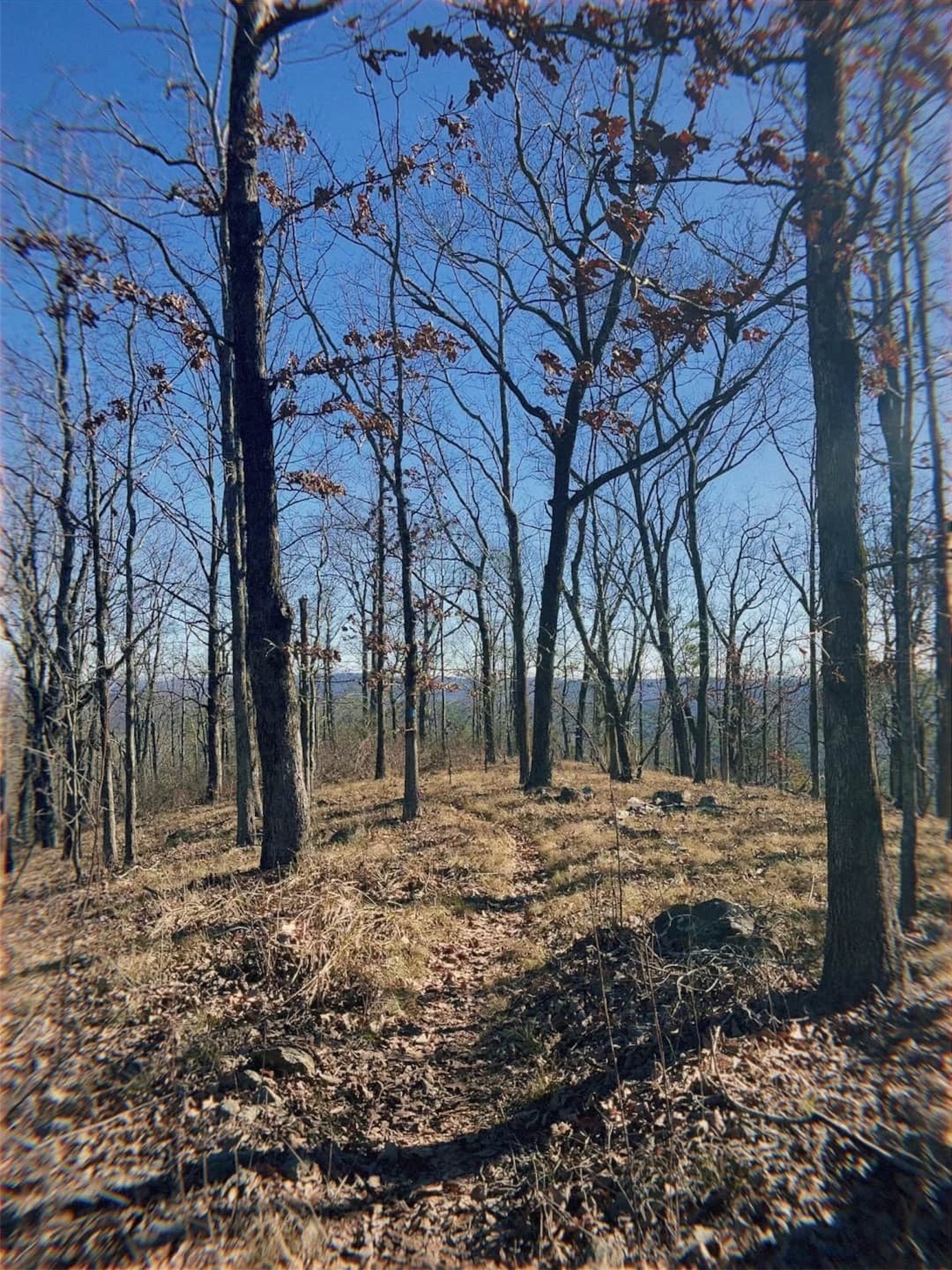
Climbing out of the canyon, there was barely a whisper of a switchback. The narrow trail was made more challenging to navigate because of the leaves and shoe-sized loose rocks. Hypothermia and ice get the spotlight for winter camping dangers, but the combo of a season’s worth of leaves and loose rocks will end hiking seasons more often than them. The only cruisy, mindless miles we would get for this entire day would be through a sea of towering pines at the end of this section before we reached our first road walk.
To Road Walk or Not to Road Walk
We went back and forth, discussing whether or not we would do the road walks. If we were doing a continuous thru-hike, we wouldn’t think twice about doing the road walks. However, because we were section hikers, we weren’t too thrilled at the prospect of spending an entire weekend walking through Dalton, GA, when we got up north. At the end of the day, we felt like we needed to attempt the Alabama road walking because it was only about 13 miles of the total trail in the Alabama section.
A road walk in my mind’s eye is relaxing. It feels like a time when I don’t have to be looking at my feet or potentially be listening for wildlife. My familiarity with road walks on long trails is painted by CDT and Florida Trail videos. I’m sure this picture would be accurate if I weren’t constantly on guard for loose dogs.
The first half mile consisted of kind waves from cars and the realization that pavement hurts your feet more than rocks and roots. It was going better than expected until we reached Caperton’s General Store about 1 mile into the road walk. Caperton’s is a stop well-known by Pinhoti hikers with inconsistent hours that doesn’t visually greet you with open arms. The high-flying Confederate flag and some less-welcoming FarOut comments had us wary as we walked past. People who work on the trail say that Mr. Caperton is welcoming and respectful to hikers, no matter what race they are. I believe that they see the best in people who support the trail, and I’m grateful that their relationship keeps the trail open. That being said, if it makes you feel uncomfortable or unsafe, I’m sure someone from the Pinhoti Trail Center can shuttle you to the next trailhead.

Tuna and Peanut Butter Wraps
After a couple of mild interactions with good farm dogs doing their job, we exited the road at mile 8.8 to our right. There was a new bucolic sign stating we had entered the “Bones Valley” section of the hike. The trail undulated with two short and steep ups and downs right off the road. This immediately slowed our 4mph road walking pace and brought us back to reality. On the verge of bonking, we stopped at the top of the third hill for a late lunch. On the menu: peanut butter and spicy Thai tuna packet in a crumbling tortilla. A hiker trash delicacy.
The trail then meanders down to Bones Bend Campsite. It is one of the few named and marked campsites on this section of the trail. In FarOut, there are plenty of other campsites in this section, but this is a maintained campsite. The camp lies slightly above a bend in the river next to a lustrous new bridge that sticks out like a pair of new shoes. Situated almost perfectly at 9.5 miles, stopping here would make a perfect first day of a thru-hike. However, we were section hiking. We needed to make a couple more miles to set ourselves up to finish at a decent hour the next day.
Three more campsites tempted us between here and mile 10.5 as the trail challenged us with more short, calf-burning, knee-aching ups and downs. Determined to crank out some miles, we made the final push up to Sunny’s View, dodging multiple coyote droppings mid-trail. It offers what would be most SOBOs’ first view of the end and NOBOs’ first view of where they started.
Vanishing Blazes and a Desperate Night Hike
It was at this point that we noticed a discrepancy between the Coros Pace 2 GPS tracking and FarOut. According to the watch, we had hiked 12.5 miles, but according to FarOut, we had only hiked 11.6.
We were devastated.
We went from “almost to camp” to 1.5 miles to camp at 4:30 pm in JANUARY. Daylight was sweeping away behind the eroded mountains rapidly. With some nerves setting in and our legs and feet crying for a break, we raced the dwindling light. At mile 12.1 in FarOut, we reached a small campsite along the creek. We had an important decision to make. Do we make camp, or do we strap on our headlamps and night hike on an unfamiliar trail?
Some people love solitude when they camp. Other people like us would much prefer to have other campers be a sacrifice to the cryptids. According to the trail log at the beginning of this section, there could be people camping where we initially planned. So, we pressed on into the night in search of camp neighbors.
Contrary to the first part of this section, the next 1.2 miles of trail were very technical. Like any trail that follows a creek, trail builders play the fun game of “How many times can we make a hiker cross this creek?”. How fun for them.
The sun had now completely set, and the temps had dropped to the mid-thirties. Our breath was smoking in the beams of our headlamps as we searched for vanishing blue blazes. I occasionally shouted ‘Blaze!’ as soon as I saw one. These shouts pierced our anxious breathing, communicating that we were not lost.
An Ice-Cold Foot Welcomes Us to Camp
According to the GPS, we had made it, but there was no sign of viable camping. Trusting that FarOut’s comments were real, we kept stumbling through the loose rock in the dark. Then, in the faintest distance of my headlamp, I saw a ring of logs. That was it. We had found it.
The trail, not done with us yet, gave us one more creek crossing. It was here where my partner dunked her whole foot in on her last step. It was cruel, and we were a bit dumb for doing it, but we made it to camp. Of course, there were no people, but we didn’t care. Cryptids be dammed! We were camping here tonight.
The trail often pushes you to your limit, and it knew we had had enough. My tent pitch was perfect the first go around. My stove lit in one click of the lighter, and the water near camp was easy to filter. We both struggled to eat because we were so tired, but we knew we needed the calories. We stored our food away from camp in a small wooden kiosk after finishing. Worn out to the point that our anxiety vanished, we slipped into our quilts. We slept straight through the night – something that rarely happens on the first night in the backcountry.

What We Learned
- Pushing more than 10-11 miles on the first day is too much in the winter. We rushed through much of the latter part of the hike to make it to camp. The anxiety was not worth it for us.
- You do not need a bear can. Save the weight. A critter hang is more than enough for the Alabama section.
- Night hiking into camp is not for us. There is too much anxiety in finding a camp at night.
- FarOut is sometimes not 100% accurate. Dig deep into those comments and see if the recent comments are positive before making a plan around a waypoint.

This website contains affiliate links, which means The Trek may receive a percentage of any product or service you purchase using the links in the articles or advertisements. The buyer pays the same price as they would otherwise, and your purchase helps to support The Trek's ongoing goal to serve you quality backpacking advice and information. Thanks for your support!
To learn more, please visit the About This Site page.
