 ">
">
Pyrenees High Route (HRP) – Salardú To The Door of Andorra (D28-34)
I fell off the routine of regularly updating this blog, apologies to those of you outside of my social media sphere. I will try my best to accurately recount the days with the help of what’s left in my memory, brief notes, and pictures. The mountains were challenging though the weather was good, so I found myself settling into thruhiker mode hiking long days and when the trail came to the quiet little European towns it was time to really rest and soak it all in. This stretch was 47.3 miles and took a week (to be fair there was an unintentional zero day along the way).
Day 28 – Salardú to Tuc de Marimanha
7.2+ miles; 3,600+ft ascent
It poured overnight in Salardú, a proper thunderstorm that I enjoyed in the safety and dryness of a pension house. Listening from a comfortable bed to the rain fall from the tiled roofs to the cobblestone street below punctured by loud rolling booms echoing through the valleys was blissfully romantic.


The following morning the village was shrouded in mist. I started early knowing I was headed up again and climbed through the fog filled forest to the neighboring village of Bagergue. I wandered around for a bit through the network of narrow stone streets looking for a cafe, along the way finding animal paintings and colorfully crocheted flower pots. I went into a restaurant that had an unlocked door and found the owner who said they were closed and I said no problemo, but as I was walking back down the alley he came out and called me back.
After a cup of coffee and a bit of sweet bread I continued on up along an old (likely really old) road converted to bike/hike route as it gradually climbed to the ski area above. I mentioned in the last post Baquiera-Beret is a stop along the Freeride World Tour, a big-mountain ski and snowboard competition. I was worried I might not be able to see it with the cloud cover but as I crested the initial climb the fog fell away, broken up and kept in the valleys below by the sun and the breeze.


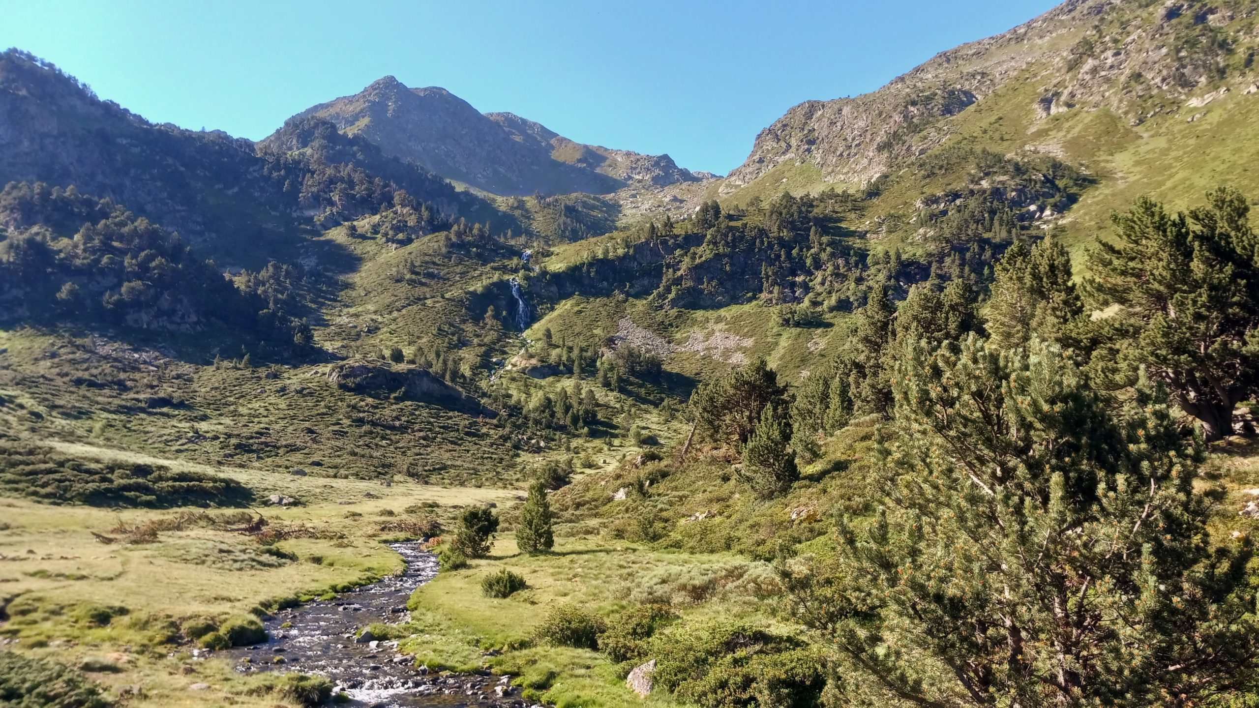
After crossing an open plateau and entering the actual ski area the route led past some small alpine lakes and around the back side of the competition face to the foot of Marimanha peak. Standing there looking at a really steep face with the GPS track essntially going straight up the face of it I saw there was another track approaching the peak from the ridge to the west of it and thought I would give that a try.
I zigzagged up 600ft and walked the approach for about a quarter mile but turned around and went back down after a closer view of the steep rock scrambles of the final pitch with consequential cliffs on either side and a strong wind. After retreating I spent the rest of the afternoon staring at the impending climb and trying to pick out the right route, until the fog climbed back up in the evening.

Day 29 – Tuc de Marimanha to Alos d’Isil
8.1 miles; 2,182ft ascent
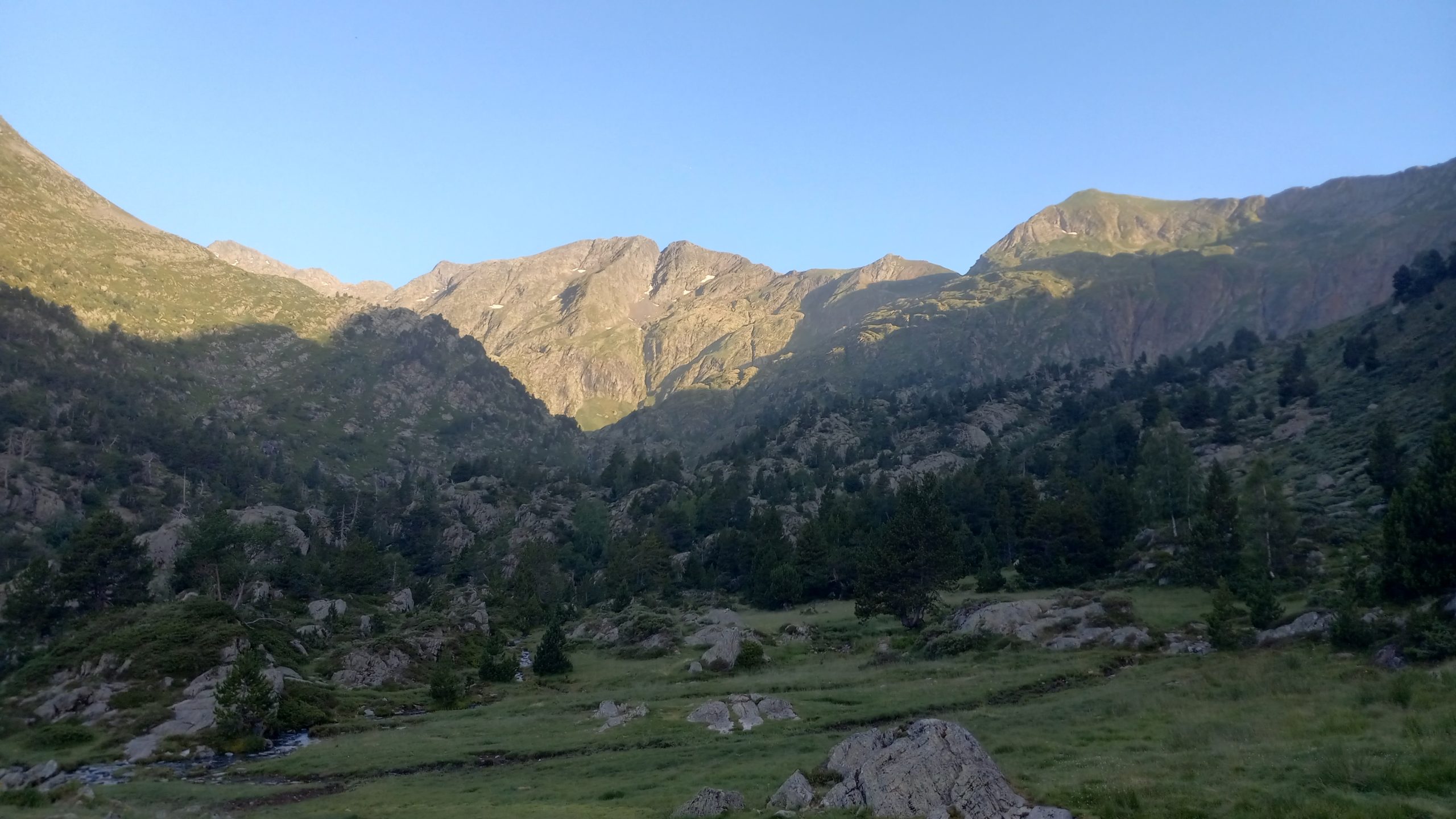
Luckily woke to a crystal clear morning and got an early start to make the best of being on the shaded side of the peak. There were some intense points with extremely steep pitches and no room for any error, but it wasn’t quite as bad as I built it up in my mind to be. The trail was very very faint but there were some cairns that led to the safest way up the chutes. I paused on the peak for a while, the views were outstanding.

The trail then dropped along a knife edge ridge and climbed the neighbooring peak before descending into a wide bowl to cross to the next pass. The descent from the Col d’Airot is just as steep as the approach to Marimanha but on super sketchy sandy eroded trail, though it is a lot more obvious.
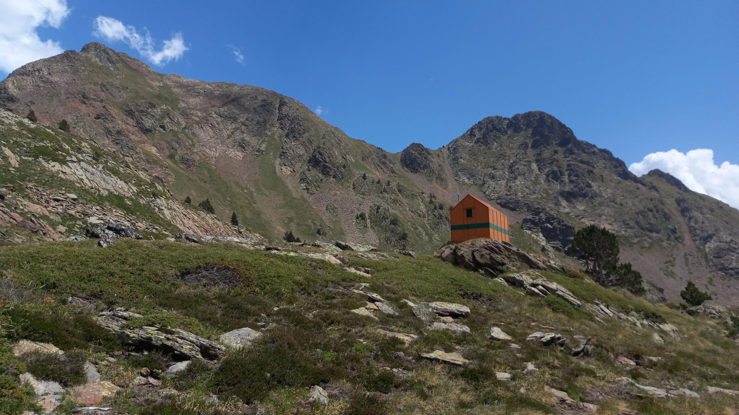
By the time I arrived at the Refugi Gracia Airoto, a rad little orange metal A-frame with a cold piped spring and a couple small lakes nearby that was the planned destination for the previous day, it was time for siesta. I talked for a while with a nice French/Spanish/Mexican guy named Nico, and a friendly Spanish man in his late 50s that was on day 8 from the Med. (absolutely crushing distance, speed hiker/runner pace for sure, his leg muscles were massive!)

The afternoon involved another pass and a steep descent before a gradual walk down plateaus and stream canyons to the very quiet hamlet of Alos d’Isil. I walked quietly through town as the sun set and lit the surrounding peaks in alpine glow, then found a spot to stealth camp a couple miles up the river.
Day 30 – Alos d’Isil to Cabana del Fangassal
9 miles; 4,903ft ascent
I remember this being a mellow day but the numbers dictate otherwise. I guess it was a long climb from the valley bottom to regain high elevation, and then there were three passes (Coll de las Cornella, Coll de Curios, and Coll de Calberante) back to back to back.

The descents were tough, the knees were really starting to feel the burn. The afternoon involved quite a few alpine lakes and navigating the surrounding boulder fields. Near the outflow of the lowest of the three Gallina lakes was the Refugi Enric Pujol but there was a large group of high school students crammed into it and all their gear scattered around the outside so I passed by after barely pausing and continued down the valley.
A little lower and a couple miles later I found the Cabana del Fangassal and surprisingly not another soul. The view back up the valley I had come from was outstanding, and the cabana broke the wind protecting a nice flat area for tent camping.

Day 31 – Cabana del Fangassal to Tavascan
1 trail mile, 3 total miles; 0ft ascent
I needed a resupply and it was a Sunday. Sometimes the supermarcados (you never really know what size they will be but they are rarely ˝super˝) are open for half of the day on Sunday. I surely would have made it if I had gotten a really early start but I took my time waiting for the sun to dry the condensation on my tent and so did not make it down to the small town by noon.
The town stop was a short off trail descent but a lot of elevation loss. After finding the store closed I had a coffee at a hotel restaurant then climbed back towards the HRP to a campsite halfway between the two, pausing for a couple hours alongside a waterfall on the GR path that cuts off a lot of the road switchbacks (I threw away these pages of the guidebook and cant remember if it was GR10 or GR11 and might have been the GR7 or 12 or 15 or…)

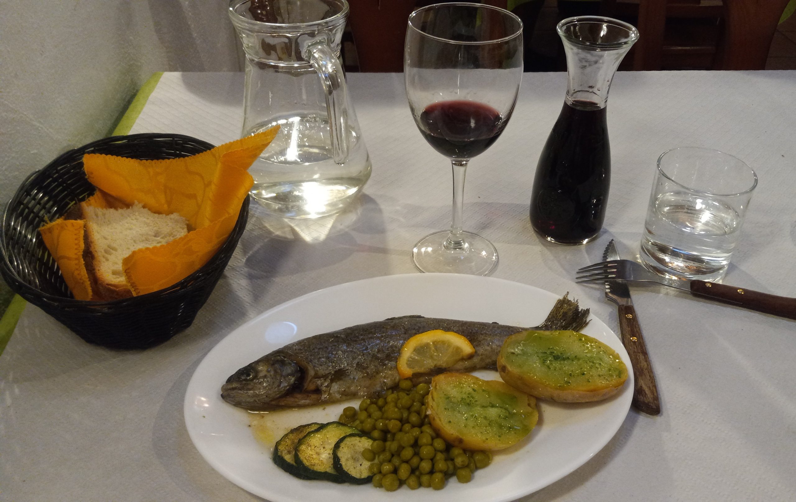
The campsite had a delicious 3 course dinner. I chose the paella for the first course, which was some of the best I have ever had, then fresh caught trout for the entre and a flan for dessert.
The wine was wonderful, they started me with a glass and when they asked if I wanted another and I said yes they just brought me a small carafe, then when I asked for a very small brandy or some digestif to go with the flan they brought me a very tasty sweet muscado. When I went to pay and reminded them of the extra desert wine they refused to charge me for it. THIS is a little of the trail magic that happens when you hike around in Europe.
Day 32 – Tavascan to Estany de Romedo de Baix
7.5 miles; 4,065ft. ascent
I had to descend again into Tavascan to resupply not knowing what time the store would open. It oppened late, after 9 if I remember correctly, and it was expensive being the only store in the area.
Then it was once again a long climb to high elevation. The side trail rejoined the HRP in the remote roadless hamlet of Noarre (so similar to nowhere) which felt like a ghost town but was totally inhabited, evident by the small solar panels on most of the houses.


After passing a nice new shepherd cabin a little higher up the trail followed the cascading Riu de Guerosso past heart-shaped lakes to the Porta del Cel.
Over the pass the descent had what would be my last patch of snow travel after which I passed a large group of Swiss hikers, then it was a steep drop through a narrow chute to the Refugi de Cartascan. This refuge had an absolutely incredible view, friendly young hosts including a floofy Newfoundland, and Spanish red wine €4/.5L.

I made some dinner then had my sunset walk down another thousand feet of elevation past a couple more little alpine lakes. At the end of the day was an Appalachian style lean-to next to a large lake reflecting the surrounding peaks. As it grew dark two hikers came in from the other direction, friends from the Czech Republic doing a modified version of the HRP together. We chatted for a bit but as it turns out hiker midnight happens in Europe too so after we lost the light the fatigue set in and we all retreated to out tarptents.
Day 33 – Estany de Romedo de Baix to Cabane de Boet
9.3 miles; 3,986ft ascent
I waited around until the other thruhikers showed movement so I could say goodbye and wish them happy trails. Then it was a cool calm continuation down the descent in the shade of the surrounding peaks and ridges.
The narrowing valley led to a stream crossing then the trail climbed again, as it does, along the next valley to the Coll de Sellente. After cresting the pass the trail descended quickly to another bright orange cabin, the Refugi Cinquantenari. Again there was a very large school group that had taken over the small ˝emergency˝ shelter.
So continuing on I walked to the lower end of the lake and dropped alongside the outflow to another nice unoccupied cabin where I could eat dinner and take my late break in peace. After a good long pause I dropped a little further to the Pla de Boet, a beautiful flat area. There was another cabin there but it was locked up tight and flat areas nearby were hard to find so I retraced my steps a couple hundred metres to the Noguera de Vallferrera (a stream) and walked up it to a fine flat spot tucked into the trees below a very nice waterfall.
Day 34 – Cabane de Boet to Port de Rat
5.2 miles; 3,346ft ascent
This day was originally planned as a big one with a pass crossing from Spain into France, then another pass crossing from France into Andorra. However, hiking doesn’t always go as planned. This is especially the case when you wake in the morning to thunder, lightning, and heavy rain. It almost turned into a negative trailmile day as there was a paid refuge back less than a mile and a bit off trail offering cooked food, warmth, dryness, beds, wine and beer…

But a window in the weather appeared around noon so I thought why not give it a go and try my luck? I got rained on but it would come in waves more like a really heavy mist that would blow up and then pass.
The Port de Boet was my doorway out of Spain into France. Down the other side I went, toward what I thought would be a cabin (it was marked as such on the GPS) next to the first lake below. Along the wY I passed a small cabin being built where the guy clearly saw me cruising in the rain but didn’t invite me in, which surprised me a little. Then after the lake I was looking for the cabin but could only find a giant pile of rocks with a hole in the middle, which I guess was it. In any case it was dry in there so I climbed in to wait out one of the waves of rain.

Another window in the weather came by, even a little blue sky, so I emerged from the rock den and continued around the cirque toward the next pass hoping to cross it into Andorra. As I climbed the 2,000ft approach the weather blew in again and a thick fog descended, dangerous conditions for going high. Luckily I saw on the GPS that there was one more cabin a little ways off trail close to the base of the final steep pitch. As I got near it I heard barking dogs and a young shepherd with 4 border collies came down the path.

I found the cabin, it was split into two halves one with a locked door and the other with an open door into a small room but with enough space to fit 4 or 5 people snuggly if necessary. It was necessary for me that evening but I was not joined by any other, though I did hear the shepherd(s, there was conversation on the other side of the wall) and his dogs come back a little later. It was a perfect place to wait out the weather- water nearby, dry, warm, and flat. Besides I wanted to see the entry into Andorra, one of the smallest counties in the world and almost entriely mountains. You can too in the next post.

This website contains affiliate links, which means The Trek may receive a percentage of any product or service you purchase using the links in the articles or advertisements. The buyer pays the same price as they would otherwise, and your purchase helps to support The Trek's ongoing goal to serve you quality backpacking advice and information. Thanks for your support!
To learn more, please visit the About This Site page.

Comments 1
the photos are absolutely splendid! a dream… the narrative is descriptive and doesn’t ramble. i just Love reading/seeing these!