 ">
">
Hiking the Seminole State Forest Through the Ocala National Forest on The Florida Trail
The Ocala National Forest is familiar territory to me. But each time I hike it, the look and feel are a bit different. The differences can be seasons, weather, gear, conditioning, or circumstances. This is my first time hiking this as a thru-hiker, and it just felt completely different to me this time. But that’s a good thing.
Anticipation
I have hiked the entirety of this section as a section hiker before, as this area is less than two hours from my home. I hiked all throughout the Ocala National Forest as a Boy Scout decades ago. I must admit that none of the ONF matches the memories I have of those early hikes, and that is to be expected. This is a working forest that is harvested and cleared every thirty years or so. The pine forests grow very rapidly in Florida, and so the character changes rapidly.
The prairies in the National Forest look the most similar. The water levels can change from year to year or season to season, but they look the same to me now as they did a decade ago. So does the Boy Scout Camp south of the town of Paisley. Some of the road walks look the same, but some look different. It is hard to figure out what the brain considers memorable enough to hang on to versus what it quickly ejects to hold on to something more interesting.
The few hikers I met so far on this trail to the south all commented on anticipating the Ocala National Forest section. It is the birthplace of the Florida Trail, and also one of the longest woodland sections of trail without road walks. I don’t think I had the same type of anticipation of this section that most other hikers have for it. Instead of wanting to see the “great forest”, I wanted to see how my memory held up over the years.
But there were a few things I was anticipating: The 88 store (which I have never visited), Sharktooth spring (which looks like it belongs on the Appalachian Trail to me), the Juniper Wilderness (which the last time I hiked was completely burned out), and Farles Lake campground (where I got Noro or a similar virus on my last trip from the campground water pump). As I said earlier, it’s interesting what the mind decides to hold onto.
Seminole State Forest
This section starts out with a small road walk up the access road for the park. The park requires a fee for camping as well as a day-use fee for hikers. The kiosk has a sign and QR code to go to the website to pay the fee. I remember there being an iron ranger here before to just shove your $3 into and be on your way. My phone would not read the QR code, so I went to the website manually. But I couldn’t figure out how to pay the day-use fee, only a camping fee. I was planning on hiking through in one day. After wasting twenty minutes, I decided to just hike on. If anyone figured out how to do it, please post in the comments section.

Seminole State Forest Requires camping and day fees. I could not figure out how to pay them a day fee, only a camping fee.
Early in the hike is the Shelter campsite. It is called that because it has a shelter on it. Pretty descriptive. I have never stayed in a shelter on the Florida Trail before. And today would continue that trend. It’s a three-sider similar to an Appalachian Trail style shelter. There is also plenty of space for tents.

Hey, look! An actual shelter! This place is called Shelter Camp – how creative.
The bulk of the Forest is either pine and palmetto or scrub oak – just like 95% of the rest of the trail. But I do remember one special feature – Shark Tooth Spring. The spring itself is along a short side trail that goes to the base of a cliff. A Florida cliff is just a wall of dirt about 25 feet high where the spring has cut through the sand over the course of its history. I love this spring because it is one of the few springs on the Florida Trail where you can reliably get good clean cold water shooting straight out of the ground. So far on the trail northbound, it is the second one I can recall after “pipe squirt” spring in the Kissimmee river floodplain.

This is what most of Florida looks like to me – short scrubby live oaks with a few saw palmetto or cabbage palms interspersed throughout.
One other feature I remember in this area is a really nasty road walk on State Road 44. When my wife and I hiked this area about ten years ago, a driver swerved off the road right towards us looking me in the eye the whole time. I do not have fond memories of this section. As I am nearing the area where I expect the road walk to begin, it never begins. The trail now crosses the road and does not follow the road. I must have missed this trail re-route update over the years. I am pleasantly surprised.
But when I get to the section where the road walk ended, I recognise the house right next to the trail. But the trail has changed. The homeowner has had fun building a tunnel and decorating his fence. I stop and marvel at the handiwork of the tunnel and explore the treasures it contains. He has many chairs, some first aid supplies, a trash can, and some water. I feel like a ten-year-old in a homemade fort in the woods.

PeeWee’s playhouse is on the Florida Trail now.
After taking a few photos, I move on and find the homeowner outside typing more “decorations” onto his fence. I talked with him for ten or fifteen minutes and discover he is the one responsible for the re-route off the road. He is my new hero. He is a very interesting character and I encourage hikers to stop and talk with him if he is outside. I would encourage that for many of the locals along the trail. Some of them may not even know that the trail exists, but some of them have intimate knowledge and history of the trail in their area. In the words of Forrest Gump – “Locals are like a box of chocolates. You never know what you’re going to get.”
The trail had been high and dry the entire day except for one small section just past the tunnel. I am sure I could have bushwhacked around it, but I was ready to wash my feet, so I just took off my shoes and walked through it. This is becoming my favorite way to deal with submerged sections of the trail. When I got to the other side, I saw a bypass trail that would have avoided it completely. I was happy to have clean feet, though.
What I was not happy about, however, was the rain that started coming towards the end of the day. I have been very lucky with rain on this trip so far, so it was inevitable to encounter rain. I am not using a pack cover, and I am using a nylon pack, so the pack quickly absorbs a lot of water. All my sensitive gear is in dry bags, so I am not worried, it just becomes a nuisance to sleep on wet gear since my pack is part of my sleep system.
Boy Scout Camp La-No-Che
One thing I had forgotten about this Boy Scout camp was the wild oranges. There are several places along the Florida Trail where wild oranges grow in the woods, but this area has an abundance of them. Commercial orange trees are usually grafted onto wild orange rootstock and the seeds carry the genetics of the rootstock. So when a bird (or hiker) spreads an orange seed, a wild orange tree grows.
The thorns on these wild trees are usually huge and the fruit is sour and very acidic. I sampled at least ten different trees looking for one that was not repulsive. As usual, I struck out. It takes a very long time to get the awful taste out of your mouth. Now I was really missing the fruit stand man on SR 520. His red navels were rocking.

What exactly are the Boy Scouts training for with this zipline over the lake?
I had also forgotten about the crazy zipline tower across the lake. What exactly are these Boy Scouts training for?
The entire area is sandy scrub oak with deer moss all over the place. The main entrance to the camp is a giant field, and on this particular weekend, the scouts were having an event and there were at least a hundred cars and twice as many tents. The trail skirts the edge of the field but stays in the woods. I could see the, but they could not see me.
Leaving the camp is a short road walk on a small road that leads out to CR 42. The small town of Paisley is a short road walk along the CR to a Dollar General and a pizza joint. Florida Trail hikers should buy stock in Dollar General since they are scattered all up and down the trail.
Ocala National Forest South
If not heading into Paisley, then the Clearwater Lake campground is a very short walk along the county road to enter the boundary of the Ocala National Forest. It is a short hike to the trailhead from the country road. Here at the trailhead is a kiosk and a plaque explaining that this site is the birthplace of the Florida Trail in 1966. From this point northward are the first official sections of the designated trail, before it was a National Scenic Trail.
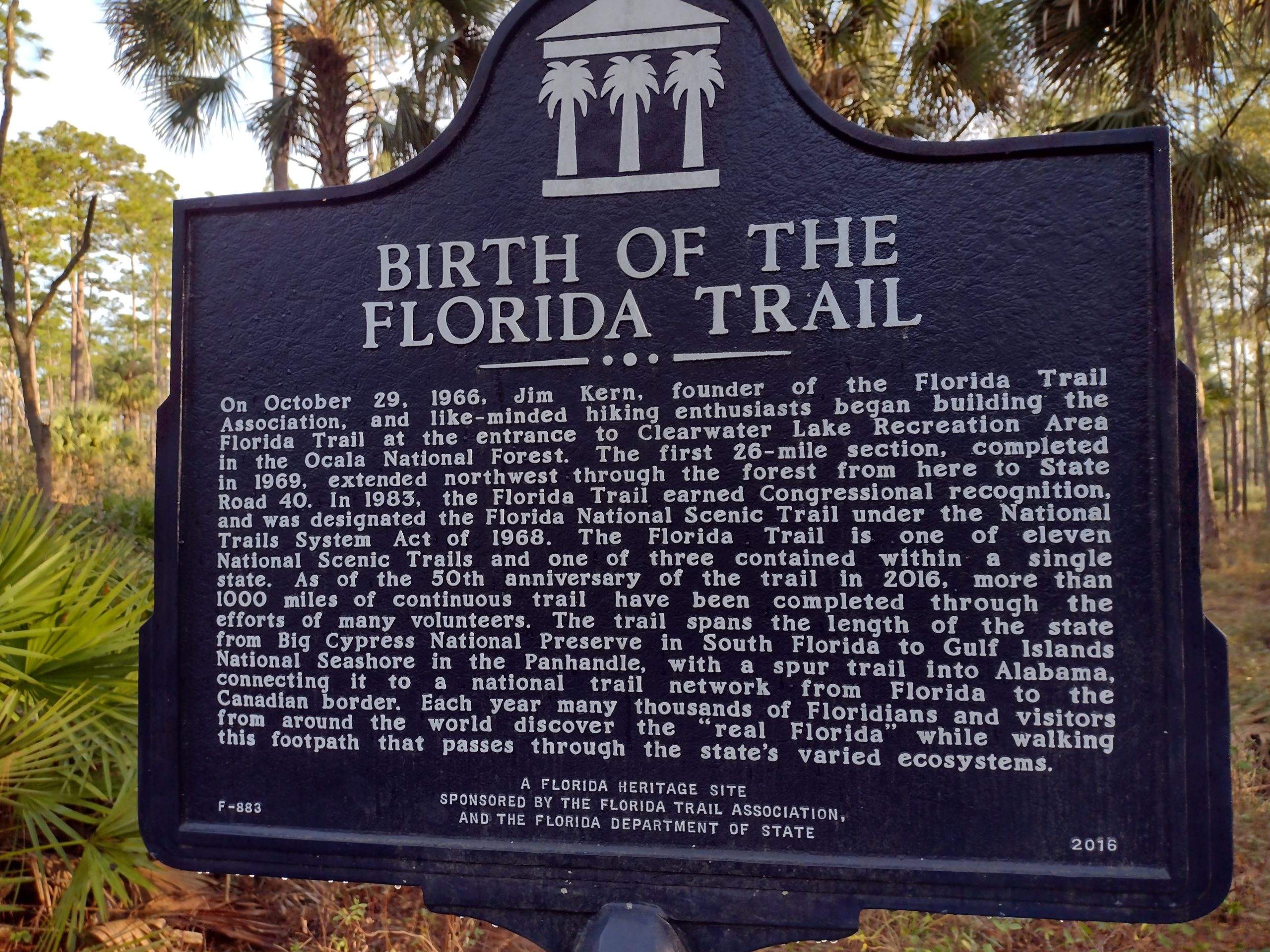
The plaque at Clearwater Lake trailhead commemorates the birth of the Florida Trail.
The other milestone for this point is the transition to another map section on the FarOut app. Since the Florida Trail is within one state, it does not have the convenient benchmarks along the way like the Appalachian Trail has with states. On the AT, a new state brings a sense of accomplishment. The PCT has only three states, but California is split into three virtual sections. The Continental Divide has five states. The Florida Trail only has map sections of 200-ish miles each to designate when a milestone is reached.
The trail immediately turns to one of the signatures of Ocala – big pines and grasses. The other two signatures are sandy pine scrub and open prairies. The trail is dry, the weather is warm, and the elevation is mild. Most of the Florida trial is pretty flat, but here in Ocala are ancient dunes that give gentle rolling hills that give you a little bit of a variation in elevation. It’s not much, but it’s different.
The National Forest is crisscrossed with backcountry and ATV roads, so it’s not really the wilderness feel that it could be. There are usually not too many hikers that I have seen on these trails during the daytime, but I do tend to see weekend hikers near the campground areas. It’s a well-visited forest, but it’s large enough that it does not feel crowded at all. It’s nothing like the zoo of McAfee knob or the White Mountains on the Appalachian Trail.
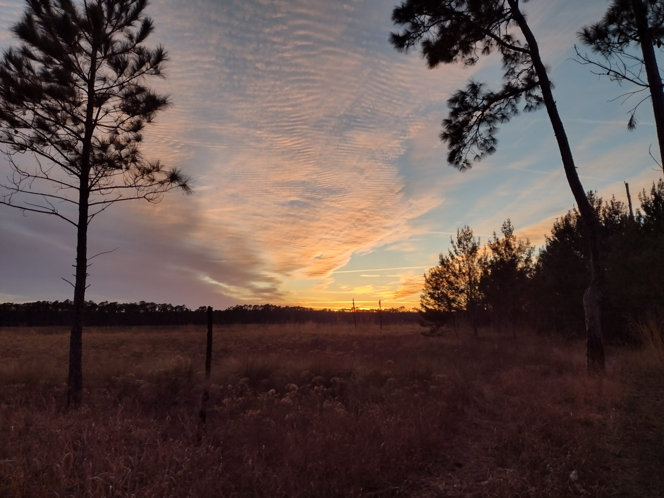
The prairie sections in the Ocala National Forest are great for sunsets and sunrises.
Designated campsites in the Forest are frequent enough, but there are still plenty of areas for dispersed camping. I prefer dispersed camping, not just to avoid the crowds, but to avoid the crowds that might not be so good with leave-no-trace camping. Ocala has plenty of wildlife that would love to steal your food. Bears have been problematic in certain areas in the past and the bears know where the official campsites are. I think they are issued maps at birth. If not using a bear canister, hanging your food is required here.
Alexander Springs is a State Park on a short side trail. It is your typical State Park campground and the spring is very nice and is a feeder to the larger St Johns River. I have stayed here on bikepacking trips, but never from the Florida Trail. The side trail is only half of a mile, but when I am in the national Forest, it just seems fitting to camp in the National Forest.
Farles Prairie is probably the largest and most recognizable feature of this section. It is a wide-open prairie that supports a year-round lake that is good for swimming. The trail skirts around the east side of the lake for about four miles. The trail had a few mud patches here and there. Some are avoidable, some are not. I ended up taking my shoes off and wading twice just to not try to find some crazy route around it. Embrace the muck.

Farles Prairie is filled with lakes, both large and small. The trail skirts around the edge for about for miles. It’s a great place to catch a sunset or sunrise.
The south end of the prairie has road access, a designated backcountry campsite with picnic tables and fire rings, and a pitcher pump. The lake makes a decent water source. When I passed through this time, the handle of the pump was missing. But I was able to lift the plunger by hand to get it to pump water. It is a deep well pump, so the plunger is very long and very heavy. It was quite a workout, but I got some good water. I still filter all the water I get from Florida pumps, however. Not all of them are trustworthy. At least the water here is good clean odor-free water.
Juniper Wilderness
Crossing State Road 40 marks the entrance into the Juniper Wilderness and Juniper Springs State Park. The trail crosses the entrance road into the State Park right near the ranger’s station. You can pay the entrance fee to use the facilities, which these days are basically the springs and picnic/camping area. They have showers, but the canoe rentals and concessions are still closed post-covid. Canoeing the Juniper River is one of the top canoe paddling in the state because of its crystal clear water and undisturbed habitat. If you elect not to go into the park, there is still water at the ranger’s station and they will let you use their restroom and charge your electronics.
The wilderness, being a wilderness, has rules regulating how they manage prescribed burns and mechanized equipment for maintenance. Which in both cases is none. There was a devastating fire that ravaged this area about ten years ago. I last hiked it the year after the fire and it felt like I was hiking on the moon. There was very little vegetation on the ground, and the remaining trees were charred sticks. The sun was unbearable.
But this time, the vegetation has recovered quite nicely. This section used to get rave reviews, and it probably doesn’t have nearly the charm it used to, but at least it is no longer like the moon. It looks like Florida now, which is a great improvement. This section is scrub, and it may not be the undisturbed scrub like other sections in the Ocala National Forest (big scrub), but it does have some hidden gems.
One of those gems is Hidden Pond. Most of the ponds or lakes in the area are just normal ponds. But this one is spring fed. It’s not a huge outflow of a spring and does not feed a river, but it does mean that the bottom of the pond is nice and sandy and not covered in muck. This is an A+ swimming hole. I did not swim in it this time, but other people were. I just sat on the sandy bank under the cover of scrub oaks and ate lunch. It’s a good place to get covered in ticks, too, since the wildlife likes to visit this pond, too.

With a runway like this into Hidden Pond, how can you not want to go swimming?
Ocala National Forest North
The exit of the wilderness quickly brings you to the other large prairie in the forest, Hopkins Prairie. This one is even larger than Hopkins, with nearly six miles of trail along the shoreline of the many lakes that fill the prairie. Both of these prairies are good places for sunsets and sunrises if you can time it that way. I historically try to camp somewhere on the shoreline of each so I can snag both experiences.
But this prairie also has a semi-developed campsite along the southeast shore just after you approach the prairie from the south. There are about thirty sites that run $12 per day and there is a resident camp host. Each site has a picnic table and a bear box, but no water and no electricity. The water comes from a single rotary pump, which gave me some sort of Noro-like virus about ten years ago. The same pump is here, with the same nasty metallic-smelling water. I skipped it this year.
This is also one of the areas that have had problems with bears in the past, so the new bear boxes are a nice addition. There are plenty of good trees for hanging bear bags, but if enough people get lazy and the bears get hungry, then it creates a problem that lasts for years. This is a place that developed that problem. It is the only campsite on the entire Florida Trail that I am aware of with official bear protection devices.
If you are into bats, they also have a very large bat house at the north end of the campground. If you are here to catch a sunset, set up near the bat house to get a two-for-one show.
The rest of the north section is alternating areas of tall pines and scrub oak. I prefer the pines. Scrub oak can get tight and make you feel claustrophobic in the woods. I prefer wide open spaces. There are plenty of hills, both in the scrub and pine areas.

I love hiking in the tall pines and grasses that are in abundance in the Ocala National Forest. Other than the occasional prickly pear cactus, this is great for hiking and great for camping.
This is the first section to provide resupply options since Paisley at the southern entrance to the Forest. If you need full service, then a three-mile side trail can take you to Salt Springs. This town has multiple restaurants and an actual grocery in addition to Dollar General and convenience stores. Most folks who venture into this town are not disappointed. There is an RV park and a campground, but I do not know if they are friendly to hikers or not.
The other resupply option is the famous 88 Store. It is only 20 yards off the trail and has laundry and a shower for a fee. The store itself is really just a bar. They do have some resupply like snacks and soups, but it is less than even a smaller convenience store. They do have some frozen foods like hamburgers, burritos, and pizza that you can cook, but it is not really a food stop. They also accept resupply boxes, and this is the route I went. They have a nice large covered area at the side of the building for hikers, so everyone who hikes the Florida Trail ends up coming here at least for a quick break.
The western route through central Florida that goes through St Cloud and Dunnellon reconnects with the eastern route just a half mile north of the 88 Store. So even the western route hikers end up going to the 88 Store via a short half-mile blue blaze trail. Oddly, the blue blaze trail is shown on the eastern map in the FarOut app. It’s a confusing little blooper.

The western and eastern routes around central Florida meet again just north of the 88 Store.
The rest of the forest continues the pine-and-grass habitat, gradually transitioning back to scrub oak habitat as you near the northern boundary of the forest. When you exit the forest, you are deposited out at Rodman dam on the Ocklawaha River. The river here is a giant lake. The trail takes you on the roadway at the top of the earthen dam with views for miles across the lake. There are restrooms at the far end of the dam with a clean water supply and picnic area. The spillway of the dam was crowded with fishermen that appeared to be catching quite a few fish.
Pick One Emotion
Nostalgia was probably the predominant emotion I felt on this section of the trail. The Ocala National Forest and Suwannee River are the two sections of the Florida Trail that I have hiked multiple times. It is like a comfortable shoe to me.
And even though the bulk of the forest looks the same year after year – Farles and Hopkins Prairies, the scrub oak forest, and the tall pines on grass-covered hills. There is still an opportunity for new experiences. The Juniper Wilderness looked completely different to me. As a working forest, logging can change the character of an area in an instant.
But for me, 95% of the trial looked exactly the same. I felt relaxed as I made my way through the forest. There is nothing that I would change. This is home to me.

This website contains affiliate links, which means The Trek may receive a percentage of any product or service you purchase using the links in the articles or advertisements. The buyer pays the same price as they would otherwise, and your purchase helps to support The Trek's ongoing goal to serve you quality backpacking advice and information. Thanks for your support!
To learn more, please visit the About This Site page.

Comments 1