 ">
">
Singing Through The Smokies
A nero into Hot Springs was much needed. My body was feeling fine, but I needed a bit of a mental reset. Some karaoke at the local brewery provided a perfect evening activity. Soon after Hot Springs, I entered the Great Smoky NP. It was 70 miles of amazing views and perfect weather… well not so much. The weather turned for the worst and the Smokies sustained their namesake.
Day 124 (11.3 miles)
I started the day slightly earlier than normal. Eager to get into town and devour more food. Food is probably the thing that I think about most on the trail. I can eat until my stomach is visibly full and then eat again in another hour. I envision my stomach like a furnace that never shuts off.
The morning was foggy and consisted of more hills to climb and descend. I set a fast pace, the diner in town was calling my name.

It wasn’t until the final descent into town that the fog lifted and the skies cleared. I got one good view a few hundred feet above the river.

As soon as I got into town I went to the Smoky Mountain Diner with Tick Bite and Dirty. We all got the double skillet dish. It was absolutely massive, but light work for a thru-hiker.


I stayed the night at the Laughing Heart Hostel. It was a clean and friendly place. A hot shower and laundry were necessary before heading to the brewery. A group of us went to get some beers and dinner. We ended up staying for a while and performing karaoke. Many of the locals had good voices, we did not. We sang until the karaoke machine literally broke… at which time we figured it was best to return to the hostel. It was a great night to be off trail!

Day 125 (17.6 miles)
As per the usual hostel start, I slept in and eventually meandered to the coffee machine. Dirty and I ended up going back to the Smoky Mountain Diner for another skillet (only a single this time for me). I then printed my Smoky Mountain backpacking permit at the outfitter in town. Afterwards, I headed back into the mountains. I had a full belly and a refueled mind.

I felt good this day, which was appreciated because the climb out of Hot Springs was long. Sweat drenched my clothing and I drank a ton of water. It was a beautiful day. There weren’t many views but the trail was enjoyable.

I took a break at a shelter about 12 miles into the day. It was the early afternoon and I was getting hungry. I ate my usual peanut butter wraps and some other small snacks. My tent was wet from the previous few days. I set it out in the sun to dry while I relaxed. After an hour or so, I packed up and headed another 5 miles to my ending point.

The rest of the miles were easy and I took my time. I specifically wanted to stay at the Roaring Brook shelter to be able to see the sunrise the next morning. The bald mountain, known as Max Patch, was only a few more miles up the hill. I planned to get an early start and make it up there before first light.
Roaring Brook Shelter: T1, S3, P2, W1, B2
Total Score: 12
Day 126 (17.8 miles)
At 5:30 am my alarm buzzed in my sleeping bag. I hadn’t slept the best that night, but the desire for a good sunrise outweighed my sleepy eyes. 2 miles of dark densely covered trails. I was a bit nervous that I might stumble upon a bear, luckily that didn’t happen. The top of the mountain was covered in a thick layer of dew. It was cold with a steady brisk wind. I found a nice spot to sit at the top and waited for the sun rays to kiss the mountain. As per the usual, I took a lot of pictures… but my lens kept fogging from the misty air.


Just as the sun was rising, Dirty came hiking up the mountain. I took that as a sign that I better get going. My numb fingers made it nearly impossible to pack up. Eventually I got my gear together and started back on the trail. I was headed into the final valley before the Smokies. In fact, I could see the Smokies from the top of Max Patch.

It was an easy and relaxing afternoon. Mostly down a gradual hill into the valley. I rolled my ankle nearly 20 times from the leaves that covered roots, rocks and uneven terrain. At the bottom of the valley was Standing Bear Hostel. I stopped in for a resupply, pizza and beer. After a few hour break, I continued down the trail. A half hour of hiking later and I was in the park. I dropped my permit in the hiker box and kept walking. I stopped at the Davenport Gap Shelter with Dirty, Ducky and Gravy. The shelter is unique because it has a fence that covers the front entrance. It provides a little peace of mind to prevent bears from entering the structure.
Davenport Gap Shelter: T1, S2, P1, W1, B4
Total Score: 8
Day 127 (19.8 miles)
Another 7 am morning sponsored by coffee! I felt really good this morning and cruised up the big climb for the day. At the top there was an option to take a 0.6 mile trail to the Mt. Cammerer fire tower. I dropped my pack and ran to it. It was another one of those sentimental and nostalgic places to me. A few years ago, my sister and I had hiked up to this tower and had an amazing morning view. I remembered how in awe I was of the mountains. Therefore, I didn’t think twice about adding an extra mile to my day.


I ran back the half-mile and then continued on some amazing trails. The weather was perfect this day. Warm in the sun, yet chilly in the shade.

It was one of those days where I felt like I was floating along the trail. There was little care for the pain in my feet, knees, and thighs. I ended my day at Peck’s Corner Shelter. It was nearly an additional half-mile off the trail and all downhill. The Smoky NP has some weird backpacking rules. One of which includes only being allowed to sleep in or around the shelter areas. The NPS does not allow hikers to “stealth camp”. This means that my mileage was restricted to where the shelters were located. Luckily, the shelters are spaced at decently sensible intervals and normally include reliable water sources and a privy.


Peck’s Corner Shelter: T1, S3, P2, W2, B2
Total Score: 24
Day 128 (21.0 miles)
A group of us woke up at 5:30 am to “beat the rain”. The morning consisted of darkness, fog and… rain. It was a bit of a dangerous setting, especially with all of the wet rock slabs. I took my time and pushed through. The sun eventually rose, but the fog stayed. A what would have been beautiful ridge was a seemingly endless cloud. Unfortunately, I didn’t capture many images over the next two days of bad weather. I kept my camera in my bag to keep it out of the rain.

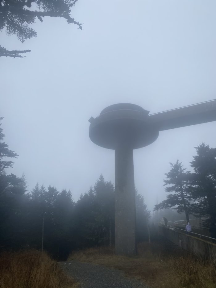
I hiked fast all day. The weather forecast predicted a downpour in the afternoon. My plan was to make it to my destination early… although the rain never showed up. I took a quick lunch along the side of the trail and then proceeded up the final climb for the day. This climb was significant. At the top was Clingman’s Dome, the highest point on the AT! It was completely socked in, but I climbed it anyway.


This high point also represented the “200 miles to go marker”. My dream of completing the trail was coming closer to a reality. The next few miles were easy and downhill. I made it to the Double Spring Shelter shortly before 2 pm. I immediately started a fire and enjoyed the dry environment. A group of us stayed at the shelter that night. Some section hikers (also active military) gave us their extra food. We were extremely grateful and took everything we could carry.
Double Spring Shelter: T1, S4, P3, W2, B2
Total Score: 48
Day 129 (19.5 miles)
Halloween! A perfect ominous morning for the occasion. I had a lazy morning letting the rain clear. I began hiking with a slight drizzle and lots of swampy trails. A few miles into the day and I hit 2000 miles. It was a weird indescribable feeling. The AT use to be couple hundred miles shorter than it is now. Had I hiked it in its early years, I would be at the finish line. Instead, I had another 200 or so miles to go. I was going to enjoy them.


There were some hard climbs and descents in the morning. A solid reminder that I still have some work to do before I finish. Luckily, the afternoon was easy. I quickly made it to Mollies Ridge Shelter and had another fire. It was a nice relaxing night at camp with good friends.
Mollies Ridge Shelter: T1, S3, P3, W5, B3
Total Score: 135
Thank you for reading this trail update! I hope you enjoyed the content. I apologize for my lack of photos in the latter half… the bad weather forced my camera into my bag. Hopefully the next section has sunny days and beautiful ridges. Until then, remember to keep wandering in your own direction.

This website contains affiliate links, which means The Trek may receive a percentage of any product or service you purchase using the links in the articles or advertisements. The buyer pays the same price as they would otherwise, and your purchase helps to support The Trek's ongoing goal to serve you quality backpacking advice and information. Thanks for your support!
To learn more, please visit the About This Site page.

Comments 2
Thx for the post even if there were no stern looks. You broke a Karaoke machine. You should get a medal …silently.
Almost done. Good luck!
Hey Drew, really enjoyed this update & the sunrise pics were outstanding!