 ">
">
Southern Maine Brings Gains
After Rangeley the trail meandered through ponds and lush forests. A day of leisurely hiking and then terrain went back to what Maine is famous for. Bemis Mtn, Old Blue, Moody, and Wyman brought some gnarly ascents and descents. Legs are tired, knees are sore, but I’m not planning on stopping anytime soon!
It was during this section that I developed a rating system for places that I have camped. The rating is comprised of 5 categories: Tenting Opportunity (T), Setting/Location (S), Privacy/Seclusion (P), Water (W), and the Bathroom/Pooping location (B). Each category is given a score between 1 and 5, 1 is the best and 5 is the worst. The scores for each night will be displayed like this example: T2, S3, P2, W1, B5. Then the scores of each category are multiplied. The best score a site can get is 1 and the worst is 3,125. This example scored a 60.

Day 19 (11.9 miles)
Had an emergency poop at 5 am, guess the town food and beer hits different. Wanted to sleep in more but I ended up watching the sunrise over the pond until nearly 7 am.

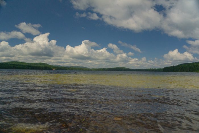
There was no rushing this morning. The terrain was going to be easy and we only had 12 miles to cover. Numerous ponds were located along the trail. Tenacious and I took breaks at almost every one of them to eat a granola bar, get water, or just enjoy the scenery.

Long Pond brought a long break for lunch. The sun was shining bright and we used it to dry out our wet gear from the previous nights rain. It was still early afternoon and we only had 4 more miles to go.
Down the trail a bit we began our descent to Bemis stream. At a road crossing there was a beautiful overlook into the valley. We stopped for a while and enjoyed the view. A NOBO hiker Dozer talked with us for a while and then we were on our way.

The campsites along the stream were plentiful and flat. Setup the tent, made dinner, developed a strategy for the next few days, and then hit the sack.
Bemis Stream Campsite: T1, S2, P3, W1, B3
Total Score: 18
Day 20 (12.4 miles)
Small rain showers in the early morning but they subsided before I got the courage to unzip my tent door. Got up and did the normal routine. A big climb (~1700 ft.) up Bemis Mtn. Second Peak followed by a ridge climb to Bemis Peak.

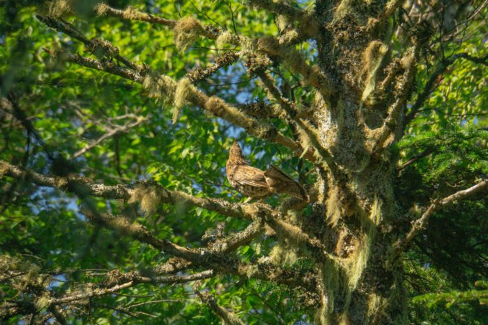
Water in this area was scarce. Had to carry water for 7 miles before the next reliable stream. We saw 5 snakes this day, including one and Tenacious stepped on. It slithered away and then got in a defensive position and struck a nearby branch with a bite. All the snakes we have seen are harmless Garter snakes, nothing to worry about but it was cool to actually see one defend itself. In addition to the snakes, a young grouse crossed the trail just in front of us.

There was a great overlook on the South side of Bemis that was perfect for lunch. Afterwards we did the remainder of the climbing for the day up Old Blue.

As we crested the peak of Old Blue a dark cloud engulfed the mountain. Rain began to come down hard. Luckily, this only lasted for a half hour or so. Not so lucky was the steep descent down Old Blue that was now soaking wet. A NOBO gave us encouragement that there was trail magic at the bottom of the mountain. Unfortunately, by the time we descended other hikers had already enjoyed it all.
The evening brought sunshine and relaxation. Lots more elevation gains were ahead of us but I was excited to make it into Andover the next day!
South Arm Road Campsite: T1, S2, P3, W1, B1
Total Score: 6
Day 21 (10.1 miles)
An early morning, on trail by 6:15 am! A hard but rewarding 1200 ft. climb up Moody Mtn. The backside was steep and rocky. Caught up to Tenacious just before crossing the creek near the bottom.

Took a break at the bottom before the climb up Wyman which was a real bitch! Steep and long. The descent was actually enjoyable and the other side meant getting into town.
Before heading into town we setup camp along a brook with cascading waterfalls. I took a dip to clean up and then washed my clothes and hung them up to dry. I had to make my best appearance for the massive town of Andover (consisting of a single general store that is also the only restaurant). A shuttle picked us up at 2 pm and took us into town. We resupplied, charged our devices, and ate until our stomachs were visibly enlarged (speaking for myself, not Tenacious).
Our ride out of town wasn’t until later that evening which worked perfectly. We were able to relax in the stores dining area and buy a continuous supply of food. Service was good for making phone calls to family and friends. That night we drank a beer at our campsite. I got a fitting picture of the beer next to a waterfall with a pool that contained native brook trout!

East B Hill Road Brook Campsite: T1, S1, P2, B3, W1
Total Score: 6
Thanks for reading this update of my AT journey! I hope you enjoyed it and that you stick around for more content that I will be writing. Until my next post, remember to keep wandering in your own direction! – No Kiddin

This website contains affiliate links, which means The Trek may receive a percentage of any product or service you purchase using the links in the articles or advertisements. The buyer pays the same price as they would otherwise, and your purchase helps to support The Trek's ongoing goal to serve you quality backpacking advice and information. Thanks for your support!
To learn more, please visit the About This Site page.
