 ">
">
Trail Profile: Backpacking PA’s Susquehannock Trail System
The Susquehannock Trail System (STS) traverses some of the most remote terrain in Pennsylvania, with more wildlife than people. Although numerous trails make up the STS, the route runs as a continuous marked loop of nearly 85 miles, making it one of the longest continuous loops in the Eastern US. During its course, the STS travels through the secluded, 265,000 acre Susquehannock State Forest. The area features one of the largest swaths of forest east of the Mississippi in a region known as the Pennsylvania Wilds. Lush forests and mountain streams dominate the scenery, providing a serene wilderness escape. Despite its beginnings over 50 years ago, the STS remains an overlooked gem.
Susquehannock Trail System Quick Facts
Length: 85 Miles ((83.45 miles in the latest guide book with an additional mile roundtrip when starting at the Northern Gateway on the access trail)
Location: North Central Pennsylvania in Susquehannock State Forest
Trail Type: Loop
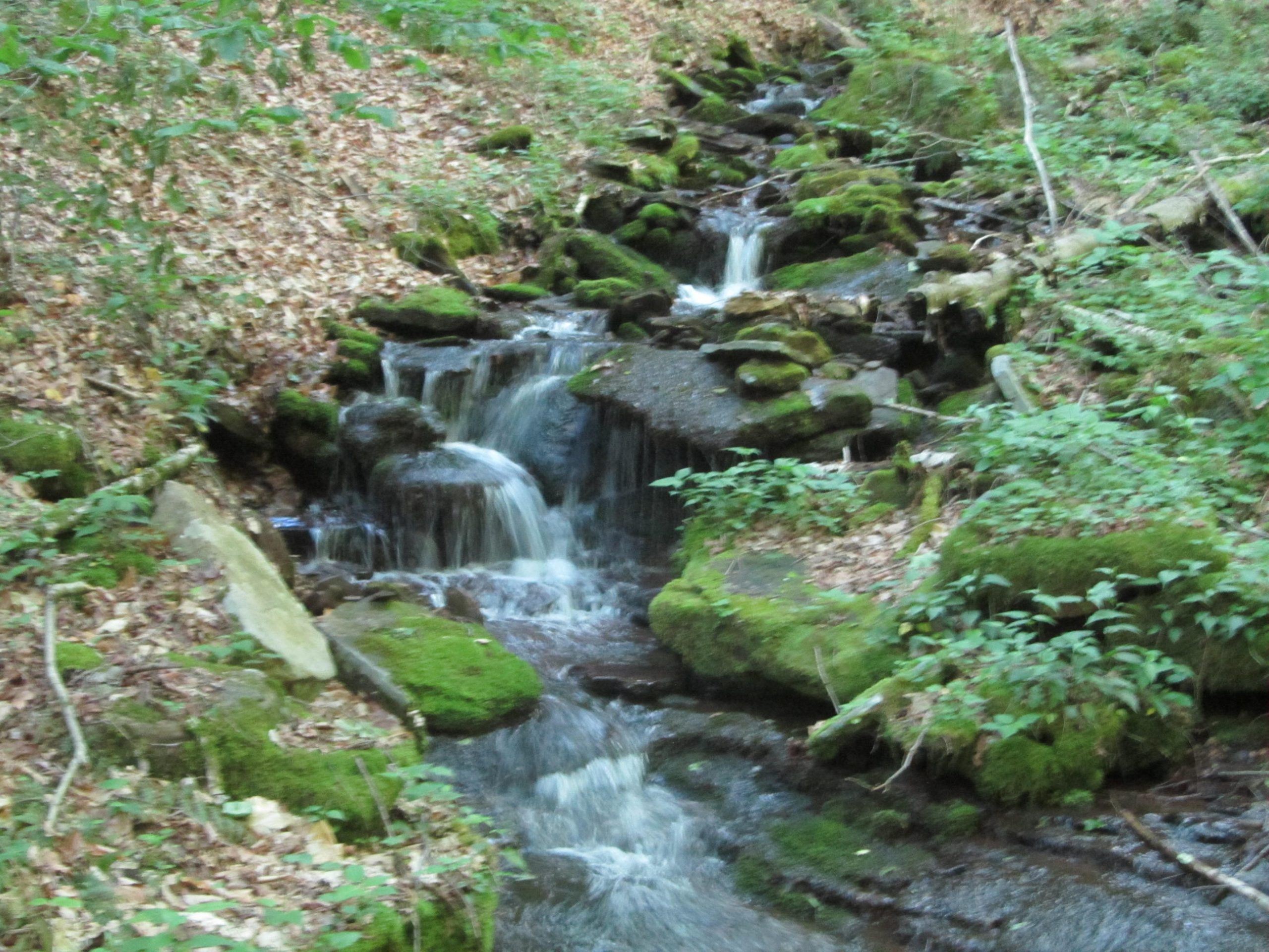
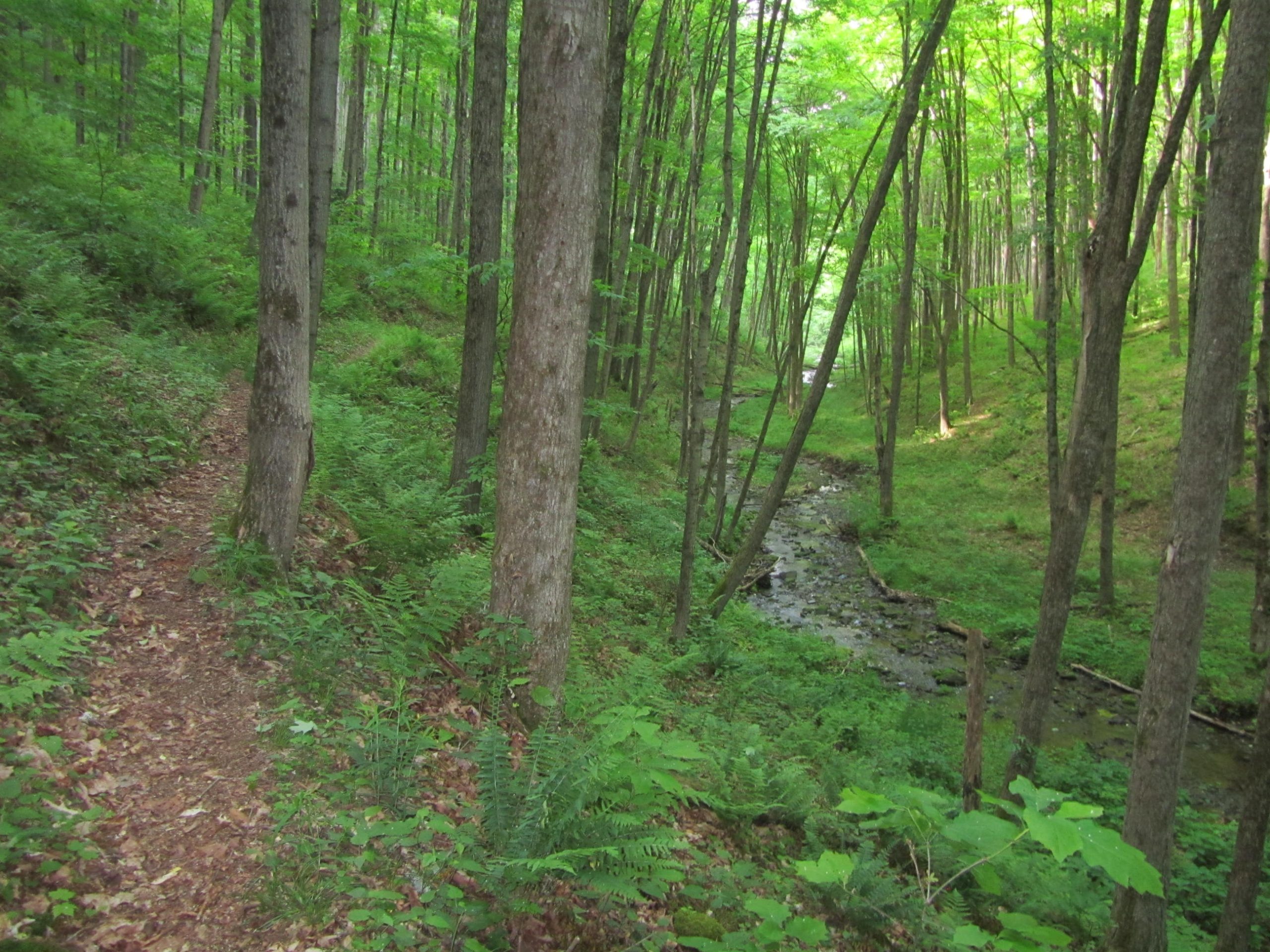
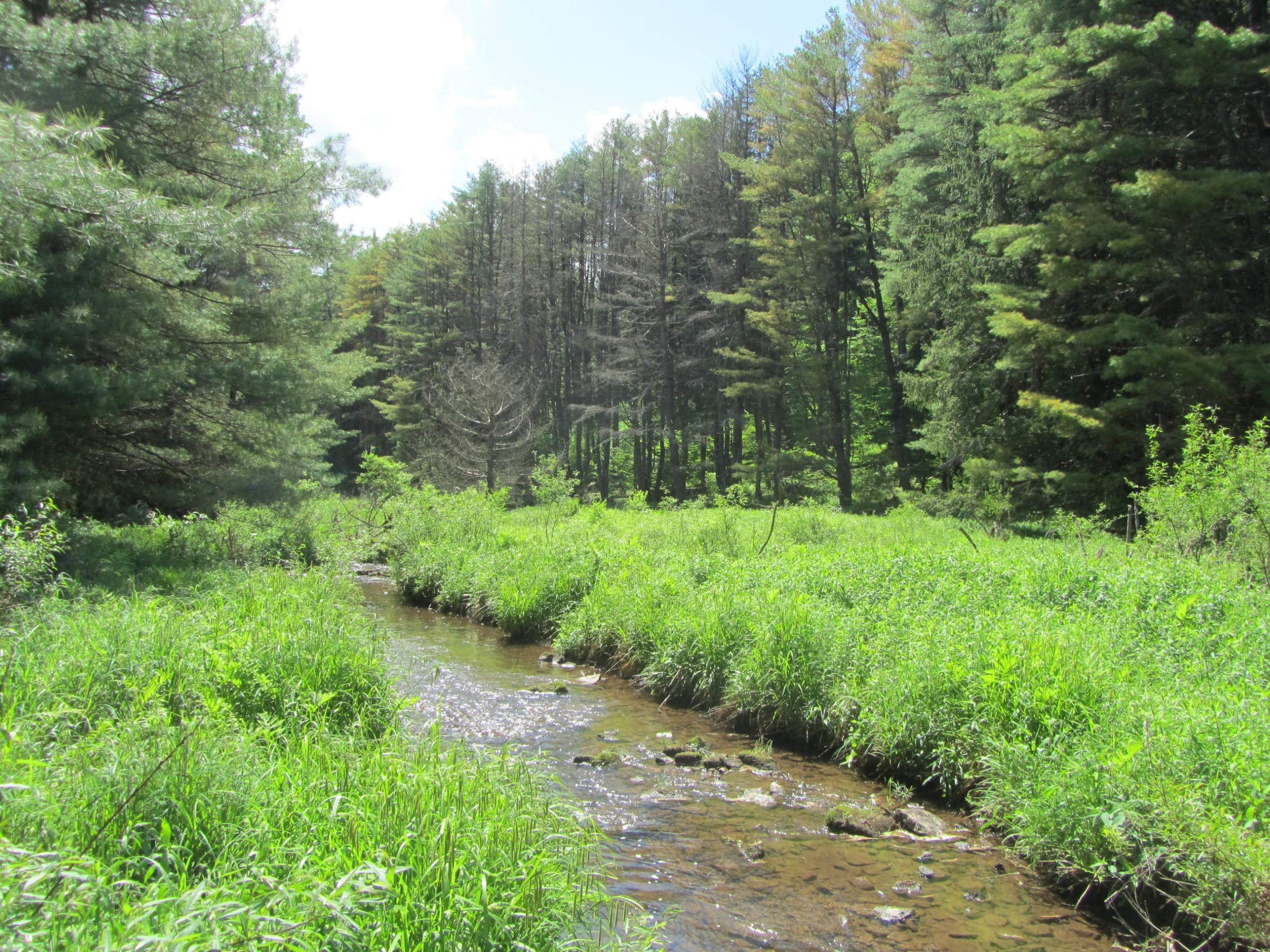
Scenery: Majority of the STS travels through hardwood forests mixed with stands of coniferous trees with abundant mountain creeks and streams. In summer, dense foliage carpets the forest floor in a sea of bright green. Brilliant foliage colors the tree canopy during autumn.
Approximate Time to Hike: Most can comfortably hike the trail in 5-8 days
Terrain

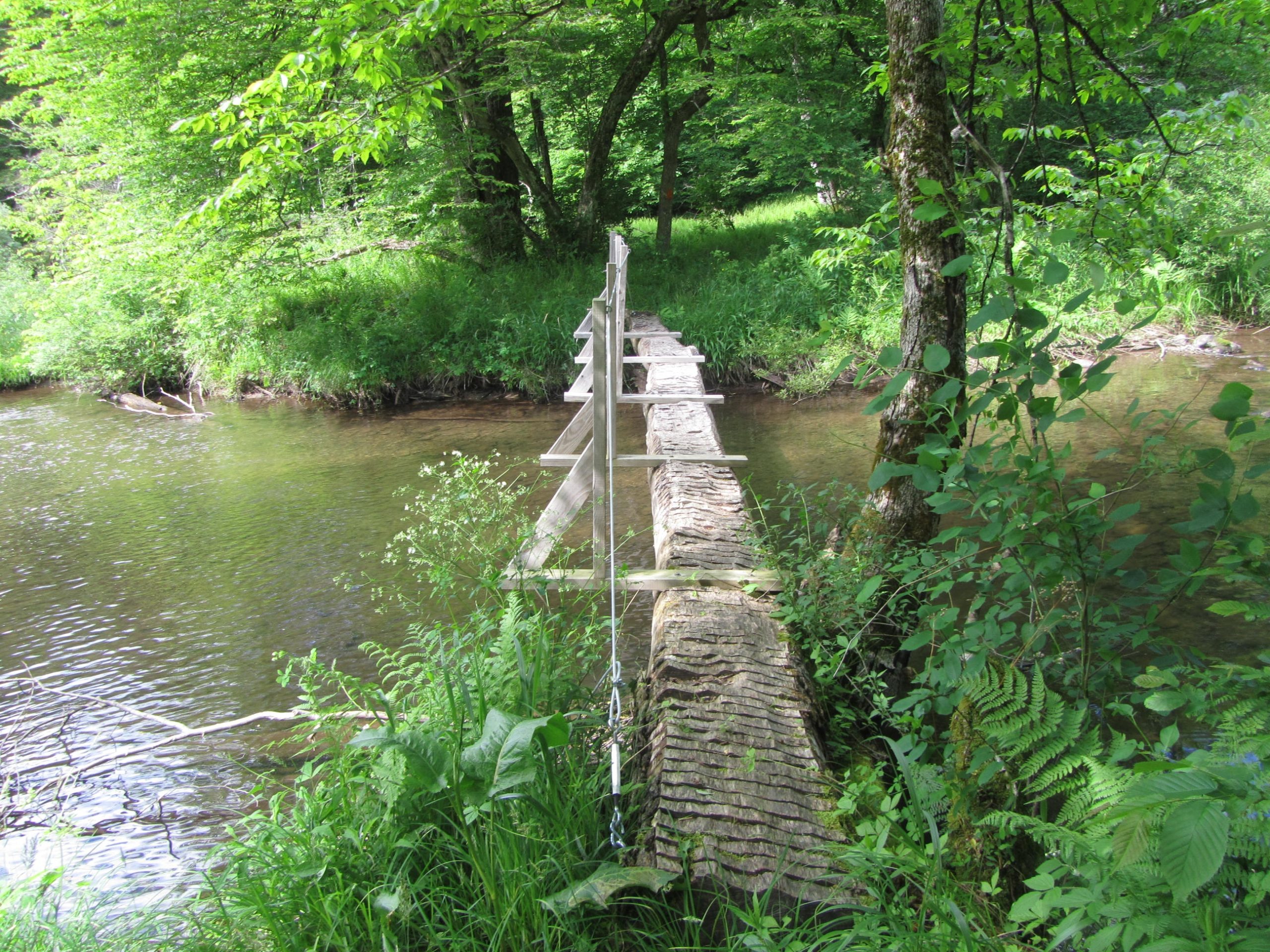
The STS travels mostly over the Allegheny Plateau. While traveling along the plateau, the terrain remains fairly level. Frequent drainages dissect the plateau resulting in numerous steep elevation changes. Several climbs and descents result in elevation changes of over 1,000 feet. When not on the plateau, the loop frequently follows the scenic creeks. The vast majority of the route travels over traditional hiking trails through the forest with brief sections that utilize logging roads, old rail grades, and a brief road walk. Elevations along the trail range from 2,545 feet along the plateau near the northern end of the loop to the lowest elevation of 1,050 feet at the settlement of Cross Fork on the loop’s southern end.
Getting There

The trail’s Northern Gateway and the most popular starting point is located at the Pennsylvania State Forest District Office at 41.769194, -77.870111 along US Route 6 about 9 miles east of Coudersport, PA or 14 miles west of Galeton, PA. The STS at Mile 0 is accessed by a marked .4 mile trail from the office with long-term parking available. The trail’s mile markers begin at the Northern Gateway.
Ole Bull State Park marks the trail’s Southern Gateway at 41.537948, -77.714621 at between Mile 26 and 27 of the trail. The State Park is located on PA Route 144 about 17 miles south of Galeton, PA or 27 miles north of Renovo, PA.
The STS passes through the village of Cross Fork between Mile 49 and 50. Cross Fork offers lodging, food, resupply options, and long-term parking at 41.482046, -77.818634, by the Forestry Building and Fire Department. Cross Fork sits along PA Route 144, 16 miles north of Renovo, PA and 26 miles south of Galeton, PA.
PA Route 44 crosses the STS twice offering access. The trail passes several forest roads and smaller roads along its course with possible access. For alternative access not listed above, refer to one of the guide books listed below.
Guide Book and Map
Two different guide books dedicated to the STS are available and they both include maps. Both books are available from the Susquehannock Trail Club website.
Guide to the Susquehannock Trail System by Chuck Dillon and Hiking the Susquehannock Trail by Ben Cramer both provide turn-by-turn details, water, and camping information, side trail descriptions, trail profiles, and maps. As of early 2021, Guide to the Susquehannock Trail offers the most current edition that includes most of the recently built shelters along the trail. Due to ongoing trail improvements, the book with the most current edition at the time of your hike is recommended.
The STS can also be found on FarOut.
On trail, frequent orange blazes mark the STS with good signage at trail intersections. Unlike most trails, the STS features mile markers every mile of the trail.
Why Hike the Susquehannock Trail System
The STS offers something for backpackers of all experience levels. The lack of crowds and seclusion are sure to please anyone looking for an escape. The abundant wildlife will thrill any hiker. Frequent water and camping opportunities allow for great trip planning flexibility. While some sections of the STS feature challenging terrain with large elevation changes, as a whole, the trail traverses modestly difficult terrain with pleasant hiking. At 85 miles, the STS is perfect for your first weeklong hike, a shakedown for a longer trek, or just a great trail to escape into the wild for a little bit. The lush forests and mountain streams along the STS are sure to put you in a zen state of mind.
Which Direction to Hike the Susquehannock Trail System
As a loop, the trail can be hiked in either direction. As far as the terrain goes, neither direction seems to provide a great advantage. Hiking clockwise may be advantageous as it follows the mileage markers along the trail and directions in the guide books.
Susquehannock Trail System Highlights

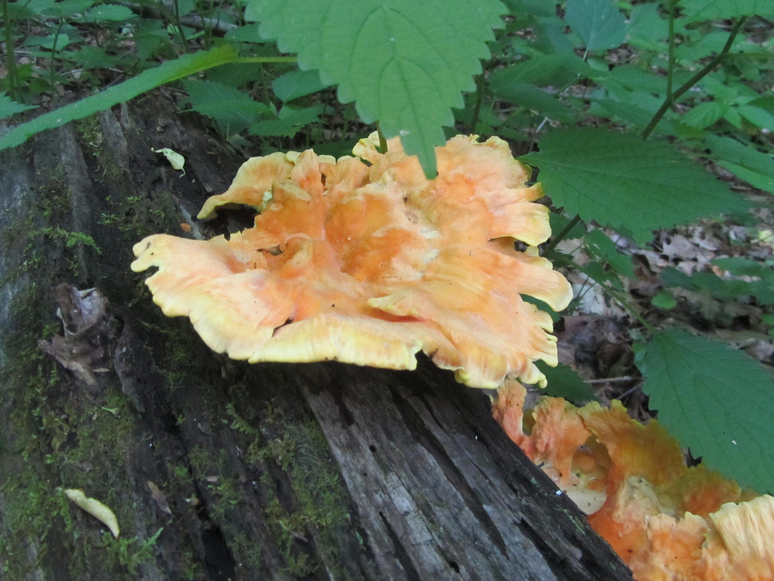
Wildlife: Chances are that you will see more wildlife than people on the STS. During my journey on the trail, I encountered more bears than I did on my entire AT thru-hike. Raccoons, rattlesnakes, owls, deer, porcupine, frogs, toads, and nonvenomous snakes all roam the area and sightings are common.
Hammersley Wild Area: The 30,000-acre Hammersley Wild Area stands as Pennsylvania’s largest roadless tract of land and the state’s second-largest Wild Area. The trail follows Hammersley Fork, a remote mountain stream, with excellent camping opportunities and swimming holes.
Night Skies: This part of Pennsylvania features one of the darkest night skies in the Eastern US. On a clear night, look up and enjoy the brilliant stars.
Seclusion: The STS travels primarily through Potter County, one of Pennsylvania’s least densely populated counties. The STS flies under most backpacker’s radar. You will feel like you have the trail to yourself.
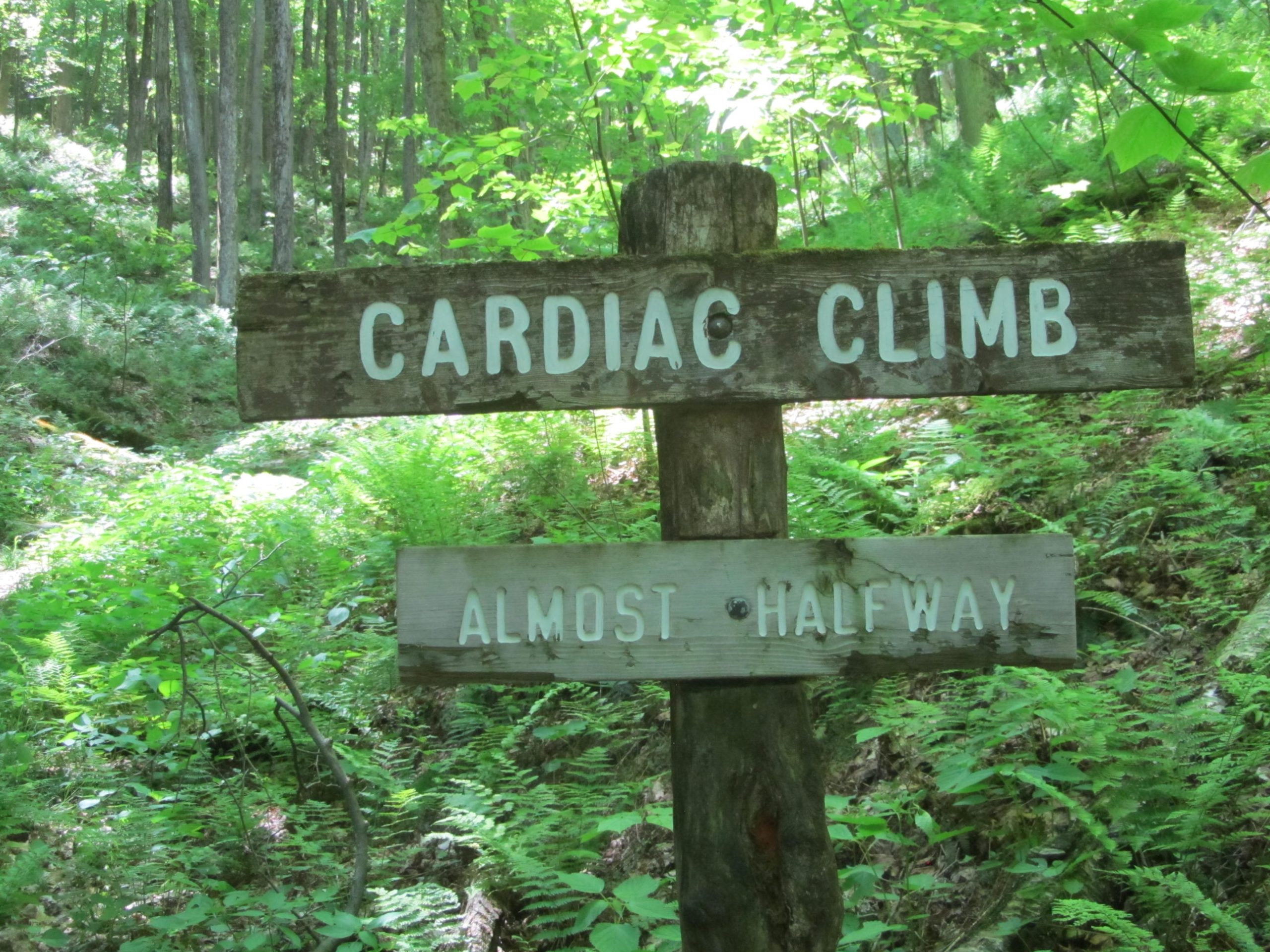
Volunteers: It’s clear that the volunteers that work on the STS care about the trail. Along the route, trail maintainers have added interesting signs for landmarks such as “Cardiac Hill” and “Spook Hollow.” Great care went into the shelters along the trail as well. The shelters often have tables and chairs, and in one case, a tic tac toe board carved into a stump with playing pieces.
Weather

The prime hiking season extends from late spring through early fall. The STS sits at a relatively high elevation for Pennsylvania and experiences some of the longest snow cover in the state. Snow as early as October and as late as May is possible.
June through September typically sees daytime highs in the 70s with 80s during hotter periods. Nights during this time typically drop into the 50s with frosty nights possible in September. Midsummer tends to be humid and hazy. Most years the weather cooperates for hikes in the fringe months of October and May. Expect snow on the ground November through April most years.
The Mid-Atlantic experiences consistent year-round precipitation. Expect 3-4.5 inches of rain per month during the prime hiking season with June as the rainiest month on average. Spring and summer thunderstorms aren’t unusual.
Gear Recommendations and Special Considerations

Tick Prevention: Unfortunately Pennsylvania is a hotbed of tick activity and diseases. The STS features abundant ferns and other ground cover that can encroach the trail at times. The trail encounters high grass near creeks and when crossing pipelines. Treat your gear and clothing with Permethrin and use repellent on any exposed skin. During my trek of the STS, I removed at least eight ticks including one embedded in my thigh. Illness followed about ten days after my trip resulting in treatment for Lyme Disease.
Stinging Nettles: In case you needed a reason besides ticks to wear long pants, stinging nettles occasionally grow along the trail. If you don’t like hiking in pants, gaiters help keep the pesky plant off your skin.
Food Storage: Bears and raccoons thrive in the remote forests along the STS. While canisters aren’t required, a solid bear hang technique is strongly recommended. If you lack the necessary skills, consider a canister or Ursack.
Blaze Orange: Hunting is a serious passion in Pennsylvania and the STS travels through a popular hunting destination. Hunting is permitted throughout the State Forest. Make your passage safer by wearing blaze orange if traveling during hunting season which typically runs most of the fall and parts of spring.
Rattlesnakes: Timber Rattlesnakes thrive in this part of Pennsylvania. During the summer, they frequently bask in the sun along the trail. A happy rattler doesn’t always give a warning and they often blend into the terrain. Pay attention, particularly in sunny sections of the trail. Pay extra attention if you hike with a dog.
Permits: While permits aren’t required to hike the STS, a camping permit is required in Pennsylvania State Forests if staying more than one night at any site. A permit from the nearest Forest Office is required for campfires between October 1st and May 25th.
Camping and Water Sources

Within Susquehannock State Forest, backpackers may camp at large. Refrain from camping on the few sections of the STS that pass through private property. Hikers pass through several State Parks on the STS. Camping in State Parks is permitted only at designated sites with reservations.
In the past few years, the STS built five shelters for overnight camping at Mile 10.5, 30.8, 42.5, 60, and 68.5. The shelter at Mile 10.5 is fully enclosed while the other four are three-sided lean-tos. Several of the shelters have chairs or picnic tables. As of 2021, all of the shelters are included in the Ben Cramer guide. The shelter located at Mile 60 is not included in the most recent edition of the Chuck Dillon guide.
Unfortunately, only the shelters at Mile 42.5 and 68.5 are located by a water source. The other three shelters occasionally have gallons of water placed by volunteers but shouldn’t be counted on. Pack any water you need when staying at one of these shelters.
The enclosed shelter at Mile 10.5 is built of stone and was originally used to store dynamite. It features stumps for sitting at the fire ring and a tic tac toe table carved into a stump.
More than 40 possible campsites are recommended in the Chuck Dillon guide. Since the STS sees relatively few users, some of the suggested campsites are lightly impacted and may not be obvious.
The STS frequently travels along creeks and streams and a reliable water source is passed every few miles.
Resupply Options

If starting at the Northern Gateway, the trail passes through the village of Cross Fork at Mile 49. Cross Fork offers a small store, dining and lodging options, and a post office. To lighten your load, consider starting at the Northern Gateway and utilizing Cross Fork’s services for a resupply just over the halfway point of the loop.
Closing Thoughts
Despite its relative obscurity, the Susquehannock Trail System should not be overlooked. With better-known trails, you get more people on the trail. The STS gives you a feel of what backpacking must have been like years ago. Although well-marked, the area feels like wilderness much of the route. The seclusion, wildlife, and peacefulness of the STS make it a rare backpacking treat, especially in the population-dense eastern United States.
Additional Resources
Susquehannock Trail Club: The Susquehannock Trail Club promotes and maintains the STS. Their website provides information and updates on the trail.
Susquehannock State Forest: The Susquehannock State Forest’s website provides information including regulations, permits, notices, maps, special notices, and other important details for the forest that the STS travels through.
Backpacking the Susquehannock Trail System: The author’s first-hand account of his trip over the STS.

Related Trail Profiles
Featured image: Photo via Troy Zohner; graphic design by Libby Thompson (@libby.des).

This website contains affiliate links, which means The Trek may receive a percentage of any product or service you purchase using the links in the articles or advertisements. The buyer pays the same price as they would otherwise, and your purchase helps to support The Trek's ongoing goal to serve you quality backpacking advice and information. Thanks for your support!
To learn more, please visit the About This Site page.

Comments 7
Thanks for the post, Troy! My wife and I are aspiring AT thru-hikers and live in NE Ohio, not too far from this trail. It may be a great training ground for us. You had me until you spoke strongly about snakes….my major weakness. How do you combat snakes and staying safe whether on this trail or the many others you have done? I need to overcome this fear in some way as to not take away from our goals. Any thoughts?
Snakes aren’t a big deal. They don’t attack unless you get too close. Rattlesnakes will usually warn you. They aren’t aggressive unless you bother them. There isn’t anything to combat. On my time on the PCT in Southern California I saw several species of rattlers pretty much daily. On the AT I crossed paths with two copperheads but regularly saw Rattlers in PA along the AT where I grew up. Be aware they are there and respect their space and consider yourself lucky for the encounter. Then focus on the real threat of the area, ticks.
Thanks for this article! I had never heard of this hike before, but now I want to try it ASAP. About a week long and it’s a loop so no complicated car spot logistics required, sounds pretty great.
Did three days on the trail last summer and I’ll be heading back up to do it the whole thing again this summer – it’s a must. Had a lot of quiet time after a busy summer to think, reflect, and walk.
Took the mile-long detour along Route 144 to Cherry Springs State Park and slept under a clear sky during the Perseid shower. I recommend this! Never seen stars like that and the band of the Milky Way was fine and distinct. They have water and a restroom, too, and you can stealth camp or bum it depending on how filled. A nice family from Virginia let me set up by a tree near their site.
Most of the people I met were at the parks that the trail runs through/near. I crossed paths with 4 or 5 other hikers, lots of bear poop, plenty of deer, and Ruffed Grouse, and a bear or two. Coolest of all was a nighthawk sitting right in the middle of the trail.
John Zimmer is a good guy, gave me a ride when I finished. The STS volunteers are great resources and will go the extra mile to help you out!
Thanks for this profile. I just found out about this trail recently on Reddit and it instantly became part of my plan this summer. I’ve been doing some research and it also looks like there are two cross over trails that connect it to the Black Forest Trail allowing for an approximately 140 mile loop which sounds like heaven.
Question for anyone who’s hiked this trail: Would you say this trail is dog friendly? I have a four legged hiking buddy who I’d love to take but this would be our biggest trip to date and we’ve never backpacked together in bear country. Any thoughts would be appreciated!
With a dog, I’d take a few things into account. I Wound up with Lyme disease on this hike. I had at least 9 ticks on me over the trip. Make sure you treat your dog with a preventative. Rattlesnakes are fairly common on the STS and even more so on the Black Forest Trail. Porcupines are also fairly common. Raccoons too. I strongly recommend a leash to make sure your dog is safe and not running into unwanted surprises As far as bears PA bears see a lot of hunting pressure and in this region they are skittish but may be more people habituated near the state parks with camping. I saw three bears including one in my campsite at twilight and they all ran when they knew I was there. Difficulty for a d dog is not too difficult. Check the State Forest link above for any leash regulations about dogs. Good luck if you go.
Hello, I am from Northeast Maryland (Baltimore County) and was looking to backpack this from a Friday-Sunday. Not all of it 🙂 Section backpacking. Can you please recommend a portion of this? I do appreciate your time! Erika