 ">
">
Te Araroa, Days 75-82: The Tararuas
Friends, when was the last time you felt like you were taking your life in your hands and preparing to fling it away like dust in the wind? For me, this was last Thursday through Saturday. I can already tell my parents are going to get really worried when they read this and email me to ask, “What the F*** are you doing out there???!!!” That is actually a fair question. But I did survive, and everything’s fine, and I will not ever go back to the Tararua Range in a giant windstorm again.
So, the Tararuas. If you’re hiking the Te Araroa Trail northbound, the Tararuas are the mountain range you come to after departing the Kapiti Coast north of Wellington. As I mentioned in my last post, the Wellington region is incredibly windy, and the Tararuas are legendary for gale-force winds and extreme weather in general – particularly along the high ridge lines and peaks, which rise to around 4500 feet above sea level. Of them, Athol McCredie, author of the Te Araroa NOBO website, writes:
“The Tararuas are notorious for mud, tracks broken by tree roots, fallen trees, numerous stream crossings, and wet, misty, windy weather… There are great views on good days from the high, open ridges, but on bad days these can be dangerous places. Statistics show that the ridge tops are in cloud 78% of the days in a year: people do get lost and some have died from exposure. And 5,000mm of rain per year falls on the western side of the range (where you are going, with much of this in summer). By comparison, NZ’s notoriously wet Milford Sound gets only a tad more at 6,400mm.”
Well put, Athol.
I guess I could just leave it there and let your imaginations do the rest of the work, but what would be the fun in that, right?
So, as one does before heading into the Tararuas, I made sure to look at multiple weather reports for the mountains before heading in. I had seen that some rain was on its way in about 6 days’ time, so I decided to cut short my stay on the Kapiti Coast by one day to head into the Tararuas with an extra time cushion. And at first, this seemed like a meaningful decision and I congratulated myself heartily for being such a responsible planner. It wasn’t until later that I fully realized how radically different – and changeable – the weather in the mountains can be. A ten-day forecast means literally nothing up there. But I’m getting ahead of myself.
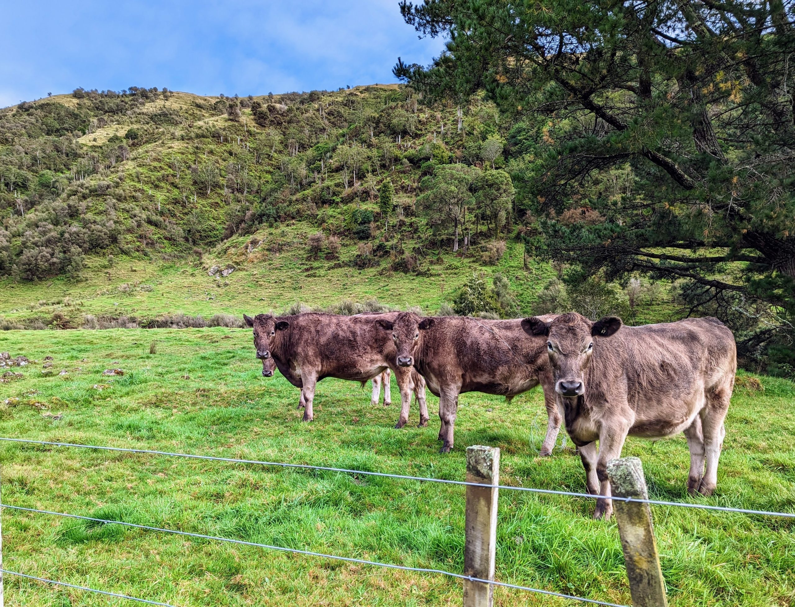
Here’s some cute cows on a farm I walked through on the way to the mountains – these guys are like, “Why are you going up there?”
On the first day of this section, I hiked from the town of Waikanae, on the Kapiti Coast, into Tararua Forest Park. The day was sunny, my pack was jammed with 9 days’ worth of food (8 for the hike plus 1 day of extra food just in case), and I was excited to get back into some backcountry. On the way in, I was even followed down the trail for a while by a baby goat! (When it finally caught up with me, it seemed really confused to find that I was not another goat. Sorry buddy, I’m a human being and I’ve got some mountains to go scare myself shitless on.)
The walk takes longer than I expect and I spend the last hour hiking by headlamp to my destination, Parawai Lodge. (I should mention that NZ Daylight Savings Time just kicked in a couple of weeks ago, and dusk is now at about 6:15pm.) So I arrive at Parawai at around 7:30, and it’s dark as a broom closet in there and the two folks who are already ensconced are fully asleep. I knock around a bit, feeling like a loud rude a**hole, until two other guys arrive (also by headlamp) and let me off the politeness hook by being way more loud and knock-around-y than me. The next day I learn that these guys, Andrew and Michael, are incredibly nice and are on a fascinatingly elaborate pack-rafting expedition, but for now they’re just my cover while I make noise and accidentally shine my headlamp into the faces of sleeping people.

Gazing through the forest at the peaks of the Tararuas
The second day is when the excitement really starts to build. I plan to walk to the next hut along the track, Waitewaewae Hut (pronounced “YTYY,” as Michael tells me), and since it’s only 6 miles away I figure I might even continue further if I feel like it. Instead, I find myself swimming through a stew of mud, looping tree roots, and decaying vegetation that renders it completely impossible to make anything like normal time. At one point I have to climb up a mudslide and my feet just slowly ooze out from beneath me until I’m lying face-down, completely prone, in the mire. The only thing worse is climbing down the mudslides, because falling down typically happens a lot faster than falling up and it hurts way more when I land. Somehow it takes me 7 hours to walk 6 miles, and when I get to Waitewaewae I am fully done for the day. Andrew and Michael arrive just after I do, and we are welcomed by a guy who opens the hut door, grins broadly, and asks if this was the worst day of our lives. This is Dylan, who has just swum through the mud with his friend Tom and washed up at the shores of the hut about two hours ago. Dylan and Tom have already gotten the wood stove going, so the rest of us shuck off our outerwear and try to warm up. All of these guys have done a lot of previous hiking in the Tararuas, so the conversation heavily features tales of mud, shitty weather, and scrapes with injury and death. Later, Andrew and Michael inflate their pack rafts and get all their stuff ready for their float down the Otaki River tomorrow – it’s fun to have boats inside a hut, and Tom, Dylan, and I are duly impressed with the snazziness of the gear. Then it’s 7:30pm and we all go to sleep.
Day three is when the mud and the weather on the peaks join forces. The day’s hike involves about 3600 feet of elevation gain, following a long ridge and taking in Shoulder Knob, Junction Knob, and Mt. Crawford before finally ending at Nichols Hut. The climb is muddy and steep but beautiful, and sunlight filters through the forest canopy to illuminate dew-sparkled mosses and ferns. I break through the bush line and I’m on a windswept ridge of rock and tussock grass – there’s even a rainbow. The wind is fierce but it’s incredible up here and I feel exhilarated. And then, quick as that, clouds materialize out of nowhere and the wind picks up and it starts to rain. The wind is gusting now, blowing like crazy, and the rain is flying up from below and then sideways, and then these shocking gusts blow out of the general background maelstrom like crazy wind exclamation points, and I try to get a move on but I can’t go any faster because the wind is trying to blow me off the ridge and all those tussock grasses are tripping me and somehow the trail on the ridgeline is nothing but deep squelchy mud. So that’s how 5 miles takes me 8 hours. The temperature drops steadily while I walk and I add layers of clothing, until eventually my gloves aren’t warm enough and I break out my extra socks to use as mittens on top of them. The only downside to using socks as mittens is that my hands start to smell like my feet, but given that they’re nice and warm I’m OK with it. I finally slog up to Nichols Hut, and when I open the door Dylan and Tom are huddled in their sleeping bags with their beanies on and Dylan says from the bunk, “OK, so now was THIS the worst day of your life?”

Rainbow! This is right before it all went to hell.

And here’s me, so excited about the rainbow, completely unaware of the extent to which everything is about to go to hell.
Nichols Hut is drafty and leaky and we can all see our breath in there – and we’re way above the bush line so there’s nowhere to get wood for a fire in the wood stove. This is when good gear, hot food, and a warm sleeping bag are the most valuable things in the universe. I eat mac and cheese in my sleeping bag wearing all my clothes, then drink a mug of hot water to warm up some more. The rain and wind continue overnight into the next morning, which is…
Day four. Stay or go? Nichols Hut is cold, and the next hut, Te Matawai, is below the bush line and should have ample wood for a fire. Plus, the weather should ease as we go down in elevation. I can’t imagine sitting here and freezing my butt off all day, and neither can anyone else, so we decide to go. Thus begins the longest, windiest, scariest, and coldest day of the hike. It’s like the day before but somehow more so – the trail follows the ridge all day, undulating up and down over peaks and saddles, climb following descent following climb. The mud coats my rain pants up to the knees, and the wind gusts are so strong that I have to crawl on all fours across a couple of exposed sections to keep from getting blown off the ridge. Thus does it take me 11 hours to walk 8 miles. The last half hour I blunder through the mud and tussock and roots by headlamp, and when the outhouse finally looms out of the dark 100 feet before the hut, I am so relieved I feel a little bit weak. There are a bunch of other people in this hut who have come up from the other direction (it’s only 1 day’s walk from here to a parking lot near a farm), and everyone’s in the process of re-thinking their plans to go up to the ridges the next day. My haggard and battle-worn appearance is probably fairly persuasive re. such decision-making.
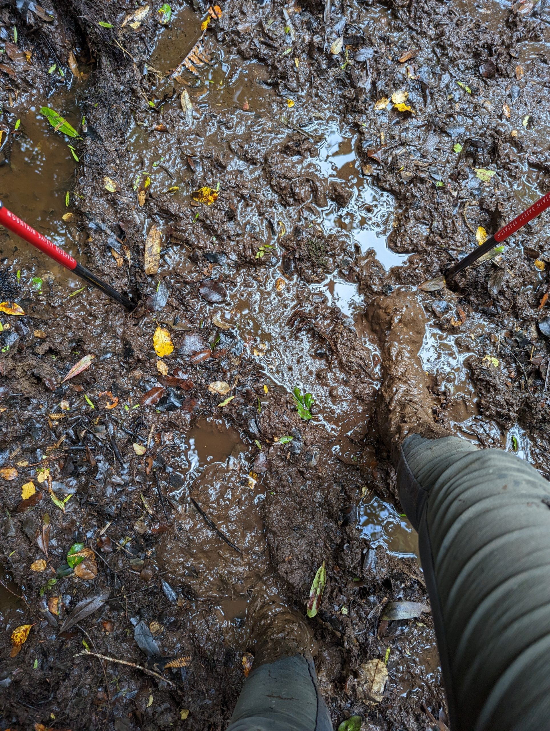
This is a mild sampling of the mud. I didn’t take any pics of the worst mud days because my hands were (surprise!) covered in mud and I didn’t want to touch my phone.
Days five through eight are completely fine – lovely, delightful hiking! – as the trail comes down from the ridges and meanders northeast through lush forest to the outskirts of Palmerston North. I am reassured that I can actually walk happily for days on end under non-terrifying circumstances, and I enjoy myself and the spectacular surroundings without worry or reservation. And now here I am in the Palmerston North library sitting at a computer and telling my tale – so it all came out right in the end. Along the way I saw the coolest hut yet on the trail – the Whare o Moturimu Hut – which is maintained by the Palmerston North City Council of all things. Palmy, as this town is commonly nicknamed, manages an enormous extent of natural area – as well as a huge planted timber forest – just past the outskirts of town, and they’re impressively organized about it. In the city-owned Arepuke Forest Park I actually bumped into a couple of contractors who were in the process of electronically re-inventorying all the road signs in the park for the city’s records. Comprehensive electronic records of remote road signs are the kind of thing that makes my little heart sing for joy. Plus which, the contractors see me again when I’m just about to walk onto the highway to get the final few miles into the city, and they pull over and give me a ride so I don’t have to risk my life on a motorway interchange.

Just look at this forest – MAJESTICAL!

The doorway of Whare o Moturimo Hut – would your city council build this in the woods and then invite weird strangers to stay in it for free?
So all’s well – and I even passed the official halfway point of the trail! – more about which in my next post. In the meantime, stay safe, my babies!

This website contains affiliate links, which means The Trek may receive a percentage of any product or service you purchase using the links in the articles or advertisements. The buyer pays the same price as they would otherwise, and your purchase helps to support The Trek's ongoing goal to serve you quality backpacking advice and information. Thanks for your support!
To learn more, please visit the About This Site page.

Comments 5
I’m experiencing PTSD while reading this, reliving the White Mountains on the AT. I appreciate the beautiful perspective these long hikes give us- nothing is ever as hard as those dirty-sock-hand hikes through hurricanes. Keep on keeping on.
Shari , you have outdone your own inimitable self in all ways. I get exhausted just reading what you are experiencing. “Holy shit!!!!” I say that out loud every two minutes while reading your posts.
You are an amazing writer, kept me reading right through the end to see how you survived the Taurarsas(sp?). ! I am enjoying the vivid descriptions of your adventures. Can’t wait to read more.
What an adventure, side note – Tararua is the plural for the ranges as Māori language do not have a S in their alphabet.
Wow, what an ordeal! You made it AND kept your sense of humor and love of the beauty on the trail. Your posts are a highlight of my week, loving every ‘edition’. Hoping for less arduous tracks ahead for you!