 ">
">
The Great Southeastern Loop: Foothills Section
The Foothills Trail is one of the best trails I’ve ever hiked. This trail ranks high in comfort and quality. There is a nice bridge at nearly every water crossing, the trail is in superb condition and very well maintained, the trail signs are impossible to miss, and it’s got a lot of variety for the region. I’d like to give a big THANK YOU to everyone at the Foothills Trail Conservancy for keeping this trail so beautiful!!
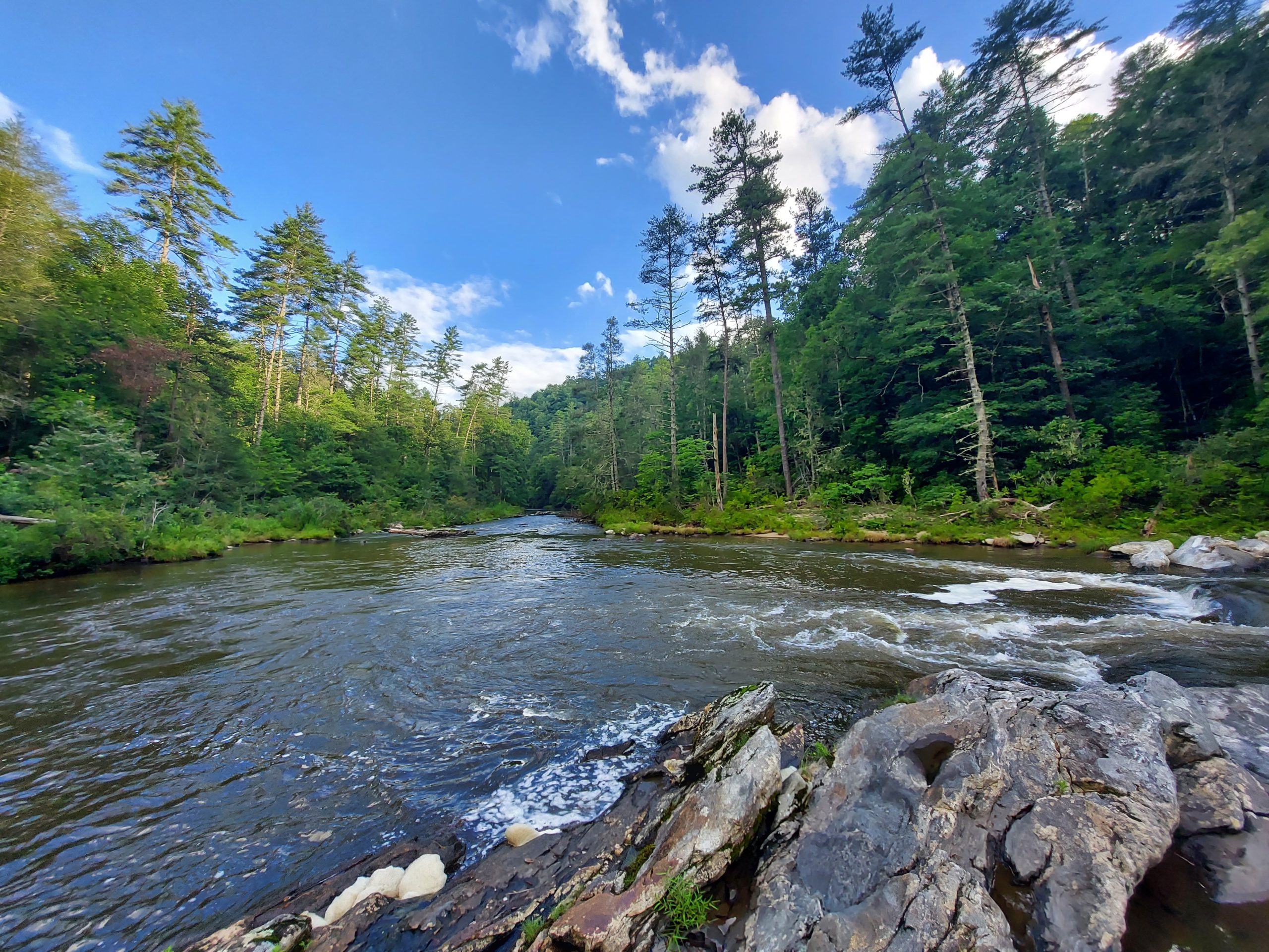
You start at Oconee State Park in South Carolina and quickly descend along the Chattooga River, which creates the stateline between Georgia and South Carolina. The Foothills Trail follows along the Chattooga River for a number of miles before a slow and steady climb up to Whitewater Falls.

The Chattooga River is one of the more pristine rivers in the region. It’s wild and free. It hasn’t suffered from storm damage, flooding or deadfall and makes for a wonderful hike with lots of river views, sandy banks and plentiful camping sites.

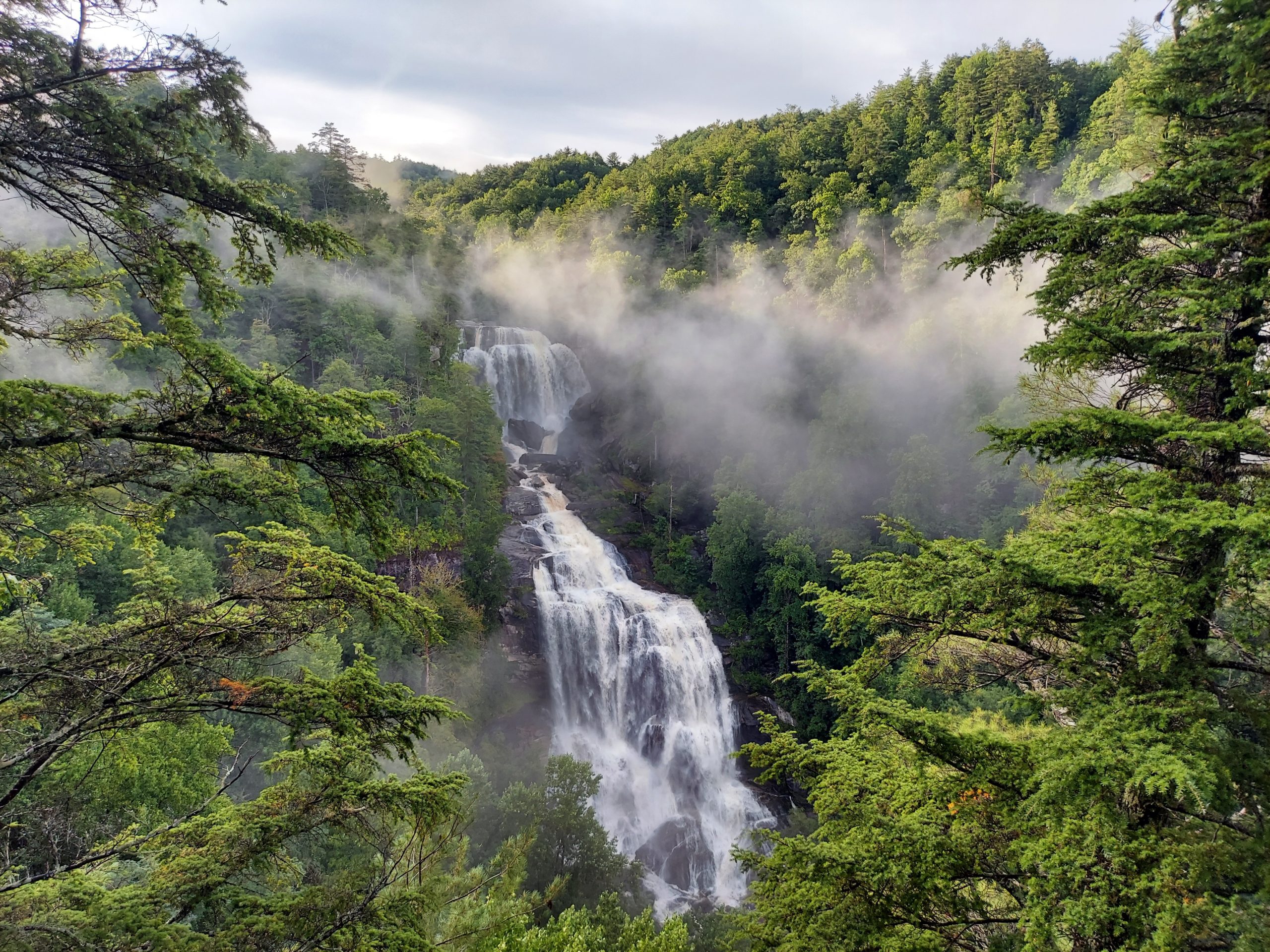
Whitewater Falls is the tallest waterfall east of the Mississippi and is a spectacular part of the Nantahala National Forest. From the Whitewater Falls viewing deck, its 47.1 miles to Table Rock State Park, and 29.1 miles from Oconee State Park.
I camped along the Chattooga River and woke up to a star filled sky. By sunrise it was misty and cloudy, but the sky was not dark or ominous. By 9:30 it was pouring sheets of rain and I took shelter under my rain fly and a nice cavernous boulder. After nearly 2 hours of waiting, I realized I was in for a soaker of a day and trudged out into the rain.

It never stopped, and I hiked the entire day in varying stages of downpour. Being from California, I prefer to hike dry and have learned to embrace the weather. It’s all I ever knew before moving East!!
The thing about the weather here, is that the most beautiful photo opportunities come with a clearing storm.

I was rewarded with the most amazing sunset at Whitewater Falls. That sunset reminded me of why I hike. You gotta be in the mountains to catch the beauty of it. And it doesn’t always happen every time. You have to stick out the worst to get the best sometimes.
I’ve driven to Whitewater Falls 3 times prior, but none of those trips were as amazing as the experience I had hiking there. Crossing the highway and dropping into the valley, I could hear the falls rumbling, I could see the Falls steaming and smoking up the valley. Those couple hundred steps up to the viewing deck, and finally seeing the whispy, smoke capped Falls was a magical moment.
That is why I love to hike.


This website contains affiliate links, which means The Trek may receive a percentage of any product or service you purchase using the links in the articles or advertisements. The buyer pays the same price as they would otherwise, and your purchase helps to support The Trek's ongoing goal to serve you quality backpacking advice and information. Thanks for your support!
To learn more, please visit the About This Site page.

Comments 1
THANK YOU for including the map. It’s super perplexing to me how rare it is for a blogger to simply screenshot their map(s)! It is dramatically more useful/applicable, especially for smaller trails or sections of a longer hike.