 ">
">
The Ouachita Trail: 223 Rocky & Remote Miles Through the Mountains of Oklahoma and Arkansas
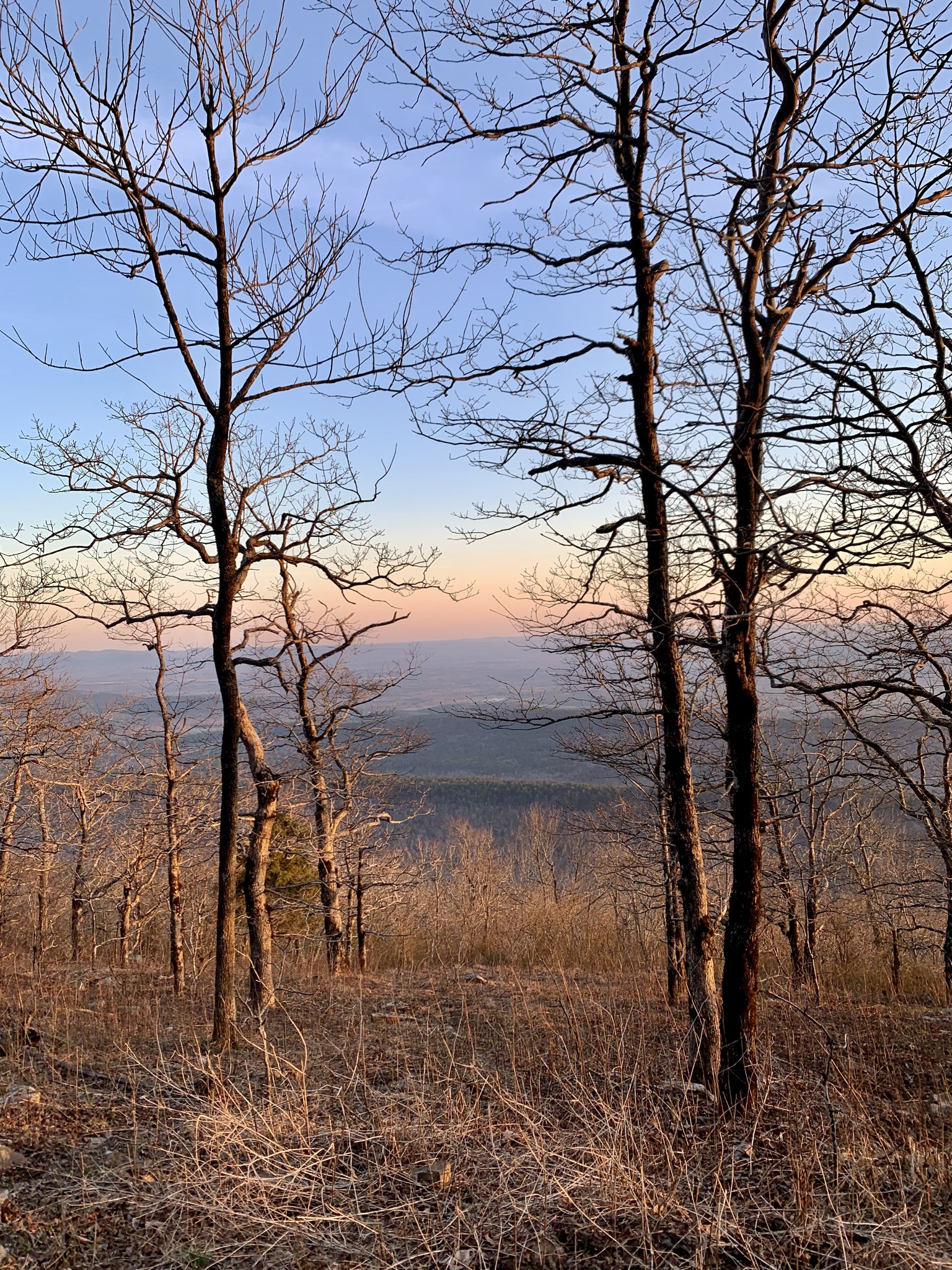
And now for something completely different: the Ouachita Mountains. Unless you live near this seldom-visited part of the country, the lovely Ouachita Trail may have passed under your radar. True, it doesn’t have the sweeping vistas and snowy peaks of the west or the culture and history of the east. But what it lacks in those areas it makes up for in unbeatable solitude and unique geology.
Between massive swaths of unbroken pine-oak forest, lots of new AT-style shelters, and rocky outcroppings, this hike still offers plenty to keep you satisfied. It’s easy to do in around two weeks, which makes it perfect for shoulder season or a great, shorter alternative to the Appalachian Trail.
The Ouachita Trail at a Glance:
- Length: 223 miles
- Elevation Gain: ~34,000 feet
- Expected Completion Time: (10-15 days, averaging 20-25 miles a day)
- Location: Eastern Oklahoma to Central Arkansas
- Best season(s) to hike: Early spring is good for mild temperatures, no crowds, and no bugs, but fall would provide more foliage and probably more water. Summertime if you want to swim in the rivers and if you’re carrying loads of permethrin.
- Trail Type: point-to-point (Talimena State Park in Oklahoma to Pinnacle Mountain State Park in Arkansas)
- Scenery: Unbroken pine forests, pine-oak woodlands, lots of rocky outcroppings, beautiful water
- Difficulty: Moderate, with no huge elevation gains, but lots of uneven trail due to rocks and roots
- Navigation: You can find the map on FarOut (formerly known as Guthook). Old school topo maps are also available on the Friends of the Ouachita Trail website. The blazes are blue and the trail is remarkably well-maintained and fairly easy to follow in almost every section.
Why Hike the Ouachita Trail?
I have to recognize the potential hypocrisy of using a public platform to advertise the solitude of a place, but for the time being, I think that this trail offers the most meditative solitude I have ever experienced while hiking. The Ouachita Mountains at night are a spiritual thing. You can stealth camp almost anywhere on the trail, or there are brand-spankin’ new AT-style shelters (with some upgrades) along the trail that you can utilize as well—and if you’re hitting a shelter on a weekday, you’ll almost certainly have it to yourself. On the weekend it’s a different story though. This is Boy Scout country, after all.
I really loved the experience of knowing that there’s nobody around you for miles in any direction. It challenged the boundaries of my comfort zone. On this particular hike in early March, we saw a total of four thru-hikers in 14 days, and very few other section or day-hikers.

Follow the blue blazes!
OK but how am I supposed to get there?
The best way to reach both trailheads is by getting a ride/shuttle or having a very dear friend drop you off (thanks again Skull Crusher). On the western side, the trail begins in Talimena State Park in Oklahoma. There is parking right at the trailhead for $5 a day.
On the eastern side, the trailhead is at the Pinnacle Mountain State Park Visitor Center. Parking there is per day as well, but the better option is to get an Uber/Lyft to/from Little Rock. One crazy guy in the FarOut (formerly known as Guthook) comments said there is a 14-mile trail from the Pinnacle Mountain State Park Visitor Center all the way into downtown Little Rock, but I have not investigated the veracity or possibility of this.
Which way should I hike it?

The trail can be hiked in either direction, and I don’t see much advantage to hiking one way as opposed to the other. It all depends on what makes the most logistical sense. As we didn’t leave a car at a trailhead, we opted to hike west to east: getting dropped off at the trailhead in Talimena SP and ending in Little Rock, so we could catch a bus back to Dallas from there. Little Rock has an airport that serves pretty much all destinations, as does Oklahoma City, although it’s a 3+ hour drive from OKC to Talimena SP.
Climate and Weather
The Ouachita Mountains get four seasons and can be rainy at any time of year. We did get a fair number of showers when we hiked in March. The trails didn’t get too muddy though until the last day, when we hiked through a flash flood and ended in a tornado warning.
I’d advise checking a weather report before heading out, but you can pretty much count on it being ideal hiking weather (60’s during the day, 40’s at night) in the spring and fall, then hot, muggy, and buggy in the summer. They say winter is possible as well since the mountains don’t get much snow. But I would definitely bring a warm sleeping bag/quilt.

There was plenty of beautiful & moody morning fog on the trail.
Gear Suggestions
Take it from the crazy guy who managed to hike the whole PCT this year with just a Coleman emergency poncho: I would certainly, certainly NOT recommend that kind of risk on the OT. A rain jacket is essential, and a puffer jacket is a good idea for any cold snaps.
There are reportedly plenty of black bears in the Ouachitas but we didn’t see or hear a single one on the whole hike. It felt perfectly safe skipping the Ursack and just sleeping with our OPSAKs in the tent. The Zpacks Duplex (or any trekking pole tent) is a great option, as you’re camping in pine forest every night. Lastly, if you are thinking of hiking the trail during hunting season, make sure to wear hi-vis clothing.
Camping
No permits are required to camp anywhere on the trail. The shelters occur once every 7-10 miles, and there are plenty of stealth campsites with fire rings in between each of those (also: you can have fires most of the year!) You can pretty much do as many or as few miles as you like each day and never have to be too committed to one spot as there’s always another one not far ahead.

This shelter totally sucked.
Ouachita Trail Highlights
There are plenty of nice lookout points along the trail. My favorite vista was from Flatside Pinnacles—there’s a 360-degree view of nearly the whole range from up there; or the side trail up Pinnacle Mountain, for its history in relation to the Trail of Tears.
My favorite shelter was Bill Potter Shelter. It was 0.5 miles off-trail, but so worth it since the Irons Fork River runs right below it and it was a very peaceful sleep.
The Queen Wilhelmina Lodge is very historic and right on trail. It is the highest point on the trail and also the 2nd highest point in Arkansas.
My favorite resupply/town was at The Blue Bell Cafe in Story, AR. Lori, who runs the place, is probably the only real “trail angel” of the OT and will pick you up from the trailhead and drive you to her store for resupply or to pick up a package. She is an absolute legend.
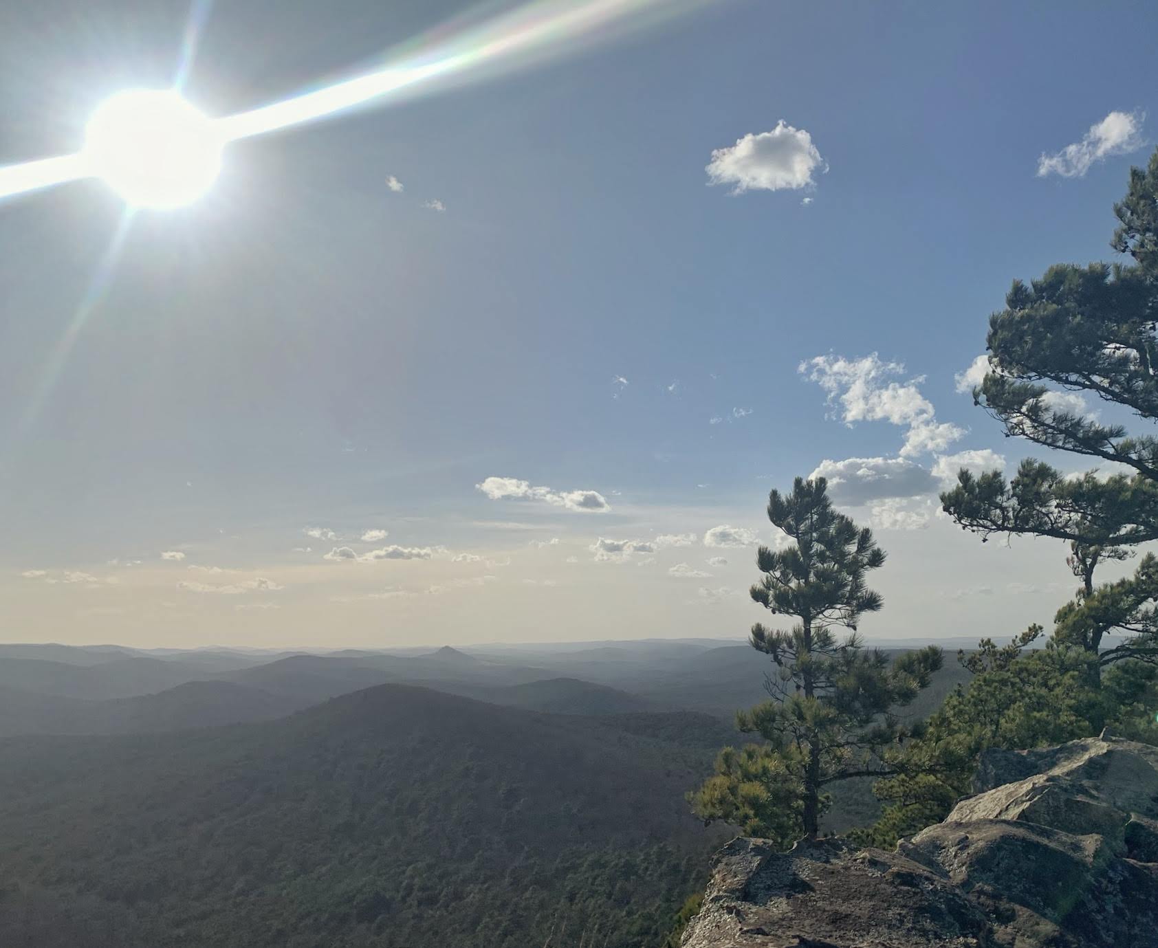
The View from Flatside Pinnacles.
How much water should you carry?
First: always use a filter! There are lots of deer, foxes, and bears around to share the sources with. But the water runs beautifully along nearly all of this trail. I have never seen such an emerald-blue flow before. Some ridges require 5-10 mile carries, and a few sources are seasonal, but you can count on 10 miles being the longest dry stretch.

Have you ever seen water this color before?
Where are you supposed to resupply?
Okay, I know I’m just one guy, but hear me out: my strategy has always been to hit a town if the option is available. Especially in Arkansas, you never know what kind of crazy experience you’re going to have. And I did love all three towns that we stopped in. On this hike we resupplied three times:
- Mena (a short hitch from mile 56)
- Story/The Blue Bell Cafe (Lori will pick you up and drive you there or you can hitch from mile 116)
- Hot Springs Village (short hitch from mile 160)
If you don’t feel comfortable hitchhiking and want to mail yourself a resupply, I would recommend sending one to Queen Wilhelmina Lodge (on-trail at mile 51) and another to The Blue Bell Cafe (mile 116), where Lori will pick you up. All other points along the trail would require some kind of hitch or incredibly long road walk.
Of course, if you are crushing 30s every day, then you probably would only need to do maybe one resupply, which would be at the Blue Bell Cafe, since it is right around the halfway point.

Don’t forget your trusty Ziploc full of crushed cheese-its for those windy peaks.
A Closing Argument
I really enjoyed this trail. I think it’s really underrated, and I can’t think of any good reasons that so many people skip it besides the location and the potential difficulty of reaching it. Being from North Texas, this is the closest thing to a proper long-distance hike that we’ve got, and I don’t think it disappoints on many fronts.
It’s a great warm-up for a longer trail, or a great alternative to the Appalachian Trail: the OT’s ecosystems, geological features, and shelter system are reminiscent of the AT. You can even link it up with the Ozark Trail in Little Rock. But, by the same token, it has none of the crowds or party culture that can potentially come with an AT hike. So depending on what you are looking for in a trail, the Ouachita Trail could be a great option.

This website contains affiliate links, which means The Trek may receive a percentage of any product or service you purchase using the links in the articles or advertisements. The buyer pays the same price as they would otherwise, and your purchase helps to support The Trek's ongoing goal to serve you quality backpacking advice and information. Thanks for your support!
To learn more, please visit the About This Site page.

Comments 5
a couple of typos. you hiked west to east not “east to west”. also Arkansas is “AR” not “AK” (Story AK) AK is Alaska. Happens all the time, when I am listing my address I say “Arkansas, A-R”, to alleviate most peoples confusion about it. Glad you enjoyed the trail, consider the Ozark Highlands Trail or the Buffalo River Trail also in AR.
Oops, thanks Peter! Ozark Highlands is on my radar for next spring too. Especially cool because it’s not hard to link it with the OT either.
The OT is a great trail and love it particularly in the late fall. The bugs are gone and the views are better. A bit rockier west so I also go W-E but the pine forests are wonderful for peaceful walks…opps, I meant to say the bears are hungry and the fire ants invade your tent at night.
My husband and I section hiked the OT in 2019-2020. We had a great experience so I was excited to read your article! It made a good section hike because there are many road crossings to facilitate easy self-shuttling. We usually had the place to ourselves. I was surprised by the beauty of Oklahoma! We enjoyed the Talimena Parkway and found the views very comparable to the Blue Ridge Parkway. We live in Arkansas, so we were not surprised by the landscape but find it beautiful also. I would not recommend hiking in AR in the summer, period. I get what you are saying about the swimming holes but typically the trails are overgrown with poison ivy and there are massive amounts of ticks and mosquitos. Plus, it’s really, really hot. We hiked many of the sections in the dead of winter. Thanks for featuring AR! Ozark Highlands Trail & Buffalo River Trail are other good options if you make it back up this way!
Years ago, when I was in college, two friends and I hiked 50 miles of the Ouachita Trail during our mid-winter (Mardi Gras) break as it was just being developed. Some parts were still just blazed and we even passed a trail crew working to clear the trail. It was a great trip! It is a trail that I recommend to anyone. Thanks for writing about it.