 ">
">
Trail Profile: The Basin and Range Trail, 1000 Miles of Rugged and Rewarding Nevada Wilderness
The Basin and Range Trail is a 1090-mile quasi-loop hiking trail located in eastern Nevada. It features hidden gems in the form of gorgeous mountain ranges and vast desert hiking. This trek is not for the logistically fearful and requires thru-hikers to bushwhack and, in some sections, blaze their own path entirely.

The Basics
- Length: Between 900 and 1100 miles
- Expected Completion Time: 45-55 days
- Location: Eastern Nevada, beginning in Ely, ends in Baker
- Trail Type: Quasi-loo
Scenery
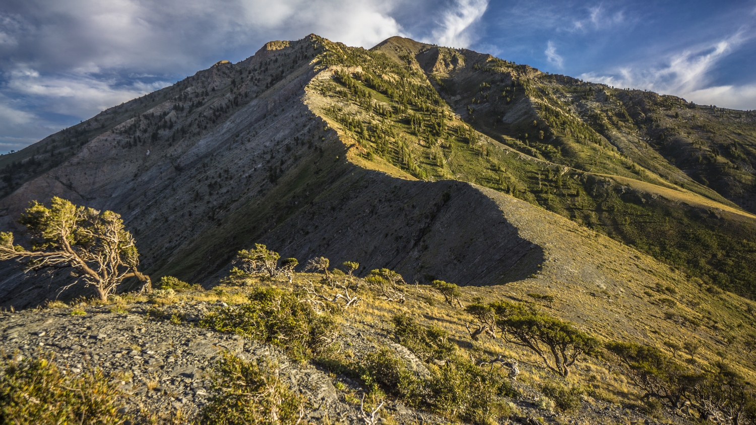
Nevada is home to over 310 mountain ranges, second only to Alaska, and the BRT will give you a grand tour of a vast number of them. These tall, narrow mountain ranges create vast desert valleys in between them, earning the name “Basin and Range Topography” for which the route was named. If you can whack your way through the rugged terrain, many hidden gems await hikers that choose to tackle this formidable and rewarding trail.
Terrain: Extremely Difficult
This route provides ample challenges for experienced long-distance backpackers and is not suited for every hiker. Hikers will exercise their bushwacking skills through many sections of this route and will require excellent navigation and water management skills.
How hard is it to navigate on the BRT?
It is important to note that the Basin and Range Trail is a route, not a trail or a clear footpath. Often unmarked, the official website claims, “no two thru-hikes of the BRT will be the same.” Experienced long-distance backpackers should have excellent navigation skills before tackling this trail.
Getting to the Trailhead
The “standard route” of the BRT is a quasi-loop beginning in Ely, Nevada and looping back around to Ely before the final section of trail that extends just beyond its borders. Hikers intending to begin this route in Ely can begin their trek by following the Egan Range south from town. You could theoretically leave your car in town but would need to find a suitable parking spot.
Which direction is best to hike the BRT?
The “standard route” would have thru-hikers heading counterclockwise out of Ely, but the spirit of this challenging trail would say “hike your own hike.”

Why Hike the Basin and Range Trail?
If you’re looking for a remote escape from thru-hiker culture with all the joys of wandering through the wilderness for weeks on end, you’ve come to the right route. The Basin and Range Trail is unique from other thru-hikes in that it is not recognized officially by any agency, and the locals often haven’t got a clue what runs through their cherished wilderness, so don’t expect trail magic or crowded campsites. This route is also for the thru-hiker that can’t get enough challenge out of the traditional trails – you’re sure to exercise your top-notch navigation skills, bushwacking experience, water management skills, and more during this beast of a trek.

Climate and Weather
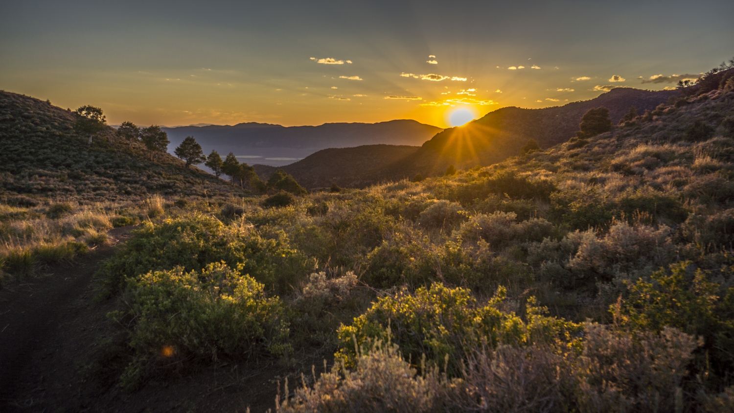
The best season for this hike is late spring or summer. Significant snow cover in the Toiyabes can be found into June, and the Ruby, Schell Creek, and the Snake ranges can all hold snow as late as July. Those seeking a snow-free trek should plan on beginning in early May and the water sources begin to dry up come mid-July. Due to the higher elevations of the trail, hikers can expect the BRT to have blue skies and mild temps in June, so be prepared for direct sunlight for the majority of miles on this route. Nevadan winds can be expected during the day, but die down at night.
Gear Suggestions for a Basin and Range Trail Thru-Hike
A sun umbrella, long-sleeves, long pants, and sunscreen will help mitigate the effects of spending hours in direct sunlight every day as well as keep the thorny bushes at bay as your bushwack along this route. Be prepared to camel up with extra water capacity to make it through the dry stretches.

Camping on the BRT
There are no fees, permits, seasonal regulations, or otherwise associated with this trail. Hikers can expect camping solo every night they aren’t in a town. The BRT is truly a stealth camper’s dream—but always remember to Leave No Trace before you head back down the trail.
Highlights of the Basin and Range Trail
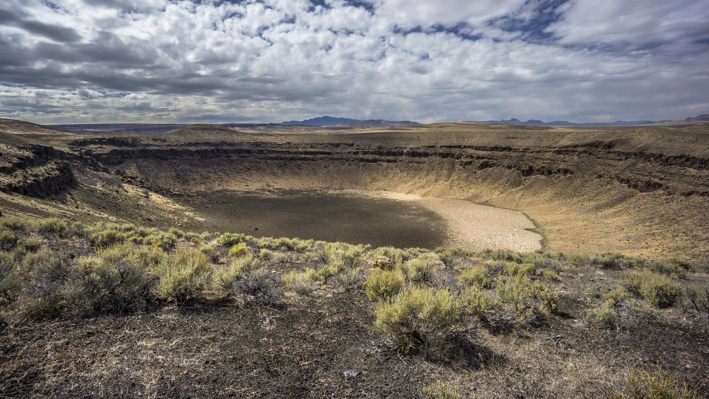
Lunar Crater Volcanic Field – The Nevada Lunar Crater (and the surrounding Volcanic Field) is an incredible sight for the aspiring astronaut inside all of us. See it for yourself in Section 2 of the Basin and Range Trail.
The Toiyabe Crest Trail – With a nice break from bushwacking, this trail offers Basin and Range Trail thru-hikers one of the few chances they’ll have to encounter another human on this route. There are numerous excellent views just waiting to be appreciated along the solid path up to the crest.
Spencer Hot Springs – Right off trail, this thru-hiker’s wet dream is located on public land, and hikers are invited to stay the night and soak under the stars.
Goshute Range – With the massive (30,000-acre) Bonneville Salt Flats located just east, the views from the top of this climb are certainly worth the bushwacking and provide stunning vistas for determined thru-hikers.
Antelope Range – Do you like pronghorns? How about fields of wild horses? This section of the BRT may be your favorite of the route.

Water Sources on the BRT
A water map and water chart are available to allow thru-hikers to size up the availability of water along the route. Hikers can intuit what sections are drier and which can be relied on for more water availability utilizing this resource. Water sources begin to dry up in mid-July, and it’s advised that only hikers with experience in water management on trail tackle this challenging route.
Resupply Options for BRT Thru-Hikers
The most straightforward way to approach resupplying on the BRT is section-by-section for 10 total resupply locations. The distance between sections ranges from 94 miles to 131 miles, and resupply boxes could be sent to post offices in each town. Some resupply options are located along the trail, and others are accessible by hitchhiking. Some hitches are a mere 15 miles but can stretch a total of 80 miles from trail.

Closing Thoughts
Eric Poulin created The Basin and Range Trail and became its first thru-hiker in 2020. Currently there is no advocacy group or trail association for the BRT, but you can support Eric by spreading awareness of the trail and subscribing to the BRT newsletter. You can also view his 60-minute documentary, “Pioneering Nevada’s Basin and Range Trail,” which captures his blazing of the route on several streaming services and Youtube.
The most informative place for anyone interested in the BRT is the official website for the trail. Here you can find out what to expect on your journey broken down section-by-section, learn about the rich geologic history of the region, and much more. There is also a shop where aspiring thru-hikers can pick up everything needed to plan their journey with the Complete Trail Guide and Kit.
The Basin and Range Trail Facebook Group is a great place to get answers to questions you may still have about your trip and up-to-date information about conditions on trail.
All photos, including featured image, courtesy of Eric Poulin via www.basinandrangetrail.com. Featured image graphic design by Jillian Verner (@yourstrulyjillian).

This website contains affiliate links, which means The Trek may receive a percentage of any product or service you purchase using the links in the articles or advertisements. The buyer pays the same price as they would otherwise, and your purchase helps to support The Trek's ongoing goal to serve you quality backpacking advice and information. Thanks for your support!
To learn more, please visit the About This Site page.

Comments 1
The Basin and Range Trail looks amazing! I’ve watched the 10-part youtube series and the hour long documentary on the BRT and they are both amazing. Beautiful and remote part of the country!