 ">
">
The Wind River High Route: A Fully Incomplete Q&A
Eearlier this month, I, along with everybody’s favorite Viking who walks good, along with his longtime buddy, Lt. Cookoo Bird, set out to complete Andrew Skurka’s Wind River High Route. Instead of writing this trip up like a normal person, I have decided to do it in Q&A form, as I am both sleep deprived and over-caffeinated.
What is Andrew Skurka’s route?
There are two popular high routes through the Wind River Range: 1) the Adventure Alan Route and 2) Andrew Skurka’s route. The latter is more challenging and about 20 miles longer. The paths overlap in spots and are largely similar, but Andrew Skurka’s route seems to tackle challenging features head on while the Adventure Alan Route avoids these, opting for the easier, and often longer, track. We chose Skurka’s route for two reasons. First, Jabba had already completed the Adventure Alan Route. Second, we are gluttons for punishment.
How did you prepare for the WRHR?
Andrew Skurka’s WRHR guide offers detailed mapsets (including alternates and bypasses), a guidebook, along with data sheets, providing all the logistical intel needed to make this hike happen. If you’re planning on hiking Skurka’s version of the Wind River High Route, either in its entirety or in sections, you’d be a fool to not get this guide.

photo: @zrdavis
What gear did you bring?
My WRHR gear can be found here.
When did you hike?
We started on the morning of August 6 and ended on the evening of the 10th.
What would you change about your gear setup?
I forgot baby wipes (which I use more so for a nightly baby wipe shower than to clean my dumper). Needless to say, I smelled quite un-good by the end of this trek.
That is quite literally the only thing I would’ve changed. I was very happy with my gear otherwise.
Did you finish?
No. We completed the first ~57 miles of the route, and hiked ~75 miles in total.
Why didn’t you finish?
Story time.
Fast forward to night four. The group is camped between Golden Lake and Lake Louise. It’s 10 p.m. Just as I’m dozing off, Lt Cookoo Bird, informs us that he’s experiencing shortness of breath. He simply wanted to make us aware of his issue and that he was going to wait another hour or so and reassess the situation.

photo: @therealhikingviking
At 11:30 p.m., I awake to Cookoo informing us that not only is his shortness of breath still present, but the symptoms seemed to be worsening. He was now feeling nauseous and lightheaded in addition to the still present shortness of breath. Every time he’d start to fall asleep, he was awoken by his inability to breathe.
Cookoo was starting to feel anxious about the situation, and very understandably so. His preferred solution was to hike out, either back to the closest trailhead, which was 18 miles away, or to a lower elevation, as he believed the symptoms were a result of altitude sickness. Although the diagnosis was very plausible, it didn’t quite add up for a few reasons. First, this campsite was no higher than any of our previous three nights. Second, he wasn’t experiencing these symptoms at much higher elevations, as we had already spent ample time above 12,000 and 13,000 feet. Lastly, he lives at the highest elevation of the group, at 7,000 feet.
Neither Jabba nor I felt hiking out was the safest decision, given that it was the middle of the night, in bear country, and we were all exhausted, leaving us prone to route mistakes or injury. But, since we couldn’t definitively diagnose what was causing his symptoms, it was unfair to write off his hypothesis.
Fortunately, Jabba brought his Garmin InReach, which has texting capabilities. We decided to reach out to my buddy Beau, who works as an ER doctor in Seattle, explaining the symptoms, and asking for his advice. Although he didn’t rule out the possibility of altitude sickness, he thought it was more likely asthma or possibly anxiety related. Ultimately, the group (Beau included), determined that taking a Benadryl might be a good idea, as it could help him fall asleep, but not sedate him to the extent that he couldn’t hike out if symptoms continued to worsen.
Ultimately, that was the fix. He was able to fall and stay asleep, feeling much better in the morning.
Given that continuing north would not only put us farther from a bail point, and the route also continued on to higher elevations, we decided it was prudent to get to the nearest trailhead. We hiked 18 miles to Boulder Lakes Trailhead over the course of our fifth and final day. We spent just shy of 24 hours connecting hitches from the trailhead back to our car in Lander.
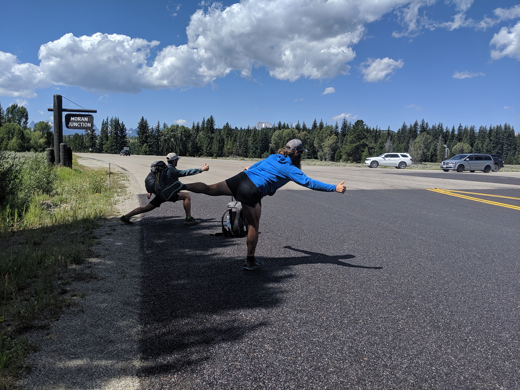
photo: @lt.cookoobird
Ultimately, our best hypothesis was that Cookoo was experiencing altitude sickness and his symptoms were exacerbated by some degree of anxiety and sleep deprivation (he had slept poorly the three previous nights as well). For what it’s worth, Cookoo was easily the strongest hiker of the group. I slowed us down considerably on boulders, Jabba was slower on the climbs, Cookoo handled both with relative ease. This was not a result of poor fitness.
Are you disappointed that you didn’t finish?
I would be lying if I said no. However, truthfully, only marginally. My overarching takeaway from the incident is pride. The group handled a stressful situation rationally, weighing all options, with our hiking companion’s safety as our primary concern. This is precisely how I’d want a group to respond had I been in his situation.
How were the mosquitoes?
Not nearly as bad as my nightmares would’ve led me to believe. I think this was a byproduct of good timing. Hikers who had recently exited the Winds had told tales of the blood-sucking clouds we would be walking into. Though they were bad in spots, I never once used my DEET, though I did apply Picaridin every day except one.

photo: @zrdavis
Did you get eaten by a grizzly bear?
Spoiler alert: I did not. Though the ever-lingering threat of a grizzly weighs on your mind throughout the trip. One of the gentlemen working at Wind River Outdoor Company, the outfitter in Lander, informed us that grizzlies have started migrating farther south in the range, and that the perception that they live exclusively in the northern end of the range is no longer true. It’s not impossible there was a dose of fearmongering in his statement, but his words stuck in my mind. Fortunately, on a scale from 1-10, our noise level was a consistent 18 (or 1.4 Jabbas), so my concern of stumbling between a murder mom and her cub was limited.
Is it really as hard as everyone says?
Or harder. If you have ample high route / off-trail experience, this route will likely be what you anticipate from a difficulty standpoint. If not, expect to be humbled. This was my first extended high route hike, and although we only completed 57 miles of the route (and 75 miles in total), it felt as if my ass was kicked by Lionel Messi wearing a Shaquille O’Neal shoe.
Skurka had warned me that horizontal distance is a meaningless metric on the subject of high route hiking; vertical distance is the better barometer. He wasn’t lying. What I wasn’t prepared for, however, was that the elevation gain is only a small part of the story. There were points where I was moving faster over terrain on a 20% grade compared to boulder hopping “flat” stretches. I learned, that regardless of the grade, I move much faster on trail vs. most sections of the route, as uneven footing, technical maneuvering, or constantly evaluating your route are both physically and mentally draining.
This trek offered up a much bigger serving of Type II fun than I’m used to.
When was your diaper the most full?

Within the first few hours. We weren’t more than a handful of miles into the trip when we crossed paths with a pair of hikers who had turned around 18 miles into the route, at the West Gully, which Andrew refers to as the most formidable feature of the entire trip. The West Gully is a steep, technical drop from Wind River Peak (the first +13,000 foot point on the route) down loose talus.
The duo said that the feature was a cliff, and they deemed the descent impossible. Though they reassured us that we would be able to handle it, the conflicting report provided a heaping dose of anxiety for my mind.
The feature ended up being much less daunting than the report or my imagination would’ve lead me to believe. That’s not to say that it wasn’t difficult, technical, or slow. It was very much all three, but at no point did my life feel at risk.
When was your diaper the second most full?
Approaching Europe Peak. The description of this feature includes a “climb up (that) looks bad,” a class-3 scramble leading to a 20-foot rock slab to be scaled, which leads to a knife’s edge at 12,000 feet. If this instills anything other than a mild rotation in your bowels, our constitutions were constructed differently.
Again, my imagination and anxiety of this feature ended up being far worse than the feature itself. Dare I say the 20-foot, rock-hold climb was even… fun?
How much food did you bring?
Eight days in total, one day more than our planned itinerary to give us some wiggle room. We opted to hire a food drop service to break up the weight since we were on a semi-aggressive timeline and the expense could be divided three ways. It still wasn’t cheap, but given our relative fitness (good, not great), we deemed it a worthy expense. Skurka outlines some options in his guide. We actually found ours independently by calling some of the local outfitters. Here’s the site we used. We paid $225 to have our food dropped near Golden Lake, a little past the halfway point (mile ~55).
How did you coordinate rides?
Cookoo, who lives just outside Jackson, WY, staged his car at the northern end of the route. Jabba and I drove up from Denver, planned to pick Cookoo up in Dubois; however, Cookoo being the suave mountain maestro that he is, was able to get a hitch to meet us in Lander.
How was the weather?
Different from the forecast. The forecast promised nothing but sunshine. We saw storms every day except one. Luckily, two of these storms were overnight, when we were already in our tents, but they were fierce. Particularly the latter, which dumped a half-inch of hail and had lightning crashing down on all sides of us. I’m not sure if what we saw was typical for the Winds in August, but it certainly was different from the Sierra (where the weather is generally very good in the summer) or Colorado (where the storms are more predictably in the midafternoon).

The fury of God was unleashed through this valley not more than two hours after this photo was taken. photo: @zrdavis
Where is the Wind River High Route’s Southern Terminus?
Where is the Wind River High Route’s Northern Terminus?
Should you hike the Wind River High Route?
For some, abso-fucking-lutely yes.
This is world class backpacking. I’ve got more than 6,000 miles under my hip belt (not true, I don’t always have a hip belt), and this was pound for pound the most beautiful terrain I have ever trekked through. The challenges, for which there are many, are outweighed by the Winds’ visually stunning rewards.
For others, likely no.
I would not encourage beginner backpackers or even those with only on-trail experience to attempt this route unless they were 1) in very good shape and 2) with at least one highly experienced off-trail hiker. More than 60% of this route is off trail. The terrain is often rugged, steep, technical, and requires proficient navigational skills. Grizzlies live here, as do mosquitoes (July-early August it seems in an average year). The weather can turn on a dime. If you come into this route ill-prepared in any way, it will happily chew your face off, and then spit your partially digested face into your now faceless face.
Will you please shut the shit up and show us some more pictures?
I thought you’d never ask.
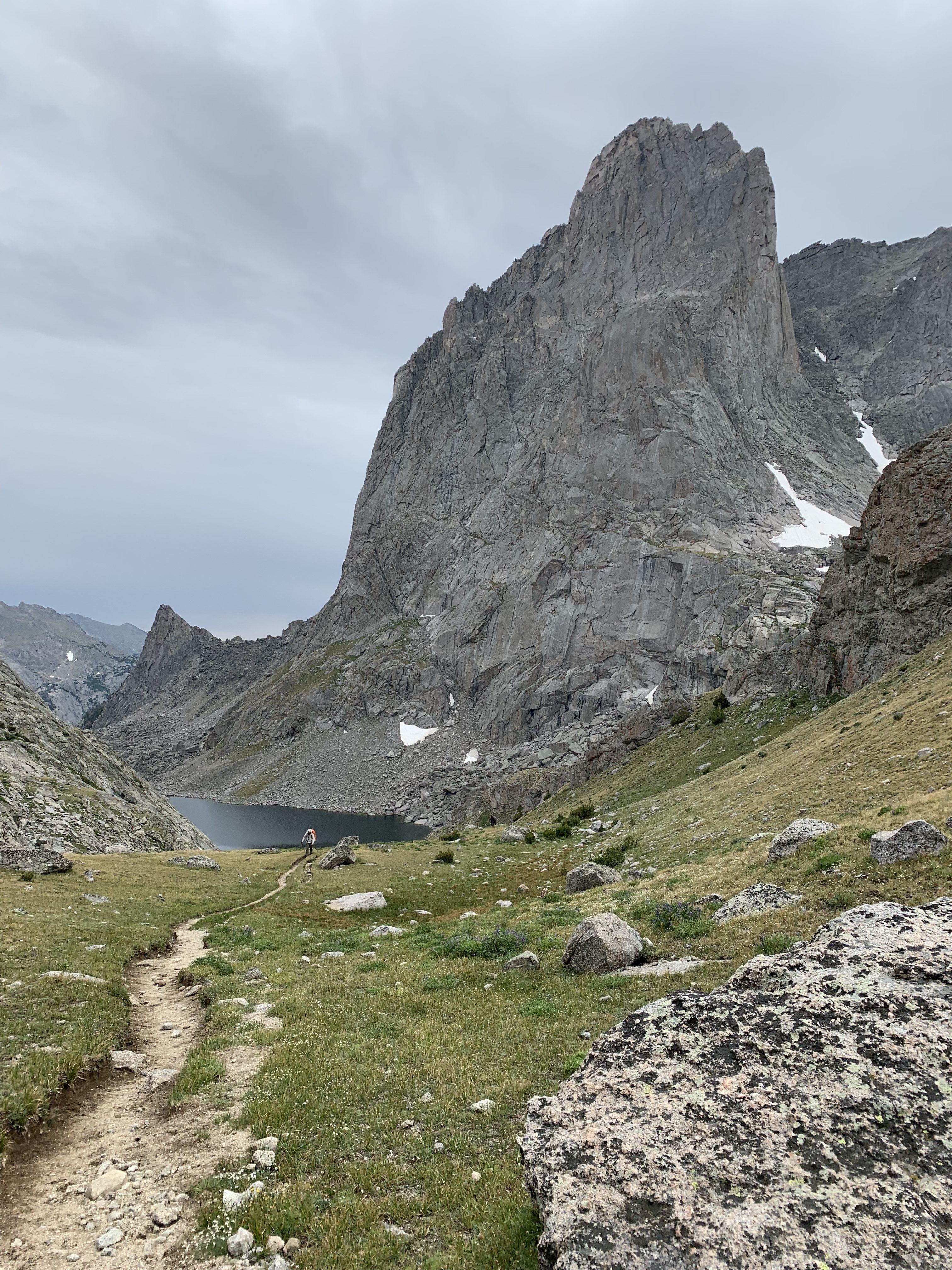
photo: @zrdavis

photo: @zrdavis
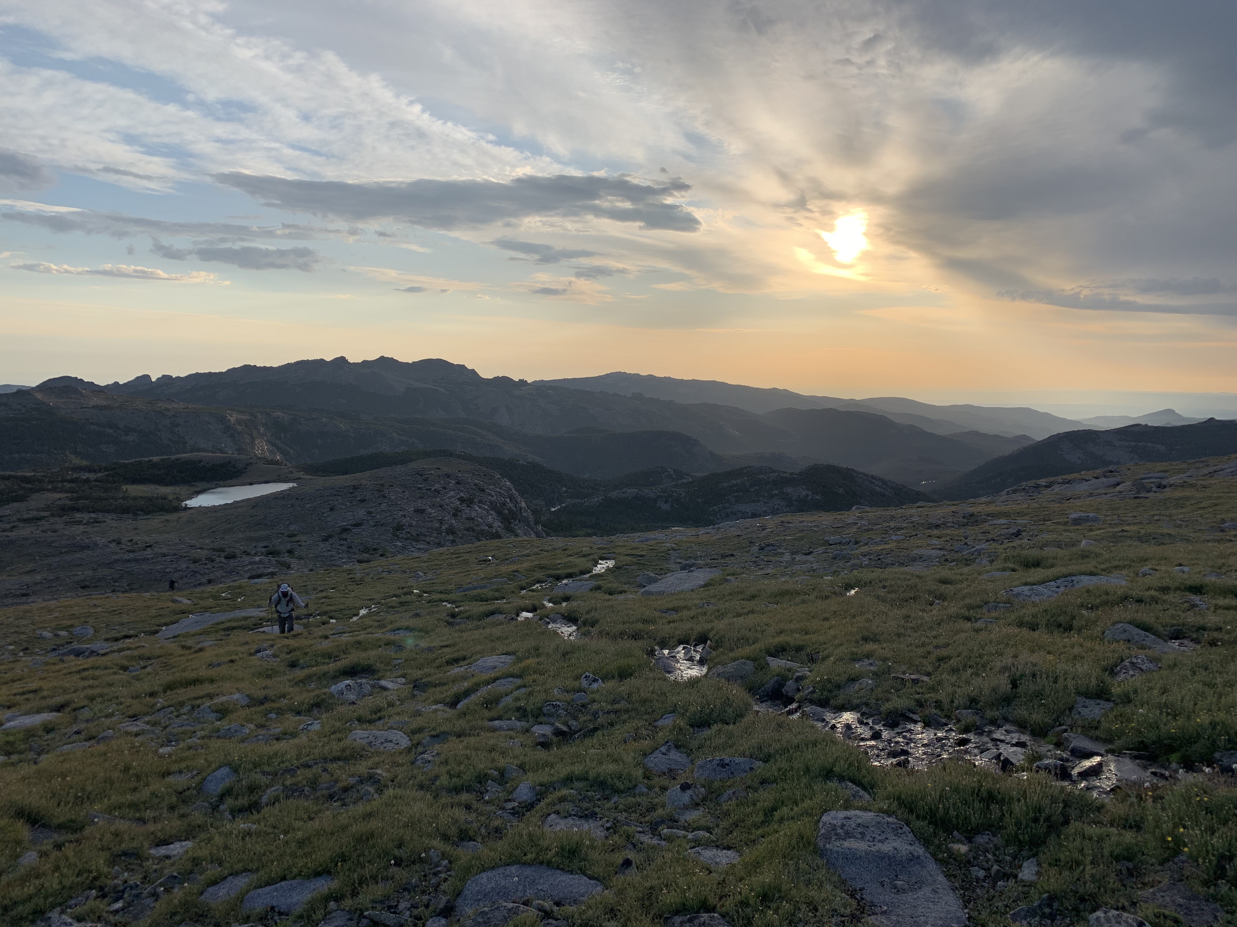
photo: @zrdavis

photo: @zrdavis

photo: @zrdavis
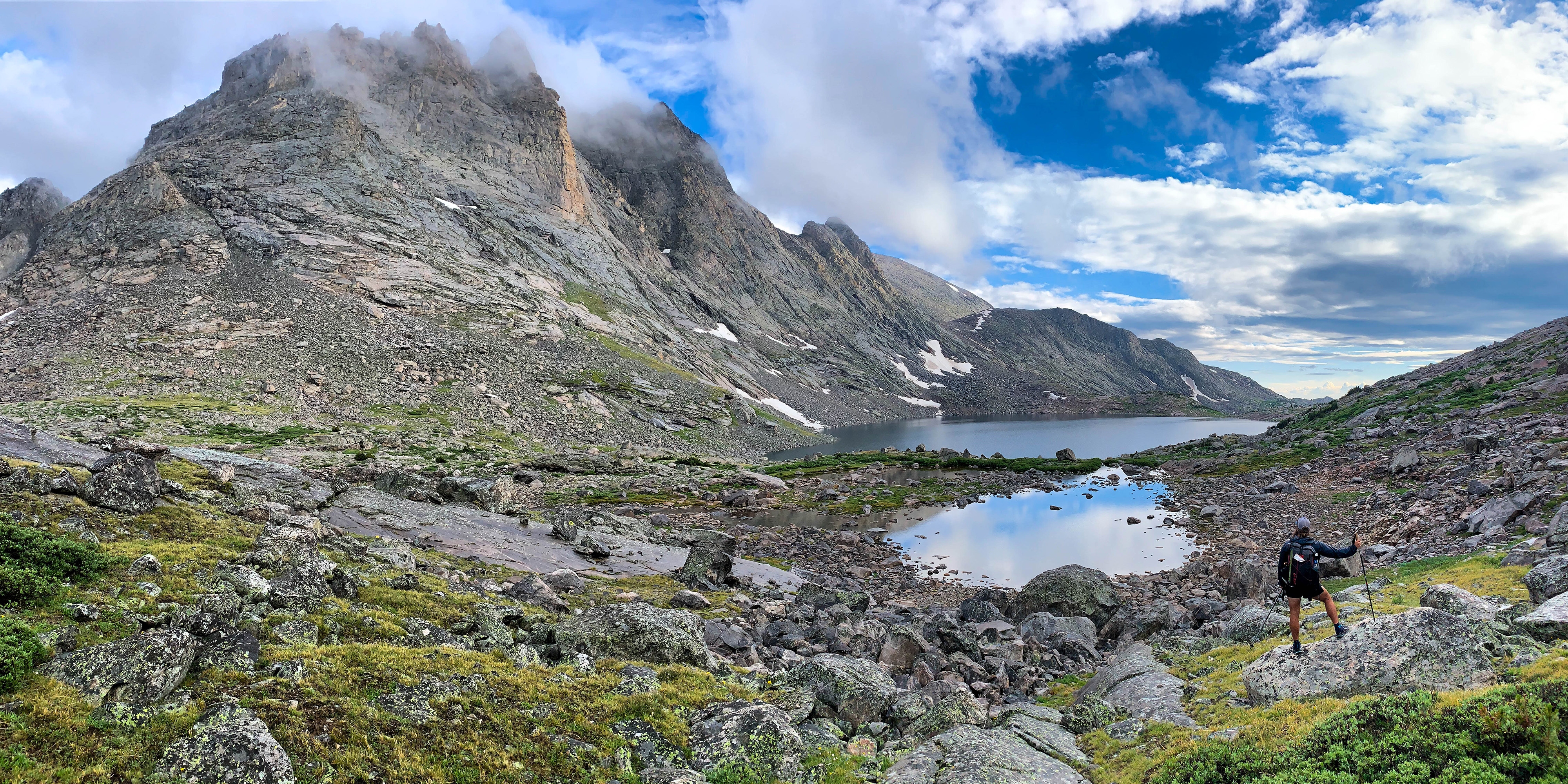
photo: @zrdavis

photo: @zrdavis

photo: @zrdavis

photo: @zrdavis

photo: @zrdavis
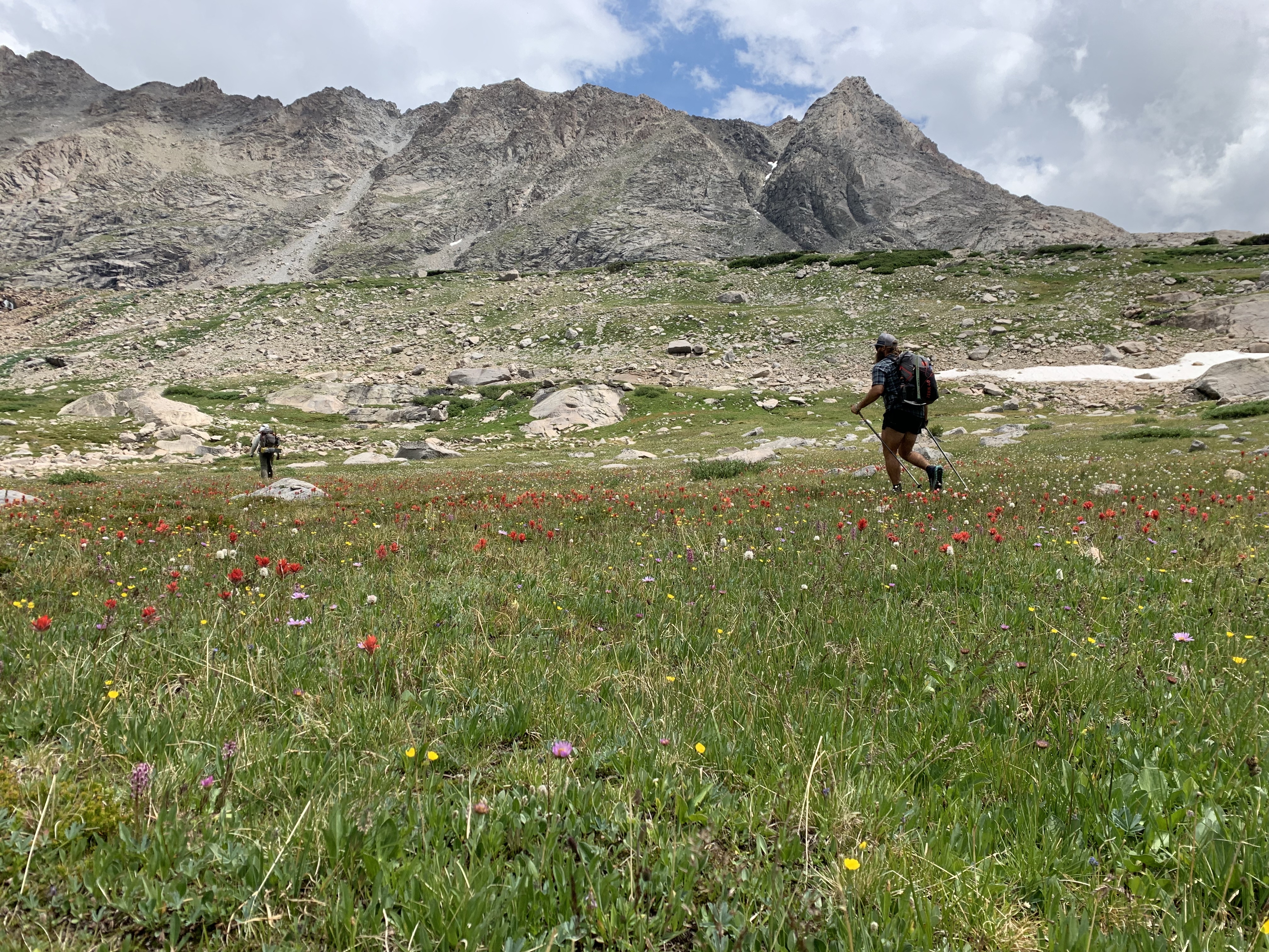
photo: @zrdavis

photo: @zrdavis

photo: @zrdavis
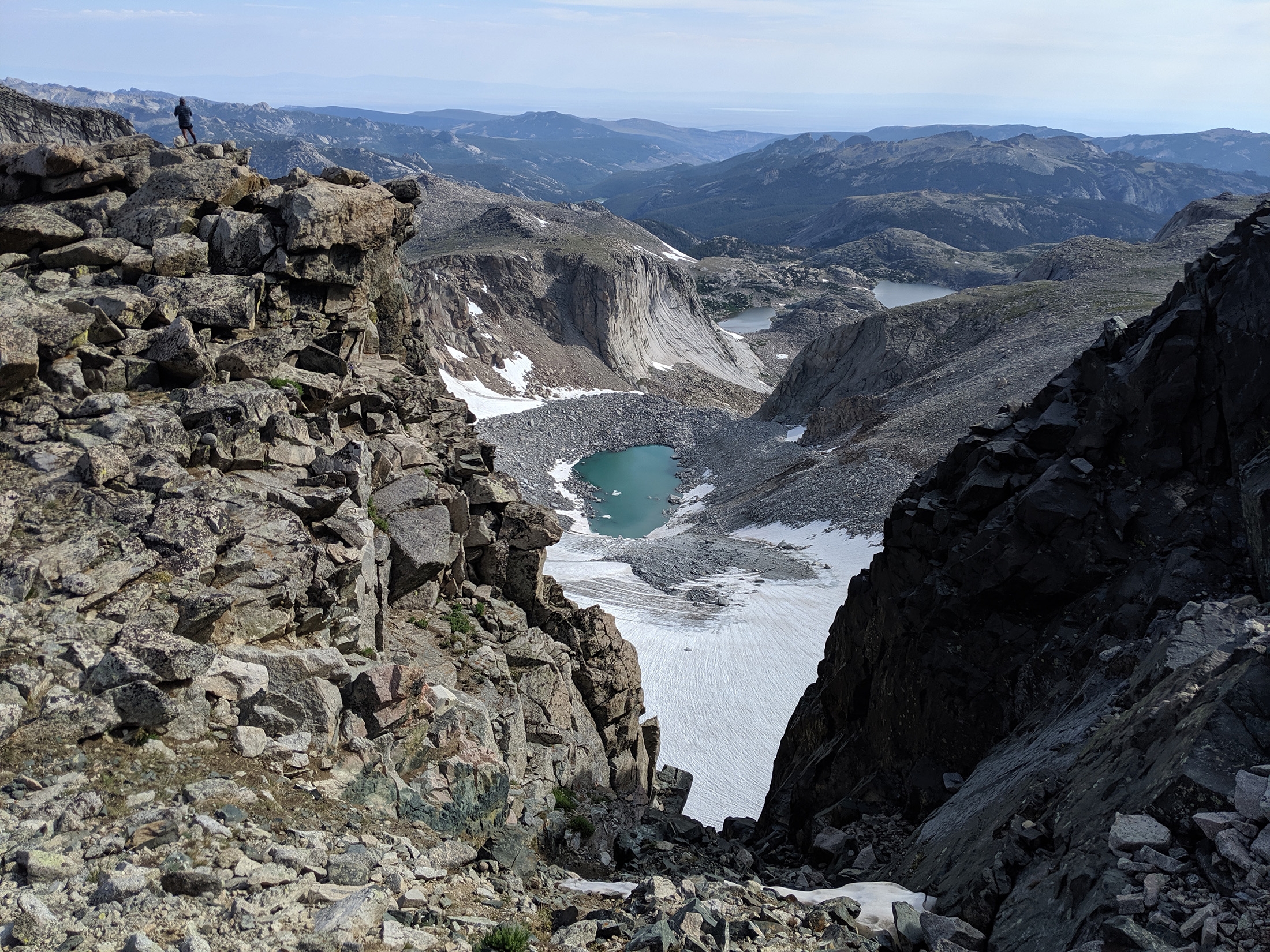
photo: @lt.cookoobird
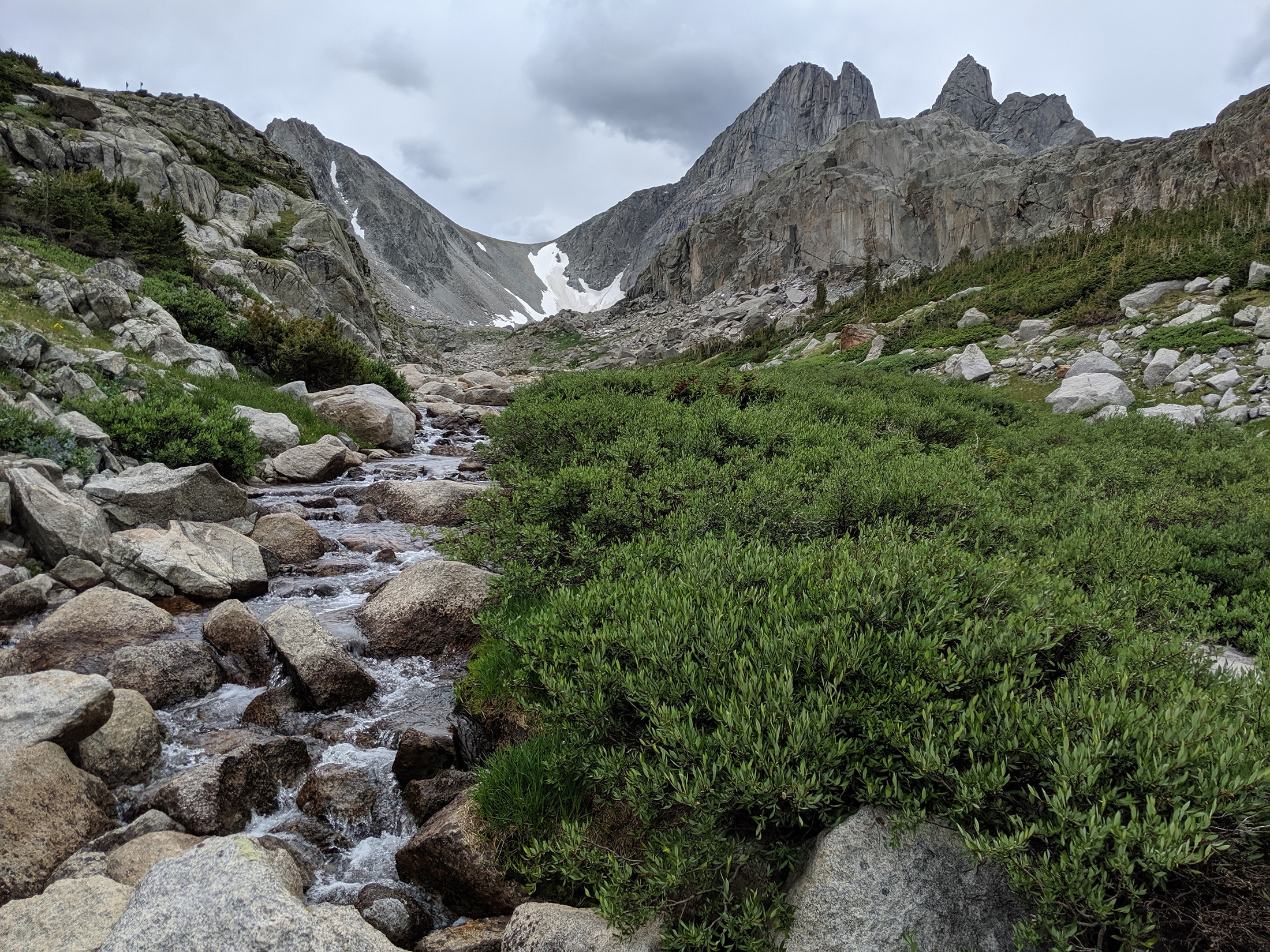
photo: @lt.cookoobird

photo: @lt.cookoobird

photo: @lt.cookoobird
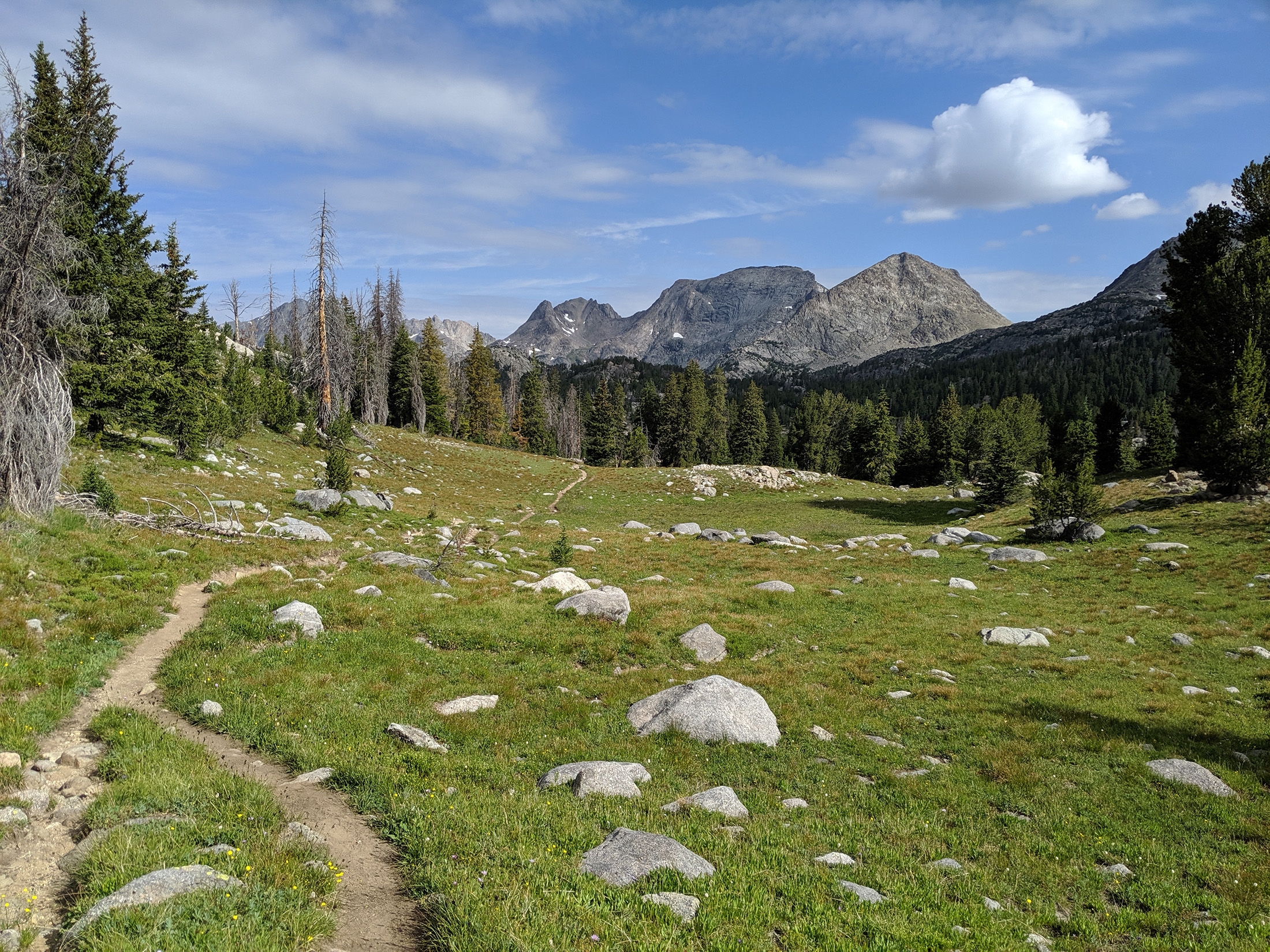
photo: @lt.cookoobird

photo: @lt.cookoobird
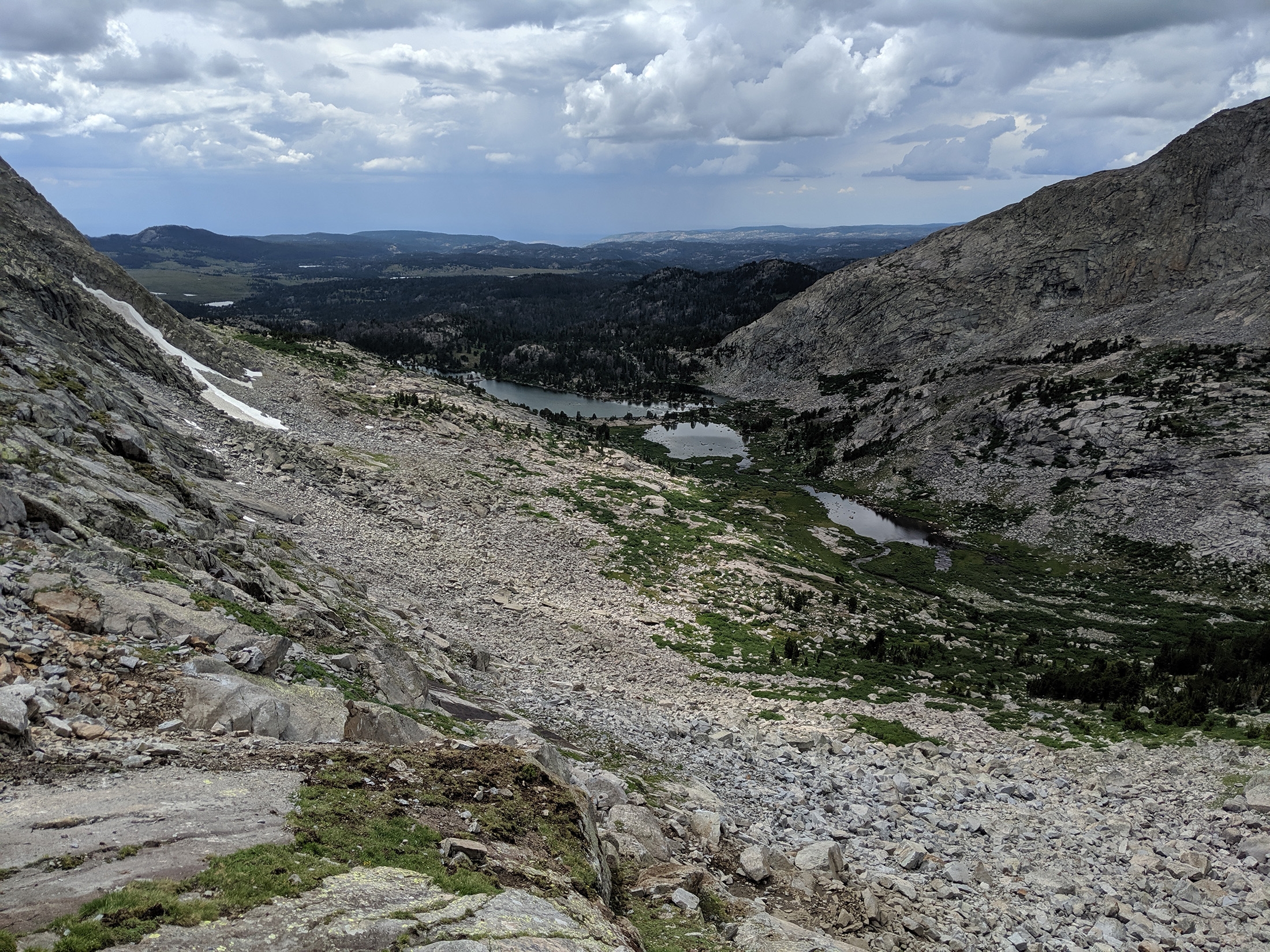
photo: @lt.cookoobird

photo: @lt.cookoobird
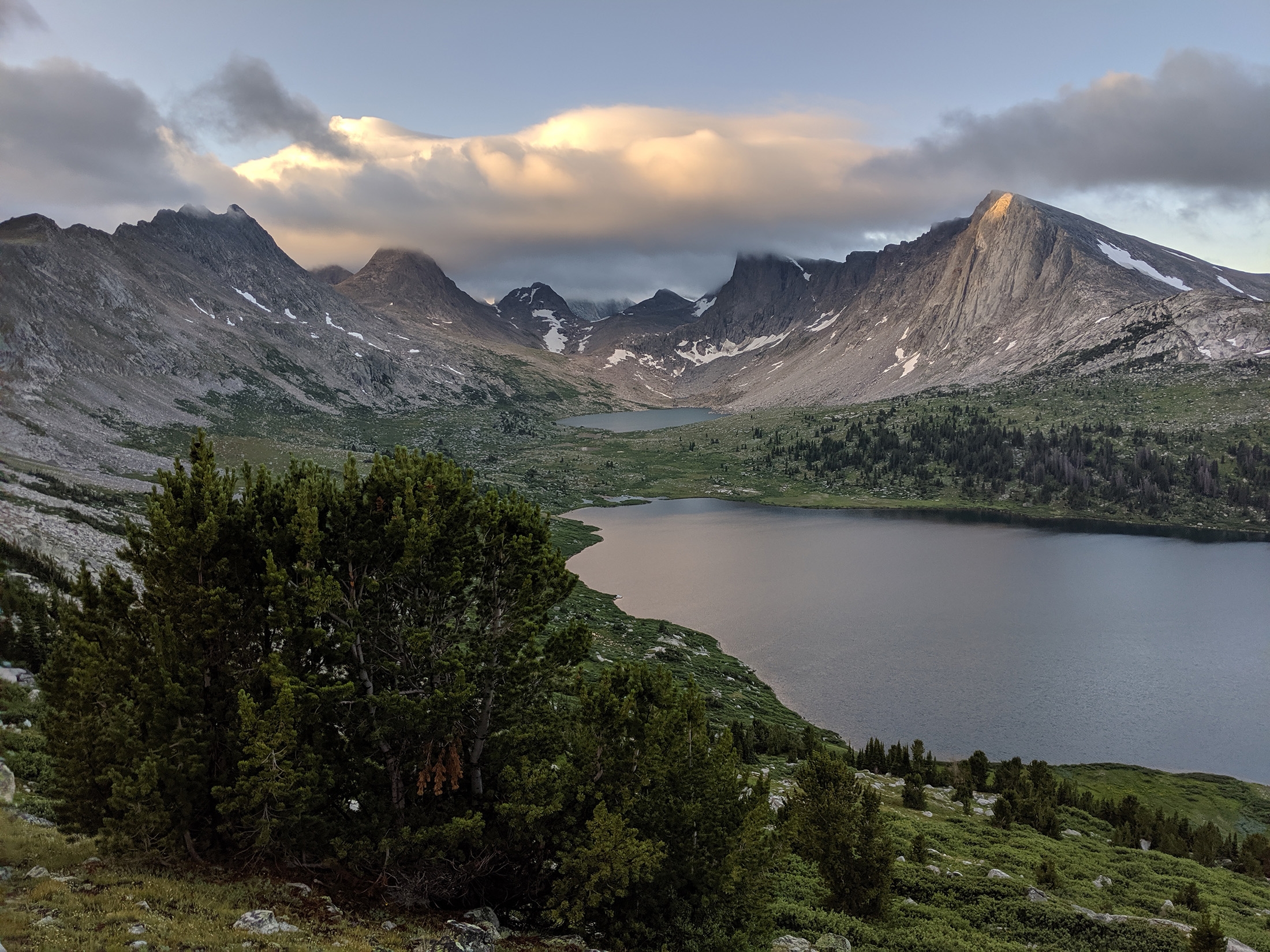
photo: @lt.cookoobird

photo: @lt.cookoobird
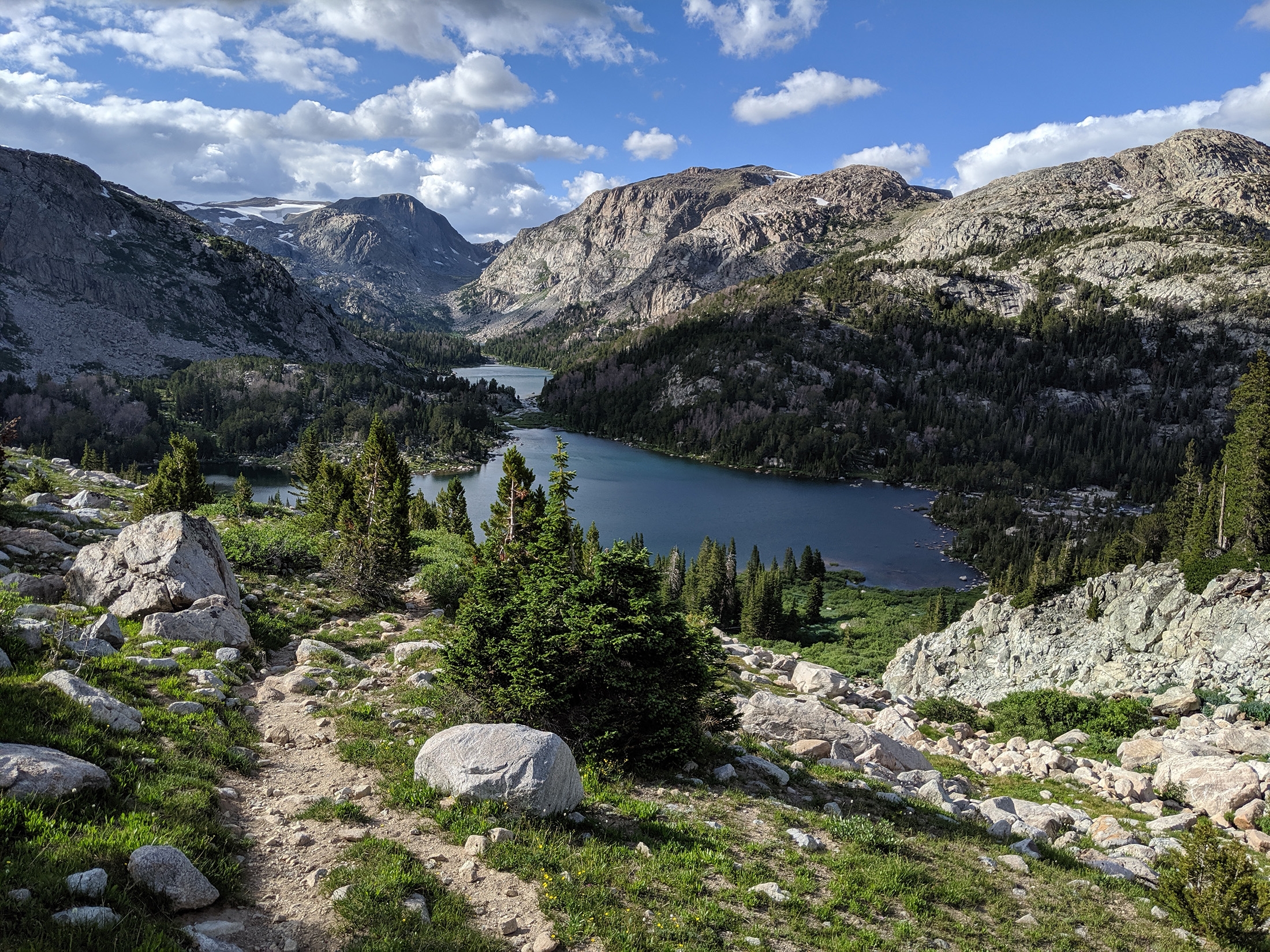
photo: @lt.cookoobird

photo: @lt.cookoobird

photo: @lt.cookoobird

photo: @lt.cookoobird

photo: @therealhikingviking

photo: @therealhikingviking

photo: @therealhikingviking
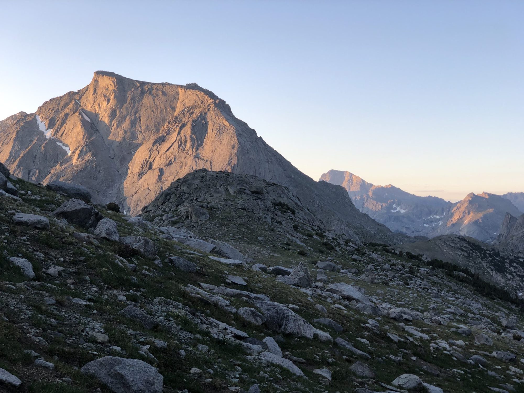
photo: @therealhikingviking

photo: @therealhikingviking

photo: @therealhikingviking

photo: @therealhikingviking
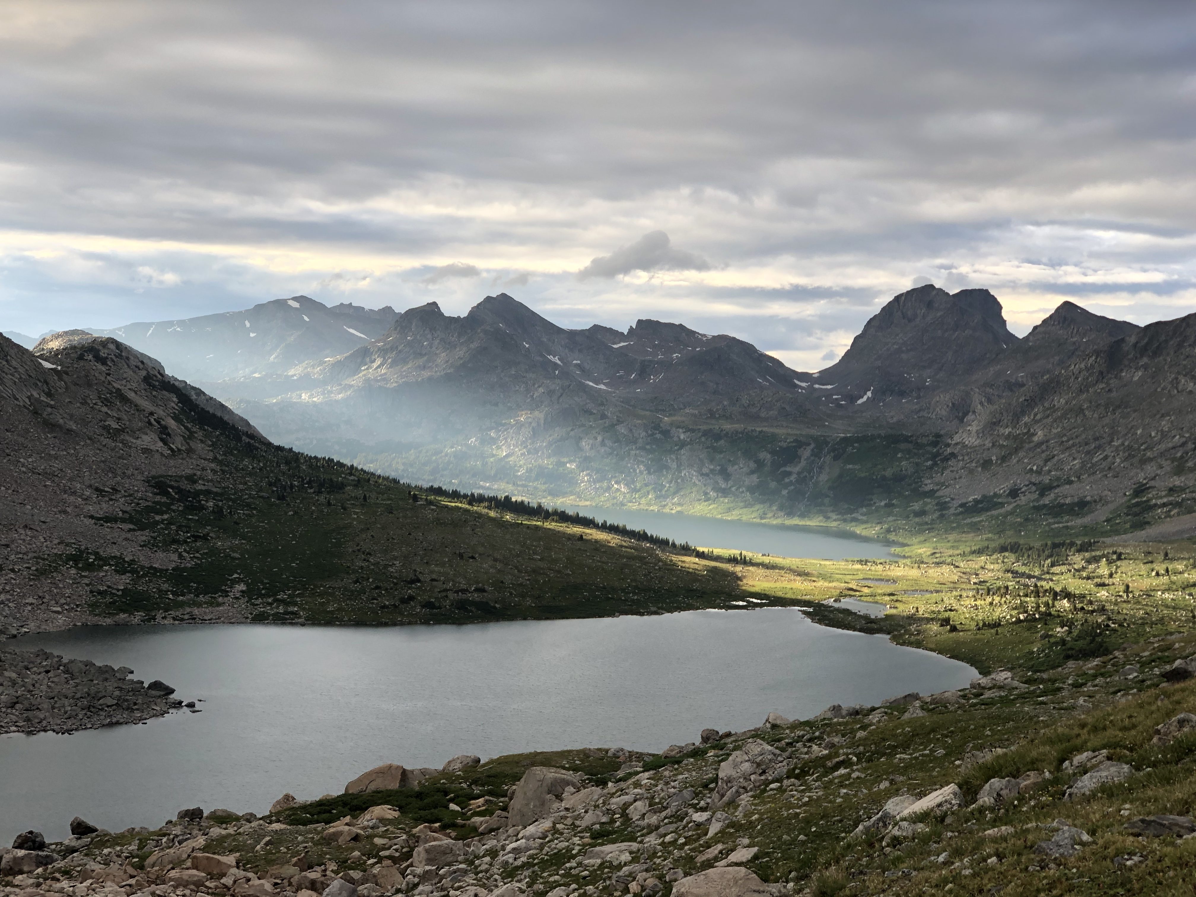
photo: @therealhikingviking

photo: @therealhikingviking

photo: @therealhikingviking

photo: @therealhikingviking
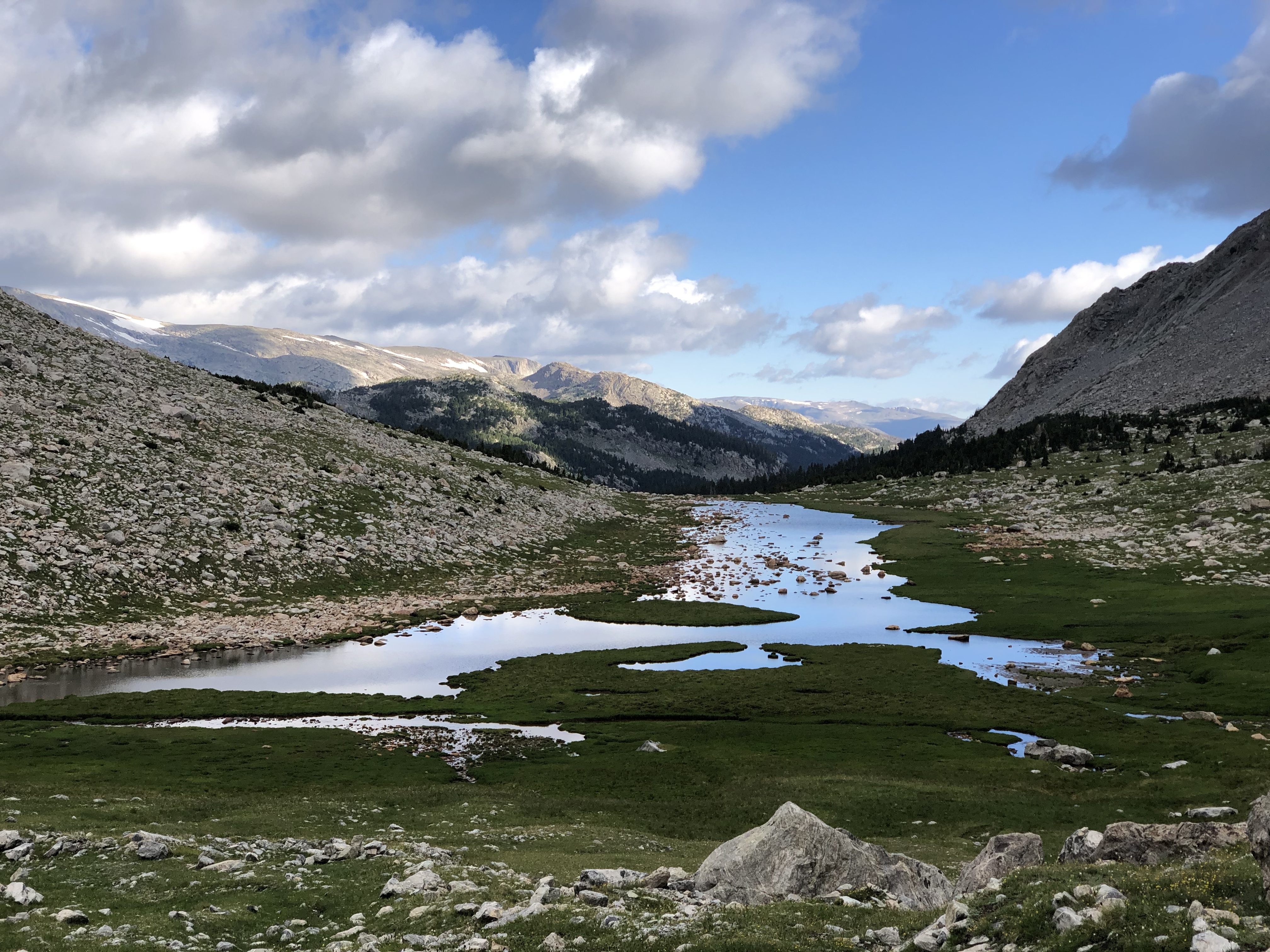
photo: @therealhikingviking
If you’ve got any other questions about this trip, drop a line in the comments.

This website contains affiliate links, which means The Trek may receive a percentage of any product or service you purchase using the links in the articles or advertisements. The buyer pays the same price as they would otherwise, and your purchase helps to support The Trek's ongoing goal to serve you quality backpacking advice and information. Thanks for your support!
To learn more, please visit the About This Site page.

Comments 5
Wonderful photos! This area looks absolutely stunning. Matt and I are interested in backpacking in the Wind River Range next summer, but I would prefer to do something much less technical. Is there a standard on-trail hike that goes through this area that involves less (or even no) off-trail scrambling? How technical is the Adventure Alan Route?
Bastards! You lengthen my bucket list mercilessly.
I understand that you are unaware of the changes occurring in the Wind Rivers unless you live here. But the increasing internet presence has and will continue to strain the range as it’s seeing a huge influx of visitors. We are trying to swim against the strong current of normalizing wilderness areas online. It would help the preservation of the Winds to not promote them as a form of reclamation. We understand the temptation of posting online but it’s important to take into consideration what effects it has on the area. We are scrambling to keep up with the unintended consequences and are very under funded. I think if we created a culture of helping wilderness keep it’s character, we will allow generations of folks being able to discover their own routes. There are also MANY high route variations that go unnamed that have been completed in years past. Skurka and Alan are certainly not the first to have completed the routes they ‘created’- only the first to post it online. Thank you for considering this post as it comes from those that are witnessing the changes in real time.
What kinds of permits did you need and were they difficult to obtain?