 ">
">
Wind River High Route Trip Report Part 2: Gear List, Food Plan, FAQs
I was fortunate enough to complete the Wind River High Route this August with two friends. The best thing about a high route is that it’s very much a choose-your-own-adventure hike. The key is to be adequately prepared (fitness, gear, skills) and do your research ahead of time so that you’ll be free to improvise when the time comes.
To aid you in that journey, below you’ll find my gear list, food plan, and answers to some frequently asked questions. If you’re in need of some inspiration/visual majesty, the previous installment of the trip report features a photo-based description of the route we took. (I did my best to squeeze a few pretty pics into this installment too, of course.)
Wind River High Route Gear List

The Big Three (plus accessories)
Zpacks Arc Haul Ultra (amazing, love this pack so much)
LiteAF Feather Weight fanny pack
Six Moon Designs Gatewood Cape + 8 stakes (needs minimum 6, I was happy to have extras for more wind-resistant pitch)
Tyvek groundsheet
Katabatic Alsek 22 quilt
Therm-a-Rest NeoAir X-Therm
Sit pad
Water
Sawyer Squeeze + cleaning coupling
Cnoc Vecto 2L bladder
2 1L Smartwater bottles
Kitchen
Snow Peak Gigapower Stove
8 oz fuel (4 oz would suffice, but I wanted the freedom to mainline hot beverages all day long)
Toaks titanium long-handle spoon
Ursack Major XL
Bic lighter
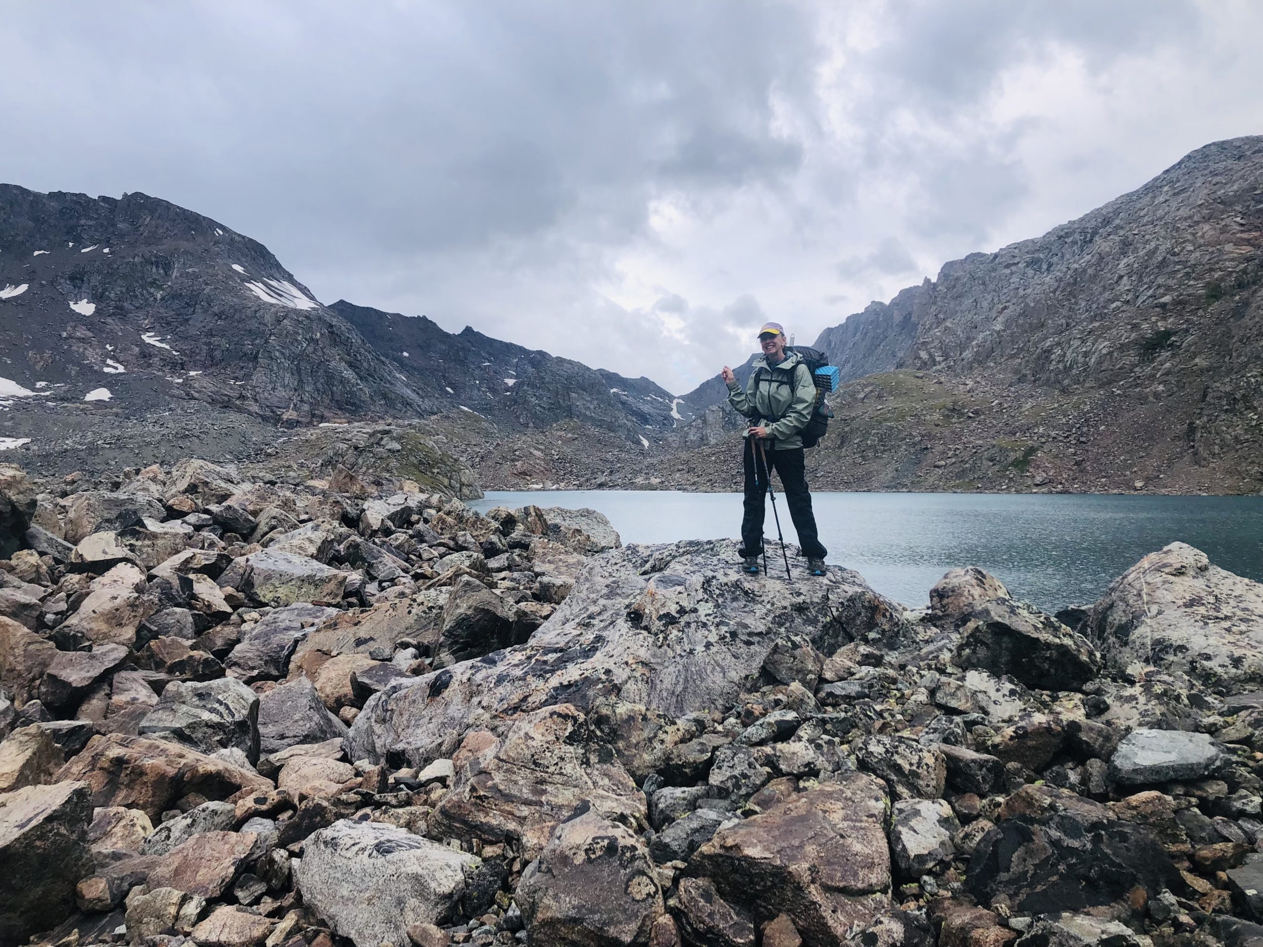
We were grateful for our rain gear on a cold, wet morning in Alpine Lakes Basin. Ft. Alison “Blissful” Young.
Navigation / Electronics
Paper maps and written description of route via Adventure Alan
Suunto M-3 D Leader Compass (lived in fanny pack most of the time)
NiteCore NU-25 headlamp (barely used; no night-hiking on a route)
iPhone 8 + quart-size ziplock for waterproofing
Anker mAh 10000 + Lightning cable for iPhone
Toilet Supplies
The Deuce trowel
Toilet paper
Extra ziplock to pack out used TP
Pstyle
Kula Cloth
Empty, clean Gatorade bottle to use as pee bottle

Camp Clothes
Minus33 wool tights
UnderArmour ColdGear turtleneck
Black Diamond Stance mitts
REI Minimalist GTX rain mitts
Feathered Friends down booties
Extra pair of hiking socks
1 20L dry sack to hold camp clothes and sleeping bag
Warm Layers for Hiking/Camp
Enlightened Equipment Torrid Pullover
Montbell tachyon wind shirt and pants
Lightheart Gear rain jacket

Alpenglow near our campsite in Indian Basin.
Worn Clothing
Salomon XA Pro 3D V8 (sturdy, great traction, too narrow for my feet. Would go with Altra Olympus next time)
Patagonia Skyline hiking pants
Smartwool Hike Light crew socks
LL Bean button-down shirt (not sure of the model, got it at a thrift store)
Anita sports bra
Extra REI quarter-zip wool shirt for cool mornings
Clip-on sunglasses (Zenni Optical)
Sunday Afternoons Sport Visor (SO fly, though appearance is better suited to playing croquet while petting a small chihuahua than backpacking)
Leki Makalu Lite aluminum trekking poles + Leukotape wrapped around pole
Miscellaneous
First aid kit – bandaids, steri-strips, Advil, Immodium, Benadryl, Neosporin, alcohol wipes, gauze, herbal salve, matches
Hairbrush – Tangle Teezer with back half removed
Toothbrush + travel toothpaste
Mini Dr. Bronner’s
Compression socks
Rawlogy cork massage ball
Inhaler
Mini Swiss Army knife
Small stuff sack to hold above (repurposed bag from old sleeping bag liner)
Katlyn “Swept Away” Pickett and Wilson the Milk Jug lead the way up a straightforward, but frustratingly rocky, pass south of Bonneville Lakes.
Gear Regrets
For once, I have nothing major to report. I only had a few items in my pack that I didn’t use at all:
- Gaiters: Brought them and never used them.
- Forgot sunscreen and chapstick: I was able to borrow sunscreen from one of my group, but my lips were wrecked by day 3, which is why I’m not smiling so much as baring my teeth at the camera in 75% of my photos.
- Extra glasses: Definitely packed my fears on this one. Not sure I regret it, though, as the chances of breaking my glasses were above average on this trip. It would have been an utter shitshow getting out of the backcountry without them.
- Footwear: I normally wear Altra Lone Peaks, but I switched to the gripper, more durable Salomon XA Pro 3D V8 for this rugged off-trail adventure. I was happy with the traction and how well they held up—my Lone Peaks definitely wouldn’t have given me as much confidence on the rocks—but Salomons are far too narrow for my feet. I had hoped to wear Vibram-soled Altra Olympuses (Olympi?), but they were sold out at REI when I went.
Gear Wins
- SMD Gatewood cape: Finally, a tarp tent I can set up without it looking totally derpy! Held up well in the incessant winds for which the range is named, and because the mosquitoes were down by late August, I didn’t regret leaving the mesh insert at home.
- Extra socks: caught up in an ultralight, ounce-slashing frenzy, I almost didn’t bring them. Our feet most definitely got wet crossing several deep streams and boggy valleys, so an extra pair proved to be a must.
- Aluminum trekking poles: This trip put a lot of stress on my poles. Although carbon fiber poles would’ve been lighter, I’m sure I would have snapped one as they are comparatively brittle. As it was, I did bend one of my aluminum poles slightly, but at least it was still usable for hiking and pitching my tent at night.
- Pee bottle: It truly is glorious not to have to get out of bed on a cold, rainy, possibly grizzly-infested night when you have to pee. Can’t recommend it enough.
Wind River High Route Food Plan
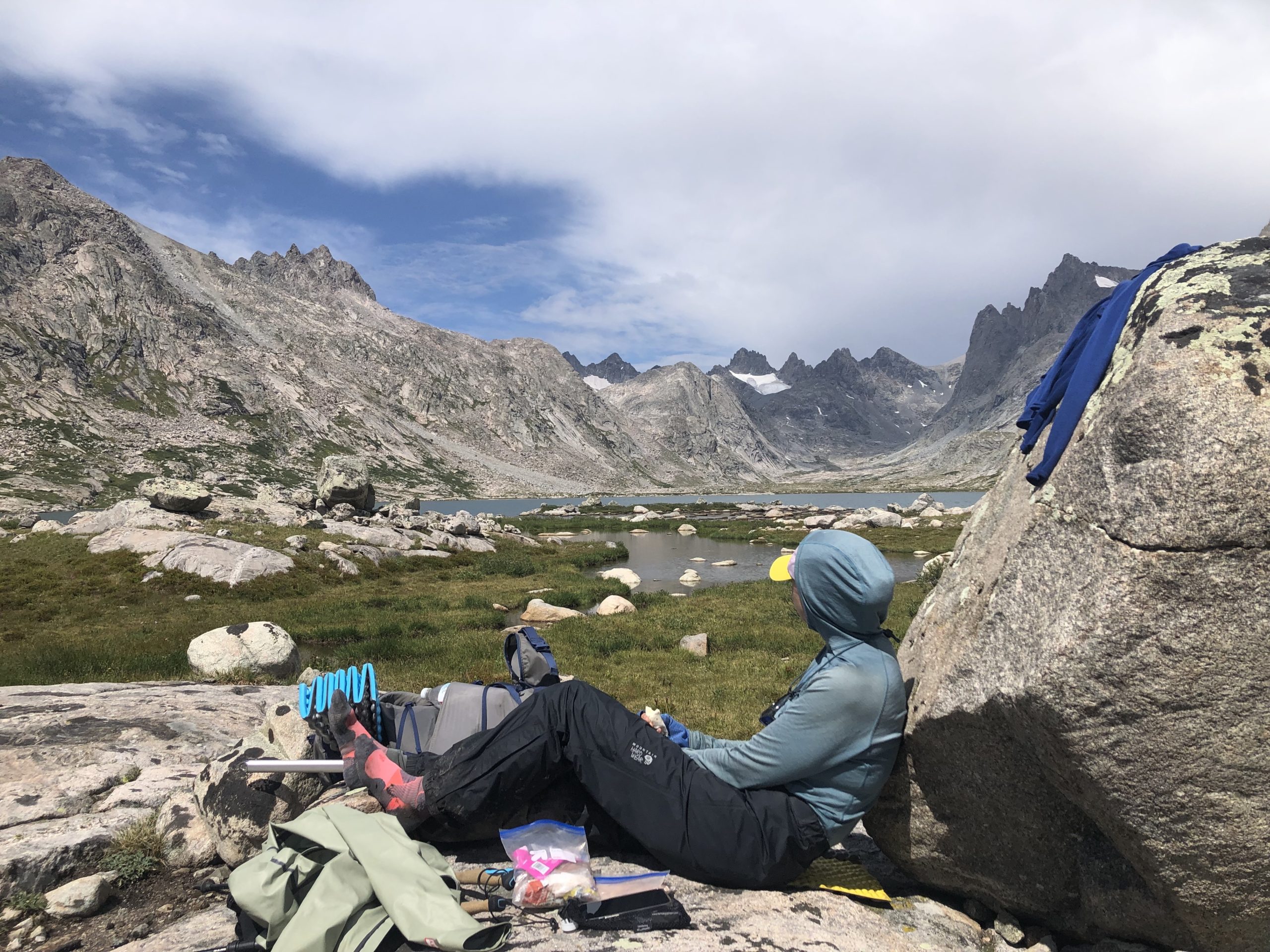
Lunch break in Titcomb Basin, featuring Alison “Blissful” Young.
Breakfast: 1 Carnation Instant Breakfast (hot), 1L hot water, 1 Fbomb Real Nutty Bar, random snacks
Snacks throughout the day: 2-3 more FBomb Real Nutty bars, two Cheese sticks, and assortment of pistachios, peanuts, Triscuits, dried chickpeas, Honey Stinger caffeine chews (enough for a one-time pick-me-up, pumpkin seed squares, hard candy (root beer barrels) to combat dry mouth
Lunch: Tortilla + peanut butter (I brought an entire small jar of Jif)
Dinner: Freeze-dried backpacking meal or instant potatoes, whatever snacks I didn’t eat during the day, peppermint and green tea for a hot drink before bed/in case we had any awful-tasting water sources (we didn’t)
Wind River High Route FAQs
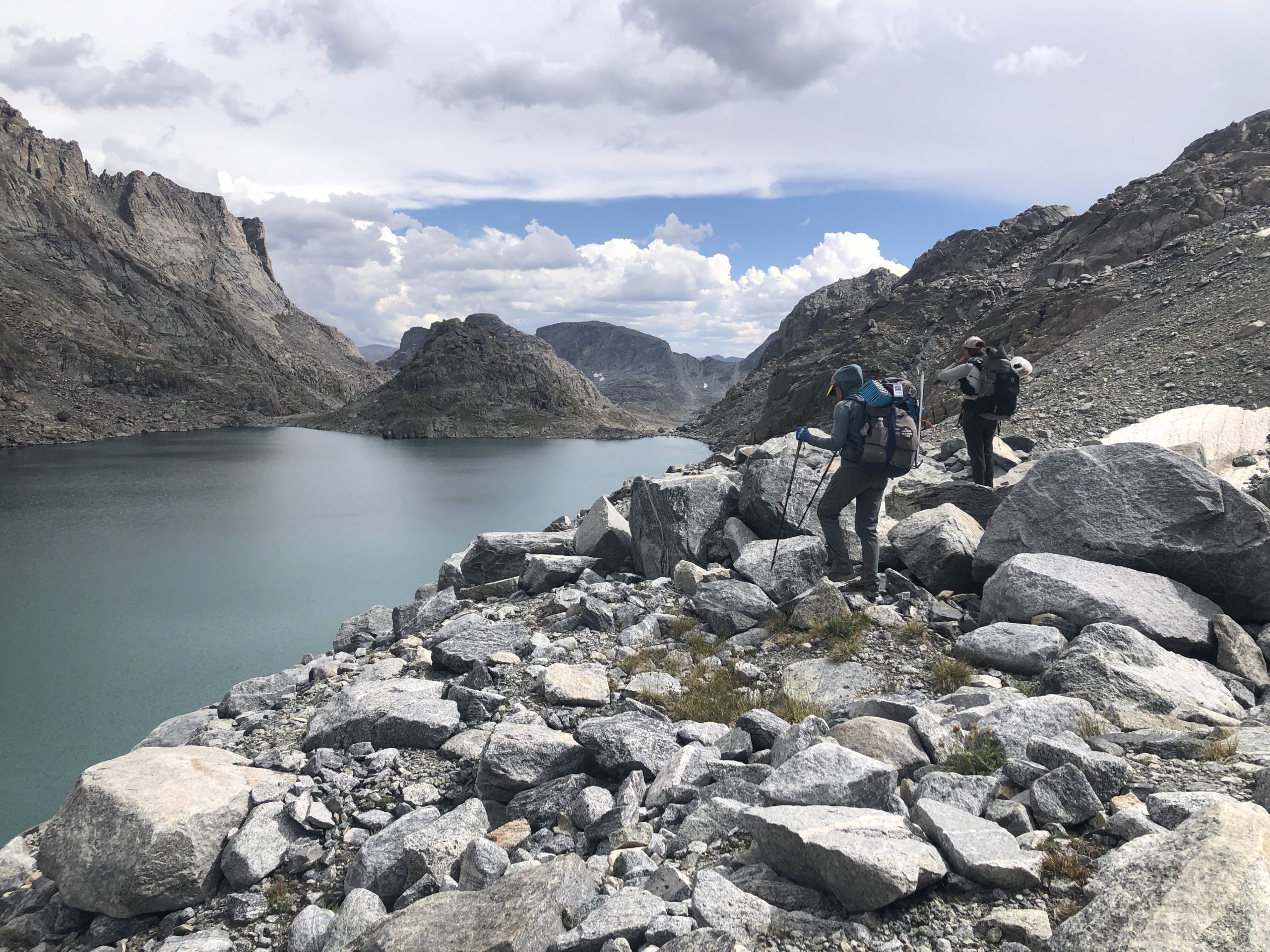
Alison and Katlyn navigating talus in Alpine Lakes Basin, one of the sections common to both Skurka’s and Dixon’s routes.
What’s the difference between the Dixon and Skurka routes?
There are two widely publicized Wind River High Routes: the Alan Dixon (Adventure Alan) route, which we did, and the Andrew Skurka route. Skurka’s route is the “original” and is considered more difficult. It is over 100 miles long vs. Dixon’s 83-ish. It also generally stays higher, especially in the northwestern part of the range, where his route keeps to the high peaks, and Dixon’s follows the Green River valley before dropping into Titcomb Basin.
The start and end points of the two routes also differ. Whereas we hiked from Green River Lakes Trailhead to Big Sandy Trailhead, Skurka’s route goes from Trail Lakes to Bruce Bridge.
Skurka’s route has more vertical elevation change per day, more areas with class three or four scrambles, and less time on trail. (Personally, I loved the beauty and diversity of Alan’s route and found it plenty aggressive without being soul-crushingly difficult. I haven’t done the Skurka version, so I can’t comment extensively on the differences.)
It should be noted that these are just the two best-known High Routes. There’s no law saying you have to follow either one to the letter, and we met plenty of people doing their own versions. If you want to choose your own adventure, many hikers recommend Nancy Pallister’s book Beyond Trails in the Wind River Mountains of Wyoming to familiarize yourself with the broader range.
Do I need an ice axe/microspikes?

Ice axes and, especially, microspikes were helpful in crossing the Knifepoint Glacier.
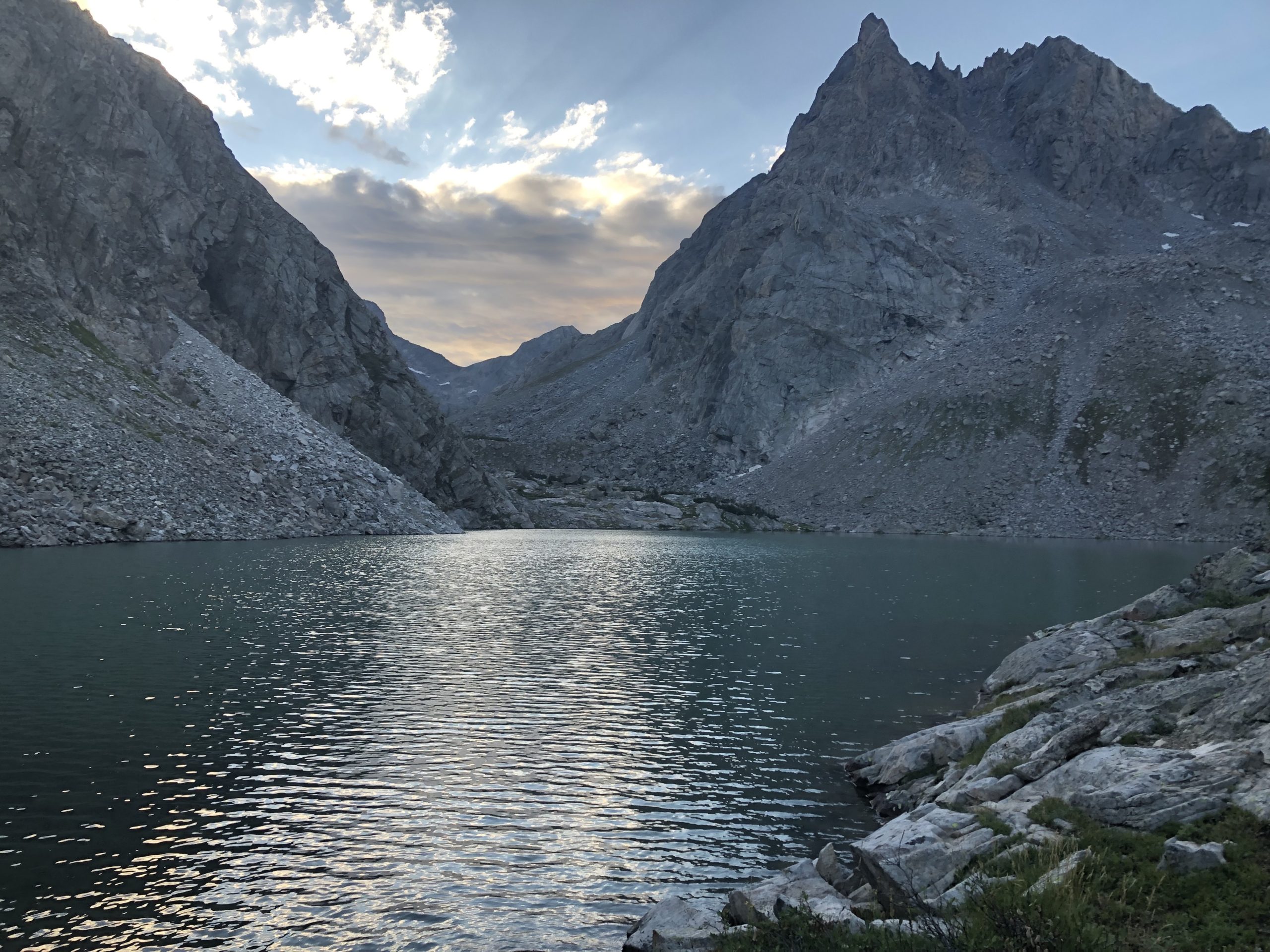
It depends on your route, the time of year, the snowpack that year, and your comfort level on snow and ice. Both the Dixon and Skurka routes traverse glaciers and permanent snowfields. By the time we hiked the Dixon route in late August of a high snow year, there were only a few small, mellow snowfields to cross, as well as the roughly half-mile-long Knifepoint Glacier.
Many hikers complete the route without an ice axe and, in some cases, without microspikes this late in the season, but we were glad to be carrying both. The extra traction made the glacier crossing easy—even though we were essentially walking on bare glacial ice by that time of year—and the axe gave us confidence crossing the higher, steeper-angled part of the glacier rather than sacrificing tons of elevation to reach the flatter section below. Also, the talus east of the glacier was a horrendous, unstable mixture of boulders, mud, and ice, and the spikes and axe were surprisingly useful in navigating this disaster safely.
How bad are the mosquitoes?
We hiked in the final week of August, which was late enough in the season that there weren’t many mosquitoes. The constant winds also helped to curb the few skeeters still on the prowl. Despite sleeping under a tarp with no mesh, I came away from the hike with no bites to speak of.
Earlier in the season, the mosquitoes are supposed to be horrendous in the Winds, though. The entire range is peppered with thousands of lakes and lakelets in which they can breed. Expect heavy mosquitos through early August of most years.
For real-time updates on mosquitoes, snow, etc., try contacting the Great Outdoor Shop in Pinedale. They’re very hiker friendly and regularly post trail reports on their website to keep hikers abreast of conditions on the ground.
What’s the best time of year to hike the High Route?
The route is hikeable from July through early September. In a low snow year, even June might be fair game for someone confident in their snow skills.
I loved doing it in late August: the mosquitoes were down, the snow crossings were minimal, and the lakes were as warm/swimming-friendly as they’ll be all year.
How likely am I to encounter a grizzly?
As of 2022, it’s not overwhelmingly likely that you’ll encounter a grizzly on the Wind River High Route, but they do live in the range, and their population is growing. You should still be bear aware and err on the side of caution.
The Winds are in the outer reaches of grizzly territory at this time, but the bears are making a comeback, and their range will likely continue to expand. We spent more time than I expected hiking through whitebark pine forests, willow thickets, and huckleberry-filled meadows. Although we never saw any evidence of grizzlies in the area, it was certainly an environment they would like. We all carried bear spray, and two out of three stored our food in Ursacks.
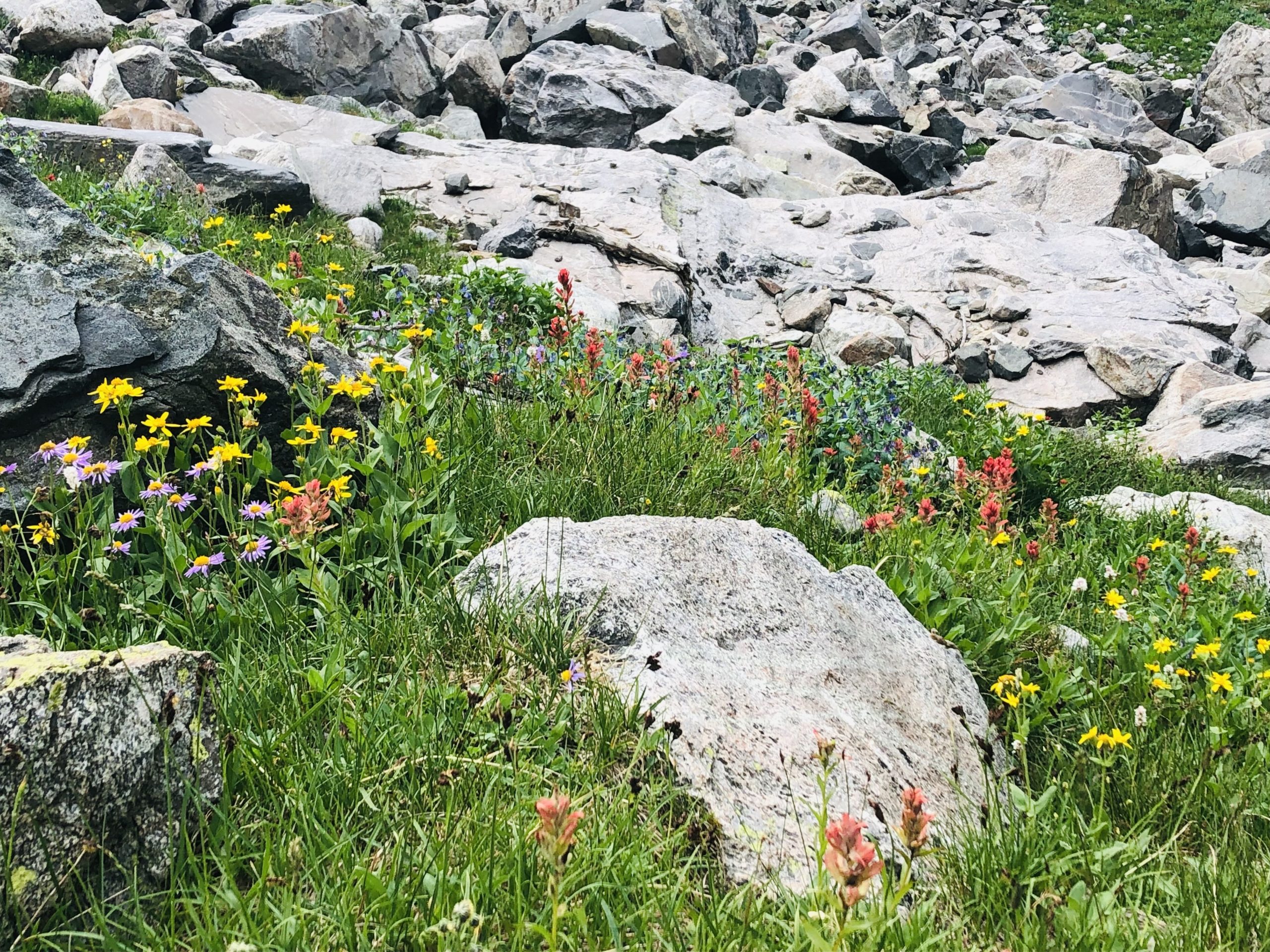
Catholes???
Though the passes are rocky, the basins are vegetated and have good soil. Cathole digging is not an issue. On a related note, I managed to drive tent stakes every night. No need to set up with rocks. A few nights were windy enough that I did choose to reinforce my stakes with heavy stones just in case.
How hard is it to navigate on the WRHR?
Knapsack Col via Peak Lake. Passes and landmarks on the WRHR are generally obvious and easy to identify.
Fairly easy. You are above treeline most of the time and have a clear line of sight to surrounding features. The passes and landmarks you are aiming for each day are fairly obvious. We mainly navigated on our phones using Gaia GPS, which, of course, makes it obvious where you are. We also carried a map, compass, and printed description of the route from Adventure Alan, which were useful navigation aids. You should always have hard-copy navigation, even if you plan to use your phone’s GPS.
We had pictures of passes and prominent landmarks saved to our phones, but these proved largely unnecessary as all landmarks were easy to recognize.
How remote is the WRHR?
We saw at least one person daily on the Dixon route and frequently crossed trails that connect back to the CDT within a few miles. Getting to the nearest town, Pinedale, from the trail is nontrivial. The best bailout point is just south of Knapsack Col, where you can walk out Titcomb Basin and pick up the Pole Creek Trail to Elkhart Park trailhead, which is within hitching distance of town.

Rainy day in Titcomb Basin.
How long does it take to hike the WRHR?
Our route (the Dixon version) was about 83 miles long and took us seven days to complete. It could be done more quickly (Alan himself did it in five and a half days while scouting the route), but taking a full week felt comfortable.
Shuttling
Getting from one trailhead to the other is a challenge in the Winds. Our route began at Green River Lakes Trailhead and ended at Big Sandy Trailhead, both of which are long drives down rough, lightly traveled dirt roads.
Hitchhiking is possible, but you should leave your car at the trailhead you plan to end at and hitchhike back to the beginning rather than leaving the hitch to the end. It takes three or four hours to drive between the two, not counting the amount of time you’ll spend waiting for rides, which is likely to be significant. Weekends are by far your best bet for getting a ride.
There are also a few paid shuttle services that will get you from one end to the other, although they are very expensive. Wind River Shuttles caters to the Skurka route hikers entering from Lander. Great Outdoor Transport Company caters to the Dixon route crowd.

Sunset over the Bonneville Lakes.
In need of some mindless visual inspiration? You’re in luck, because in the Winds, even my mediocre iPhone 8 photography looks good! Check out Part 1 of this series, which featueres 18 stunning photos from the Wind River High Route.
Featured image: Graphic design by Zack Goldmann.

This website contains affiliate links, which means The Trek may receive a percentage of any product or service you purchase using the links in the articles or advertisements. The buyer pays the same price as they would otherwise, and your purchase helps to support The Trek's ongoing goal to serve you quality backpacking advice and information. Thanks for your support!
To learn more, please visit the About This Site page.

Comments 2
Finally catching up on your Wind posts. Great reporting! And I’m very happy that Wilson made it in too ? He’s back down in southern Utah and Arizona right now keeping everyone in his immediate vicinity hydrated.
Thank you! Wilson is truly the glue that holds us all together.