 ">
">
Yutswholaht (Days 10-12)
Yuts-whol-aht: Walking through the face of the mountains. That’s the indigenous name for the Beaufort Range, a series of mountains that mark the boundary between the traditional territories of the Hupačasath and Tseshaht First Nations in the southwest and the K’omoks First Nation in the northeast. The plan was to ascend from Port Alberni to walk along its crest, all the way to the little town of Cumberland.
Ascending
Steve dropped me off at the trailhead and snapped a photo of me before my ascent on day 10. With my bag full of food, I started up the logging road that would steadily rise through the cutblocks at the base of the mountains and into the alpine. This would be my first serious elevation gain since I began my hike, and also the first time I would be navigating the different kind of terrain that is found up there. I was nervous and excited for the new challenge, which had filled my dreams in anticipation the night before.

Me, about to ascend :0
The road afforded views here and there of the lakes and farmland of the Alberni Valley, and the clouds of steam rising from the wood products mill in town. Soon I found myself on Don’s trail, leading up to Mt Irwin and Mt Hal, the first two summits of the challenge. The underbrush thinned and the trees became less bushy, revealing the bare brown-red ground of soil and rotting wood. What few shrubs there were had been flattened by the snow and were only just starting to offer up their new leaves. This made it easier to walk around without a trail, since the ground was more even and less densely overgrown than in the lower-elevations.

Don’s trail
As I passed by Mt Irwin, I saw my first patch of snow. Little did I know what was in store for me up ahead! As I sat down for a snack just underneath Irwin’s summit, I watched the view shift and change around me with the incoming clouds. A glimpse here, a glimpse there – never the whole thing at once. I started to think that maybe it was a good thing it didn’t reveal itself fully all at once – The faint little fields and houses down below were dizzyingly far away. It was distracting, when trying to concentrate on your next footstep in the slippery steepness, to be reminded of how high up I was.

Cloudy from Mt Irwin
by the time I was up and over Mt Hal, I got the hang of using my phone’s maps to navigate the marker-less, trail-less, snowy environment. Walking on the snow in my hiking boots was also another learning curve – how to angle my feet so I didn’t slide down when I intended to go up, and how to use my shoes like skis when I wanted to descend fast.

Snow Walking
It was a long day of new experiences. exhausted, I camped under a big tree, one of the few snow-free flat-ish spots I could find.

Snow Camp
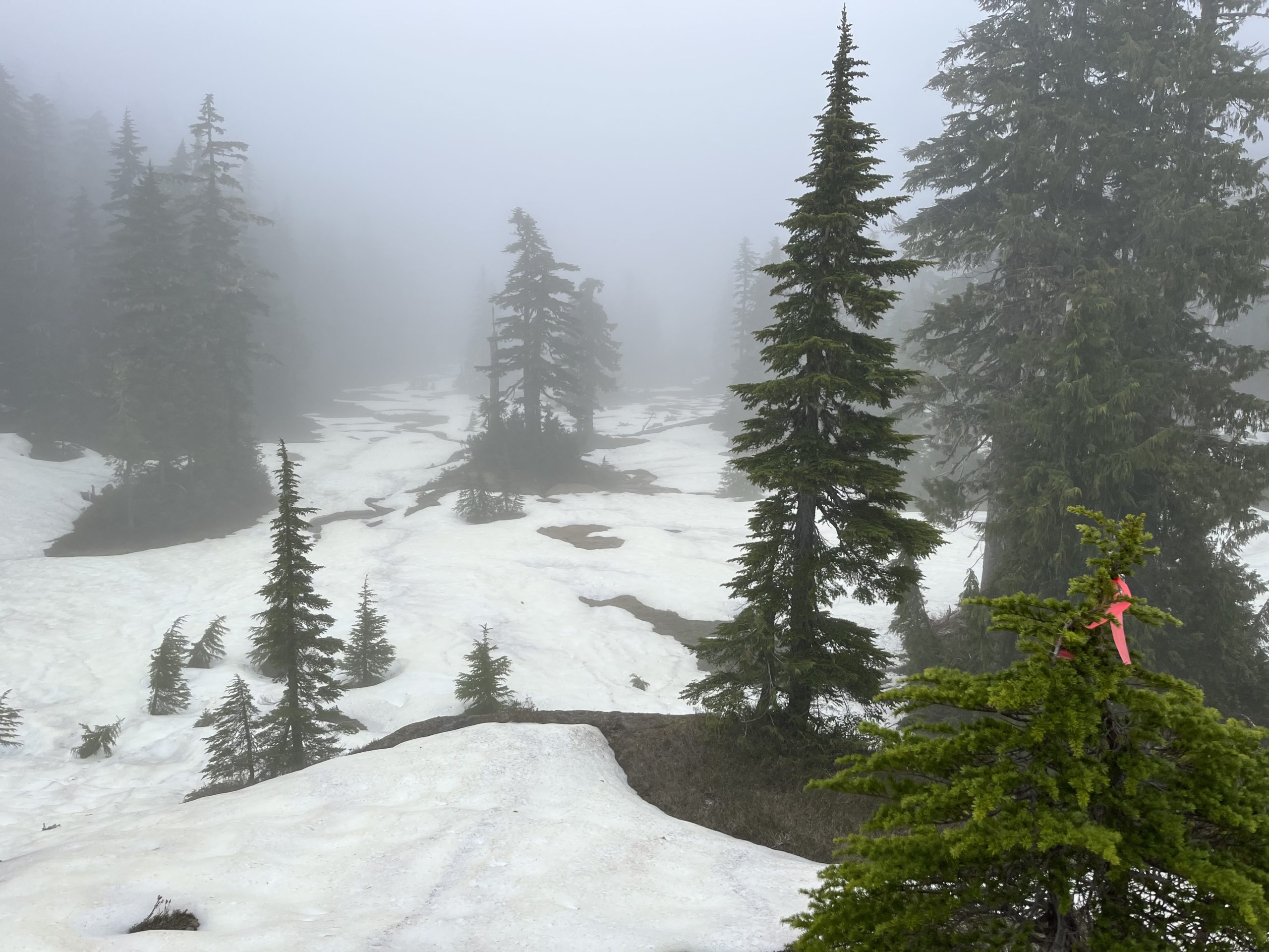
Fog Walking
Day 11 was a long and difficult trek, as I hit Mt Joan, the Squarehead, and Mt Apps, and ended the day with a climb halfway up Mt Cameron. I was in the clouds all day. Insulated from the world below, and never running into a single person (who else would come up here in bad weather and the snow?), it was just me in my own little foggy video game: consult my phone, find out the direction I need to go, pick a landmark to aim for. Walk, and repeat.
It was like the Slenderman game… if anyone remembers that
I saw a few deer bouncing around in the snow, and followed their tracks for a while as they aligned with my path. The low hoots of owls and the calls of birds echoed in the mist.

Views where???
Not being able to see very far, and putting full trust in my GPS maps, I scrambled up wet rocks and charged through clusters of trees, all for the sake of that digital dotted line. Sometimes, I would get to a drop off, and have to figure my way around it to continue in the direction I needed to go. Whenever I caught sight of a trail marker, I felt relieved. For about half the day I was able to follow the markers pretty easily – but in some places, where the snow covered them or they were scarce, it was tougher.

Me, wondering what I’m doing
Tightrope
It was a short climb to the top of Mt Cameron for the sunrise on day 12. Finally, the views I had been waiting for! There wasn’t a cloud in the sky, and the snow, tinged yellow from scattered tree pollen, was softening by the minute underneath my feet. This actually made it easier to kick footholds in the steep sections (of which there were plenty!).
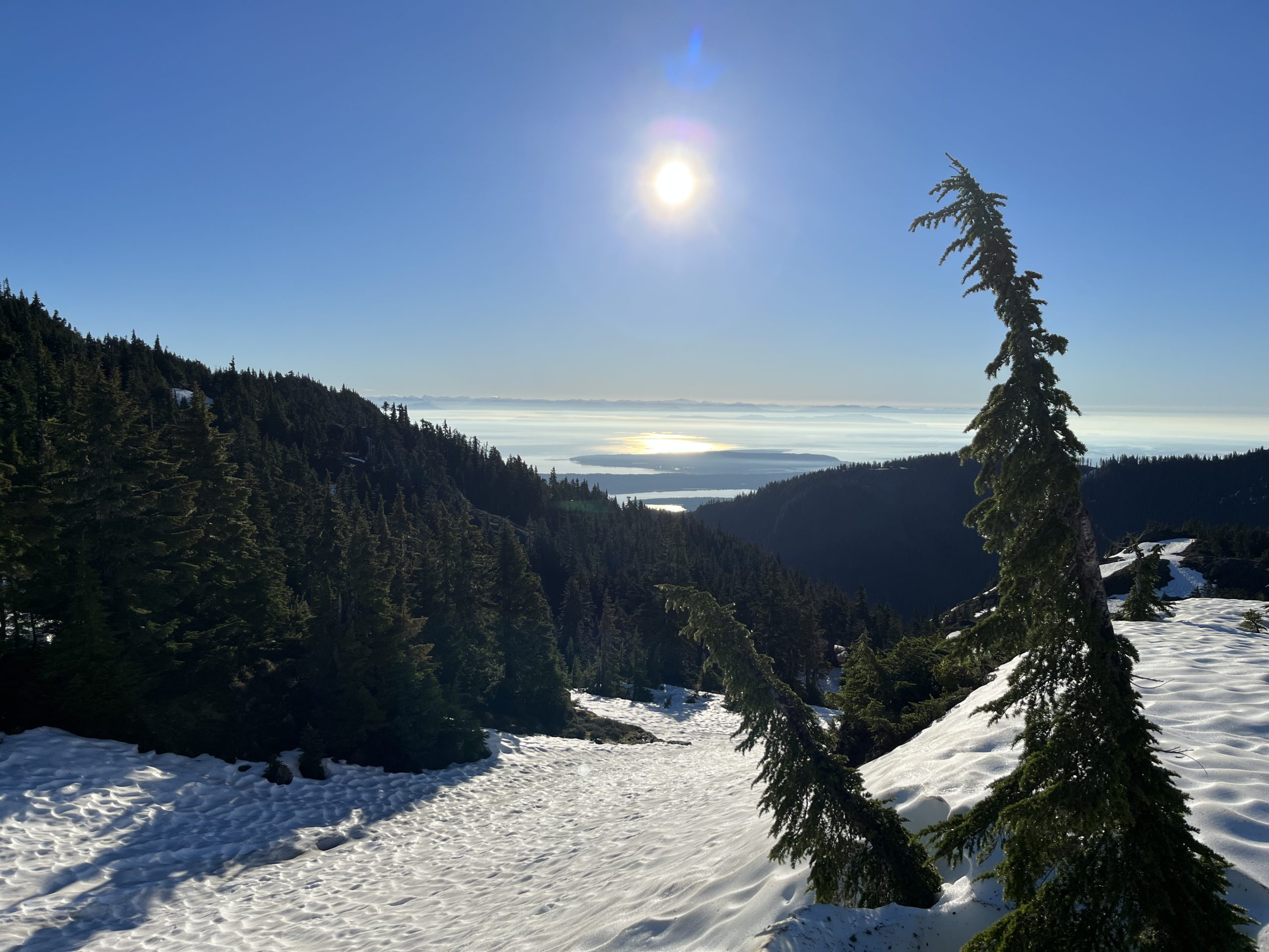
Sunrise on Cameron
The backside of Mt Cameron featured a few steep drop offs. There was a pretty sketchy one that probably would have been doable when the snow had melted – but when I got to the top, the ravine was filled with a wall of ice that made it difficult to find a safe way down. I ended up throwing my bag to the bottom, then scaling the rock wall to the side to get down safely.

Rock climbing down the left side of this ravine
From Mt Cameron, the markers led me steadily up to Tuesday Peak, and then Mt Henry Spencer. From top of the latter, the views were 360 degrees. To the northwest, I could perfectly trace out my tightrope walk with the contours of the land to Mt Stubbs and Tsable Mtn. I was grateful for the sunny weather, as the way to Tsable via Stubbs was unmarked – but relatively easy to figure out. I just had to stay on top of the ridge and it would take me where I needed to go.
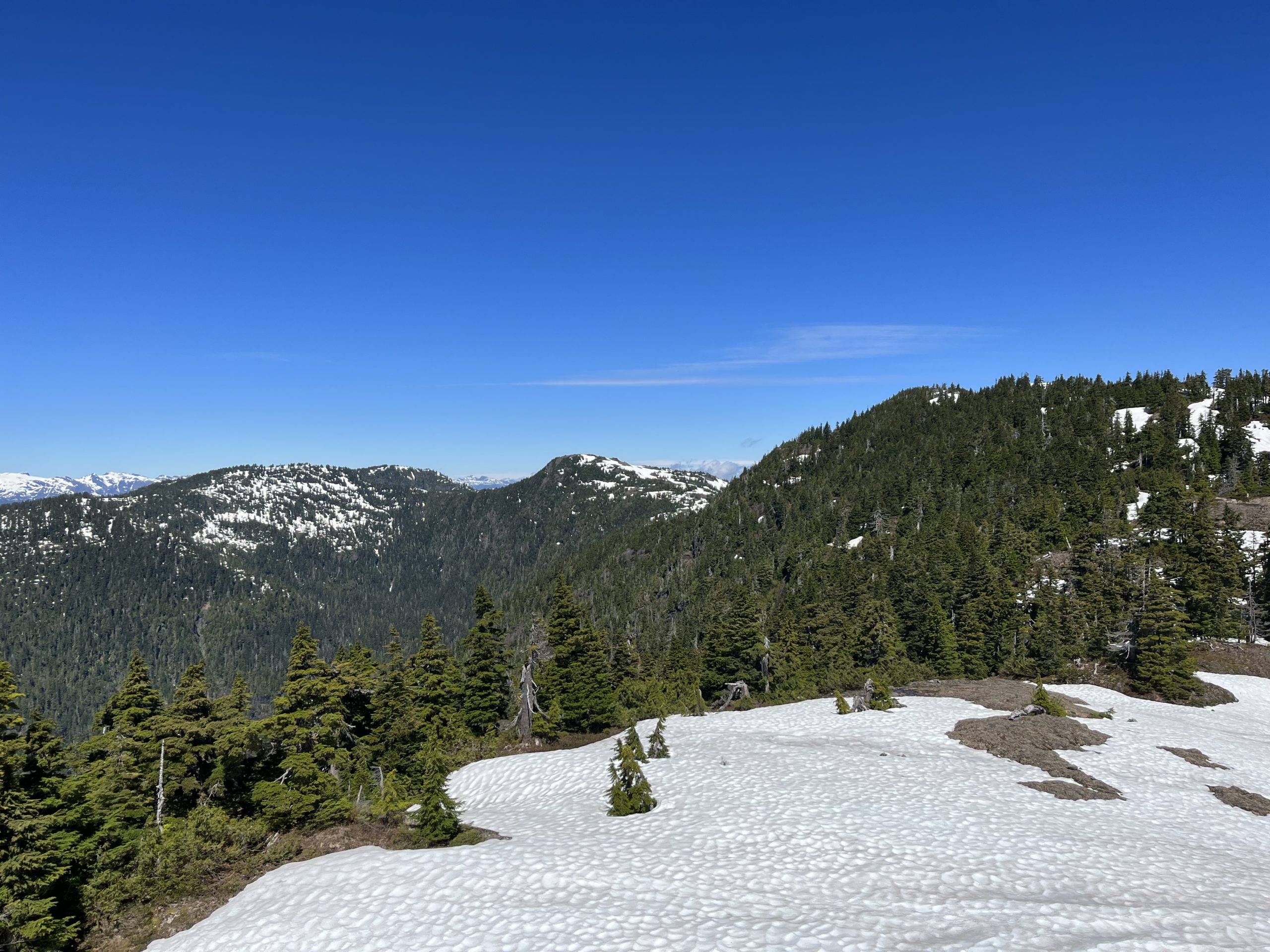
Left to right: Tsable, Stubbs, Henry Spencer
The day passed in a blur. My awareness was fully in the present, laser-focused on the next step, the next foothold, and the next hand grip (if needed). I adopted a sort of tunnel vision, to keep my mind on the task at hand, and avoid getting too overwhelmed by unhelpful thoughts (I’m so high up! What if I fall? Look at that lake so far below! What if there’s a cliff on the other side of this hump?).
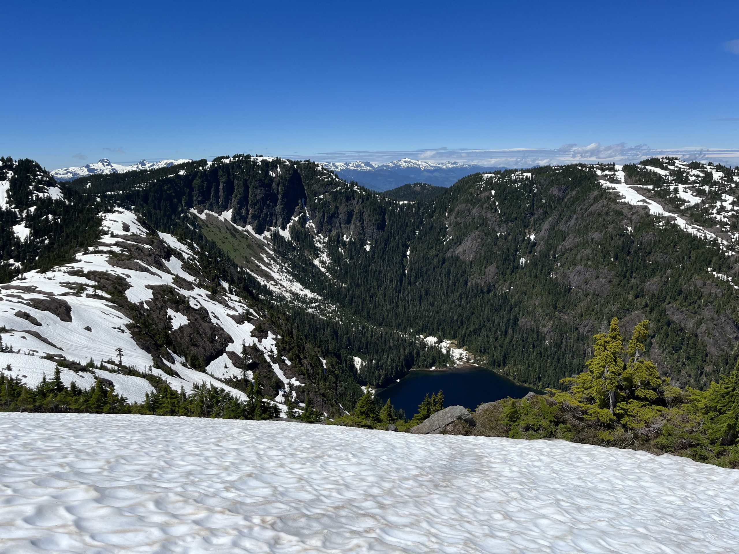
Don’t look down… side-hilling in the snow
By the time I reached Tsable Mtn, I was utterly exhausted. I took a nap in the blazing sun of the afternoon, and listened to the birds and the buzzing bugs.

Nappy nap
Even though it was scary at times, I’m glad I did it, I thought. As I lay there tired and triumphant, I spotted Mt Baker way off in the distance to the southeast. How clear a day it was!
Halfway down the steep backside of Tsable, I found a perfectly flat spot just the right size for my tent. It appeared as if someone had even cut away the brush already. Thank you to whoever saved me the work!
Signed,
Carly

This website contains affiliate links, which means The Trek may receive a percentage of any product or service you purchase using the links in the articles or advertisements. The buyer pays the same price as they would otherwise, and your purchase helps to support The Trek's ongoing goal to serve you quality backpacking advice and information. Thanks for your support!
To learn more, please visit the About This Site page.

Comments 1
You’re doing so well, Carly, and you’re writing your story so well! looking forward to the next issue. Stay strong!