 ">
">
50 Days on the Te Araroa
Four months removed from my trip to New Zealand and fully immersed in work life, I figured this would be a great time to share my experience tramping in New Zealand. While visiting New Zealand over the winter I had the opportunity to work at a berry farm, road trip through the south island and walk the South Island portion of the Te Araroa trail. I arrived in New Zealand with no real plan but in the back of my mind was the Te Araroa (TA) and it drew me in as I drove around the country and saw the dramatic landscape. When I decided to hike the TA I had just enough time left before my flight home, that I figured I could walk the south island which consisted of 1300 km’s or roughly 800 miles of trail.
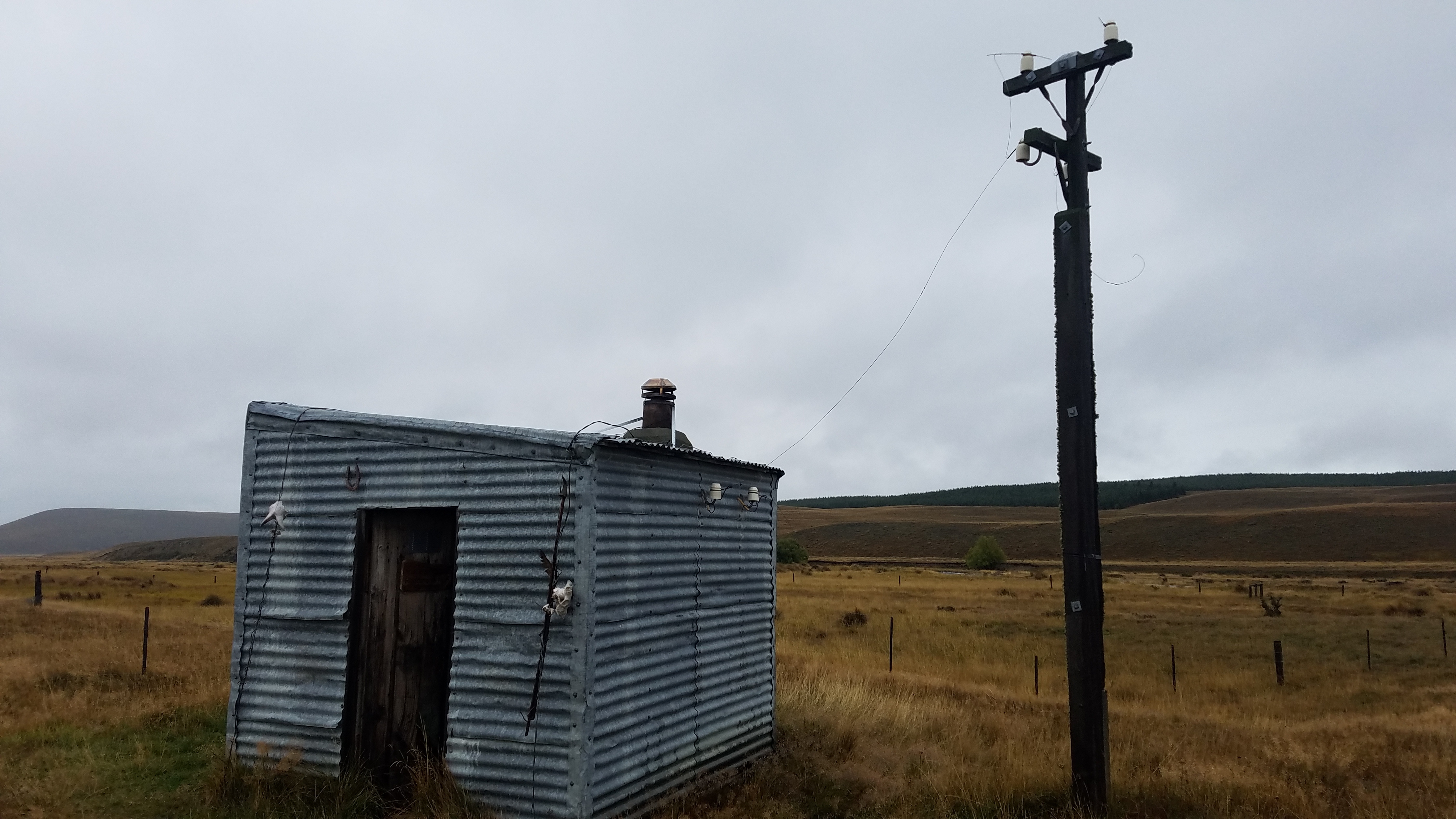
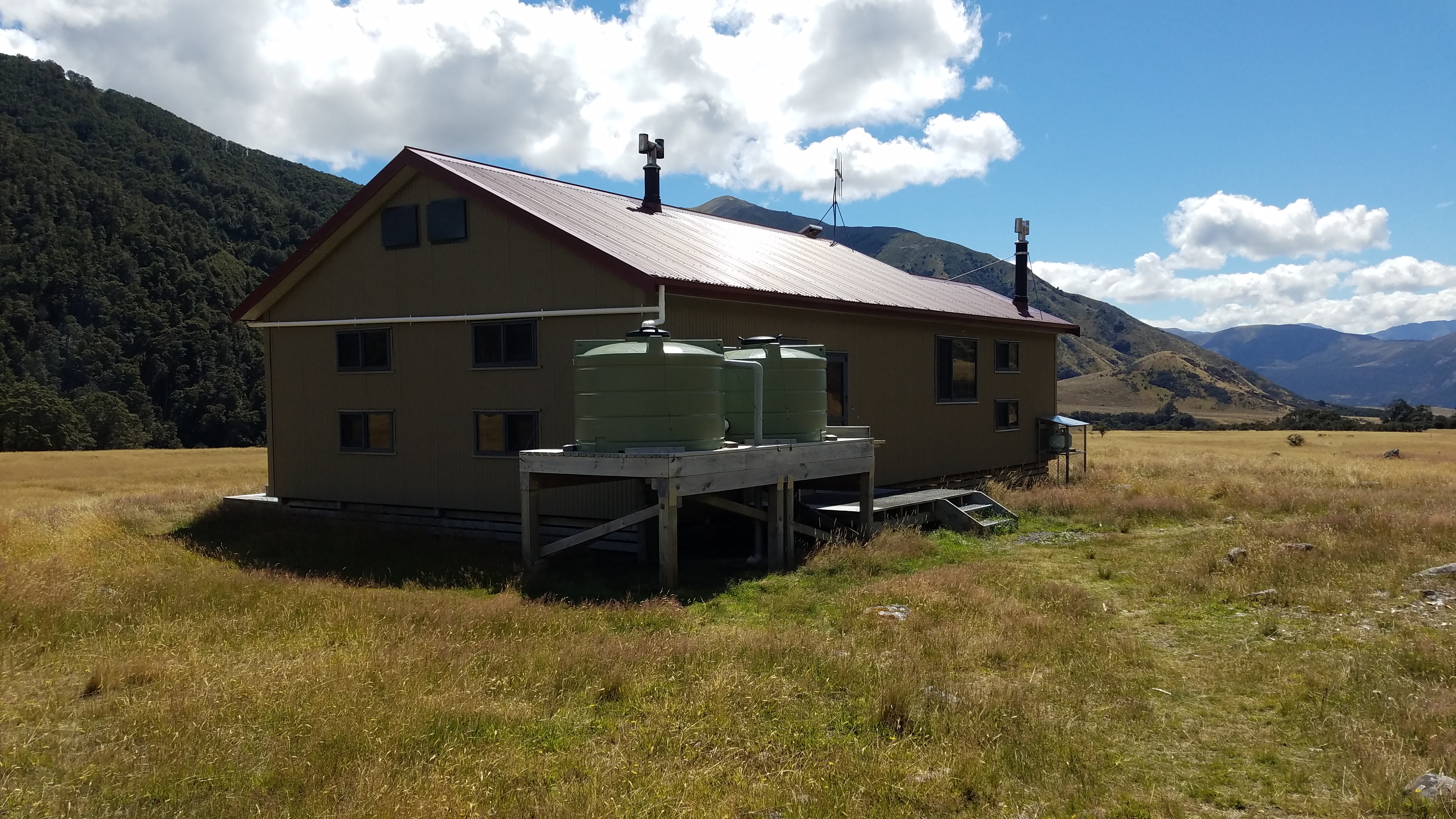
Before I get into my hike recap let me provide a few details for those not too familiar with the TA. The TA was officially opened in 2011, so it is very new compared to the long trails in the US. It runs from the top of the north island starting in Cape Reinga and ends in Bluff at the bottom of the south island of New Zealand, at a length of 3000 km’s. Along the trail, more so in the south island, are a multitude of huts that provide shelter from the ever changing weather. New Zealand is well known for their system of back country huts and they are a source of pride for the Kiwi’s. The huts range from 1-2 person alpine bivi’s to extravagant buildings in the national parks equipped with running water, flush toilets and fully stocked wood burning furnaces with room for 30 plus trampers. Common to each hut are foam mattresses, privies and secure shelter from the outdoors. For those who have experienced the shelters along the AT, these extra conveniences make for quite the enjoyable backpacking experience and are why I highly recommend tramping in New Zealand. Due to the infancy of the trail, it is not well known in the country and there is not as much of a defined trail culture compared to the long trails in the US. Most of the locals I met while hitching to town or the trail figured me to be just another tourist traveling the country as hitchhiking is quite commonplace.
New Zealand and subsequently the TA experience quite unstable weather, capable of drastic changes in a very short time. During my time on the TA I experienced heavy rain, relentless sun and heat, fresh snow and gale force winds all while hiking in the middle of summer when weather is typically the most stable. Combining that with the fact the TA continuously crosses rivers and streams, reveals the true challenge in walking the TA. At many times the trail becomes the river or stream that it is following. The trail markers are far and few and the only way forward is wading through the river. For those thinking of walking the TA, I would highly recommend bringing trekking poles for the water crossings and hiking with others to aid with swift crossings.
My one complaint of the TA which is rather minor is the lack of freedom or stealth camping options on the trail. In the south island typically during the connecting stretches between tracks where the trail follows roads and farm pasture camping was usually banned. As I was used to camping wherever on the AT and PCT this took a little adjusting to. Near the conclusion of the trail the last hut is located 100 km’s from the end of the trail, it also happens to be the last free campsite that you can stay at on the trail. Your other options are pay campgrounds off trail or illegally camping on private property which is not recommended. This took some of the freedom out of the experience and made for a rather lackluster finish, as I was simply staying at campgrounds and hostels and not really on trail anymore.
One more small complaint about New Zealand. There are no native mammals in New Zealand except for one species of bat. Every other mammal; the possum, stoat, rat, wallaby, and various deer are seen as nuisance animals and are under attack by the Department of Conservation. While the reasons to eradicate these invasive animals are probably more than justified, the DOC goes about it by blanketing the national parks and TA in traps and various poisons. Walking down the trail and seeing poison pellets and warning signs indicating the use of cyanide and other substances was rather disconcerting and took some of the pureness of the environment away from the mystique of NZ.
The TA isn’t technically one continuous footpath in the south island. There are multiple natural hazards that the trail runs into and then picks up on the other side. When I first learned about these my initial thought was to simply walk around and connect back up with the trail keeping a continuous footpath. I later learned the possibility of doing so was rather slim and would require multiple days of road walking so I simply adopted a new approach and met some wonderful travelers as I hitched around two rivers and a lake.
Lastly, the TA is more a collection of short tracks linked together than it is a continuous trail. Usually a short walk down a dirt road or through farm pasture would lead to the beginning of a track heading into the mountains. The track typically ascended from a river valley crested through a mountain pass and dropped down through another river valley to a road that continued to a town. These tracks would typically take 3-5 days to walk and included multiple huts along the way, which allowed for easy resupply planning. With exception of the final road walk into Bluff, I typically didn’t mind walking the roads as they were usually not too busy and were gravel farm roads for the most part, saving my feet from the pavement.
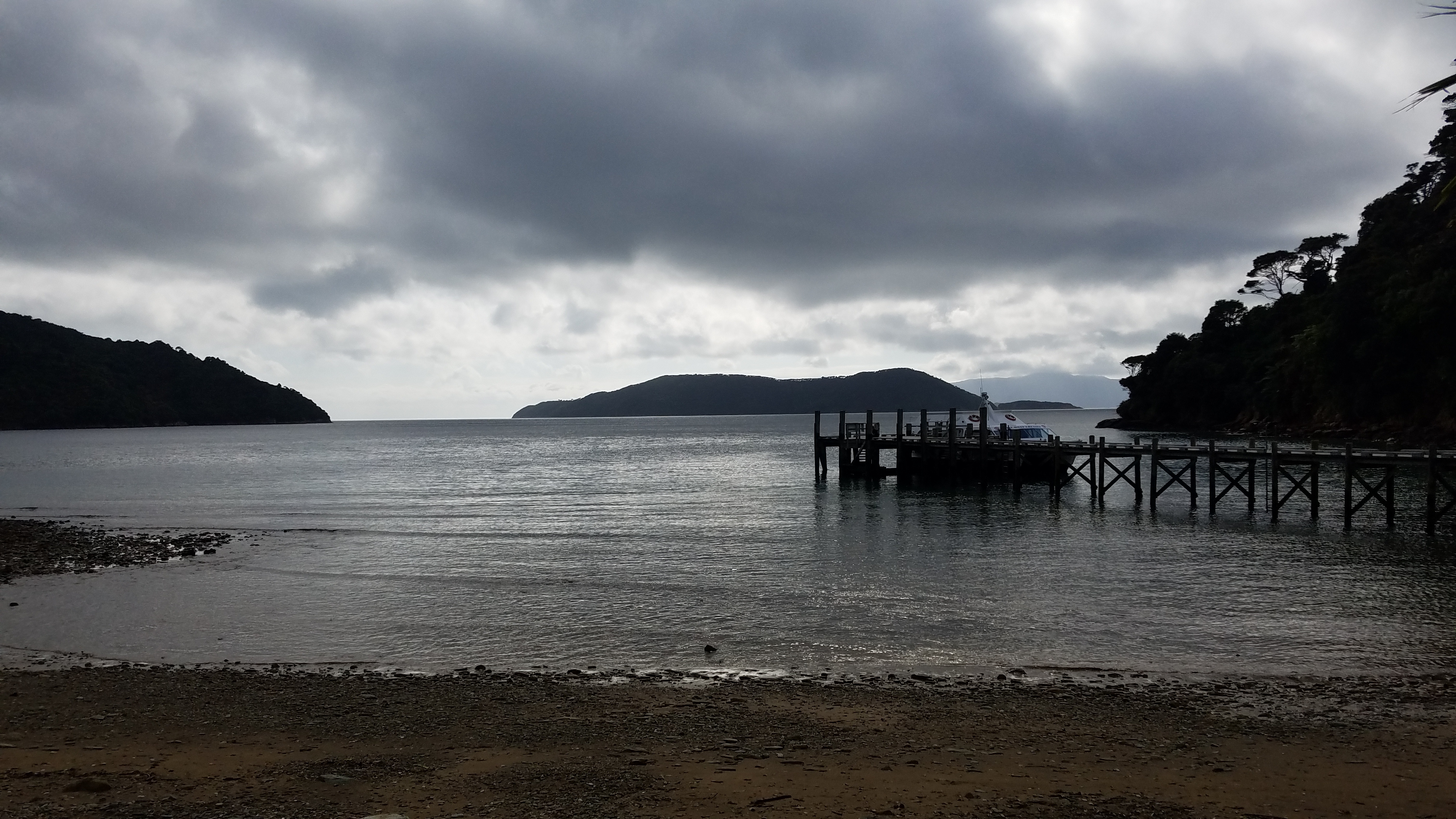
View from Ship Cove, the northern terminus of the TA in the south island.
Towards the end of January I boarded the local mail boat from Picton and headed towards Ship Cove, the site of James Cook’s first landing in New Zealand and the northern start of the TA. The trail begins on the Queen Charlotte Track which winds through various coves for 70 km’s never deviating far from the Queen Charlotte sound. Since the Queen Charlotte track is very popular in NZ it was very well maintained allowing for easy walking and was a great way to get reacquainted with long distance backpacking. Looking back this section certainly made me a little over confident as I would soon learn some difficult lessons as to what tramping in New Zealand was all about.
Following the QC track and a quick stop in Havelock (The Greenshell mussel capital of the world) the trail heads into the Richmond mountain range. It is in the Richmond’s that the TA begins to show its true colors.


Above are a few photos from my trek through the Richmond’s. The bottom picture is on the approach to Mt. Rintoul, in the center of the picture is a rock cairn and faint trail marker. The five days I spent in the Richmond’s defined my trip to New Zealand, I experienced awe inspiring vistas, relentless ascents and descents, insane weather and subsequent raging rivers, a new appreciation for food and the kindness and generosity of fellow trampers. Without digging too deep into the details, I ended up putting myself in a precarious situation by underestimating both the weather and river crossings in NZ.
My first day in the alpine brought me to the summit of Mt. Rintoul which I never saw clearly due to dense clouds and rain. I ran up and down this section of trail in sandals questioning my preparedness and thinking only about the next hut. Once I arrived, soaked and cold I started a small fire in the furnace and began to thaw out. The storm that had overtaken me was the remnant of a tropical cyclone that at last check was supposed to miss the area I was in. Once I regained my composure and took hold of my food level I knew I had to keep moving in order to not run out prior to the next town stop. I headed out warm and dry focused only on getting to Mid Wairoa Hut 15 km’s away. I arrived at the hut close to dark, exhausted but in high spirits believing that the worst was behind me. I was immediately greeted by two Kiwi trampers that were quite concerned with the approaching weather. Turns out the heaviest rain from the cyclone was coming later that night and the upcoming river crossings would be practically impassible. I heeded this advice and hoped for the best, knowing that I had to keep moving the following day to avoid running out of food. Later that night the heavy rains arrived and continued in a torrent until around noon the next day. After the rain subsided all that remained was the loud drown of the raging creek near the hut. It had drastically increased in size and what could be easily crossed a day earlier simply was impassible by foot. The reality hit that I was now stuck on trail with no where to go safely, a first in all my time spent backpacking.
I spent the entire day resting, filling out crossword puzzles and trying not to think about food as I rationed what remained. To be honest the other hikers who shared the hut with me offered me food but I turned them down and dealt with the hunger anyways. I had tons of back country experience in the US and here I was 4 days into my TA hike wet, cold and out of food. My thinking was I got myself into this and as long as I could deal with the hunger I would do so. Not eating a sufficient amount of calories was a new experience for me in which I learned much about myself from the ordeal.
Thankfully once the cyclone passed the weather improved and as quickly the creek rose it soon dropped to a safe level allowing me to get moving again after only one day lost. A long 35 km day brought me to end of the Richmond’s and the small town of St. Arnaud, where I questioned my life choices and consumed endless pasta. While the rest of my time on the TA was never as challenging as the first section I look back with an appreciation for the lessons learned and was thankful for the extra day of food that I would always carry from this point onward.
Continuing on from St. Arnaud, the trail passes through Nelson Lakes, Arthur’s Pass and skirts Mt. Cook National Park. The trail eventually passes through Queenstown (the adventure capital of NZ), drops out of the mountains toward Fiordland National Park and finishes with a stunning walk through coastal towns along sandy beaches ending at Sterling Point in Bluff. Each portion brought amazing scenery, challenging river crossings and incredible experiences. No matter the events of the day, being able to rest in a heated shelter with running water and the company of other trampers made it all worthwhile. In typical thru hike fashion the days spent on trail flew by for me and as soon as I finished I longed to be back on trail. I was left with countless stories and amazing memories from my time spent in New Zealand and while hiking the Te Araroa. I finished this 50 day walk in the woods with a renewed desire for adventure and an appreciation for the amazing landscapes throughout the world.
-PackMan


This website contains affiliate links, which means The Trek may receive a percentage of any product or service you purchase using the links in the articles or advertisements. The buyer pays the same price as they would otherwise, and your purchase helps to support The Trek's ongoing goal to serve you quality backpacking advice and information. Thanks for your support!
To learn more, please visit the About This Site page.
