 ">
">
A Trio of English Walks: Part 1 – The Ridgeway
Hiking During Covid-19: Travel Bans Galore
2020 has turned out differently than anyone (except Epidemiologists) could have expected. As a result, plans have been scuppered, lives have been needlessly lost through carelessness and lack of action. I have spent 2020 in the UK with my family with dreams of visiting my boyfriend, Orange Blaze (OB), on an indefinite hold. We met on our Thru-Hikes of the Appalachian trail in 2019 and decided to return to Vermont to hike the full Long Trail in July 2020. UK residents cannot travel to the USA without spending 2 weeks in a country not on a ban list. I also feel uneasy about passing through small communities at this time so I thought of the Ridgeway in England.
It is clear that these plans took a back seat, therefore OB finished the section of the AT that he missed due to a bout of Lyme symptoms, and I took to hiking the best of the English Locality that I could fit around work, lockdowns, and my surprising lack of fitness.
The Ridgeway: A History

Via By Cnbrb – Own work, CC BY-SA 2.0, https://commons.wikimedia.org/w/index.php?curid=69231060
‘Historic UK’ will tell you that a Ridgeway is a path of hard ground across hill ridges that take the traveler from A to B. In this case from Overton Hill, Wiltshire to Ivinghoe Beacon, Buckinghamshire. Though this path has been used since the Anglo-Saxons 5,000 years ago, it was designated a National Trail in 1973. Coincidentally, the Ridgeway’s path is never more than a 90-minute drive from my hometown of Abingdon.
The route passes several historic sites of significance that tell the history of the last several thousand years. These include the remains of Uffington Castle at White Horse Hill – an Iron Age Fort, and Wayland’s Smithy – a Neolithic burial mound.
Breakdown:
Distance – 87 miles
Total Ascent: 9385ft
Total Descent: 9208ft
Trip Total Duration: 5 days
Mileage Breakdown: 9.8 – 20.8 – 20.0 – 20.0 – 16.8
Nervous Breakdowns during lockdown: 0, but please take care of your mental health and wellbeing!
Setting Out
I have walked on the Ridgeway several times before this trip. I worked at Harwell Campus, nestled below the ridgeline for 18 months, where I frequently took walks to practice walking on uneven surfaces. This was training for the AT, but this path is as smooth as an airport ‘travolator’ when compared to the chaos and rocks of Appalachia. School friends organised an overnight trip in 2017 for a ten year reunion where we covered about 20 miles. I have even been dragged along it on the odd dog walk too.
Certainly, the first weekend out of a several month lockdown I knew I had to hike for my own sanity and wellbeing. I packed up all the food I would need and was dropped off at Overton Hill by my dad. I had fine-tuned my gear for this four-night trip:

Overton Hill: The Western Terminus of the Ridgeway.
Gear:
Literally everything that I used on the AT – including boxers, socks, and bodily odour infused hiking shirt. Merrell Moabs with about 700 miles of wear just about carried me through, whereas my Big Agnes tent was as dreamy as ever.
In my defence everything has been through the wash a few times (except my Quilt), though I wasn’t planning on standing too close to anyone for them to catch a whiff. If a person were to be caught downwind from me on a scenic overlook, then that is unfortunate for them.
Wild Camping:
There are villages and towns to which one can descend from this trail for overnight stays. I however wanted to get out and sleep in my tent. To sleep on land in England you must have permission of the landowner. This is difficult to obtain in most cases as you don’t know who owns the land. I instead followed the tried and tested setting up camp late, and leaving early. This combined with ‘Leave No Trace’ principles makes for a firm compromise. Common sense is useful – i.e. Don’t set your tent up in the middle of a farm field and then be mad when a combine harvester harvests you.
The Ridgeway Terrain
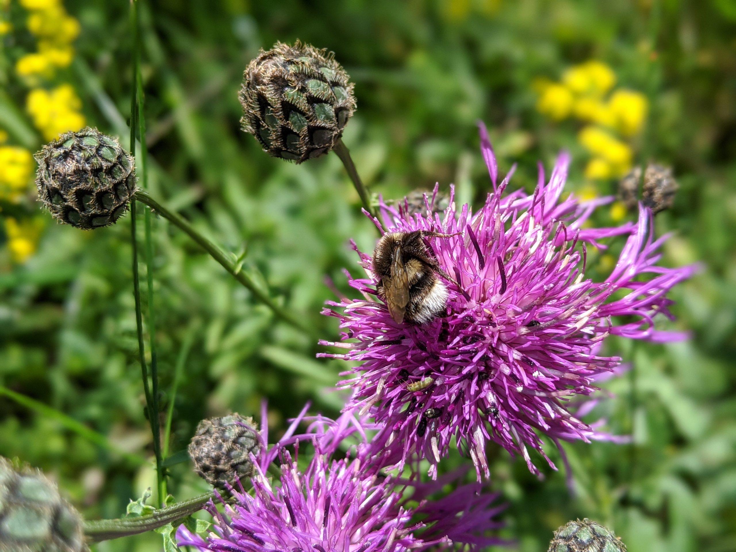
The first day of hiking started at about 18:30 with a gentle breeze and small rain clouds on the horizon. I hiked with purpose, feeling the full weight of my pack on my back, pressing feet firmly against the hard-packed dirt of the summer, and avoiding the copious quantities of cowpats. The midsummer wildflowers that crossed the landscape are beautiful in July. I found it easy to get caught up taking pictures and watching the bees busy at work.

Wildflowers aplenty along the Ridgeway.
A Dew pond was set serenely to the side of the trail. These were made for the livestock that grazed the ridge, but has since become a haven for wildlife such as dragonflies, frogs, and birds. I was caught in a very light rain that invigorated my dusty day hiking bones. I set my tent halfway down the ridge on a track that wouldn’t be used by tractors in the early hours.

Berwick Bassett Dewpond.
Gravel
From my second morning, there was a marked change in the scenery as I ascended to the main ridge that would take me to the valley and river that posed the only real ascent and descent of the whole trip. The ridge is firm ground that makes for quick walking. Even after so much inactivity, I comfortably maintained a 4 mile per hour pace. Winds blow with gusto on the Ridgeway due to its exposed nature. With a light sweat from exertion, this breeze was greatly enjoyed.
Packed Dirt makes for ideal hiking conditions.
Descending to the valley floor took us through the villages of Goring and Streatley. This is the first populated area of 3 that I encountered. Dirt tracks turn to small roads, and then the addition of footpaths makes for even swifter walking. My sister and her partner live one village over so they popped by to deliver water, snacks, AND A DOG!
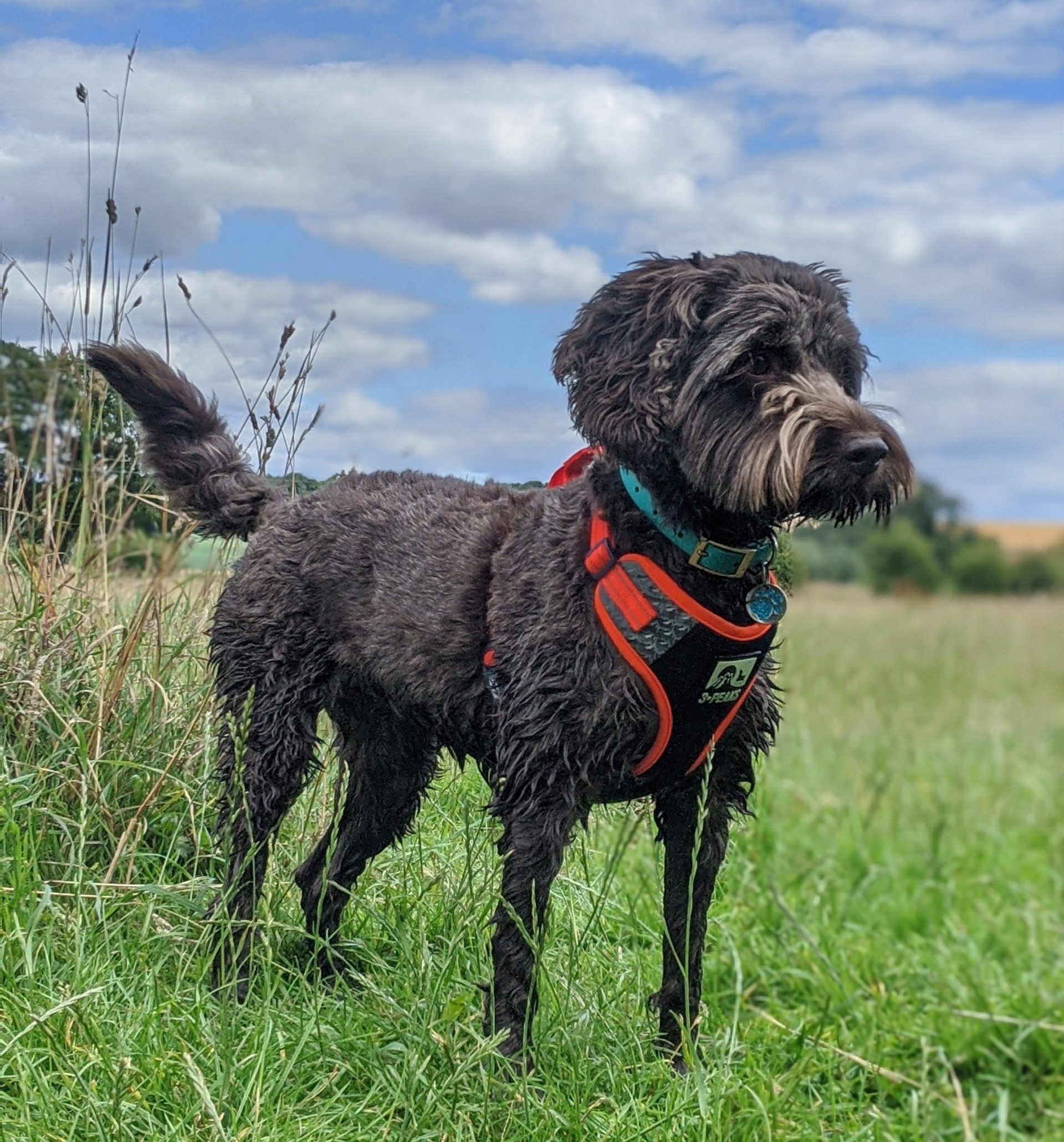
Piper the Cockapoo.
Towpath
Piper joined me on her first overnight camping experience. We walked together for 10 miles on each of the days she traveled with me. She not only took to the softer ground of the grassy river banks but even joined me for a dip in the Thames.

Piper navigating the riverbank.
The pleasant banks were interspersed with fortified sections to prevent erosion, with fields juxtaposed against the concrete paths that took us under impressive brick railway bridges.

A different kind of view on the trail – a train bridge crosses the Thames.
Farmland
There was also significant portions where you traverse, or skirt around, farmland. Walking these in summer is ideal as the ground is firm as you pass through fields of wheat (don’t be tempted like Teresa May), and crops of Peas growing in their shells.
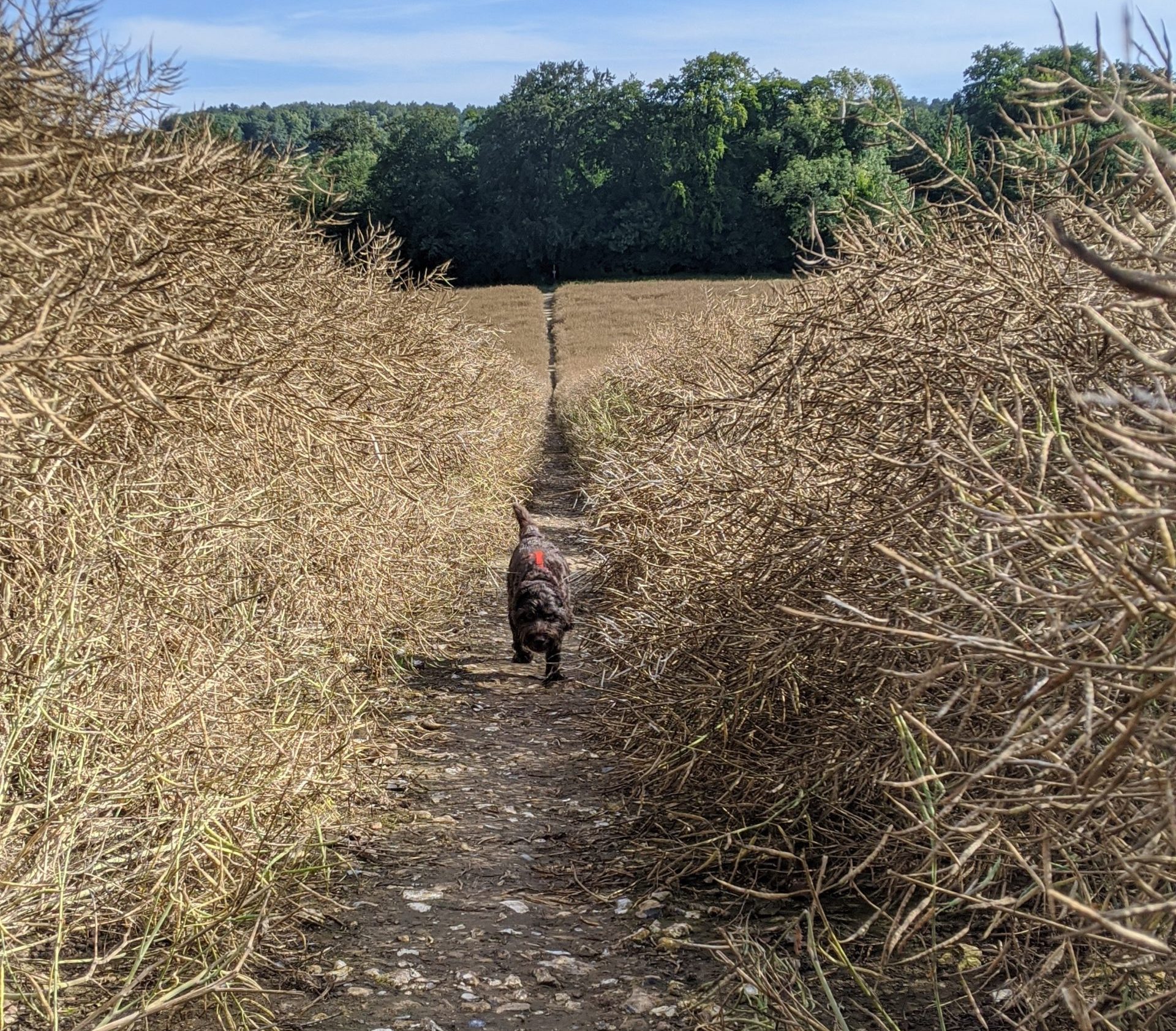
Piper running along the right of way through farmland.
National Trust Land
Many pockets of the Ridgeway have National Trust Status. This is land that is maintained and protected by the national trust for its historic value, as well as scenic beauty.

National Trust Land at White Horse Hill.
Whether the land is grazed by sheep, cows, or avid walkers, you navigate grassy hills, with views of the land below, and if you’re luck a monument for your efforts. These can make for uneven walking unless you have one leg slightly longer than the other (make sure you pick the correct direction to hike in this case.)

Hills take us to views – though these hills are actually Barbury Castle remains so are the view.
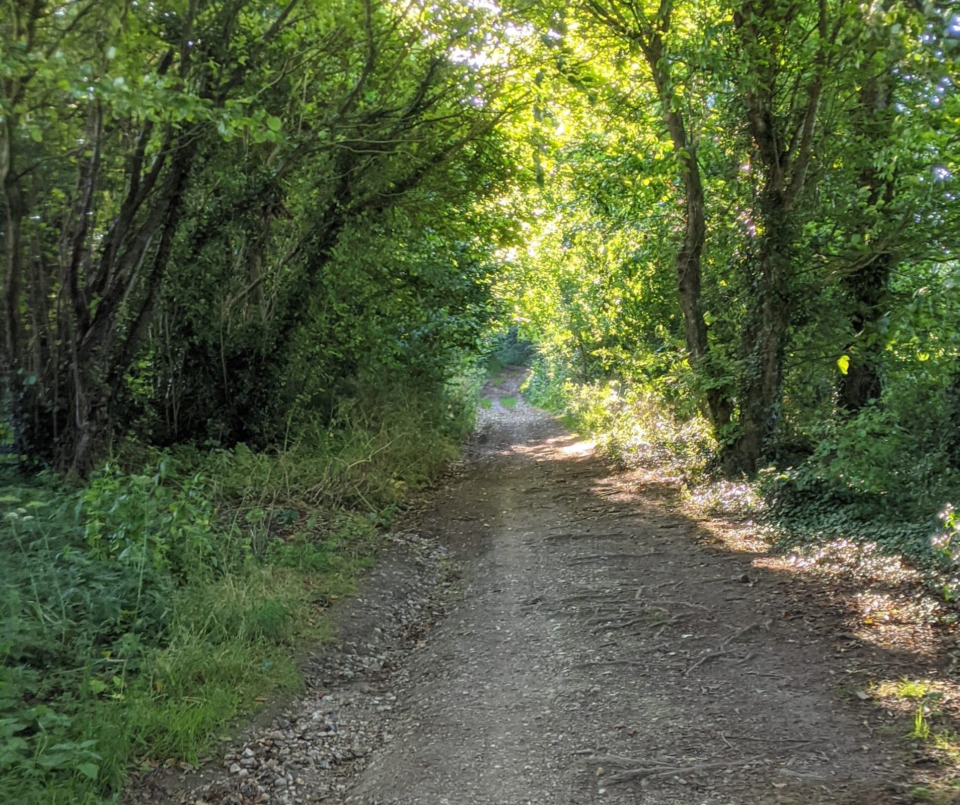
Furthermore, these areas also hold forest land with cleared, dirt paths so it is easy to stay on the path. During the heat of the afternoon, these are a blessing of shade, providing a welcome change of scenery to the open landscape along the exposed ridge. This is a short trail, but you are rewarded with a variety of scenery for your efforts.

Piper loving the forest.
The Ridgeway Views
The views are mostly seen to your left (the North) when you hike from West to East. The landscape is open enough that you won’t strain your neck for looking left all day, though a few times I almost lost my footing from doing so. There are countless views that I stopped to admire, including the perfect spot to eat a tortilla filled with peanut butter and dried apricots (Sweet and Savoury together = yummy).

Pretty views of the surrounding countryside near Ivinghoe Beacon.
Towns
Goring and Streatley, Wendover and Tring are the main towns/villages that you pass through on the Ridgeway journey. Picture large houses, buildings with the names: The Old Post Office, The Old Schoolhouse, The Maltings. Each village/town would have its traditional buildings which have been repurposed as houses with exposed wooden beams over time. Goring and Streatley are on opposite banks of the Thames and the paths afford a spectacular view of the river. The high streets of the towns are a popular spot for cafes, with socially distanced customers enjoying a slice of cake and a pot of tea as the world passes by.

The Thames at Goring and Streatley.
There are many more villages that are nestled into the foot of the hills. These are made characteristic by the simplistic churches that are the heart of the village. Each one is simplistic in design, very old (some as old as nearly 1,000 years), and adorned with generations of family graves that are clearly resting in a very peaceful spot.

One of the many churches along the Ridgeway; at Wendover.
The churches are usually a reliable spot to get some water, but they are not the only locations. Along the ridgeway, there are several farms, and even private dwellings that have drinking water available to the hikers, bikers, and horse riders that pass through. This small touch is a lifesaver when there are few, if any, potable natural sources on trail.

Potable Water Sources are located along much of the Ridgeway.
Monuments + Stately Homes
It is fair to say there are wealthy families that live in the rural lands surrounding the ridgeway. Stately Homes have right of way paths that skirt the edge of the land and these make for stunning scenery. The Chequers Estate is one of these homes whose grounds you walk around. For those who don’t know, this is the Estate that the UK Prime Minister may use for a retreat, or government business. Keep to the path here as there are security forces on patrol.

Stately Homes and Manors make for photogenic scenery.
There are several memorials and monuments along the Ridgeway that commemorate locals, whether their connection to the land, or the war memorials in villages. I slept under the view of one monument that spoke of the commitment of one man to the town of Wantage in his life. The most impressive monument however has to be that at Coombe Hill. This monument that was almost destroyed in one lightning storm in 1904 honours the men who died in the Second Boer War.

Coombe Monument.
Finally, there is the White Horse at Uffington. The castle is well-defined mounds of grass that show the former boundaries, and the White Horse is carved into the hillside. The exposed chalk surface gives a striking contrast to the green grass that surrounds it. To get the best view of this, you need to descend a steep path to the bottom of the ridge and climb another hill. I took my best ‘from the side pic’ and carried on my way as they didn’t count as trail miles.

Aerial View of The White Horse at Uffington By USGS – World Wind (go), Public Domain, https://commons.wikimedia.org/w/index.php?curid=4302322
Nature:
This one is self-explanatory.

Nature aplenty: From cows to trees, and bees working hard to dogs playing in the water.


What I Learned From Hiking the Ridgeway
Hiking the Ridgeway gave me that chance to focus on one task. It was refreshing to only have the worry of covering the miles each day and then relaxing. I stretched properly for the first time in months. I finished a book that I had been struggling to be in the mindset to read. When I needed a break, I lay on the ground and watched the cloud pass by and enjoyed the day.
My companion for 2 days Piper had a great camping experience. At camp, she patrolled the area looking for any threats (read: squirrels). After getting used to the tent material, she lay down ready to sleep. Piper kept licking me, which is her sign to go to the toilet. Meanwhile, I kept letting her out to no avail. I was getting irate when it dawned on me that I was her new, personal salt lick. I couldn’t stop laughing as she got bolder and attacked my arms with a tongue bath, to the point I had to cover up for a peaceful night of sleep. It brought me joy to see Piper have such a fun experience and I will definitely borrow her for more camp trips in the future.

Piper is pooped after a 10-mile jaunt. Here she is resting on her (my) Thermarest.
Renewed Confidence
Finally, this trip boosted my confidence to plan more trips. It acted as a long-overdue reminder as to the personal benefits to getting outdoors and enjoying nature. People struggle to hold on to the good feelings they once had. Conversely, I believe the remedy is to continue to push yourself outside your comfort zone to keep your wellbeing in check.
This hike is suitable for any walkers and can be done in as few or as many days as needed. There are plenty of villages with Bed and Breakfasts if you prefer a more formal sleeping set up, but camping is what I love.
Above all, I loved this trip and was very happy when I reached Ivinghoe Beacon, where I could enjoy the view, before heading home for a much-needed shower and large meal (Shangki Li for any locals).

Feeling elated at Ivinghoe Beacon after 87 miles of hiking.

This website contains affiliate links, which means The Trek may receive a percentage of any product or service you purchase using the links in the articles or advertisements. The buyer pays the same price as they would otherwise, and your purchase helps to support The Trek's ongoing goal to serve you quality backpacking advice and information. Thanks for your support!
To learn more, please visit the About This Site page.
