 ">
">
GDT Section A: US Border to Coleman, AB
The Great Divide Trail has been a Great Unifying Adventure. There is only one other activity I have done that compare to the difficulty and comeradere of the first week on the GDT; wildland firefighting. After the first week we have walked into town with twinges and aches, stumbles and cramps. If we were cars, we’d be questionably road worthy, and rightfully so.
Day 1: Waterton Townsite > US Border and back. 17km
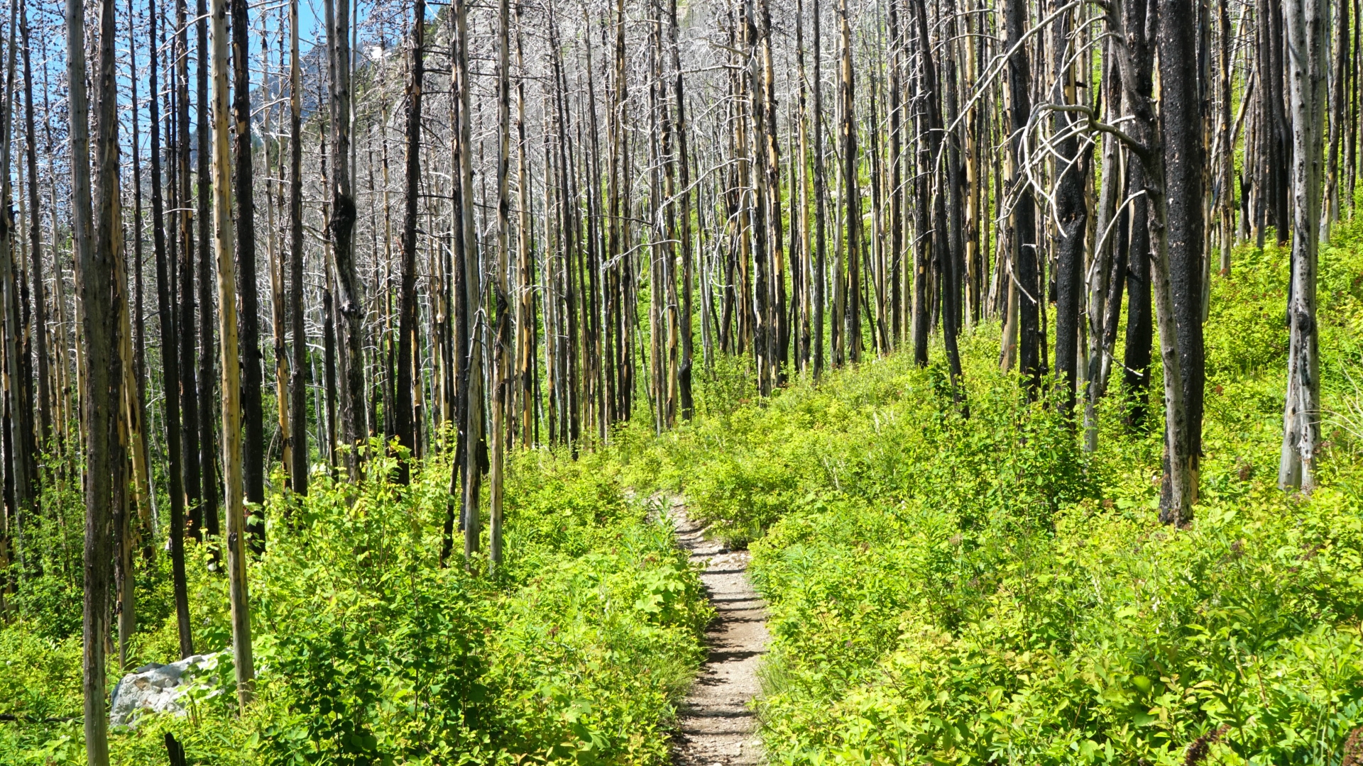
Day one of an adventure is always grand, spirits are high and bodies uplifted. Day one was a down and back hike to tag the US border somewhere between Montana’s Glacier National Park and Alberta’s Waterton Lakes National Park. Easy? Not so much. Much of the area had been recently burned and had lost all of it’s shady potential leaving us, and Solange’s parents, to bake away in the midday sun. Fortunately the lake is colder than a yeti’s ice box and chilled our feet nearly as instantly as a microwave heats. The day was not a gimme as anticipated. A landscape incredibly rugged to the south and peaks in distant Montana loomed like grey steeples from stone mountains. Upon the hike back, not far from camp, we passed by a hiker in the opposite direction she turned to us and said “GDT?”. Baffled by how she could tell we responded yes and told her we were in site H29, to which she said “I’m in H30”. It appears that we had similar ideas when booking. Still confused as to how she knew we were hiking the trail we asked, it turns out the shorter the shorts, the better the hiker. We have some damn short shorts.

Notable Features: US/Canada border, kissing in front of the ferry, another GDT hiker!
Day 2: Waterton Townsite > Akimina Creek 21km

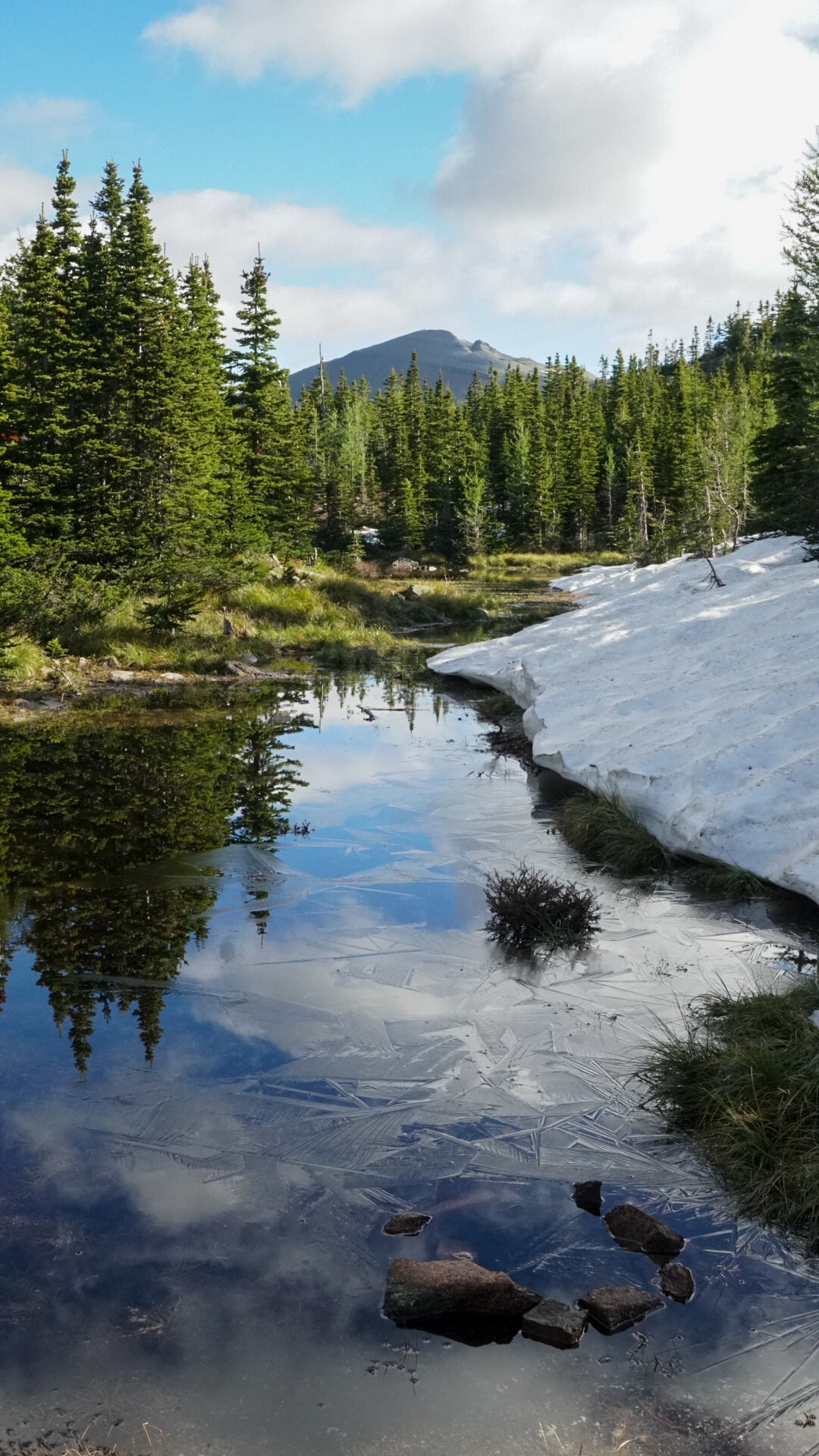
Continuing through the burn we made our way up into the mountains via switchbacks. It was not until sometime when we reached an intact forest where the temperature dropped and water ran. It was nearly at this point when the snow appeared as well, first in patches then gaining continuity as we climbed. With no trail we frequently checked the map and navigated with the geography of the land using the cirques and peaks as our guides. Jackie, the other GDT hiker, leap frogged our progress most of the day, her passing us as we took a break and vise versa. We walked past frozen lakes, over avalanche debris, even climbed up a cornice. It was not until we went over the pass that the snow disappeared for the day and all of the forest standing snags, burned away. The day treated us kindly, albeit challenging, and by the end of the long descent to Cameron Lake we were ready to cool off. We didn’t mind that there were chunks of ice floating not far from the dock, we jumped in then tanned ourselves dry. From here there were a couple kilometers between us and the campground, an easy go. Jackie made it to the lake and we all walked together. Along the way a lady was walking back to her car with a trophy of a rainbow trout covered in black spots, a dark green back and cheeks rosy as a woman’s blush. I think I may have put her off by my interest in her fish. I summed up the day nicely in my journal The alpine was magnificent, raw rock in the sky. We climbed over the saddle at Carthew Lakes and were greeted with gusts of warm wind and views more striking than before. Today was well earned, looking forward to tomorrow.
Notable Features: Avalanche path, cornice, cirques, fire scars, single point triangulation, rice and beans 10/10.
Day 3: Akimina Creek > South Kootenay Pass 13km
Another day where each climb was punctuated “should be easy from here”. Nope.
Up, up, and up is the best way to describe day 3. From morning to stopping most of our day was…up. I was unaware that the BC Alberta border had a cleared swath along it, but it does, at least at Akimina Creek. It is a long clear section of treeless boundary that climbs and climbs for 600 meters in just shy of 2 kilometers, a average slope of 30° and average is just what it was, because some areas I could place my hiking poles at a 90° angle and each one would be touching the ground! It was a slow start to the day.

This was all along the Sage-Rowe alternate trail. We chose to take this route over the standard route due to snow on the north aspects that shadowed the standard route. Sage-Rowe alternate, high above, faces south. We plodded along several kilometers, side hilling through archaic boulder fields where we scrambled up, over, down and in between under the midday sun. This is the last place we conversed with Jackie for the day, once again leap frogging. The terrain softened briefly, until we reached Festubert Mountain (2,500m), where crawling on all fours through loose shale and completing some “Moderate Scrambling” led us to the summit. not far behind, a brewing thunder storm. Looking back about halfway up the peak, clouds were dark and building. Little time was between us and the storm, spurring us forward. We pushed on as quickly as the terrain would allow, slipping down snow fields and stumbling on downed trees. Four kilometers later we arrived at South Kootenay Pass, the lighting was flashing above us. We pitched the tent and sheltered. The storm was on us. Rain pelted the tent with such ferocity that no individual drops could be heard, a noise more similar to a crashing wave than a drop. We lay there listening, the tent bent down and tickled our noses, bring the crashing waves closer to our ears. The storm carried on for hours while we lay there, eventually setting up our sleeping bags and retiring the day, 5 kilometers short of our intended goal. Distance to make up tomorrow.
Notable Features: regular route impassable, thunder storm, big hills, scrambling.
June 29 – South Kootenay Pass > Scarpe Pass 22km

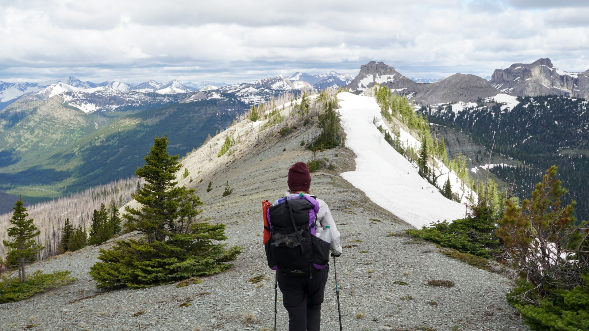
The days do not let up, in lieu of significant elevation, we traveled on snow a majority of the day.
Because we had retired to bed early the night before, our day began at 5am. The wind had not calmed. Kishinena Peak was our first objective to cross. We leaned into the upslope winds as they threatened to topple us. It was among the trees that we found Jackie’s footprints meandering along, they looked old. She must’ve passed us while we tented last night.
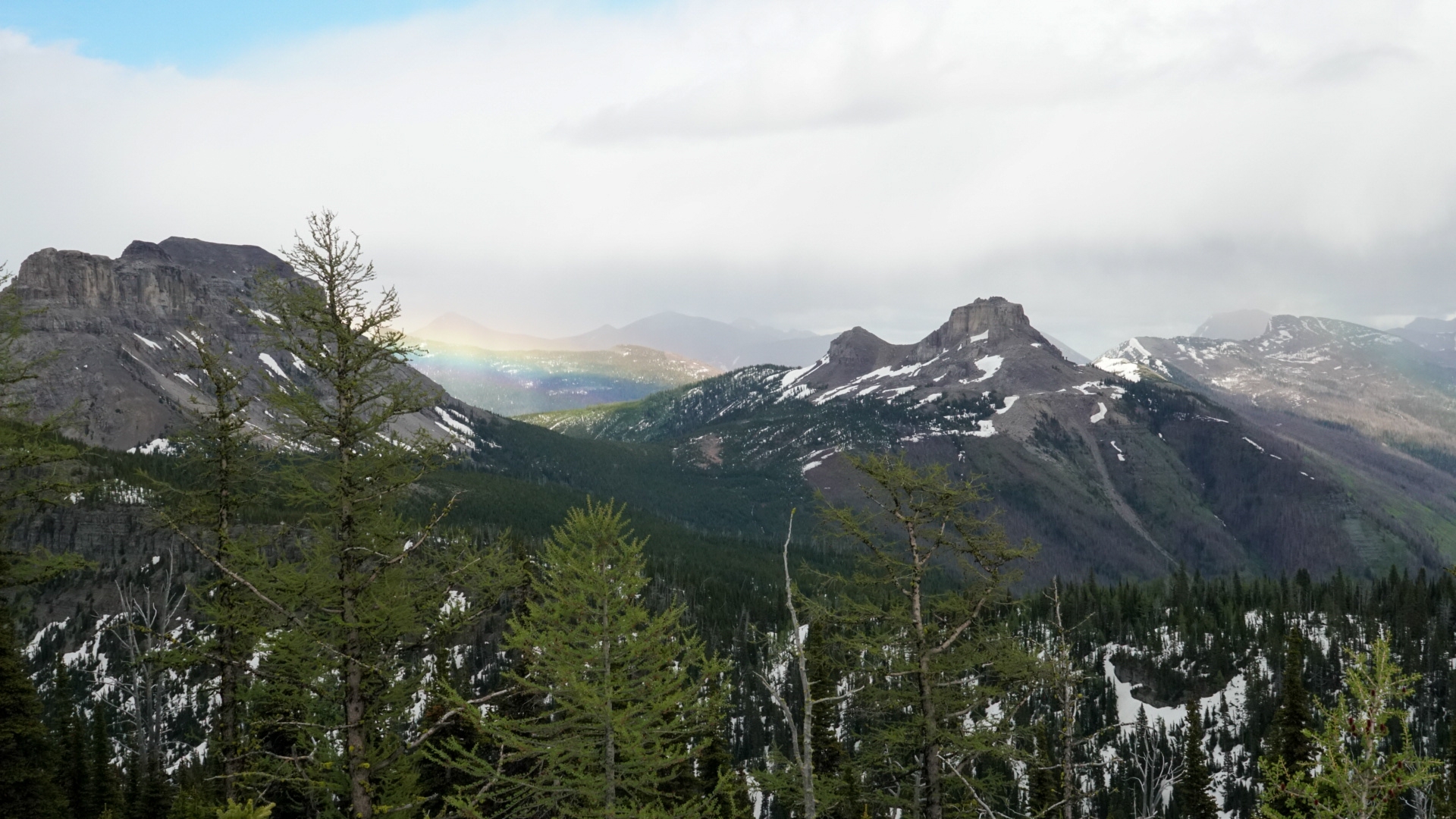
For hours the wind tore at us, we bundled in our clothes with no shelter or time to spare. It wasn’t until Font mountain where we dropped into the valley that the wind relinquished it’s punishing gales. A relief of calm. On our descent into the valley we came across fresh tracks, as we neared it was apparent that a bear had been near, the snow was melting too quickly for these to be old. Shouting we alerted the creature of our presence and entered the forest. Trusting our compass bearing, we eventually found the trail wrapping around the slope and continued down. At the bottom was Jackie, napping under a tree. There was our first sign of a GDT blaze next to her. We walked together for a while, into the next valley where we eventually lost her and returned to our map and compass. Upon the next ridge we saw what we thought was La Coulette, the notoriously difficult summit. That’s the way to go. Another storm pelted the ridge as we neared La Coulette, with no real trail on the ridge and a trail that dropped below on the map, we went down several meters. “Look, I think that’s a trail” yelling to Solange over the wind. She nodded. And we went. There was no trail. We were caught on the side of a mountain in sideways rain wondering where the fuck our trail was. Cold and wanting to make up time for yesterday, we decided to open the GPS. La Coulette, was not THE La Coulette, and we were on the wrong mountain. Just because there is a big mountain in front of you, doesn’t mean you are climbing it.
Return we did, back onto the ridge and and snow. It was here that Solange sank hip deep into the snow, but her foot was stuck on a buried tree. Eventually removing her foot without a shoe, I dug into the snow and under the tree to extract the lost footwear, pulling it from the subterranean layer, I retrieved a shoe resembling a snowcone. Stuffed with snow.
The day turned out to be a 6:30 to 6:30 hike, all in snow. We arrived in camp exhausted, cold and wet. Jackie sat on a log eating dinner, welcoming us to camp. After a day like this, we were ready to be off the snow and on the trail.
Notable Features: Solange lost a shoe, bad compass reading, tons of snow.
June 30 Scarpe Pass > Castle Mountain Ski Resort. 25km
I could say with all honesty, that each day has been more challenging and interesting than the previous. What we were told was the hardest day on the trail sits behind us.
The real La Coulette peak was on the tick list today, not Jutland Mountain as we had attempted. Jackie made it out of camp earlier than us and we wouldn’t cross paths until the summit.
The night was frigid, I shivered in my sleeping bag and slept poorly. We awoke to ice on the tent and over our water source, a small pond. It was hard to move fast when all I wanted to do was be warm again. Breakfast and packing came around slowly.
Another day of climbing up, there is no shortage of climbing up hills in the Canadian Rockies. Up to La Coulette ridge we climbed, where another peak on the ridge waited for us. Climb, climb, climb. La Coulette was huge, but it wasn’t that the mountain itself was challenging, it was the entire ridge which proved difficult.
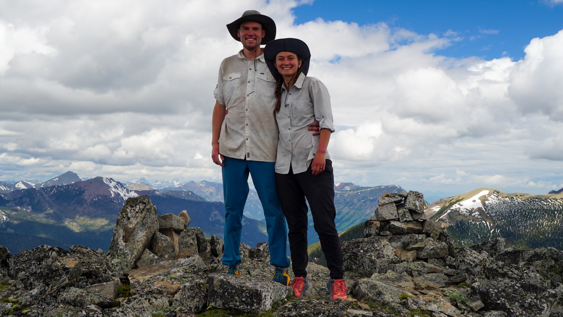
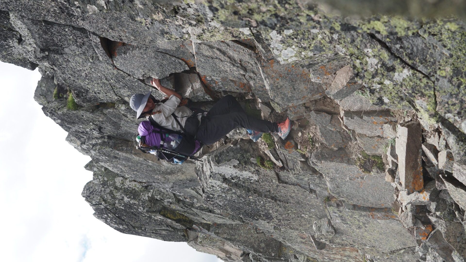
11:40 AM and we stepped onto base of the peak, there was no way but, you guessed it, up. Slow and slower I led the way, following game trails on the side of the peak, no trail too steep in grade. One trail connected to the next as I walked at a meditative pace, ensuring to walk slow enough to only breath from my nose. The trails went up and so did we, eventually bypassing the summit and reaching the other side. This was not our goal. We faced the peak, now within a short distance and shimmied up. 12:40 PM atop the peak that was regarded as the pièce de résistance of the entire trail. It felt good, really damn good. All around, 360° views, of glacier carved valleys and astonishing peaks. We spent some time up there, catching our wind, enjoying a celebratory Snickers and analyzing the route down. Neither way looked safe, steep corniced cliffs marred our routes. We decided to blaze our own trail, down the first part of Barnaby ridge then duck into the bush where it would connect with an old road and from there we would link up with the trail, effectively reducing the exposure and risk.
The descent to Barnaby Ridge was not straightforward, steep to cliff like bands of rock needed to be descended before we could “hike” again. Tricky, tricky this was as the exposure on either side was pushing the boundary for a “hike”. Jackie went right, I went straight, we both managed fine. Then came Solange, following Jackie’s route she held the rock, moving her feet with precision to gather good footing. Nearly there, one more hold, then the crashing happened. A boulder the size of our packs came loose as she was climbing down, rock against rock sound carved out the air waves. The boulder tumbled down the hill. Solange did not. By whatever grace or miracle she held on and avoided being smashed with the rock although it was not without consequence. Shaking, she came over to us holding her hand. Her left pointer finger and knuckle were already swelling and blue. Shit. The rock had rolled over her hand and crushed her finger. She couldn’t move it. There was nothing to do but continue down somewhere safer. A bit more sliding and route finding we arrived where no more exposure was below us and analyzed her finger. No Bueno. More swollen, less movement. She popped an Ibuprofen and grabbed a handful of snow to reduce the swelling, we still had to get off the mountain.
The next couple hours were spent sliding down snow, kicking steps, and dodging trees. Eventually landing us on the edge of a large old growth forest, we sat down and reassessed her hand. No movement from the finger. After some brainstorming, Jackie suggested using a tent stake as a splint. Fantastic! We did just that. From then on she had the use of 1.25 hands.
The old growth forest was slow going, deep gullies ran with snowmelt, downed trees created obstacles and bridges, thickets of bushes pulled at our passing feet. The forest felt good, it felt alive, succession was all around us. Life was abundant for both flora and fauna, although the trail is not designated through the forest, I would suggest it for any person who needs a forest fix after copious time in fire scars and alpine environments. The alternate we named “Barnaby Bushwhack”, a six hour approach to connect a peak to the standard trail.

The day was late, 6 PM and we still needed to walk 12 kilometers. Luckily, we found the trail, the first section of the hike that a trail was physically present for a long distance. Phew. We turned on the jets and cooked down that trail, singing, hollering and hooting as we made headway into civilization. At 8:30 we arrived, joyous to see a place to camp. We set up camp, cooked our meals and went to bed. Another day of hiking tomorrow.
Notable Features: summited La Coulette, Solange vs. Rock, descending La Coulette, bushwhack, trail, moose pee?
July 1st and 2nd: Castle Mountain Ski Resort > Lynx Creek 25km. Lynx Creek > Coleman 25km.

The two days following our alpine escapades were tame as teddy bear. We followed 50km of atv trails into town over two days. The road walking is pretty tough on the body, shins began to hurt and Solange’s left calf became extremely tight, perhaps having to do with her change in gait from her finger. The afternoon of July 1, I had gastrointestinal issues and every 45 minutes needed to jump off trail into the woods. Fortunately, it was only for an afternoon, nonetheless, not a great experience.
We made it to town, limping in, tired and sore. Solange went to the hospital while I made dinner arrangements (18″ pizza and beer). Turns out she fractured her finger, probably the best result from the circumstance. The doctor recommended buddy taping her broken finger to her adjacent one until it heals. She will continue the hike!
Section B, Coleman to Peter Loughheed Provincial Park. Up next.

This website contains affiliate links, which means The Trek may receive a percentage of any product or service you purchase using the links in the articles or advertisements. The buyer pays the same price as they would otherwise, and your purchase helps to support The Trek's ongoing goal to serve you quality backpacking advice and information. Thanks for your support!
To learn more, please visit the About This Site page.
