 ">
">
The Pyrenean Haute Route: 460 Miles of Premier Trekking in France and Spain
The Pyrenean Haute Route (HRP*), is a 465-mile trek from Hendaye on the Atlantic to Banyuls-sur-Mer on the Mediterranean. It’s probably the best thru-hike I’ve ever done.
On the HRP, the challenge of hiking in an unfamiliar cultural and linguistic setting made thru-hiking feel fresh and exciting again.
While you can also traverse the Pyrenees on the GR10 trail in France and the GR11 in Spain, the HRP is the only route that follows the spine of the range as closely as possible from one end to the other via an elaborate network of roads, trails, and — sometimes — no trail at all.
Here’s everything you need to know about how to hike the HRP/Pyrenean Haute Route.
*In case you were wondering, HRP stands for Haute Randonnée Pyrénéenne, which is the French name for the trail; most people refer to the trail as the HRP, so I’m sticking with that abbreviation.

How To Hike the HRP: Quick Navigation
At a Glance
Getting to the Trailhead
Best Direction To Hike the HRP
Navigation
How Hard Is the HRP?
Why Hike the HRP?
Highlights
Climate and Weather
Camping
Gear Suggestions
Considerations for Non-Europeans
Water Sources
Resupply
Closing Thoughts
Pyrenean Haute Route At a Glance

Length: 465 mi
Expected Completion Time: 5 – 7 weeks
Elevation Gain / Loss: +167,946 ft / -167,946 ft
Start / End: Hendaye, France / Banyuls-sur-Mer, France
Difficulty: Hard
Best season to hike: July – September
Scenery:
Trail type: End-to-end thru-hike
Location: Following the French/Spanish border from the Atlantic to the Mediterranean (briefly passing through Andorra along the way)
Maps and Guidebook:
- West to East guidebook: The Pyrenean Haute Route by Tom Martens (Cicerone guide; available as hard copy and ebook, also comes with GPX points that can be loaded into your own GPS navigation app)
- East to West guidebook (French language only): Trans’Pyr by Jerome Bonneaux
- West to East and East to West: Paul Atkinson’s free and printable Pocket HRP guide (also comes with GPX points)
- Maps: I recommend making and printing your own from Caltopo
Getting There

We spent two nights in Hendaye before starting the HRP.
I flew into Barcelona, caught a connection to San Sebastian, and then took a taxi to Hendaye.
Most Americans fly into a major city like Madrid, Paris, or Barcelona, and then catch either a connecting flight down to Donostia-San Sebastian airport, which is about two miles from Hendaye. Within Europe, flying with a budget airline is faster and cheaper than taking a train or bus most of the time.
From Banyuls, you can easily catch a bus or train to Barcelona via Perpignan and fly out of the airport there.
READ NEXT – 11 Long Trails To Hike in Europe
Best Direction To Hike

The Mediterranean resort town of Banyuls-sur-Mer is a perfect place to cap off a grueling thru-hike
West to east is most common for several reasons.
First, it’s easier. Starting on the Atlantic provides a more gradual introduction to the route. You’ll still be climbing A LOT every day, but you won’t have to deal with truly gnarly terrain or sketchy high alpine conditions until after the first week.
In contrast, starting from the Mediterranean means you’d have to deal with hotter, dryer conditions right away, and by your fifth stage you’d be summiting the 2784-meter Pic du Canigou.
That also means hikers starting from the Med in early summer will encounter snow and ice early in the hike. By starting on the Atlantic, you’ll give the high country a little more time to thaw while you work your way through the Basque hills.
Starting at the Atlantic also sets you up for a more social experience. The HRP isn’t crowded in either direction, but you’ll have a much better chance of meeting and hiking with fellow HRPers heading eastbound.
Importantly, the Cicerone guidebook is written west-to-east. Trying to reverse engineer the author’s step-by-step directions would be a headache. Paul Atkinson’s HRP Pocket Guide is available in both directions, but the only full-on guidebook written for east-to-west hikers is Trans’Pyr by Jerome Bonneaux, and it’s only in French.
Finally, ending on the Mediterranean is romantic. To me, Banyuls definitely seemed like a more charming town than Hendaye and one that I was glad to spend a few days enjoying after the hike.
Navigation on the HRP

Here’s my recommended guidebook/map strategy, based on my experiences and what I saw others doing:
- Get the digital Cicerone guidebook on your phone
- Download GPX points into your GPS app of choice for daily navigation
- Gaia GPS with France IGN Topo and Spain IGN Topo as base layers
- HRP GPX points
- Many ways to source these, but you can get a set for free from Cicerone with your guidebook purchase
- Paul Atkinson’s HRP Pocket Guide also comes with GPX
- Also this extensive file of useful waypoints; includes several HRP variants
- GR10 and GR11 GPX points: optional but possibly helpful, as the HRP intersects/merges with them frequently
- Build and print maps from Caltopo
- Optional: print and carry HRP Pocket Guide
Roughly 80 percent of the HRP follows dirt roads and singletrack, while the remaining 20 percent is off trail and requires route finding skills.
Markings on the HRP are somewhat inconsistent. In general, it’s indicated by white-and-red markings, but so are all the GR trails in Europe, so be cautious any time you reach a trail junction to ensure you stay on the correct route. In Andorra, the HRP is sometimes marked in yellow.

A white-and-red blaze marking the path near L’Hospitalet-près-l’Andorre
When the route goes off-trail, there may only be cairns or no markings whatsoever. At these times, some wayfinding is necessary.
While a GPS app will make this easier, you still need map and compass skills. I knew one person who lost his phone and used map and compass to navigate the majority of the route.
Overall, navigating the HRP is not as difficult as (for instance) the Wind River High Route, but it still demands careful attention to your surroundings.
How hard is the HRP? How long does it take to thru-hike the HRP?

I found it physically challenging. There is a LOT of up and down on this trail, and the high passes are quite rugged and talus-strewn. The trail mostly follows reasonably graded dirt roads for the first week, luckily, but even these earliest stages still regularly feature 5000 feet of daily elevation gain.
I’m a pretty average hiker; on the AT and Colorado Trail, I was comfortable covering about 18-20 miles per day, while 20-25 miles was my sweet spot when I hiked in the PCT desert. I started the HRP in decent physical shape, but my body still felt happiest just sticking to roughly one guidebook stage per day (despite trying to move a lot faster than that at first).
The trail is broken down into 44 stages, so keeping a one-stage-per-day pace would have you completing the thru-hike in just over six weeks, or closer to seven if you take zero days.
It’s definitely possible to hike faster; for instance, Erin Saver of Walking With Wired did it in about five weeks, completing roughly 1.5 stages per day, and one particularly intense hiker I met was on track to complete in under three weeks.
Another data point for US hikers: I hiked the Adventure Alan version of the Wind River High Route one summer before the HRP; day for day, the Winds are definitely harder.
READ NEXT – HRP Chapter 1 (start of my daily HRP blog from last year)
Why Hike This Trail

In short: he combination of majestic scenery, cultural exchange, overall pleasant weather conditions, incredible food/drink/amenities, friendly trail community, and conspicuous lack of mosquitoes makes this easily one of the best hikes I’ve ever done.
In more detail:
1. It’s long enough to feel thru-hikey, but not so long that you have to blow up your entire life to complete it.
2. As an American, the HRP was a perfect and stimulating way to experience parts of France and Spain that are off the beaten tourist track. I loved experiencing the culture of this region and constantly discovering new vocabulary, foods, and the billions of quirks of daily life in Europe.
3. The hiking itself is deliciously varied: sometimes rugged, technical, and challenging, sometimes carefree and frolicky a la Sound of Music.
5. Dozens of nearby summits are accessible from the route, making it a peak bagger’s dream.

Prices at backcountry refuges, such as the Refuge de Bayssellance pictured here, are higher due to the difficulty of staffing and supplying them
6. The cost of living is lower than the US, so treating yourself to the occasional hotel room or meal out is more affordable than American hikers are used to — although restaurant and hotel bills will still add up over the course of a six week hike if you’re not careful.
Fortunately, wild camping is also possible throughout the trek. You can do this trip fairly inexpensively or splash out and make this the most glam thru-hike imaginable — your choice.
Highlights

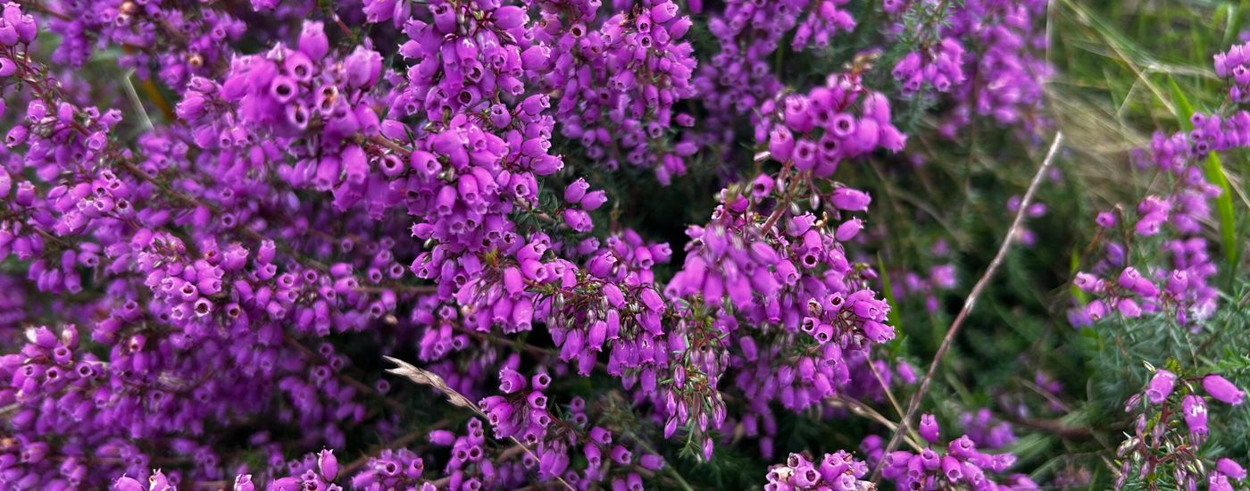
Basque country: The mountains aren’t as big and it rains a lot, so it gets a bad rap in HRP lore, but I loved the pastoral lushness of this area and its many picturesque villages. And the food is amazing. It’s one of the sections of the trail I would be most excited to revisit.
Col de Ronceveaux and Roncesvalles Monastery: The Col de Ronceveaux was the site of Charlemagne’s only military defeat in the 8th century, and the HRP goes straight through it. Nearby is Roncesvalles Monastery, parts of which date back as far as the 11th century (and which has several excellent hotels and restaurants on site).
The Camino Frances goes through the monastery. Intrepid HRPers can follow that storied trail a mile or so into the village to resupply at the grocery store if they wish.

Roncesvalles Monastery
Pyrenees National Park: What many would consider the crown jewel of a thru-hike that’s studded with so many scenic gems. The roughly 70 miles my partner and I spent within the borders of France’s Pyrenees National Park were some of the most magical of our six weeks on trail.
Highlights of the park include the charismatic Pic du Midi d’Ossau, thrilling traverses of the Passage d’Orteig and Port du Lavédan, and Vignemale, the tallest peak in the French Pyrenees.
Cirque de Gavarnie: This famous cirque is a tourist destination in itself, drawing large crowds of sightseers to the tiny town of Gavarnie tucked at the base of the 1500-meter-high limestone amphitheater. The cirque features one of the tallest waterfalls in Europe, the 422m Grande Cascade de Gavarnie.

The Cirque de Gavarnie
Pico Aneto: The tallest peak in the entire Pyrenees. It’s not directly on the route but can be summited as a side trip.
Andorra: What better way to experience this tiny, landlocked country than on foot? The Andorran Pyrenees are stark and beautiful contrast dramatically with the nation’s bustling cities.
Stage 38: I fully expected the HRP to be getting dull and civilized by Stage 38. Instead, ascending scenic Vallée d’Eyne and then tracing the ridge to Refui d’Ull de Ter was one of the most epic days of the whole hike.
Pic du Canigou: One of the few proper summits that lie directly on the HRP. From the top of Canigou, you’ll get your first view of the Mediterranean on the horizon.
Banyuls-sur-Mer: What better way to end a grueling thru-hike than by kicking back in a Mediterranean seaside resort town? Banyuls was incredible when we arrived in early September: the tourists were gone, but the days remained long and sunny and the water was perfect.
Climate and Weather

Conditions on this trail can swing from nearly 100 degrees Fahrenheit to windy and just above freezing over the course of a single week
Basque country is green, lush, and very, very damp. Rain and fog are common in this region, and it’s not unusual for a hiker to traverse the whole of Basque country wreathed in featureless grey fog.
Things change once you reach the core of the range — roughly from Lescun (Stage 9) onward.
From here on, you’re dealing with big mountains, and they behave as most big mountains do. The French side is dramatically cooler and wettter than the Spanish side. Passes are likely to be snowbound through the end of June, and snow can linger in some areas until late summer. The weather is unpredictable and temperamental, and afternoon thunderstorms are common (though perhaps not so common as in the Rockies).
At the same time, plan for the possibility of intense heat in the summer months. Extreme heatwaves are growing increasingly common in Spain, and even the Pyrenees are not immune; I saw temperatures as high as 99˚F in August.
As you approach the Mediterranean, the trail will grow hotter and dryer, with less tree cover and more scrubby chaparral. Even so, we had decent tree cover almost until the final stage of the hike and never faced issues with water scarcity.
Camping

Camping is a source of anxiety for many non-Europeans planning the HRP. The rules on what is and is not allowed aren’t really clear and there’s a lot of conflicting information online.
My short answer is that, yes, it is possible to wild camp virtually every night on this trail. My hiking partner and I camped almost every night and rarely had trouble finding a suitable site at quitting time.
According to Tom Martens in the Cicerone guidebook, bivouacking is allowed in France as long as you’re at least an hour’s walk from any road, and in designated areas within the national park between 7 p.m. and 9 a.m.
Technically it isn’t legal in Spain, but bivouacking is generally tolerated as long as you’re not obnoxious about it. If you set up far from any roads and don’t stay more than one night, you should be fine.

Hikers can stay for free at unmanned backcountry cabins like the Refugi Enric Pujol pictured here
The trail is also replete with unmanned cabins that are available for any hiker to use, as well as manned refuges where you can pay to stay or, usually, camp for free in a designated area near the building.
Finally, you can often find paid campgrounds in or near town. In my experience, they were often as nice or nicer than staying in a hotel or gîte in town.
Gear Suggestions

In general, pack as you would for the Colorado Trail or the High Sierra.
Warm sleeping bag: Plan for occasional freezing nights, even in summer. I had a 20-degree bag and a liner; paired with a Therm-a-Rest NeoAir Xtherm and wool base layers, I stayed warm every night.
Good rain gear: It rains a lot in Basque country. Further inland, we still encountered rain and occasional snow. I used Montbell Tachyon wind pants and the Lightheart Gear rain jacket.
Tent: Trekking pole and freestanding tents are both fine; I carried the Zpacks Duplex.

Traction: I started the trail in mid July after a drought winter and didn’t need traction. If you plan to start before mid-July, especially in a snowier year, you may want spikes. If you plan to tackle any side summits, like Vignemale, you can often rent crampons and ice axes from nearby refuges (but you may need to be a guest to utilize this service).
Threaded stove: Just bring whatever stove you normally use; it will be fine. Despite reports that threaded fuel canisters compatible with US stoves are hard to find in the Pyrenees, I never had trouble finding one.
Click-on canisters are common throughout Europe, so confirm that you’ve got a threaded canister before buying.
Wall plug adapter: If you’re coming from outside the EU, get some adapters for your wall plugs. I like this kind.
Map and compass: I primarily navigated with the guidebook and Gaia GPS, but this is still a high route where navigation isn’t always a given.

Reliable water filter: The Pyrenees are full of livestock. Other than springs, I filtered all my water.
Sun protection: Much of the HRP is exposed, and the Spanish side is notoriously sunny. Sunscreen, sunglasses, and a hat are essential.
Considerations for Non-Europeans

Phone plan: I used the Orange Holiday eSIM. I liked it, but next time I want to try a data-only plan from a company like Airalo or Holafly. Between WhatsApp, social media, and wifi calling, I was able to keep in touch with people back home easily without incurring international roaming charges.
Travel/medical insurance: I used World Nomads, which many US thru-hikers are already very familiar with. Buy your policy soon after making travel arrangements to get the most out of your policy. If you wait too long to buy insurance, you’ll miss out on certain benefits like trip delay/cancellation coverage.
Wallet: Obviously you’ll need to carry your passport. Bring multiple credit/debit cards. You’ll need a way to withdraw cash as not all businesses accept cards. Optional: reloadable prepaid cards from Revolut and Wise offer favorable currency exchange rates and even enable you to withdraw about $200 USD per month at ATMs without fees.
Language: Google Translate is a lifesaver on the HRP. Make sure you download French, Spanish, Basque, and Catalan for offline use. Brush up on the basics of French and/or Spanish before your trip. I was surprised by how much English was spoken along the HRP, but my high school Spanish still came in handy.
Metric conversion app: I found it helpful to keep an app on my phone for converting meters, kilometers, and degrees Celcius into familiar units.
PyreneanHauteRoute Facebook group: This is a great forum to ask questions about the route and get feedback about conditions on the ground. The group is moderated by Tom Martens, who literally wrote the book on the HRP.
Jetlag: It’s a thing. Give yourself a day or two in Europe before hitting the trail, and start slow so your body has a chance to adjust.
Water Sources
Water is abundant on this trail. The French side is much wetter and lusher than the Spanish side, but even in Spain we never went more than 10 miles without encountering water and never carried more than two liters at a time.
Do carry a reliable water filter, as livestock are abundant throughout the range and sources could be potentially contaminated. (That being said, this isn’t the Arizona Trail; livestock or no, I don’t remember ever having to collect water from a source that I considered truly disgusting. So that’s a win.)

A sheep goes window shopping in Candanchu, Spain
Resupply
Large food stores are not really a thing anywhere in the Pyrenees, so you may have to get creative with your resupplies. Don’t plan to rely on US hiker staples like instant potatoes, ramen, Carnation breakfast smoothies, and Nutella.
Baguettes, cheese, cured meat, nuts, dried fruit, couscous, lentils, canned fish, pasta, oatmeal, and chocolate are staples in the average HRPer’s food bag. I temporarily gave up vegetarianism on the HRP, but it’s certainly possible to do the hike without eating meat.

Charming Larrau, France is on the GR10, not the HRP, but still reachable for HRPers via hitchhiking
Resupply is possible roughly every one to three days, not counting the many refuges and inns where you can often stop for a hot meal. My longest food carry was five days between Candanchu and Gavarnie.
Here is a complete list of all the towns in which I resupplied on the HRP and how I got to them:
- Hendaye (flew to San Sebastian, taxi; trail leaves direclty from town)
- Aldudes (walked in)
- Burguete/Roncesvalles (walked in)
- Larrau (hitched)
- Lescun (we hitched, but its also accessible on foot)
- Candanchu (hitched, then caught a bus to Canfranc for more options)
- Gavarnie (walked in)
- Parzan (walked in)
- Benasque (hitched)
- Salardú (taxi, caught a bus to Vielha for more options)
- La Massana (hitched from Arinsal ski resort; there’s also a bus)
- L’Hospitalet-près-l’Andorre (walked in)
- Arles-sur-Tech (walked in)
- Le Perthus (walked in)
- Banyuls (walked in; end of the line)
Getting to Town
The route often goes right through town, but hitchhiking is also ridiculously easy throughout most of the HRP. Parzan was the only town where we failed to catch a ride. Fortunately, it’s not too long of a road walk.
The towns and resorts nearest the trail sometimes have limited amenities. Don’t be afraid to look further afield if you’re in need of a larger grocery store, outfitter, etc. For instance, from Candanchu we caught a bus down to Canfranc, and we did the same from Salardu to Vielha and from El Serrat to La Massana. Local bus systems are generally inexpensive and easy to navigate.
Mail Drops
I don’t know anyone who sent mail drops on this trail, but it would theoretically be possible to put together and mail some boxes when you arrive in Hendaye.
I never attempted this myself and encourage you to fact-check me on how it works. But I believe general delivery is available in both France and Spain.
In France, boxes shoud be addressed to
Your Name
Poste Restante
Full address of post office
Writing Poste restante on line 2 is what indicates that the package is for general delivery. You’ll be charged an extra fee for this service and your box will be held at the post office for 15 days.
In Spain, there’s apparently no charge for general delivery. The address is structured similarly, but write Lista de Correos on line 2 instead of Poste Restante:
Your name
Lista de Correos
Full address of post office
Closing Thoughts

The HRP is awesome. Go hike it.
READ NEXT – How To Hike the GR5: A 400-Mile Thru-Hike of the French Alps
Featured image: Graphic design by Zack Goldmann.

This website contains affiliate links, which means The Trek may receive a percentage of any product or service you purchase using the links in the articles or advertisements. The buyer pays the same price as they would otherwise, and your purchase helps to support The Trek's ongoing goal to serve you quality backpacking advice and information. Thanks for your support!
To learn more, please visit the About This Site page.

Comments 3
Doing the HRP July 2024, and until then absorbing everything I can lay my hands on. Your punchline “The HRP is awesome. Go hike it.” is what I will carry with me 🙂
Now to day dream about the HRP… great helpful write up. So thorough and organized. Thank you. One point of curiosity/contention- is 18-20 daily AT/CT miles really “average”. Seems a touch fast and could mislead newbs in my opinion.
I walked the HRP in August/September of 2023, and it’s just as great as Kelly says it is. I did the trail from west to east (Hendaye to Banyuls-sur-Mere), and would recommend going that direction. Basically, the further east I got, the better I liked the route. A few observations:
I thought screw-on gas canisters were more common than the click-on version. I saw the screw-on models for sale in a couple of refuges.
Daytime temperatures in September were great for hiking, but nights went below freezing on a pretty regular basis. No big deal, but be ready for this.
Printing maps from CalTopo and having the CalTopo app on my phone worked extremely well. I put my route on the CalTopo app, and it worked so well I tossed my paper maps. Parts of the first few days were a maze of user trails created by shepherds, farmers, mountain bikers, etc., and it was a big help to have a track to follow.
Refuges can get incredibly crowded at the height of summer, plan on booking ahead. Having a shower and dinner in the refuge and camping outside in the bivouac area gave me the best of both worlds.
In September, a lot of campgrounds, refuges, hotels and even supermarkets will close up for the shoulder season between summer and ski season. Some refuges will only operate on weekends in the fall.