 ">
">
My Journey On The PCT In 2023: A Recap and Update

campo, ca
It’s been nearly two months since I completed my hike on the Pacific Crest Trail. In this post, I want to take a less conventional approach and share my thoughts and experiences from this unique journey in 2023 and talk about where I’ve been and what happened.
Unprecedented Challenges on the Pacific Crest Trail

This year was unlike any other for thru-hikers, presenting a host of new and challenging obstacles. From heavy snow to trail closures and the typical trials and tribulations of a thru-hike, we had to be as resilient and open-minded as possible. Achieving a “pure” PCT hike seemed almost impossible, given the countless times the trail disappeared under blankets of snow, leaving us to navigate by speculation, guesswork, and the company of fellow hikers, all while making the best of the situation. The journey started off well enough, but the further north we ventured, the more curveballs nature threw our way.

kennedy meadows south, ca
When I initially embarked on the PCT in Southern California, I was uncertain about how far I would get and whether I had another full thru-hike in me. The unpredictability of the snow conditions left everyone, including me, in uncharted territory. My plan began to shift after I encountered early snow in the San Jacinto range, leading to some of the most challenging hiking days I’ve ever experienced. Navigating through the snow was slow and frustrating, and I found myself unable to enjoy camping in icy conditions. It was at this point that I made a pivotal decision: if I wanted to maximize my enjoyment on the PCT, I needed to make some changes. Snow just wasn’t my thing. So, I continued until Kennedy Meadows South, having covered 700 miles, and decided to skip the Sierra, travel to Chester, California, and resume my northbound journey, all while keeping my options open regarding reaching the border.
Adapting to Unpredictable Snow Conditions

grizzly peak, ca
Just when it seemed I had dodged the bullet of the record snowpack, reality set in once more. Snow was omnipresent, even in NorCal, and I faced some harrowing days, notably the infamous Grizzly Peak experience. Opting for the proposed alternate route, I found myself navigating a relentless manzanita bushwhack, navigating dangerous cornices, and struggling through slushy snow on a seemingly endless day.
Battling Mosquitoes and Pushing Through Oregon

the face of a defeated man
I eventually bid farewell to snow somewhere in Southern Oregon, but new challenges were quick to emerge. Relentless mosquitoes invaded my life. While Oregon’s beauty was undeniable, it disappeared in a blink of an eye because stopping at the picturesque lakes was not an option; you’d be devoured alive. DEET and picaridin were no match for these formidable foes. Each morning became a battle to exit my tent with minimal blood loss, and the constant buzzing drove me to the brink. I recall a friend asking what horrific thing had happened to my legs, which were covered in mosquito bites. It was brutal.

the one time I won.
As one can only endure so much, I reached my breaking point near Chemult, Oregon. I was exhausted, frustrated, and more agitated than ever before on the PCT. There were moments when I seriously contemplated quitting. However, I reminded myself that this was temporary, albeit excruciatingly challenging. With that in mind, I pushed forward.

not so “budget” inn
I kept hiking until I neared a road, where I waited for a hitch for about two hours. My destination was Chemult, a town about half an hour off the trail, nothing more than a truck stop and a motel at the end of the road. Determined to escape the mosquito-infested nightmare, I persisted and eventually secured a ride. I ended up overpaying for a motel that could have been straight out of a Kerouac novel, complete with a cheetah print shower curtain, wood paneling, a moth infestation, and the ambiance of a pilot truck stop. But I was content. Sometimes, all you need is a break to refresh yourself and remind yourself that everything will eventually be okay. I took two days off and then continued north.

near three sisters wilderness
The mosquitos got better as did the views. Although there are plentiful burn zones in Oregon, areas such as Mt. Hood and the Three Sisters make up for it. Oregon ended with what I like to call the “influencer’s alternate” which starts right before the Bridge of the Gods on the border of Washington. The Eagle Creek alternate was a refreshing end to the state and had plenty of views, and people as well… But then came Washington.

eagle creek alternate, OR
The Beauty and Challenges of Washington
Washington not only brought upon a new challenge, but also grandeur like I hadn’t seen before. Everything felt more prominent, more green, and honestly reminded me a bit of home. The granite, rocky, and slightly more technical climbs were tough but also some of the most enjoyable sections of trail. Most notably the Goat Rocks.

goat rocks, WA
Goat Rocks reinvigorated my hike. It made me feel like what I was doing was something that was truly special. Being on the knifes edge, I was all alone and in the midst of a storm. It was drizzling but had just started to clear. I was all alone, on this crazy mountain, walking, doing something for myself not because I had to or because I should, but rather I could. I’m sure the guy who had first hiked the trail felt something similar. I mean, you have to be pretty crazy to go up there, let alone be the first. I had a newfound motivation to keep going. Washington kept getting better and better and here was never a dull moment.
The more I hiked, the more my plan changed again. My new plan was to reach the border and hike 2000mi on the year and that would satisfy me. Seemed doable, right? I had made it 1600+ mi to get here, what was stopping me? Everything was good until it wasn’t. Remember those curveballs?
A Change in Plans: Navigating Trail Closures

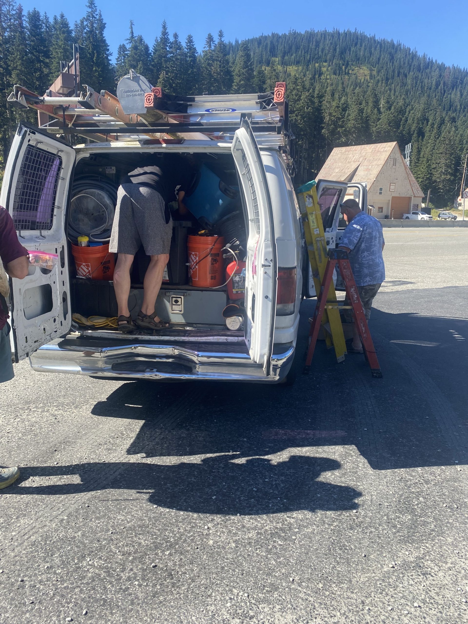
Upon reaching Stevens’ Pass, the few people I had been hiking with had planned to take one final zero in the town of Wenatchee. One last time to relax and soak it all in and prepare boxes for Stehekin. Getting to town was another hard hitch, but also one of my most memorable. Myself and two others crammed into the back of a white van, loaded with electrical cables and reeking of gasoline. We were sweating profusely but laughing at the whole situation. One friend of mine was sweating so bad, he looked like frosty on the first day of spring, melting. The driver at multiple points even asked us “anyone pass out yet?”. It was all so surreal. Dodging in and out of traffic we zipped our way into Leavenworth and decided we would get in a different death trap to get to our destination.
Everything was going great, we got a cheap hotel with three beds and decided to settle in for the night and keep our chores for tomorrow. That next morning, I set out to WinCo to prepare and ship my boxes. I loaded up on candy and had planned 5 days from Leavenworth to Stehekin and 5 days from Stehekin to the border. Upon mailing my boxes of food at the post office I headed back and was greeted with unfortunate news on Instagram. The PCT were to be closed south of the border and it was undetermined what sections would be closed and for how long. I slept on it and we all were unsure what to do.
The plan then became to hike to Stehekin and see how the fires were when we got there. But once again, as I headed back to trail and was hanging out in Leavenworth, there was another trail closure south of Stehekin, making my plans even more complicated. It seemed like the fires were just getting worse overnight and hiking through smoke wouldn’t seem ideal. Everyone was scrambling to make up a plan, lots chose to go directly to Harts Pass but for me, I didn’t have any emotional attachment and wouldn’t feel a sense of finality if I couldn’t hike there, north on the PCT. I would’ve been risking an unsafe situation and for what?
The detour that was posted sounded like more of a headache than anything. It was 80mi to reach another town and then to hike on an unmaintained trail. Logistically, it wasn’t worth it and honestly I was pretty checked out. If I were to reach the border, what would it mean to me symbolically? I had already skipped 600mi, I’d be risking an unsafe scenario, and it would just be to say I did it and to get a photo. All of which didn’t really matter to me. This next section was supposedly really beautiful and I didn’t want to miss out on something just to say I did it.
The Decision To End My PCT Hike: A Reflection

So, after lots of thinking, I took my out. I called it. I decided to head home and end my hike on the PCT. It wasn’t easy but it just seemed like the right thing to do in the moment. I know I’ll probably always think back on it as a “what if” type scenario and if I were to continue hiking but you can’t think like that. It was my time, and that’s okay. In 2023, I ended up hiking 1836 out of 2650mi on the PCT and got my fill. Although I’m upset with how it ended, I’m appreciative of being able to spend as much time as I did out there.
To everyone I met, spent time with, I appreciate you and am grateful for the time I got to spend on the PCT this year. It may not have ended in ideal circumstances and this year was weird as is, but thank you to everyone who supported me. Love y’all

This website contains affiliate links, which means The Trek may receive a percentage of any product or service you purchase using the links in the articles or advertisements. The buyer pays the same price as they would otherwise, and your purchase helps to support The Trek's ongoing goal to serve you quality backpacking advice and information. Thanks for your support!
To learn more, please visit the About This Site page.

Comments 1
Great write up juice!!