 ">
">
The Struggle is Real
“Is this really such a struggle?”

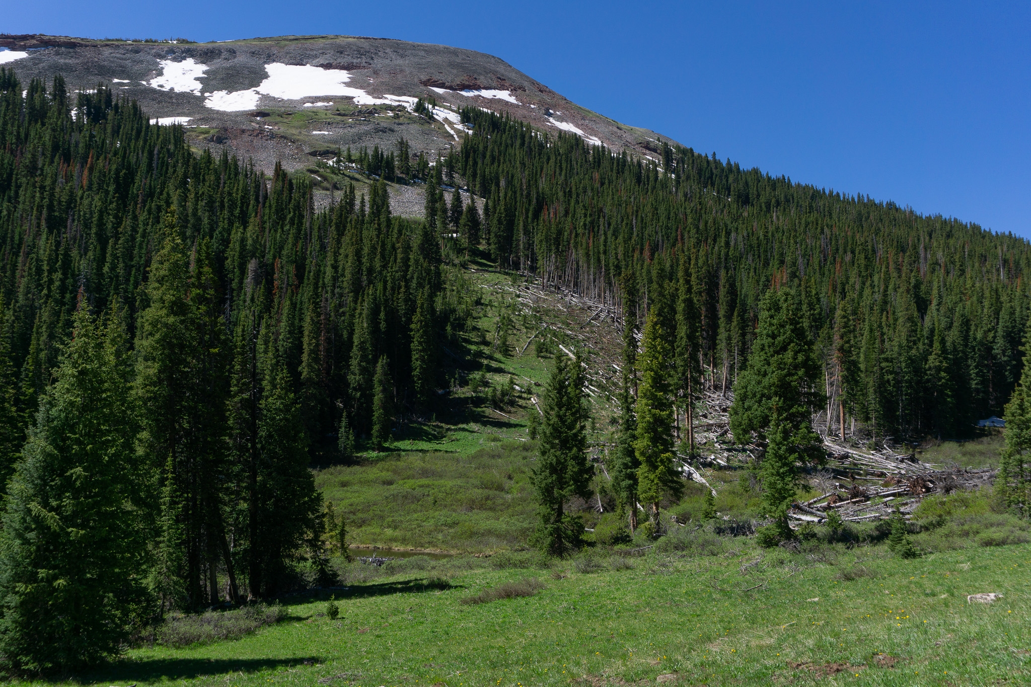
Coniferous forest on the slopes of Copper Mtn. Resort
…I wondered as I hiked the next morning out of Copper Mountain. There was still frost on the ground, glittering like a thousand little snowflakes under each step, but I was warm and excited as I raced up the valley towards the mountains. Each bend in the trail held a new scene, a new wonder, be it marmots, avalanche scars, big trees, the mountains above… and oh the wildflowers. Up to this point, they had been sparse and merely budding, but for some reason, in this protected valley, there were many blooming, all raising a song in celebration of the sun. My breath created cloudlike patterns in the mountain air ahead of me as I climbed up the valley, my cheeks flushed and my eyes alight with interest. If you couldn’t tell by now, I was happy this morning 🙂

The passage above is almost a direct quote from my journal entry that day.
In this magical valley, day 9, I felt joy… not just the shallow, fleeting happiness I’d felt in isolated moments during the last 125 miles, but actual joy, deep and lasting. I didn’t and don’t know where it came from, especially after such a tough day yesterday. But, for whatever reason, I was excited for what was to come.
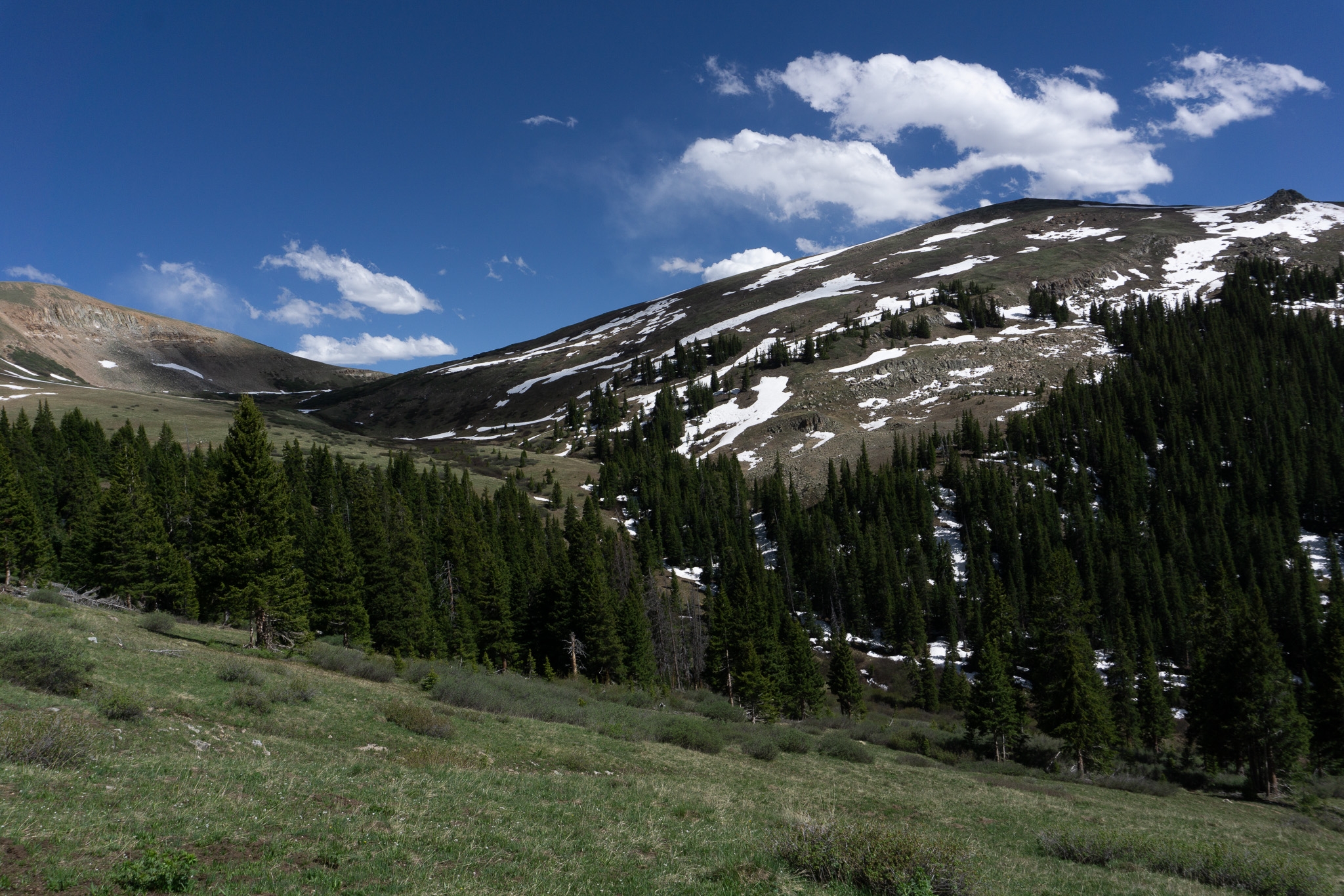
One of several avy scars coming down off of Jacque Peak
As I hiked ever higher, the landscape changed from spruce and fir coniferous forest to open glades, the creek carving a floodplain perfect for breakfast. Oatmeal and almond butter with cinnamon next to the brook was like meditation. Climb, stop to take a picture, climb some more while singing to music in my head, stop to take in the view, climb, rest on a pretty rock, etc.
The morning went quickly, and before I knew it I was at snow line lying on a rock sunbathing.
Ok, this is kinda a bit hard…

Snowier terrain ahead!
Eventually, Phoenix caught up and we trudged up into a winter wonderland together. The meadow changed on a dime– within a quarter mile, the trail went from sunny, wildflower-y summer to blowing, windy, cold snow. There were patches where the alpine plants stubbornly poked out through the snow, but for the most part, the snowbanks were long and unending. But the landscape was still insane. We passed the 10th Mtn Division hut, looking cozy and inviting below the pass. And suddenly, we were there… about 60 vertical feet below where we needed to be, Searle Pass.

A massive, and nearly vertical, snowfield
Looking up at the steeeeep and long snowfield, I realized what I’d forgotten… sunglasses! And sunscreen too! I donned protection, hoping the damage wouldn’t be too bad. Some CDT hikers, among the first I’d seen up to this point, came sliding down on the edge of the field.
“Is that YOU???” they yelled down as we contemplated the wet and cold climb ahead of us.
“Who?!” We yelled.
“Oh, NEVER MIND!” They yelled, sliding the last 20 feet gracefully.
“Who are you dudes? We thought you were our buddies Stump and Treebeard.” We introduced ourselves, and asked the inevitable:
“How’s the snow up there?”
“Oh, it’s not too bad, nothing like what’s down south.”
“Yeah?” I was obviously nervous, and they looked at me critically, scoping out my alright gear but apparent complete lack of confidence.
“You’ll be fine, there’s plenty of hikers behind us that can help you more. We skipped up to avoid the Collegiates.” Their voices grew quieter, as if talking about a great secret: “But let me tell you… there’s this guy, Yeti, who followed the redline the entire way.”
“The entire way???” I couldn’t believe it.
“Yeah, you’ll want to talk to him.” Their voices returned to normal:
“Anyways, you guys have a good time getting up this, it’s sick up there! We have some pizza to get to.” And with that, they set off at a fast clip down the mountain.
As they ran down the trail behind us, we turned back towards the snow. “Well, I guess this is it,” I said, and we climbed, one kick-step to the next kick-step, until the bank leveled out and the pass came into view.

The Searle Pass sign just coming into view
🎵 I’m walking in a winter wonderland 🎵
Searle Pass was the most beautiful thing I had ever seen. I crunched up to the top of the snowbank on the highpoint, and my jaw just dropped. To my right and my left, there were two large gray-reddish mountains, like rocky snow-walls, hemming me in. To the back, there was a window into where I had been– snowbanks sloping down into a summery and vividly, impossibly green valley. But ahead, there was naught but white.

From the apex of Searle Pass, all I could see was snow, snow, and more snow. The trail winds through this bowl-shaped valley before tracing around Elk Ridge (center), and over Kokomo Pass (on the other side of the ridge).
Well ok, yeah, that might’ve been a *bit* dramatic, but it sure felt that way. There was so so much snow! Squinting, I could see the trail appear between snowbanks, disappear again, and reappear, with some posthole steps from previous hikers between. This would be fun. After a quick pepperoni, cracker, and cheese lunch at the top of Searle Pass, we set off across the snowy bowl between the twin passes.

Alpine bluebells! The first I’d seen on the trail so far.

You can see 3 waves of mountains in this picture… the immediate ones (Upper Sawatch), the Mosquito Range across Tenmile Valley, and on the horizon, a few peaks of the Front Range. I’ve come a long way!
A couple hours later, I was standing on Kokomo Pass. “Well, that was fun,” I thought. There was so much snow, but somehow, it didn’t posthole like Georgia Pass. And there were SNOWBRIDGES. Yeah, they were cool.

Woop! Woop!
“Why don’t we turn around and do that all again? It was so much fun!” I jokingly said, Phoenix glaring at me, a little annoyed. “You can,” she said, “but I’m going down before that storm fries me,” pointing at a darker cloud above our heads. “Nah, it’s fine” I said, just feeling contrarian. Nevertheless, after some surveying of the view from Kokomo, and unsuccessful calls over nonexistent service, we headed down into the woods on the other side of the Continental Divide.
Looking back up towards North Sheep Mountain and Kokomo Pass
Snowbanks gradually gave way to drier woodlands, and pretty soon, we were all the way at the bottom of the mountain.
Yeah, so the struggle is real now…
The high alpine brought joy and fun and beauty, but where I was now was decidedly not that, I decided as I walked on the dusty roads of Camp Hale a couple hours later. What had seemed magical that morning now seemed drab and old. The azure sky, which I marveled at, was now just blue. The green vegetation and the colorful wildflowers were just fine. I guess that’s how it goes when you’re tired and it’s getting dark, and there’s nowhere to camp. That’s right my friends, welcome to Camp Hale National Monument.

Ok, looking back at this picture, maybe Camp Hale wasn’t so ugly.
This old World War II era training area still has unexploded munitions and significant asbestos pollution, so camping is not allowed in the valley (or as we would learn) in the adjacent land either. As night fell, we found a shoddy camp over the valley rim, and decided it would have to do. As I lay in my tent, thinking over the day I’d had, all I could think was: “wow, am I sunburned.”

Ahead, tomorrow’s challenge… Holy Cross Wilderness
Until next time 🙂

This website contains affiliate links, which means The Trek may receive a percentage of any product or service you purchase using the links in the articles or advertisements. The buyer pays the same price as they would otherwise, and your purchase helps to support The Trek's ongoing goal to serve you quality backpacking advice and information. Thanks for your support!
To learn more, please visit the About This Site page.
