 ">
">
My AT Thru-Hike – The Beginning
Yes, I have started my Appalachian Trail Thru-Hike. In fact, I am well on my way. I have found, though, that it is very difficult to blog on the trail. I am currently in Blowing Rock, NC visiting my sister for a few days. I got off the trail at Roan Mountain, TN, mile 395.2 and will be returning April 18 to continue my thru-hike.

The following are some notes I made during the first couple of weeks. Since then, I have decided that it is much easier to post pictures and a few words on Instagram. If you are interested, you can follow me there where I post something almost every day: https://instagram.com/karl.halvorson/
On April 7, I flew down to Atlanta Georgia as planned, got picked up from Ron’s Appalachian Trail Shuttle service as planned, made it to Amicalola Falls State Park as planned, and started hiking, not as planned. I was intending to stay at the thru-hiker shelter behind the visitor center and get a fresh start in the morning, but I was feeling good and anxious, so I just started hiking that day. It was a warm sunny day and the 604 steps that I had to climb straight out of the gate were difficult, but after getting to the top, I thought the climb was not too bad and experiencing the falls close up was spectacular.

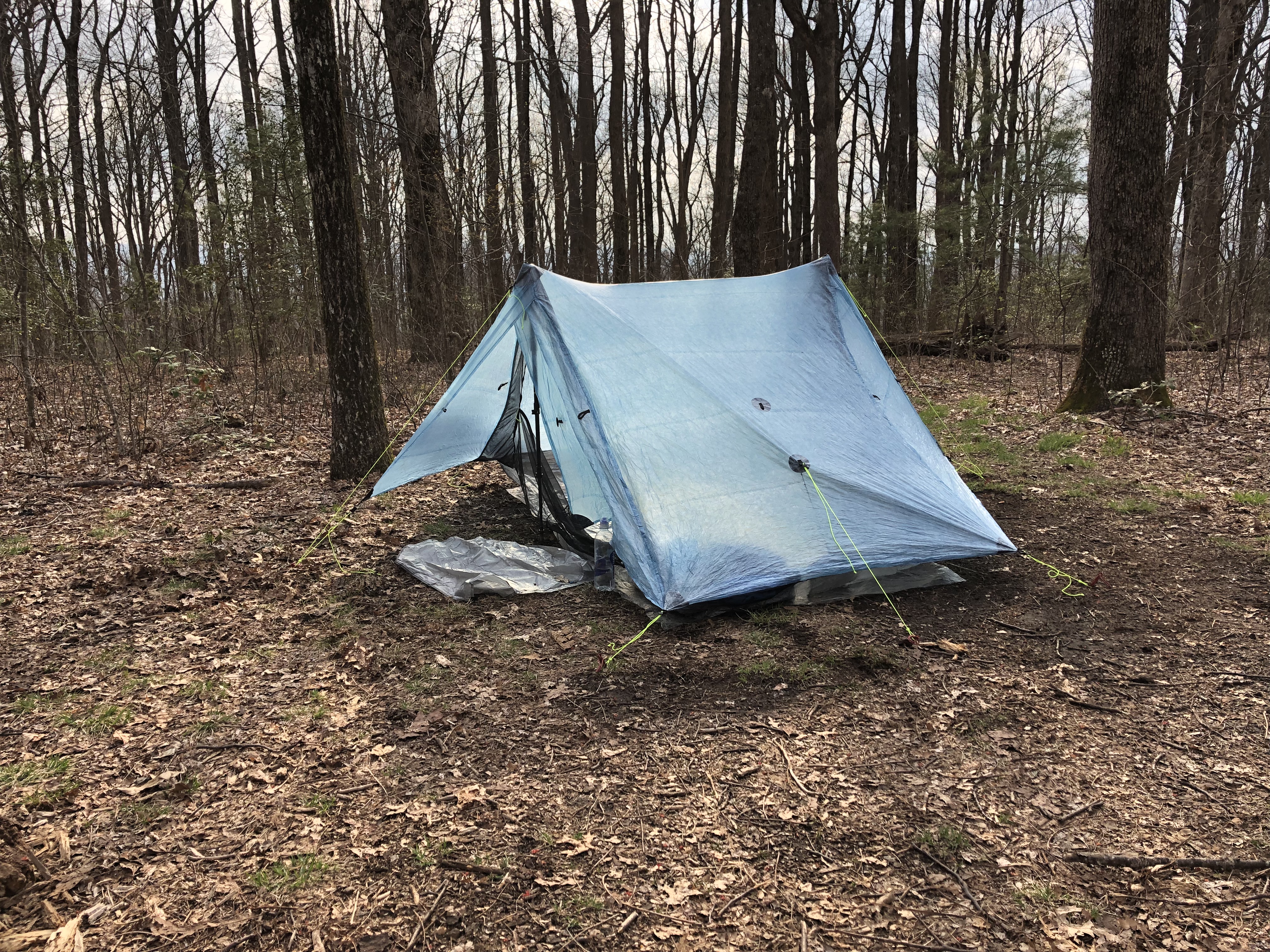
I made it to the 3.5 mile mark on the Approach Trail where there was a tent site and decided to camp there for the night. I had a bite to eat, hung my bear bag, set up my tent, unloaded my gear into my tent, inflated my air mattress and pillow, and settled down for the evening. That night, a tremendous rain storm swept through my camp, but I stayed safe and dry all night.
The next day on Monday morning, I packed up and headed to the top of Springer Mountain where the southern terminus of the Appalachian Trail officially starts. I made it there in good time. There were a few hikers at the top, the first hikers I had met so far. I took some photos, signed the registry and began my 2,200 mile thru-hike.


Next stop, Hawk Mountain Shelter, so down springer mountain I went. I got a few steps and slipped on a large rock that was wet from the previous night’s rain. I went down, but not too hard. Not a good start to my thru-hike, though.It was raining off and on that day. It can get rather warm hiking in rain gear, so when I had decided that the rain had let up, I took my rain gear off and stowed it on top of my pack where I could grab it easily if the rain happened to come again. It did, of course, so I took my pack off, put on my rain jacket and rain kilt again, put my pack back on, adjusted the straps again, and continued on. It was about this time that I realized my prescription sunglasses had fallen out of my backpack shoulder strap pouch. I had hardly even began my thru-hike and already I had lost something. Not a good sign. I suspect they fell out when I slipped on that rock, but it could have happened at several spots when I took my pack off.
The rain soon dissipated again and shortly after that, I arrived at Hawk Mountain Shelter where I was greeted by many hikers crammed into the shelter trying to stay dry. I said my greetings and went right away to find a spot to pitch my tent for the night, hoping I could do it before it started raining again. I got settled in, ate my dinner, and put my food bag with all my other smellables in a bear box. I was so glad not to have to hang my food in a tree that night.I woke really early Tuesday morning, got all my gear packed, used the privy, grabbed and packed my food bag, and left the shelter site when it was still dark. I decided I would hike a little ways until the sun came up and then eat my breakfast, which I did. It was a beautiful morning that turned into scattered rain showers like the day before.
I was headed to Gooch mountain Shelter. I arrived at Gooch Mountain Shelter and settled in for the night pretty much like the night before. My plan for the next day, Wednesday, was to hike to Lance Creek Campsite which would be an easy 8.3 mile day. Lance Creek is a typical stopping off point because beyond that was a section of trail in which there is a bear problem and you can only camp in this section if you have a bear canister. Most thru-hikers don’t have bear canisters because of the extra weight and size that comes with having one. Hiking through this section involves hiking over Blood Mountain which would be a long and difficult hike to do in one day for most thru-hikers.
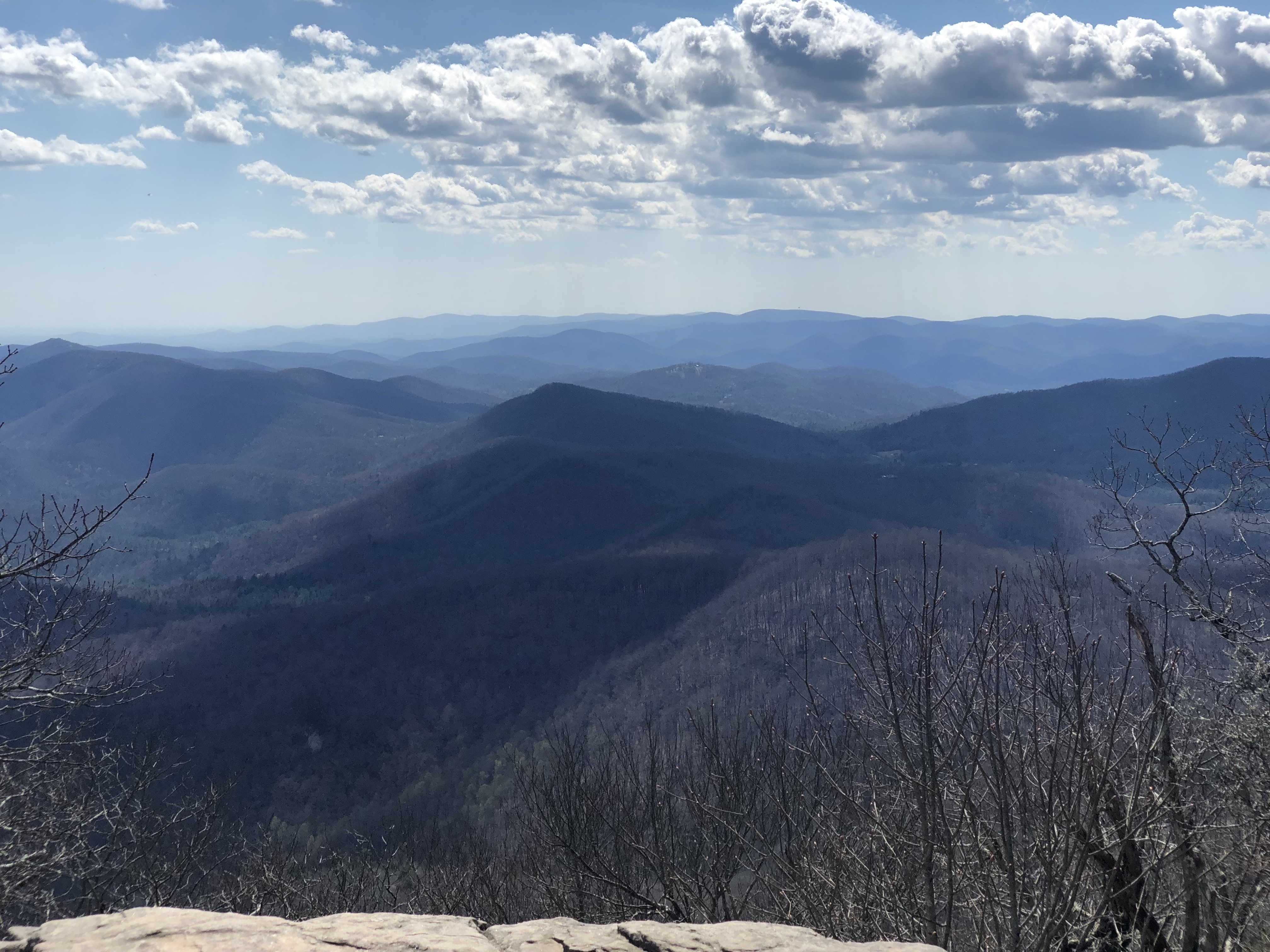
Along the way I came across a ridge runner. We were chatting and he mentioned that there was another campsite I could go to if I wanted to hike more miles and still be outside of the bear canister zone. So I hiked on looking for this spot. After some time, I looked on my Guthook app and found that I was well within the bear canister only zone. This meant I would have to hike on and over Blood Mountain to Neal Gap. Hiking up Blood Mountain was hard but not as difficult as I thought it would be and the rewards of reaching the top were spectacular.

The hike down I found to be almost as challenging as the hike up. By the end of the day I was glad to finally arrive at Neal Gap and the Mountain Crossing outfitters and hostel. I stayed at the hostel that night, the first hostel I would experience.
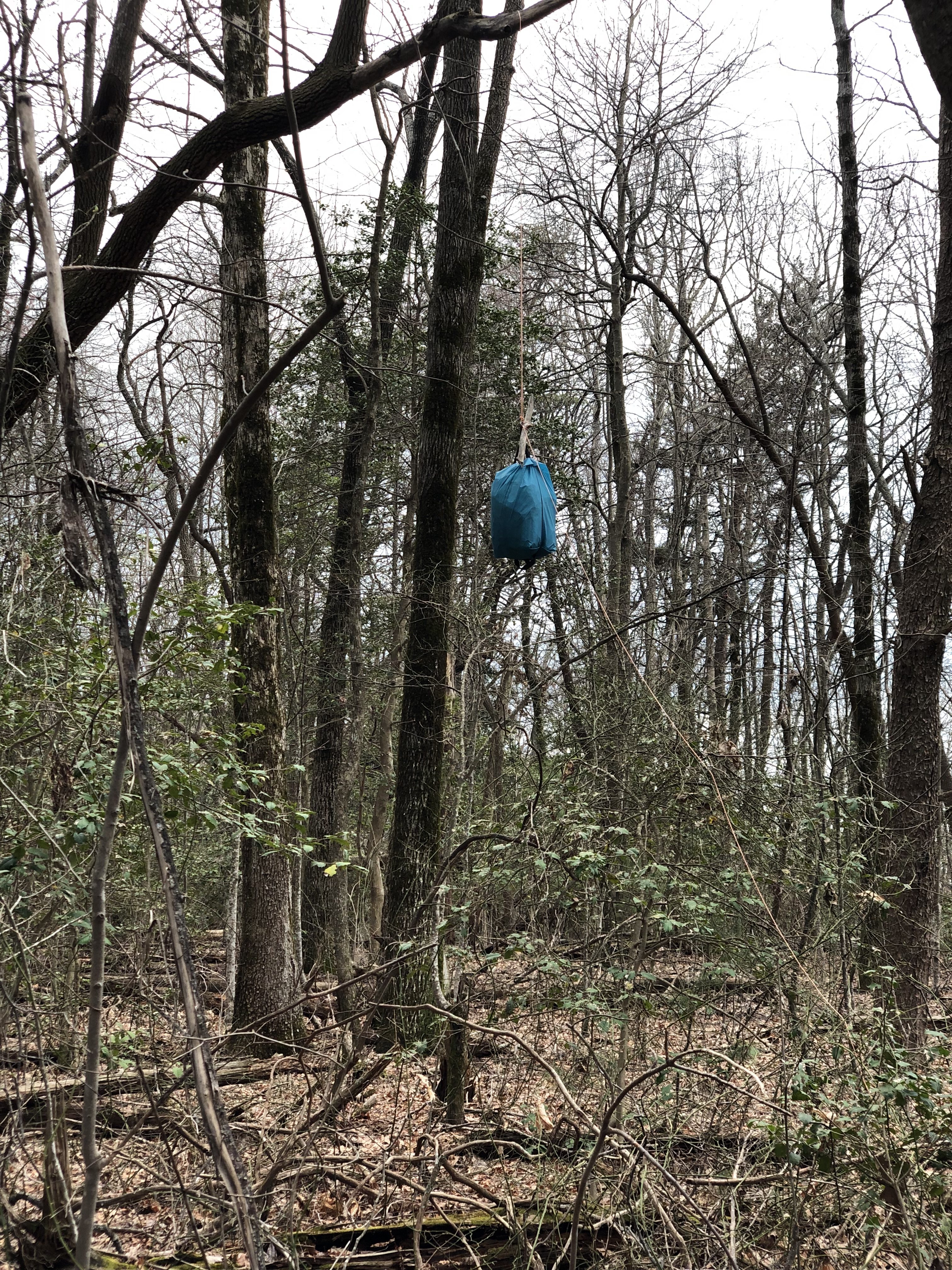
The trail actually goes through Mountain Crossing via a breezeway between the outfitter and the hostel. I payed for my evening stay at the cashier counter and they gave me a towel for a shower. I found a bunk, took a shower, and settled in for the night.From Neal Gap, at sunrise, I packed my pack and headed north to the next stopping point which would end up being the Poplar Gap tent site. This tent site was just a clearing on the side of the trail. I was the first person there, but soon others showed up deciding to camp there as well. Some of them were people I had met or passed earlier on the trail. That evening I realized that I had lost my bear bag kit — the rock sack, cordage, and carabiner used for hanging my food bag and other smellables in a tree away from the reach of bears and any other creatures interested in getting to those things. Realizing this, I had to ask a couple of hikers who had settled on the same campsite if I could hang my food bag on their line, which both were very okay doing, so I hung my bag with one of them.
That night was very windy early in the evening with scattered showers during the night. In the morning, from Poplar Stamp Gap camp site, I packed up my wet tent and other gear and headed north on the trail not sure of how far I would hike that day. The trail was really wet and every time my left foot slipped or hit a rock or root, I would get a wrenching feeling in my left thigh. By the time I got to Unicoi Gap, I was limping, and decided I had better take a break. The forecast was calling for thunderstorms in the next few days, so it was a good time to take cover from that as well. I found the number for the Baymont Inn, located in Helen, GA. It was relatively inexpensive and had a free shuttle, so I decided to spend a day or two there. When I got there, it was still early in the day so I was able to wash my clothes and gear, set my tent up in the hotel lawn to dry it out, and take a much needed shower.
Helen, Georgia was a small German-themed tourist town, so after finishing cleaning and drying my gear and myself, I ventured into town in search of German food and drink. I found a place called Bodensee and treated myself to some German beer and sausages.

I sat at the bar and sang country music songs along with some of the locals there. In the morning, my leg was feeling much better after rest and stretching, but the storm had not yet come and gone, so I had some time to kill. I ventured into town once again and ended up at a place called the Troll Tavern. There I sat at the bar again and ordered a burger and some more German beer. The burger was very good and of course so was the beer. When I was done, and asked for my check, the guy I was sitting and chatting with at the bar insisted on paying for my entire meal. I guess that was some southern hospitality.Feeling anxious about being trapped in the tourist town of Helen Georgia, I decided that I would spend the last day of bad weather at the Top of Georgia hostel where I was expecting my next resupply package.
I had to pay someone to drive me back to Unicoi Gap, but Top of Georgia Hostel would come get me from Unicoi Gap with their free shuttle service, and staying there for a night would be cheaper than at the hotel. This hostel was a little better than the Neal Gap Mountain Crossings hostel. The people running it were much more informative, the bunk house had a working kitchen, they had an area open 7am to 7pm for eating and lounging, thy served a free bowl of cereal and hot beverage in the morning, and they laundered your clothes for you. They also had a free shuttle that went into the town of Hiawassee, Georgia twice a day.
I took advantage of all they offered and thought the stay there was okay.Top of Georgia is actually located just a short distance from Dick’s Creek Gap, but because I had them pick me up from Unicoi Gap, I had to go back and do that section of trail which I thought would take me two days to complete. It actually took me only one day, but instead of paying for another stay at Top of Georgia Hostel, I camped at a site real close to Dick Creeks Gap parking area. There were a few new faces at this campsite. After getting all my camp chores done I helped gather firewood and we all sat for a while chatting around a campfire.In the morning, from Dick’s Creek Gap campsite, I packed my gear and started the short hike back to Top of Georgia Hostel, not to stay there, but to pick up the resupply package that was sent there. I passed the Dick’s Creek Gap parking area and started heading down the hill towards Top of Georgia Hostel, when a car stopped next to me and asked if I needed a ride somewhere. I said I was hiking just a short ways down the road, but sure, I would love a ride. It turned out that the woman had just dropped her husband off at the Dick’s Creek Gap trailhead. They had driven all the way from Michigan and she was now driving all the way back. She drove me right up to the front of the hostel and dropped me off. I picked up my package, got it all sorted and packed, and headed back up the road to the Dicks Creek Gap Trailhead.
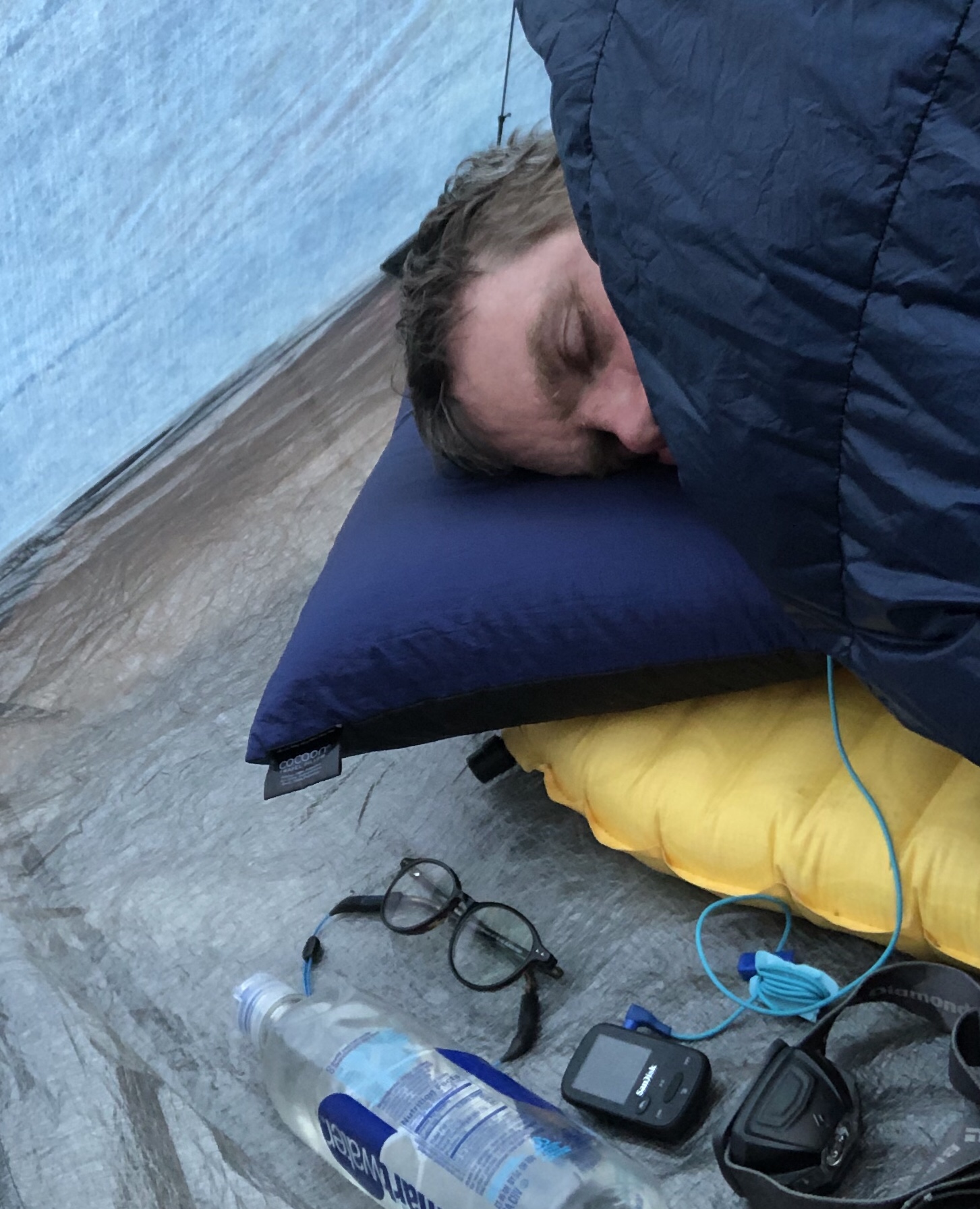
From there I started hiking up the trail with a goal of reaching Standing Indian Shelter by the end of day. Boy was I wrong! It was only an 11.8 mile hike from Dick’s Creek Gap to Muskrat Shelter, but it turned out to be a very difficult one and by the time I got to Muskrat Shelter, I could go no farther. I was absolutely exhausted after that hike and after doing my camp chores, I just crashed in my tent and fell asleep.
On the eleventh day, my goal was to go as far as I felt I could go without wearing myself out too much. I made it to Carter Gap Shelter, but I didn’t really want to stay at a Shelter site again. I find the shelter sites are often crowded and noisy.
I think many people like them because of the amenities such as a privy, bear cables or bear boxes. They also usually are close to a water source and they are a place for socializing. I don’t mind hanging my own bear line, I don’t mind pooping in the woods, I can usually find a place to pitch my tent that is nearby a water source, and I often would rather have privacy and quiet at the end of a long hard hiking day. I decided I would hike on and find a tent site farther down the trail. I ended up finding one near the 95.5 mile mark. On day 12, April 18, I again packed up fairly early from my stealth site, and headed north pretty much with the intent again of just going as far as I could. There was warnings of another storm coming, so that was on my mind, and if I could, I would try to get to a trail town or lower ground by the time it hit.
It was still pretty early when I came across some trail magic at Mooney Gap. A man had a small table with fruit, coffee, and juice. It was a real treat having that early in the morning.

From there it was a very technical climb up Albert Mountain. It was very steep and a lot of rock scrambling. As difficult and tiring as it was, though, it was actually a lot of fun. And the views near and at the top were spectacular. Well worth the climb. The tower deck was closed, but I climbed as far up the tower as I could. The descent down the other side of Albert Mountain was very easy and gradual and I made it to the Rock Gap parking area with little effort. I was able to get reservations to stay at Gooder Grove Hostel and Zen, the proprietor, came and picked me up. It took a little getting used to the way this place was operated, but it turned out to be a very enjoyable stay.Downtown Franklin was only a short walk from the Hostel and during my three day stay there while waiting out bad weather, I made several stops into town to eat, grocery shop, and to get a haircut.
After three days I was anxious to get back on the trail, so on Easter Sunday, April 21, I had my coffee with cocoa in the morning, and then set out on the trail again.

I’m not sure when I’ll have the chance to post again, so in the meantime you can follow me on Instagram.
Until next time, Happy Trails!

This website contains affiliate links, which means The Trek may receive a percentage of any product or service you purchase using the links in the articles or advertisements. The buyer pays the same price as they would otherwise, and your purchase helps to support The Trek's ongoing goal to serve you quality backpacking advice and information. Thanks for your support!
To learn more, please visit the About This Site page.
