 ">
">
Your Guide to Resupplying on the Continental Divide Trail
Planning your resupply on the Continental Divide Trail can be intimidating. While there are hundreds of possible alternate routes for your CDT journey, most of these alternates are more like micro-alternates, and will have minimal impact on your resupply strategy. However, there are a few alternate routes that can impact your resupply, while some seem to exist solely to make resupplying easier.
You don’t have to decide on each and every alternate right now. And you shouldn’t. Plans and schedules are for real life, and thru-hiking isn’t real life. However, you’ll probably need to prep your first few boxes before you set out on the trail, and make your decisions about a couple early alternates.
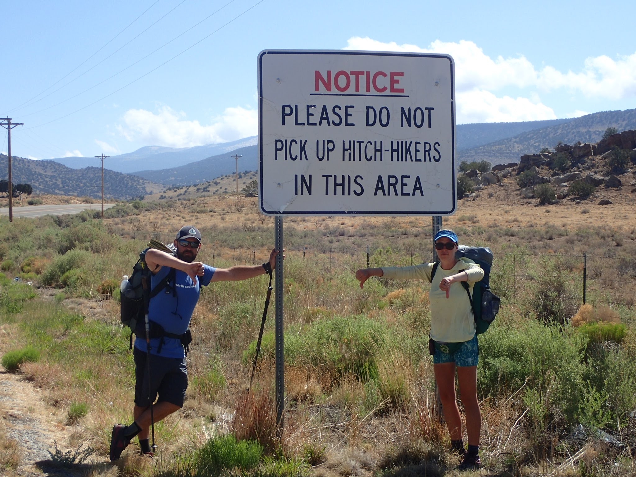
The most popular plan for resupplying on the Continental Divide Trail (and most long trails) is to do the bulk of resupplying along the trail, sending a few boxes to key areas with difficult or nonexistent on-trail resupply. It’s not impossible to complete the CDT without sending a single box. I know at least one hiker who has done it. But that’s a lot of gas station resupplying, and in some instances requires extra hitching or longer food carries.
For the sake of brevity, I’m not going to list each and every single possible resupply stop and alternate. Instead, I’ll hit on the places you might consider sending yourself a box, and the alternates that will impact your resupply options. This guide should apply to the vast majority of thru-hikers, but the spirit of adventure on the CDT may take you on a new or little-used route that you won’t find covered here. Do your research if you plan to make your own alternates. I’m listing this in NOBO order, because that’s the way I went. I do have notes for SOBOs included as well.
I also reference Guthook a lot, because the app is widely used and offers more resupply info than some other sources. However, there is significantly less information and overall less accurate information than the Guthook guides you might be used to from other long trails. It’s the nature of the CDT. You can maximize your CDT experience by making sure to contact Jonathan Ley for his maps and notes, and upload them onto the Avenza app. But that’s more about the overall trail experience, and we’re here to talk about resupply. Let’s dig in.
Note that all mileage listed below comes from Guthook, and will vary slightly from the mileage listed on Ley maps, in Yogi’s guide, or other sources.
New Mexico

Before you hit the trail, it’s a good idea to make some decisions about your New Mexico alternates and prep and mail those boxes ahead to yourself. I’d recommend 2-3 resupply boxes for the state, listed below. NOBOs will also want to send their snow gear and some paper maps (if not carrying them already) to Chama before heading into the San Juans. You could certainly send yourself some food as well, but there is a full grocery store in Chama so it’s not necessary.
Mile 173: Gila River

There are two major alternates in New Mexico that impact resupply: Gila River and Ghost Ranch. The Gila River alternate is one of the most recommended alternates on the CDT and starts at NOBO Mile 173. After the bootheel, the thought of walking through cold, clear flowing water for days is pretty irresistible. Plus, resupply is much simpler. You can mail yourself a box to Doc Campbell’s (37.9 miles into the Gila alternate), and you’ll walk right past it on the alternate. From Doc Campbell’s it will be 130 miles at most to Pie Town. This can be shortened slightly by taking the Gila River High Route or the Pie Town road-walk alternate, both of which will shave off a few miles.
If you decide to stick to the official route and skip the Gila, you’re facing a roughly 250-mile stretch between Silver City and Pie Town. If you don’t want to carry 250 miles of food with you, you could send a box to the PO in Winston (NOBO mile 267) and hitch from Highway 59. Bring 100 miles of food from Silver City, and send yourself 150 miles of food in your Winston box to get to Pie Town. Post Office hours are limited, the town is tiny, and the hitch is long and requires changing highways. For this and many other reasons, the vast majority of hikers take the alternate.
Mile 425: Pie Town
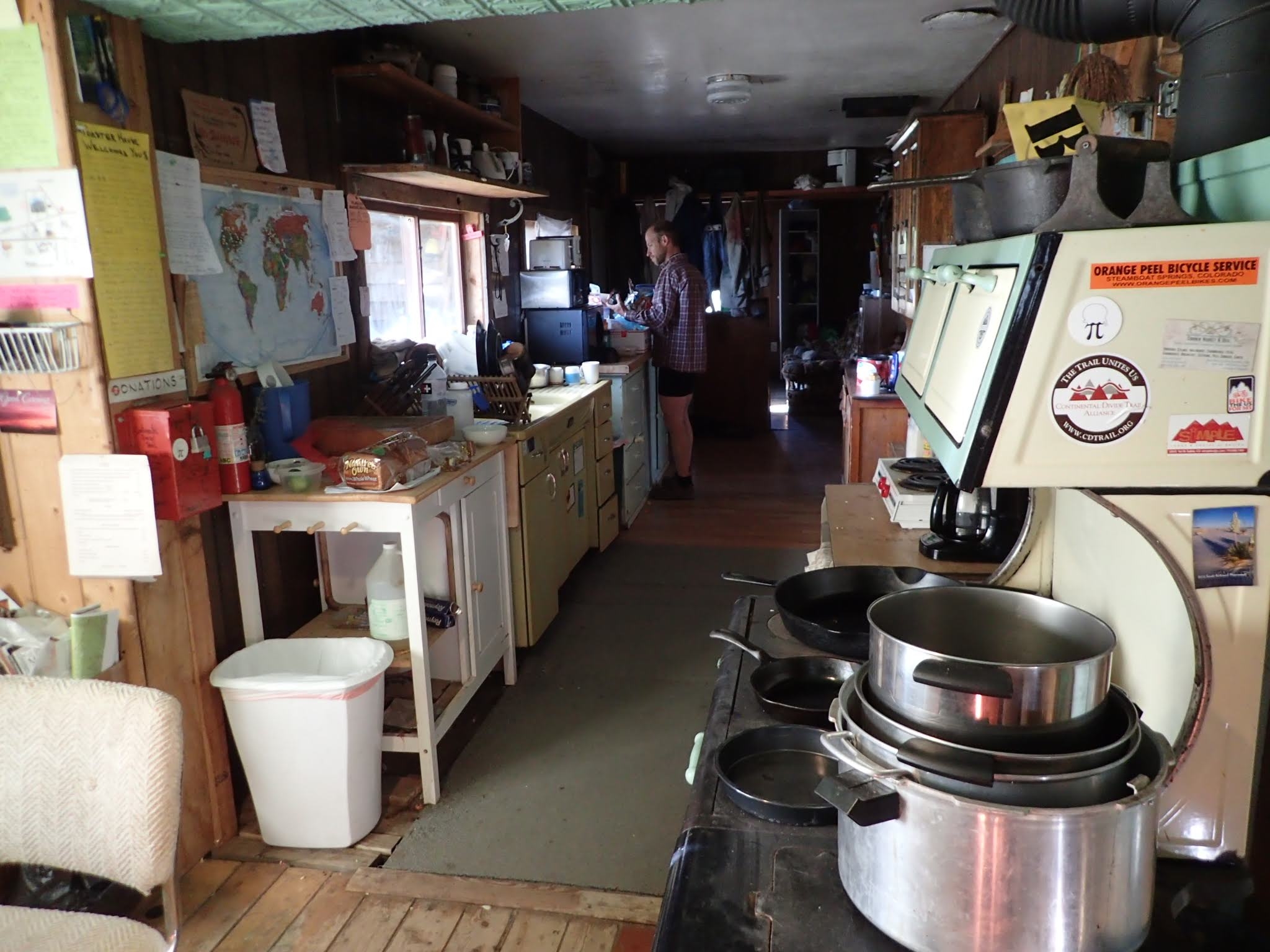
The kitchen at the Toaster House, and a hiker rifling through the hiker box.
While there are several establishments serving up pie and hot food, there is no grocery store in Pie Town. There is a gas station along the official route, but it’s much easier to just send yourself a box here, especially if you take the alternate into town which bypasses the gas station. You can stay at the Toaster House, a donation-based hiker/biker house, and get your package sent there as well. You can also send a box to the Gathering Place if you’d like it to be a little more secure, or the post office, but be aware hours are limited. Your next resupply will be Grants, just over 100 miles up the road, although this can also be shortened with a variety of possible alternates. One thing to keep in mind with your Pie Town box is that the hiker box at the Toaster House is HUGE, with ramen, potatoes, and oatmeal for days. You can conceivably pack this resupply box light and supplement from the hiker box. If you plan to zero here you might want to send yourself some town food as well. There is a full kitchen including a microwave at the Toaster House.
Mile 686: Ghost Ranch
The Ghost Ranch alternate seems to exist mostly because the resupply is simpler – send yourself a box there and you’ll walk right through Ghost Ranch to pick it up. The walk into Ghost Ranch is a mixture of road walking and cross country, but the hike out is a very pretty hike climbing out of a canyon. The alternate begins at mile 686 and the ranch is located at mile 11 of the alternate. Don’t go to Ghost Ranch for the buffet – every report I’ve heard is that it’s overpriced and not very good. But you can use their microwave to cook some of your own food for yourself.
If you opt for the official route through here, you can still pick up a box from Ghost Ranch, you’ll just have to hitch there to get it from Highway 84, trail mile 700. Otherwise, you could hitch South to Abiquiu to hit the general store, or try a long 40-mile hitch North to Chama. Whether you take the alternate or the official route, it’s just over 90 miles to Cumbres Pass, where you will access Chama.
Mile 792: Chama

Hikers at the Y Motel in Chama. Cheap lodging and right across the street from the grocery store.
NOBOs don’t need to send a box here (except their snow gear), but for SOBOs, this is a good place to stop, rest after the San Juans, and mail your boxes through New Mexico.

Colorado
Resupplying in Colorado is the easiest state on the CDT. Just about every town has a grocery store, and you can easily do the entire state without sending yourself any boxes. However, if you plan to resupply in Twin Lakes, read on. Also, as you plan out your Colorado resupplies, keep in mind that your mileage will slow down, particularly in the sections NOT concurrent with the Colorado Trail. Plan accordingly. You’ll go slower than you want to through here.
Mile 1,162: Twin Lakes

The cop in Twin Lakes is always on duty.
Twin Lakes is probably the most expensive place to resupply on the entire Triple Crown. I can’t remember specific prices, but I sort-of recall that a sleeve of Pop-Tarts was like $2.50—more than the typical cost of an entire box, which is pretty ridiculous. (I do recall hot coffee was cheap though.) The general store also didn’t allow hikers to fill their water bottles. WTF is that all about? You could send yourself a package here, but with a little planning, you can avoid resupplying here altogether. Leadville is only 30 miles north on the trail, and has regular grocery stores. At worst, you might need to grab some snacks to supplement yourself, especially if you decide to hike the alternate up Mount Elbert, Colorado’s highest 14er.
Wyoming
Welcome to Wyoming
After the unrelenting mountains of Colorado, it’s time to start cruising in Wyoming. If you want to push big miles, now is the time. It would be easy to hike the entire state without bothering to send yourself a resupply box. However, Rawlins has a Wal-Mart and a grocery store, making it a great place to stop and prep your boxes for the Idaho/Montana border as well as any boxes you might choose to send yourself in Wyoming.
Mile 1,747: Lander/Atlantic City/South Pass City
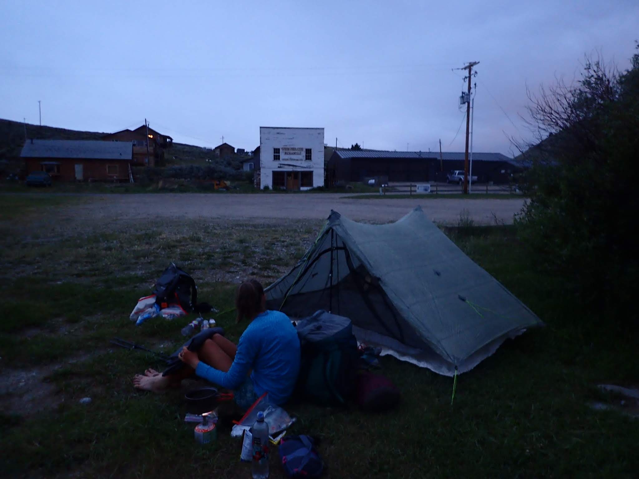
Camping in the parking area at South Pass City.
Your first town past Rawlins offers three possibilities. The simplest is to hitch into Lander from South Pass City. You can resupply there, stay there, and eat there. I hear it’s a great trail town. Alternatively, you could hitch into Atlantic City. There is free camping at the church and there is also a restaurant. No resupply though, so you’ll need to send a box if you go this route. Lastly, if you want to avoid town, the trail walks right through South Pass City. Don’t let the name fool you—this is little more than an abandoned mining town turned tourist attraction, but they accept hiker packages and they have soda. You can pick up your box here, camp in the parking lot, charge your electronics in the public restroom, and be on your merry way. There’s even a hiker box, although it’s not very big. Keep in mind that this is your last stop before the Winds, and there are a few things to consider.
The Winds

I’ll just leave this here.
The Winds are a special part of the trail. The Cirque of the Towers and the Knapsack Col alternates are both highly recommended and are both similar mileage to the official route (less than a two-mile difference). There are also numerous other alternates on the Ley maps, which are worth checking out as well. The main thing to consider with these alternates is that navigation, snow, climbing, and spectacular views will probably slow your pace.
We pushed through the entire range without going into town to resupply. We had to push big miles each day as well as ration our food to make the full 170-mile stretch to Dubois. Still, it was my favorite section of the entire trail. We loved the Cirque of the Towers alternate, but skipped Knapsack Col as we weren’t well equipped for the high snow conditions. We also did a couple shorter Ley alternates that were awesome.
Most hikers go into Pinedale to resupply. From South Pass City, it’s 81 miles to the Pole Creek Trail. Take this 11-mile trail, then hitch into town. On your return trip, you’ll hike 11 miles back to the CDT and have 87 trail miles to Dubois. Pinedale sounds like a really great trail town.
Mile 1,915-1,918: Dubois/Brooks Lake/Lava Mountain

Our Motel in Dubois let us cram 5 hikers into this room. They also had loaner clothes in their hiker box. Here we picked up bear spray, secured our Yellowstone permits, and picked up resupply for the next stretch.
After the Winds, Dubois is your stopping point before heading into Yellowstone. You can hitch into Dubois and resupply there, but it is a long hitch. If you haven’t sent any boxes ahead through the Idaho/Montana border, this is pretty much your last opportunity to do so. It’s also a good spot to pick up bear spray if you didn’t in Lander. If you’re in a rush and want to skip town, you have two options to pick up a package. You can send yourself a box to Lava Mountain Lodge—off the same highway as Dubois but a much shorter hitch—or you can send a box to Brooks Lake, a few more miles up the trail, but virtually right on the trail. From here, it’s 100 miles to Old Faithful, 137 miles to Mack’s Inn, or about 150 miles to West Yellowstone.
Mile 1915: Teton Alternate
Some hikers are starting to make alternates through the Tetons. These routes involve finding your own route sources and doing a bit of bushwhacking. It is possible to resupply for this route without sending any boxes, though it might be expensive in Jackson. Start here to research the Teton Route.
Mile 1,951: Butte Super Cutoff aka Big Sky Route
The Big Sky Route, also called the Butte Super Cutoff or sometimes just the Super Butte, is a massive alternate that is taken by a few hikers every year, but isn’t mapped out in Ley, or Guthook, or Bear Creek. Like the Teton route, it’s more of a build your own adventure route and offers a variety of possible routes as well. You’ll be away from the official CDT for several hundred miles. I’d suggest starting here to plan your route and resupply if you decide to take this alternate.
Mile 2,017: Old Faithful Village

The employees at the Old Faithful Lodge will probably be nice enough to let you sneak a shower. They also have a decent buffet, but be prepared for crowds.
As of last year, the postmaster at the Old Faithful post office announced they would no longer hold hiker packages. This may change again, but be sure to call ahead before trying to send yourself a box here. You can buy whatever you need at Yellowstone general stores, you’ll just be paying National Park prices.
What you need to purchase here will depend on how you’ve planned out the next few stops, and whether you mailed some boxes from Rawlins, Lander, or Dubois. Let’s assume you’re willing to go all the way to Lima before you resupply again. Via the official route, it’s just under 150 miles. Via the Mack’s Inn Cutoff, it’s about 110 miles. But you’ve got other options.
From Old Faithful Village, it’s 52 miles to Targhee Pass, where you can hitch into West Yellowstone and resupply. Lastly, from Old Faithful Village, it’s only 37.7 miles to Mack’s Inn Resort via the Mack’s Inn cutoff, where you can pick up a package.
Idaho / Montana Border
With the exception of West Yellowstone, pretty much every town along the Idaho/Montana border is very small and lacks a full grocery store. There are a variety of towns you could stop at, but the most straightforward route is to stop in Lima, Leadore, and Darby. It’s about 100-120 miles between each town. Darby has everything you need (and was one of my favorite trail towns), so you only need to worry about Lima and Leadore.
Mile 2,039: West Yellowstone/Mack’s Inn
To take the alternate or the official route? The main reason to take the Mack’s Inn cutoff is easier resupply—you can send yourself a box from Rawlins or Dubois, or opt for the limited resupply available there. I hear the route is nothing to write home about and a little bushwhackey, but the official route in this section is a lot of dirt roads, so I’m not sure one is better than the other. Mack’s Inn Resort is just over 15 miles into the alternate. On the official route, West Yellowstone (trail mile 2,069) is a tourist town, so don’t plan on staying unless you’re prepared to fork over way too much money for a hotel room. But there is a grocery store with decent resupply. Don’t ask me why, but for some reason Guthook doesn’t list West Yellowstone as a resupply point at all. If you’ve put off prepping boxes for the Idaho/Montana border region up to this point, West Yellowstone is your last spot to do so. From West Yellowstone, it’s 100 miles to Lima. From Mack’s Inn, it’s 73 miles.
Mile 2,165: Lima
We didn’t plan to stay in Lima, but it was the biggest gathering of thru-hikers we encountered along the entire trail, so we changed our minds!
The road to Lima is the interstate, but the owner of the motel in town runs shuttles for tips. The town has a restaurant and gas station, but sending a box here is definitely recommended. Send your box to the motel, because the post office only holds packages for two weeks. Lodging is cheap and there is a restaurant, so this is a good place to stop for a rest. From Lima it’s 100 miles to Leadore.
Mile 2,268: Leadore
This tiny town has a library, mini-mart, and lodging. The owner of the hotel/RV park runs shuttles to the trail for tips, holds hiker packages, and has a hiker box. The road to town is a dirt road with no service, so consider planning ahead to secure your ride. We actually resupplied at the store here, which wasn’t horrible but somewhat limited and a little pricey. From Leadore, it’s 120 miles to the Chief Joseph trailhead, where you can access Darby, Wise River, or Wisdom to resupply in town.
Montana
Time to leave the borderlands behind and head into Montana proper. From here you actually pass through several large towns, and could certainly hike to the border without sending any more boxes. However, it might behoove you to send 1-2 boxes to the smaller towns, which you can do from Butte/Anaconda, or Helena.
Mile 2,464: Butte/Anaconda

Walking through Butte. We really enjoyed the Pizza Ranch!
Whichever route you take through here, both Butte (access from mile 2,552 or 2,651) and Anaconda (mile 27 of the alternate) have several grocery stores, so there is no need to send yourself anything to either town. If you’re NOBO, this is a good spot to prep boxes for your final leg. You could also make it to the border without any more boxes without too much trouble. If you’re SOBO, this is probably the best spot to prep and mail your boxes through Idaho and Northern Wyoming. From Butte, it’s 100 miles to Helena. From Anaconda, it’s just 77 miles to Helena, or 145 miles to Lincoln.
Mile 2,722: Lincoln
If you resupply in Helena, it’s only 130 miles to Benchmark/Augusta, so you don’t have to go into Lincoln. Only 70 miles past Helena and 60 miles from Augusta, Lincoln has a convenience store, cheap hotels and restaurants, and some interesting history. We didn’t go in to resupply, but we enjoyed it all the same and picked up a few extra snacks. I’d only send a box here if I was trying to skip Augusta/Benchmark.
Mile 2,780: Augusta/Benchmark

Taking full advantage of all the food in Glacier!
Side note: the mileage for this waypoint on Guthook is not accurate. You access Benchmark/Augusta from the Benchmark Trailhead—Guthook mile 2,780.3, not from mile 2,722.3 as the waypoint reflects. That would be one crazy hitch.
There are two options at this resupply point. You can send yourself a box to Benchmark Wilderness Ranch, a short walk down the road, or you can hitch into Augusta to resupply.
The road to Augusta is a dirt road, so the hitch to town can be tricky. Still, traffic in the summertime isn’t terrible. We used a sign (very helpful in tourist areas) and hitched from the front of Benchmark and didn’t have to wait too long, but I have heard it can take awhile. The motel in town does offer a shuttle, but I don’t recall much phone service in this area. There is a small grocery store in Augusta with decent but limited resupply options.
If you don’t want to go into town, you can send a box to Benchmark for a $25 fee if you follow their specific requirements. I’ve heard mixed reviews about sending boxes to Benchmark. It sounds like hiker packages are not stored in a secure area, and some hikers in 2018 reported missing items and/or boxes that had been tampered with. I also know people who had a fine experience. Use at your own risk.
And that’s it! From Augusta/Benchmark, it’s 130 miles to East Glacier, your final resupply stop! You can resupply in town there, plus you’ll have other opportunities to eat food once in the National Park.

This website contains affiliate links, which means The Trek may receive a percentage of any product or service you purchase using the links in the articles or advertisements. The buyer pays the same price as they would otherwise, and your purchase helps to support The Trek's ongoing goal to serve you quality backpacking advice and information. Thanks for your support!
To learn more, please visit the About This Site page.

Comments 2
While informative, it is not necessarily a resupply guide. It’s just an overview. To me, a guide would list towns where resupply is available, distance between towns, how far off the trail the town is for resupply, etc. Unfortunately this “guide” has none of that.
Nonetheless, this “guide” has been helpful. Thanks for posting it.