 ">
">
40 Days, 40 Nights
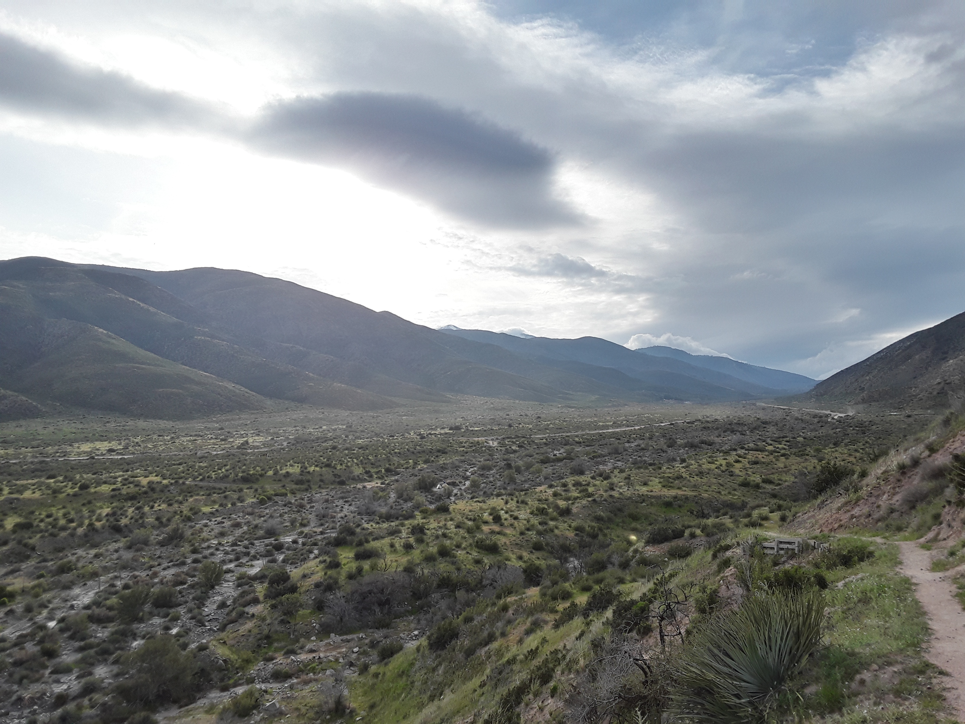
Has it really been that long? As I post this, I’m still contemplating my next move. Only 75 miles through the Angeles National Forest and down to the Mojave Desert. First 30 winds along the ridges cresting the Angeles Crest Highway, taking one up to Baden-Powell, Windy Gap, South Mount Hawkins, and Mount Williamson before coming down to Cooper Canyon on the way to Three Point. The latter half snakes between spring camps and fire stations toward Highway 14, stopping outside a KOA and the PCT completion monument erected June 1993.
Fewer and Fewer Footprints
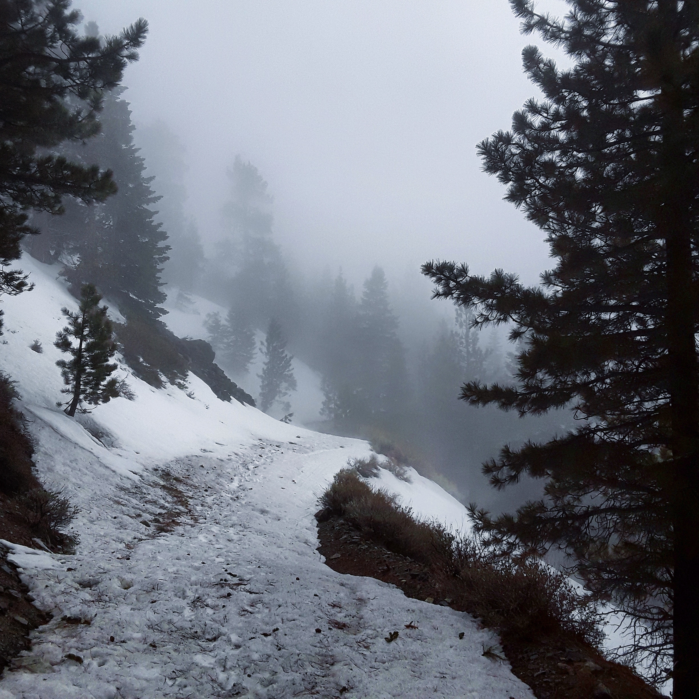
This section has been on my mind since climbing over San Jacinto. The A. N. F. section is the highest the trail climbs in SoCal, reaching 9,300 feet at the Baden summit spur. Ride the spine up and down and one will be halted at Eagle Roost Picnic Area by the endangered mountain tellow frog closure. Two options—road walk or a 20-mile HalfMile detour—and only a few more miles of snow before easy cruising for a while heading north.
Leaving Wrightwood this week, I am aware of maybe a dozen or so hikers making it through. Only a handful have pushed on from here. That doesn’t surprise me. What had surprised me more already was the amount of people flipping throughout the first 700 miles of the trail. There’s quite a few aspects to look at here.
Lasting Weather Patterns
From my latest check winter isn’t over yet, with another two feet expected to drop in areas already seeing record highs. Biggest difference between this year and the iconic Year of Fire and Ice is the lasting snowfall. In 2017 I recall the last heavy snow came in March and chilly rain scattered in April. It’s now the second week of April and warm, high pressures are finally pushing back.
It’s been almost a weekly system rolling through like clockwork since I’ve stepped on trail. Mount Laguna saw occasional flakes when the wind chill dropped low enough. Every week San Jac wiped cemented any trace of any adventurer daring to climb. Evidence of daily melting and nightly freezing were clear from the slick ice and sliding of earlier hiker in the San Gorgonio and San Bernardino regions. Now the footprints are just barely existent in the Angeles forest.
Early Start Problems
With April and May almost guaranteed to sell out immediately, prospective hikers are being nudged to take on earlier start dates. Being on trail for most of March, I have seen firsthand the effect of the issue. To note, I had made the decision for an early start prior to applying for the permit as I wanted to start early for the calendar year. Within the first 50 miles I had already ran into individuals that started in February but were stalled from both inexperience and lack of preparation. A week later and the same was abundant camped up in Idyllwild. After slipping through the San Jacinto bottleneck, the lack of eyes and bodies going through the San Gorgonio left about 100 miles of mystery and eye-opening obstacles. Even those who came to the trail prepared opted to flip to the Mojave.
The ridiculous rate of rescues that occurred within my first three weeks (and still occurring regularly as far as I’m informed) on trail drew concern for the factors related to the situation. Fingers were being pointed before these incidents occurred; a glance through the Facebook class forum will support this. Is the PCTA permit system at fault? Or a lack of personal accountability for preparation? Could any, if not all, of these incidents have been prevented, disregarding those that occurred from lack of gear or preparation as the answer is then rhetorical? We can all armchair every incident and assume the likely outcomes but only those involved will truly understand how those moments went down.
There are more factors to consider but these two I will emphasize for the time being.
So What Are You Gonna Do Now?
Lacking any traction devices for Baden-Powell, I am for once truly concerned about the next section of snow/ice. Fewer footprints to attest to the trail conditions and I’ll probably end up doing it solo. The handful of snow atop Guffy Springs and Blue Ridge proved to be a decent obstacle for the inexperienced, citing slips from probable late afternoon crossings and poor stepping even with spikes. Only 30 more miles of such conditions! Word has it that a ranger is posted on the mountain, turning back those who are lacking both gear and honest preparation. Quite interesting as I had slackpacked the day before the ranger’s arrival and I believed the conditions to be manageable. I also heard the same individual whose pack I had found on top of Fuller Ridge had returned to hike the trail and had to be rescued off Baden-Powell due to severe conditions and/or lack of preparation. I’m gonna hold that last one to a mild rumor.
There is also a consideration for the Manzanita trail, rather crossing the base of Baden-Powell and further than summiting. Research would be needed about the trail, though.
The least considered option is to hitch up Highway 138 and rout to Mill Creek Fire Station or send it to the KOA on Soledad valley. Having to return to this section wouldn’t be too difficult with possible living arrangements after this year’s hikes, in the proximity. Still, I rather not have to make up for missed miles in the end game.

This website contains affiliate links, which means The Trek may receive a percentage of any product or service you purchase using the links in the articles or advertisements. The buyer pays the same price as they would otherwise, and your purchase helps to support The Trek's ongoing goal to serve you quality backpacking advice and information. Thanks for your support!
To learn more, please visit the About This Site page.
