 ">
">
Peace and Hardship Through the Range of Light: PCT Part 9
This is a very long post. I could have split it up, but I think keeping it all together gives a better sense of how I felt through this section. So find a comfy chair, grab your beverage of choice, and enjoy!
I wish I could describe to you the excited anticipation I felt leaving South Lake Tahoe. The High Sierra. John Muir’s “Range of Light.” I was finally getting to the only section of the PCT that rivals the North Cascades for beauty. My imagination was filled with towering peaks above steep passes, raging streams, crisp sunrises, and sitting for tea with the ghost of John Muir. Would I have enough food? Would the altitude have a significant effect on me? What is the weather going to do? As we piled into the car, these questions and visions whirled around in my head.
Disclaimer: Due to some technological hiccups (or maybe because I dropped it off the 2nd story of the hostel…), I lost ~200 pictures taken between SLT and Tuolumne Meadows. This is sad, and means that you will have to put up with a long block of text for a bit. You’ve been warned….
To Yosemite, and Beyond!
Minutes after stepping out of the car, we came across Mrs. Focus in a small trailhead parking lot. She was following her husband along and supporting him on his hike, while providing Magic to others along the way. We stayed for a short time, signed a panel for a PCT quilt she was making, then continued upwards. Later in the day, I drank one of the beers I had packed out while walking through a beautiful meadow just north of Carson Pass. Of course I passed a group of section hikers while maintaining a steady 3mph with a can of Coors in my hand, but I reassured them “I don’t usually drink while I walk.”
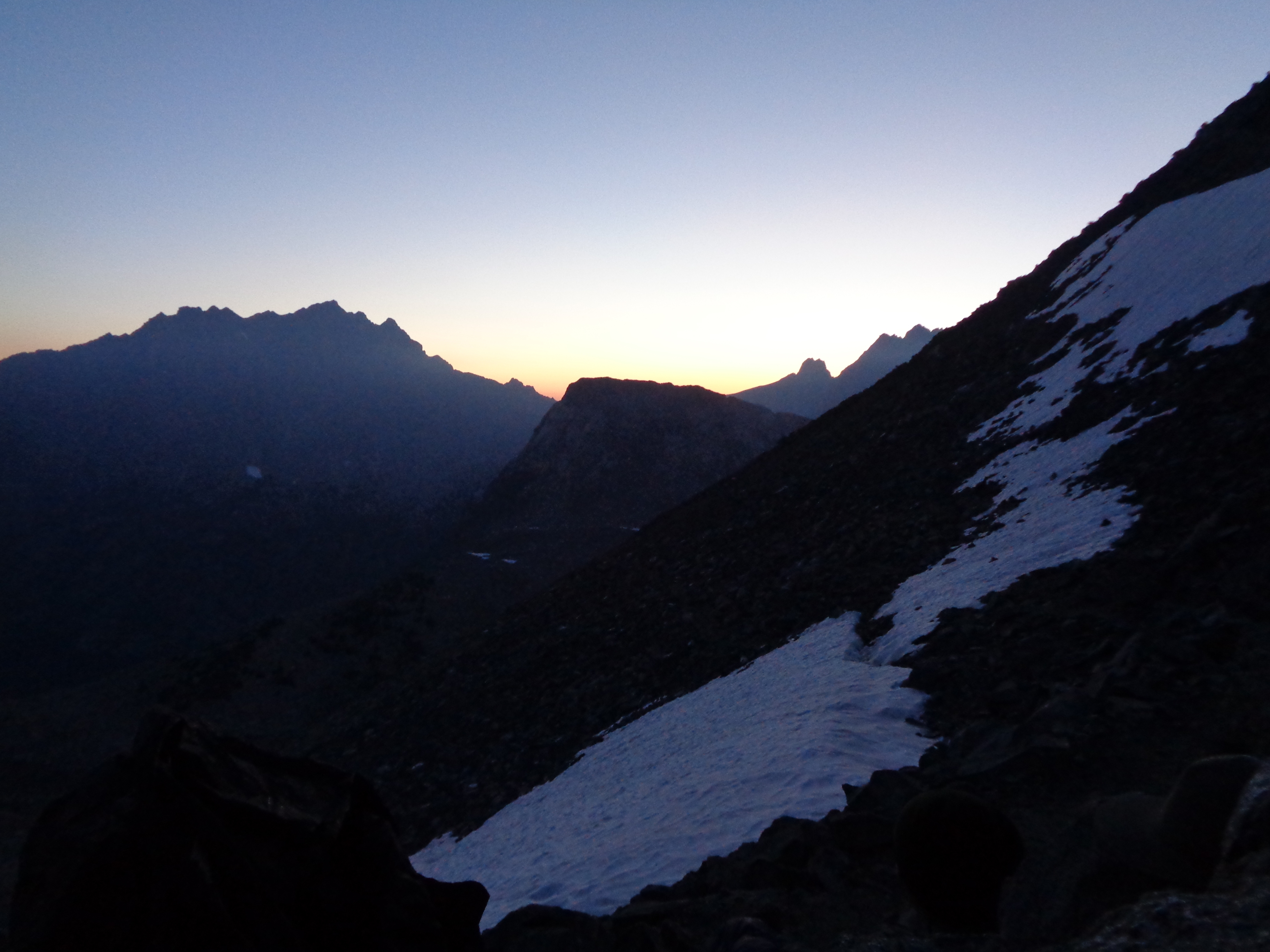
That afternoon, we darted across a ridge as dark storm clouds gathered across the valley and a fierce wind tried its best to separate me from my beloved hat. Any precipitation stayed on the neighboring ridge, but we got a taste of the afternoon storms that would be an almost daily menace for much of our time in the Sierra. My hat survived.
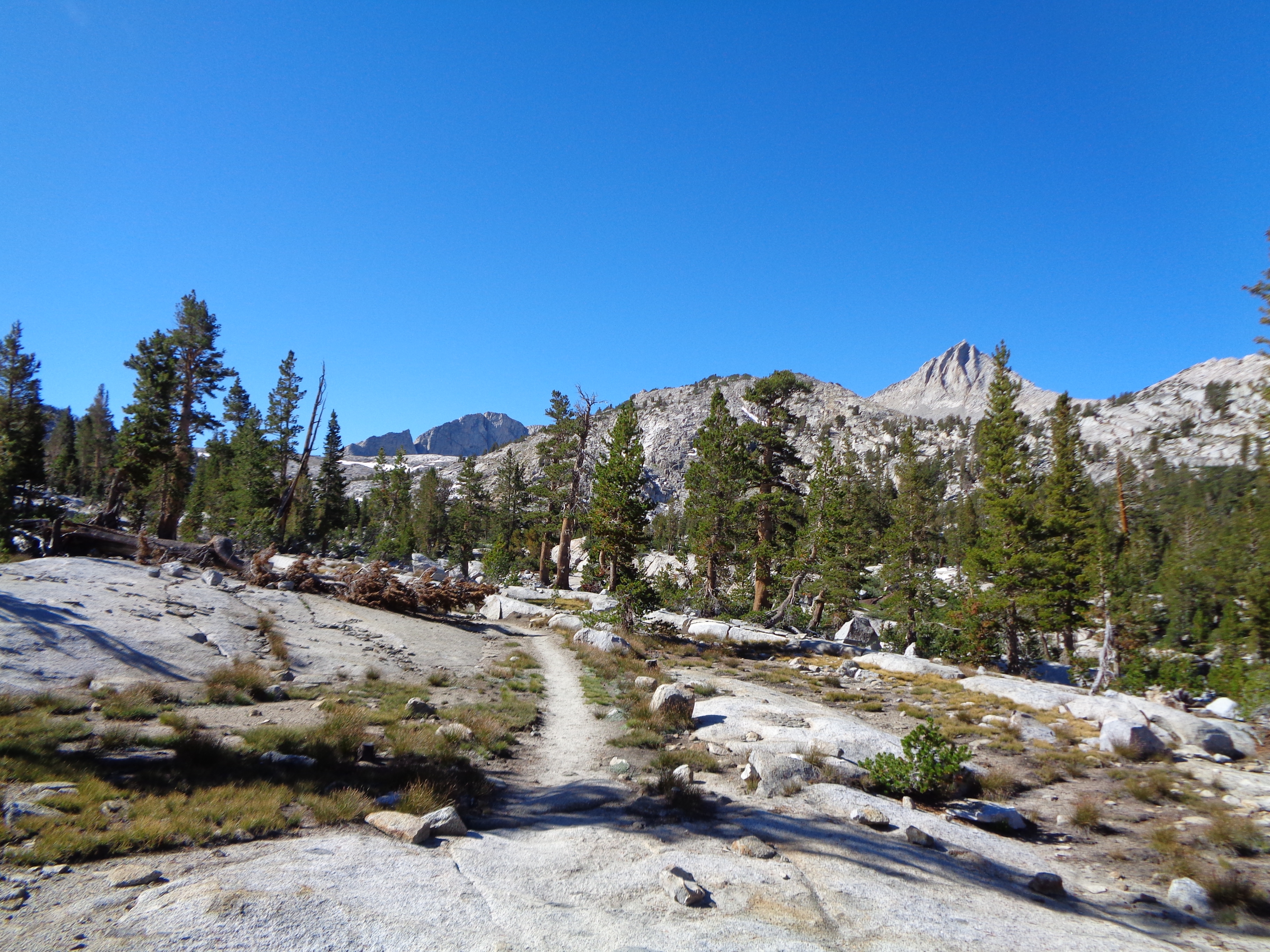
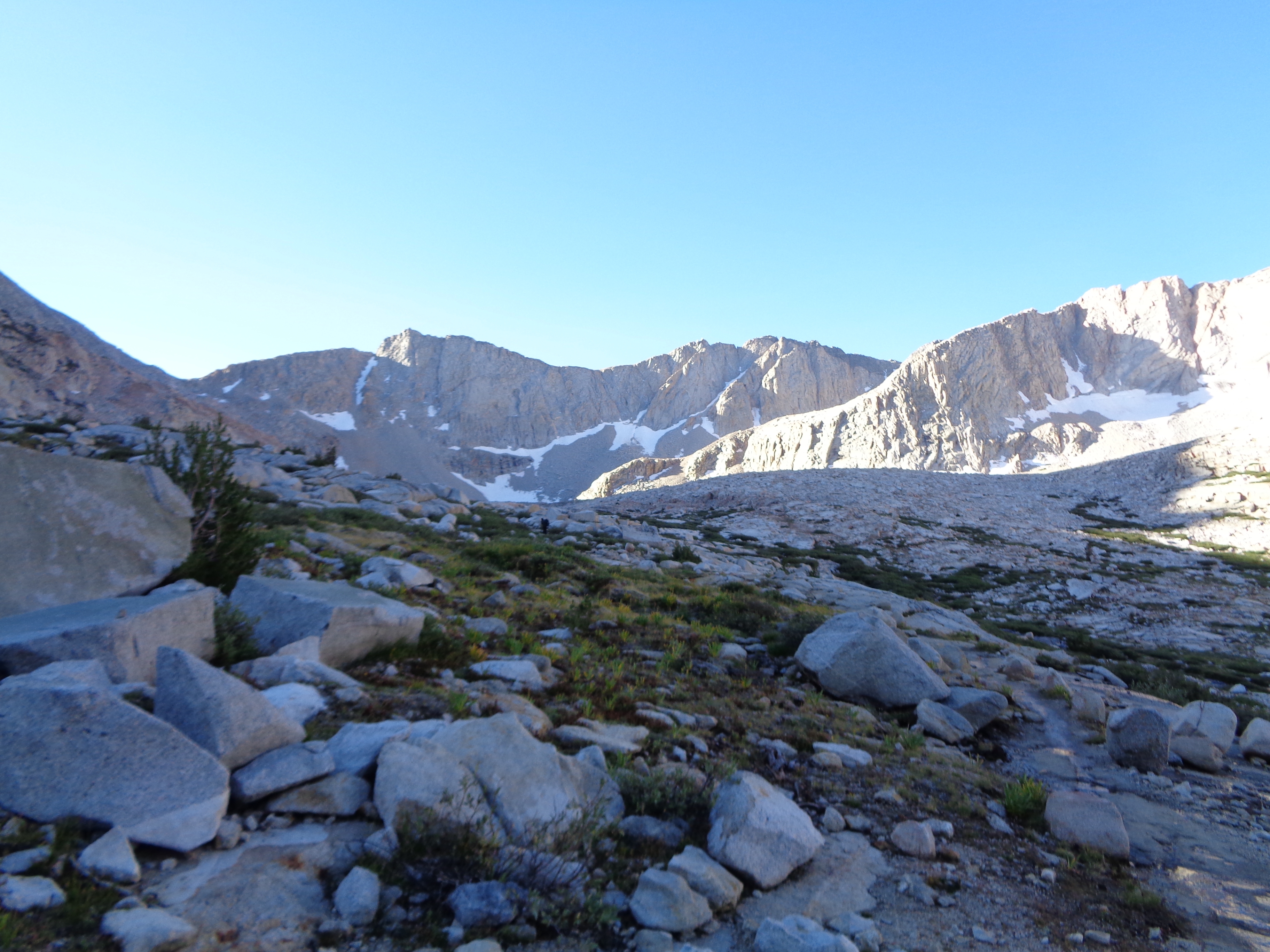
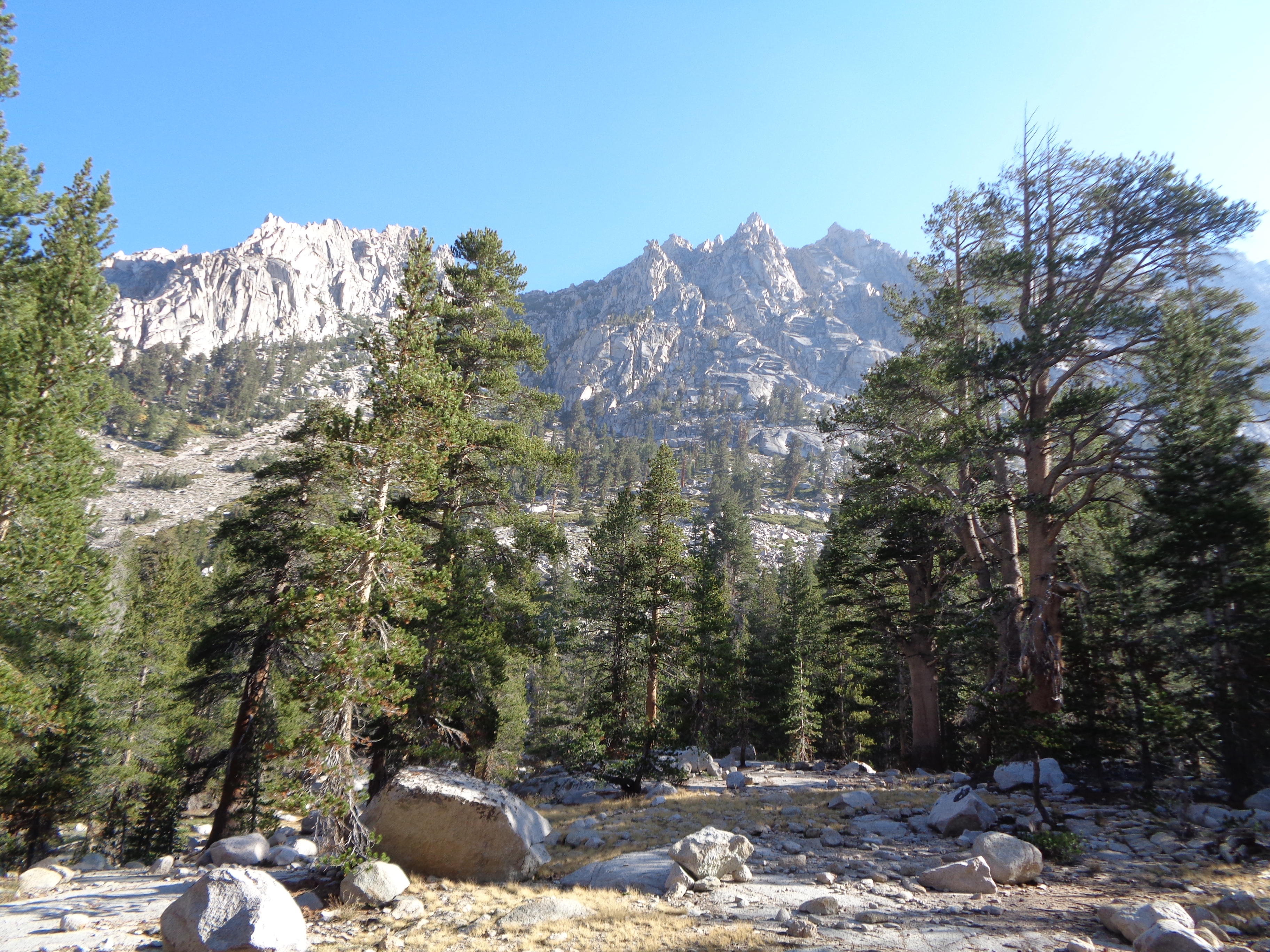
The following day was marked by huge vistas providing glimpses of the granite wilderness drawing closer. It was also a day where staying warm became a challenge, a distinct change from the often scorching section I had just come through. Even with abundant sunshine, I was quickly chilled whenever I stopped. Putting on layers is an easy and intelligent way to deal with this phenomenon, but I’m a stubborn ass and figured I’d save that for when I really needed to. I was enjoying hiking with Kirby and Per Bear, and it was around this time that I really began to see us as a trail family.
Kirby and I were out of camp before Per Bear was even stirring the next morning. We were going to Kennedy Meadows North for resupply, but Per had brought enough food to get all the way to Tuolumne. Up, up, and more up we went. My lungs and muscles began to feel the first effects of altitude, as I started to struggle as we approached 10,000ft for the first time. Cresting a pass before descending to the road, Kirby and I burst into laughter as we were treated to the most spectacular view of the High Sierra yet. Pure, unfiltered joy.
Our resupply was just about as perfect as you could write it. Got a quick ride to the campground, where we plowed through a hot lunch as a cold rain started outside. The store had a great selection at shockingly reasonable prices, and I tossed back a beer while charging my phone and breaking down my resupply under the porch. I did not envy Per Bear at that moment, likely crossing Sonora Pass in some pretty nasty weather.
A light rain persisted as Kirby and I began hitching back to the trail, which took a little while. By the time we got back up to the trail, the rain had stopped but was replaced by a cold wind. The climb to Sonora Pass is basically two giant switchbacks across the face of a mountain, with no shelter from the elements. As we crossed the pass and hiked along a high ridge, I broke down and put on pants and my rain coat to stave off hypothermia as the sun set.
And then the stars came out. Up to this point, I hadn’t been a big fan of night hiking. I get tired as soon as the sun goes down. I was hesitant to forfeit views. And, yes, I get spooked out by things that go bump in the night. But that night, crossing the high country south of Sonora Pass, my perspective changed completely. I became lost in the dark sky punctuated by points of light from unfathomably distant stars. I felt just a bit closer to understanding the reality of how beautifully insignificant we are. And then we saw glowing eyes in the dark and I kind of lost my shit. I calmed down after a few minutes and Kirby and I made camp in a nice flat spot, hoping we would catch Per Bear in the morning.
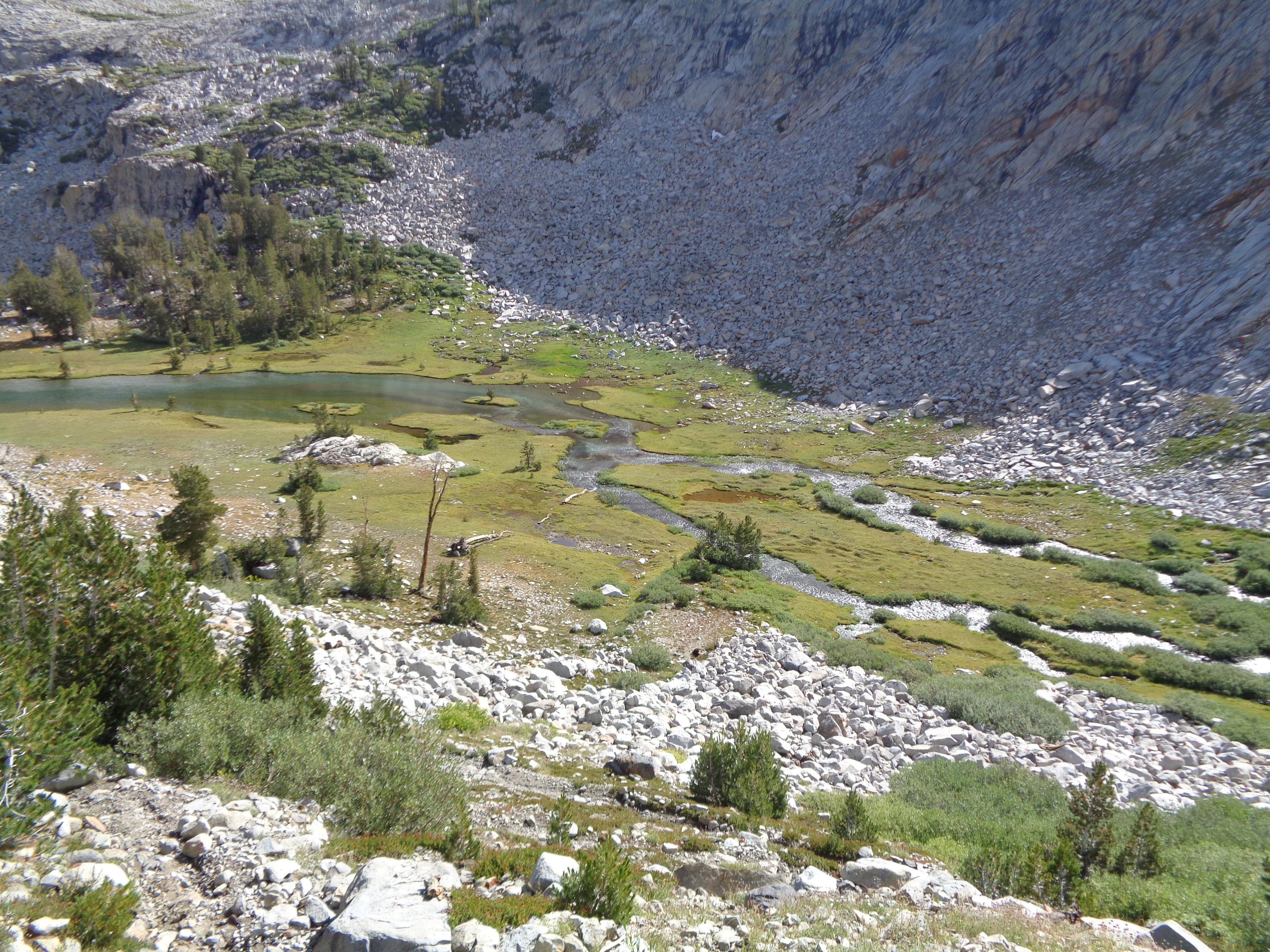
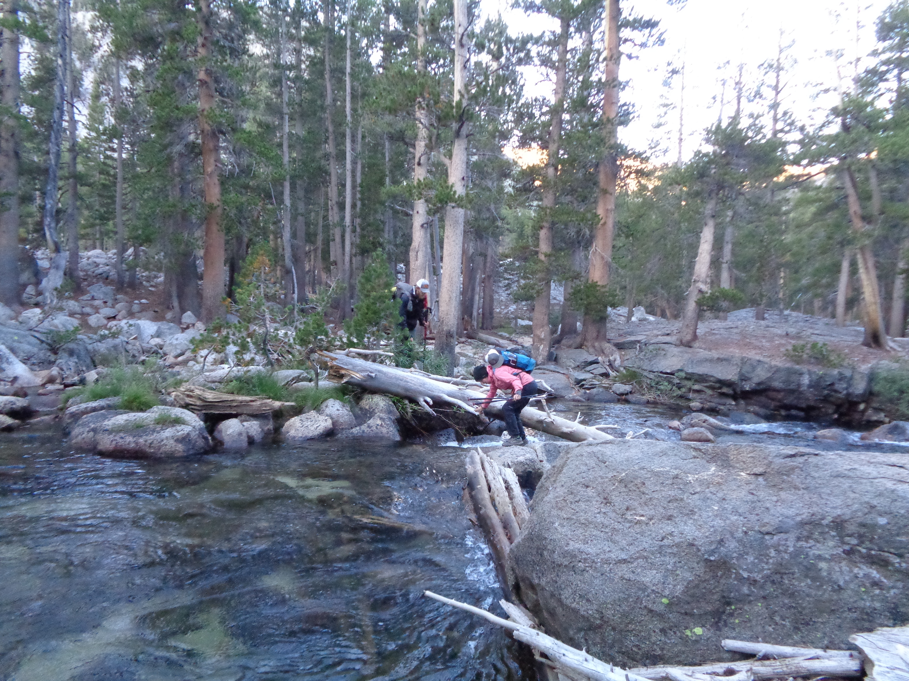
Which we did, just a few minutes down the trail. But he was still in his tent packing up, and the air was cold, so we kept hiking towards the park boundary. At Dorothy Lake Pass, we entered Yosemite NP amidst soggy meadows and impressive granite walls. I walked through an afternoon storm, enchanted by the massive, dripping trees and the thunder booming through the canyons. The first Sierra ford was nothing like the narrow, roaring torrents I was preparing for, and I easily crossed barefoot to avoid getting my shoes even wetter. The rain eventually stopped before I crossed Kerrick Canyon, and I made camp at the top of the next ridge. (If you’re keeping score, it has now rained on me TWICE during the hike. I have less than 1000 miles to go at this point.)
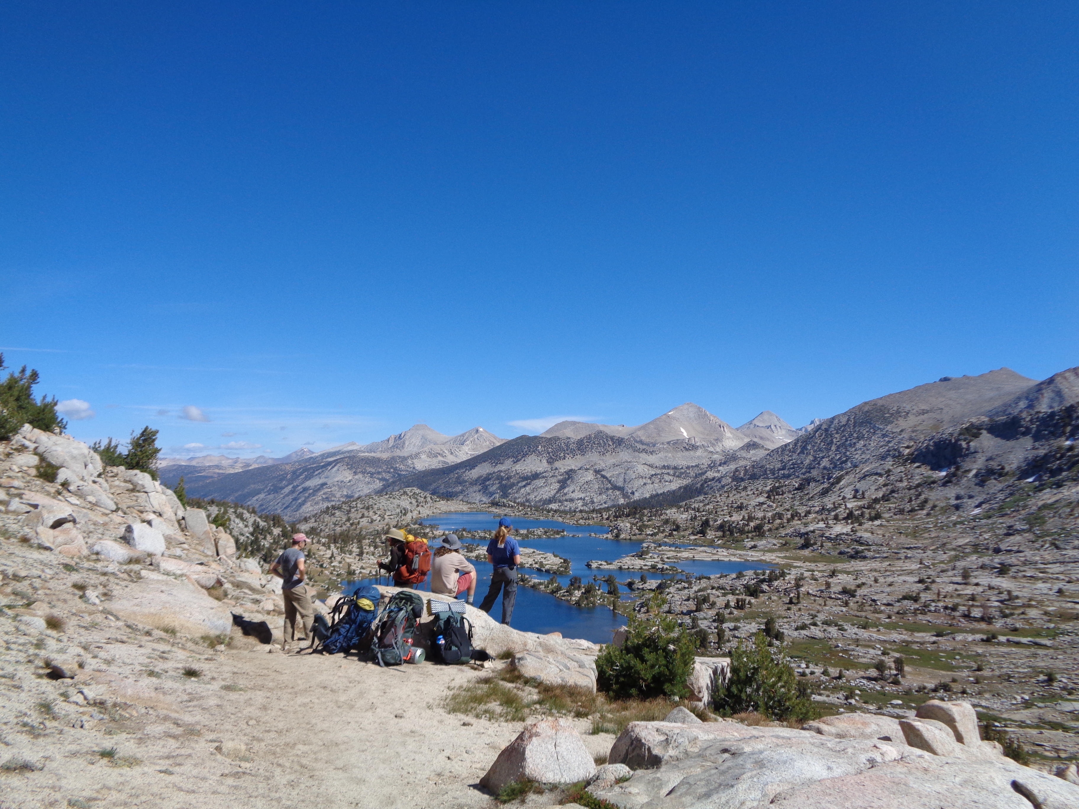
More creek crossings again the next day, a few of which I was able to cross on logs or rocks. While I was eating a snack and talking to two flip-flop hikers, Kirby and Per Bear caught up. We passed Smedberg Lake on our way to the stunning Benson Pass, and I’m trying to keep from dragging my jaw along the trail in awe of the mountains around me. Seriously, if you’ve never visited the backcountry of Yosemite, you should get out there! I was not as fatigued by altitude as I had been around Sonora Pass, and stoke levels were at an all-time high. “Hiking motivation is delightfully low,” I wrote in my journal after a prolonged afternoon water/laundry/fuck-it-lets-go-swimming break. Kirby and I pushed on ahead of Per Bear, and camped by Tuolumne Falls beneath the darkest, clearest night sky I had yet to see.
Condensation from the cold night air had made packing up a hassle the last few mornings, but we woke up surprisingly dry and headed for Tuolumne Meadows. I enjoyed the sunny stroll along the Tuolumne River, and gained a serious appreciation of the force of water and ice made evident by the round, smooth, and shiny rocks all around. Tuolumne was extra exciting, since my friend Anja would be joining me!
I got to talk to Five-Star and Fresh who I met at Timberline Lodge while waiting for her to show up. Then, our plan to grab supplies from the store was foiled by a power outage and subsequent generator failure. The gaggle of PCT and JMT hikers assembled around the now-closed store sounded like a distressed flock of chickens as we scrambled to reassess our plans. Kirby decided to hitch down to the Valley, while Anja and I figured that she had brought enough food for both of us to last to Red’s Meadow. Just as we were about ready to go, the lights came on and there was a mad rush on the store. I grabbed a bag of chips for good measure, then headed south.
Whew. That was exhausting. Thanks for putting up with that; and now, back to blogging with pretty pictures.
You’re in the Big Leagues, now!
South of Tuolumne is where things get REALLY big. It’s about a 10mi approach to Donahue Pass, at a still intimidating 11,000ft. That would be the lowest of the 13 passes to come on our way to Whitney, the most tantalizing of side trips. Hiking with Anja (who we dubbed “The Baptist”) and catching up on events from back home was a wonderful treat. It rained again, this time steady and cold enough to immediately stop to add layers. Anja was super chill with it, and as we arrived in the meadow below Donahue the clouds began to blow away. As we set up camp in a great flat spot above the trail, Kirby passed, determined to get over Donahue today after a frustratingly long trip to Yosemite Valley. 
As if to underscore how serious things were about to get, another powerful storm came in overnight. My tent, much ignored up to this point, did an admirable job of protecting me from a wind-driven rain. I slept soundly (as usual), but in the morning learned that Anja hadn’t. Given the likelihood of more afternoon storms and Anja having had no time to adjust to the altitude (we’re both from Minneapolis, elev. ~800ft above sea level), she decided to head back to Tuolumne and meet up with another friend of hers who works in the park. So we had a relaxed morning, enjoying the misty sunlight as the moisture from overnight began to evaporate. Around 9 we finally parted ways, and I took some figurative and literal deep breaths. Here we go.

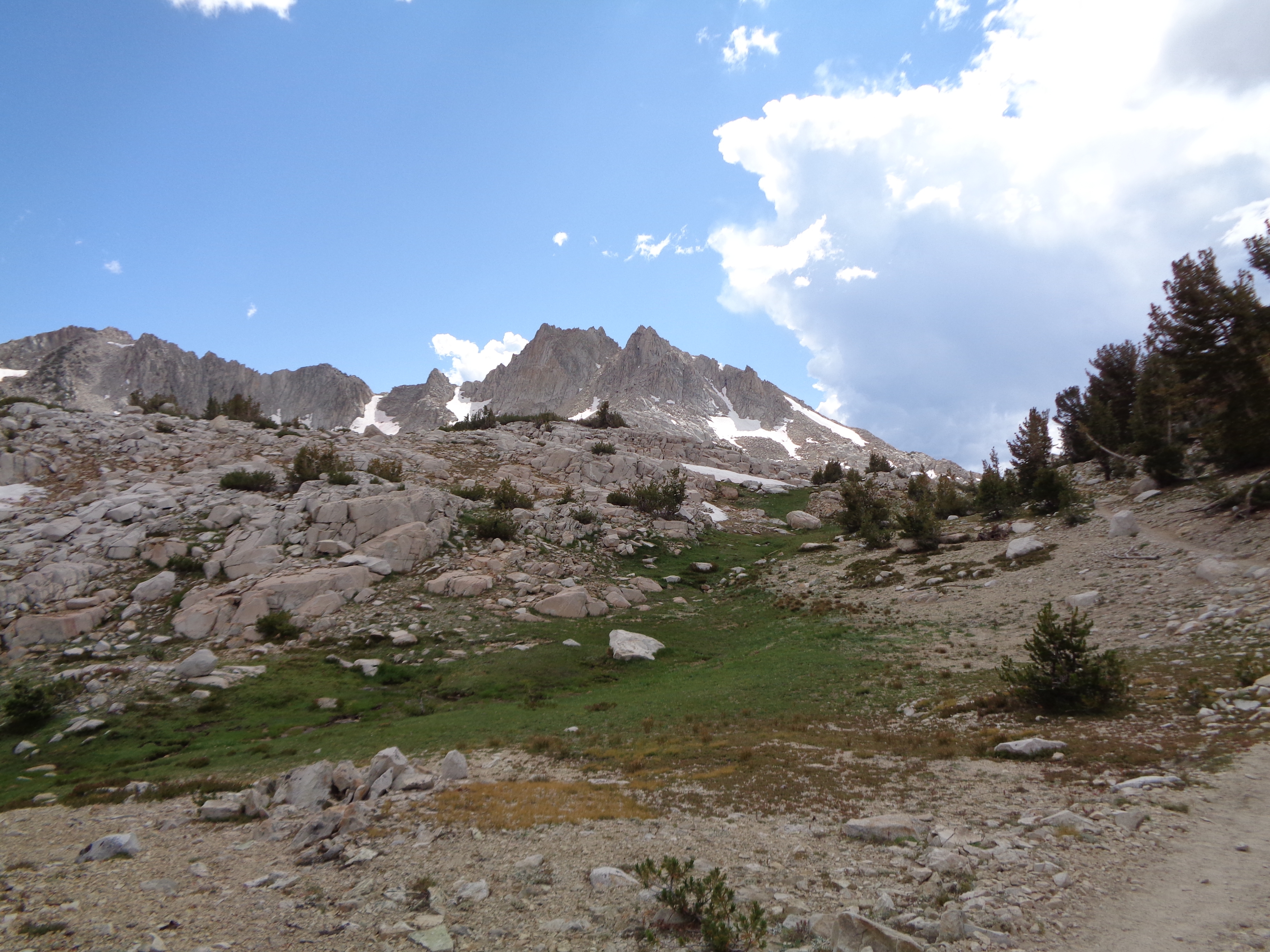
If I haven’t mentioned it before, I LOVE climbs. If I had to choose, it might be my favorite part of the actual physical hiking. So sometimes I struggle to pace myself appropriately, I just get so dang excited. I ended up stopping frequently to catch my breath as I got higher, but that afforded me plenty of time to soak in my surroundings. I imagine Donahue is a bit less impressive to NOBOs, who have already been through the heart of the range, but I was struggling to come to terms with just how heckin’ BIG everything was. A creek that I had crossed at the foot of the climb cut back and forth through the broad meadow it had no doubt helped to form.

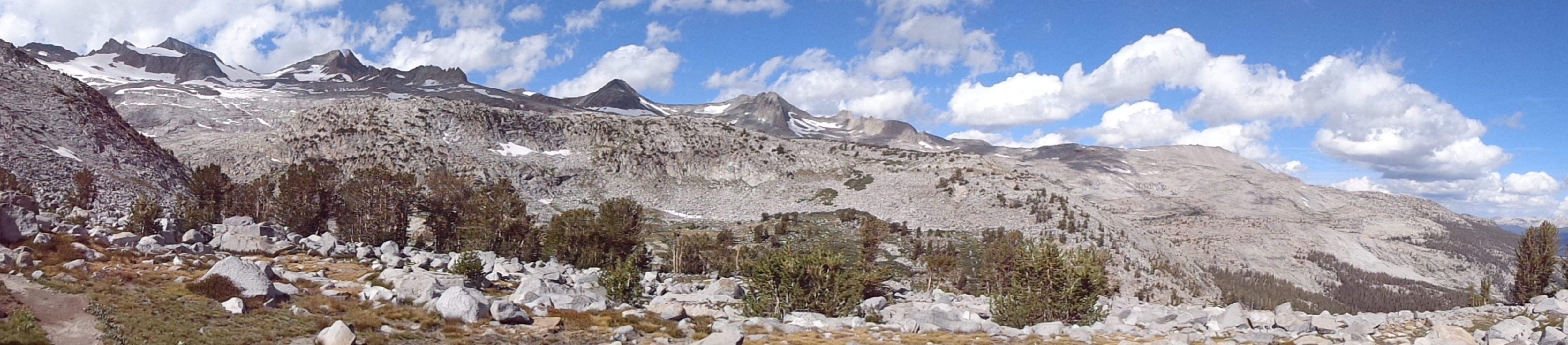
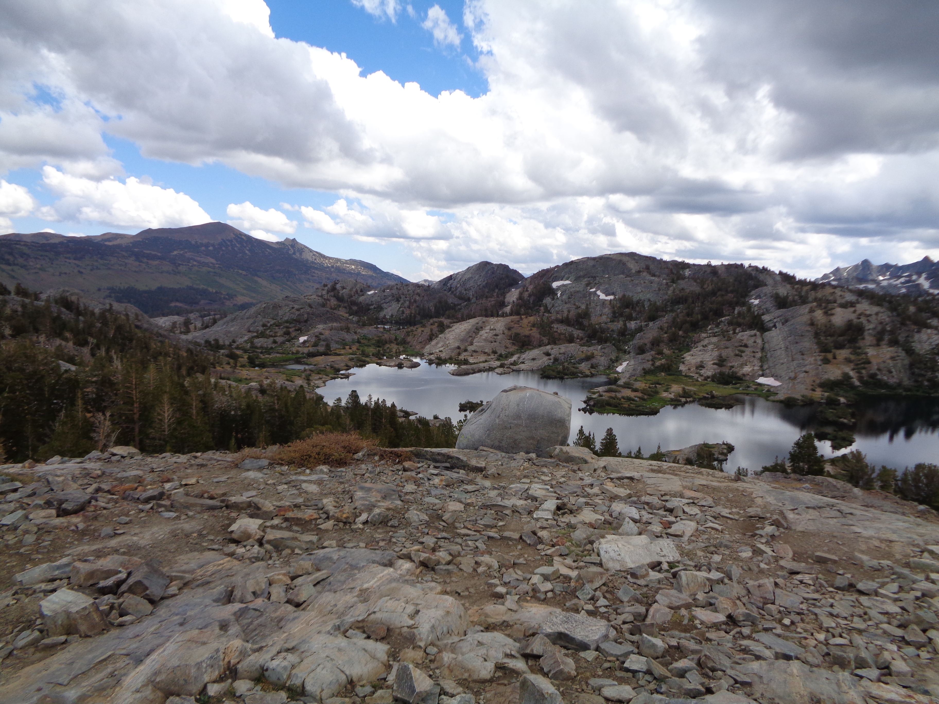
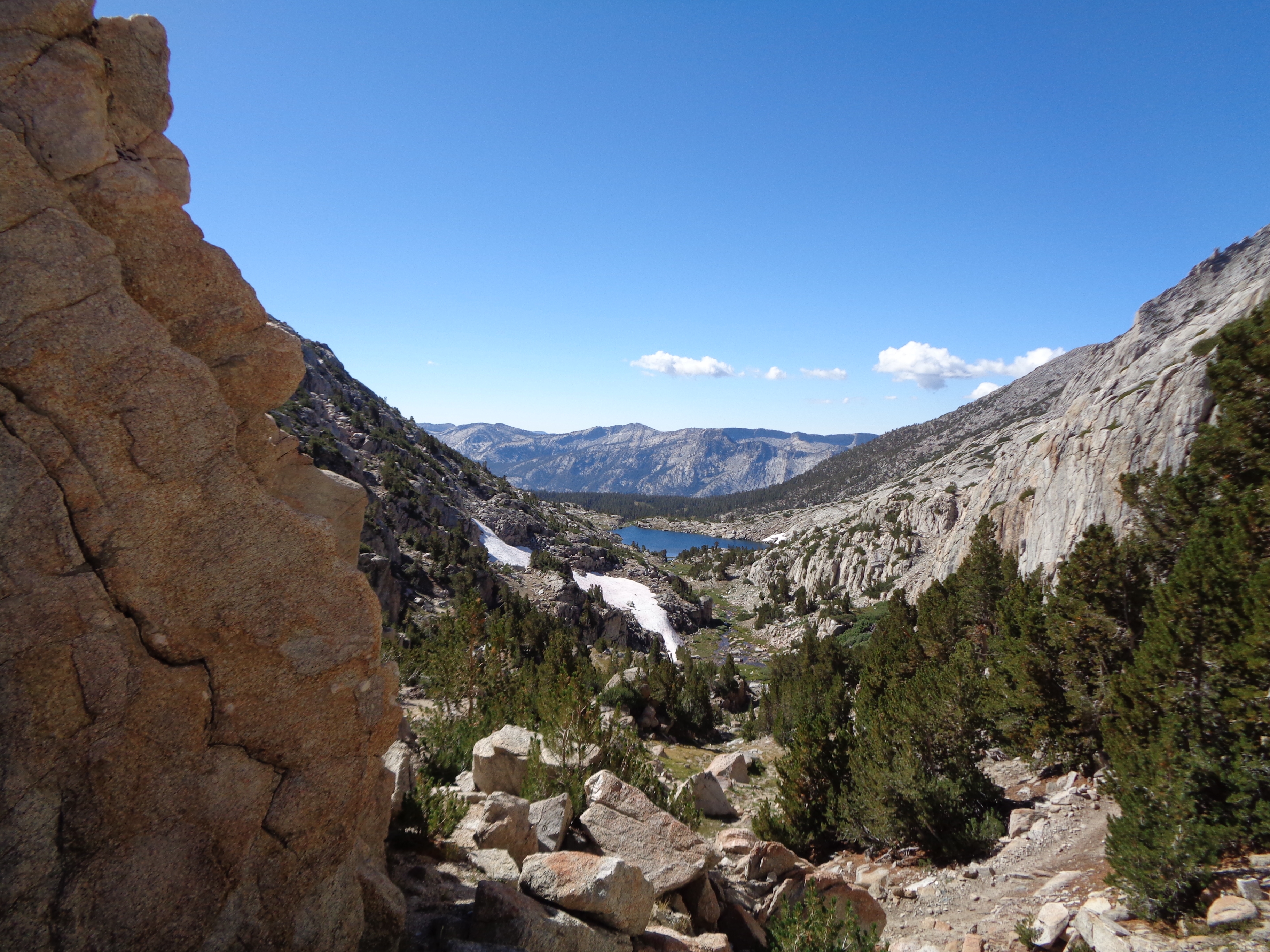
The top of Donahue felt like a gateway to another world. What I had seen up to now was peanuts compared to what lay ahead. Yosemite’s rounded domes gave way to narrow, angular peaks whose flanks were covered in jumbled boulders shed from the face since the glaciers retreated. For the first time since Washington, I saw large snowfields and glaciers (thankfully all well above the trail). I dawdled for a while, but thoughts of the potential bad weather eventually persuaded me onward. 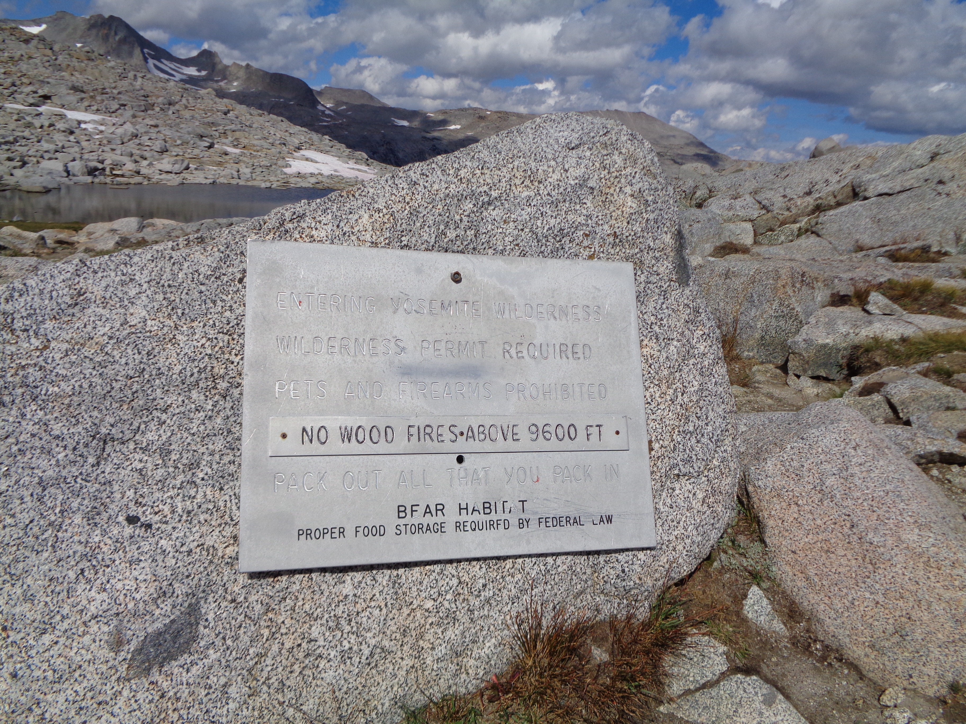


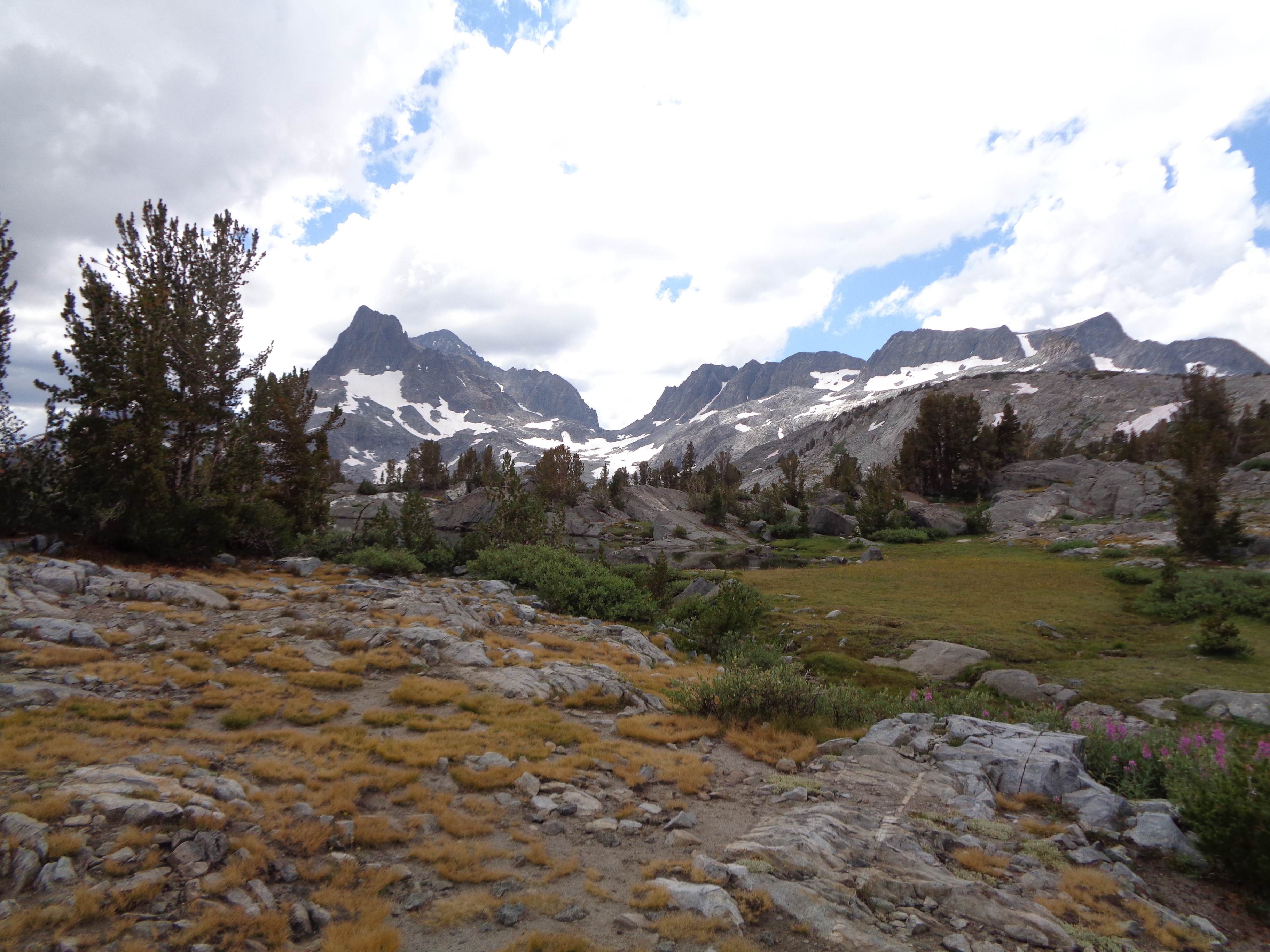
The trip to Island Pass was a delightful, gentle walk through a meadow with copious views of the surrounding mountains. I admired the massive lake below me, but carried on when the reflection of the growing dark clouds became blurred by little waves created by the building wind. 


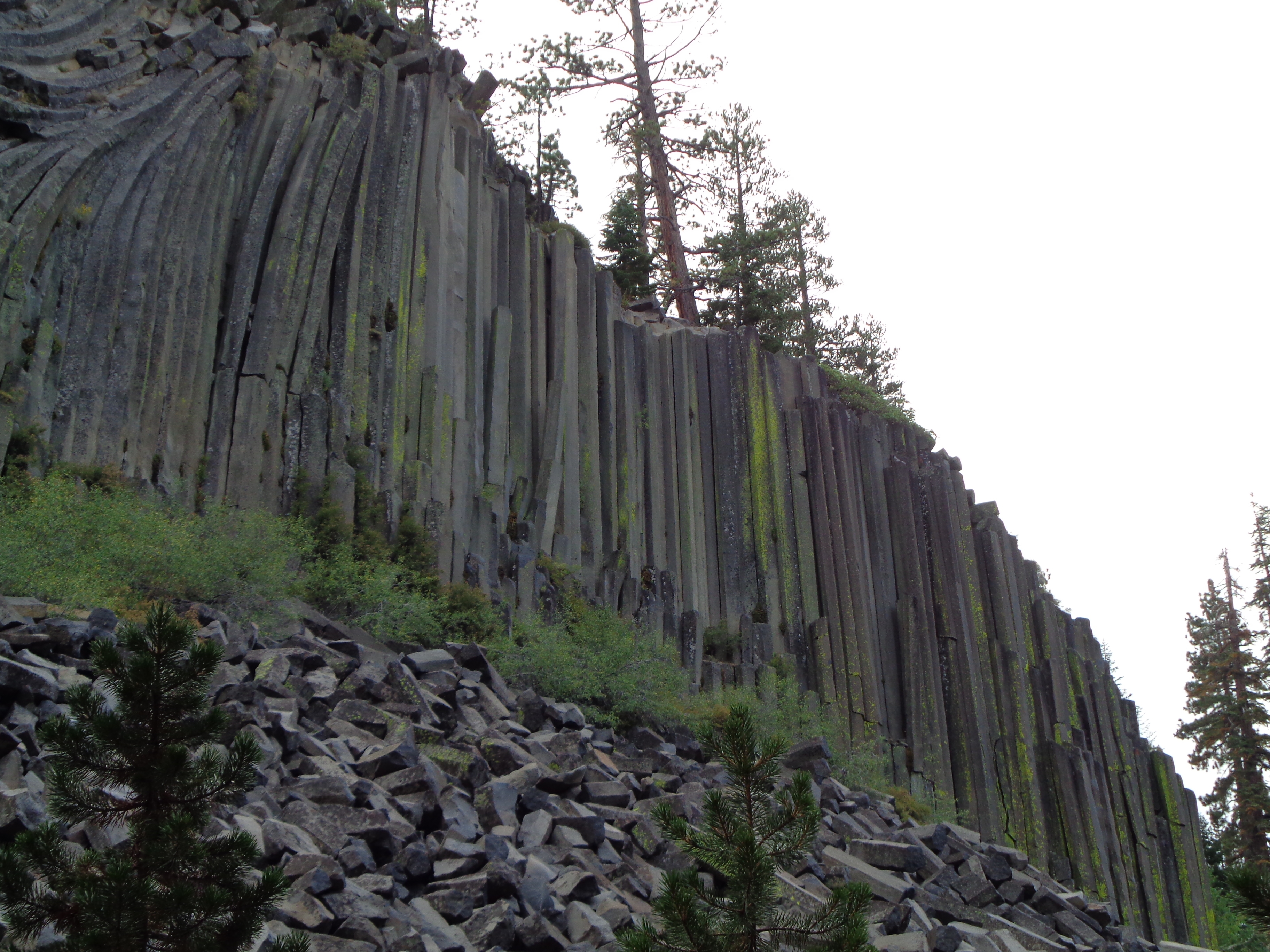
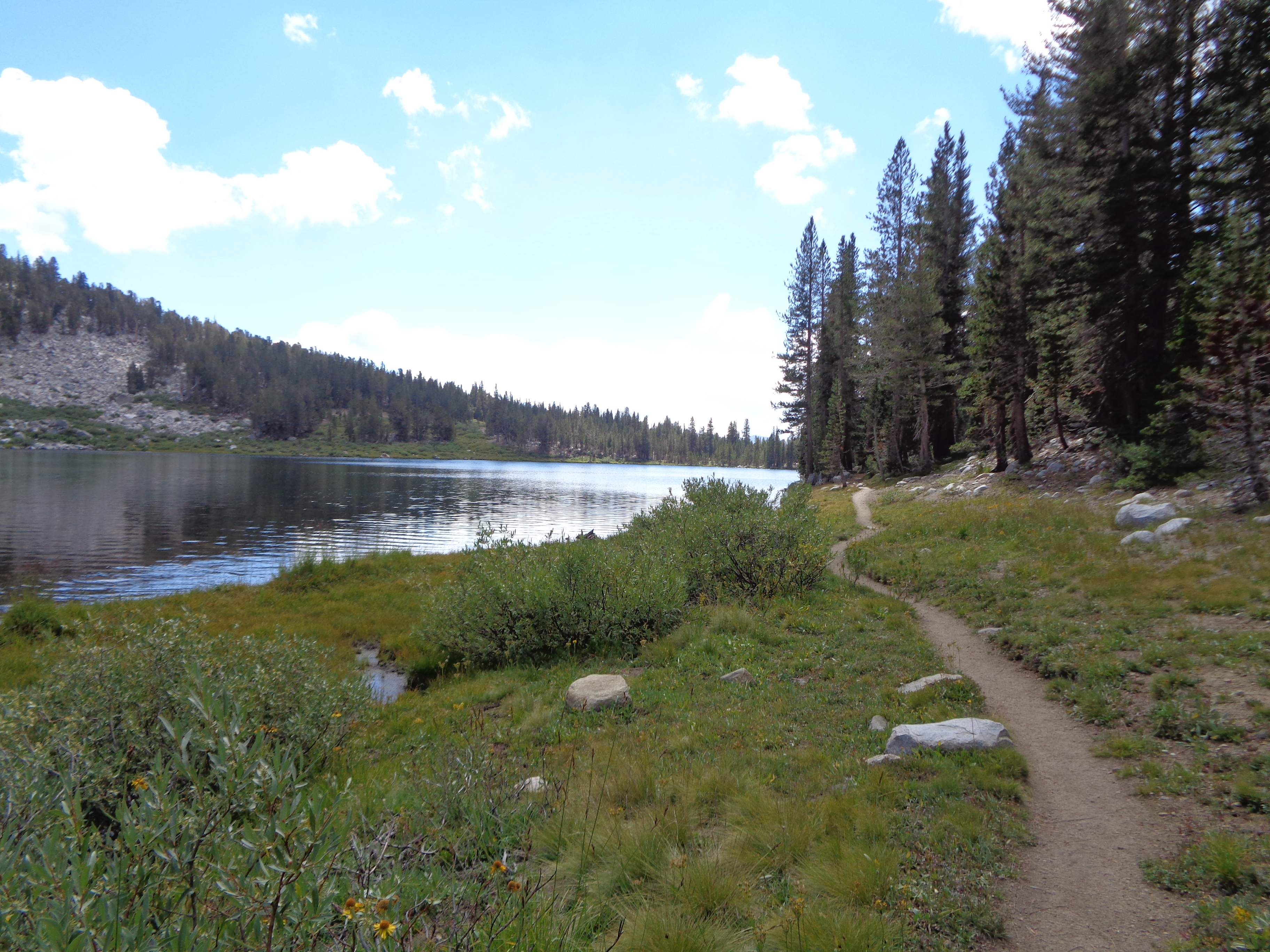
Down through the woods, down what felt like a never ending slope towards Red’s Meadow as the weather continued to deteriorate. I walked through a startlingly crowded Devil’s Postpile NM just before the campground and realized I had heard the name, but didn’t know a damn thing about it. Not even what I should be looking for. I think it added to my amazement at this somehow natural rock formation.


You know that feeling you get when the sky turns a color it should definitely not be? As I walked through the campground looking for the bear-box turned hiker-box, I realized I was going to need to get my tent up with a quickness. Luckily I saw an obvious congregation of JMT hikers and was soon fighting to pitch my tent in the wind. As soon as it was up, I chucked my stuff inside and seized the opportunity to check out my first hiker box resupply before hell broke loose.
And then it did. All of it. I got caught in a hailstorm on my 2nd day of the AT, but that felt like a calm drizzle in comparison to what was coming down at that moment. With my tent about 20ft away and my head already in a bear box full of food, I did what any rational hikertrash would do. I hopped right in that fucker, shut the door, and started eating!
Several Pop Tarts later, the deafening ricochet of hailstones off my steel roof subsided. I poked my head out to survey the damage. My tent, which had so nobly defended me the night before, had met its match. In all fairness, I think I forgot to close the vestibule all the way. Regardless, my tent was all “2D” and sporting a new floor covering of already-melting hailstones. Yay.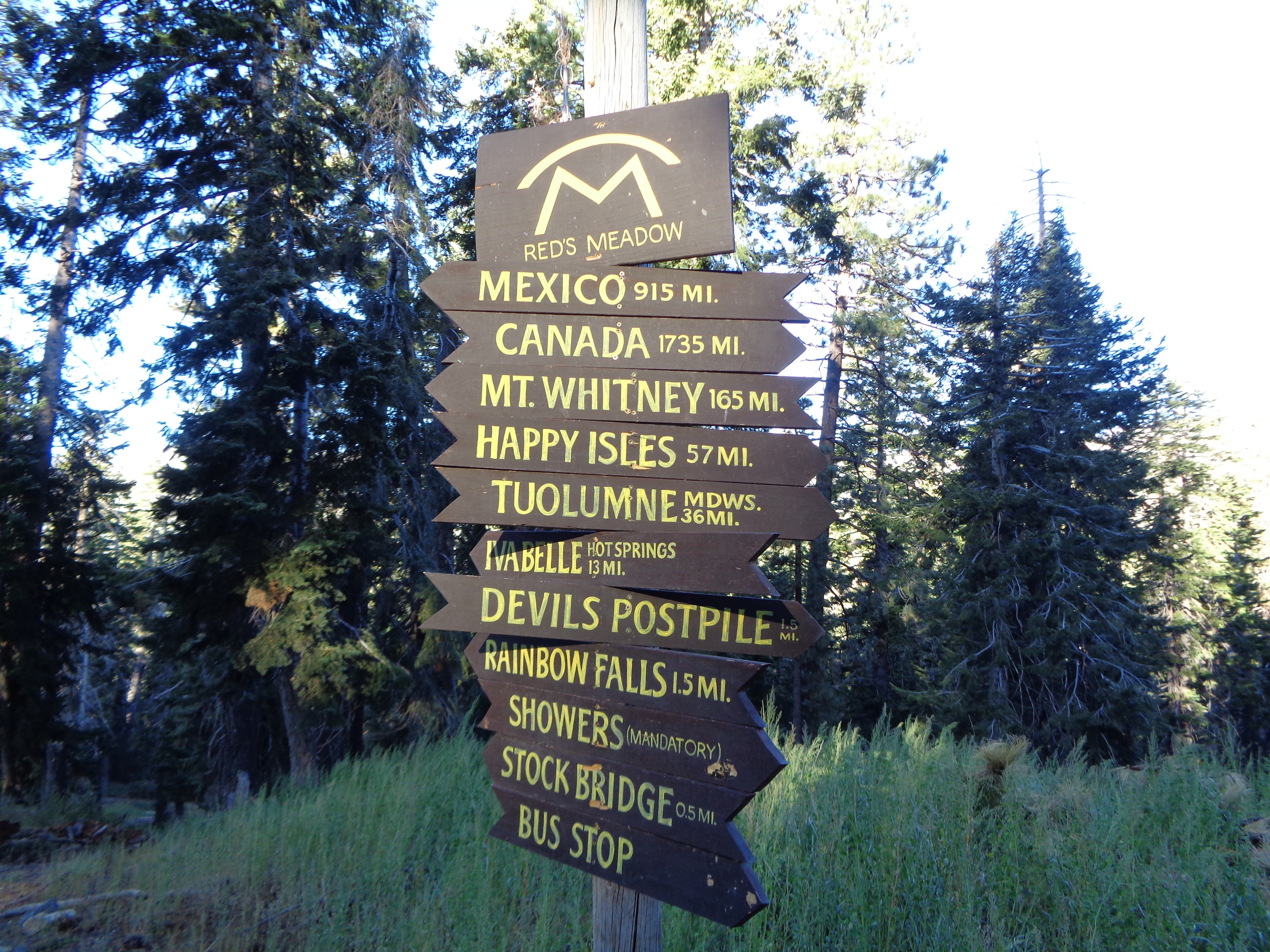
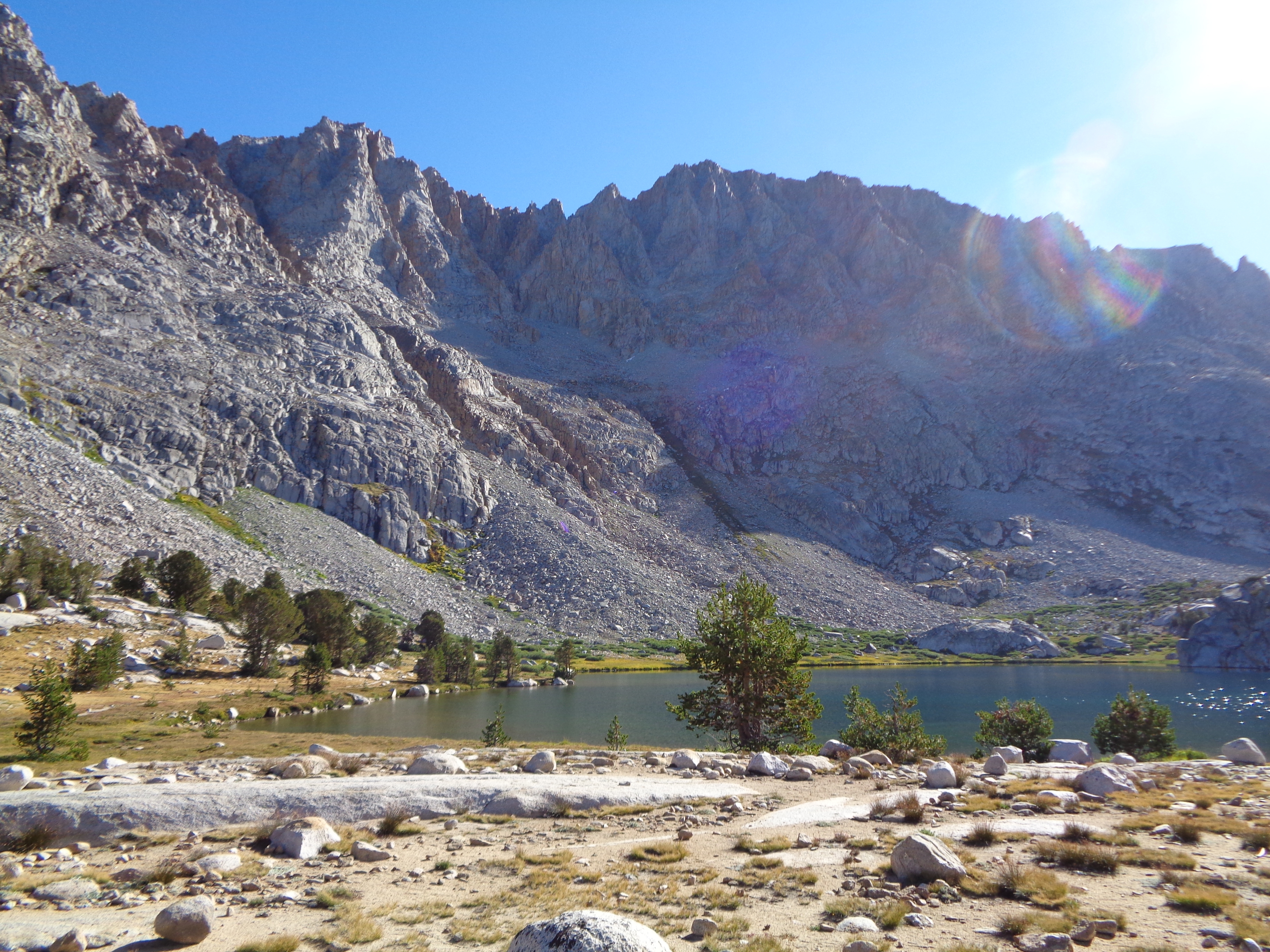
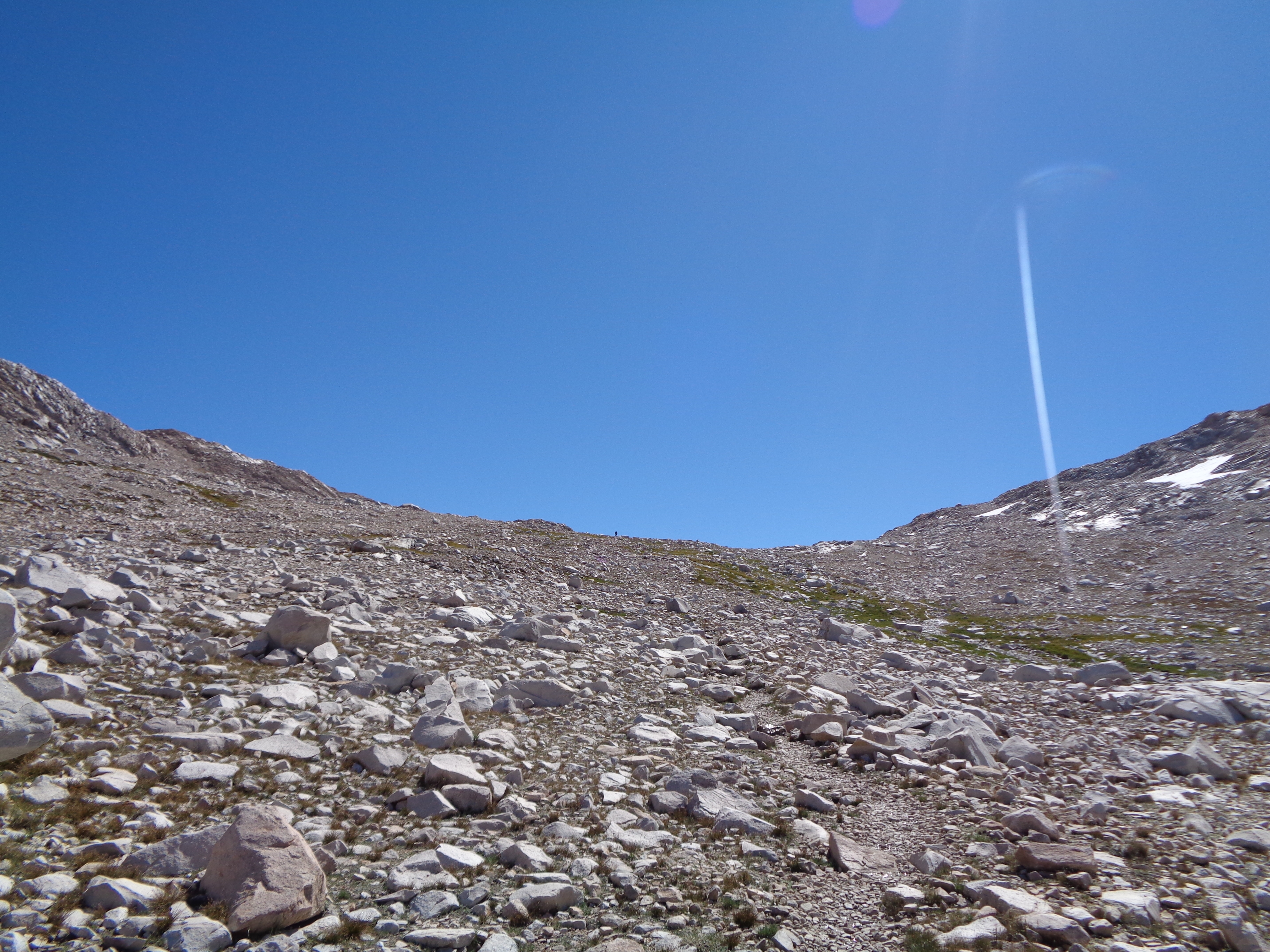
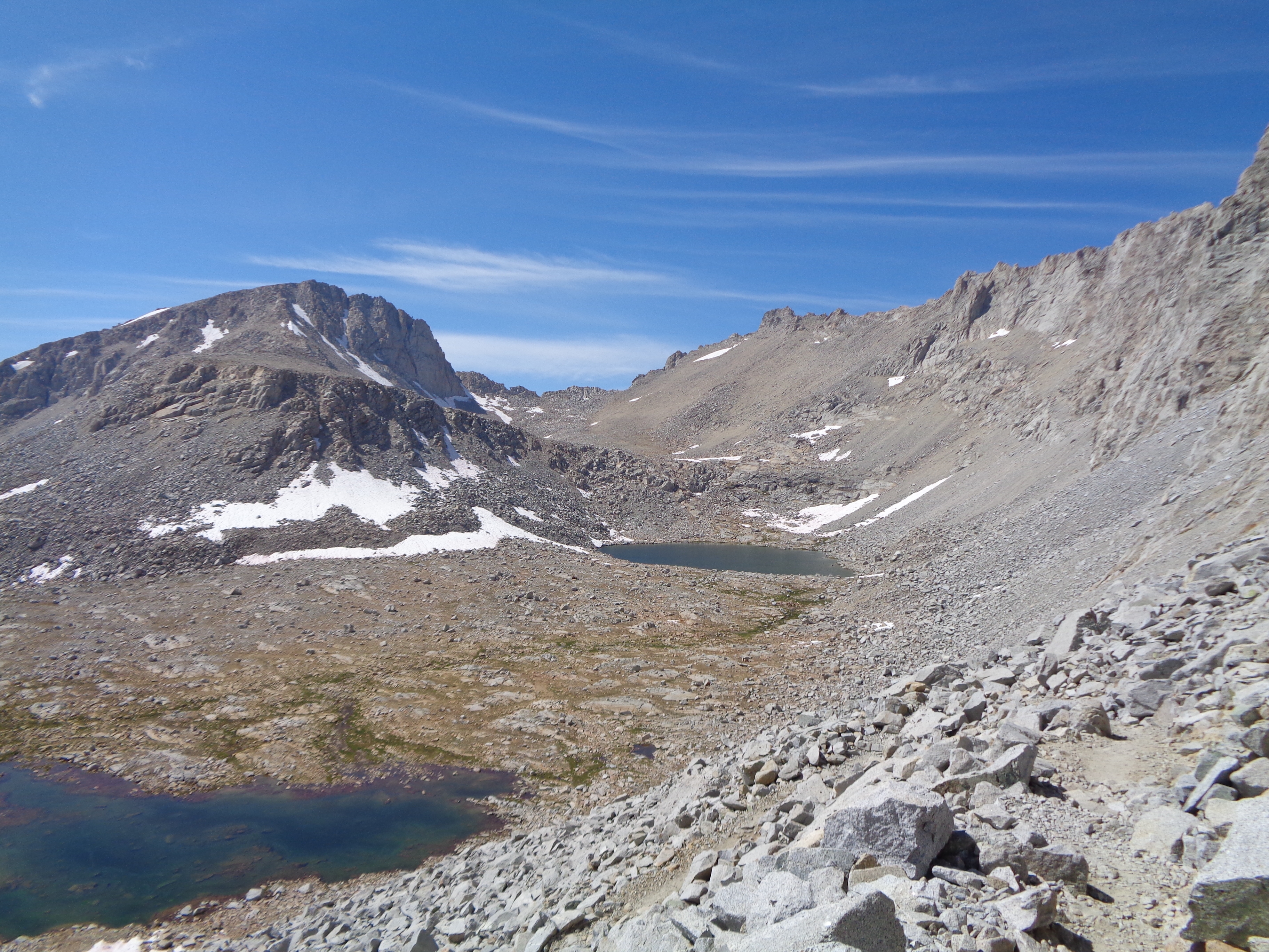
But I wouldn’t let such a trivial matter as that pull me down. I reset my shelter and slept soundly that night. The next day’s hike to Silver Pass was all sunshine and butterflies (no, literally) and the summit revealed more massive canyons flowing around the mountains. Still wary from last night’s theatrics, I began descending as those familiar dark clouds started to build again. Things remained calm until, of course, I reached some switchbacks down an exposed canyon wall as the thunder started up. 


 Silver Pass, looking south
The rain held off until I was back in the woods, but it was unpleasantly cold from the start. Thankfully, I caught back up to Kirby and Per Bear as the rain continued, which boosted my spirits. Setting up your tent on a weird slope in a tiny alcove next to the trail because you’re cold and wet and don’t want to hike any more sucks a lot less when you’ve got company.
Another day, another pass. I was settling into a nice rhythm. Life was simple. There was only hiking, demanding enough focus to tune out distracting thoughts but still allowing space to drink it all in. We crossed a ridge in the soft morning light, me running to try and keep warm. Getting over Selden early was extra appealing because it meant more time relaxing at our last resupply, Muir Trail Ranch.

 The summit was rather crowded (4 whole people!) so I snapped a few pictures but made a bee-line for a crystal clear lake below. I knew I’d have time at MTR, but is stayed there a while to dry out my gear. Gear-drying stops in the Sierra are not a chore, but a privilege. As I polished off the half bag of Frito’s I’d found in my bear box/storm shelter, I started to get a bit nervous about this resupply.
Selden Pass, looking north
Selden Pass, looking south
Here’s the plan: Go to MTR (on a ~3mi side loop), charge phone and headlamp, pull together 5-6 days of calories from the hiker box (enough to get me over all of the 12,000ft passes, Forester Pass, and Mt Whitney), and then figure out how to fit all of that into my tiny bear can. No sweat. Everyone says that the MTR hiker box is the best hiker box there is.

“I’ll be fine!” I kept telling myself, all the way down to the Ranch.
There were lots of hikers around, mostly on the JMT. I just laid in the sun for a while, elevating my feet and processing the last few days. Eventually, I had to get down to the important part. Anything I found that I wanted to eat but not carry, I ate then and there. There was plenty of food, and I felt better about being able to get adequate supplies. I wasn’t sure what everything was by the end, but it all (basically) fit in my bear canister and I felt pretty sure I had enough calories in there.
SPOILER ALERT:
I didn’t.
Not even close. My appetite increased massively at elevation, which I hadn’t accounted for. I may have sort of forgotten how long it would take us to summit Whitney and return (basically 3/4 of a day). My retrospective estimation is that I ended up with about 3.5 days of a comfortable diet. It took us 5.5 days to get to Lone Pine.
YOLO
Yep. I said it. I would say it a lot over the next few days. Sure, we had several opportunities to get out and resupply before our planned stop in Lone Pine. But then we’d have to leave. And where’s the fun in that? Skipping Whitney wasn’t even a consideration. We wanted our trip through the highest, possibly most remote section of the trail to be a full-immersion experience. 
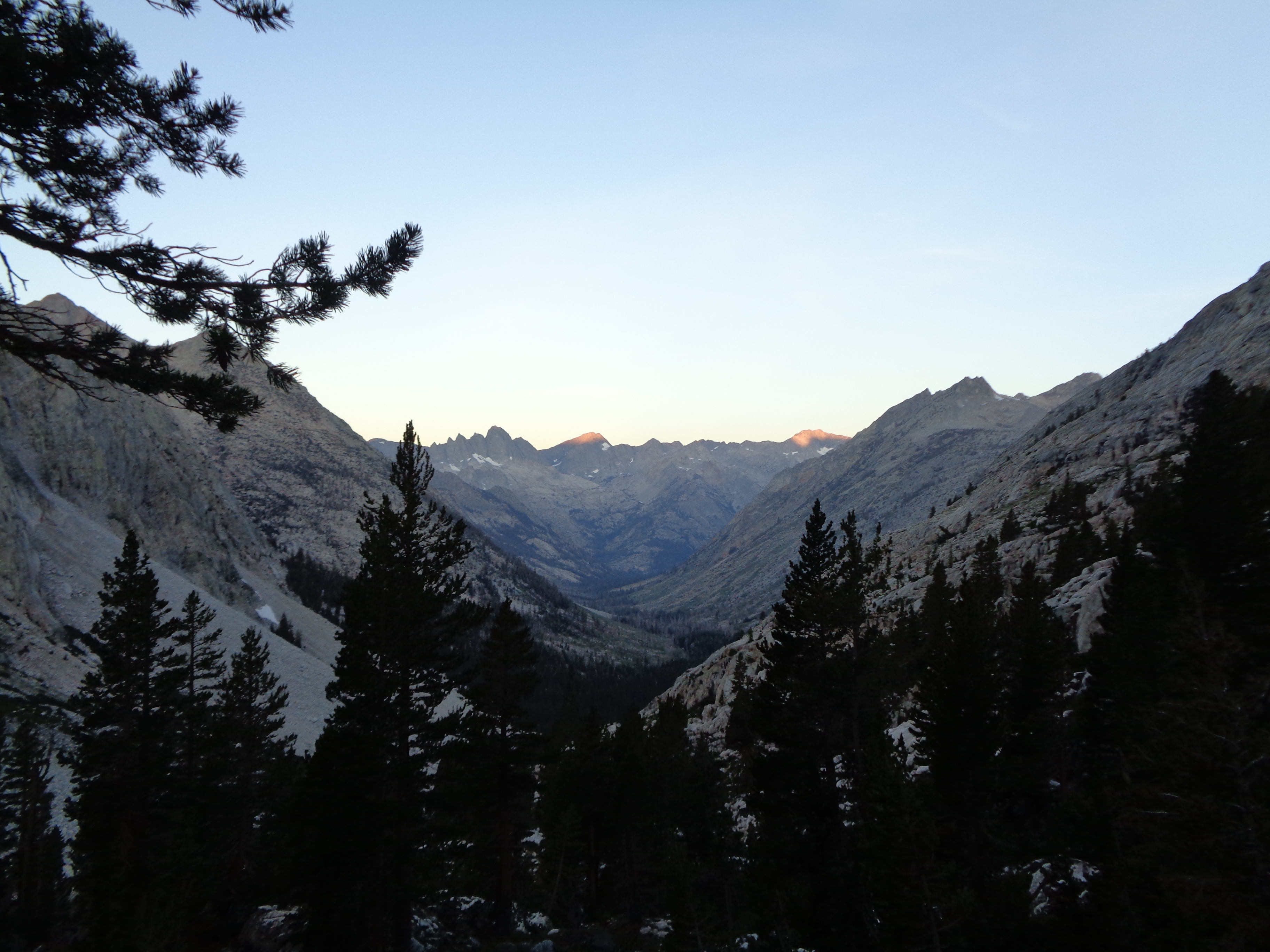
Per Bear had left first, and had suggested a campsite about a mile before the ford of Evolution Creek. Kirby and I practically ran out of MTR, excited for what we were about to get into. Over dinner, we discussed possible itineraries, and the food issue was starting to nag in the back of my mind again. We didn’t come up with anything solid. Get over Evolution Creek and Muir Pass tomorrow, take it from there.
We packed up in the dark and turned our headlamps off just as we started walking. I had a Larabar for breakfast. Thanks to some clutch comments left on Guthook, we found a series of rocks and logs where we could get across Evolution without getting in the water. Icy rocks and icy logs. I don’t like crossing fast water on slippery logs the same way I like climbing. In fact, I like it a lot less. But we made it across, and began the 14mi climb to the legendary shelter at the top of Muir Pass.
This was the easy part.


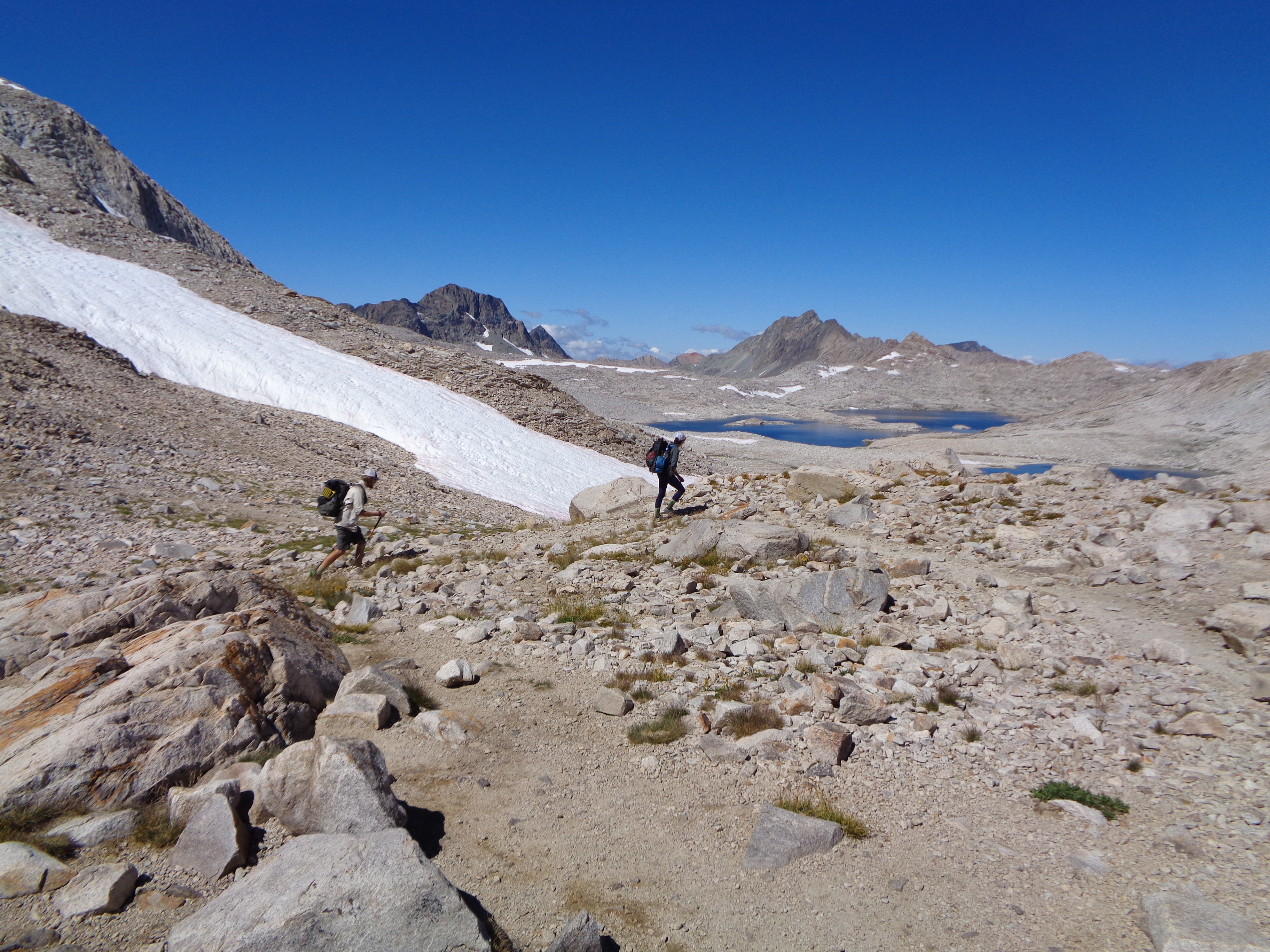
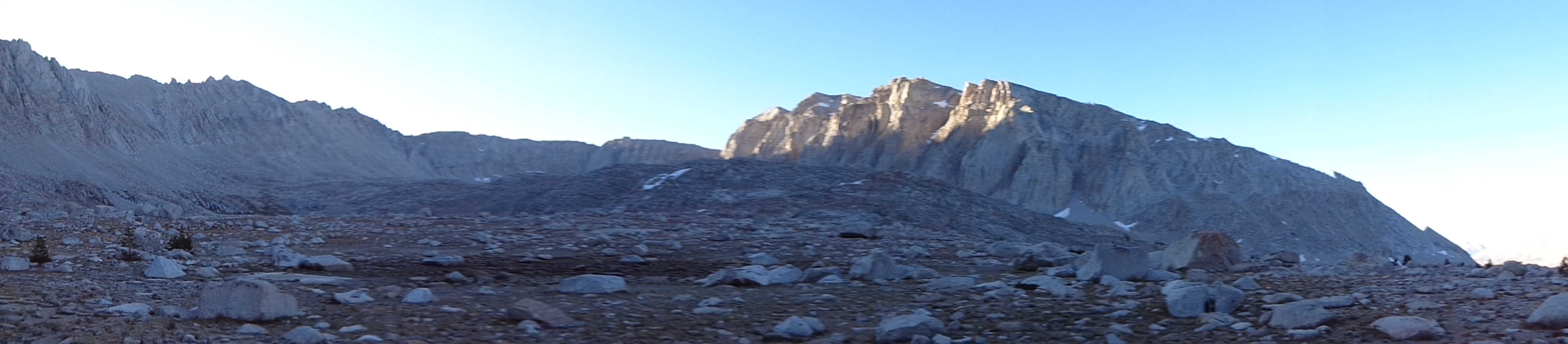
The SOBO approach to Muir Pass is a twisting route around a series of rising canyons. Each has a lake, which get clearer as you go up. Green grasses and brush gives way to talus and snow. I think I ate another Larabar on the way up. My surroundings rendered me speechless.


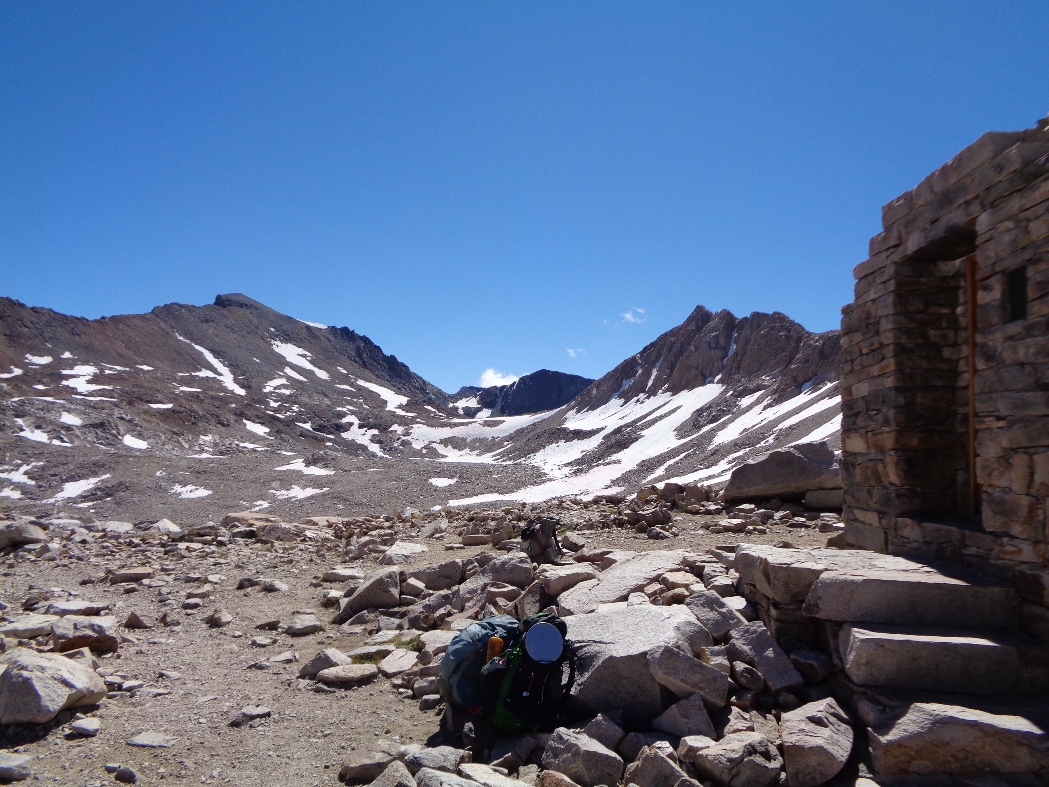
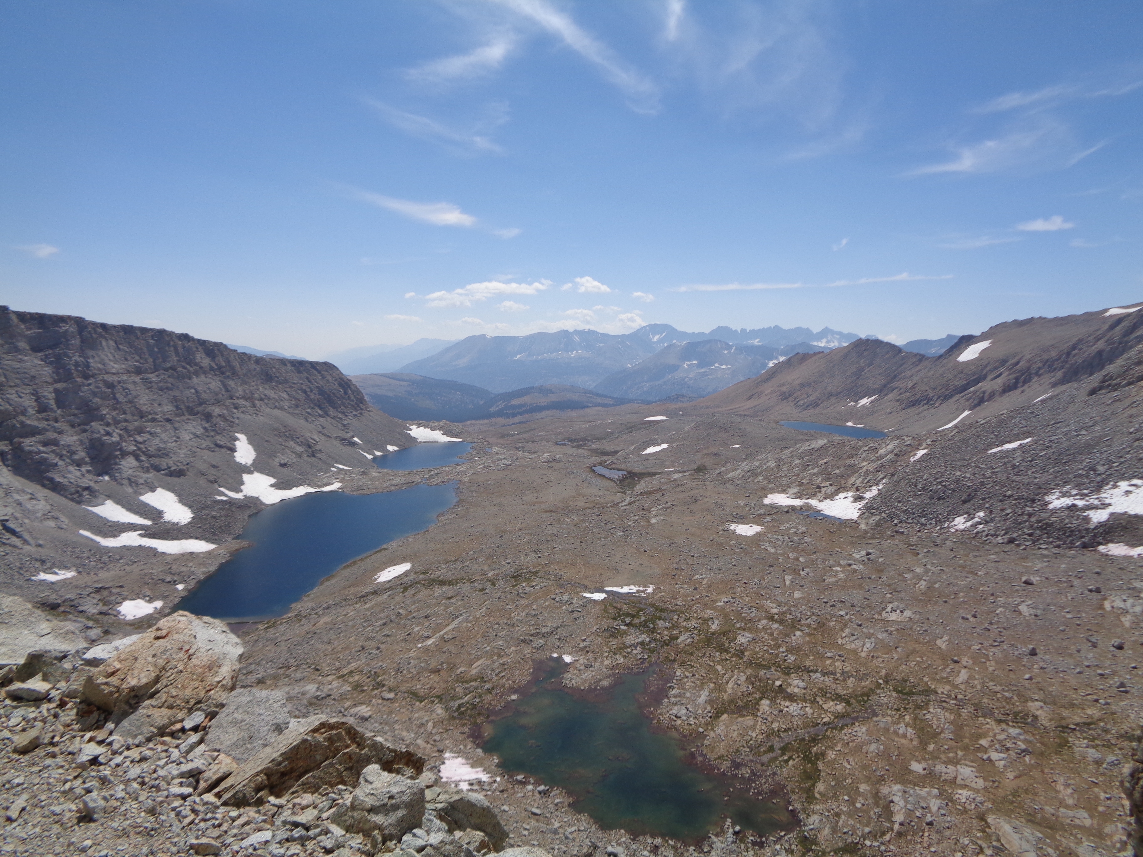
 It was taking much longer to reach the summit than I had thought it would. We had slept at about 9,000ft, and the amount of time at relatively high altitude was starting to catch up. I was definitely breathing heavily despite the pretty gentle grade. Probably didn’t help that I’d consumed all of 500 calories over 14mi and 3,000ft of climbing. I thought I saw the hut in the distance, but then I thought that I might just be hallucinating. Then, finally, magically, Holy Shit that’s actually the top! No impending signs of bad weather, no crowds, and the beauty of King’s Canyon all around.
Finally, the actual top of the pass!
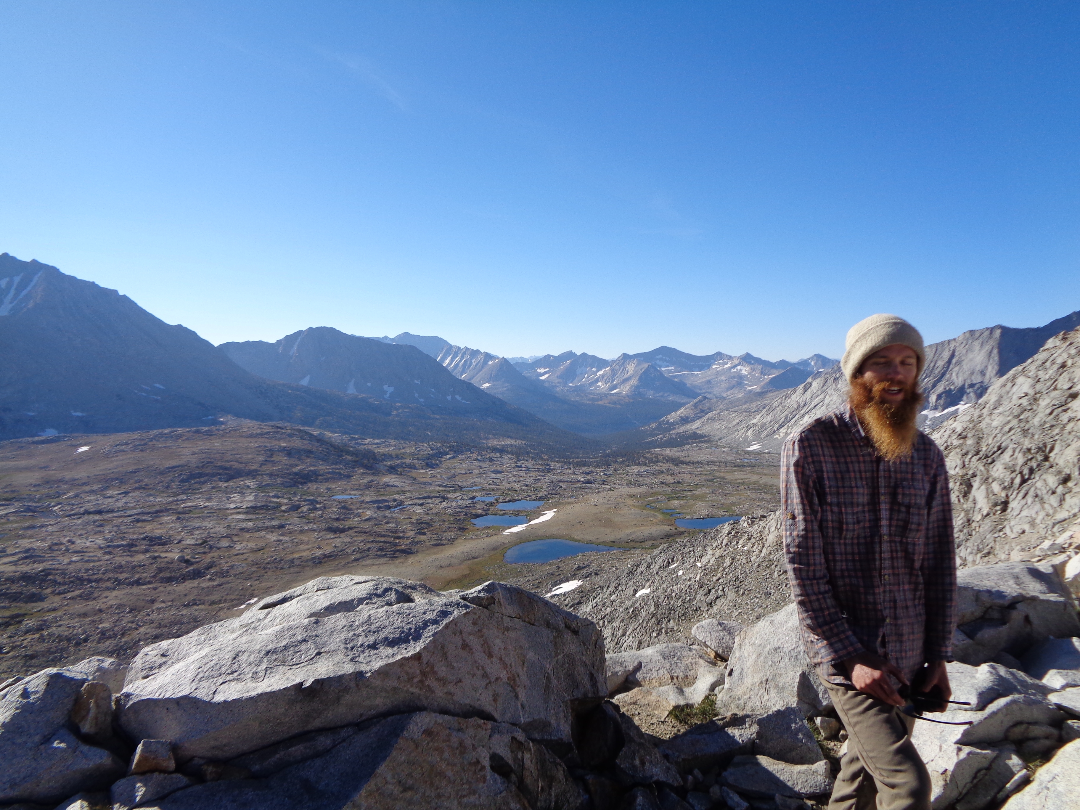
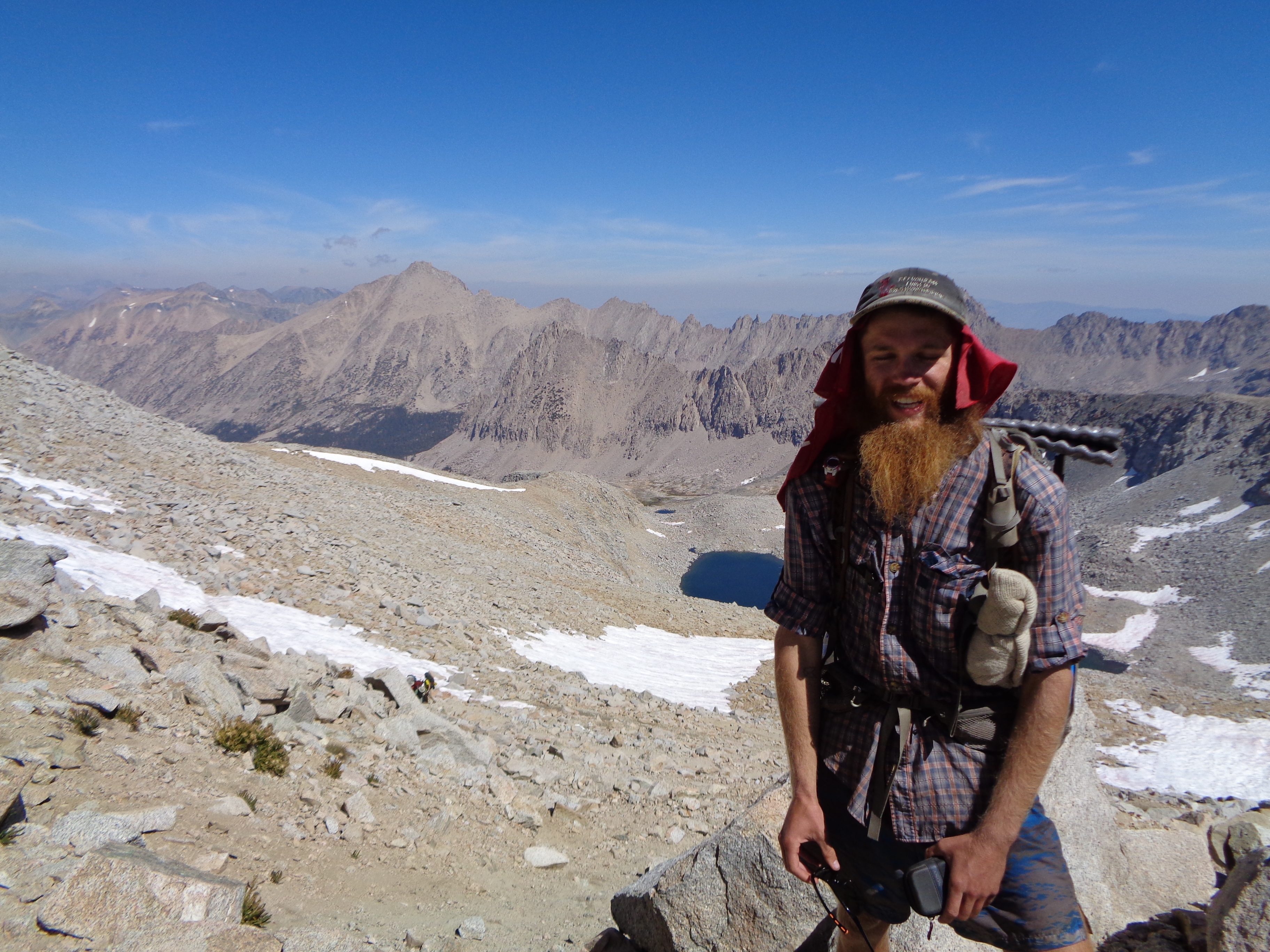
Bad ass friends in bad ass places

Standing there, in the radiance of the Range of Light, I was happy. Not, like, regular happy. A calm, subtle happiness with a hint of rainbows, unicorns, and fluffy bunnies. A depth of happiness I’d never felt before, and honestly might never feel again.
“Lunch” (I ate a tortilla with a tuna pack and a packet of mayo) dragged on, with no desire to move. I think there were some Sirens singing on Muir Pass. Alas, we finally started down under still-blue skies to get as close to Mather as possible. On the way down, we settled on a plan. Climb Mather and Pinchot tomorrow. Sunrise on Glen Pass and Forester the next day. Whitney on the third day. The forth day would be about 20mi to a trailhead where HOPEFULLY we would get a hitch into Lone Pine. It’s an ambitious itinerary.


 We shared a campsite with two very nice JMT hikers who let us sit around their fire at night. With an ambitious day planned, we did our best to pack quietly and left about 5am. Climbing the “Golden Staircase” of Mather Pass as the sun’s light shone off the walls of the canyon was powerful. All around was rock, the last scrubby vegetation forgotten hundreds of feet below. My feet felt incredibly heavy going up the last steep switchbacks to the narrow pass. But then I was there, and I heard that Siren song again.
Morning light from the Golden Staircase
 Mather Pass, looking north
 “Duuuuuuuuude” -Me
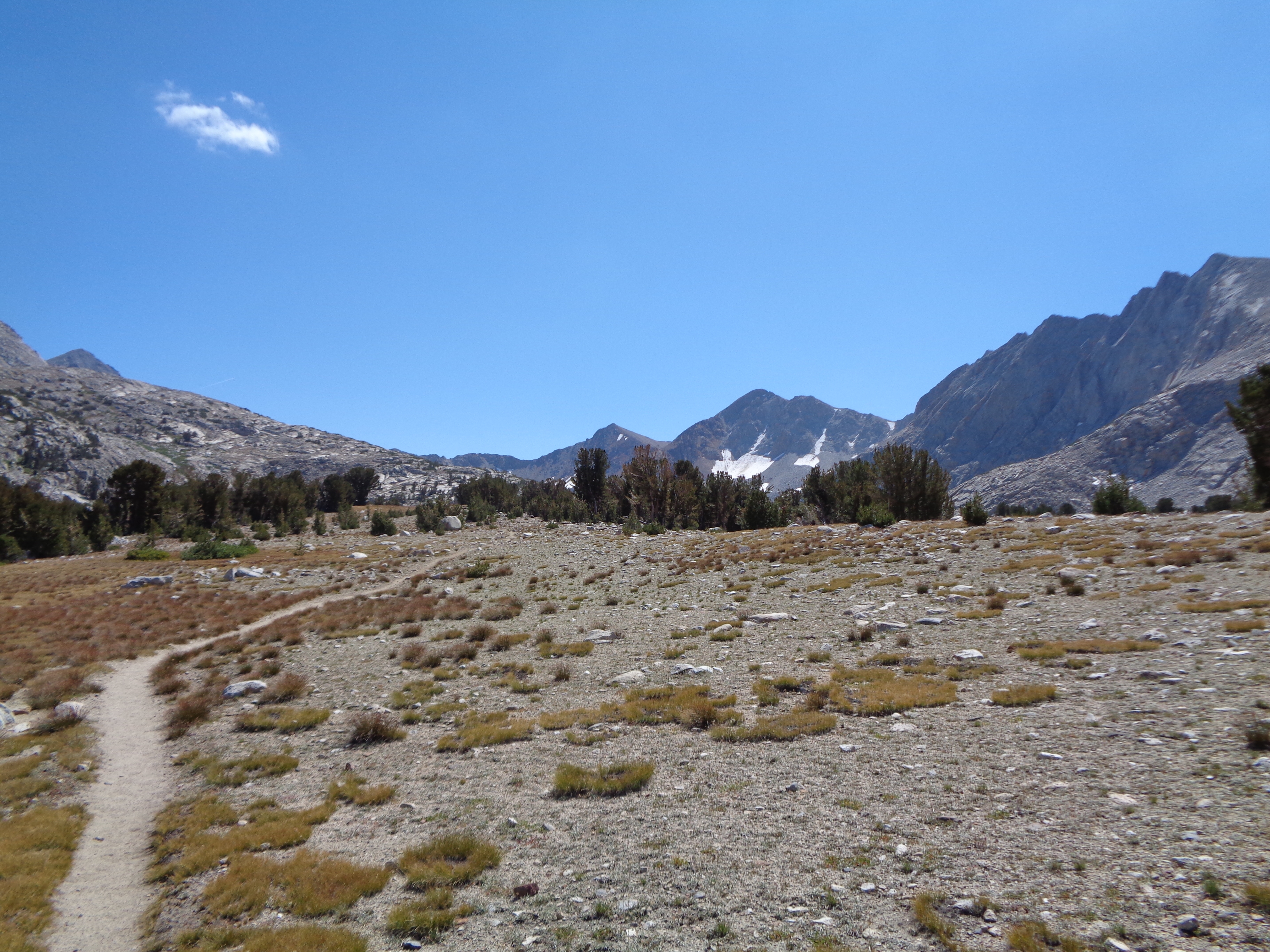
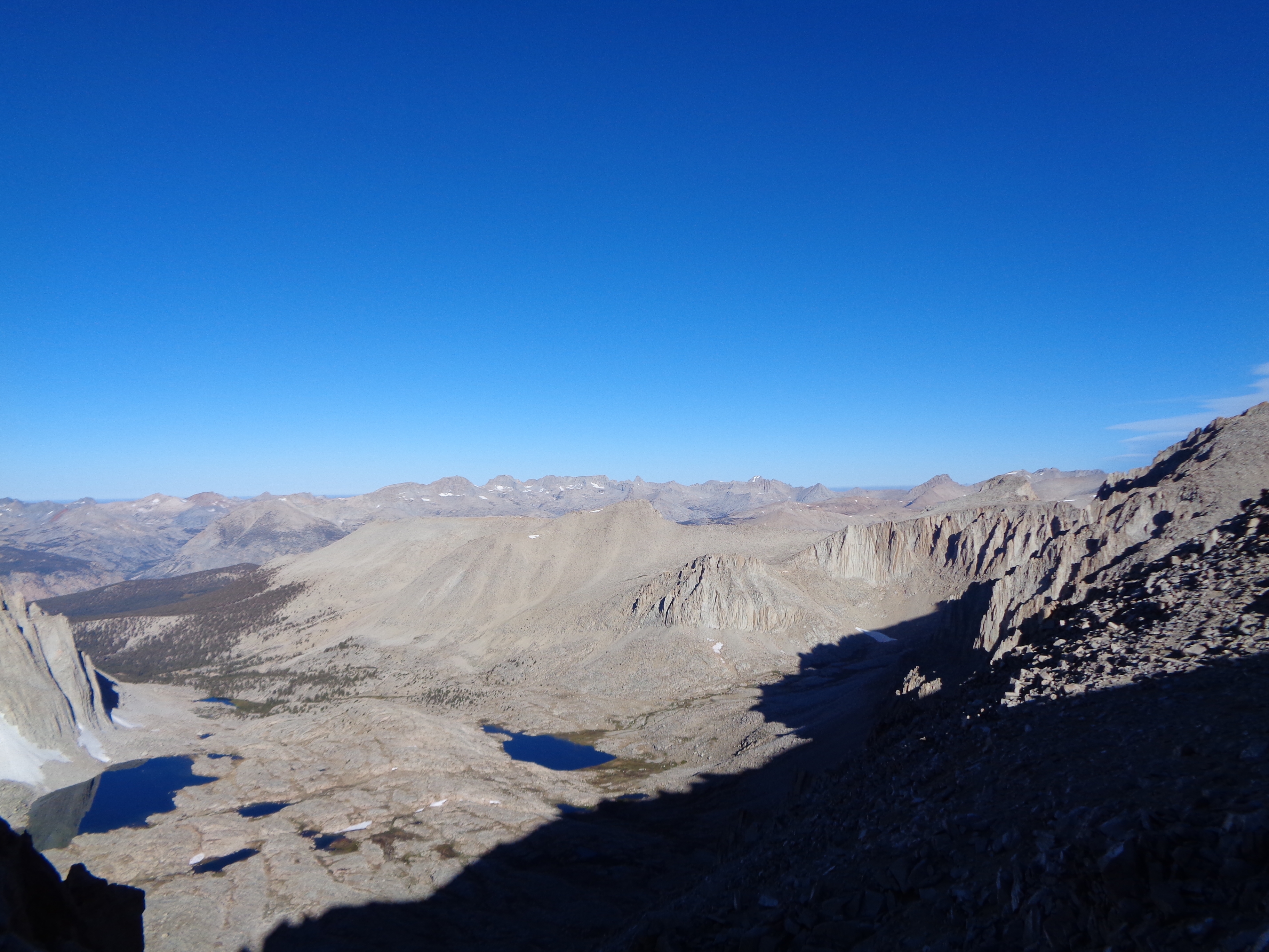
Something I hadn’t heard about the Sierra, but wish I had: The sun is fuckin’ BRIGHT out there. Even if you “don’t use” sunscreen, use it here. The trip over to Pinchot was largely exposed through beautiful meadows and occasional patches of open forest. The air was cool, but I was roasting in the sunlight.
I was eating more this day, opting to hold off fatigue for now but be hungrier later. I felt really good going up Pinchot. Again, the sky was blue and nonthreatening. Maybe our streak of afternoon storms was really over?

The sun shines brightly

Approaching Pinchot


Pinchot Pass, looking SW
It was precisely here that I decided I didn’t want to get into the business of picking favorite passes. It’s just not a thing that should be done.
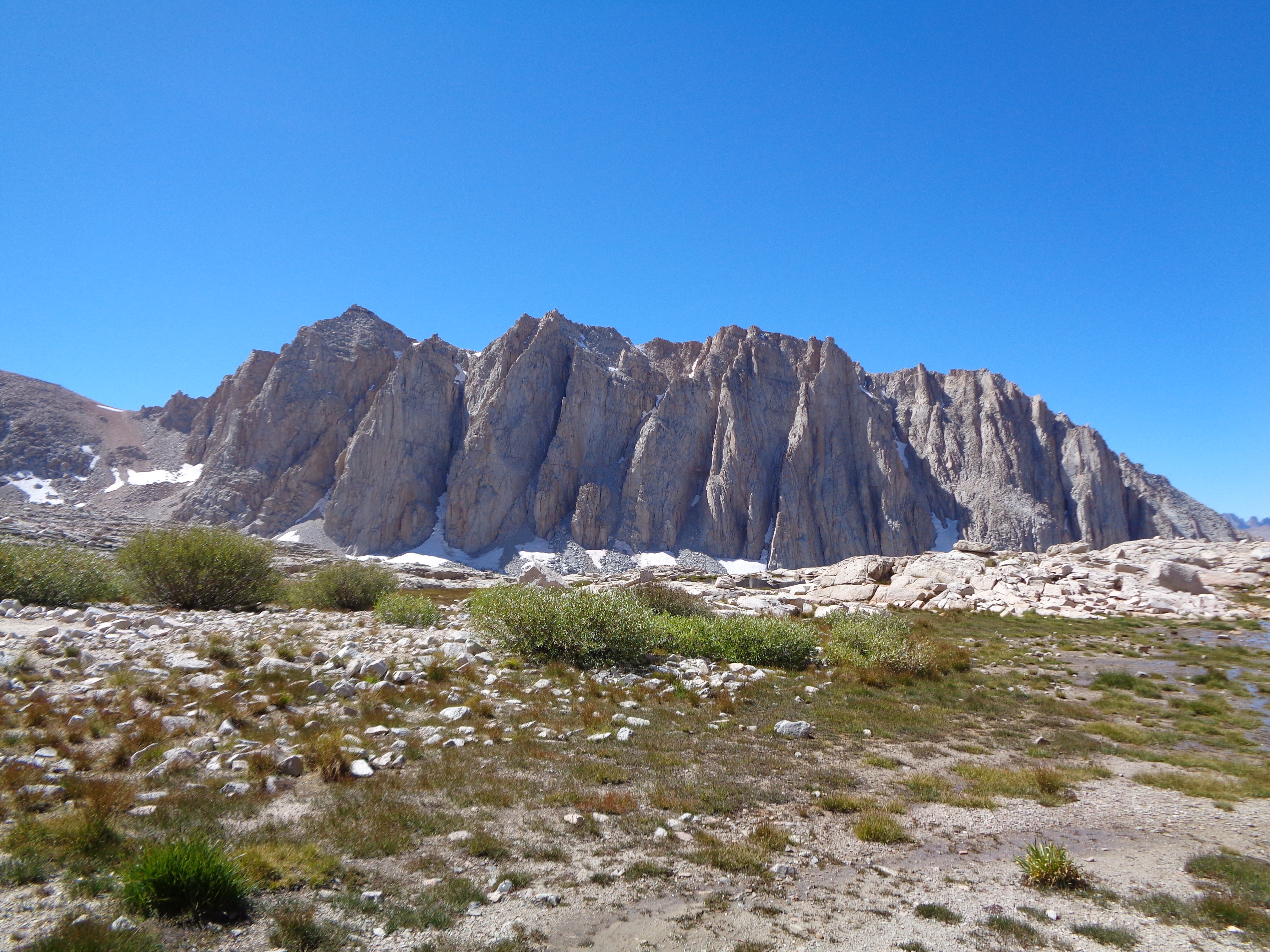
Our goal for the rest of the day was to get as close to Glen Pass as we could. I was getting tired, and I totally bonked well short of Rae Lakes. Per Bear was a great motivator, and we made it to within two miles of the lakes. Overnight it got cold. And it got wet. And as we were fumbling about in the early-morning dark, packing wet gear turned into packing frozen gear.
The trail switchbacks over a large rock field, which is glazed with a perfectly slick layer of frost. Arriving at the frigid summit, we realized it is a narrow spine with long, sharp drops to either side. “The sunrise is going to be so worth it,” I kept telling myself.
Right on time!


 Something about a choir of angels…
Fuckin right it was! Such a pretty sight. Feeling more excitement than cold and fatigue, we began the long descent to Vidette Meadow. All that we had left was Forester and Whitney. Could it all possibly be going by this fast? And yet, climbing Muir Pass just 48 hours earlier felt like it happened ages ago. Time is weird and immaterial. I was happy, and nothing else really mattered.  Atop Glen Pass

 Looking upwards from Vidette Meadow
Forester is on a different scale than all of the previous passes. Like Muir Pass, a series of massive, twisting canyons hid the pass from view for much of the approach. There was already a steady stream of hikers making their way up the trail. Focusing entirely on maintaining forward motion, I discovered how intensely I wanted to reach this point. How significant it was to me. I don’t even really know why, but I know that it was. I recorded little details of the climb deep in my brain, but processed very little on my way up.

I’m so happy! Forester Pass, looking south
I’m so hungry! Forester Pass, looking north
I actually sobbed at the top. For like, a minute. Thankfully I had a bit of time alone up there to pull myself together before more hikers arrived. Summiting Forester under ideal weather conditions was such an incredible feeling, I kind of stopped caring about the pit in my stomach for a while. If I had done things right enough to get here, solved all of the problems that had come at me, then I really could do anything. It’s a nice feeling.
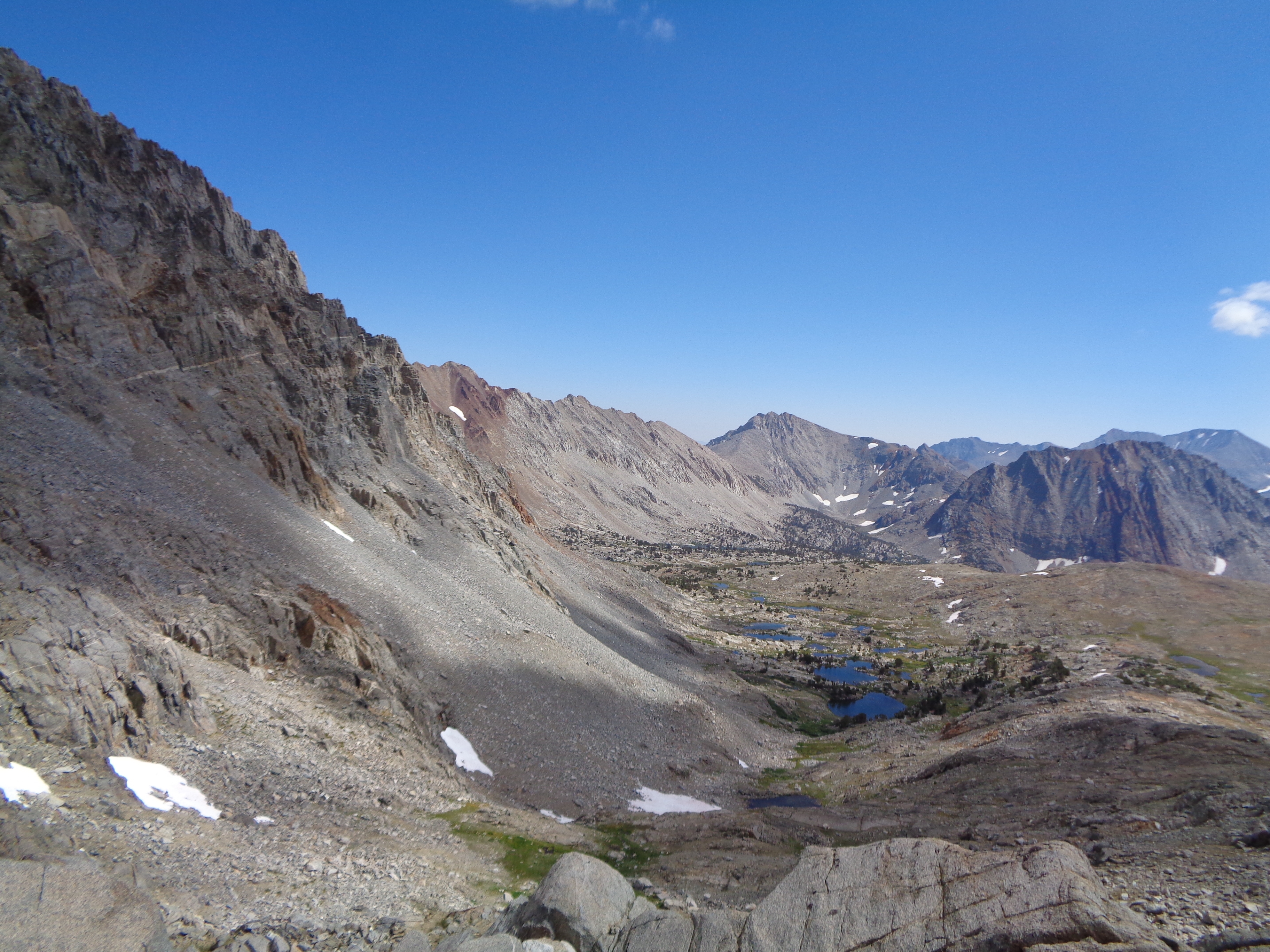
My dream-like state persisted all the way to the base of Forester’s southern face, and through the meadow sloping away from it. Then I started to notice changes in the landscape. The gray, chunky granite underfoot was changing to a kind of sandy slab, and things felt rather parched as we made our way towards the turn for Whitney.
Descending the pass

Looking back at the pass. Yes, it’s that tiny little notch in the wall.


The changing landscape heading towards Whitney
Elated but exhausted, we arrived at Crabtree Meadows and I ate my last remaining dinner. With one night still to go before town. But I was gonna need everything I had to get up Mt Whitney. I was doing pretty well overall, but could feel the effects of the altitude near the tops of passes. And Whitney’s summit rises almost 1500ft higher than Forester Pass.
We stashed our bear cans, shelters, and other non-essential gear behind a large blowdown. The trail was once again frozen, and crunched under our shoes as we made our way up around Guitar Lake. All you can see is a wall to your left, a wall ahead of you, and a wall far off to your right. It’s the wall on the left. That’s the one you go up. I focused on breathing and not on counting the switchbacks as I climbed higher. It’s a long way up. But a great trip. 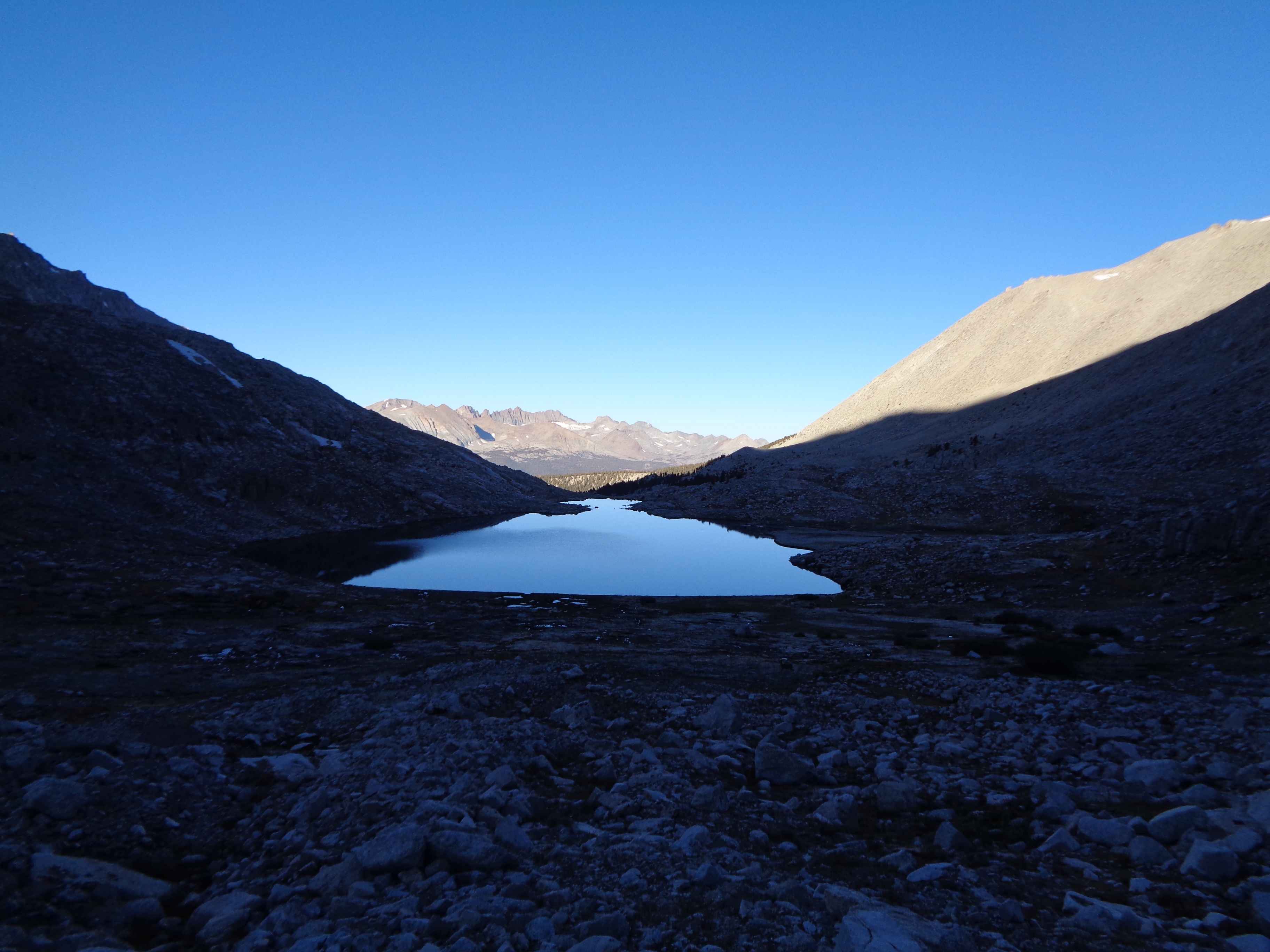


At Trail Crest, the hard work is basically done. Just another 1000ft and 2mi to the summit. Let me tell you, those are a long two miles. You’re up so high, already higher than everything around you. You can see the earth curve away at the hazy horizon. The eastern flank of the Sierra Nevada drops two vertical miles to the scorching Owens Valley.

Peeking out towards the Owens Valley
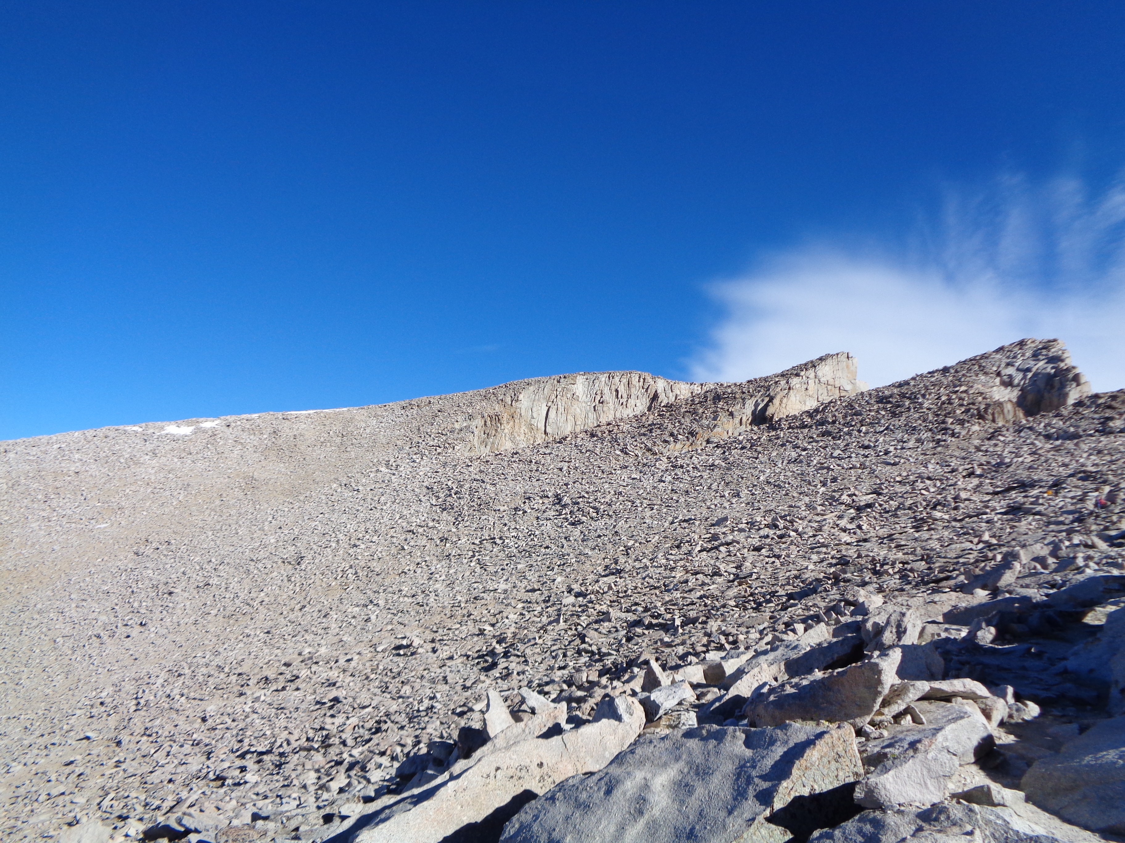
The basically indistinguishable summit of Mt Whitney, 1 mile to go!
The summit itself is just a modest upward extension of the ridgeline. And it’s fucking cold. I’m wearing every stitch, and eventually have to resort to pulling out my warm sleeping socks to put on over my mittens. This makes photography rather difficult, but I tried.
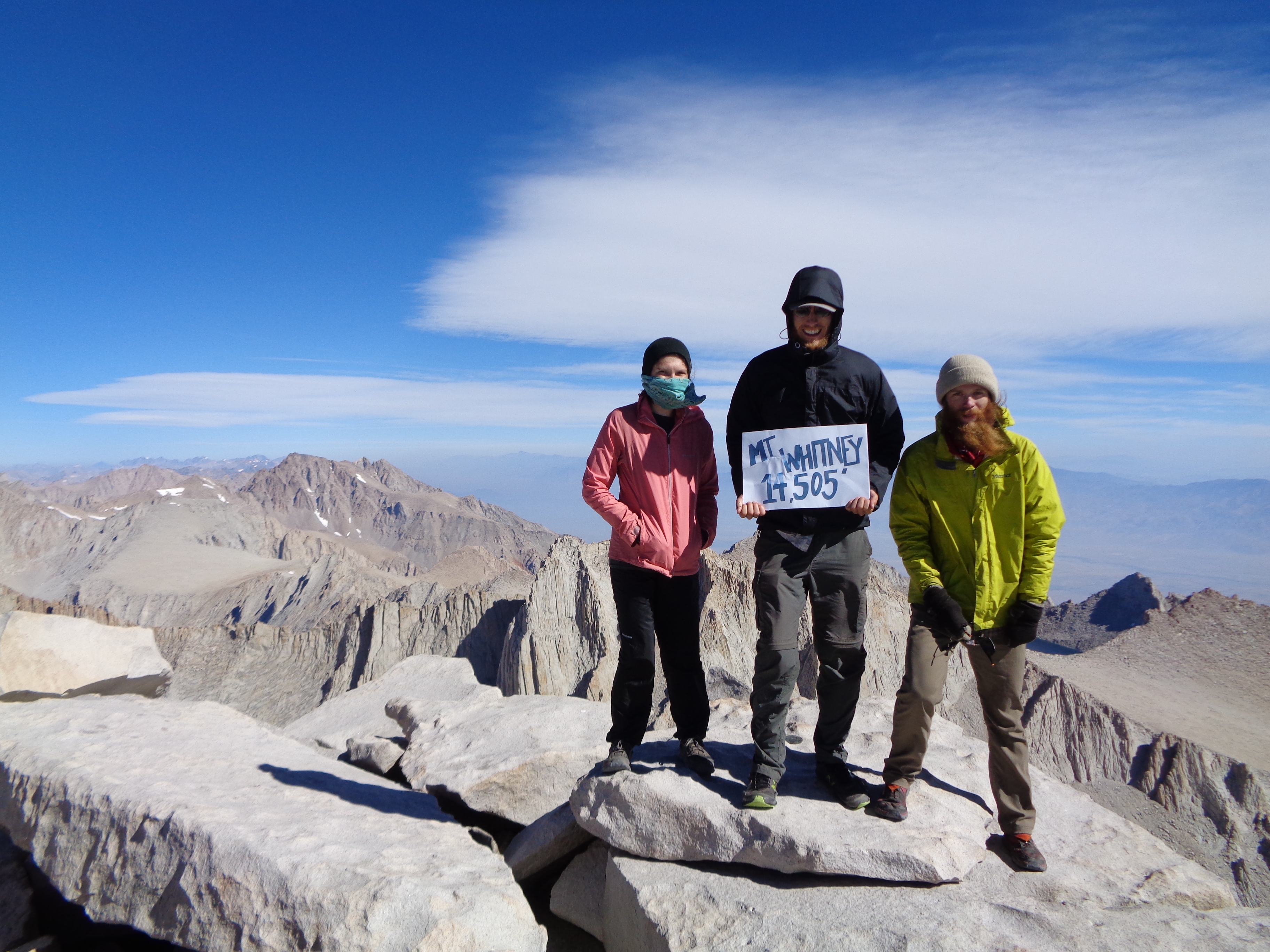
We all made it!


Atop that mountain, Per Bear absolutely redefined trail magic. For days, or heck, probably over a week at this point, he had saved two Snickers bars. He had opted to go stuffed to the gills with food, and wasn’t suffering with a huge caloric imbalance like Kirby and I had been. And he saved the best stuff for us, right when it meant the most. It was by far the most delicious and energizing Snicker’s bar I’ve ever eaten. Whitney was the perfect finale for our amazing trip through the Sierra.
Getting down was a bit trickier, on account of I sort of got really stoned on the summit.
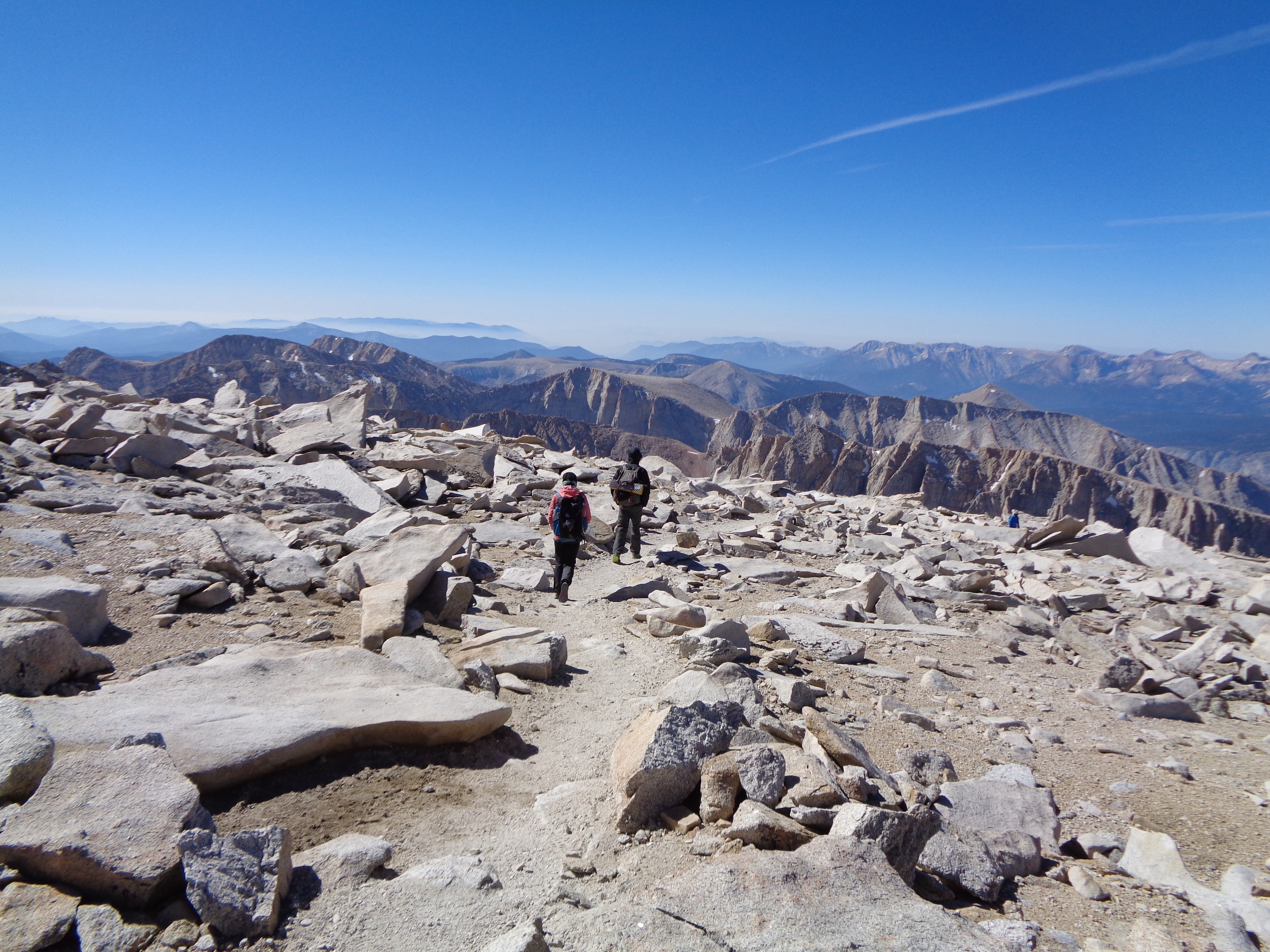
Starting down

Back along the ridge
The trip back down the switchbacks was a little slow. We had been going really hard the past few days, and it was all starting to catch up. We made it through. The big challenge was behind us, and with it went a bit of our energy. And then, as we neared the cache with our almost empty bear canisters, we passed the camp of a couple hiking the JMT we had met the day before. They were finishing tomorrow. And they had extra bars. Lots of bars. TONS of bars. It was the most magical day. I’d never say I was a fan of protein bars, but at that moment they could have been a brownie sundae with chocolate chip cookies on top. Kirby and I ran back to our cache, each with an unstable pile of protein bars cradled in our arms. We were positively giddy, a feeling I don’t think I could ever replicate.
Everything was perfect.

Survey marker at the summit of Mt. Whitney

This website contains affiliate links, which means The Trek may receive a percentage of any product or service you purchase using the links in the articles or advertisements. The buyer pays the same price as they would otherwise, and your purchase helps to support The Trek's ongoing goal to serve you quality backpacking advice and information. Thanks for your support!
To learn more, please visit the About This Site page.
