 ">
">
Shit Gets Real and Challenges Mount on the AZT
A Slow Restart
Tim dropped us back at Sandy Seep, and we continued on the Equestrian Bypass out of Flagstaff. Walnut Canyon was a scenic but short-lived start to the day. Later, on a dull, exposed section of trail within earshot of a busy Interstate and train line, the trail tested my faith again. With the thrill of the Grand Canyon wearing off, I wasn’t sure I could do another 600 miles of flat, drab landscapes.
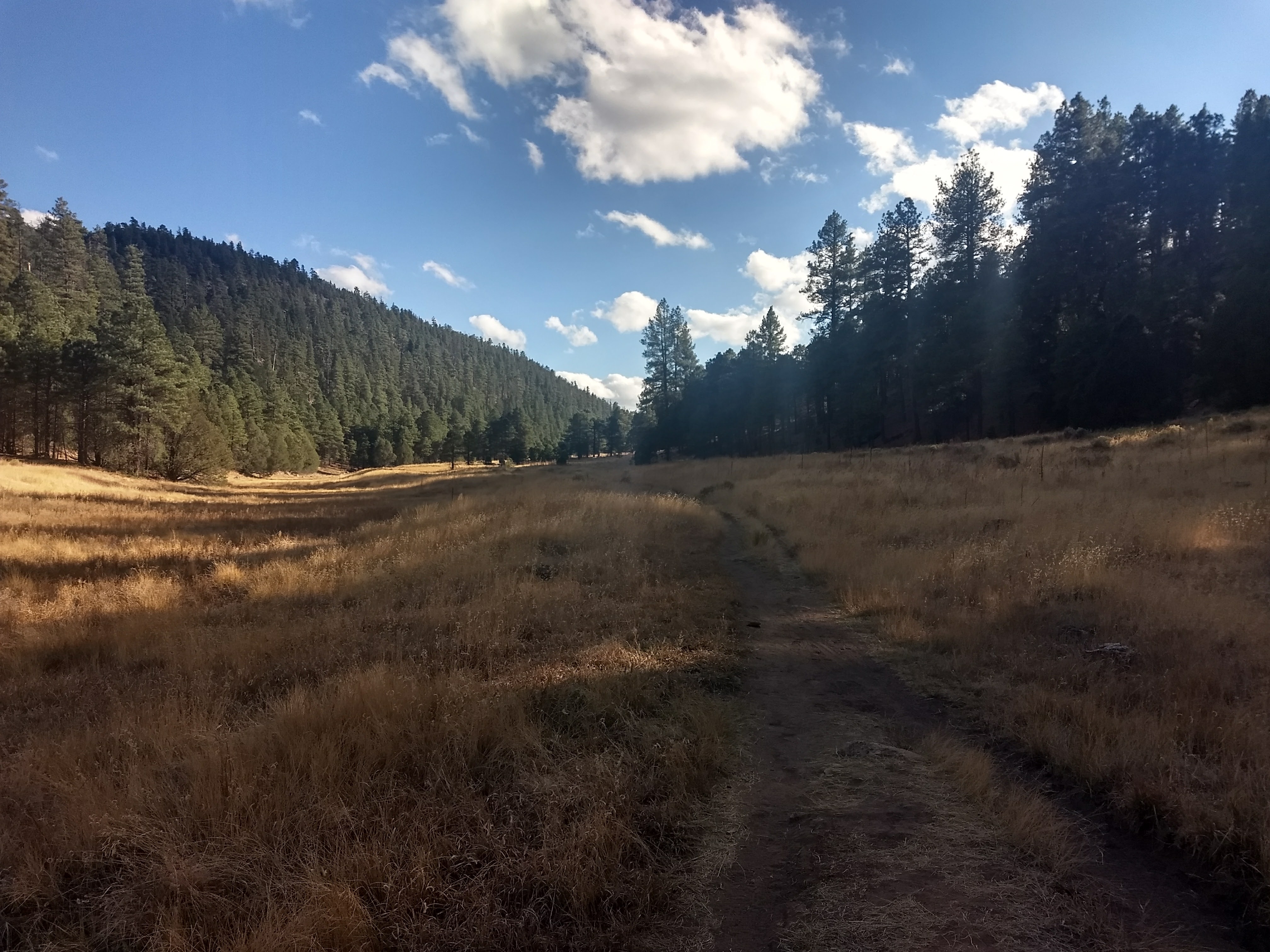

Towards the end of the day, we passed through another amazing canyon with a hefty climb up the side at the end. Melody had left us a water cache at the next trailhead, but we arrived to find several of the jugs to have been punctured! Likely by squirrels and mice who have apparently begun to associate plastic with food. Thankfully most of the jugs still had plenty of water, and we filled up before making a few more miles to camp. The terrain was flat, but for miles and miles the terrain was quite lumpy and rocky. While rearranging some smaller rocks in our campsite, Per Bear accidentally picked up a dried cow shit!
The next days were a roller coaster of highs and lows. In the end, I was convinced that not coming out here would have been a horrible mistake.

But first, more roads
The trail that morning was a mixture of nice trail and more dirt roads. We met a few hunters out along the Forest Service road as we walked in the morning. Across the highway, the trail followed an old logging rail bed up the slopes of Mormon Peak. There were interesting interpretative signs along the way giving some history of the area.

We finally got to enjoy lots of wildlife sightings, and started seeing elk and deer quite frequently. The day passed uneventfully after the bulk of the climbing was over. We rested at a piped spring, but spent much of that time chasing down gear blown away by gusty winds. The chilly autumn air felt great that afternoon, as I had started to miss the wonder of changing seasons in more northern climates.

Kind of hard to see, but this buck waited patiently while I took his picture.
Once again, we found ourselves hiking into the night. Kirby’s headlamp was dying, and there was a confusing road junction just before we planned to camp. Per Bear and I made the turn, but Kirby missed it. She spooked us about 15 minutes later, rolling into camp almost unnoticed in all black with no light.
I woke up cursing in the middle of the night when I realized that the raindrops in my dream were actually real-life raindrops. Figuring it wouldn’t last long, and honestly too lazy to do more, I just unfolded my tarp and laid it over me like a blanket and promptly fell back asleep. The rain must have stopped quickly, as everything was dry by the morning.

When the AZT becomes the AT
We continued walking through nondescript pine forests on roads. Kirby and I had a long conversation that day about working on cars and bikes, our favorite tools, and shared funny mechanic stories to pass the time. The road became amazingly rocky around Sheepherder Tank where we stopped for lunch. It felt like being back near Duncannon on the AT! Once again, we had to empty several packets of drink mix into the “water” we collected so we wouldn’t see how green it was while drinking.
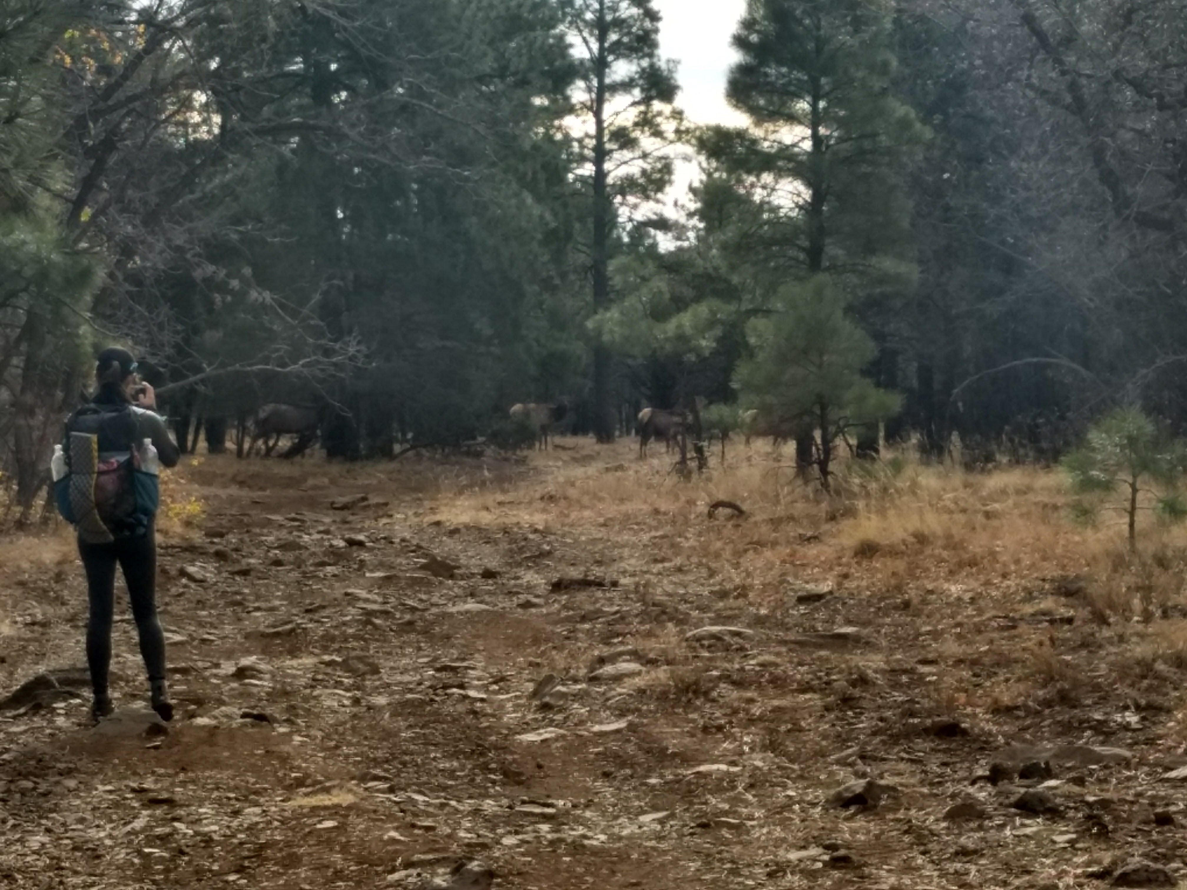
Another herd of elk along a very rocky forest road
We came through the seasonally closed Blue Ridge Campground before a short steep climb onto another pine-covered plateau. I had another Pennsylvania AT flashback when the trail dropped 800 feet in less than a mile, just to cross a dry canyon and climb back up the other side just as steep. It was a very pretty section with lots of loamy soil and moss, definitely not something we’d seen lots of in Arizona!

Atop the Blue Ridge

No water, but plenty of trees in this canyon!
Back on the plateau, we started the final road section before reaching our planned resupply in Pine. The rocks were gone, and I truly enjoyed the gentle stroll as the sun fell towards the horizon. Thankfully there was enough light left to get some good pictures at our big milestone for the day. We reached the 300 mile mark of the AZT, which conveniently also marked 3000 miles of hiking since starting the PCT! 

That’s a heck of a milestone
I took a moment to reflect on all of those miles and how some milestones feel so much different than others. I don’t even remember reaching 2500 miles near the end of the PCT. It was simply a point along the way. I thought of the Trail as a single unit, and the amount of miles making it up seemed less important. But reaching 3000 miles in a season, detached from one trail or another, felt immensely powerful. That’s a whole shitload of miles! I enjoyed thoughts of some of the finer miles along my journey as I finished the last few miles to camp under soft starlight.
Mogollon Rim
Not only do Arizonans have peculiar definitions for words like “tank,” they also have a certain way with pronunciation. We got up early to finish of the 17 miles into Pine, descending over and traversing along the Mogollon (pronounced “Mug-ee-yon”) Rim. We began in an increasingly dense cloud, the kind of cloud you often find along the crest of prominent ridges high above the valley floor. Passing General Springs Cabin, I even got a little bit of the “spooky woods” vibe that I loved so much from hiking in the White Mountains.

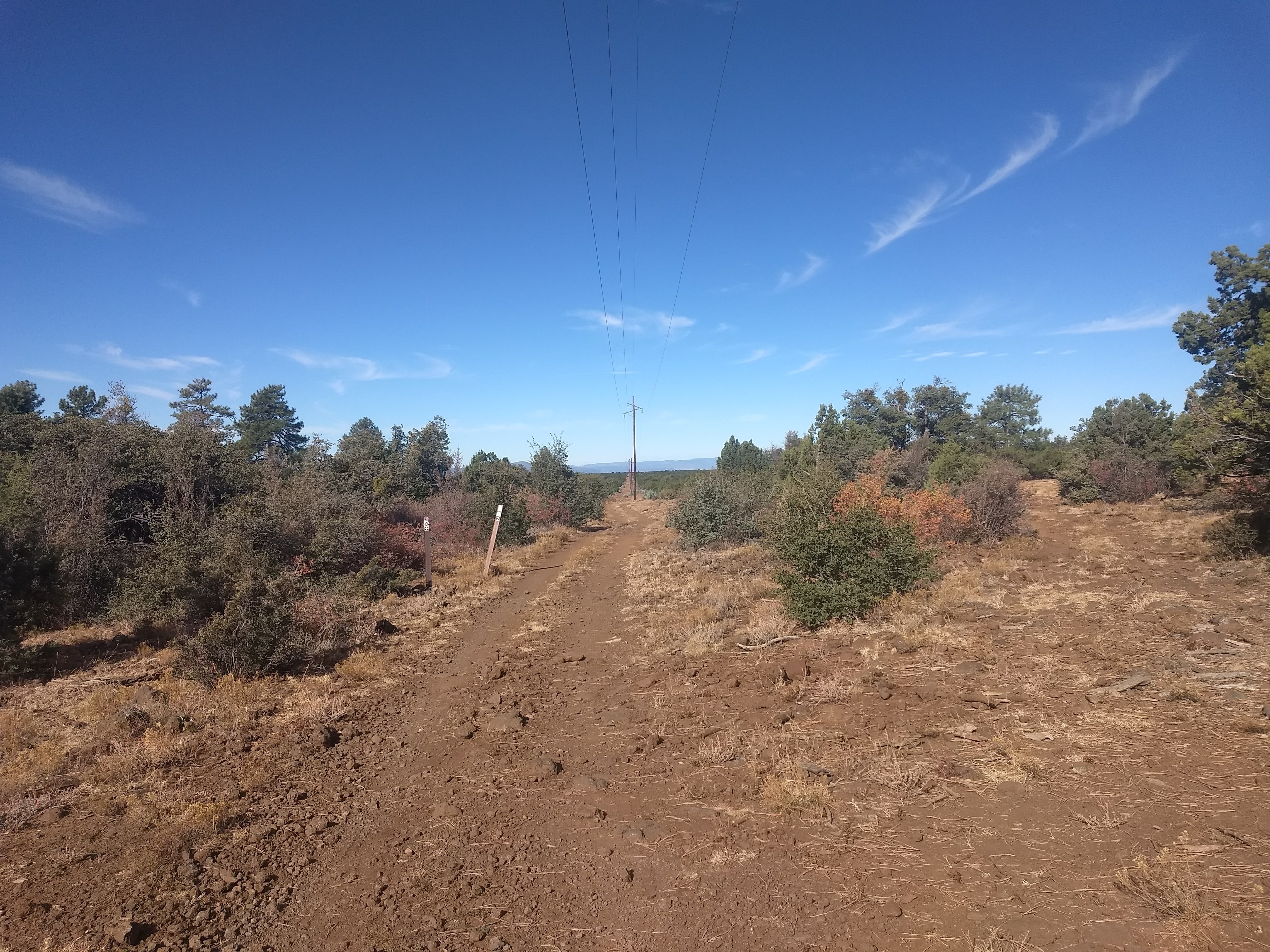
Just past the cabin, the trail dropped. And I mean DROPPED! I stubbornly continued down the powerline (which I think is thankfully not the official trail) and had to basically crab-walk down it to prevent myself from sliding to the bottom. I could see the clouds breaking up in the distance, and was looking forward to what I had been told was a fantastic stretch of trail. After the last 200 miles of extended road walks with little breaks of single track, we were finally getting back to proper trails.
Just above the Washington Park Trailhead, the trail leveled out along the headwaters of the East Verde River. I was overjoyed to see honest to goodness fall foliage! That moment cured a bit of homesickness and made me even more excited and committed to see the rest of the AZT. From there, we began an extended traverse along the middle elevation of the Rim. It is an amazing geological feature that stretches East to West for hundreds of miles, and acts as a significant ecological barrier. We were leaving the higher elevations and forests of Northern Arizona behind, and entering the low desert environment I had been expecting all along.

Staring down the powerline

I love crunchy red leaves on the ground!

Looking back to the top of the Rim as the clouds break

The Hi-Line trail was a great walk. Some elevation change here and there, but for the most part it followed a contour and offered occasional views along the Rim. Caught up in all the scenery, my “spidey senses” started tingling and I stopped short and actually looked at the trail ahead. I had been about to stumble into a dead elk, splayed outacross the trail not 10 feet in front of me.
It clearly had not been dead long, but I couldn’t see anything to indicate how it had died. No torn flesh, no obvious fall/slide trail, and no blood. It was an interesting moment, where I acknowledged death as just another part of life, and kept on walking without giving the animal much thought. That might sound callous, but after over 3000 miles trekking through some of the most pristine natural areas in the US, you develop a different relationship to the larger environment.

How did you die?
Pine
Unsurprisingly, the first stop in Pine was beer and lunch. When we arrived at That Brewery, a stranger waved us over to his table. Tim is a Passage Steward and trail crew volunteer for the ATA, and had recognized us as hikers (by sight or by smell, I wonder?). He very generously paid for our lunches and beers, then drove us to the grocery store once we were somewhat full.
We chatted all the way through the store, which had unfortunately limited and expensive options. I did find a plastic bottle of hot sauce however! Outside, we said our thanks to Tim and headed out in search of pizza before returning to the trail to camp. Since we hadn’t taken any time to repackage our food, we ate delicious gourmet pizzas while surrounded by dirty packs and a dozen plastic shopping bags. We sat outside of the closed brewery after dinner to poach their WiFi and outlets while packing up.
It was a very short walk back to the trail from town, but with a belly full of pizza and beer I was feeling a bit reluctant. On the way, someone pulled their car over beside us and rolled down the window. Mind you, this is several hours after dark, and my mind started jumping to wild possibilities. Turns out, the driver had just recently finished a trip on the Grand Enchantment Trail between Albuquerque, NM and Tucson, AZ. We chatted a bit awkwardly through the window for a moment, but quickly sought the warmth of our sleeping bags.
Enter the Mazatzals
The morning began with a long, dusty dirt road climb, crossing quite a few rustic cattle gates. We were planning a big day to eat up miles on a relatively long stretch to the next resupply in Globe. I just started churning out miles across another plateau, along another power line, under the scorching Arizona sun. All I could think of was reaching the East Verde River, a natural water course so significant we had heard there was no dry way across! In Arizona? Could it be? I day dreamed about the river while walking through clouds of dust from a random caravan of SUVs along the power line road.
A hint of better things to come in the background
Crossing the Verde
The trail departed the road as we finally began the descent to the river. We walked through a garden of bizzare rocks with worn, smooth curves and cavities. It looked like a bunch of scattered dinosaur skulls. Down a set of switchbacks lined with greenery, we could see the Mazatzals across the river valley. As the rocks started to fade farther down, the trail turned into a chalky powder several inches deep. The slope got steeper, and the footing even less reliable. And then the trail disappeared entirely, lost in the oblivion of cow trails that littered the slope.

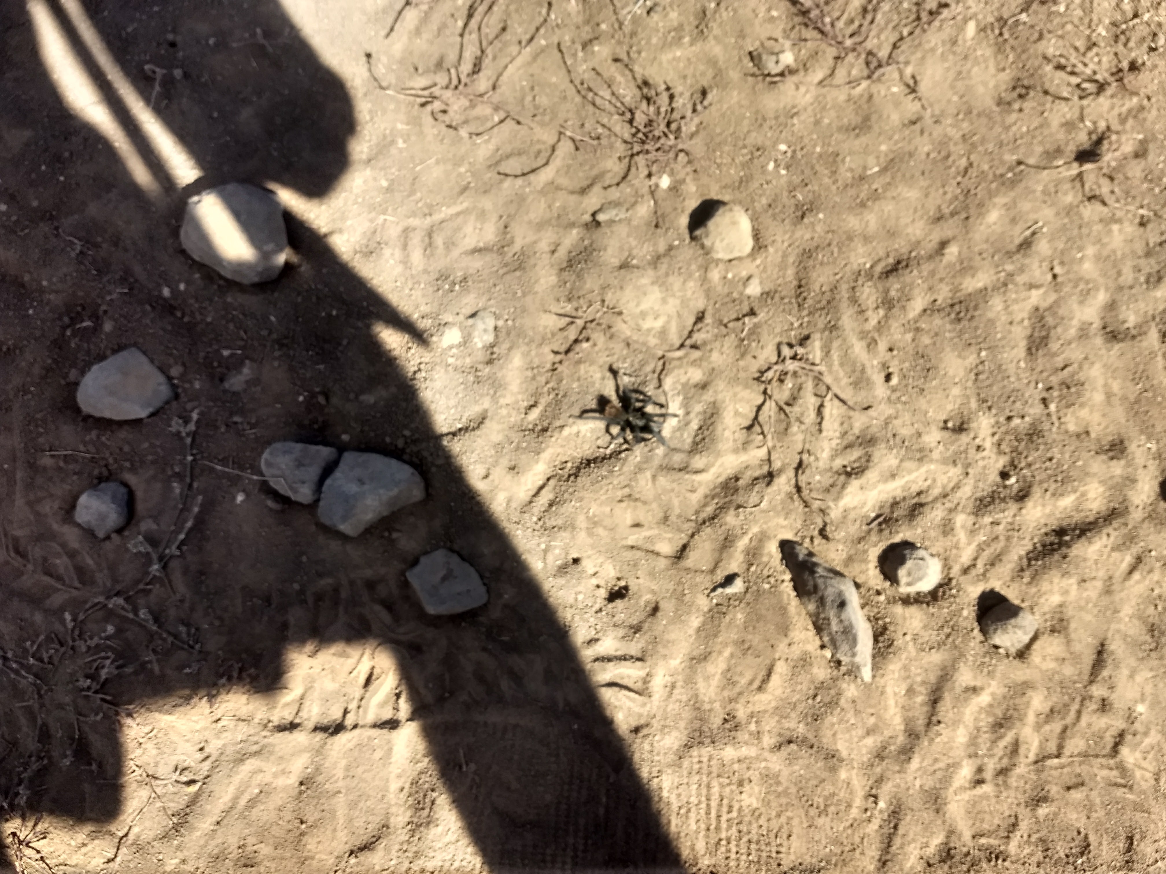
Arizona Tarantulas are so tiny!
For a half mile or so, GPS navigation helped keep me pointed in the right direction, at least. I could see another hikers’ footprints, and I followed them for a time. Then somehow, I ended up in a tangle of dense shrubs with low hanging branches. I was still pointed downhill, towards the river, but at this point I was unsure of how far off the trail I was. Too stubborn to relocate the trail, I pressed on cross-country and determined to follow the river until it rejoined the trail.
And then I stepped shin-deep in a swampy mud pit trying to cross a small tributary. I was not terribly amused. No, by the time I got to the river, I felt the need to sit down and do some deep breathing exercises to calm down. Finally, I was back in mountainous terrain, and the trail had decided to conspire against me! The crossing itself was easy, and I settled in on the opposite bank to wait for Kirby and Per Bear. They also got quite lost, and also had a few choice curses to shout at the trail.
And now, we climb
We lingered by the river for quite some time, and realized that we needed to book it to make it to camp at a reasonable time. There was a big climb, but our plan was to just hike until a few minutes past dark then grab the first flat spot that would fit us all. We hadn’t made much progress before stopping to get out headlamps. The trail climbed an incredibly steep and loose 4×4 track. At random but unfortunately frequent intervals, clumps of horrible thorny, whip-like vines grew across our path. I clenched my teeth and growled at each bunch as they tore my clothes and cut my arms and legs.
We climbed on into the night, the steep slope not providing anything even close to a camping opportunity. I howled into the night when we reached a saddle, but it was so covered in vegetation as to make camping impossible. My bad mood had been snowballing throughout the day, and I was starting to feel thoroughly exhausted. We began a gradual downhill, but I kept losing my footing and slipping on the ball-bearing pebbles that coated the trail. Each time, I ruptured the quiet night with volleys of my favorite profanities.
Kirby flung her own obscenities into the night when a bat flew into her forehead. Not even kidding.
Sometimes, Winning feels a lot like Losing
Not a moment too soon, we reached a listed campsite where another hiker was already set up. I immediately felt bad for all the shouting, and apologized through their Dyneema walls. Luckily for us, Steel Cranium is one of the chillest hikers out there and we were quickly laughing about our shared struggles along the East Verde. As usual, my negativity melted away as I got comfortable in camp, and I put petty frustrations behind me.
Long-distance hiking is hard. Sometimes you get lost. Sometimes the trail is really sketchy and you fall. The water situation can be pretty dismal and disgusting. But, that’s what keeps me going. The true experience of a long-distance hike is built from the horrible, hilarious, inconvenient, and beautiful surprises. The more surprises, the better. Even ones that make you curse yourself for ever tying your shoes.

This tree couldn’t be more in the way

This website contains affiliate links, which means The Trek may receive a percentage of any product or service you purchase using the links in the articles or advertisements. The buyer pays the same price as they would otherwise, and your purchase helps to support The Trek's ongoing goal to serve you quality backpacking advice and information. Thanks for your support!
To learn more, please visit the About This Site page.
