 ">
">
Tahoe Rim Trail: Trip Report
After 13 days, 168.6 miles, and (my dad’s favorite stat) 518,404 steps, Alex and I hiked the Tahoe Rim Trail! I still can’t quite believe it happened or that it’s already over. Join me in reliving my time on trail by reading a day-by-day account of our hike.
I calculated the trail miles using Guthook. The steps are sourced from my FitBit, so they include trail miles, off-trail wanderings, setting up camp, town chores, and everything else.
Click here for a Youtube video highlighting our trip and here for a gear breakdown.
Trip Report
Day 1
Endpoints: Mt. Rose Trailhead to Marlette Peak Campground
Miles: 14.5 today / 14.5 total
Steps: 46,759
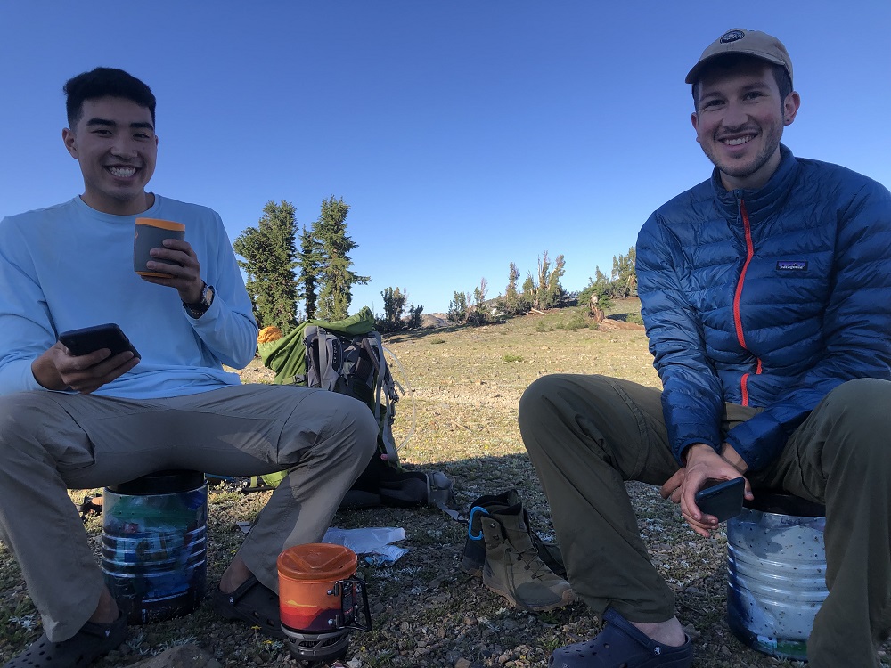
We started the first day by driving from our South Lake Tahoe hostel to the Mt. Rose trailhead. It was a bit stressful battling weekend traffic, parking, getting organized, and ensuring no food was left in the car. But finally, we set off! We hiked through Tahoe Meadows and throngs of day hikers, then wove across the ridge between views of Lake Tahoe and Carson City.
The first leg of our journey consisted of two hiking days and nights, followed by a shorter day with a night in town on the third night. Throughout the first day, we got familiar with how and where to pack our essential daily gear. Snacks, lunch, sunscreen, and our trowel were placed in the outer mesh pocket of my Gossamer Gear Mariposa. Dinner and the rest of the food resided in our bear bin, centrally packed in Alex’s Osprey pack.
Just as we were fading at the end of the day’s hike, we reached beautiful views of Marlette Lake. Shortly after, we reached the Marlette Peak backcountry campground. We enjoyed the relative luxury of the campground – a bathroom, bear bins, and water spigot! – with plenty of other thru-hikers. Before bed, we (probably unwisely) added more steps to the day and hiked up to a ridge for an awesome sunset and lake view.

Marlette Lake and Lake Tahoe
Day 2
Endpoints: Marlette Peak Campground to South Camp Peak
Miles: 14.6 today / 29.1 total
Steps: 47,841
We started hiking around 7:30 on Day 2, which would turn out to be one of the latest mornings of the trip for us. While the incline out of Marlette Peak Campground yielded stunning lake views and ridge walking, it was already scorching. The heat combined with my very poor blister prevention skills (tape early, tape always!) made the trail to Spooner Lake a killer of a hike. In normal life, I tend to be the faster, shorter-break-taking, more annoying hiker than Alex. Despite my tiredness and soreness, he convinced me to lay around (literally) at the Spooner Trailhead for 3 full hours to rest and recover.

Literally laying around
After filling up on water (thank you trail angels!), eating, napping, eating some more, and waiting out the worst of the day’s heat, we set off for the remaining 5.5-mile, 1,600 ft incline at a very slow pace. We made it to the top of South Camp Peak just in time to set up camp and enjoy dinner with another rewarding sunset and lake view.
Day 3
Endpoints: South Camp Peak to Kingsbury Grade
Miles: 9.6 today / 38.7 total
Steps: 27,589
We pushed ourselves quickly and earlier today with the promise of town time tonight. I was thrilled by the prospect of town food, a shower, and real bed for the night. Our first resupply box awaited us at Tramway Market in Kingsbury. However, by the time we reached Kingsbury Grade, my blister situation had worsened. Since our ride happened to be in the area earlier than planned, we decided to skip the miles (the purists gasp) between Kingsbury Grade and the Kingsbury South Trailhead.
After picking up our box, stuffing our faces with massive burgers, organizing our new food, and showering, we got to sleep. Pro tip: don’t rip your blisters off with the tape! It will hurt, a lot. And make your nurse friends angry.
Day 4
Endpoints: Kingsbury South Trailhead to Mile 98.5
Miles: 16.8 today / 55.5 total
Steps: 52,833
I was pretty nervous to get back on trail for this section, since my feet weren’t in great shape, and it was one of our biggest days in terms of miles and elevation gain. The trail heads up from Kingsbury South, passing the Nevada-California border and Monument Pass. The area is very deserty, dry, and, as usual, hot. Star Lake served as a refreshing just-over-halfway lunch spot. A lot of other hikers we saw here were already at their camp spot for the night. Though in the end I would recommend our itinerary to anyone interested in the TRT, Star Lake is one spot I would try to camp at if I did it again.

Star Lake
Day 5
Endpoints: Mile 98.5 to Showers Lake
Miles: 14.3 today / 69.8 total
Steps: 46,759
Like most of the remaining trail days, we woke up at 5 am on Day 5. After getting water at Freel Meadow, we hiked a bit farther before making breakfast to avoid some of the worst of the mosquitos. As we moved south and clockwise around the lake, the mosquitos got progressively worse. After a long downhill through the woods, we reached the Big Meadow Trailhead, and shortly afterwards, Big Meadow itself. We enjoyed a grassy, sunny lunch by the creek where we washed out our socks, replenished water, and ate.

Big Meadow
The rest of the day passed by slowly due to the heat and copious sweating. We enjoyed frequent breaks by Round Lake, the PCT junction, and Upper Truckee River. Compared to the day before, we made it to our campsite at Showers Lake relatively early in the day. Somehow, though, the non-hiking hours still flew by. We realized that chores – setting up camp, filtering water, cooking, filtering water, swimming, washing out clothes, filtering water – were often more time consuming than we realized. Did I mention that filtering water takes forEVER? Anyways, Showers Lake was additionally exciting due to joining up with the PCT, and we had more neighbors than usual here.
Day 6
Endpoints: Showers Lake to Lake Aloha
Miles: 16.2 today / 86 total
Steps: 48,964
Departing Showers Lake began with a beautiful sunrise, but quickly deteriorated into a mosquito swarm of a morning hike. We could barely stop for water, much less breakfast, until we out-hiked the mosquitoes. Or maybe they just went away as the sun rose? A few miles after Showers, we returned to a brief view of Lake Tahoe and then went steeply downhill to Highway 50. After we crossed the highway, we picked up speed, excited to meet up with our friend Patrick. Patrick was both our resupply for the next four days and joining the hike for the remaining half of the loop.
We met Patrick at the Echo Lake parking lot, where he and his sister graciously brought us ice cream, iced coffee, cold fruit salad, and sandwiches. It felt like personal trail magic to enjoy the cold treats in the tiny shade patch we’d claimed. We did a few more chores, reorganizing gear and food with our new addition, before hiking off again.
The trail was instantly rockier as it climbed passed lower and upper Echo Lakes – our welcome to Desolation Wilderness. If I did it again, I would hop on the boat taxi for a change of pace. Though we didn’t originally plan to, we hiked all the way to Lake Aloha that night. We had planned to spend several hours at the lake the next day, so we figured we should push it to fully sleep in the next day. The lakeside was crowded with backpackers, but we found a nice campsite between the shore and the trail.

Our campsite at Lake Aloha
Day 7
Endpoints: Lake Aloha to Gilmore Lake
Miles: 4.8 today / 90.8 total
Steps: 23,505
Today we engaged in a normally purely off-trail concept – sleeping in! Since we hauled a couple extra miles the previous day to reach Lake Aloha, we had nowhere to be until the evening. AKA: no alarms needed. We planned to lounge around our campsite and the lake, and lounge around we did.

Sleeping in on our low-mileage day
Though a few chores worked took place, like hiker laundry (swish it around in the mountain lake/stream and call it clean) and the bane of my existence, filtering water, we spent most of the day swimming from rock island to rock island around Lake Aloha. Alex has backpacked around Lake Aloha several times and thought the water was warmer than he’d ever experienced.

Pat on a rock island in Lake Aloha
After lunch, we packed up and hiked to Gilmore Lake. Given the heat of the afternoon, we dunked our shirts right before departing to lower our temperatures until the shirts dried. Winding around other lakes in Desolation, the trail is beautiful, albeit rocky. Once we reached Gilmore, the mosquitoes came out in force, pushing us to spend the evening at the windier beach rather than next to the tents.
Day 8
Endpoints: Gilmore Lake to Richardson Lake
Miles: 15 today / 105.8 total
Steps: 45,349
Back into the swing of regular hiking days, we woke up at 5 to set off. The mosquitos while packing up were horrendous, and I seemed to be the worst affected by them, both in terms of actual bites and mood. I plan to bathe myself and all my gear in permethrin before going outside, ever again. From Gilmore Lake we hiked up, up, up to Dick’s Pass, which made for a splendidly scenic breakfast spot.
Breakfast atop Dick’s Pass
We hiked down Dicks Pass gleefully quick, spurred on by the stunning views in the heart of Desolation Wilderness as well as the absence of mosquitos. After filling up on water and snacks at the Fontanillis Lake outlet (lovely), we pushed another 4 miles before lunch at Phipps Creek (yucky). Another hot, sweaty afternoon followed until we reached Richardson Lake.
A few car-campers but mostly thru-hikers populated Richardson Lake. We had a great time hanging out with other TRT and PCT hikers here, swimming in the lake and gathering around the (cold) fire pit to chat with everyone, trade snacks, and offer back-cracking services.

Camp at Richardson Lake
Day 9
Endpoints: Richardson Lake to Ward Creek
Miles: 17.2 today / 123 total
Steps: 49,101
We packed up amongst the other hikers, but the PCT hikers soon vanished up the trail, probably doing double our planned miles for the day. We stopped at Barker Pass for a short break, and as we were about to leave, a car pulled in and the driver called out the window, “anyone want some trail magic?” To which the response is always, of course, yes. It truly was magical to watch the couple pull cooler after cooler out of their car, stocked with cold Gatorades, fresh grapes, snacks, water, and more.
From Barker Pass, we hiked up switchbacks to the Twin Peaks, where we split off from the PCT. We ate lunch just off-trail from McCloud Falls, though it’s a stretch to call it a waterfall. In terms of the rest of the day, we’d originally planned to camp where the trail first encounters Ward Creek, at the bridge. However, since we were reaching Tahoe City the next day, we figured if we pushed on tonight, we could reach town (aka food) earlier the next morning. So, on we hiked, to the next Ward Creek access point. There wasn’t much space for tents, but we managed to comfortably fit our group of 3, a couple we met that day, and another solo hiker.

Returning to Lake Tahoe views after leaving Desolation
By this point, Patrick had realized he had overpacked a bit for his first ever backpacking trip. Think: a hammock and a tent. While we loved swinging in the hammock at Lake Aloha and at breaks, he planned to send it (and other redundancies) home from the Tahoe City post office. Thus, in honor of the last night with the hammock, he strung it up to try sleeping in it for the first time. That meant Alex and I got to enjoy the luxury of sleeping in Pat’s 2-person, non-ultralight tent, which had several additional square feet than the Nemo we normally use. It was glorious and Pat didn’t even get attacked by mosquitoes.
Day 10
Endpoints: Ward Creek to Tahoe City
Miles: 5.1 today / 128.1 total
Steps: 18,901
We hiked the 5.1 miles from Ward Creek to Tahoe City faster than I’ve hiked ever before. We were giddy with the thought of all that awaited us in town – brunch! Easy to access drinking water! Brunch! Showers! Time to backflush the filter! Real beds! Snacks! Brunch! We could hear town before we reached it, and first saw “civilians” as they floated past us in the Truckee River. We hiked straight to Rosie’s Café for a large brunch. Afterwards, we did our errands: replacing all 3 of our water filtering bags that had broken the day before (probably caused by our Sawyer filter needing a good backflush), washing clothes, and resupplying our groceries for the remainder of the trip.

The face of pure joy anticipating brunch in only 2 miles
Day 11
Endpoints: Tahoe City to Watson Lake
Miles: 13.2 today / 141.3 total
Steps: 38,949
From the hotel, we hiked uphill from the Tahoe City Trailhead. The grade wasn’t as steep as expected and we made great time. We took only a couple short breaks and arrived at Watson Lake by 3:30pm, which was early for us. I think Watson Lake gets a slightly bad rep. Sure, it’s a little muckier than the Desolation Lakes, and busier with car campers and trailers, but it was still nice! Don’t hate on Watson.
The last three days of our hike were full of incline, so I was a little nervous going into them. But today, Alex and I both looked at each other as we approached Watson. “I don’t feel nearly as dead as I should right now,” we said. “Why do my feet bones feel like they’re being ground into dust only 75% as they normally do?” we wondered. Were we…could we possibly be…getting our trail legs? It didn’t seem possible. Maybe it was just the easy day yesterday combined with sleeping in a real bed. Surely the feeling of increasing strength would dissolve as tomorrow went on, which would be our biggest day on trail in terms of both miles, elevation gain, and water carrying.

Hiking to Watson Lake
Day 12
Endpoints: Watson Lake to Gray Lake
Miles: 17.2 today / 158.5 total
Steps: 44,954
Anticipating the worst, as is my specialty, I persuaded the boys to waking up at 4:30 in the morning. The first three miles from Watson were mostly downhill then up and down to the Brockway Trailhead. We were thrilled to see trail angel water at the trailhead, giving us the opportunity to hydrate and replenish for the rest of the day. I’d heard many thru-hikers talk about returning to their trails to do trail magic, which had honestly puzzled me. But after this hike, I totally get it. We felt such joy and relief to see simple jugs of water waiting for us; being the cause of that joy and relief for strangers would be magical.
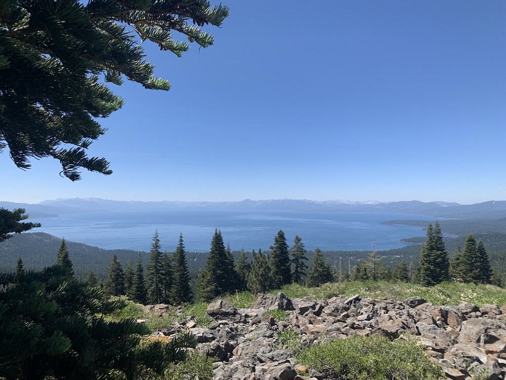
While the trail from Brockway to Gray Lake was pretty exclusively uphill, the grade wasn’t terrible. After a few miles, we were rewarded with stunning, full-Lake Tahoe-visible views that we hadn’t seen anything like since the first two days on trail. We perched on the rocks overlooking the lake at the California-Nevada border for a while, then walked along the open hillsides until we reached the turnoff for Gray Lake.
I mean, come on
Gray Lake, like Watson, seems to get some mixed reviews. But when I say the Gray Lake inlet was a paradise, we truly couldn’t believe how beautiful it was. The water was ice-cold, completely clear, and flowing past lush, blooming wildflowers. While it was less a lake than the stream flooding a meadow, it hardly diminished the beauty. It was easily our favorite campsite, and we spent the evening relaxing next to the flowing water, eating dinner, chatting with our camp neighbors, and admiring the sunset.
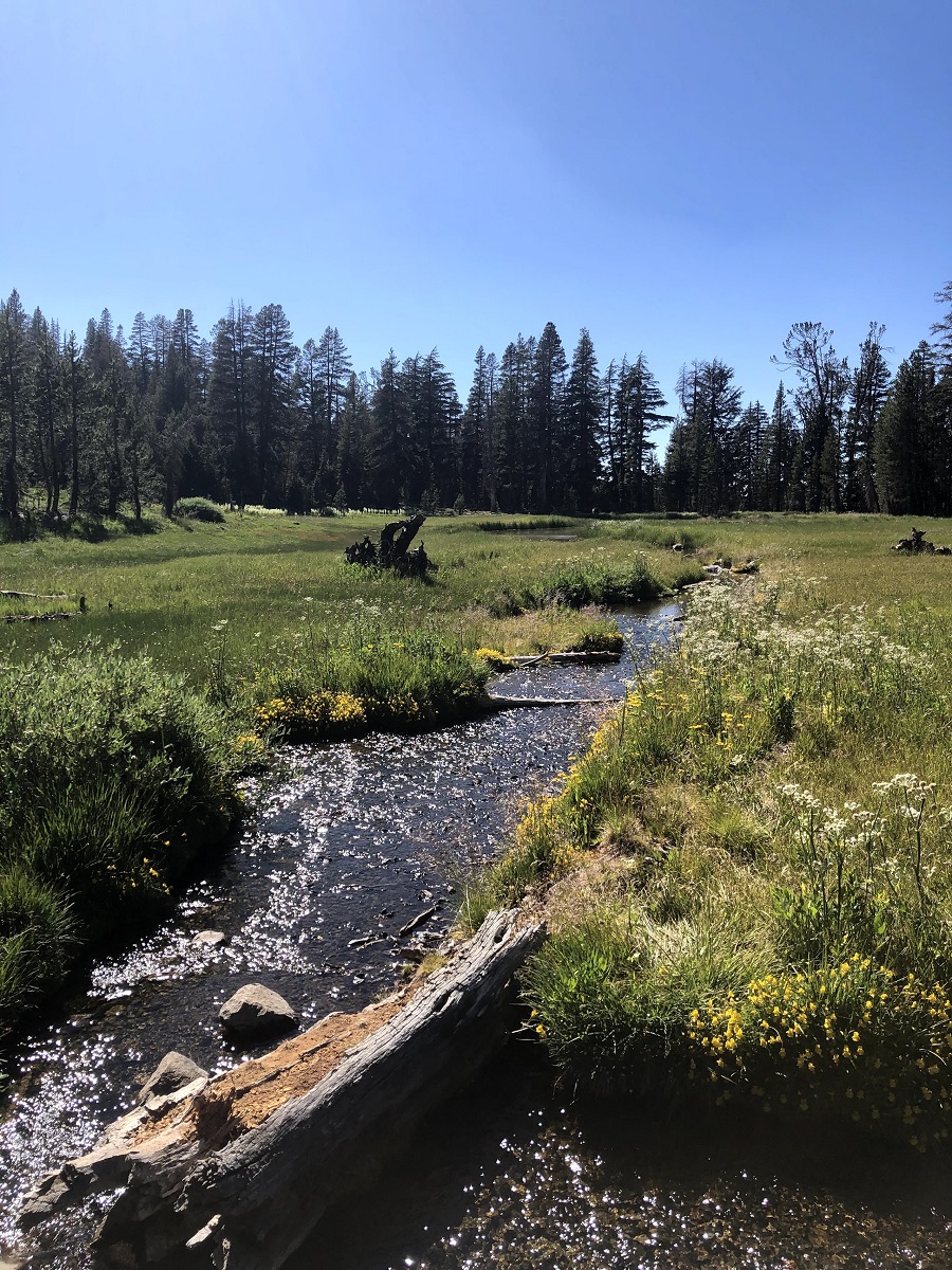
Like, seriously. Do you see those flowers?
Day 13
Endpoints: Gray Lake to Mt. Rose Trailhead
Miles: 10.1 today / 168.6 total
Steps: 26,900
In honor of our last day on trail, we let ourselves sleep in until 6 and enjoyed a slow breakfast next to the inlet. Then we hiked up and out of the Gray Lake basin, returning to the normal TRT. From there the trail climbs up to Relay Peak, the highest point on the trail. The last three days of our trip confirmed how thrilled I was with our itinerary. It was lovely to end the trail on the top of it, with views of the entire lake we had walked all the way around.

Fritos does not sponsor me, but they should
We hiked down from Relay Peak, winding our way down the switchbacks to Galena Falls. We joined up with the day hikers heading to and from Mt. Rose Trailhead. The last couple of miles were surreal, especially when we chatted with day hikers who were astounded to hear we were on day 13 of 13. Finally, our car came into sight and the trail gave us one final piece of magic – what we thought might be a parking ticket on our windshield turned out to be a note from other TRT hikers we’d met. They had finished earlier that day ahead of us, congratulated us, and wished us well.
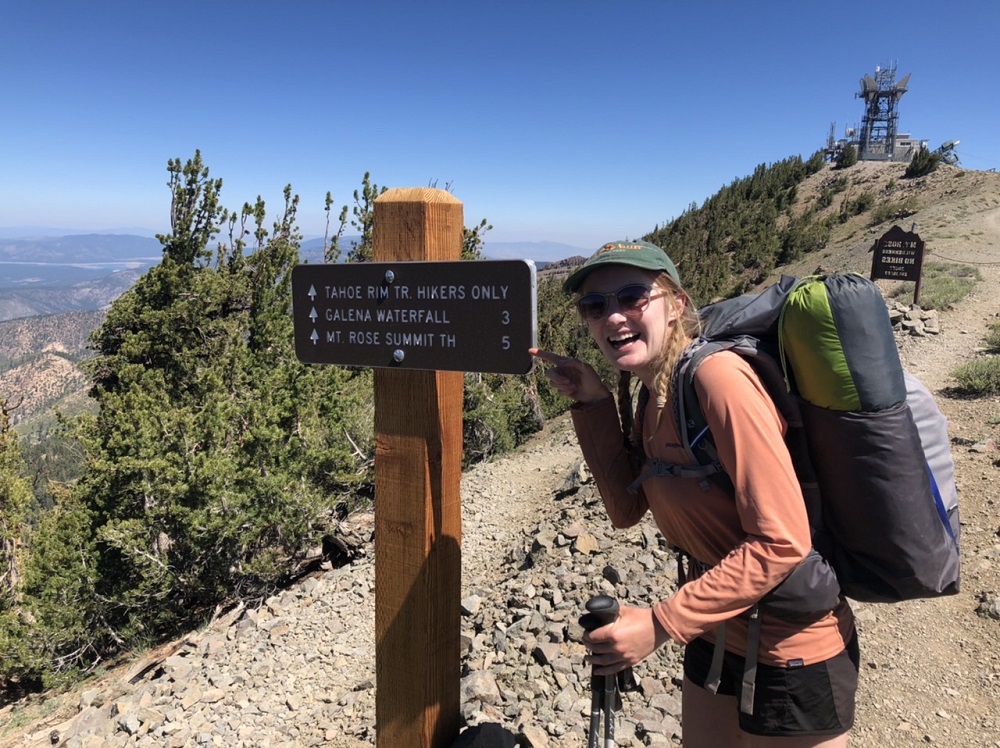
The last 5 miles of trail
Condensed Itinerary

We loved our itinerary and would recommend it to anyone. If you want to add another night on the trail, we wished we could have camped at Star Lake, which we passed on Day 4. Otherwise, we found our campsites decently spaced apart in terms of water locations.
Thinking big picture, we also liked this itinerary for the distribution of views it afforded us. We got some stunning, above-treeline views on Days 1 and 2 that fueled us as we were getting used to new pains on trail. Passing through Desolation Wilderness in the middle of the hike was rewarding for the frequency of water and thus swimming locations. The last stretch from Tahoe City to Mt. Rose returned us to the high elevation, view-filled hiking that reminded us how far we’d come. Just as importantly, this itinerary allowed us to evenly space out our resupplies without carrying an excessive amount of food at any given time. Sharing 1 bear bin between 2 people for the first half, and 2 bear bins between 3 people for the second half, we didn’t have much bin capacity to spare on our first days out from a resupply.
Water Carries
Our longest water carries took place on Day 2 and Day 12. On Day 2, the only water we could plan on was at Spooner Lake, between Marlette Peak Campground and Edgewood Creek, which we wouldn’t have reached until Day 3. The downside of Spooner Lake is its off-trail location and reportedly mucky waters. Luckily, we were able to fill up using trail angel water located at Spooner Trailhead. On Day 3, we were pretty low on water when we reached Kingsbury Grade at mile 78.8. There was one jug of water there, but we went into town to resupply on this day.
On Day 12, we hiked between water sources, from Watson Lake to Gray Lake. This would have been about 17 miles of carrying water, which would have been manageable. But luckily again, we were able to use trail angel water located at Brockway Trailhead. While no thru-hiker can rely on the existence of trail angel water, it’s good to know where it might be.
Costs
Calculating the cost of this hike turned out to be more complex than I’d imagined. Do I add in the total cost of all my gear, or just the gear I bought new for this trip? Is it more useful to see the combined costs for 2 people hiking half of the trail and 3 people hiking half the trail, or just one person’s share? Hopefully my method of categorizing our costs is useful for you!
Food
- Days 1-6: $152.81 for 2 people, $76.41 per person
- Day 3 town food: $34.63 for 2 people, $17.31 per person
- Days 7-10: $90 for 3 people, $30 per person
- Day 10 town food: $87.56 for 3 people, $29.19 per person
- Days 11-13: $107.29 for 3 people, $35.76 per person
- Resupply box shipping: $15.50 for 2 people, $7.75 per person
For one person, these food costs total to $196.42, or about $15.12 per each of the 13 days.
Travel
- Pre-Trail Driving CO->CA (gas & snacks): $118.52 for 2 people, $59.26 per person
- Pre-Trail Hostel: $122.96 for 2 people, $61.48 per person
- Tahoe City Hotel: $157.30 for 3 people, $52.43 per person
- Post-Trail Driving CA->CO (gas & snacks): $151.15 for 2 people, $75.58 per person
- Post-Trail Hotel: $91.80 for 2 people, $45.90 per person
Getting to and from trail can quickly increase the cost of your hike. We drove from our home in Denver to the trail in California, primarily to make our pre- and post-trail travels more accessible. These costs would obviously vary for everyone depending on where they come from. The total travel costs to and from the trail for one person total to $294.65, or about $22.67 per each of the 13 trail days.
Other
- Garmin Subscription (1 month): $53.67 for 2 people, $26.84 per person
- Desolation Wilderness Permits: $36 for 3 people, $12 per person
- Replacing Water Filter Bags: $25.87 for 2 people, $12.94 per person
Since these costs don’t include the cost of gear, I’ll say cautiously that getting ourselves to and from trail, staying fed and housed on trail, and securing the one-time costs of our Garmin and permits comes to about $542.85 for one person. Divided by the 13 days we were hiking, that’s $41.78 per day.
There are ways to lower that cost – perhaps camping before and after the trail rather than staying in hotels. Gas was pretty expensive during the time we drove halfway across the country, but compared to flight costs, it can be hard to say what would be cheaper.

View from South Camp Peak on Day 2
Thanks for reading my book about the Tahoe Rim Trail! We loved this trail. It was a great introduction to the thru-hike style of backpacking, complete with resupplies, brushing elbows with PCT hikers, stunning views, and physically demanding mileage. Patrick completed the trail daydreaming about finishing the other half, Alex wants to hike it again, and I’m brainstorming what might be next on our list!

This website contains affiliate links, which means The Trek may receive a percentage of any product or service you purchase using the links in the articles or advertisements. The buyer pays the same price as they would otherwise, and your purchase helps to support The Trek's ongoing goal to serve you quality backpacking advice and information. Thanks for your support!
To learn more, please visit the About This Site page.

Comments 2
Thanks for sharing your Tahoe Rim Trail trip report! It’s always inspiring to hear about adventures on this iconic trail. Looking forward to reading about the highlights of your journey and any tips you might have for fellow hikers.