 ">
">
AT Days 22-25
Hot Springs to Little Laurel Shelter, 20.0 miles
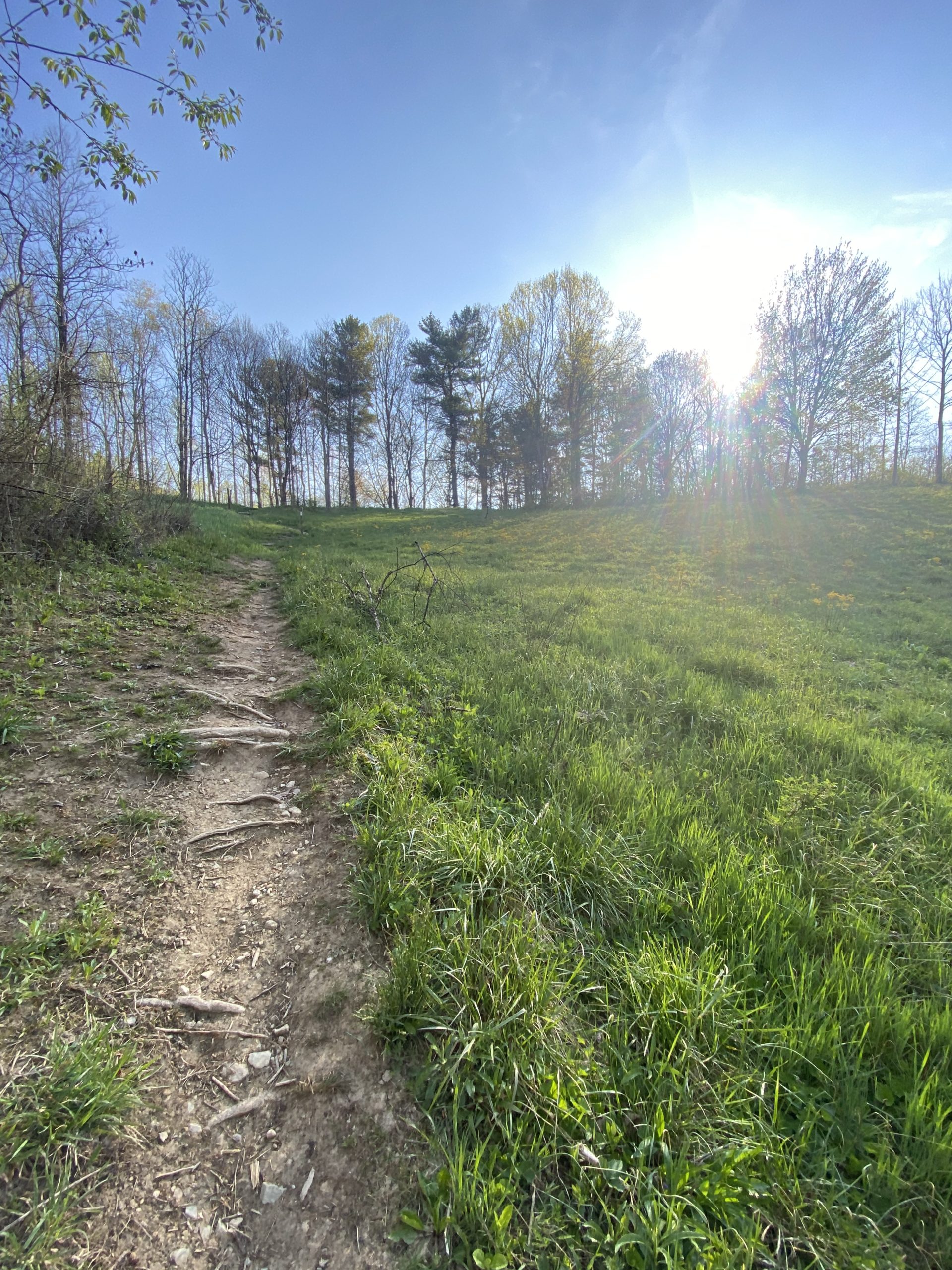
Leaving Laughing Heart Hostel right around 7 AM, I followed the AT for about a mile through town before the trail skirts off the road and back into the woods. The climb out of town was a very manageable one thanks to the series of switchbacks.
Consecutive ascents up Rich and Spring Mountains, followed by a long descent down to Allen Gap placed me at 16 miles for the day by around 1:00. I ate lunch right near Alan Gap, where I met and hung out with Wazoo, Heat and Bells who were hanging out the gap.
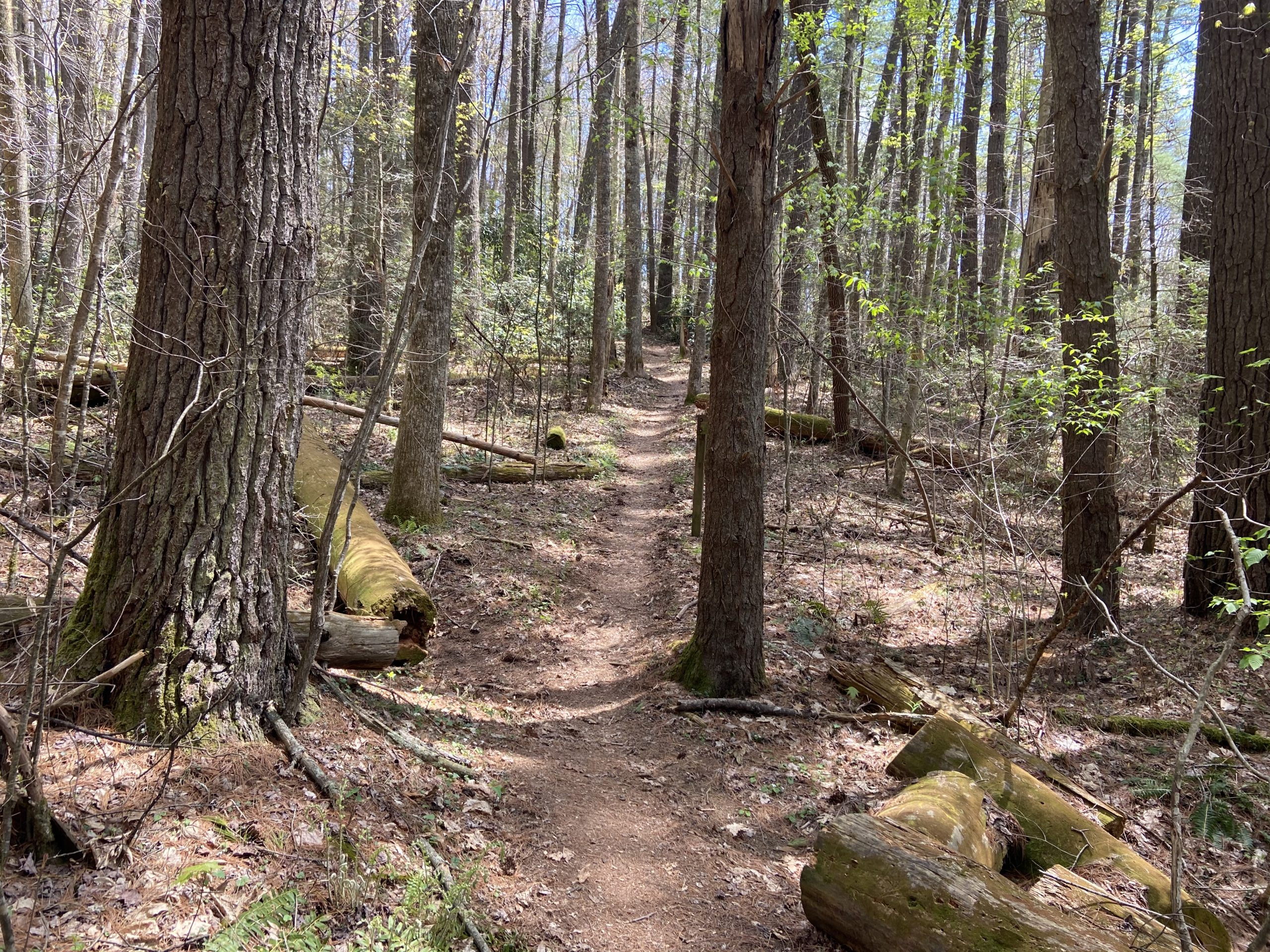
Past the gap, the AT begins its long ascent through pine forests back up to 4,000 feet, but not until passing by Little Laurel Shelter halfway through the climb just above 3,600 feet.
I was still feeling good and briefly contemplated continuing on for a couple extra miles, but the many flat tent spots to choose from and a relaxing afternoon were too hard to pass up on. Wazoo, Heat, Bells, Trail Candy and his sister Olive Oil all arrived within the hour. We enjoyed a chill evening swapping stories by the fire along with a few section hikers.

Little Laurel Shelter to Hogpen Ridge Shelter, 23.0 miles
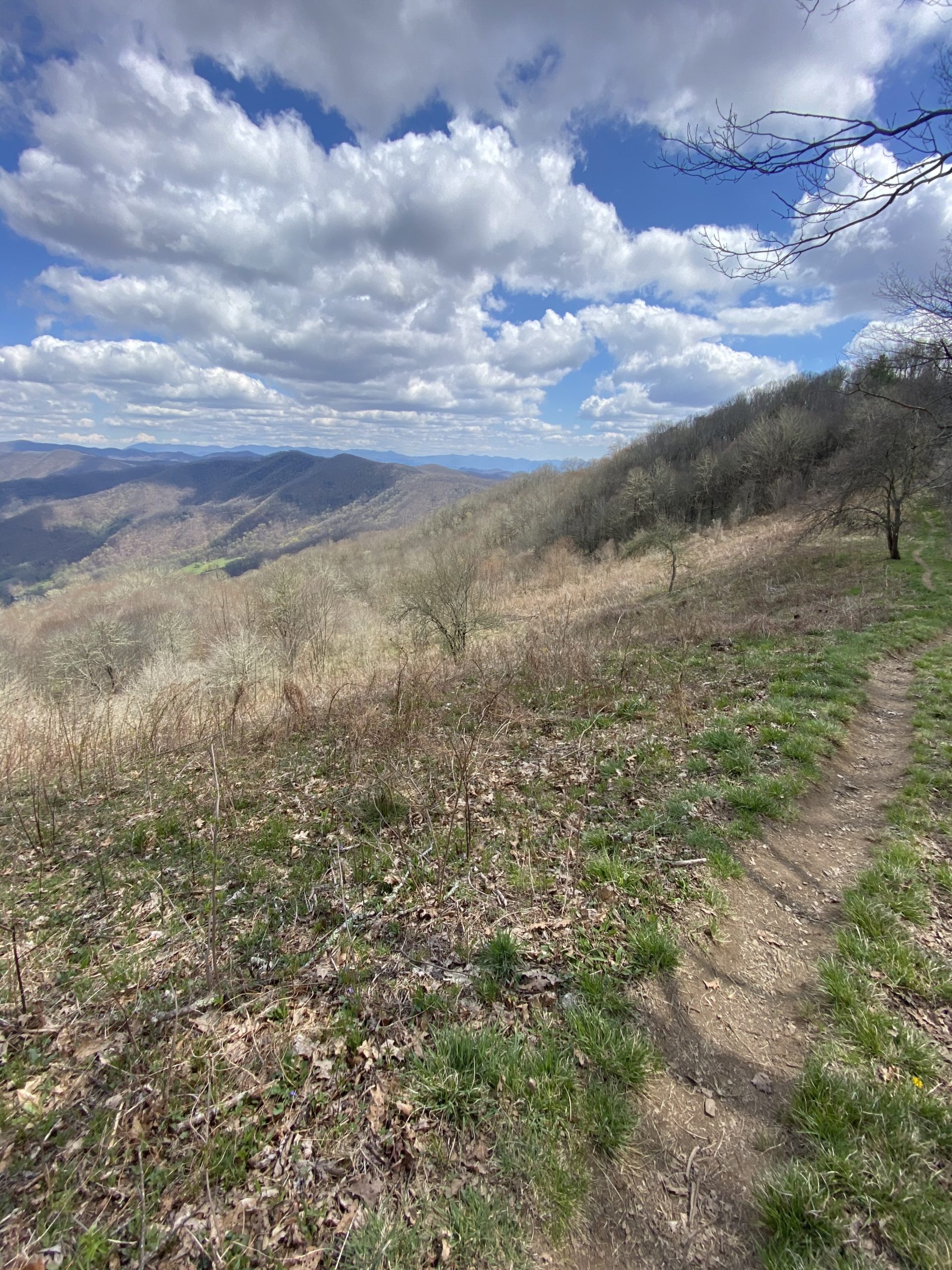
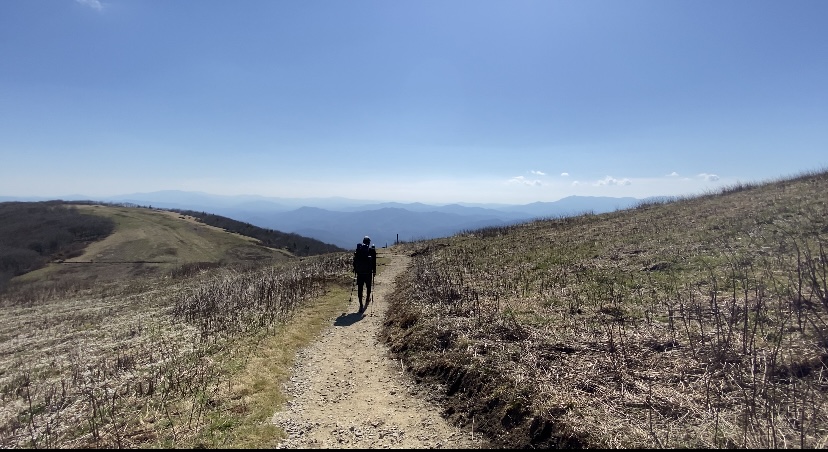
The day started off with finishing the climb that I had begun yesterday up to above 4,700 feet. A tedious, rocky ridge walk followed; any misplaced step could be the cause of a twisted ankle, or worse. The trail leads hikers to above the tree line on the ridge; offering 360-degree views of the Tennessee lowlands to my left and the Blue Ridge Mountains of NC to my right.
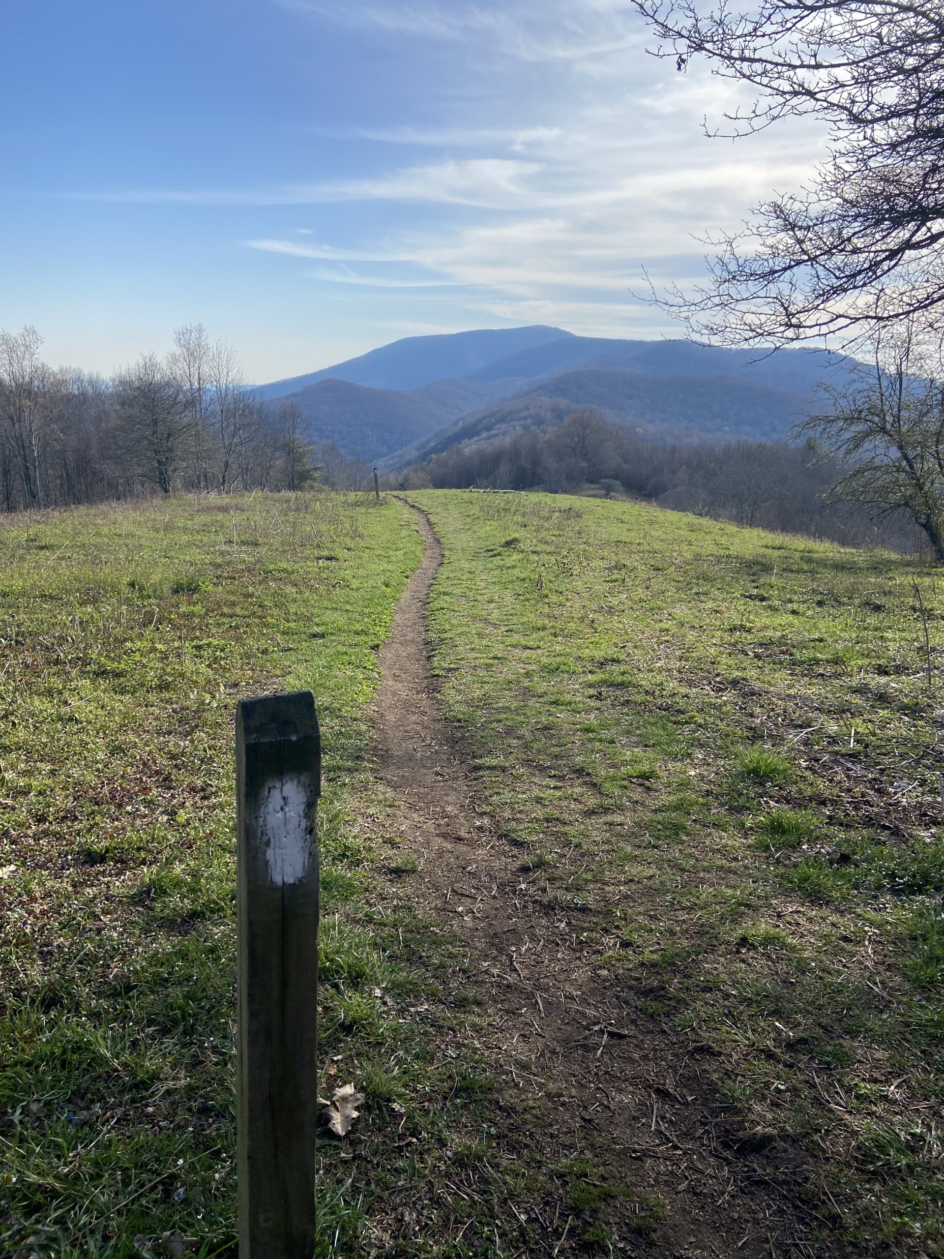
A very gradual, mostly flat descent made for a quick hiking pace before beginning the brief climb up to Big Butt; a Rocky outcrop providing minimal views despite the exciting name. From there, the AT continues its descent through the picturesque forests of the Cherokee National Forest down to Devil’s Fork Gap, where I stopped to rest 16 miles in for the day, before one final climb up to Hogpen ridge.
Despite the challenging climb, the landscape was captivating; greenery was everywhere, showing that Spring is beginning to take over the forests. Halfway up the climb, I passed a massive waterfall that was just asking to have its photo taken. I arrived to camp just after 4, to an empty shelter area. A few other hikers rolled in within the hour, and we enjoyed an amazing fire thanks to Timber (you can assume why his trail name is timber).


Hogpen Ridge Shelter to No Business Knob Shelter, 20.5 miles
I began descending off Hogpen Ridge just as the sun was beginning to rise over the distant mountain peaks. I took my time on this gradual descent to let my legs warm up and to enjoy the wonderful array of colors before me. 2.5 miles in, I arrived at Sam’s Gap, where a table of trail magic was already set up. What a way to start the day!
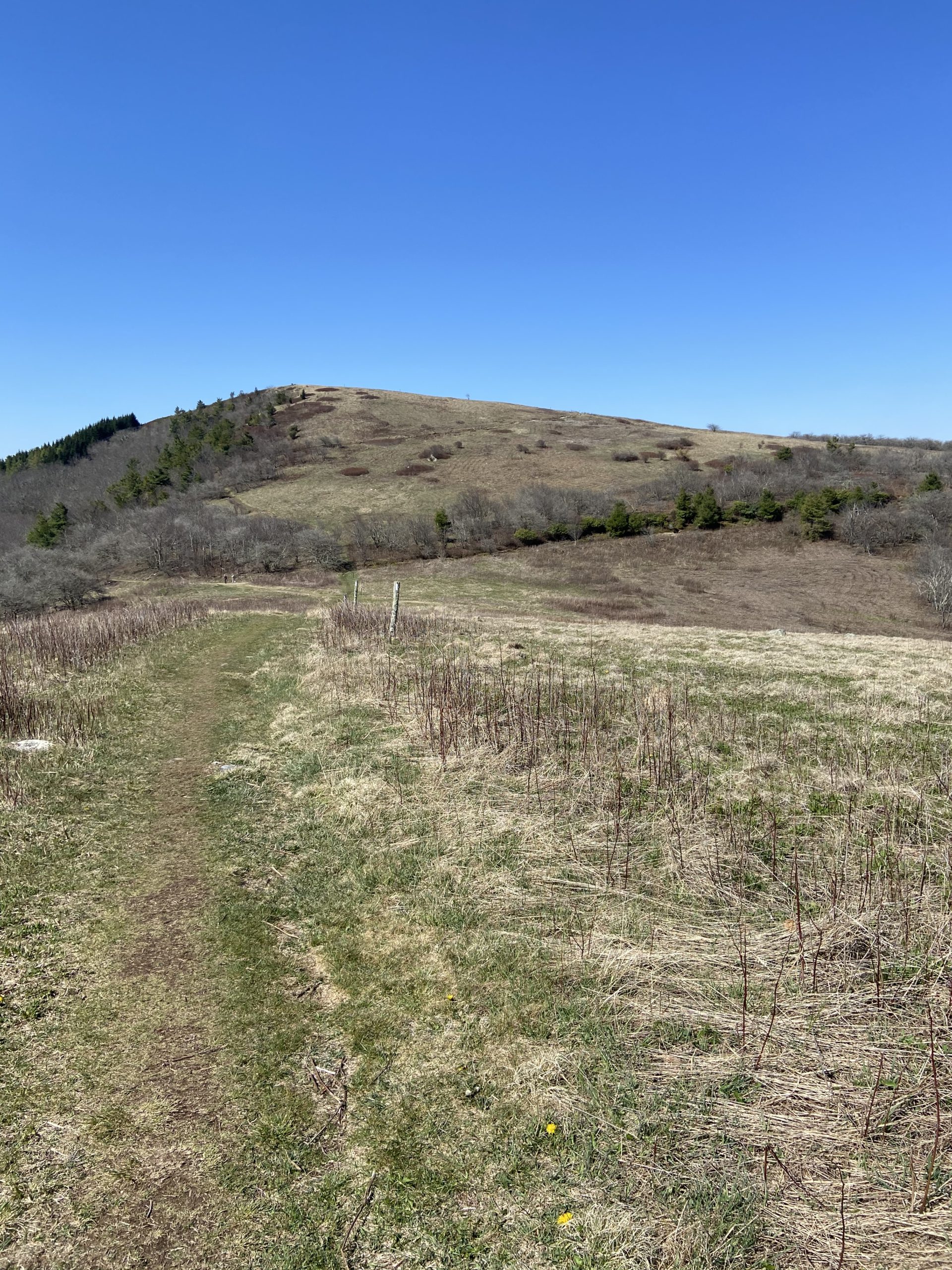
Fueled by more coffee and breakfast #2, I began my ascent up to Big Bald Mountain, climbing over 1,700 feet in a span of roughly 6 miles. At around the 5,000-foot mark, the trees disappeared and the fun began. The AT reaches the top of the bald, grassy summit of Big Bald at over 5,500 feet, then continuing on along the grassy ridgeline.
I was in awe of the scale and beauty of this bald mountain; it was like nothing I had never seen before. It was kind of like Max Patch but much larger and more epic. Expansive views of surrounding mountain peaks were everywhere, and you could see exactly where the trail was headed from a far distance away. The trail continued on like this for about a mile or so before dipping back into the scenic forest. More bright green grass and purple “Spring Fever” flowers lined this section of trail.
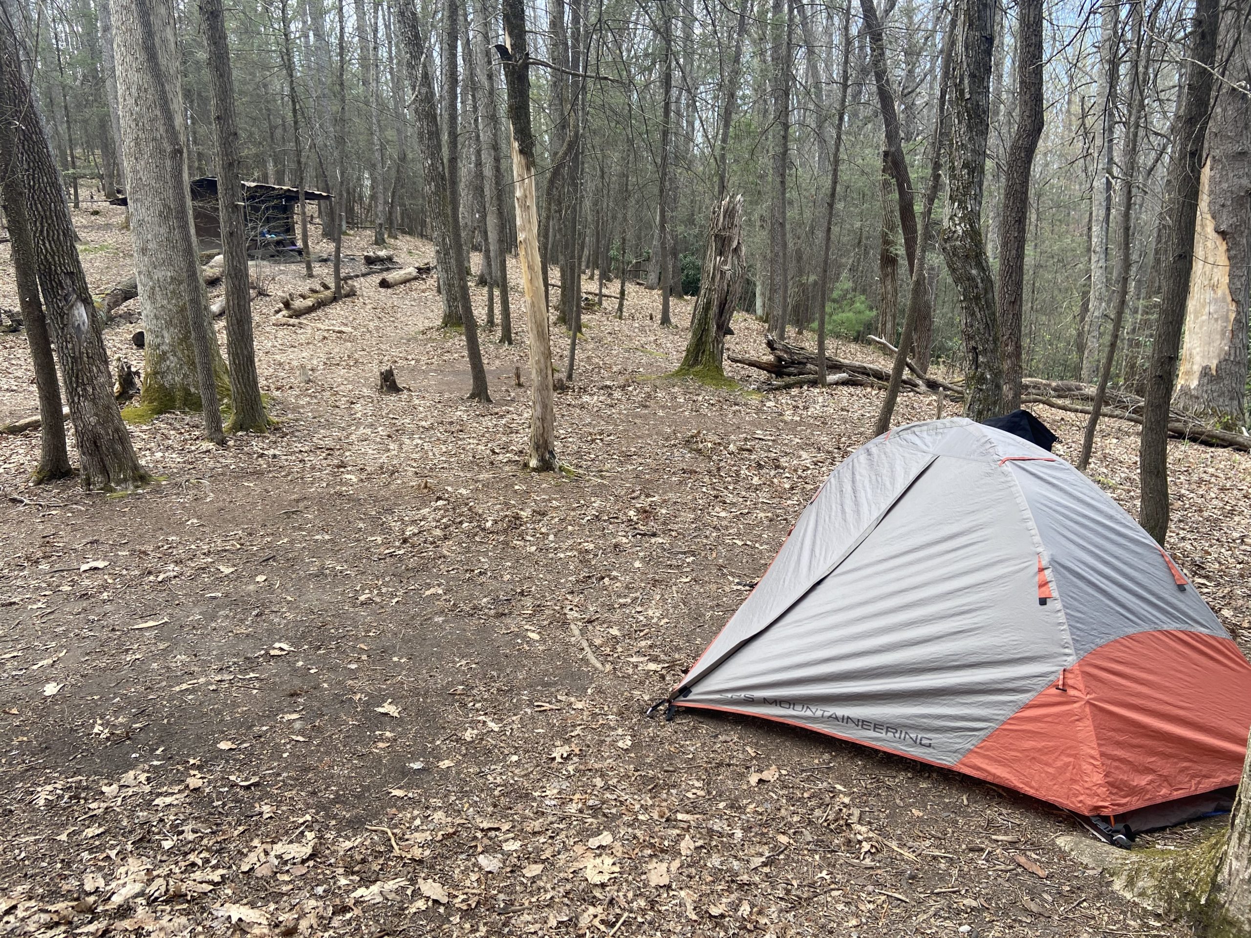
A long descent off the bald followed by a steep climb up to High Rocks led me to my lunch break at 14 miles in for the day. Pushing on, the AT crosses US 19W before making its way to the No Business Shelter, where I pitched my tent to call home for the night. Within the hour, Trail Candy and two other hikers from last, Peter and Platinum, arrived at the shelter. There were maybe 10 people in total at the shelter area, much different than the typical crowds of 30 back in Georgia.
No Business Knob Shelter to Uncle Johnny’s Cabin, 6.1 miles
Trail Candy and I were on trail by 7:30 to begin the 6-mile descent down to the town of Erwin, Tennessee where we had booked a cabin at the popular Uncle Johnny’s Hostel right off the AT. We descended through the pine and rhododendron forests at a fast pace, arriving just after 9:30.
Upon arrival, we quickly got all of our town chores out of the way before enjoying a chill afternoon eating quality town food and enjoying some drinks. “Near-o” days are much like zero days, having almost all day to let your legs rest and enjoy the benefits of civilization. It started to rain just as we arrived, proving to be the perfect day for a “near-o”.
Trail Candy carries a DSLR camera with him and takes some phenomenal photos throughout his hike. If anyone wants to follow an AT hiking account with pro-quality shots, feel free to check out his Instagram page


This website contains affiliate links, which means The Trek may receive a percentage of any product or service you purchase using the links in the articles or advertisements. The buyer pays the same price as they would otherwise, and your purchase helps to support The Trek's ongoing goal to serve you quality backpacking advice and information. Thanks for your support!
To learn more, please visit the About This Site page.

Comments 1
Your journey looks so exciting! I’m so happy for you. Safe travels!