How to Thru Hike the Appalachian Trail: A 101 Guide
Welcome to How to Thru-Hike the Appalachian Trail: A 101 Guide! This resource is designed to help you understand everything you need to know about thru-hiking the Appalachian Trail. Here you will find information regarding the trail and the culture that surrounds it, gear talk, thru-hike preparation, hiking strategies, social etiquette, and much, much more. To skip to a specific subject of interest and for easier navigation utilize the quick links in the Table of Contents below.
Table of Contents
- What is the Appalachian Trail
- History
- The People’s Trail
- When to Hike
- Thru-Hiking Routes
- Navigating the Trail
- Guidebooks & Maps
- Camping & Shelters
- Water
- Preparation
- Cost
- Gear
- The Big 4
- Clothing (coming soon)
- Stoves (coming soon)
- Resupply
- Getting to Town
- Hostels
- Outfitters
- Best Practices
- Hike Your Own Hike (HYOH)
- Leave No Trace (LNT)
- Proper Pooping (coming soon)
- Dangers/Risks
- Other FAQ
- Further Reading
- Trail Terminology
What is the Appalachian Trail?

The Appalachian Trail, more commonly known as the “A.T.,” is a national scenic long-distance trail meandering nearly 2,200 miles through the Appalachian Mountain range in the eastern United States. The A.T. cuts into the heart of Appalachia, passing through 14 states, eight national forests, six national parks, and numerous state/local recreational areas. Throughout its length the trail takes hikers through a foray of environments including dense forests, woodland slopes, exposed ridges, grassy balds, open farmland, lowland swamps, mountain bogs, and alpine peaks. In order to provide a more primitive experience, the A.T. attempts to avoid more developed areas, passing through only a handful of small mountain towns. Yet, many of these nearby communities embrace the trail and have become an important part of the A.T. experience. Broken down, the trail can be split into four distinct sections, each with its own set of challenges and rewards.
For a visual overview of the trail check out our Interactive Map of the A.T.
SUBSCRIBE TO THE TREK NEWSLETTER The Southern Mountains
Here there be mountains. The Southern Mountains are home to the A.T.’s southern terminus and is the first region of trail experienced by the majority of thru-hikers. The trail takes hikers up, over, and around the beautiful wooded mountains of the Chattahoochee, Nantahala, Pisgah, and Cherokee National Forests. Though these peaks are generally considered easier to ascend than those in New England, the climbs here are frequent and considerable in size. The Southern Mountains are home to the highest peaks found on the entire trail. In this region, thru-hikers have the privilege of hiking through some of the A.T.’s most beautiful areas including the Great Smoky Mountain National Park as well as the high grassy balds unique to the region.
Notable Locations: Springer Mountain | Blood Mountain | Nantahala Outdoor Center | Fontana Dam | Great Smoky Mountain National Park | Clingmans Dome | Max Patch | Hot Springs, NC | Big Bald | The Roan Highlands

The Virginias
The Virginias make up both the longest and shortest states on the A.T., respectively. Nearly a quarter of the entire trail passes through Virginia alone–that’s over 550 miles! By comparison just a scant four miles pass through West Virginia. Though contained within those miles is a crucial landmark: the headquarters of the Appalachian Trail Conservancy in historic Harpers Ferry, WV. Hikers travel along Virginia’s spine through the Jefferson and George Washington National Forests. In southern Virginia hikers see the state’s highest summits along with the open balds of Grayson Highlands State Park… including the wild ponies! From there, the mountains begin to transition from high-rising peaks to the more modest ridge lines of central Virginia, where hikers see woodland and farmland collide in the valleys below. While elevations may begin to decline hikers are not yet free from occasional long, difficult climbs and descents. In northern Virginia, hikers travel through the Shenandoah Mountains side-by-side with the famed Blue Ridge Parkway, Skyline Drive, and over 100 miles through wondrous Shenandoah National Park.
Notable Locations: Damascus, VA | Mount Rogers | Grayson Highlands State Park | McAfees Knob | Blue Ridge Parkway | Skyline Drive | Shenandoah National Park | Harpers Ferry, WV | Appalachian Trail Conservancy HQ
 The Mid-Atlantic
States: MD | PA | NJ | NY | CT | MA
The Mid-Atlantic region is home to the lowest elevations on the the A.T. The trail descends from its northern and southern mountains into low-rising ridge lines, farmland, wetlands, and boulder fields. Lower and more gradual elevation changes make some sections of the trail through this region the easiest to travel. However, the region is not without its own challenges. Some sections of trail in northern Maryland, Pennsylvania, and southern New Jersey are infamous for their sharp, rocky terrain, while New York contains a surprising amount of sharp ups and downs over larger stones and boulders. Many hikers also travel this region in the summer months making exposed sections through farm and wetlands particularly wearing. Though, by leaving the remoteness of the high mountains the Mid-Atlantic region tends to run closer to civilization than the other parts of the trail. It passes near residential areas, over interstates and freeways, through numerous state parks, and comes within a mere 34 miles of New York City. Consequently hikers will find the trail through the Mid-Atlantic region peppered with historical sites for ready hikers to explore.
Notable Locations: Washington Monument | Pine Grove Furnace State Park | Lehigh Gap | Pochuck Boardwalk | Bear Mountain | Trailside Museum & Zoo | Great Falls | Upper Goose Pond | Mount Greylock
 New England
New England beckons an epic return to the mountains for northbound hikers and provides a challenging start for those preparing a southbound venture. The dense forests of Vermont’s Green Mountains, the alpine peaks of New Hampshire’s White Mountains, and the vast lakescapes of Maine’s wilderness offer some of the grandest sights to be seen on the entire A.T. Of course, those seeking to reap these mountain’s rewards must first earn them. The final three states are wryly known as Vermud, No Hope, and Pain. Vermont is well known for it’s muddier-than-usual trail conditions while New Hampshire’s White Mountains will challenge hikers with long, arduous climbs often requiring regular hand-over-foot rock scrambling. Maine’s nearly 300 miles of remote wilderness will put hiker’s outdoor skills to the test, ranging from rocky climbs to river fords and everything in between.
Notable Locations: Stratton Mountain | Mount Killington | Hanover, NH | White Mountains National Forest | Mount Moosilauke | Mount Washington | Mahoosuc Notch | Kennebec River | Monson, ME | 100 Mile Wilderness | Baxter State Park | Mount Katahdin
Through the Eyes of a Hiker
Straight from the horse’s mouth! For a deeper look into what it’s like to be an A.T. thru-hiker and what you can expect from each state check out this small sampling of blog posts below from previous year’s hikers.
- ME – Maine is the Tony Perkis of the AT
- NH – Journal Through the Whites
- VT – Vermud…
- MA – Sweet Home Massachusetts
- CT – Pfft! What Was That? Connecticut!
- NY – The State No One Ever Warns You About
- NJ – New Jersey, Bears, and Bull Frogs
- PA – Almost Out of Pennsylvania
- MD – WV to Boiling Springs
- WV – What? Like It’s Hard?
- VA – Still In Virginia
- NC/TN – Hiking in the Smokies
- GA – Hey Georgia, I See You (and My First 69.3 Miles)
Back to Top
History
The project is one for a series of recreational communities throughout the Appalachian chain of mountains from New England to Georgia, these to be connected by a walking Trail.
– Benton MacKaye, An Appalachian Trail: A Project in Regional Planning

Benton MacKaye (left) Myron Avery (right). Photo courtesy of the Appalachian Trail Conservancy.
The idea for the Appalachian Trail was birthed by Benton MacKaye. In 1921 MacKaye made his ambitious vision public with his proposal: An Appalachian Trail: A Project in Regional Planning. However, in his proposal MacKaye envisioned much more than a simple hiking trail. He dreamed of a Utopian ideal with small, self-owning community camps set up near the trail supported by food and farm camps where people could come reap the numerous benefits of mountain living. Over the next several years MacKaye spent his time trying to gain support for his ambitious plans. In 1925 MacKaye eventually found enough like-minded individuals to organize the Appalachian Trail Conference (eventually becoming the Appalachian Trail Conservancy, ATC) and begin developing a plan of action for the heart of his proposal: a walking trail from New England to Georgia.

An early vision of the A.T. proposed by Benton MacKaye to the Appalachian Trail Conference in Washington March 1925. Courtesy of the Appalachian Trail Conservancy.
Through the latter half of the 1920’s the A.T. saw little progress. The ATC had succeeded in connecting existing trails and breaking new ground in the north but progress in the southern regions was lacking. Arthur Perkins, a retired judge from Connecticut, took control over the ATC from Benton MacKaye near the end of the decade. It was Perkin’s efforts that attracted the attention of a Washington lawyer known as Myron Avery. Avery and a few other local supporters began mapping out a path for the trail through northern Virginia and West Virginia.
Eventually, Avery succeeded Perkins as the head of the ATC and under his leadership the development efforts for the A.T. surged, albeit at the cost of internal disputes. As progress on the trail continued Avery and MacKaye’s visions for what the A.T. was and should be clashed. Avery’s more pragmatic idea for the trail as a means for making the mountains more accessible to the masses did not align with the MacKaye’s more romantic vision. The feud eventually culminated in 1935 with MacKaye diverting much of his attention away from the A.T. and towards other projects. Regardless, under Avery’s continued efforts the A.T. was finally connected as a continuous footpath stretching from Georgia to Maine on August 14, 1937. However, work was far from over.
The following decade the trail was plagued with challenges. A hurricane in 1938 heavily damaged parts of the trail in the north. That same year Congress approved the extension of the Blue Ridge Parkway, which would ultimately displace nearly 120 miles of trail. Conflicts with the trail running through private lands also began to arise. Then with the onset of World War II, progress on the trail was more or less halted for much of the decade with many volunteers’ efforts focused on the war.

The first thru-hiker, Earl Shaffer, atop the A.T.’s northern terminus on Mount Katahdin (1948). Courtesy of the Appalachian Trail Conservancy
However, in 1948 new life was breathed into the trail by a man named Earl Shaffer. A recovering WWII veteran, Shaffer set out on the A.T. and became the first recorded thru-hiker in history–a feat that at the time was believed impossible. After the war trail efforts were able to be refocused. Finally in 1951 despite never officially being “closed,” Avery once again declared the A.T. open as a continuous footpath.
Throughout the 1950’s and 1960’s work on the trail continued, refining its path. External developments began to encroach on the A.T.’s corridor prompting the ATC to seek legislative help. Spearheaded by ATC’s co-chairmen Stanley Murray and Murray Stevens (who took the reigns after Avery’s sudden passing), work began to formulate federal legislation that would ensure the protection of the A.T. corridor. Their efforts paid off in 1968 when President Lyndon B. Johnson signed the National Trails System Act into law making the Appalachian Trail the first national scenic trail under the National Park System (NPS). This act would set in motion the long and arduous process of officially acquiring and placing the A.T. along federal lands–a process that would not be formally completed until 46 years later in 2014.
ARTICLE: How the AT Works
Back to Top
The People’s Trail

Hiker Parade at Trail Days 2013 in Damascus, VA.
The chain connects every person out there, whether they are past hikers…or new hikers…The chain is a support network. You know about people hundreds of miles in front of you and hundreds of miles behind … through only the most rudimentary of mechanisms – paper notebooks, message boards and the word of hostel owners. And being a hiker, living out in the Woods with the scorpions, the snakes, the trees and the dirt … you inexplicably feel bound to each and every other person who does the same. The chain runs North and South, East and West. It spans ages and breaks class boundaries.
– Voodoo, NOBO 2008
The best stories from the A.T. tend to revolve around the people of the trail. Whether they be hikers, townies, hostel owners, Trail Angels, or another part the A.T. family, this community is unlike any other. Compared to other long-distance trails the A.T. is considered a more “social” trail. This is in part due to do the immense increase in the popularity of northbound hikes, but there is much more to it than that. While the A.T. takes hikers out into the wilderness and at times into very remote areas, it is intertwined with civilization more frequently than many of its sister long-distance trails. It winds its way not only through the backwoods of Appalachia but also through small-town America. As a result countless nearby communities have come to embrace it as a part of their culture. Many hikers will flood you with stories of the deep and meaningful connections they made with other hikers. Many others will tell you of the incredible random acts of kindness bestowed upon them by Trail Angels. Today being a part of this A.T. community is as much a draw as the wilderness that surrounds it.
Trail Magic

One of the experiences most highly anticipated by A.T. hikers is “trail magic”. Trail magic describes random acts of kindness bestowed upon hikers often by complete strangers. The kind souls who gift hikers with trail magic are commonly referred to as Trail Angels. Unsurprisingly, many Trail Angels are former thru-hikers “paying it forward”–returning the kindness they received on the trail to current hikers. However, anyone can be a Trail Angel whether they are familiar with the A.T. or not. Trail Magic can be something as simple as a free snack or it can be as elaborate as setting up a small coffee shop at a road crossing. Some Trail Angels even make a habit of inviting hikers into their homes. All it takes is a kind heart and a willingness to help a hiker along their way. You can find information for “professional” Trail Angels offering shuttles and lodging in some guidebooks and occasionally at outfitters.
Hikers will find these memorable encounters throughout the entirety of the A.T., but due to the higher concentration of northbound hikers there is often an over-saturation of trail magic in the Southern Mountains in the spring. This has somewhat changed the dynamic of trail magic at times making it seem less like a random act of kindness and more like an anticipated guarantee. Regardless, should you be fortunate enough to be on the receiving end of trail magic do not take it for granted and be sure to show a deep level of appreciation. Should you be a former, future, or even current hiker looking to grant a little trail magic yourself be sure to carry it out responsibly. The high levels of trail magic in the south share similar conservation concerns as the high level of hikers themselves. Please read these guidelines by the ATC to help get you started.
ARTICLE: Trail Angels and Trail Magic on the Appalachian Trail
ARTICLE: The Generosity of Trail Magic
ARTICLE: Trail Magic – Love It or Hate It?
Volunteer Efforts
The National Park Service holds the ultimate legal responsibility for the A.T. and the ATC acts as its primary advocate to the public and government. However, much of the physical work involved in keeping the trail alive is done by an army of willing volunteers. There are currently 30 official maintaining clubs affiliated with the ATC, each with it’s own specific stretch of trail to care for. Maintenance sections can be as small as the Wilmington Trail Club’s 7.2 miles or as large as the Maine Appalachian Trail Club’s 267 miles. The ATC works with these clubs to help coordinate volunteer efforts where they’re needed most. Clubs do everything from maintaining existing trails and painting blazes to excavating trail reroutes and building new shelters. The trail got its beginnings thanks to the volunteer efforts of men like MacKaye and Avery and its continued existence relies on people like you and I taking time out of our day to give back to the trail. To learn more about how you can become an A.T. volunteer visit the ATC’s volunteer page here.
ARTICLE: From Thru-Hiker to Volunteer: How to Give Back
ARTICLE: How the AT Works: What DOES a Maintainer Do?
ARTICLE: How the AT Works: Volunteering Safely
Back to Top
When to Hike
Most thru-hikers are expected to spend anywhere between 4 to 7 months out on their adventure. This means hikers can assume to experience two to three different seasons during that time. As a result most thru-hikers position their journeys between March and December in order to hike in spring, summer, and autumn conditions. While it is not impossible to hike during winter months the low temperatures, deep snow, and sometimes unpredictable storms make traversing the trail more difficult; sometimes dangerous. However, the exact time of year a thru-hiker should set out on the A.T. is highly dependent on their hiking route. The starting point, ending point, and direction of a persons hike will consequently determine when they need to start.
About 99% of the A.T. is open to the public year round with the major exception being Mount Katahdin and Baxter State Park (BSP). By October 15th BSP closes to overnight camping and only allows visitors day use of the park. By November 1st vehicular access to the park is usually closed. These closures are set in place as Mount Katahdin becomes too dangerous for hikers to summit as winter approaches. As a result of these regulations the ATC, Maine Appalachian Trail Club, and BSP recommend completing a climb of Katahdin by the October 15 deadline to ensure hiker safety. However, depending on conditions it is possible for BSP to initiate closures on earlier dates if necessary.
ARTICLE: Katahdin Thru-Hiker Alert Baxter State Park
Back to Top
Thru-Hiking Routes
One of the most important decisions thru-hikers need to make before starting their adventure is what direction they want to hike the trail. This decision can majorly affect the way a hiker will experience the A.T. both physically, mentally, and socially. There are a lot of ways to tackle this 2,200 mile monster so here are some things for hiker’s to consider when weighing the options.
Northbound (NOBO)

The Southern Terminus of the A.T. atop Springer Mountain.
A northbound hike, often referred simply as “NOBO” by hikers, is easily the most popular choice for most A.T. thru-hikers. A northbound hiker starts their adventure at the A.T.’s southern terminus on Springer Mountain and hikes north toward the northern terminus atop Mount Katahdin in one continuous trip.
The popularity of northbound hikes has resulted in crowded trail conditions. In 2014 approximately 2,500 thru-hikers registered as northbound hikers. That’s around 87% of all hikers and over 10 times the number of southbounders for the 2014 season. While this may benefit the social experience of the trail for some it comes at the cost of other complications. Such a large influx of hikers at the same time each year is beginning to stress and damage the trail and its surrounding environment in the south. As a result it is recommended by the ATC and many conservationists for hikers, if at all possible, to consider alternate options to northbounding.
When to Start
Northbound hikers typically start in late March or early April ending their hike between late August and early October. In recent years the most popular start dates have been March 1, March 15, and April 1. It is highly recommended to avoid starting on or near these dates to help alleviate crowding on the trail.
Considerations:
- Starting at Springer Mountain is mentally, physically, and logistically simpler than starting at Mount Katahdin.
- Hike ends at Mount Katahdin–considered the toughest climb on the A.T. while also being considered one of the most jaw-droppingly beautiful.
- Shelters and campsites will often be over-crowded during the first few hundred miles.
- Higher likelihood of exposure to norovirus and similarly transmitted illnesses due to crowded conditions.
- Can expect to hike in winter conditions during the first month of their hike. The high southern mountains in Georgia, North Carolina, Tennessee, and southern Virginia can still experience freezing temperatures and deep snow as late as April. Northbound hikers must be prepared to carry winter gear suitable for such conditions for around their first 500 miles on trail.
- Often hot and humid weather conditions in the Mid-Atlantic states. Also prime mosquito season.
- Can expect to hike in comfortable weather conditions in southern New Enlgand, but with cooler conditions returning in New Hampshire and Maine towards September and October.
Southbound (SOBO)

Northern Terminus of the A.T. atop Mount Katahdin.
Hiking southbound on the A.T., also known as hiking “SOBO,” is the antithesis of a northbound hike. A southbound hiker starts their adventure at the A.T.’s northern terminus atop Mount Katahdin and hikes south toward the southern terminus on Springer Mountain in one continuous journey.
Undergoing a southbound hike is less popular as it requires hikers to start their journey with the most difficult terrain. Hikers start with the hardest climb on the trail with Mount Katahdin moving on to the remote 100-mile wilderness followed by the challenges of southern Maine and the White Mountains. For many newbie backpackers this makes for quite the tall order and as a result southbound ventures are only recommended for experienced backpackers. Also some people are not as excited by the idea of ending their hike upon Springer Mountain rather than Mount Katahdin, but that is entirely subjective. However, for those willing to undertake the challenge there are still beneficial reasons for choosing to southbound on the A.T.
When to Start
Southbound hikers typically start in June or early July ideally ending their hike in November or December.
Considerations:
- Springer Mountain may provide a less “dramatic” conclusion than Mount Katahdin.
- Fall colors are in full swing by the time hikers reach Virginia and the southern Appalachians
- Fewer hikers attempt a southbound hike each year. Encounters with other hikers will be less frequent. However, this means campsites and shelters are less crowded.
- May still experience high heat and humidity through parts of the Mid-Atlantic.
- Mount Katahdin through New Hampshire contains some of the most difficult trail conditions. Hikers are frequently required to climb and rock scramble in their first few hundred miles on trail.
- Heavy rains and wet weather are common during the summer months in New England. Be prepared for potentially muddy trail conditions and high stream crossings.
- Black flies can be a nuisance throughout June and early July in the north.
- Required to hike through hunting season in the southern states starting as early as October.
- As November approaches hikers may experience cold weather and snow in the southern Appalachians.
ARTICLE: SoBo Vs. NoBo Thru Hikers: The Tiny Differences and The Immense Similarities
ARTICLE: 4 Reasons to Hike SoBo
Other Alternatives
 Because of the problematic issues of crowding for northbound hikes coupled with the extreme starting difficulty of southbound hikes there is an increasing number of A.T. hikers seeking out alternative itineraries for their adventure. Carrying names like the “Flip Flop”, the “Head Start,” and the “Leap Frog,” alternative hikes are becoming popular choices as they allow more flexibility in starting and ending dates along with many other benefits. In some ways it is a “best of both worlds” approach to hiking the A.T.
When to Start
There are many ways to construct a flip flop hike which the ATC outlines in fantastic detail. However, one of the most common examples has hikers starting near the A.T. halfway point in Harpers Ferry during May and hiking north reaching Katahdin by August or September. Hikers then return to Harpers Ferry and hike south intending to end their hike on Springer Mountain by November or December.
Considerations:
- Allows hikers to start off with the easiest terrain the trail has to offer with Maryland and southern Pennsylvania.
- Trail crowding is a non-issue.
- Hikers can get through the Mid-Atlantic states before peak summer temperatures arrive.
- Pleasant hiking temperatures for the White Mountains in July.
- Encounter early-bird northbound hikers during the first half of the hike and end your hike with southbounders.
- Miss peak mosquito season in the Mid-Atlantics and black fly season in Maine.
- Fall colors are in full swing by the time hikers reach the Virginia and the southern Appalachians.
- Required to hike through hunting season in the southern states starting as early as October.
- As November approaches hikers may experience cold weather and snow in the southern Appalachians.
ARTICLE: Alternative Thru-Hikes on the Appalachian Trail
ARTICLE: 10 Reasons You’ll Love a Flip-Flop Thru-Hike
ARTICLE: The Path Less Traveled
ARTICLE: Flip-flop, Leapfrog, NoBo… the AT choices
Back to Top
Navigating the Trail
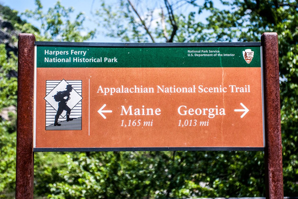
The A.T. is considered to be among the longest continuously marked trails in the world. An estimated 165,000 white blazes guide hikers along the 2,189 miles of trail. A “white blaze” is a 2 x 6 inch swatch of white paint typically placed on trees, rocks, sign posts, and various other locations signifying the path of the A.T. White blazes are also marked for both northbound and southbound travel. The distances between white blazes vary, but are generally not too far apart. However, The ATC recommends that if you have traveled more than a quarter-mile without spotting a white blaze hikers should retrace their steps until a blaze can be located.

A typical white blaze on the A.T.

A typical double white blaze signifying an abrupt direction change or trail intersection.

A double white blaze signifying a left turn on the trail.

A typical rock cairn as seen in the White Mountains.
In areas where painted blazes are inappropriate or difficult to see, rock cairns are a common substitute. A “cairn” is simply a small pile or stack of rocks and stones marking the path of the trail. While less common then white blazes, cairns are heavily relied upon in certain sections of the A.T., such as in the White Mountains of New Hampshire.

A typical blue blaze found along the A.T.
Side trails that connect or intersect with the A.T. are marked with blazes of other shapes and/or colors. These side trails are commonly referred to as “blue blazes,” as they are often marked by painted blue-colored blazes reminiscent of the A.T.’s white blazes. Side trails can include spur trails leading to A.T. shelters, water sources, vistas, or a plethora of other destinations. Many blue blazes will be marked with signs at their intersection with the A.T. noting their destination. Otherwise, it’s best to consult a map or guide book to verify a side trail’s destination before leaving the A.T.
ARTICLE: The Best Blue Blazes on the Appalachian Trail – Part 1
ARTICLE: The Best Blue Blazes on the Appalachian Trail – Part 2
ARTICLE: The Best Blue Blazes on the Appalachian Trail – Part 3
ARTICLE: The Best Blue Blazes on the Appalachian Trail – Part 4
Fording
In rare occasions, hikers will need to ford streams, creeks, and rivers. This is particularly true in Maine. Most fords are easily manageable and do not pose significantly elevated risk. However, during and after heavy rains fords should be assessed with caution. Several crossings will be equipped with ropes to help guide hikers through the ford as well as provide a source of balance.
There is only one river hikers are advised to never ford–the Kennebec River in Maine. The Kennebec is the widest unbridged crossing on the trail measuring over 200 feet. Random water releases from a dam located up river can cause water levels in the Kennebec to rise quickly and unexpectedly. Though water releases may be infrequent they can occur with little to no warning down river. Fortunately, the ATC and the Maine Appalachian Trail Club help fund a ferry service to safely carry hikers across the river. It is highly recommended that all hikers please use the ferry service to cross the Kennebec River to ensure their own safety. You can find more information on the Kennebec River ferry services in the articles below.
ARTICLE: Crossing the Kennebec
ARTICLE: Kennebec River Ferry Service
ARTICLE: How the AT Works: River Crossings
Back to Top
Guidebooks & Maps
While the signature white blazes go a long way in guiding hikers along the A.T., it is highly recommended that all hikers consult and bring guidebooks and/or maps with them when setting out on the trail. Both maps and guidebooks are invaluable resources for any thru-hiker, each with their own pros and cons.
Guidebooks
Today guidebooks are a more popular choice among A.T. hikers over traditional maps. They provide extensive and practical information about not just the A.T. itself, but also its surrounding businesses and communities all contained in one small, easily affordable package. Also because the A.T. is so well marked and maintained most hikers do not require a traditional map to safely navigate the trail. Still, guidebooks rely on a hiker’s ability to follow the white blazes and stay on the A.T. Hikers who venture off trail or get lost will find the guidebook to be of little assistance beyond maybe a few helpful phone numbers (if you have signal) and as kindling.

There are two prominent guidebooks utilized by most A.T. hikers: The A.T. Guide by David “AWOL” Miller and the Appalachian Trail Thru-Hikers’ Companion by the Appalachian Trail Conservancy and Appalachian Long Distance Hikers Association (ALDHA). Both guides offer a wealth of information about the A.T., such as elevation profiles of the entire trail, mileages, shelter locations, water sources, town maps, contact info for hostels and outfitters, and much more. However, guidebooks do not show a general overhead view of the trail’s path as would be found on a traditional map. Even so, both The A.T. Guide and the Appalachian Trail Thru-Hikers’ Companion are excellent resources to help hikers throughout their A.T. journey. If you need help deciding which guidebook is for you check out the article below for a helpful comparison.
ARTICLE: The AT Guide vs. The Thru-Hiker’s Companion
Maps
Traditional maps, while not as detailed as modern guidebooks, still provide valuable information. They give hikers an overview of their surroundings in a way guidebooks are not equipped to do. They allow hikers to view a better lay of the land by showing surrounding topography, providing insight on the paths of relevant side trails & forest roads as well as better insight into the location of the A.T. in relation to the surrounding area. Unlike guidebooks’ ability to contain all its information in a single bound volume, it’s impossible to have a detailed view of the entire trail on a single map. If hikers wish to have maps for the entire A.T. they can expect to have to purchase many maps for the different sections of the trail.


Which Should I Choose?
This decision is ultimately one of personal preference. Guidebooks are generally cheaper, heavier, and provide mountains of useful information. Maps are generally more expensive, lighter, and gift a view of the trail that guidebooks cannot. If it can be afforded, carrying both is also a valid option as both resources compliment each other well.
Back to Top
Camping & Shelters
It should be no surprise that sleeping out in the woods is a regular part of any thru-hike. While traveling the A.T hikers will generally have two primary options to choose between when it’s finally time to settle in for the night: utilize one of the established A.T. shelters or resolve to set up their own traditional campsite.
Shelters
 A.T. shelters, also known as huts or lean-tos in some areas, are a feature on the A.T. that is rather different from many other long-distance hiking trails. They are generally 3-sided wooden structures with an overhanging roof and a slightly elevated wooden floor. The intention of these shelters are to help minimize and manage the impact dispersed camping can have on wilderness areas by attempting to localize camping activities to specific locations on the trail. There are more than 250 shelters spread out along the A.T. with most conveniently positioned near reliable water sources. Distances between shelters vary, but hikers will typically run into a shelter every 5 to 15 miles.
Like much of the A.T., shelters are built and maintained by local volunteer trail clubs. Shelters vary in size with some holding as few as 5 hikers and others as many as 20. However, shelters operate on a first-come-first-serve basis and are open to all A.T. travelers, not just thru-hikers. That means if a shelter is full by the time you arrive you’ll need to either pitch your own tent or hike on to the next available campsite.
Additional amenities at shelter sites vary as well. Some may be equipped with an adjoining picnic table, established fire pits, bear-bagging systems, and privies. Also many, but not all, shelter sites are equipped with additional space for tent camping should the shelter itself already be full for the night. However, shelter life doesn’t come without its issues, so here are some things all hikers should consider before taking up shelter space.
 There is a proper social etiquette involved when accepting space in a shelter. If you’re not willing to adhere then you probably should just pitch your own tent.
- The majority of A.T. shelters are free to use. Yet, there are some that require a small fee. Such shelters tend to be found in high-use areas and often have an on-site caretaker.
- Shelters’ convenient locations along the trail coupled with their many backwoods “luxuries” make them popular stops for A.T. hikers. Many thru-hikers utilize them as checkpoints for lunch breaks or for ending a day’s hike. As a result they tend to become social hubs for hikers, particularly if you are traveling a typical northbound hike. This makes shelter sites a great opportunity to meet and engage with other hikers.
- Bring ear plugs. If you intend to sleep in shelters expect to deal with other hikers’ night-time quirks, such as snoring, sleep talking, and even night-terrors.
- Sleeping in a crowded shelter can be aptly compared to sleeping in a sardine can.
- Shelters are highly sought after on rainy days and nights as their overhanging roofs often provide the best protection from the elements on the trail. As a result they tend to fill up fast when it starts to get a little wet.
- Many shelters have become a hub for rodent and pest activity. Years of hikers cooking/eating inside/around shelters has attracted resident mice and other critters bent on getting into your packs and food bags.
- Do not assume you will be able to sleep in a shelter every night on the A.T. Many circumstances may arise that can make shelters innaccesible or unavailable. Therefore, it is important to be able to supply your own shelter in these situations.
For a better view of shelter locations along the trail check out our Interactive Map of the A.T.
ARTICLE: Shelter Etiquette on the AT
Back to Top
Camping
If an established shelter is full for the the night or if shelter life just isn’t your thing, then you must rely on traditional camping. According to the ATC there are at least 100 designated campsites scattered along the A.T. in addition to the camping available near shelter sites. Much like shelters they are often positioned close to a water source but tend to lack other amenities found at shelter sites. Though some more well-traveled campsites may come equipped with wooden tent platforms and in a few cases also privies. Some campsites located in high use areas may also require a small fee.
Apart from designated sites there are areas along the trail where hikers are allowed to choose their own campsites. This practice is known as “dispersed camping.” While the term essentially describes the practice of setting up camp wherever a hiker wants, hikers will often find popular “established” dispersed camping sites that have been regularly used by hikers in the past. Popular dispersed campsites are often marked in A.T. guide books. If at all possible it is desired for hikers to reuse existing campsites as opposed to clearing new ground to establish a new sites.

Photo credit G N Bassett. CC BY-ND 2.0.
While permitted in some form in many areas along the trail, the rules and regulations regarding dispersed camping vary depending on what state, town, or park you’re within the boundaries of. The A.T. runs through lands managed by a plethora of different agencies making identifying camping regulations sometimes difficult. For example, dispersed camping is strictly forbidden within the Great Smoky Mountain National Park. All hikers are required to stay at designated shelters and campsites only. Similar regulations apply in places like New York, New Jersey, and the White Mountains in New England. There are also some areas that may permit dispersed camping but limit the use of campfires outside of established pits.
It is the responsibility of each individual hiker to be aware of the regulations of the various areas they travel through. The ATC organized this useful spreadsheet outlining camping regulations in different areas on the A.T. If a specific area has imposed regulations on dispersed camping they are likely a safety effort, a conservation effort, or both. Limiting dispersed camping in well-traveled areas minimizes damage to the trail and its surrounding areas. If at all possible it is highly recommended to avoid clearing new areas by always trying to use established campsites, whether they be designated or dispersed. Doing so helps to preserve the ecosystem of the trail for the enjoyment of those who follow behind you.
ARTICLE: ATC Spreadsheet on Camping Regulations
Back to Top
Overnighting in the White Mountains

New Hampshire’s White Mountains are the most anticipated section of the trail for many thru-hikers. Notable for both its awe-inspiring beauty and notoriously challenging climbs, the White Mountains also add a another logistical challenge for hikers to contend with as camping becomes a little more complicated. First off, the A.T. in the Whites passes through many Forest Protection Areas (FPAs) – areas designated by the US Forest Service as “high use” that need protection from overuse. FPAs include any areas in alpine zones above tree line, around shelters, huts, and all other places where over-camping is considered a problem such as by roads, ponds, and other fragile ecosystems. As a result camping of any kind is prohibited in these areas.
To help prevent camping in FPAs there are there are 13 conventional shetlers and designated campsites found within the Whites hikers can utilize. However, in both instances, because of their high use, most shelters and campsites in the Whites are accompanied by a caretaker and often require a small fee in order to use (so make sure you have cash). Not to mention some of these campsites and shelters can be upwards to a mile detour off trail in some instances. In addition, the distance between the shelters can also be quite large at times. For example there are over 40 miles separating Ethan Pond Shelter and Imp Campsite Shelter as the trail passes over the Presidentials. As a result thru-hikers have come to rely on the Appalachian Mountain Club (AMC) hut system as an additional lodging option through the Whites.
AMC Hut System
The AMC operates 8 huts along the A.T. through the White Mountains. These huts do not operate like conventional shelters. These huts are staffed by AMC crew members who provide lodging, home-cooked meals, and educational programs for paying guests. For thru-hikers to earn a place at one of these huts requires either a reservation with a substantial fee or a work-for-stay agreement with the hut’s crew. Given the fluctuating nature of a thru-hike it is highly unlikely a thru-hiker will be successful making and keeping an advance reservation (much less want to pay for it). Rather most thru-hikers will rely on the work-for-stay option, but this is by no means a guarantee either. Work-for-stays are first-come-first-serve and are entirely up to the discretion of the operating crew. Also space available for work-for-stay hikers is very limited with each hut usually accepting only 2 – 4 hikers per night. Naturally there are some exceptions. In special circumstances a hut may welcome in more hikers, such as during bad weather. Also Lakes of the Clouds hut has a basement shelter called “The Dungeon” where hikers can pay $10 for a bunk.
Hikers can expect to do a couple of hours work to earn their stay whether it be sweeping, washing dishes, scraping ice out of freezers, or any other chore the crew deems necessary. In the end your hard work is rewarded with whatever delicious food the paying guests did not eat and a warm spot on the hut floor for the night.
Snagging a spot in a hut is one part planning and one part luck. Most huts will not start accepting work-for-stay hikers until close to 4:00PM, so you don’t want to end your day at a hut too early or the hut crew may turn you away. However, you also don’t want to arrive too late or other hikers may have taken all of the available spaces. So if you’re plan is to end you night at an AMC hut be sure to strategically plan your arrival.
Because of there is no guarantee at a spot in an AMC hut, hikers should ensure they have a backup plan in case they miss the window to snag a work-for-stay. It is a realistic scenario for hikers to have to continue on to the next hut, shelter, or campsite down the trail.
ARTICLE: A Thru-Hiker’s Guide to the AMC Hut System
Back to Top
Water
Water is the most important resource thru-hikers must learn to manage on the A.T. Usually water is easy to find on the trail. As hikers meander through the woods they’ll cross numerous fresh springs, streams, ponds, rivers, and lakes from which they can draw water. It is not uncommon for hikers to pass multiple water sources in a single day. Shelters and popular campsites are also usually positioned within reach of a viable water source. Both guidebooks and some maps will mark the locations viable water sources for hikers to take advantage of.
It is important to note that water sources listed on maps or guidebooks can sometimes dry out in drought conditions. While this is atypical, local climate and weather conditions can affect the availability of water on certain areas of the trail. If there is a problem area displaying uncommonly low water levels local rangers, and even the ATC, will try to post alerts to keep hikers informed.
How Much Should I Carry?

Photo credit Staffan Evardsson. CC BY 2.0.
How much water hikers need to carry at a given time depends mostly on the number of water sources available on a given day. Crossing fewer water sources necessitates carrying greater amounts. However, if water on a given day is abundant it becomes more a matter of personal preference.
Water is one of the heaviest items hikers have to carry weighing in at approximately 2.2 pounds per liter. As a result carrying more than is needed can really weigh you down. A general estimate is that hikers will have to carry anywhere between 1 – 2 liters of water. It’s unlikely most hikers need to carry more than 2 liters at a time except for in special circumstances.
In general hikers new to the trail will likely need more water than more seasoned backpackers until their body adapts to the trail. Even so newbie hikers still tend to carry more water than is necessary. With time every hiker will begin to identify their hiking preferences and find their preferred method for handling their water needs.
That being said, thru-hikers often suffer from chronic dehydration due to the incredibly high levels of activity they exert every day. It simply becomes more difficult to sufficiently drink enough water stay well-hydrated in these conditions. If you feel thirsty it means you are already dehydrated. Therefore, it is best for hikers to continually drink water throughout the day, particularly in warmer weather, to help avoid more serious health complications associated with dehydration.
Water Treatment
With any open backcountry water source there is an inherent risk of contamination. The water found along the A.T. is oft not swimming with parasites, but the obvious problem with viruses and microscopic organisms is that you can’t tell if they’re there just by looking. When most people speak of water-borne illness on the A.T. they are likely referring to giardia: a microscopic parasite that can cause severe nausea and diarrhea among other symptoms dangerous in wilderness settings.
It is highly recommended that all hikers carry with them some form of water treatment method. These typically come in the forms of either a filter or a chemical treatment. Both methods are equally effective and are much more enticing options than boiling all of your water one pot at a time. Which method you choose is a matter of personal preference, but here is a list of general considerations:
Filters
- Preventative measure: filters out particulates and pathogens from collected water.
- Often heavier (depending on the model)
- Usually requires more physical effort in the form of pumping or squeezing.
- Water is drinkable immediately after it’s filtered.
- May require regular maintenance to maintain effective functionality (depending on model).
Chemical Treatments
- Reactive measure: kills pathogens in collected water through chemical reactions.
- Typically lighter
- Most common types are chlorine drops or iodine tablets.
- Does not keep particulates out of water.
- Usually requires time to fully treat water before drinking. Typically 10 – 30 minutes depending on the amount of water being treated.
 While these are not the only methods for water treatment they are easily the most popular. UV light wands are effective but rely on batteries or regular charging in towns. Some hikers prefer the low-tech solution of adding chlorine bleach to their water. However, this method is not recommended because if done improperly it runs the risk of being toxic to the drinker.
Understand that drinking unfiltered/untreated water does not guarantee you will become ill. There are hikers every year who travel the trail who never treat their water and never get sick. Some of these hikers may have adapted resistances to certain infections or may actually have a more robust immune system, but most are simply just lucky.
We understand that treating water can often become a tedious camp chore prompting many hikers to, at some point, try unfiltered water to save time and energy. Much of the time you may be able to squeak by as healthy as ever, but it only takes one time to put you in a world of discomfort. Even so, should you run into a situation where you need water and are unable to access a recommended treatment method (or if you’re just being complacent and lazy) you can sometimes determine the level of risk a water source poses by a number of objective factors.
- Giardia in particular is a parasite that lives in the guts of people and animals passing via feces. Though all backcountry water sources may be potentially harboring giardia cysts, lower-lying water sources near farmland or in areas with higher access to animals and runoff may pose a greater risk of contamination.
- Water-borne pathogens tend to attach themselves to suspended solids and other floating particles present in the water as opposed to just swimming around freely in the liquid. As a result the less dirt and particles in your water the less likely it’s going to make you sick. Granted, this is very much a “rule of thumb” estimation.
- Drawing from a flowing, moving water source is always better than drawing from still water. Still water runs the risk of stagnation and is more likely to contain parasites and waterborne illnesses.
ARTICLE: Should You Treat Backcountry Water? What the Science Says.
ARTICLE: Water Treatments for Backpacking and Hiking
ARTICLE: About Water
ARTICLE: How to Survive Waterborne Diseases on the AT
Back to Top
Preparation
To say hiking the entirety of a nearly 2,200 mile trail is a monumental undertaking would be an understatement. Trying to prepare for such an endeavor can get a little overwhelming at times. How do you properly plan out 4 – 6 months of living in the woods? Well that depends a lot on the kind of person you are. Some people are planners and some people just like to go with the flow. However, heading out onto the trail having done little to no planning or research whatsoever is a recipe for failure. At the same time, being unable to alter or adapt your plans throughout your hike may lead to the same end. As a result the closer you fall to the middle of the spectrum between being a control-freak and a master of free-flow probably the better.
How do I find the time and money?
A free six months doesn’t just happen, nor does a spare $5,000. Thru-hiking requires a decision, a commitment, and a conviction. Most thru-hikers are not wealthy, nor are they without personal responsibilities, loved ones, and businesses that depend on them. Many hikers quit their jobs, get out of leases and sell their stuff or put it in storage, and make the difficult decision to put their normal relationships with loved ones on hold for a half year. It’s not easy, but it is possible. It all starts with a decision.
It’s not easy for most people to find a spare $5,000 or put their lives on hold for six months. But whether you make $20,000 or $200,000 a year, the decision to hike the Appalachian Trail is going to require the same thing: a huge commitment.
If you want to hike the Appalachian Trail, you can’t define it as a vacation. You will need to consider it a lifestyle change. This is a six-month journey; for most people, it is not a dream that can go from inception to reality in a matter of weeks or months. It will most likely take years of saving, planning, and balancing of your personal life.
For different people, each sacrifice is going to carry a different weight. People who have debts or undefined career paths might find it harder to accumulate the savings. On the other hand, people who have established careers, houses, and/or families will most likely find it hardest to get the time for a thru-hike. Whatever your responsibilities are, to plan a thru-hike requires patience – and flexibility. You will need to be able to look ahead at the next few years (or even decades) and make a plan based on where you will be with your job, how your family is going to feel, and what you can save in that time period. But, you will also need to be able to throw that plan away and jump at the opportunity to hike if it appears in the form of an unexpected lay-off or your high schooler suddenly suggesting that you hike together.
ARTICLE: 13 Unlikely AT Hikers (If They Can, You Can)
Back to Top
Logistics
 When preparing to work out the logistics of your trip you’re going to have to be prepared to study. Research, research, and then research some more. Study your guide book, read articles, examine blogs of former hikers. The more information you can absorb the better. Naturally you don’t have to become an encyclopedia of all things A.T., but do enough research to become familiar with the place you’re going to be calling home for the better part of a year.
Creating a rough itinerary of your trip can go a long way in helping to understand the trail and the kinds of challenges you could face on a thru-hike. Before you can get to working out a rough plan for your hike there are a couple foundational questions you should answer first:
- What is my time frame?
If you know you don’t have a strict schedule then you may be able to more freely choose how you wish to experience the trail. However, a set deadline may limit your options. For example, if you are in school until late May then a Northbound thru-hike may be hard to manage as you won’t be able to start until too late in the season. Regardless, knowing your time frame makes the next question that much easier to answer. - What direction am I going to hike (Northbound, Southbound, Flip-flop, etc…)?
Knowing what direction you’re going to be hiking the trail ultimately determines your experience including but not limited to:- When you can start.
- When you must finish.
- What seasons you’ll hike through.
- Weather & temperature expectations.
- Number of other thru-hikers you’ll encounter.
Having the answers to these two questions will provide the foundation for any and all of your future pre-hike planning. The rest is up to you. It’s your hike after all. Make it your own. Coming up with a hiking schedule is now just a matter of taking out your guidebook/maps and crunching the numbers.
Still, use the term “schedule” loosely. While having a schedule of sorts for your hike can be helpful in regards to planning mail drops and managing a stricter timeline it is not realistic to think that once you’re actually out hiking on the trail that you will be able to completely stick to your pre-made itinerary. Most people report their itineraries going out the window within the first few days on trail. Over 4 – 6 months it is impossible to predict all of the unexpected surprises that could cause you to have to alter your schedule. Hiking the A.T. often necessitates an air of flexibility to adapt to unanticipated circumstances. So if at all possible it’s a good idea to leave yourself some wiggle room, if you even feel the need to build an itinerary at all.
Back to Top
Registering Your Hike

Photo courtesy of kimmywashere.
Once hikers have committed to the idea of their thru-hike they can (and should) register their hike with the ATC. Registration holds the potential to help mitigate one of the most serious challenges facing the A.T. without the need for additional regulations. With the immense popularity of northbound thru-hikes over-crowding has been an unfortunate consequence. Crowding has started to cause undue stress to the trail and its environment resulting in damage to shelters and campsites, the trampling of local flora, trash build-up, and even harm or habituate wildlife. In addition, crowded conditions have also begun to negatively impact the A.T. experience sought by many prospective hikers.
Fortunately, with the new registration system hikers can now get a picture of when their fellow hikers are planning to hit the trail. Registration makes it is possible to see in advance around what times over-crowding is likely to occur. This allows hikers to better plan and space out their start dates to help alleviate these issues in turn helping to improve overall conditions for all hikers on the A.T. Currently thru-hiker registration is ultimately a voluntary venture, but given the benefits it can have for the trail coupled with the fact that it is completely free means there isn’t really a good reason not to. To find out more information or to register your thru-hike click through to the ATC’s thru-hiker registration page here.
Back to Top
Permits
Technically, no paid permits are required for hiker to “access” any part of the A.T. However, some paid permits and other fees are required for hikers to “camp” along certain sections of the trail.
Great Smoky Mountain National Park
A backcountry permit is required to camp within this national park. However, thru-hikers may apply for a special Appalachian Trail Thru-Hiker Backcountry Permit. To qualify for this permit hikers must start and end their hike 50 miles outside of the park’s borders and must only travel along the A.T. while inside the park. Each individual thru-hiker requires a permit and each permit costs $20 a piece. Permits are valid for 38 days from the date of issue and give hikers 8 days to travel through the Smokys upon entering the park. Hikers are also required to always have a physical copy of the permit on their person while within the park. The easiest way to acquire a permit is via online registration and email here. However, hikers may also call the park’s Backcountry Office at 865-436-1297.
Shenandoah National Park (SNP)
Backcountry permits are also required for thru-hikers traveling through SNP. However, unlike the Smokies no fee is required to obtain a permit. For thru-hikers the easiest way to obtain a permit is at one of the self-registration points at the northern and southern boundaries of the park along the A.T. However, permits can also be obtained at visitor contact stations during normal business hours or by mail from the Park Headquarters. You can find more information regarding SNP permits from the park’s website here.
Baxter State Park (BSP)
Due to recent tensions between the thru-hiking community and BSP it is imperative that hikers understand and comply with the rules and regulations associated with the park. In an effort to help the park better manage the increasing numbers of A.T. hikers starting in 2016 BSP is requiring all northbound thru-hikers, section hikers and flip-flop A.T. hikers entering the park to secure an A.T. Long Distance Hiker Permit Card. At this time southbound thru-hikers are not required to obtain a permit. In 2016, there will be no limit to the number of permit cards available and their will be no cost to secure a permit. However, permit cards must be acquired in person. A.T. hikers will be able to obtain permit cards at the following locations:
- Park Headquarters in Millinocket
- The Appalachian Trail Lodge in Millinocket
- Directly from the BSP/AT Steward at Abol Bridge
- Katahdin Stream Campground in Baxter State Park
Permit cards will also be required for any long-distance A.T. hikers staying at the Birches shelters at Katahdin Stream Campground. Learn more here!
Back to Top
Physical
 As you can imagine hiking over mountains for 2,200 miles is going take a physical toll on your body. Therefore it is wise to prepare your body for the trials ahead. As weeks and months pass during your hike your body will adapt into a full blown hiking machine with the calf muscles of an Adonis. However, this transformation takes time. Those first weeks on the trail are always the toughest so any physical preparation you can accomplish will make the transition to trail life that much easier. If you’re not a natural athlete or tend to loathe the idea of exercise don’t worry. A strict workout regimen is not necessary, plenty of people have successfully thru-hiked with minimal training, but exercise in any form is better than none at all. Here are some things you can do to give you body an advantage in those first few weeks.
- The best way to get in shape for backpacking is to go backpacking! Take yourself on as many shakedown trips as you have time for. It doesn’t matter if they’re day-hikes, overnighters, or longer. Just get yourself out climbing mountains with your gear. These hike will help you to start identifying your physical limitations, test your gear, and gain you other valuable on-trail experience.
- Even if you can’t always make it out to the mountains find excuses to carry your pack around. Get used to what it feels like carrying a pack everywhere. If all else fails walk around your neighborhood or local parks with all of your gear slapped onto your back.
- Whether you’re a paragon of health or your fitness leaves something to be desired, when first setting out on the trail it’s wise to take things slow. The biggest mistake new hikers tend to make is pushing too hard too fast. Trying to push more miles than your body is ready for is just asking for injury. Start by only doing 7 – 12 miles gradually increasing your mileage as you go. Listen to your body and don’t let other hikers’ paces dictate yours.
ARTICLE: 5 Steps Toward Preventing Injury Before a Thru-Hike
ARTICLE: 5 Benefits of Training Before the Trail
ARTICLE: How to Prepare Your Knees for Long Distance Backpacking
ARTICLE: Yoga Exercises for Hikers
Back to Top
Mental
Although hiking ~2,200 miles across North America’s oldest mountain range is a physical feat on par with few others, the old adage is true: thru-hiking is primarily a mental challenge. Considering that this website is based off a book on this very subject, we may be a bit biased in saying so, but mental preparation is the most important aspect in preparing for a thru-hike.
There are no shortcuts when it comes to preparing your head for a journey of this magnitude. We encourage you to read Appalachian Trials to best ready your mind. Below are just a couple of the more important areas to focus on prior to embarking.
Purpose: Knowing your purpose for thru-hiking is paramount. Whether it’s after a week’s worth of hiking through rain or battling a debilitating case of blisters, there will come a time when you will ask yourself, “why am I doing this?”. Those without a convincing answer are far more likely to vacate the trail.
Expectations: Those who go into a thru-hike expecting a half-year vacation are also at high risk of falling short of their goal. Although thru-hiking very well can be the most exciting half-year of one’s life, there will be many days which are the furthest thing from fun. It’s likely that hikers will sustain their own set of “trials” such as injury, illness, loneliness, severe discomfort, dehydration, malnourishment, and boredom, just to name a few. Knowing how to cope with these challenges will make or break one’s success in attempting a thru-hike.
ARTICLE: The Virginia Blues
BOOK: APPALACHIAN TRIALS
Back to Top
How Much Does It Cost to Thru-Hike?
There are a lot of factors to consider when trying to determine how much your thru-hike will cost you. Running out of funds is a common reason many thru-hikers have to end their hikes early, so adequate forethought and planning is important to ensure you stay financially afloat during your adventure. A common average quoted by many is that it costs $3,000 – 5,000 per person to hike the trail. However, this estimate does not include initial gear purchases and other financial commitments outside the scope of the A.T. It’s very possible to spend far less or to far exceed this range depending on your specific needs and desires. A thru-hike can be done on a minimal budget, but doing so involves sacrificing many potential in-town luxuries that may be hard to pass up. Here are some questions to consider when looking at the finances of the trail:
- How much gear do you need? Gear is easily the most expensive upfront cost for planning a thru-hike. If this is your first trail then you may need a lot of gear. Look for ways to minimize your costs by entering sponsorships, taking advantage of sales, buying used gear, or even making some of your own DIY items.
- Can you minimize your financial commitments before setting out on the trail? If so, do it. The fewer bills you have to keep track of while hiking the more rested your wallet (and mind) will be.
- Do you need/want insurance coverage while hiking. If you don’t have any coverage provided by family or an employer, travel insurance is a cheap and viable option for covering your hike.
- How likely are you to stay in town? Town stays and visits can eat through your funds quickly be it dining in restaurants, paying for shuttles, or staying in hostels and hotels. Could you sacrifice any of these luxuries even on an occasional basis?
- Do you plan to take any excursions off trail? Do you want to visit any tourist spots? Take a trip into New York City, perhaps? Then makes sure you can fund such ventures.
- Do you have enough set aside to cover potential injury or illness?
These are but a small sampling of the things that may affect your finances. There are many different strategies and different outlooks on the subject. Consult the articles below for more insight on A.T. finances:
ARTICLE: 18 Ways to Prepare Your Wallet for Your Thru-Hike
ARTICLE: A Guide for Cheap & Affordable Hiking Gear
ARTICLE: Stretch’s Money Spent & Miles Hiked on the Appalachian Trail
ARTICLE: 15 Essential Thru-Hiker Items for $25 or Less
ARTICLE: Thru-Hiking for Frugal Bastards
ARTICLE: How to Platinum Blaze: The Chronicles of Squirt
It’s important to remember that while we thru-hikers like to joke about being filthy vagabonds and sometimes act like we’re practically homeless, the reality is usually the opposite. Many thru-hikers are far from homeless and people familiar with the trail know it. Adequately preparing for the A.T. means adequately preparing your wallet insofar as possible, not just your body and mind. While most hostels and outfitters can in some capacity understand that a thru-hikers budget is sometimes tight, they are businesses who do not always appreciate being asked for discounts and handouts. The burden for financial stability is on us: the hikers, not the businesses and services we wish to use.
Back to Top
Gear
Figuring out gear for your thru-hike is one of the most fun—and time-consuming—aspects of your preparations. The options are infinite and the choices can be overwhelming to those unfamiliar with long-distance backpacking. The best thing you can do is research. Read articles. Talk to former and future hikers. Visit outfitters and ask questions. Here are some links to get you started.
ARTICLE: The Thru-Hiker’s Suggested Gear List
ARTICLE: How to Pack for an Appalachian Trail Thru-Hike
ARTICLE: Base Layers for Hiking: What You Need to Know
The Big Four
While everyone’s specific gear will vary, there are a few things that every hiker needs: a backpack, a sleep system, a shelter, and footwear. Known as the “Big Four,” these pieces of gear are often considered the most important (and often most expensive) in every hiker’s arsenal. For smaller pieces of gear it’s not as big a deal if you need to replace or switch out items mid-hike, but the Big 4 you want to try and get right the first time if you can. Otherwise you can expect both physical, mental, and financial repercussions seeking replacements.
Backpacks
It should go without saying that every backpacker is going to need a backpack. Your backpack is, of course, the tool that allows you to carry all of your belongings with you as you trudge over mountains. It’s your both your best friend and your livelihood on the trail, so you always want to make sure its got your back. An ill-fitting backpack can lead to a number of problems leading to severe discomfort and both back and shoulder pain. Therefore you want to find the backpack that fits you and your gear the best. This means getting properly measured and fitted. This can be most easily accomplished by visiting a local outfitter. Any outfitter selling packs should have staff capable of properly fiting customers. However, due to their nature some bigger chain outfitters may be less knowledgable.
If you go into a thru-hike with a pack exceeding 65 liters, odds are, you’re going to end up buying a new pack. Many big box outfitters are going to try and talk you into a larger pack than you need. If you can fill a 75 liter pack, you’re carrying too much stuff. Likely an even smaller pack will best suit your needs, but that will depend largely on the compactness of the rest of your gear. A high loft, down sleeping bag will go a long ways to opening up space in your pack, as will carrying the clothes that you need and nothing more. Also remember to include the actual weight of your pack into your overall gear weight calculations. For a thru-hike you won’t need a pack weighing much over 3.5 lbs. max.
Companies like Osprey, Gossamer Gear, ULA Equipment, and Granite Gear all make great packs for thru-hiking.
ARTICLE: By the Numbers: Backpacks on the AT
ARTICLE: Backpacks: How to Choose
Back to Top
Sleep System
Being able to get a good night’s sleep on the trail is imperative to your health and happiness. Finding the right sleeping bag + sleeping pad combo for you is crucial. Naturally, sleeping bags designed for backpacking are a bit different than those you might take to a friend’s sleepover. They need to be light and packable. Should you get a down or synthetic bag? Should you get a sleeping pad at all? If so what kind? Do you need a bag liner? All of these are excellent questions that need answering, so follow the links below for more information on sleep systems. A few key points on your sleep system are below.
- NOBO thru-hikers leaving between mid-March to mid-April typically opt for a sleeping bag in the 15 to 20-degree range, and often switch to a cooler setup for the summer.
- Down offers a better warmth to weight ratio than synthetic but loses its insulation when wet. This is why a high-quality tent is crucial- to ensure your shelter remains dry at night, whether it be from condensation or shielding off rain.
- The higher a down sleeping bag’s loft, the better its warmth-to-weight ratio. 700 loft is good, 800 is great, 900 or more is excellent.
- Sleeping bags that use hydrophobic (i.e. waterproof) down are well suited for the AT’s damp environment. Common applications are DriDown and DownTek.
- Therm-a-rest makes great sleeping pads. We really like the NeoAir XLite, but Big Agnes also makes some popular inflatable options.
- Sleeping bag liners are great, but aren’t necessary. Their best feature is that they can absorb a hiker’s stank that would otherwise soaked up by your sleeping bag. Also a liner is easier to wash than your bag, which is a selling point not to be underrated. Although they do add insulation, ideally a hiker is carrying a sleeping bag suitable for the coldest conditions they’d encounter on the trail.
- Bag liners can make excellent substitutes for those summer nights where your sleeping bag is just too warm to sleep in.
Some sleeping bag brands we like are Marmot, Feathered Friends, Enlightened Equipment, Zpacks, Western Mountaineering and Kelty (for those on a budget). For those seeking synthetic options Mountain Hardwear makes some of the best and most packable on the market.
ARTICLE: By the Numbers: Top Sleeping Bags & Pads on the AT
ARTICLE: Sleeping Bags for Backpacking: How to Choose
ARTICLE: Sleeping Pads: How to Choose
ARTICLE: Sleeping Bag Liners: How to Choose
Back to Top
Shelters
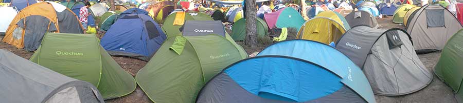
Photo credit Matt M.. CC BY-NC 2.0.
ARTICLE: By the Numbers: The Top Shelters on the AT
ARTICLE: Tent, Tarp, or Hammock? A Flow Chart
ARTICLE: Backpacking Tents: How to Choose
ARTICLE: Hammocks: How to Choose
Back to Top
Footwear
Much like the rest of the “Big Four,” hiking shoes can greatly affect the comfort of your hike. Blisters, bone bruises, twisted ankles, and sprains among other foot-related ailments can be caused by nothing more than ill-fitting footwear. Trail runners and hiking shoes have become a common choice for A.T. hikers, though traditional boots still populate the trail as well. Footwear is a deeply personal choice, more so than any other category. We encourage you to check out the “By the Numbers” article below to get an idea of what brands and models former thru-hikers have preferred, but the decision will come down to trying on the footwear to learn what best works for your feet. For deeper insight on finding the best footwear for you consult the articles below.
The hardest part about picking the right boots is that you probably won’t know for sure whether or not the shoes will work for you until you’ve actually bought them bought them and taken them on a few hikes. Trying them on in-store can only do tell you so much. So if you don’t have the money to keep buying new pairs of shoes we recommend buying your shoes at a store, such as REI, that has a forgiving return/exchange policy that will allow you time to test your footwear in the field and bring them back to try another pair if needed.
One factor to consider is that your foot is going to change during the course of your thru-hike. It will flatten and swell. For this reason most thru-hikers get shoes one size larger than they currently need to project for this change.
ARTICLE: By the Numbers: The Top Footwear on the AT
ARTICLE: Are Trail Runners Superior to Trail Runners?
ARTICLE: Hiking Boots: How to Choose
The best way to start finding the gear that works best for you is to start getting hands-on experience. Visit outfitters and talk to experts. Try gear out in the store. Once you buy it, take it out in the field and test it some more. More often than not, hikers have to work with their gear a few times in the field in order to formulate a proper opinion. This is where those trusty shakedown hikes can really come in handy. If you find out a piece of gear isn’t working for you, replace it! And don’t worry if you ending up disliking a piece of gear once you’re already out on the trail. One of the many outfitters along the A.T. will be happy to help you sort out your problem.
Get our full thru-hiker’s suggested gear list here.
Back to Top
Resupply
Resupplying on the A.T. is actually easier then you might think. While the heart of the A.T. takes you through the Appalachian wilderness, it also takes you within practical distances from numerous towns and communities along the way. The A.T. takes hikers within reach of a town approximately every 3 – 5 days on average. These towns naturally serve as useful resupply points for tangible goods such as food and gear, but they are also helpful for restoring your physical energy and mental fortitude. Of course, it isn’t always necessary to go into town to resupply. Sometimes you’ll be able to achieve a successful resupply at a random gas station at a crossroads. Some hostels even keep themselves stocked with basic supplies for hiker resupply. Towns just tend to be more reliable and offer a greater variety. That being said all towns are not created equal when it comes to resupply. The quality and distance to grocery stores will vary from town to town and don’t expect every town to have an outfitter to satisfy your gear needs. This is where a guidebook can serve you well, as it offers maps of popular towns listing relevant local businesses for hikers.
Mail Drops

Photo courtesy of Jennifer Henderson Williams
While not a necessary to stay supplied on the A.T., mail drops are still a common practice some thru-hikers utilize for resupplying. The concept is essentially a hiker packs desired supplies into a package and then mails said package to a specific destination ahead of them on the trail. The intention is that the hiker will then pick up the mailed supplies when they pass by the location the package was mailed to.
Mail drops require a lot of logistical preparation. Naturally, the more mail drops desired the more complex the logistics. Because post office’s will only hold packages for a limited amount of time hikers often must coordinate with family or friends back home to ship the boxes for them within the desired timeframe. Fortunately many outfitters and hostels along the A.T. offer to hold mail drops for hikers as well and will usually hold them for longer periods than the post office. These options are often better choices than the post-office itself as it also frees the hiker from the strict operation hours of the US Postal Service.
It isn’t wise to use mail drops to supply yourself with items that would be easily acquired from shops in trail towns. Mail drops are most appropriately used to help you resupply with items that are not easily accessible from the trail, such as prescription medicines, unique dietary needs, or just a special treat to lift your spirits.
Whether you need mail drops or not for your hike is highly dependent on your specific needs on the trail. Consult the articles below for more insight on if mail drops are for you.
ARTICLE: How Many Mail Drops Should You Send on the Appalachian Trail
ARTICLE: A Guide to Mail Drops on the Appalachian Trail
ARTICLE: The Best Towns to Send Mail Drops on the Appalachian Trail
Back to Top
Getting to Town 
While the A.T. meanders straight through the middle of a few towns, these are few and often far between. Typically towns and other resupply points can be anywhere between 1 – 20 miles away from the trail. For towns a short distance off trail walking is a potential option, but is often highly undesirable for obvious reasons. Some hiker-friendly towns may feature local businesses that offer shuttles for thru-hikers for a reasonable fee (usually outfitters or hostels). A guidebook can help identify if such services are available in each town. Similarly there may be resident Trail Angels who openly offer shuttling services to hikers. Willing Trail Angels are often listed in some guidebooks as well as in certain outfitters along the trail.
Hitchhiking

Photo courtesy of Jennifer Henderson Williams
Failing any other options many thru-hikers commonly resort to hitchhiking. However, this comes with a few considerations worth noting. First and foremost the act of hitchhiking is technically illegal in some form or another in all 14 states that A.T. passes through. More specifically TN, PA, & ME all have out-right bans on all forms of hitchhiking. Massachusetts only specifically bans the practice on turnpikes or highways. The remaining 10 states ban that act of soliciting a ride on/in a roadway implying securing rides from gas stations, parking lots, etc. is permitted. In many cases the actual laws for hitchhiking are vague and open to interpretation. For example, there is a lot of written language about not standing “in” the road to hitch but whether this also implies the side or shoulder of the road isn’t necessarily clear. In any case in most states along the A.T. the enforcement of hitchhiking laws are pretty relaxed. As long as you are not obstructing the flow of traffic, safely on the shoulder of the road, and an officer isn’t having a particularly bad day hikers can usually stick out their thumb with little fear of reprisal. However, some states have garnered a reputation for stricter enforcement than others, New York and New Jersey in particular.
Beyond the fear of legal issues there is an obvious level of risk with accepting rides from strangers. Most drivers near towns around the trail who would stop do so because they are accustomed to the sight of hikers near A.T. intersections. Many are former/future hikers themselves looking to help out fellow A.T. adventurers. Still, never feel like you have to get into a car with someone just because they are the first to stop. If you ever feel uncomfortable getting in a car with someone then don’t! Plain and simple!
ARTICLE: Hitchhiking Tips and Tricks to be Successful and SAFE!
Back to Top
Hostels

Thru-hikers looking to take a night or two off from setting up camp can seek out one of the many hostels set up along the A.T. Hostels provide a nice middle ground offering more comfort than sleeping in a shelter or on the ground while remaining fairly inexpensive when compared to other lodging options in town.
Many hostels have become destinations that are looked forward to just as much as other parts of the trail. Every hostel has its own flare and personality often providing a memorable and unique experience for its guests. This is due in no small part to the cast of colorful characters who staff these establishments to offer weary hikers a welcomed respite from the trials of the trail.
Services commonly provided by hostels can include bunks or beds, showers, laundry, kitchen access, shuttling services, mail drop services, and much more. Some hostels even include breakfast or dinner with their stay. On average hikers can expect to spend anywhere from $10 – 50 to stay at a hostel depending on the location and services available. The exact services provided at each hostel will vary and some services may cost additional fees. Some hostels even double as outfitters and vice versa.
Some hostels may also offer work-for-stay opportunities for hikers in special circumstances allowing hikers to pay for their stay by doing chores and other tasks for the hostel. However, work-for-stay opportunities are not guaranteed to any hiker and are up to the discretion of the hostel owners.
Many hostels, though not all, exist primarily with the intention of providing services to A.T. hikers, particularly thru-hikers. As a result a number of hostels are not open year-round and tend to only operate during peak thru-hiker season. This means that hostel hours tend to cater toward northbound hiker schedules due to the immense popularity of NOBO hikes. This also means that the highest concentration of hostels are located in the southern portion of the trail, thinning out in the Mid-Atlantic, and resurging again somewhat in New England. Contact and service information for hostels can be found in the A.T. guidebooks.
ARTICLE: Hostels and Lodging Along the Appalachian Trail
ARTICLE: A Thorough List of Hostels on the Appalachian Trail
Hostel Etiquette 
Hostels may have ingrained themselves as a popular part of the A.T. experience, but unlike the rest of the trail you actually have to pay to experience them. While many hostels provide special services to thru-hikers it is important to remember that they are, in fact, businesses. Many hostels are run by former hikers so they tend to understand a thru-hiker’s budget, but at the end of the day a business needs to be able to turn a profit in order to survive. Hostel owners work hard to keep their businesses operating and they are likely not getting rich doing so. Hostels tend to be lower-budget operations that are run more out of their love for the trail and a desire to be around the trail community.
There are a few hostels that ask for donations rather than charge hikers a set fee for their services. These hostels should not be looked at as “free stays”. There are a number of legal reasons why a hostel may be donation based, but many of these hostel owners are simply generous people. Either way, thru-hikers should look to compensate the hostel and its staff in some way for any services rendered, no matter what. Anything is better than nothing.
Also, think twice about complaining or trying to haggle down hostel prices. First of all, the odds are the prices being haggled already undercut your other lodging options, so if you don’t want to pay then just pitch your tent elsewhere. Running a hiker hostel is not easy work. Think about how much time hostel staff spends giving shuttles, and about their water and electric bills from hikers using all of their utilities day and night. Respect their rules. If they don’t allow dogs there’s a reason, so try not to beg for an exception. If they don’t allow alcohol don’t try to sneak it in behind their backs. Don’t be loud, rowdy, and inconsiderate to its surrounding community. While you may get to disappear back into the woods the hostel will be left dealing with any messes your actions may cause. In recent years several popular hostels have closed their doors for good citing poor behavior from hikers as the primary reason for shutting down. An unfortunate precedent has been set. So, please treat hostels and their owners with the respect that is due them.
ARTICLE: Want to Work in a Trail Hostel? 4 Things You Should Consider First
Back to Top
Outfitters
In the broadest and most self-explanatory sense an outfitter describes any business capable of “outfitting” hikers with the gear they need to get out on the trail. Outfitters allow hikers to acquire, repair, or replace various items such as backpacks, bags, clothes, stoves, boots, hiker food, fuel, and everything else in between. Some outfitters may even offer additional services to thru-hikers including shuttles and accepting mail drops. There are a great number of outfitters accessible to hikers along the trail, most of which are strategically stationed in trail towns. However, every town along the trail does not house an outfitter. So be sure to take advantage of outfitters when you have the chance. Hiker’s equipped with a proper guidebook will find information for many of the outfitters within reach of the A.T. Generally speaking the highest concentration of outfitters found near the A.T. is located in the southern half of the trail. Nearby outfitters become more scarce in the Mid-Atlantic region and once again become more frequent in New England.
ARTICLE: A Thorough List of Outfitters on the Appalachian Trail
For a better view of where to find popular outfitters along the trail check out our Interactive Map of the A.T..
Back to Top
Best Practices
 While the centerpiece of a thru-hike means spending most of the time out in the woods, hikers are still participating in the larger community surrounding the A.T. It’s a microcosm of normal life often mirroring aspects of the “real world” hikers left behind. When you’re out thru-hiking the trail you represent the thru-hiker community as a whole whether you like it or not. As a result your actions can have both positive and negative effects on the perception of thru-hikers both from within and outside the A.T. community as a whole. Though one of the most appealing aspects of an A.T. thru-hike is experiencing the feeling of an overwhelming sense of freedom, there is still overarching code of conduct that guides the overall hiker community. Understanding these best practices can help you avoid unfortunate faux pas with your hiker brethren and other members of the A.T. community.
ARTICLE: Thru-Hiker’s Code of Conduct
Hike Your Own Hike (HYOH)
The phrase “hike your own hike”, often abbreviated “HYOH,” represents a pervading ideal in thru-hiking culture. It is a philosophy embraced by many to help improve every hiker’s personal A.T. experience while also representing a ethical code for how hikers should interact with each other and other members of the A.T. community. For many, hiking the A.T. is potentially a once in a lifetime experience. Therefore, it is each hiker’s prerogative to hike in such a way that they will not look back at their time on the trail with any regrets. The one proviso to this philosophy is that any method of hiking should not impose or negatively impact (insofar as possible) another hiker’s experience, and by extension other members of the A.T. community as well. In short, it means every hiker is entitled to hike their own hike up and to the point that it begins to negatively impact the experience of another hiker. HYOH is meant not only to help you improve your own A.T. experience, but also help other hikers to do the same. For a more in depth discussion on HYOH consult the article below.
ARTICLE: When HYOH Doesn’t Apply
Leave No Trace (LNT)
If there is anything in the outdoor community at large that could be considered a near universally accepted law-of-the-land it is the Leave No Trace principles. Created by the Leave No Trace Center for Outdoor Ethics these seven principles represent the best guidance to help minimize adverse impacts during outdoor recreation. While it is nearly impossible to realistically leave NO trace during your time in the outdoors the goal of these principles is to minimize the impacts you can have. These principles are designed not only to help protect, respect, and conserve the environments we visit, but also to respect the experiences of other outdoor enthusiasts. While there is no written law that forces hikers to follow LNT it is important to note that many wilderness and park authorities do ascribe to these principles and factor them into both their policies and regulations. It would do all hikers well to make themselves familiar with these principles so that they may understand how to responsibly enjoy the A.T. For a more detailed discussion of LNT and each of the seven principles click through the links and articles below.
LNT: THE SEVEN PRINCIPLES:
-
Plan Ahead and Prepare
-
Travel and Camp on Durable Surfaces
-
Dispose of Waste Properly
-
Leave What You Find
-
Minimize Campfire Impacts
-
Respect Wildlife
-
Be Considerate of Other Visitors
ARTICLE: Leave No Trace on the AT
ARTICLE: How the AT Works: What Happens AFTER You Poop in the Woods
Back to Top
Dangers / Risks
By most accounts the A.T. is not a dangerous place (at least no more so than anywhere else in the world). In someways it may even be safer than walking down a busy city street. However, that does not mean that hikers are completely free of the risk of illness, injury or even death. There tends to be a large gap between what people unrealistically perceive as threats on the trail and the actual threats. Much of this comes simply from inexperience and the spread of misinformation. Let’s examine a few common misconceptions, before discussing more serious things to watch out for.
Perceived Threats
Bears
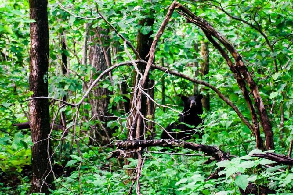 Yes, the Appalachian Wilderness is home to black bears. Yet, black bears are not the hulking beasts you’ve seen in cartoons and movies. In most cases they are actually very timid creatures more prone to run from you before you even get the chance to run from them. To put things in perspective, there have been less than 75 people killed by black bears in the last 115 years. Black bears tend to actively avoid humans in areas where they are not already accustomed to them. Even places where bears encounter humans frequently, such as in the Great Smoky Mountain National Park and Shenandoah National Park, they prefer to mind their own business. While they do have carnivorous habits, most of their diet consists of roots, berries, and bugs. Black bears are opportunistic eaters, meaning they will likely go for whatever is easiest for them to get their paws on, including human food.
This is not to say black bears do not pose any threat to humans. The creatures are most dangerous when hikers manage to come between a mother bear and her cubs. Also, hikers who do not properly manage their food storage run greater risk of an encounter.
In summation: while black bears are a seemingly threatening animal, they prefer to leave you alone and be left alone in return.
Snakes
 Living out in the woods for six months means that there is a near guarantee every hiker will at some point cross paths with a snake. There are a great number of species that call this part of the country home. Fortunately, the majority of these species are harmless and pose little threat to hikers, such as eastern rat snakes and ring snakes. However, venomous snakes can also be encountered on the A.T., the most common being copperheads and timber rattlesnakes. While a venomous snake bite is possible on the trail the odds of suffering such a bite are exceedingly low. Snakes rarely go out of their way to be aggressive. Most bites occur from defensive scenarios in which the snake feels cornered or threatened. Most snakes will attempt to flee and avoid confrontation only turning aggressive as a last resort.
It may provide some reassurance to know that venomous snakes do not always use their venom in a defensive bite as they possess a finite amount at any given time. Expending this resource means the snake’s body must work to produce more venom. Venom is primarily used to help snakes immobilize prey and using it on something they know they are not/cannot eat (i.e. a hiker) is a waste of this resource. That being said any bite from a venomous snake should still be checked by a medical professional as soon as possible.
While accidental bites sometimes occur from an unfortunately placed footstep, most bites are the result of mishandling or unnecessary/unsafe interaction with snakes. As many snakes effectively blend into their surroundings, it is safe practice to closely examine an area before sitting down for a break or setting up camp. If you encounter a venomous snake it is imperative you not try to touch or move it, even if it is directly on the trail itself. Rather give it a wide berth. Allow it to move of its own accord or navigate around it at a safe distance. It is also not an appropriate solution to kill these snakes. They are an important part of the ecosystem surrounding the trail and help keep rodent and tick populations in balance. Some species, such as timber rattlesnakes, are even considered threatened or endangered in many areas. Remember, that when you are out on the trail you are in these animals’ homes and not the other way around. YOU are the guest.
Consult the articles below for more information.
ARTICLE: Snake Bite First Aid and Treatment
ARTICLE: Snake Identification
People
It’s true there have been unsavory characters associated with the A.T., but such characters are uncommon. Most people encountered on the trail are friendly and ready to share in their love of the outdoors. It is an unfortunate fact that people have been the victim of violent crimes on the A.T., but such incidents are extremely rare. In the A.T.’s entire history there have only been a handful of murders associated with the trail, most all of which were carried out by non-hikers. Relative to the murder rate for other places in the country the A.T. is actually one of the safest places you can be!
If you ever find yourself encountering someone on the trail you do not feel comfortable with, there are steps you can take to distance yourself from that person. If the person in question is a townie or stranger on the side of the road, you can just move on down the trail to leave them behind. If another hiker is making you uncomfortable, consider altering your hiking pace to increase the distance between you. Failing that, try spending time in town and hope they move on. Sometimes skipping some distance up the trail is even the safest course. It may complicate the logistics of your hike, but safety is always more important. There is also safety in numbers—find a friendly group of hikers to always have a few buddies nearby.
ARTICLE: How to Avoid Creepy Men While Hiking
Safety Concerns for Women
…Are the same safety concerns for men.
Nature does not discriminate between the genders. Human danger on the A.T. is extremely uncommon and, in a community that polices itself, evaded quickly. There have been instances of women being attacked on the trail, but they are extremely rare. In truth, women are safer on the Appalachian Trail than they are in any city, or on any college campus.
Women’s safety is a frequent concern for family members because people love their wives, mothers, sisters, and daughters – but it’s a concern that is based on the idea that women are more vulnerable. The woods are one of the few places where this concern is not only baseless, but sometimes even problematic. For instance, to avoid posting on social media your location is smart, but to completely avoid telling other hikers what your plans are can leave you stranded in the face of more likely danger – injury and exposure to the elements. It’s not a bad idea for all hikers to consider the question, ‘if something were to happen to me right now, when would a search party find me?’
The Appalachian Trail is a community which serves an important role of support. For any hiker, male or female, you are safer trusting in each other’s best intentions rather than being divided by fear.
Back to Top
Actual Threats
Being Under or Ill-prepared
Being underprepared is ground zero for many wilderness emergencies. Relatively speaking, the A.T. is a safe place, but not having the right gear, underestimating the weather, and generally not knowing how to handle yourself outdoors can compound the risks. You don’t need to be a wilderness survival expert, but you do need to know enough to understand why it’s unwise to hike into a snowstorm in the Smokies wearing four layers of cotton.
Ticks
 The most dangerous creature found on the trail is not a hulking bear or a slithering rattlesnake. It is the tiny, seemingly insignificant creature known as the tick. Ticks can be found throughout the entire length of the A.T. becoming most abundant in warmer months. Ticks are dangerous primarily for their ability to carry a plethora of transmittable diseases, the most prevalent being Lyme Disease carried by deer ticks. This parasite’s small size and painless bite makes them hard to find once they’ve latched on to you. It is important to perform tick checks every night to catch these little buggers before they can cause any harm. To read more on ticks consult the articles below.
ARTICLE: Tiny Terrors of the AT: Everything You Need to Know About Deer Ticks and Lyme Disease
ARTICLE: Report: Tick-Transmitted Powassan Virus “Worse Than Lyme Disease”
ARTICLE: Deer Tick Virus May Be On the Rise Near the AT
Hypothermia
 Hypothermia describes the event when your core body temperature falls dramatically enough to begin to impair bodily functions and eventually lead to death. Hypothermia is of particular concern to hikers who will be traveling during winter months. Northbounders starting in March and Southbounders ending in November or December can expect to hit cold, wet, and snowy conditions in the southern mountains of the A.T. The real danger is that many hikers will not realize they are suffering from hypothermia before it is too late. As a result it’s important that hikers equip themselves with gear to help stave off hypothermia and also understand its warning signs and how to treat them. For more information click here.
ARTICLE: Keep Your Warmth: How to Avoid, Recognize, and Treat Hypothermia
ARTICLE: Three Actual Threats on the Appalachian Trail (and how you can protect yourself)
Dehydration
 Dehydration can be a serious problem for thru-hikers. Due to the intense physical activity, thru-hikers often suffer from chronic dehydration. It’s hard to drink enough water to be properly hydrated, but if not properly managed more serious issues can arise. Intensive physical activity in warmer temperatures can increase the rate of dehydration—think about how much you’re sweating! However, this thought process can unfortunately lead to the misconception that cooler temperatures mean less risk of dehydration. If you feel thirsty, it means you’re already dehydrated, so drink throughout the day and whenever you stop to ensure you don’t reach that point. Intake of salt and other electrolytes can also help alleviate dehydration as they allow the body to more efficiently absorb water.
Heat Exhaustion & Heat Stroke
Hiking in the summer months, particularly through the Mid-Atlantic region, brings high temperatures and serious humidity. Heat exhaustion, often accompanied by dehydration, can occur when you’ve been exposed to high temperatures for too long. This tends to manifest as a feeling of extreme fatigue, headaches, and dizziness on top of other potential symptoms. If signs of heat exhaustion go untreated, the condition can become much more serious and turn into heat stroke, when the body loses its ability to regulate temperature control. This is a serious condition requiring immediate medical attention. Consult the articles below for more information.
ARTICLE: Heat Cramps, Heat Exhaustion, and Heat Stroke First Aid for Hikers
ARTICLE: A Close Call with Heat Exhaustion
Back to Top
Should I Bring a Gun on the A.T.?
The short answer is no. There is nothing keeping people from bringing guns on the A.T., but the idea just doesn’t make sense for the average hiker. While some people feel more comfortable with a firearm on their person, there is no practical reason any hiker would need a gun on the A.T. Hunting on the trail is unreliable and impractical. It is also illegal in most areas near the trail. Guns are also quite heavy. Even a small firearm plus ammunition would account for a sizable portion of your pack weight. The A.T. also passes through 14 different states, each of which hold different laws and regulations concerning concealed carry and general firearm possession. Lastly, the A.T. community is made up of kind and friendly individuals. It is highly unlikely you would end up in a situation where you would require such a deterrent.
ARTICLE: Do You Need a Gun on the AT?
ARTICLE: Seven Frequently Asked Questions Regarding Guns and Bears
Back to Top
Other FAQ
Do I need an itinerary?
Definitely not. In fact, any attempt at a daily itinerary will likely go out the window after just a few days. Hiking pace is too difficult to predict, and quite frankly, planning too much takes away from the spontaneity of a thru-hike. If you’re working with an aggressive strict deadline, this can change things, however you’d be more likely to follow a loose itinerary as opposed to a day-by-day mileage prediction.
Is it safe to hitchhike?
Yes. No life action guarantees 100% safety, hitchhiking is no exception. However the stories of dangerous encounters while hitchhiking are extremely rare. Towns surrounding the AT are extremely familiar and friendly toward thru-hikers. Odds are, you won’t be their first.
Further Reading
Websites
Articles
- The Best Appalachian Trail Books
- 21 Fascinating Facts About the Appalachian Trail
- 10 Fantastic Hiker Traditions on the Appalachian Trail
Back to Top
Trail Terminology
The A.T. community has a language all its own. Brush up on your terminology with our Appalachian Trail Glossary.
Back to Top
Do you enjoy this resource? Consider giving back by becoming a Friend of Appalachian Trials or with a new Appalachian Trials Tee.