 ">
">
The Last Section Part 7: Into the 100 Mile Wilderness
This is part 7 of a 188-mile northbound section hike of the Appalachian Trail in Maine in September 2023. I started hiking at the road crossing near the town of Stratton, ME and finished at Mt. Katahdin in Baxter State Park, the northern terminus of the trail!
Need a catch-up? Here’s part 6!
Day 10: Monson, ME to stealth tentsite near Long Pond Stream
Captain Bill was ready in his truck early that morning, as the three of us hikers loaded up our packs and were ready to get started into the famous 100 mile wilderness. During this section of trail, there are still logging roads and private backroads that make it accessible by car. But the “100 mile wilderness” title comes from the fact that there aren’t any towns or resupply stops for 100 miles without going far off the trail.
Once we were back at the road crossing near Monson, Moosejaw and Chili Pepper set off ahead of me, and with their speed I knew this was the last time I was going to see them since meeting them two days prior. This section hike was full of short encounters like that, where I wish I could have gotten to know certain people for more than just a day or two.
I was not thrilled about the weather forecast for the coming evening and night, which was going to bring rain and more rain. Rain felt like the theme of the hike so far. But no problem, I had a plan.
In 2021, well into my longest section hike, there were three memorable relentless days of rain in a row in Vermont. By that point I had finally figured out how to deal with it. A handful of other hikers and I stuck to 10 miles a day, going shelter to shelter, which gave us the mornings to be miserable slogging along the trail and the afternoons to claim a spot, recoup and get warmed up in our sleeping bags.
So all I had to do on this day was bust through 10 miles of hiking, get to the shelter in the early afternoon, and be ready to curl up when the rain started that was going to last all the way into the next day. Except that my plan fell apart and failed miserably.
My Plan Fails
The first mile or two looked just like the trail had been prior to arriving in Monson. My surroundings were vibrant green and beautiful, and I wasn’t around a ton of other hikers. I took a snack break at the first shelter after three miles. From that point forward, it was like the dam broke open and all of the hikers poured out at once that had been holed up in Monson to ride out the hurricane weather.
I watched tramily (trail family) after thru hiker after section hiker parade by. That first day of the 100 mile wilderness, I saw the most hikers that I had seen compared to any other day of this section hike so far. It reminded me of being in Georgia in April during the thru-hiker bubble, which I had experienced in 2019. My spirits didn’t fall too much, because I said to myself, “Most of them are thru-hikers, they’re faster and are going to hike a lot more than 10 miles today and I should still be able to get a spot in the shelter to ride out the rain.”
And so the day carried on. Ten miles took forever. I was moving as fast as I could move but the terrain wasn’t easy. I kept getting caught up in little groups of hikers where we couldn’t pass each other because none of us were fast enough to get ahead, yet weren’t slow enough to fall behind either. Weather really bottlenecked everybody and now here we all were, trying to get a good start on day one of the final stretch.
I started losing hope that my plan of beating the rain would work, but was relieved that it had only been drizzling and not downpouring yet when I finally made it to my planned end-point at Wilson Valley Lean-To.
As I walked up to the shelter, my heart sank. It was full. There was an entire tramily already hanging out in it, one of the groups that had passed me in the morning. They were nice people and probably would have squeezed me in had I decided to ask, but the situation in itself really had me at a new low. I had this whole vision for the day where I was on top of it, I knew how to do this kind of thing, and by 4 pm I’d be sitting in the shelter drinking tea in dry clothes as the rain came down.
It hit me again that I was no match for the thru-hikers. This time, I wasn’t a long distance hiker who could get to the shelter early in the day on a bad weather day like I had been that one time in Vermont. Instead, the tramily in the shelter was executing my plan, and it wasn’t happening for me. No matter what I did, or how early I started, I was going to be beat. My grand vision of starting the 100 mile wilderness dry faded into the abyss, and a new realization took over that I would be wet after day 1 was over, whether it be my tent or my clothes.
I was very ready to be done hiking, but the tent sites around the shelter were total wash-outs, meaning setting up my tent in one of them would almost certainly mean I’d be waking up in a big puddle. This was confirmed when two hikers who wound up camping there told me about it later on. I refilled my water bottle from the creek next to the shelter, and started hiking again as a group of three section hikers arrived at the shelter to face the same fate. I could hear the dejection in their voices amongst their discussion with each other.
“Alright,” I told myself, “This won’t be that bad. I’m really tired but I’ll just hike a little farther and find a nice stealth tentsite to set up, get in real quick, and hopefully everything besides my tent will be mostly dry.” And then I studied the Farout app for a few minutes, and my heart that had already sunken might as well have just fallen to my feet.
Logistics again. If I went on and then stealth camped somewhere past the shelter, I’d be fording a river the next day called Long Pond Stream that would likely be impassable with all of this rain. I had planned to take the bypass route. Wendy from the ATC visitor center had described this bypass route to walk-around the river crossing, but the trouble with these walk-arounds was that for most of them you had to decide to take the route long before actually reaching the river crossing, sometimes go miles out of the way to cross the river over a bridge somewhere, and then eventually re-join the trail.
This particular walk-around route started right past the shelter. I had to do it that evening.
A Rainy Road Walk
Once I started this detour walk that left the trail, I wouldn’t be able to stop and camp until I re-joined the AT in about four miles, because I would be along roads. It was definitely going to get dark before I’d finish the route and be able to set up camp. I didn’t want to hike four more miles into the dark, but with the alternative being that I could camp in a sloped puddle near the crowded shelter if I wanted to wait until the morning, I walked on.
I felt this weird mix of confidence and sadness, all in one. I started to follow Wendy’s directions for the detour, along with the same route on the Farout app that had thankfully been added in for hikers to follow since high water had been such an issue. I felt a little down by the fact the day turned out this way and suddenly very alone. Then I put it past me. It turned into this strange pumped-up energy that I was going to do this, I had this, I knew how to handle it based on hiking the rest of the AT up until now, and this is the type of stuff that makes the challenge of the trail what it is.
So not long after I stepped off of the AT and took a right turn on a narrow logging road, I actually started to enjoy the change of scenery. By the time I came out onto a larger road, I felt a lot better. I never saw any cars along this quiet backroad, but did pass a couple quaint houses and private property signs. I walked and huddled under my umbrella trying to stay as dry as I could, but I knew just the remedy to make it that much better.
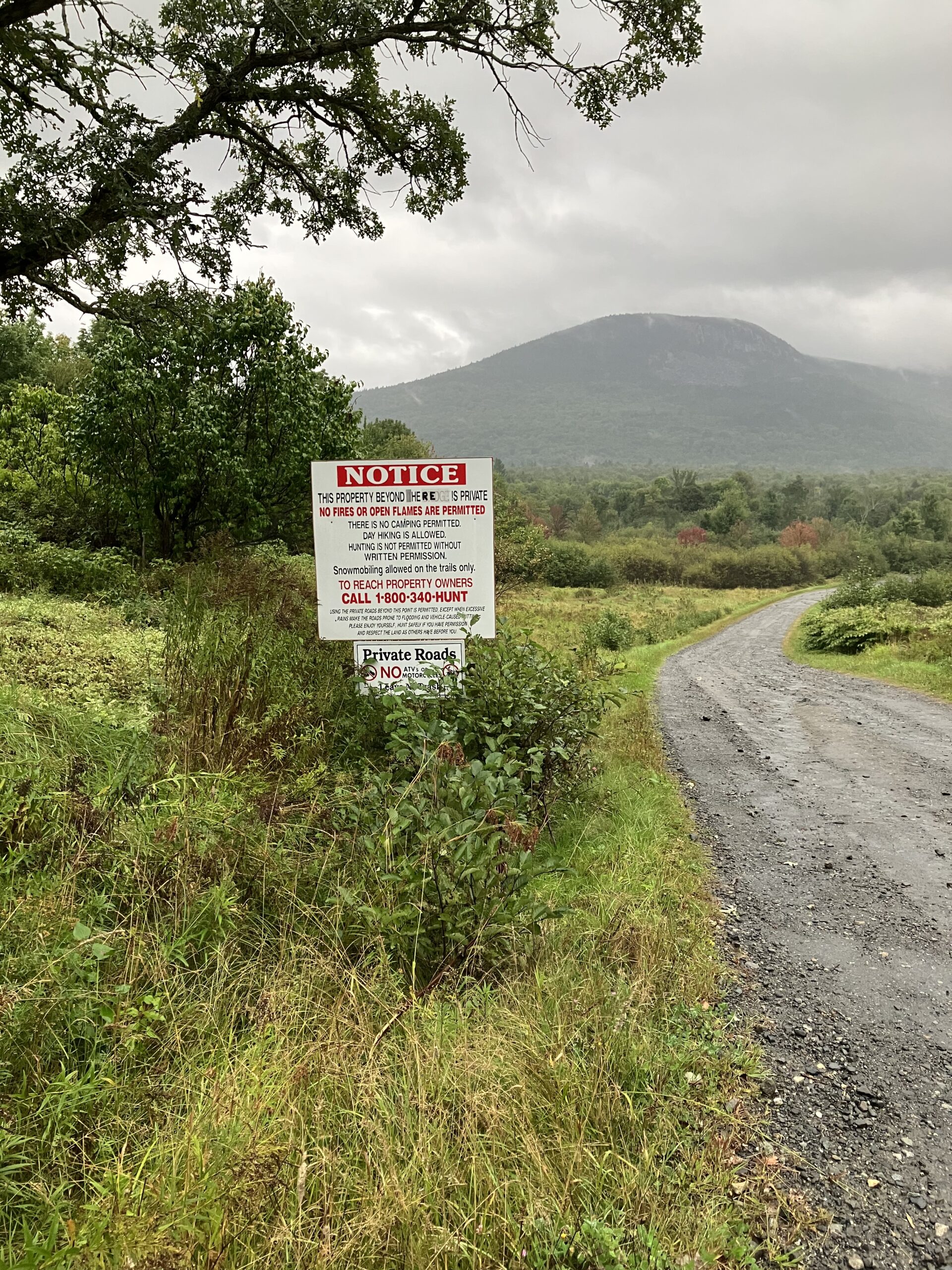
This sign made me pause until I realized it said hiking IS allowed! My road walk gave me a nice change of scenery
Before Captain Bill had dropped us off at the trailhead that morning, he gave us some hand warmers. I’ve decided over time that whenever someone gifts me something on the trail, I should take it. Forget about saving weight, and at least carry it for a little while. I pulled out one of the hand warmers and alternated putting each hand in a pocket with it. Not only did it physically warm me up, but the caring nature in which that hand warmer had been given to me warmed my soul.
It wasn’t long before I found myself in the inevitable darkness. I was off of the road by this point, back to a trail that was going to lead to the AT per the directions of Wendy and the Farout app. Unfortunately, between this trailhead and the AT stood a barrier of ankle to calf-deep mud all along the way. This is not an exaggeration. Rain came down on me as I shined my headlamp around with every step, trying to find some dryer way around the mud pits.
The dark made everything harder. My mind kept swapping between the self-talk of “You’ve got this, this is badass” and “What in God’s name are you even doing here.”
By the time I found the flagging tape around a tree that marked the turnoff for the last narrower bit of trail that was to connect to the AT and meant I was very close, I decided I’d camp at the next place I could find. I was already tired of tromping around in the mud looking for trail marker after trail marker by headlamp and constantly checking my location to be sure. I was so fortunate that there was a perfect little clearing with a few tents worth of space on this last side-trail, and there was no question that I had also found the river.
Long Pond Stream
I stood there for a second, stunned. “This is what we were supposed to cross!?”
You couldn’t have paid me to cross that thing. Rapids roared, and I didn’t need daylight to know that the water was more white than blue.
I set my tent up as quickly as I could in the steady drizzle, and felt a complete wave of thankfulness once I was comfortably settled in my sleeping bag. I laid there listening to the raging water close by. I was strangely comforted by it, but still just trying to process how that day had gone so far from my original plan of drinking tea while dry under a shelter that I had no idea what to expect in the days to come.
Read part 8 here!

I took this picture of Long Pond Stream the next day after I packed up my tent, downstream from the actual crossing point on the Appalachian Trail. I was glad I took the detour!

This website contains affiliate links, which means The Trek may receive a percentage of any product or service you purchase using the links in the articles or advertisements. The buyer pays the same price as they would otherwise, and your purchase helps to support The Trek's ongoing goal to serve you quality backpacking advice and information. Thanks for your support!
To learn more, please visit the About This Site page.

Comments 5
Loved reading your post Sarah!! Those rapids looked beautiful but scary too! You’re a trooper! All that rain! I know I couldn’t do that! Proud of you😘
🙂 I wish I could post the video I have of the rapids because the picture doesn’t do it justice!
Sarah, congratulations on your completion of the AT hike. It’s a lot of fun and exciting times, great job! Stay safe and healthy all the best Brian.
Thank you Brian!!