 ">
">
Overview of the Major Alternates Along the CDT
Are you a purist? Get ready for a different kind of adventure when you embark upon the Continental Divide Trail. This is not the PCT, and it’s definitely not the AT. There is not one unbroken trail from border to border, no single defined footpath to follow.
Although the CDT is getting more complete every year, and there is now an “official” designated route, the tradition of alternates on the CDT is still embraced by most of those who embark on this particular route between Mexico and Canada.
You can still be a purist on the CDT by walking an unbroken path. Alternates not only make resupply easier, but they often take you to the best scenery along the trail. Furthermore, they add an extra sense of adventure and freedom to your standard thru-hike. Embrace the alternates, just as you will embrace the brutality on the Divide.

There are literally hundreds of possible CDT alternates. If you look closely at your Ley maps, you’ll find you can take an alternate of some sort practically every day. Chances are, you’ll make an alternate up yourself a time or two when you realize you’ve veered off course somewhere and don’t want to backtrack.
It sounds intimidating, but most of these alternates are small and do not have a major impact on your plans or your mileage, so you can decide at the time which way you want to go.
However, there are a lot of big alternates, and some of them veer quite a way off from the main route. Oftentimes, I wasn’t sure which route I wanted to take, and I wished for some comparison between the options to help me decide. I never found a great resource, so here is my best attempt at making one.
Since I can only speak to the routes I chose on my CDT journey, I’ve gathered feedback from some other CDT hikers and as much information I could glean from the internet to compile it all here. In addition to asking many, many people about their experiences on different alternates, I also referred to blogs, Reddit, and other online sources to give the best overview possible of those alternates I am not familiar with.
While I’ve spoken to a variety of hikers, I’d like to give a special shout-out to a few fellow Trekkers/CDT alumni who took extra time to help me specifically with this article by writing detailed accounts of their experiences for me. Check them out and give them a follow.
Katie “Wildie” Brown (Wildie’s Trek Author Page)
Brian “Knots” Cornell (Knots’ Trek Author Page)
Michael “Tree” Sweet (Tree’s Trek Author Page)
Also, special thanks to Rachel “Wizard” Brown of the CDTC for taking time to provide useful feedback.

Before we dig in to the alternates, we first need to talk about maps and guides. Each source will have slightly different information. Ley’s official route differs in some areas from Farout’s official route. FarOut has far fewer alternates, while Bear Creek doesn’t show any alternates. Bear Creek has the best quality topography, while FarOut has the best information about water sources. Read on for the full breakdown.
Ley Maps

Screenshot of a Ley page and notes.
Before any other maps or guides for the CDT, you need the Ley maps. The maps themselves might not be the greatest, but the routes, notes, and information are more comprehensive than anything else you will find. You’re seriously missing out if you don’t get these. You can print them, but you can also get the Avenza app and use the maps through there, so you get your GPS location right on the map. The CDTC has also made their maps available on Avenza, which show the official route on quality topo maps.
CDT App (FarOut)
If you’ve hiked a long trail before, you know about FarOut. The CDT app is great, but don’t limit yourself just to FarOut. There are very few alternates mapped out, a few inaccuracies, and limited information about town resources. That being said, it’s still an invaluable tool and simple to use.
Yogi’s Guide
Yogi makes great guidebooks with a lot of comprehensive information that can help you with CDT planning. The more experienced you are, the less you will appreciate the info in her books. Still, I like that she provides feedback from a variety of hikers and offers some information about different alternates and resupply options. A SOBO will appreciate that this guide in written in southbound order.
Paper Maps
You’re probably wondering if you should carry paper maps for the CDT. Most of the time you’ll be just fine with your phone. But there are at least a few times, such as in snowy conditions in the San Juans or parts of Montana/Wyoming, you should bring some maps along, even if only for security reasons. There are several maps available. The Ley maps are printable, but you’ll get better quality topographic maps from Bear Creek Survey or the CDTC. The Bear Creek and CDTC maps don’t show alternate routes. Trails Illustrated maps are a good option if you want to carry quality topographic maps that include alternate trails for specific segments of the trail (such as the San Juans).
Gaia GPS

Sample screenshot from Gaia
If you plan on taking on some DIY alternates such as in the Tetons, you’re going to want proper GPS navigation and planning abilities. Gaia GPS is the go-to subscription for most adventurers. It works on your phone and grants you access to quality topographic maps, including the Trails Illustrated series. Mapping routes is easier on a computer, but doable on your phone.
Time to tackle the alternates. As I mentioned before, there are far too many alternates to cover here. Read your Ley notes every day to see what your full range of options are. We’re just here to talk about the big ones and help you decide which route is right for you. All mileage references are from FarOut.
New Mexico CDT Alternates
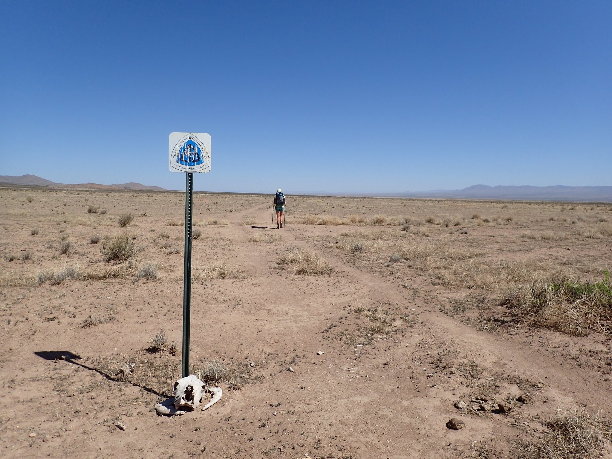
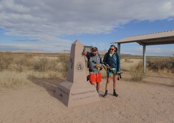
Southern Terminus
There are several options for the Southern Terminus. The official route is recommended—it has the monument and stays off roads. Head here for a full overview of your Southern Terminus options.
Gila River
NOBO Mile 173.1, SOBO Mile 2661.6
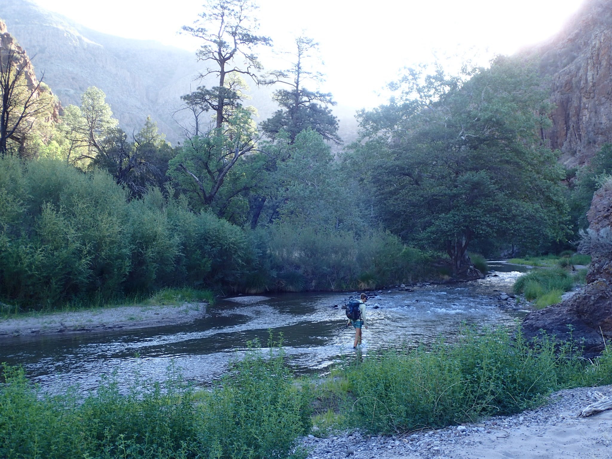
The Gila River alternate following a low-snow year.
The alternate through the Gila is one of the most popular alternates along the CDT, for obvious reasons. Multiple river crossings per mile can be both fun and refreshing, plus there are hot springs and the Gila Cliff Dwellings. Resupply is much simpler on this alternate, as you walk past Doc Campbell’s post right along the route. On the flip side, crossings can be treacherous when water levels are high, and the constant alternating between water and dirt is tough on your feet, not to mention your socks. The brush is often overgrown and can cut up your legs. “The Gila River alternate traverses through a sensitive riparian area. Hikers who choose this alternate should be extra conscientious about practicing minimum impact traveling and camping techniques. We also advise folks to check the water levels before they head out there.” –Rachel Brown, CDTC
The underloved official route goes over the Black Mountain Range. Fearmongers will tell you there is no water on this route, but they’ve never been here, so don’t listen to them. It’s not as bad as it sounds, especially in a high snow year. The Black Mountains are beautiful and probably the most remote section of trail in New Mexico. On the downside, the resupply is more challenging on this route, although not impossible.
Cebolla/Mesa/Bonita-Zuni Alternates
NOBO Mile 452.4 | SOBO Mile 2478.9
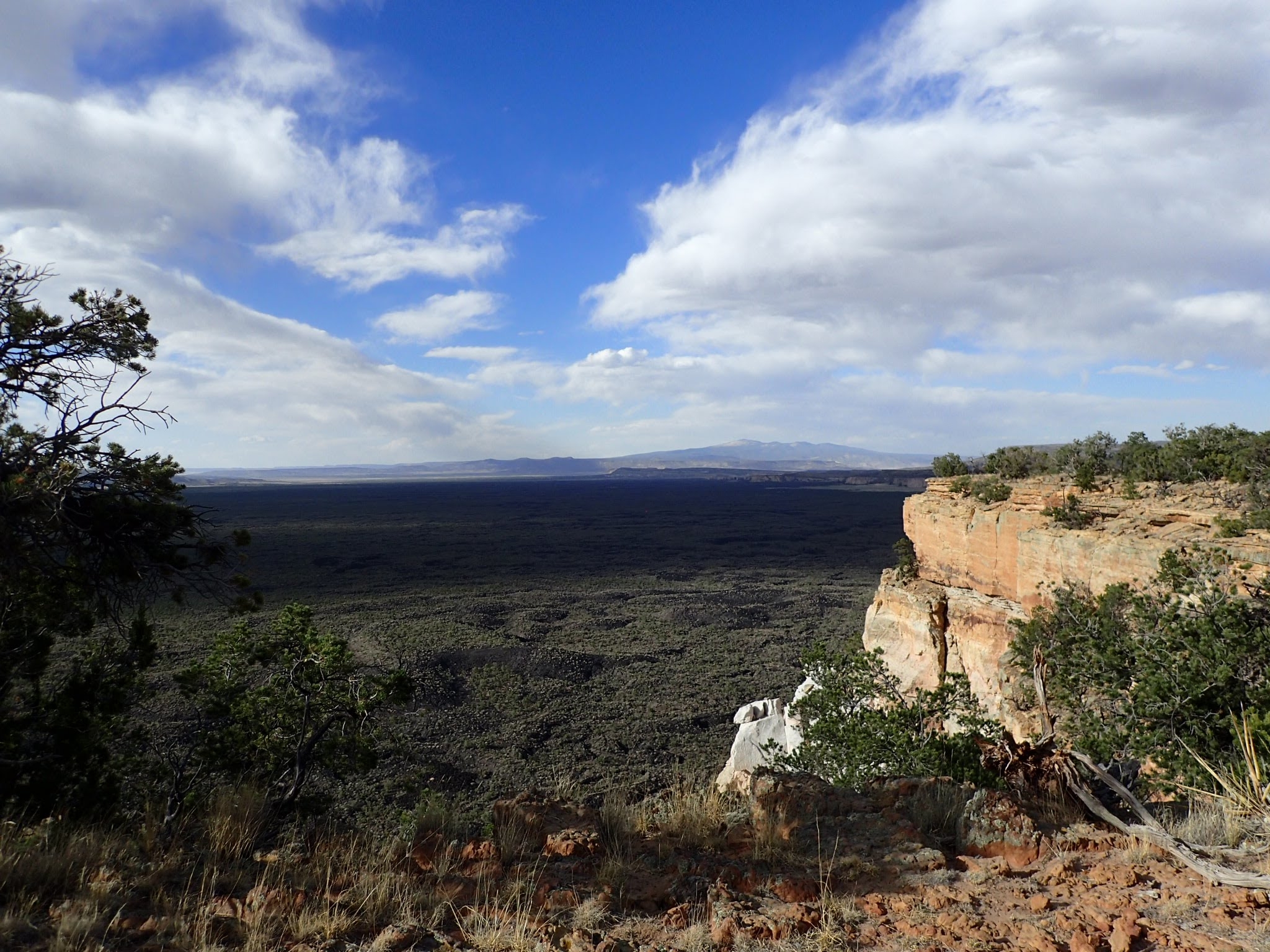
A view from the top of the mesa, overlooking the lava fields to the west.
The route between Pie Town and Grants offers several potential routes. The official route follow the chain of craters across “el Malpais”—an area covered in lava flows. The scenery is cool, but it can be tough on your feet.
The Cebolla Alternate avoids the lava flows as it crosses through cow country before entering a small wilderness area. Eventually this route joins the highway, and Ley’s route (but not FarOut) will take you along a trail up a mesa that parallels the highway. Eventually, the trail ends and you have to make your own way down. It can be an adventure, depending on the route you choose.
For the final stretch into Grants, you could follow the highway for a long road walk into town on the official route. Or, you could hop on the Bonita-Zuni alternate. This route follows a dirt road through a wide canyon as it heads into Grants. Taking the Cebolla-mesa-Bonita alternates will allow you to see a little bit of everything in terms of scenery and avoid significant time on the pavement. The Cebolla route to the official route will take you on the shortest route to Grants, but with a long walk along a paved highway. Sticking to the official route the entire way is the longest possible option.
Ghost Ranch
NOBO Mile 685.9 | SOBO Mile 2300.7

Climbing out of Ghost Ranch.
Most people take the Ghost Ranch alternate because it means you can walk to your resupply. There is a lot of dirt road walking on the alternate toward Ghost Ranch, but the climb out of Ghost Ranch to rejoin the trail is very beautiful. The official trail and the alternate are not drastically different, but sticking to the official route means you’ll have to hitch to resupply.
Colorado CDT Alternates
Creede Cutoff (San Juans)
NOBO Mile 876.0 | SOBO Mile 2021.2
A taste of the San Juans during a low-snow year.
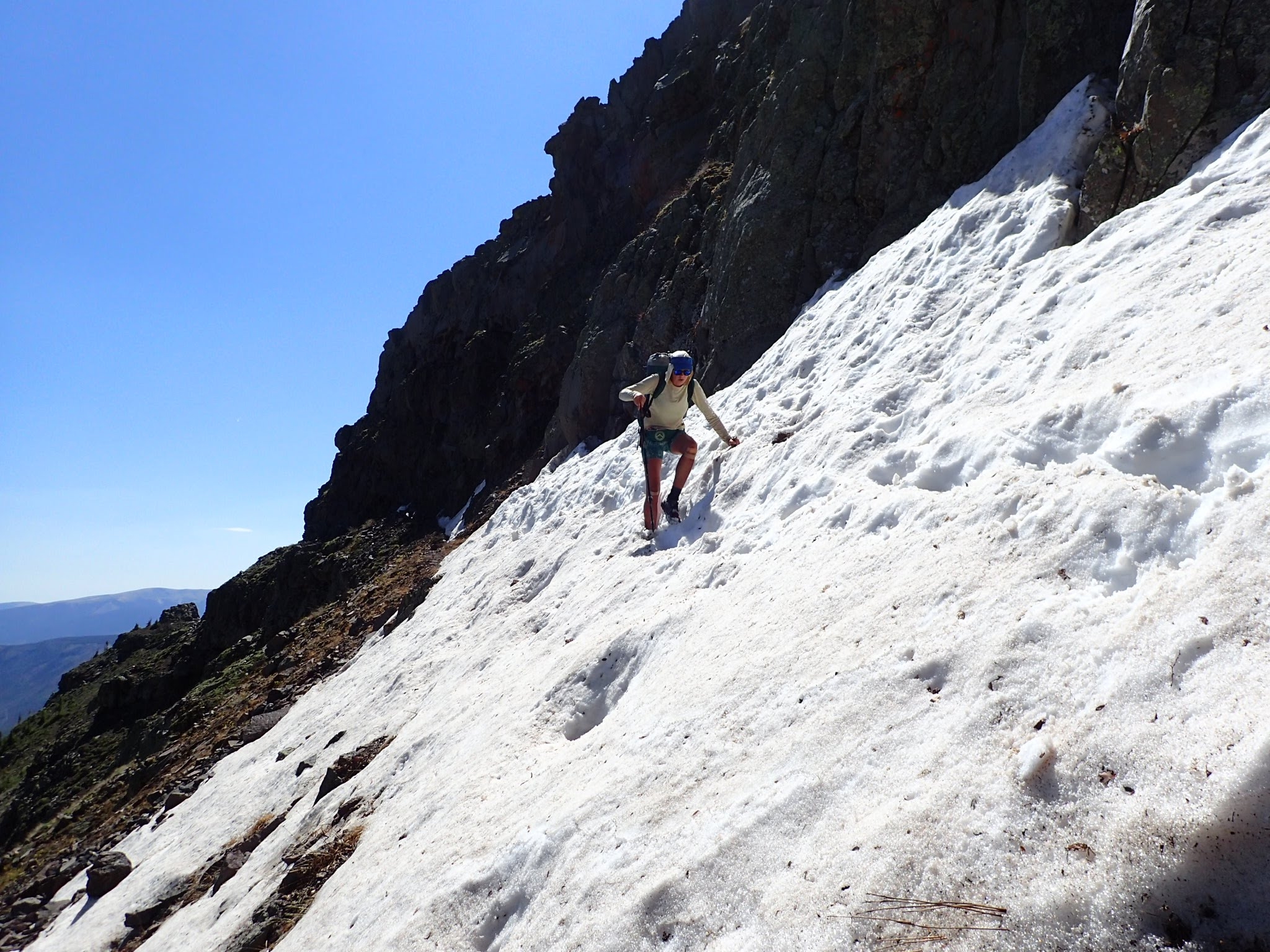
Your route through the San Juans will mainly be determined by the snow or fire conditions. The San Juans are beautiful but the trail can be sketchy at best and downright scary and dangerous if there is significant snow. Beetle-kill has turned this area into a tinderbox, so the fire danger is also high and blowdowns are frequent. If conditions permit, the San Juans are highly recommended. This is a difficult but rewarding section.
The Creede route is a lower-altitude route through the mountains. Like the official trail, blowdowns are common and the trail feels neglected, but if you’re not used to that by now, you will be by the end of this journey. This route will avoid most of the snow, but it is also a shortcut farther north where more snow is likely waiting for you. Timing is important on the CDT and alternates can’t change that.

Mount Elbert
NOBO Mile 1164.9 | SOBO Mile 1846.2
This alternate is a short connector that summits Mount Elbert shortly after you leave Twin Lakes. Mount Elbert is the highest peak in Colorado and the second highest in the contiguous US, behind Mount Whitney. If you’re feeling extra motivated, you could also add in a summit of Mount Massive to the north (NoBo Mile 1172.7, SoBo Mile ), just a few inches shorter than Elbert and far less crowded. Both are easy summits as far as 14ers go, but Massive is an out-and-back summit so it adds a few miles.
Silverthorne Route
NOBO Mile 1218.9 | SOBO Mile 1717.8
The Silverthorne Alternate avoids knife edges, but still packs in some big climbs and high altitude. Notice there is no tread to follow here.
The Silverthorne Route bypasses the exposure of Grays and Torreys Peaks. By this point in Colorado, you’re either loving the exposure or hating it, and if you are over it, the Silverthorne route is for you. But don’t be fooled. This route is not easy, the trail disappears frequently, the GPS line on FarOut is wildly inaccurate in some segments, and the going feels very slow for the recorded mileage. There are some sketchy moments on this route, but there are no knife edge ridges to worry about.
The official route takes you over Grays Peak, the highest point on the Continental Divide. The scenery is epic, mountain goats are common, and you go over the highest point on the official trail. If you are afraid of heights or the exposure so far has made you uncomfortable, you might want to reconsider whether this route is the best choice for you.
On the other hand, if you love the knife edge walks, there is another alternate for you up Grays peak called the Argentine Spine. An exposed route with no water, the trail takes you along a ridge, going up and down over several smaller peaks as it approaches Grays. The terrain is tough but the views are amazing.
Wyoming CDT Alternates
Rawlins Road Walk
NOBO Mile 1571.6 | SOBO Mile 1388.5

The Rawlins Road Walk. It’s just like this for a long time.
Only on your Ley maps, the road walk into Rawlins has become a popular choice not for the scenery but for the water. As you enter the basin, most of the surface water is alkaline and not suitable for drinking. The alternate follows a road – sometimes dirt, sometimes paved – that offers one good water source about halfway through. The road roughly parallels the trail and is slightly shorter. On the downside, it’s a long and boring road walk with no shade, and you have to camp right off the road. Fortunately, there is almost no traffic after dark.
The official route offers similar scenery but avoids pavement. It is important to research your water sources in this segment before you head out. Because so many hikers take the road, you’re likely to find some nice solitude and pleasant scenery on the official stretch.
Cirque of the Towers (The Winds)
NOBO Mile 1778.0 | SOBO Mile 1213.7

The Cirque of the Towers.
If you only do one alternate for the entire CDT, it should be this one. The Winds are already fantastic, but the Cirque alternate takes you through some really epic scenery. Massive peaks carved by glacial erosion, high altitude lakes, and stunning views are all common sights on this route. However, navigation can be challenging through this section and your mileage will be slower than expected. If you’re getting frustrated, take a break and enjoy the scenery. This alternate is not suitable for horses, and in a high snow year may require microspikes and ice axe.
Knapsack Col (The Winds)
NOBO Mile 1833.4 | SOBO Mile 1167.1

Views in the Winds are never disappointing, no matter which route you take, but if you want to go to there, take the Knapsack Col alternate.
Also in the Winds, the Knapsack Col is another stunning alternate over a high-altitude pass. For a NOBO hiker, this is your last chance to climb over 12,000 feet over Wyoming’s highest pass. The climb is tough but the views are epic. If this is a high snow year, this route may require some snow gear well into July. It is possible to do part of this alternate and rejoin the CDT without going over the pass, so check your Ley maps. This alternate is not suitable for horses.
Staying on the official route entirely through the Winds would not be a disappointment by any means. There will still be views, lakes, and lovely scenery. It just won’t be quite as dramatic as the Cirque or Knapsack Col. On the bright side, the trail will be easier to follow most of the time. If snow is high and you don’t have gear, sticking to the official route is recommended. No matter which route you choose, your feet will be wet.
Grand Teton Alternate
Roughly NOBO Mile 1860 | SOBO Mile 1030 (mileage will vary)
Though not an official CDT alternate, some hikers are starting to make their own alternates through the Tetons. This is a chance to get in a little more altitude in Wyoming, aside from just the Winds. The scenery is stunning, but the route requires some difficult bushwhacking and added research. You won’t find this route in any of the guides mentioned here, and maybe that is exactly the type of adventure you’re looking for. Start here if you want to research more about this alternate.
Big Sky/Butte Super Cutoff
NOBO Mile 1952.2 | SOBO Mile 446.7
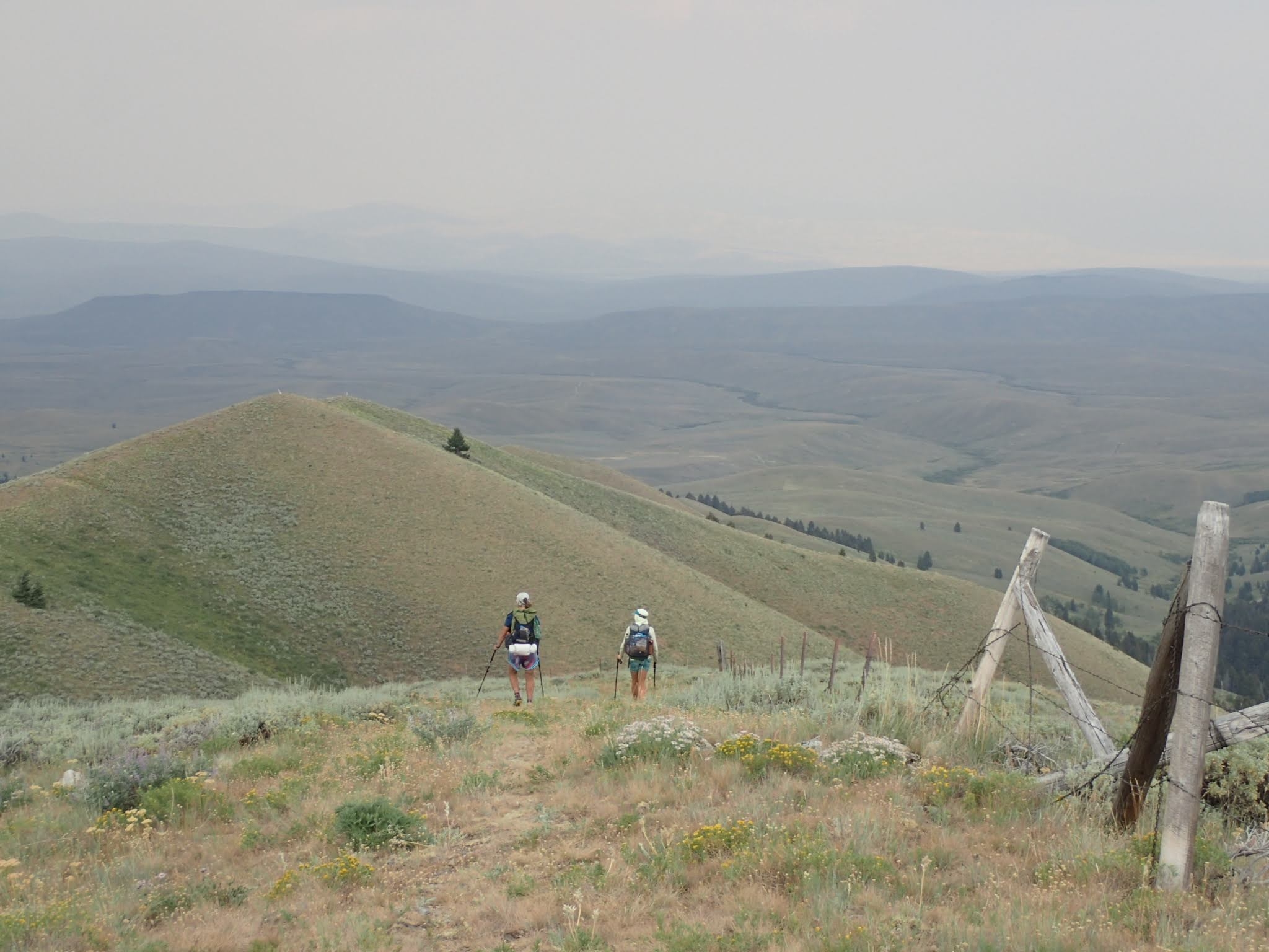
Typical scenery on the Divide along the Idaho/Montana border.
Another “unofficial” alternate, Yogi refers to this route as the Butte Super Cutoff. People who opt for this route, however, tend to call it the Big Sky alternate or the Super Butte. This alternate cuts off several hundred miles including the entire Idaho section of the CDT, offering more of Yellowstone and the beautiful Spanish Peaks. This is a good route for hikers needing to make up some time, or for those who are looking for more of an adventure than the standard CDT route. On the downside, there are some long boring cross country segments. Start here if you want to take a closer look into this route.
The official trail along the Idaho/Montana border stays on the divide, although the scenery is much less dramatic after Yellowstone and the Winds for a NOBO, or Glacier and the Bob for a SOBO. There are a lot of rolling hills and the climbs aren’t as hard, so the area can feel monotonous for some. The trail towns are all tiny in this section, and tiny towns make the best trail towns. We had tons of fun in this section.
Idaho CDT Alternates
Mack’s Inn
NOBO Mile 2039.0 | SOBO Mile 905.2

The official route between Yellowstone and Lima is longer than the Mack’s Inn Cutoff, but offers some great views and easy-to-follow trail.
The Mack’s Inn Cutoff is another alternate that probably exists for the on-trail resupply and it also shortcuts a meandering segment of trail just north of Yellowstone. On the plus side, the alternate has no significant climbs and is generally easy hiking. However, there are some hot, exposed road walks, and most hikers report that the trail is difficult to follow upon leaving Mack’s Inn and becomes more of a cross-country bushwhack. Still, you’ll walk right past a Subway and a Mexican restaurant.
The official route in the area is also fairly easy with no major climbs. The scenery is nice and the trail frequently follows dirt roads, but it can feel a little monotonous compared to some of the more dramatic scenery in Yellowstone and Montana. Still, there are some great views through here. Resupply on this route requires going into the touristy West Yellowstone. It’s expensive, especially for lodging, but has many options for food and resupply.
Montana CDT Alternates
Anaconda Cutoff
NOBO Mile 2463.8 | SOBO Mile 410.7

A taste of the wide and clear tread on the Circle of Butte.
The Anaconda Route is another shortcut route that involves more paved road walking but also walks right through town. By all accounts Anaconda is a great hiker town, and the scenery on the alternate is very pretty, even for a highway walk. If you need to make up some time, this alternate cuts out about 90 miles.
The official route in this segment is often referred to as the “circle of Butte” because the trail basically does a wide loop around town. Butte is bigger than Anaconda, so this makes it a less-convenient hiker town, but it is still reasonably small, mostly walkable and has a decent bus system. The trail in this section is probably the most well-maintained segment of the entire CDT, most likely because it is also a mountain bike trail. I personally only remember seeing one biker on the trail, but I do remember abundant raspberries, very wide tread, and lots of little ups-and-downs.
The Bob
Spotted Bear Pass Alternate starts NOBO Mile 2809.5 | SOBO Mile 162.0

Fires in the Bob forced us on an entirely new alternate, but it was still beautiful.
There is no wrong way to see the Bob Marshall Wilderness. It’s beautiful. The past few years have seen a lot of fires and closures through this area. You might find yourself on an entirely new alternate because of fire closures, but if the trails are open, the main alternate people take in the Bob is Spotted Bear Pass. It cuts out about 15 miles from the official route. Both routes are scenic and not drastically different to one another, so I don’t think you’ll regret either option.
Glacier National Park
Chief Mountain Junction NOBO Mile 2979.2

Views from the Chief Mountain Alternate in Glacier.
Like the Bob, chances are, fires in Glacier might prevent you from taking the route to Waterton and force you on the Chief Mountain Route. Both routes are considered official, and the Chief Mountain Route is much simpler logistically speaking, especially for SOBOs. Do Waterton if you can, but if not, the scenery in Glacier is never disappointing. Both routes are beautiful, and both have monuments where you can take photos.
While in Glacier, check out the various trails and talk to the rangers about other potential alternates you could take. There are a variety of ways you can extend your time in the park to take in more of the awesome scenery, and lots of mini-alternates you can take to change up the views. There is no wrong way to do Glacier: all views are spectacular and the trails are well-cared for.

This website contains affiliate links, which means The Trek may receive a percentage of any product or service you purchase using the links in the articles or advertisements. The buyer pays the same price as they would otherwise, and your purchase helps to support The Trek's ongoing goal to serve you quality backpacking advice and information. Thanks for your support!
To learn more, please visit the About This Site page.

Comments 11
Megan, thanks so much for the article and, more importantly, all the research that you did to provide us with solid recommendations.
Thank you for helping simplify the CDT alternate options. I was definitely going to do the Gila River alternate, but might add a few more now!
Thanks for this.
I like the idea of alternates, but mostly for emergencies and contingencies. Being a bit of a purist, I would prefer to hike the recommended CDT by the CDTA at least once in my lifetime. Feels more pioneer-like. Perhaps most of the alternates can be left for other separate trips. I cannot imagine not summiting Gray’s, for example, on a CDT through hike. But it’s a long-assed 6-month trail. Already anticipating that the San Juans will be the biggest NOBO challenge to stay true to path. Even in the summer, places like Ice Lake have snow.
Of course you should hike the trail the way you prefer to, but I do encourage you to keep an open mind, if only for the Cirque of the Towers.
Given an ordinary snow-year, as long as you don’t enter the San Juan’s too early in the season they shouldn’t be a problem. That doesn’t mean there won’t be snow or the terrain won’t be challenging, but it’s totally do-able with the right gear and experience. High-snow years are a different story of course.
I think the biggest threat to any thru on the CDT is fires – and that threat grows bigger every year in every state the CDT crosses. The best defense for that is to keep a swift pace and do your best to stay ahead of trail closures, but beyond that it’s up to fate.
Best of Luck and Happy Trails!
Thanks for this article. It would be helpful if you listed the difference in mileage between the alternates.
That’s a lot of work. Get Guthook (FarOut), buy the CDT trail, plus download the Key maps. Then you can calculate the miles your self on alts you are considering.
..download the LEY maps..
Many thanks for this informative overview 🙂
Where one can find GPX/KML files of main alternates like Gila, WRHR, etc ? (I have Ley maps, thanks to him).
I am used to some android apps (Osmand, orux) and would like to feed them with track files.
The US Forest Service is publishing many tracks files (in a Shape File data base) but they are unsorted regarding the CDT. Sorting them out is doable … But an already cooked GPX would be great.