 ">
">
PCT Weeks 6 through 7ish: Mill Creek Fire Station to Tehachapi
You might have noticed that I’m missing a post on week 5ish. That’s because I had 6 glorious days off to rest my shin at home before hitting the trail again! Thankfully, the shin pain is mostly gone and the rest of my body definitely benefited from the time off.
Since rejoining Nik at Mill Creek Fire Station, we have hiked the San Gabriel’s until they turned into desert, wound through wind farms, walked through blinding fog, and ascended back up into a different set of mountains. I have also seen the largest rabbit I’ve ever seen, spotted goats in a boat, had the highest blood sugar I’ve ever tested, and have firmly developed Christmas toes. Oh- and we passed 500 miles!
Day 38:
Mill Creek Fire Station to Messenger Flats Campground, 12.35 miles

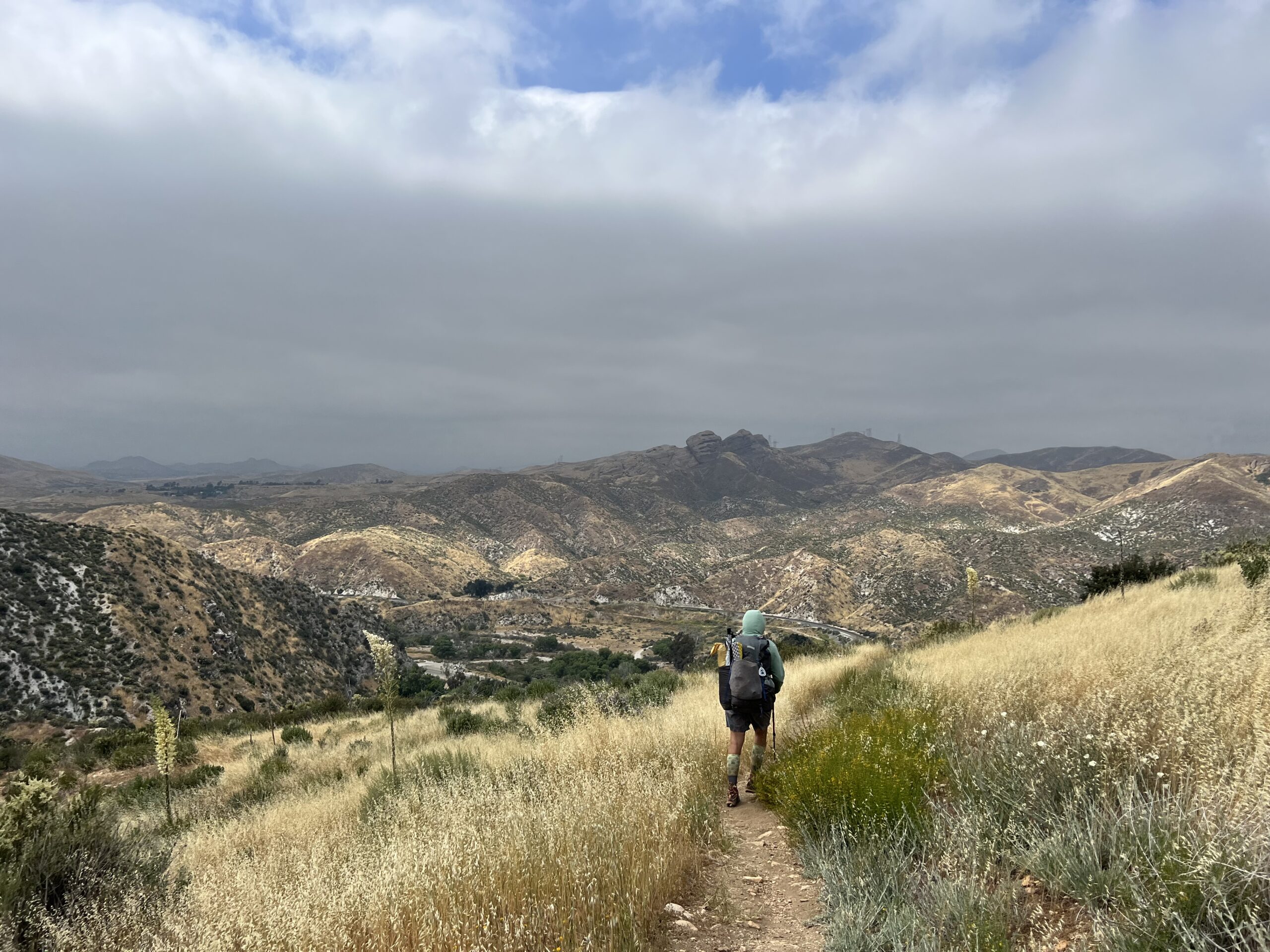
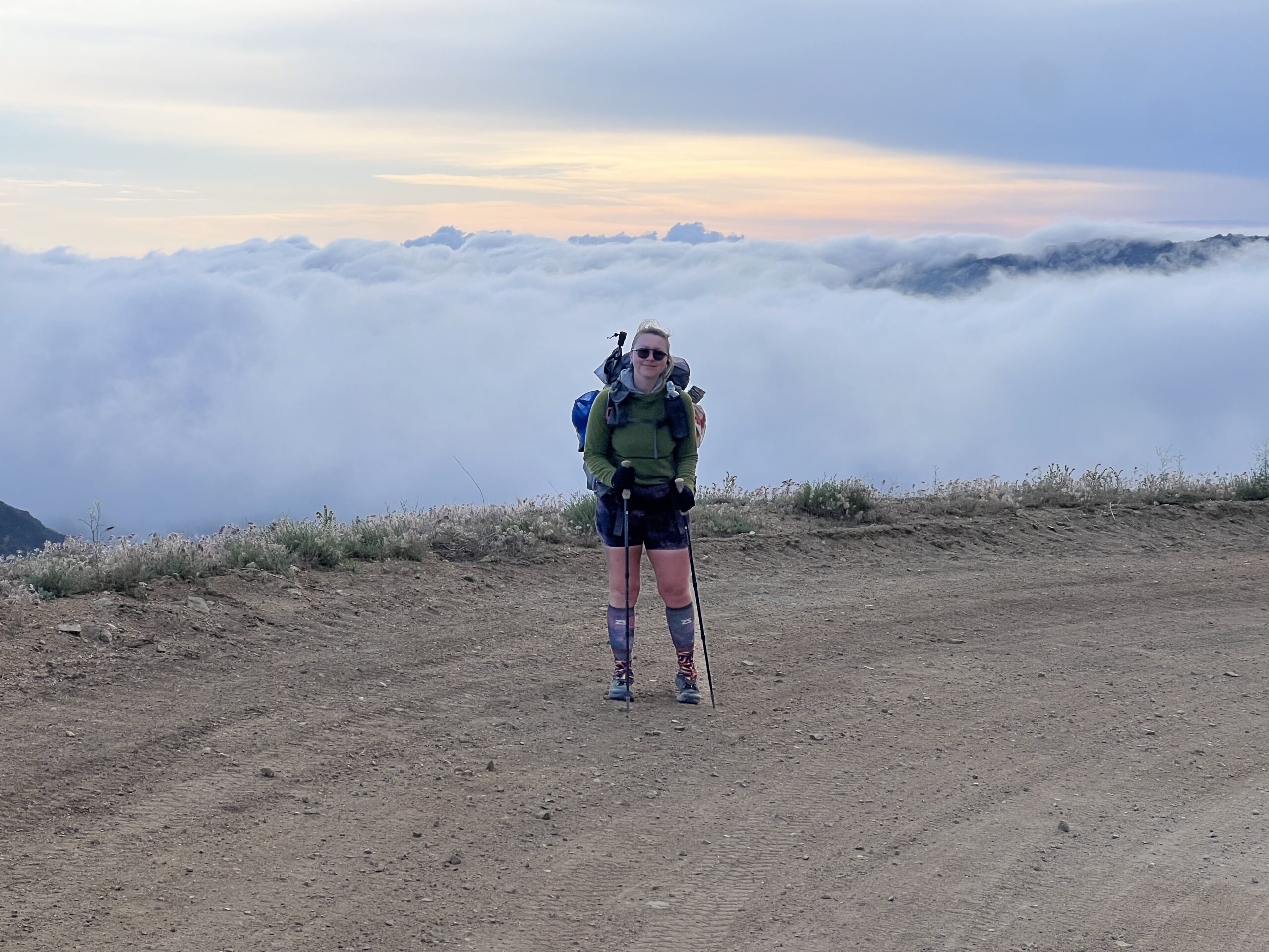
Mitch dropped us off at the Mill Creek Fire Station and we resumed our trek north. Since I was easing back in to long days with my newly healed leg, we knew that we wouldn’t be hitting huge miles yet. Better slow than re-injured!

We climbed above the clouds and I enjoyed the familiar landscape of my local mountains. We began seeing bigger and bigger trees, then created a saddle that brought us to the Messenger Flats campground which had all the rare trail luxuries – picnic tables and…a pit toilet! All in all it was a successful day back on trail.

Day 39: Messenger Flats Campground to former Acton KOA, 14.73 miles

We climbed up and down, eventually descending towards Acton. We were above the clouds for most of the morning and could hear a train in the distance but with the thick fog it felt like an invisible ghost train.
The trail began turning desert-y once more. We were back in tall, dry grasses and yuccas. We were very grateful for the overcast weather.
At the campground we took full advantage of the frozen treats, hot showers, flushing toilets, and charging outlets. Only the second night back on trail and already a shower! This would be the last until Tehachapi…
I forgot to take a screenshot of my blood sugars this day but I’ve figured out that I need to bolus for my breakfasts on hiking days up to ~75% of the bolus I would do at home. I’m sensitive in the morning to eating anything and since I usually eat before taking down my tent and packing, I have enough time for the insulin to prevent a huge spike without crashing once I hike.
Day 40: Former Acton KOA to Serenity’s Oasis, 10.96 miles

We woke up and had a very healthy breakfast of cold Diet Coke and an ice cream bar. Don’t judge.

 We hiked along rolling desert hills before reaching Highway 14. It was surreal waking through the long, pitch black tunnel beneath a highway that I’ve driven across so many times, usually on the way to some sort of adventure.

Emerging from the tunnel into Vasquez Rocks was surreal. I’ve hiked around this area many times but this time I was hiking to it from Mexico. It’s easy to get down on myself some days because of blood sugar issues or the shin issue that cause me to hike less miles or slower than I would like, but moments like this where my brain can briefly comprehend how far we’ve come remind me of what I’ve accomplished so far.

As we turned into Agua Dulce towards the place we’d camp for the night, we witnessed a helicopter rescue off of one of the rocks. I don’t know what happened but hope the person is ok!
We met a friend at the Mexican restaurant in town. It was delicious but we got sick from the food and had a rough night.

Day 41: Serenity’s Oasis to campsite, 11.94 miles
We got a late start due to stomachs that hadn’t quite recovered. Nothing like food poisoning before a long water carry up an exposed climb!

We used our sun umbrellas for shade while breaking for lunch partway up the climb. My glucose sensor was having issues so I pricked my finger and my blood sugar was a staggering 571! I have never tested so high since originally being in DKA when I was first diagnosed. I tested several more times not believing it but it was real. I was extremely concerned so I drank a lot of water and electrolytes, gave myself 4 units of insulin, and we waited there under our umbrellas until my sugar finally started coming down. Once I was in the 300s we resumed climbing. I had purposefully given myself 4 units because I knew we still needed to climb and this was almost half of what I would have normally dosed for that high of a sugar.

Awhile later as we climbed, my sensor again was having issues and I started to feel the familiar feelings of a low blood sugar. I thought that surely I couldn’t be low since I had cut my correction down so much but alas I pricked my finger and I was 59. I had somehow swung down over 500 points in less than an hour. I had to eat a lot of gummies to bring this one up and at that point was feeling pretty exhausted. This would end up wreaking havoc on my body and totally trash the next morning.
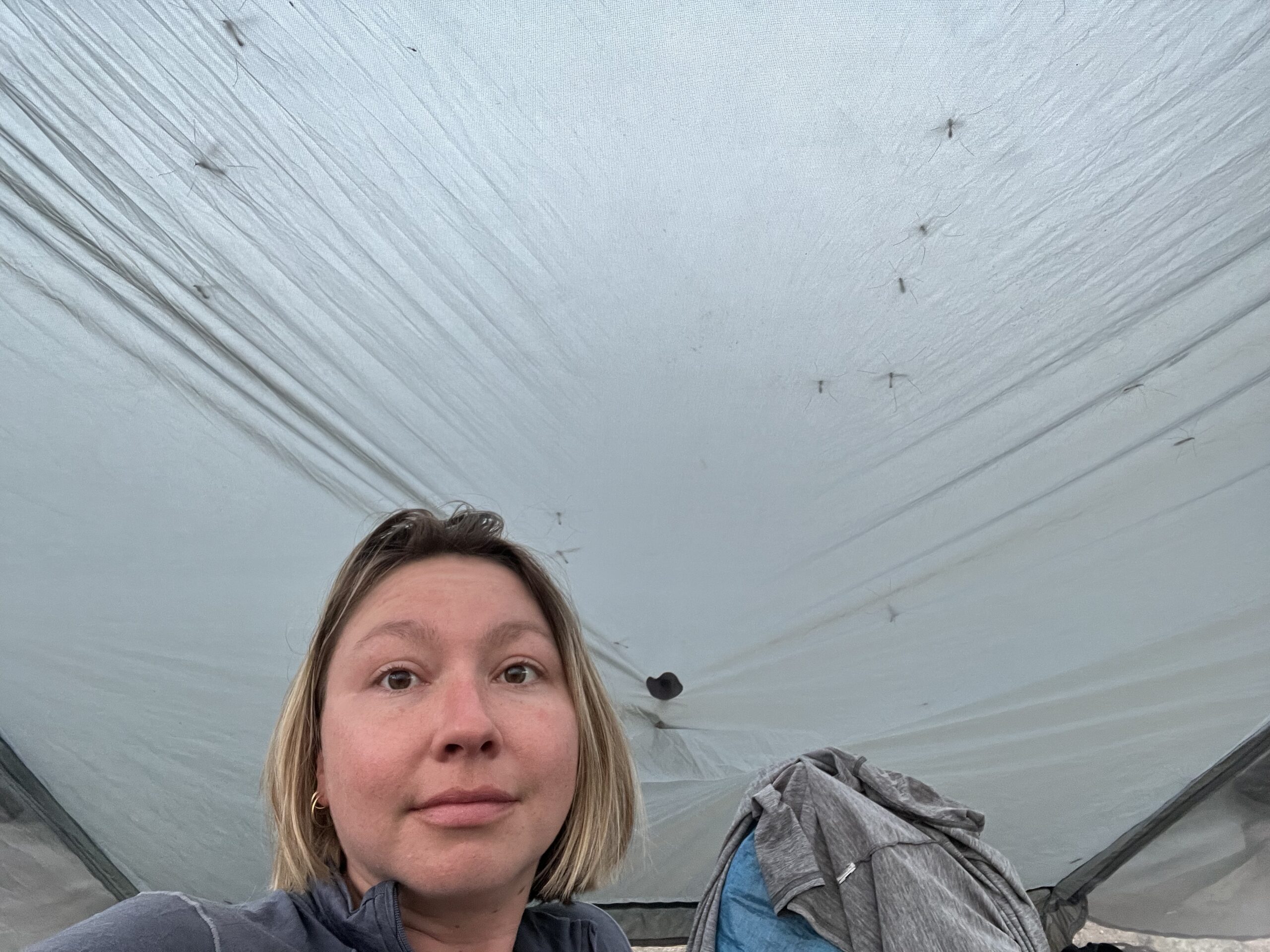
We camped in some spots tucked into bushes that provided nice wind shelter. The crane flies took a liking to my tent and there were so many walking around on their long, skinny legs that it sounded like power like static inside my tent.

Day 42: Campsite to campsite, 13.57 miles
We got a very late start. I slept horribly, with a growing migraine all night. In the morning my head was pounding so hard that every movement almost made me puke. I was so nauseous that I couldn’t get anything down and couldn’t even put on my hiking clothes because their sweat smell triggered my nausea. I tried my best to get down a bunch of water and migraine meds, worried that I had gone into DKA the day before. Eventually I felt like I could walk and we set off with the resolve that if I started feeling worse, we could bail out at a road crossing nearby.
We took it slow and thankfully I gradually improved. After about an hour I was able to eat half of a bar and my head slowly felt better. We were still able to get over 13 miles in which, while less than we had originally planned, was way more than I thought I was going to be able to do. I am thankful that I can often push through and bounce back quickly after physical issues but man was this one a doozy that I’d like to never repeat.

Day 43: Campsite to Sawmill Campground, 20.57 miles
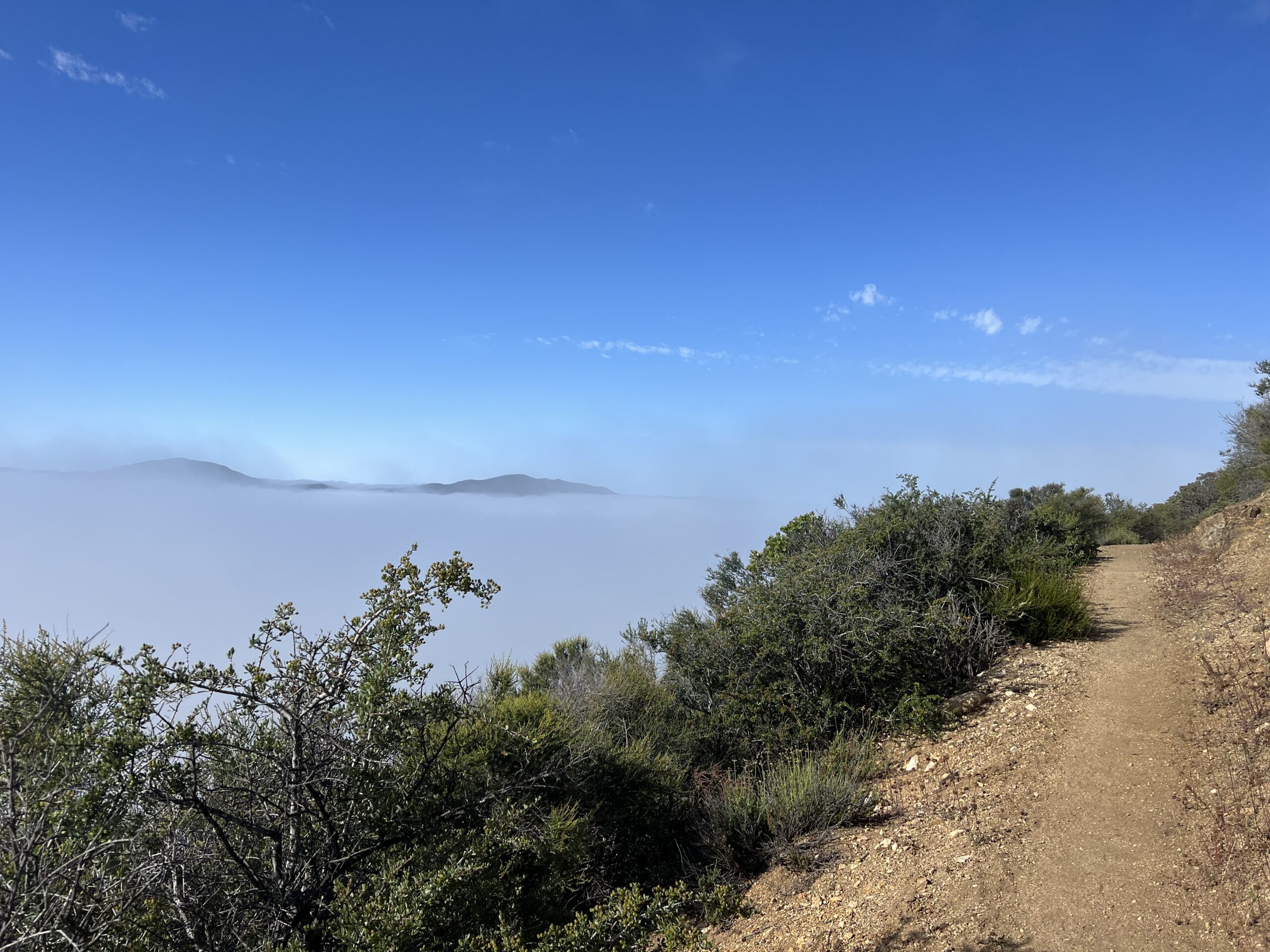
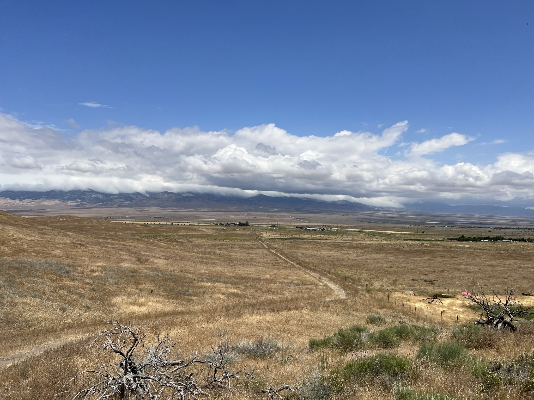
We woke up in a cloud and climbed until we were above the clouds. I was grateful to be feeling so much better, although still pretty exhausted.

We had a long day ahead of us to get to where we wanted to camp and I tried to be very intentional with breaks and stretching for my shin.

We had a long water carry and a long climb but the day became very cool, cloudy, and windy so we didn’t go through as much water. It’s amazing how 10 degrees difference changes your water consumption.

This cave was pretty deep and no I did not go in. No thank you.

For the next 10ish miles there several of these rainwater guzzlers as water sources. They are cleverly built but a bit hard to actually retrieve water from. Better than nothing though!
We took a road that paralleled the trail for the last several miles to camp. There were reports of overgrown poodledog bush on trail and since that plant acts a lot like poison oak, we decided rashes were not what we needed that day. The road ended up being beautiful, albeit extremely cold and windy, but we were able to observe the fields (yes FIELDS) of the poisonous plant from afar.
I don’t think I’ll ever get sick of hiking above the clouds. I also am so appreciative of my body that it can go through so much trauma one day and then hike over 20 miles the next. Diabetes sucks, plain and simple. But you do your best to roll with the punches, not die, and enjoy your life along the way.
Also, I forgot to take a screenshot of my sugars again. Sorry!
Day 44: Sawmill Campground to Horse Camp, 10.56 miles

We let ourselves sleep in since we were tired and the weather was a bit nasty. Once we left, we passed 500 miles! We also ran into a trail maintenance crew.

The day was cold and foggy but we were thankful for that over high temperatures.

The trail continued to wind through a lot of burn areas but eventually took us through some beautiful oak groves.

We ended the foggy day at a no longer maintained camp ground that still had a beautiful picnic bench.

Day 45: Horse Camp to Hikertown, 9.4 miles

We made good time in the morning descending down to Hikertown. Many signs warned us to stay on trail because of a nearby hunt club. Good thing I didn’t pack my antlers for this stretch.

We watched the mountains that we had spent the last several days in melt away into the Mojave. We could see wind turbines far away in the distance.


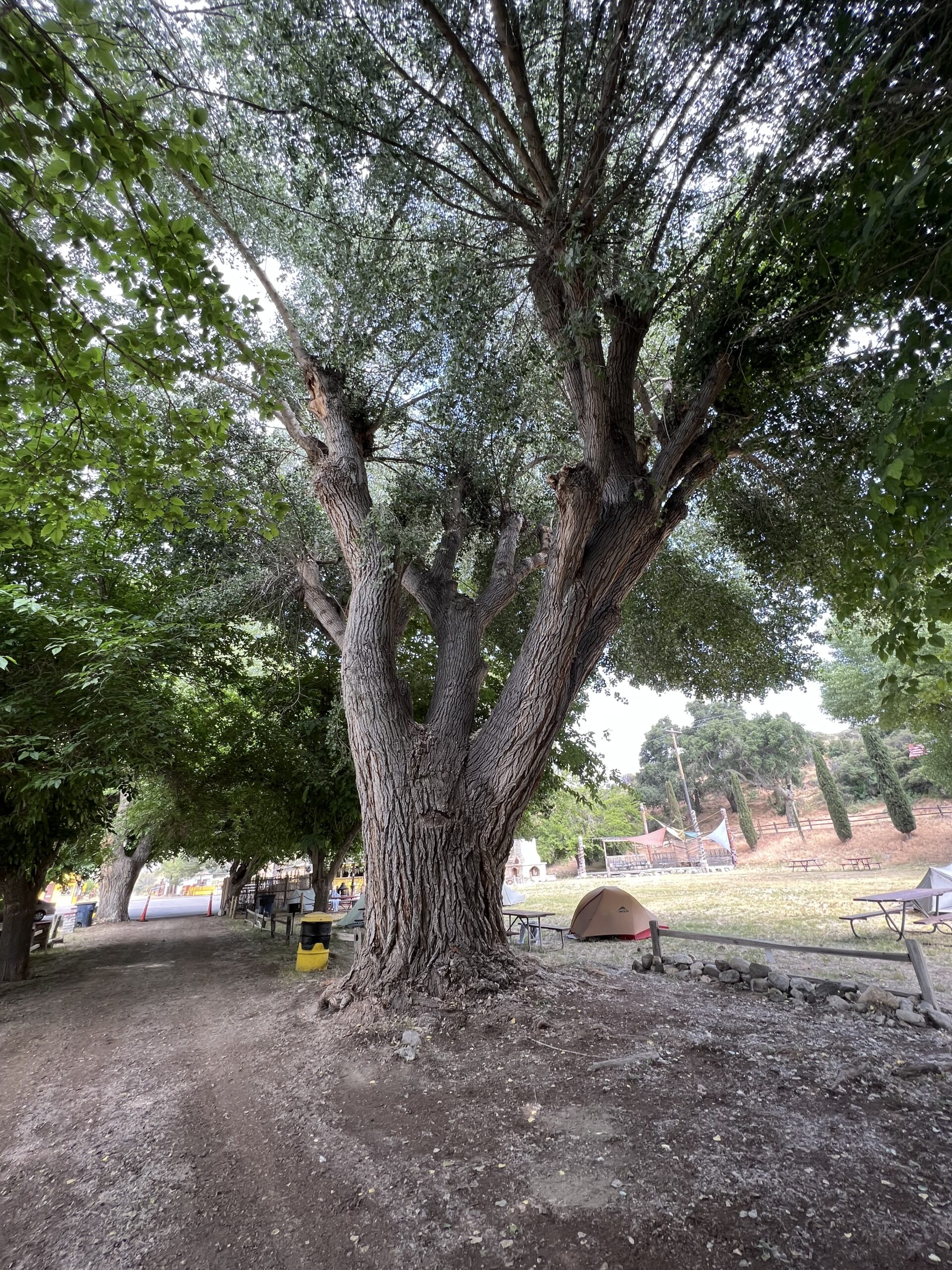
We eventually made it to Hikertown. It’s essentially a huge lot dotted with old western movie sets. They let hikers camp there, charge devices, and get mailed boxes for a small fee.

We got a ride to the market with some other hikers. Correction: the woman who runs the plane gave a hiker her keys and let us just take her van! We got cold drinks and a burger before heading back to set up camp.

A lot of people night hike the next section due to it being so exposed and waterless, but the forecast showed mild temperatures the next day so we decided to sleep and just get an early start.
Missing my blood sugar plot again! I was too busy catching up on painting postcards.
Day 46: Hikertown to Cottonwood Creek, 18.16 miles

We got an early start and began following the aqueduct (which you can’t actually access for water).
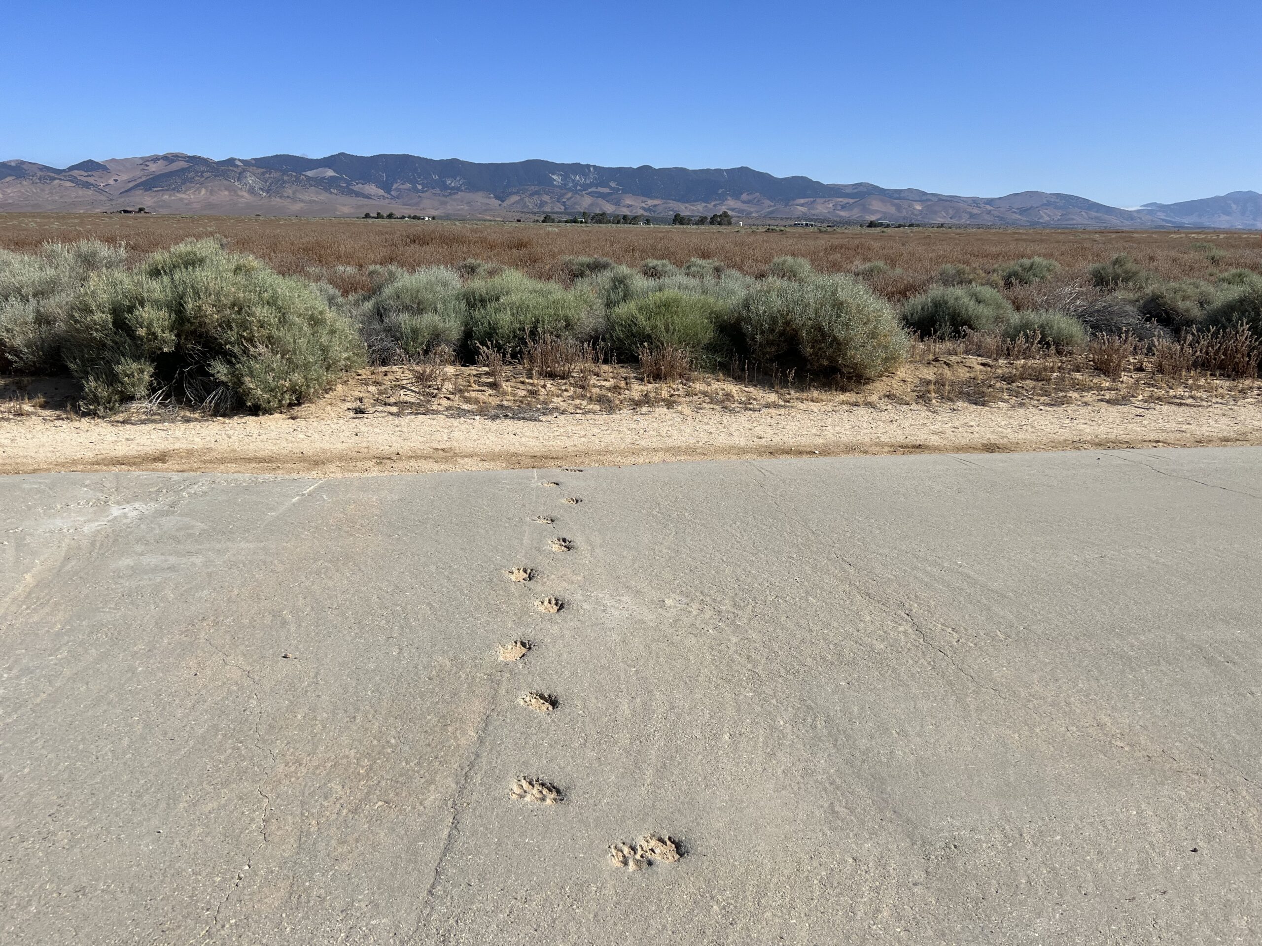
My favorite part was seeing occasional animal footprints in the concrete on top of the aqueduct. Nothing stops nature!

Goats in a boat! I now need to acquire goats and an old boat because it’s impossible for this to not make me extremely happy.


Once we reached the buried portion of the aqueduct, these occasional concrete access points offered perfect sit opportunities.
We eventually started to see Creosote and a lot of it. I LOVE the smell of Creosote. We often have a bundle hanging in the shower at home. It basically smells like desert rain and we were walking through groves of it. There were also tons of juniper trees, which smell just as lovely. My nose was so happy!

The clouds were very dramatic and as they moved we would be in cool shade one moment before being in hot sun the next. We spent the afternoon cloud hopping.
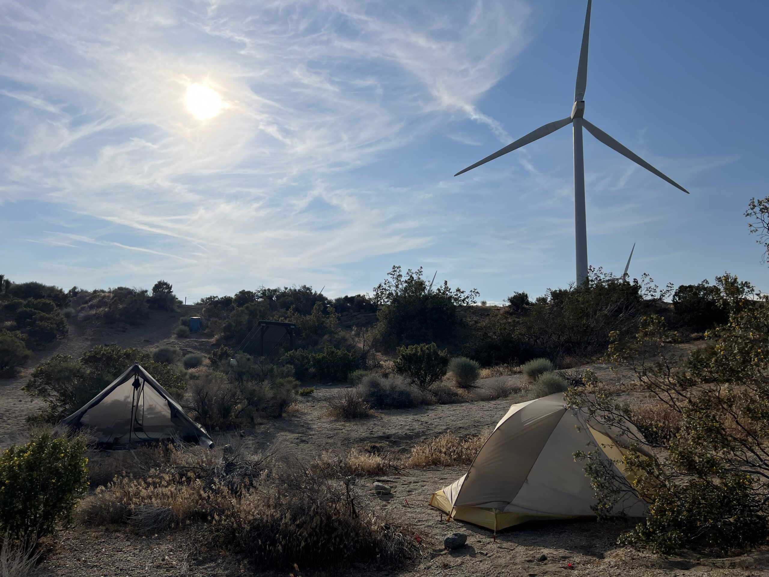
We finally made it to water and camped earlier than we originally planned due to the eventual hitch into Tehachapi being 8 miles closer than we thought. We set up our tents beneath the wind turbines, which sounded like jets flying over with the occasional train horn (squeaky turbines). It was strangely soothing.
I promise I’ll be better with blood sugar graphs next stretch! Diabetes burnout is real.
Day 47: Cottonwood Creek to Campsite, 16.08 miles

Turbines! I don’t know why but they make me so happy. It was fun walking through them since usually I’m just looking at them from afar as we drive through the Mojave.

We took a break under the shade of a Juniper tree, looking at a Creosote bush.

What goes down must go up, so up and up we went back into the mountains. Steep climbs, no shade, and long water carries make two unhappy feet.

At the top of our long climb we found the most amazing water cache. There was even an umbrella for shade, board games, fruit, and a trash can! Thank you trail angels!

We got to camp as the sun began setting and a ginormous bunny greeted us. He also left us some pebbles for good measure.
Day 48: Campsite to Tehachapi, 9.59 miles

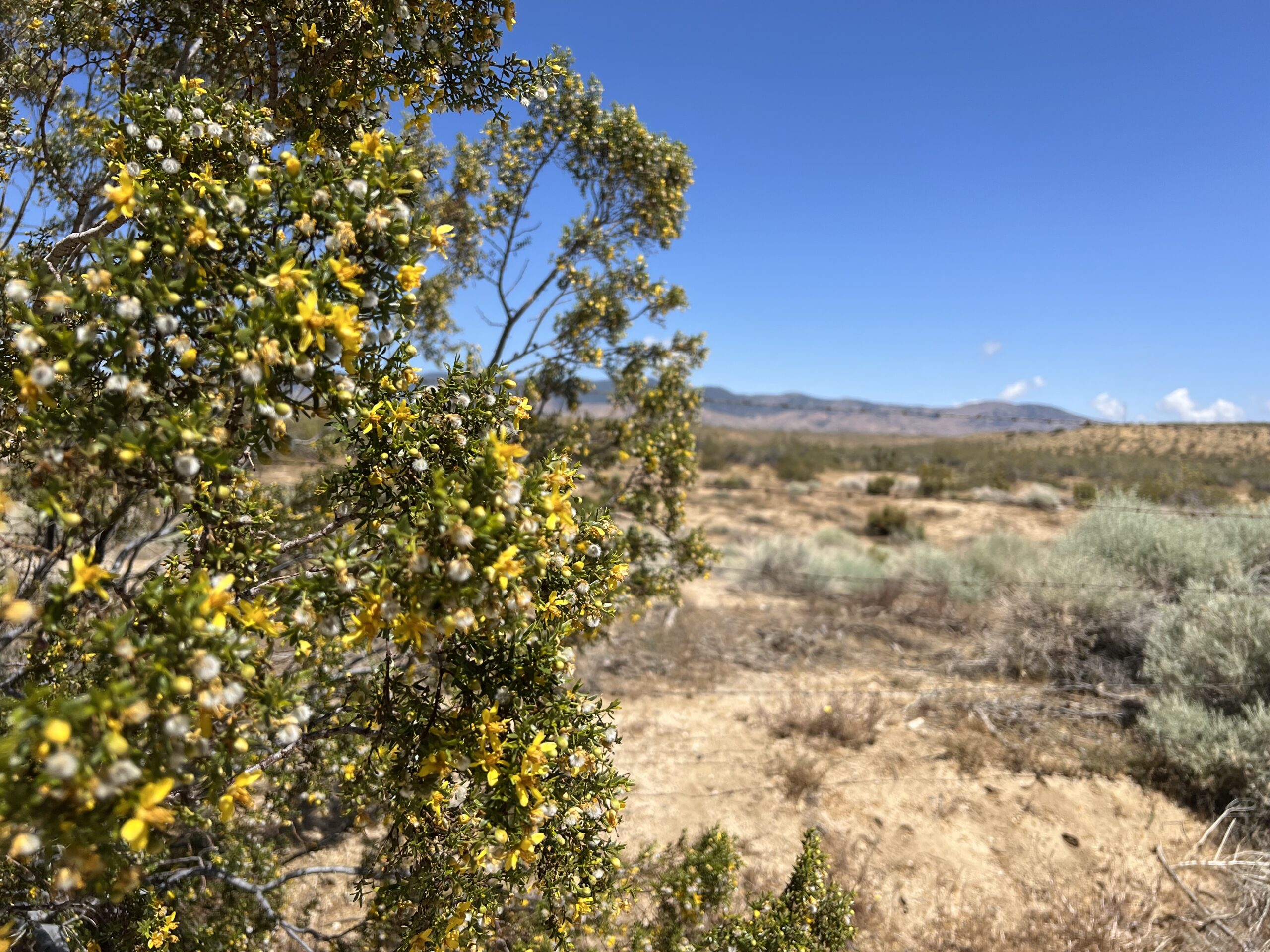
Nothing motivates you to hustle like town day! We made our way through tons of these yellow flowers. The bees were loving them and the sound of that many bees while you’re encased in flowers is almost overwhelming.
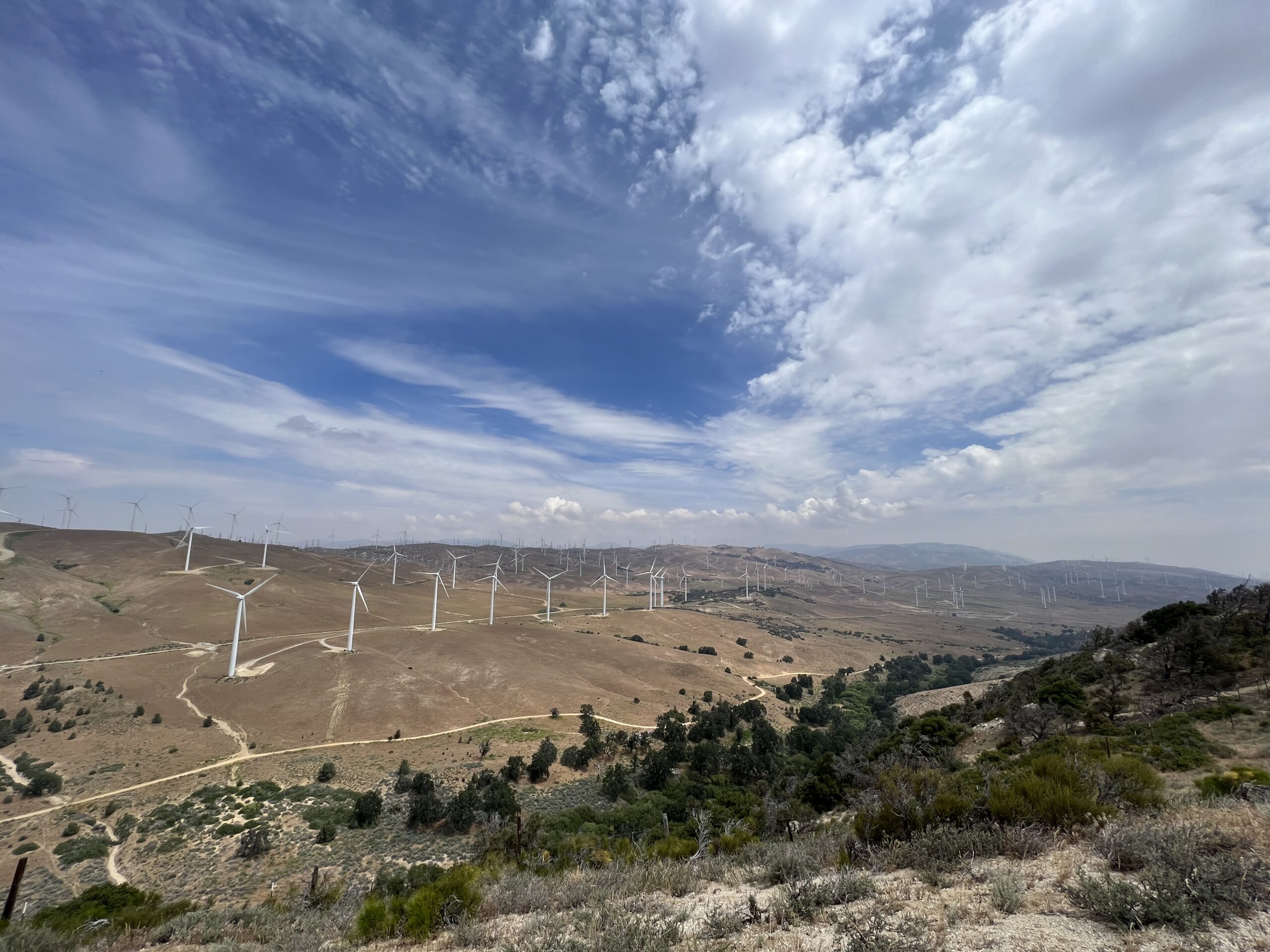
We started seeing another wind farm, although this one was much bigger and had a variety of new and old style turbines.

If it fits, we sits.

We saw at least 4 snakes in the last couple of miles down to the road. We later learned that the previous day a hiker had been airlifted out in that area from a rattlesnake bite!
We tried to hitch for awhile with no luck but eventually got a ride from a trail angel into town.

Time for a zero and resupply for an 8 day stretch!

This website contains affiliate links, which means The Trek may receive a percentage of any product or service you purchase using the links in the articles or advertisements. The buyer pays the same price as they would otherwise, and your purchase helps to support The Trek's ongoing goal to serve you quality backpacking advice and information. Thanks for your support!
To learn more, please visit the About This Site page.

Comments 1
Low blood sugar headaches suck! Keep it up!