 ">
">
The Colorado Trail Guide: Essential Safety Tips for Hiking the CT
So, you’re hiking the Colorado Trail. You’re hyped, you’re prepped, and you have a plan. That’s great! It sounds like you’re just about ready to go. All that’s left at this point is to get out there and do the thing—safely, ideally, and without getting zapped by lightning or devoured by a marauding bear* in the meantime.
*Not actually a thing you really need to worry about, and we’ll discuss why below. But even if bears aren’t a true danger on the CT, that doesn’t mean other dangers don’t exist. Lightning is a real threat on the CT, and so are altitude sickness, dehydration, and exposure to extreme temperatures.
All of these risks can be managed as long as you know what to expect. So let me tell you! Keep these Colorado Trail safety tips in your back pocket throughout your thru-hike and you’ll have nothing to worry about.
READ NEXT – Everything You Need to Know to Hike the Colorado Trail
Safety Concerns on the Colorado Trail: What You Need to Know
Altitude Sickness

Most of the Colorado Trail is above 10,000 feet, so you need to be careful about altitude sickness.
Most of the Colorado Trail is over 10,000 feet above sea level. People who aren’t acclimated to high elevation are at risk of altitude sickness anywhere above 5,000 feet. At best, flatlanders hitting high elevations will feel out of breath and more easily fatigued than usual. But altitude sickness can become a very serious, life-threatening condition. Nausea, fatigue, and brain fog are all warning signs of altitude sickness (though it manifests differently in different people, as will their tolerance for altitude changes). The best thing you can do is spend a few days in the mountains before exerting yourself on the trail.
The first 40-ish miles of the trail from Denver are below 8,000 feet, giving you a chance to ease in with a few lower-elevation days. But from mile 40 on, the trail climbs steadily to above 10,000 feet and (with a few minor exceptions) basically never comes back down again until you near Durango.
You should be particularly careful those first few days climbing up to 10K and beyond for the first time. Reduce your mileage, drink plenty of water, and be gentle with yourself if you feel more tired than usual. If you do exhibit signs of altitude sickness, especially symptoms of severe illness like confusion, racing heart, and fever, get to a lower elevation as soon as possible. If symptoms worsen, treat it like the emergency it is and seek help.
READ NEXT –
- How to Stay Safe While Hiking at High Elevation
- How to Avoid Altitude Sickness During High Elevation Hikes
Even after you adjust to the thinner air of the high mountains, you still need to be cautious about gaining too much elevation too quickly. The rule of thumb for backpackers is to never sleep more than 1,000 feet higher in elevation than the night before. That means it’s OK to climb more than 1,000 feet in one day, just as long as you come back down and sleep within 1000 feet (elevation) of your previous night’s campsite.
Ed. note: We are hikers, not doctors. Always consult with a medical professional if you have concerns about altitude sickness or any other condition.
Lightning
Rough weather can roll into the backcountry on a dime in the summer months. Be prepared for changing conditions.
According to the National Weather Service, about 500,000 lightning flashes hit the ground in Colorado in an average year—how fun! Afternoon thunderstorms are very common and can even be a daily occurrence in July and August. The best thing you can do to mitigate your lightning risk is to avoid hiking above treeline in the afternoon (yes, this means you’ll sacrifice some truly incredible above-treeline camping opportunities).
Up next: The Backpacker’s Guide to Lightning Safety
Start hiking early in the morning and plan to get down low again by noon or one p.m. In my experience, thunderstorms are most common after one or two in the afternoon, though I’ve gotten caught in them as early as nine a.m. so it really just depends. Also, there are some stretches of trail where you’ll be exposed above treeline all or most of the day, no matter how early in the morning you start (the stretch around the CT’s high point at mile 373 comes to mind).
If you do get caught above treeline and fear a lightning strike may be imminent, spread out from your companions by at least 50 feet and assume the lightning position (crouch on the balls of your feet with your head down and your hands over your ears).
Widowmakers
One thing you’ll notice while hiking the CT is that there’s a whole heck of a lot of dead trees. Some were killed by fires, but most fell victim to one of the various kinds of bark beetles that are currently running rampant in the Rocky Mountains.
Usually, when camping in a forest, you should look up before pitching your tent to ensure you’re not setting up right underneath a large, dead tree that could come down on you and crush you in the night. That advice still applies on the CT, but the reality is that sometimes you’re going to camp in an area where every tree for miles is dead and that’s just the way it is. Just keep an eye out for particularly large snags, especially if they have heavy-looking, partially broken branches or are leaning heavily over your tent.
READ NEXT – 8 Things East Coast Hikers Must Know Before Hiking Out West for the First Time
Fire
Speaking of all those dead trees, the Colorado Rockies, like most of the arid mountain west, is incredibly fire-prone. Statistically speaking, it’s fairly unlikely (though not impossible) that you’ll actually find yourself caught on the trail in the midst of an actively burning forest fire.
The greater danger is smoke inhalation, especially if you have asthma or other respiratory conditions. I made a point of carrying my inhaler on the CT even though I rarely need it, knowing that wildfire smoke would put me at greater risk of an asthma attack. Fortunately, other than one truly disgusting day where the smoke was so thick I could barely see a half-mile in any direction, the smoke was mostly an annoyance when I hiked (though it did diminish the views in many sections significantly).
I recommend checking the national smoke map frequently during fire season (when battery and cell service allow). There will be fewer fires and less smoke earlier in the summer, so you may want to go for an early-season thru-hike if this is a primary concern for you. (In exchange, you’ll get more lightning and more snow and ice on the trail. Read our Logistics guide to decide when is the best time to start your thru-hike).
Exposure

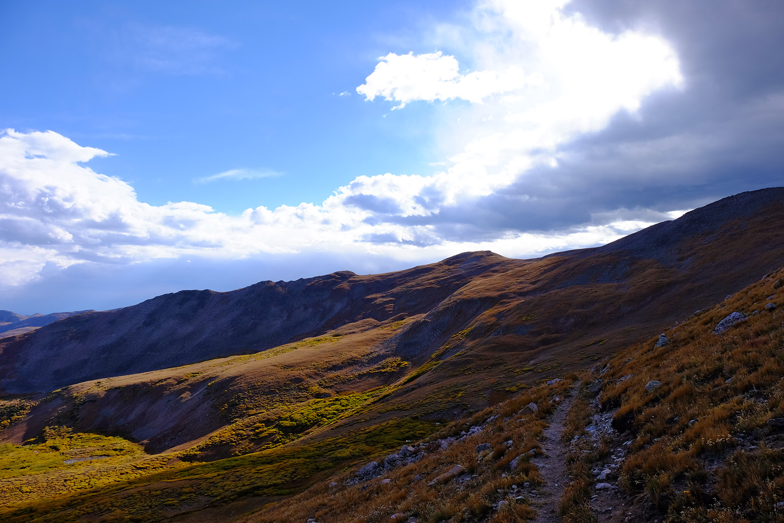
Just a bit northeast of Emma Burr Mountain. The alpine environment of the CT is unpredictable and offers little in the way of shelter.
Besides getting zapped by lightning, you also have to worry about high winds, sun exposure, and hypothermia in the high Rockies. The weather can change very rapidly in this part of the world. One minute you’re cruising along beneath bluebird skies and everything’s just great, the next minute (literally) it’s freezing and hailing and there’s lightning and the world is on fire and everyone is screaming and OH GOD WHY DID I THINK THIS WOULD BE FUN ADSFADFASDFADF.
My point is, you have to be prepared for all types of conditions if you want to hike the CT, no matter the time of year, and especially when you’re above treeline and lack the protection of surrounding vegetation. Dress in layers so you can adapt to changing temperatures and pack a hat and gloves. A rain jacket is an absolute must for your safety and protection from cold temperatures, wind, and rain. You should have either rain pants or wind pants (the lighter option) as well to ensure you are warm and protected enough above treeline.
Bring a sleeping bag and pad that can handle sub-freezing temperatures, which you’re likely to encounter at night even in high summer. A 20-degree bag will be adequate for most people, but if you run cold at all, go with a 15 to be safe. (For more details on recommended clothing and gear, check out our Colorado Trail gear list).
Even when the weather is fair, you still have to protect yourself from intense sun exposure above treeline (you will be amazed how easily you burn up there). Many CT hikers opt to carry an umbrella for ultimate shade, but this is optional. You should definitely bring sunglasses and a hat. If you wear long sleeves and pants, you may not need sunscreen, but if you’re a shorts-and-t-shirt hiker, put sunscreen on the list too.
Dehydration
For the most part, water is abundant on the Colorado Trail. However, there are a couple of segments that feature longer dry stretches where you need to be careful about your water supply, especially later in the summer. You’ll get hit with one of them right off the bat with Segment 2, just 16 miles out of Waterton Canyon. There is no water available on the trail from the South Platte River at mile 16.5 to the Buffalo Creek Fire Station, where you can fill up at the outdoor tap, at mile 26.6.
To make matters more challenging, Segment 2 was burned by a severe wildfire years ago and there is virtually no shade or tree cover throughout the 10-mile stretch, so it’s both dry and hot. Drink your fill and carry water from the South Platte and be sure not to miss the fire station at the end of the segment (it’s a couple hundred feet off-trail). Otherwise, you’ll have to hike another three miles to the next natural water source at 29.5.
After Segment 2, the next area of significant water concern is the stretch right after the Collegiates, roughly from mile 253 to the Eddiesville Trailhead at mile 330. There is water in this section, but some sources are seasonal and can run dry later in the summer so it’s worth paying slightly closer attention than you normally would. Also, much of the hiking in this section is through cow pastures, and the water can be a little scuzzy as a result. Filter carefully and consider using a secondary purification method, such as Aqua Mira drops, just in case.
Finally, near the very end of the trail, there’s an up-to 21-mile dry stretch starting at Straight Creek (mile 442) and ending at Taylor Lake (463). There are a few seasonal sources in this stretch that can break it up, but in my experience, they are questionable at best. One, Deer Creek (mile 456), was supposedly flowing weakly when I hiked the trail most recently in 2021, but I walked right by it (searching hard) and never found it. This stretch will be more challenging in late summer when more snow-fed sources are running dry.
Creatures

Is this marmot thinking about eating your snacks? Probably.
Bears: There are black bears (no grizzlies) in the Colorado Rockies, but they generally don’t go above 10,000-feet elevation, and bear encounters aren’t all that common on the CT. This is good news, as trees for hanging bear bags are often spindly, dead, or non-existent.
I still hung my food as often and as well as possible. I’ve gotten pretty good at throwing a bear hang over the years (if I do say so myself) so for the weight of a length of paracord and a few minutes of effort each morning and evening, why not take this added precaution to protect my food and the local wildlife from each other? Hanging food helps keep it from chipmunks, pikas, marmots, and other small animals that might chew through my supplies.
The one area where I have heard of relatively frequent bear encounters is the campsite near Jefferson Creek at mile 78, just before the climb up to Georgia Pass. The campsite is right by a road, and apparently car campers often stay here and leave a lot of food trash, so the area is starting to develop a bear problem. This is a shame since the campsite itself is absolutely gorgeous and idyllic.
Mountain lions and grizzlies: Grizzlies are not a thing in this part of the world, so you don’t have to worry about that. There are mountain lions in the state, but like black bears, they don’t live above 10,000 feet and encounters on the Colorado Trail are rare.
Moose: They are most active at dawn and dusk. You may see them in areas with a lot of water and willows around that time of day, so be alert while you’re hiking. They can be a bit uptight, so the best thing you can do is give them space and not make any sudden sounds or movements to alarm them. Seeing a majestic moose is a real treat, just keep your distance and practice situational awareness to avoid catching each other off-guard.
Insects: Realistically, insects are the biggest critter-based threat you’ll face on the Colorado Trail. While Lyme-disease-bearing deer ticks don’t live in the Colorado Rockies, there are other species of ticks that can transmit other equally undesirable diseases. There are also mosquitoes (surprisingly fewer than you might think, but definitely still a thing), which are irritating at best and potentially disease-bearing at worst. For that reason, I still recommend that CT thru-hikers treat their clothing and gear with permethrin before hitting the trail. For a trail as short as this one, a single application should be enough to last you the entire journey.
Snow Travel
July and August hikers in a typical year, especially those starting from the Denver end, don’t generally need to worry about this. Some snow will linger throughout the summer, particularly in the Collegiates and the San Juans, but you should be able to manage it without needing special equipment or snow skills. If snow travel is something that really worries you, start your hike in late July or August for the driest possible trails. Just remember that by late September you’re at risk of bumping into the beginning of next winter’s snowstorms.
If you’re hiking the CT off-season, you should carry microspikes and, depending on that year’s snowpack and how off-season we’re talking, an ice axe. CT hikers who start in June will be likely to encounter trickier snow situations when they hit the Collegiates, for instance, so you should be more confident in your snow skills if you’re starting that early.
“Two-Legged Varmints”
I always remind prospective hikers who are worried about safety that very few violent crimes take place in that setting compared to most. I feel much safer alone on the trail than I do walking alone at night through the streets of Philadelphia, for instance.
Still, that’s no reason to be complacent. I carry pepper spray when I hike, and I make a point to make connections with other hikers even if I don’t intend to walk with them all the time. It helps to be known on the trail. The hiking community is the best safety net you can ask for out there: tap into that community spirit and lean into your friends when you need help or reassurance.
If you carry a GPS device with you, try to check in at least once per day with your friends and family back home so that there’s a record of your last-known location. (Counterargument: I am lazy and often forget to check in every night, so make sure your loved ones don’t immediately jump to dark conclusions if they don’t hear from you for a few days).
Finally, practice situational awareness. If you listen to music while you hike, try just using one earbud at a time so you can hear what’s going on around you. Pay attention to your surroundings (this will help keep you from getting lost too). Listen to your gut if something about another hiker bothers you.
I can’t guarantee you that you won’t meet any bad people while hiking the Colorado Trail. You might—unfortunately, they’re everywhere. But I will say that in my thru-hiking career, the very few negative or creepy experiences I’ve had are far outweighed by the positive ones, and I’ve found the hiking community to be overwhelmingly kind and supportive. As with all things in life, choosing to thru-hike is about risk management.
Should you bring a GPS device on the Colorado Trail?

The CT is generally easy to follow, but GPS devices can do more than just help you navigate: they’re very useful for communicating with the outside world even when you lack cell service.
There are differing schools of thought on this, but I say it’s worth the investment and the weight for your peace of mind and that of your loved ones back home. Something like the Garmin inReach Mini will allow you to stay in touch with friends and family via two-way satellite messaging, get a basic weather forecast at your current location, and of course, provide you with the all-important SOS button if you suddenly find yourself in deep shit and need help.
What have we learned?
After all these safety tips, you might be thinking that the Colorado Trail sounds like a pretty scary place. Don’t let my fear-mongering fool you! It really isn’t that dangerous. But like any activity, it does carry some inherent risks, and because you’ll be in the backcountry, you have to be prepared to deal with them because help may not come right away. By understanding the possible risks of thru-hiking the Colorado Trail and being ready for them, you can mitigate the danger so your hike is as carefree and wonderful as possible.
More Resources from the Colorado Trail Guide
Everything You Need to Know to Hike the Colorado Trail
11 Highlights of the Colorado Trail You Won’t Want to Miss
Colorado Trail Packing List
Logistics for a Colorado Trail Thru-Hike
Towns and Resupply on the Colorado Trail
Colorado Trail Section by Section
Collegiate East vs. West: 8 Key Differences for CT Hikers
How to Hike Every 14er on the Colorado Trail (with FarOut Miles)
The Beer Drinker’s Guide to the Colorado Trail
Featured image: Graphic design by Chris Helm (@chris.helm).

This website contains affiliate links, which means The Trek may receive a percentage of any product or service you purchase using the links in the articles or advertisements. The buyer pays the same price as they would otherwise, and your purchase helps to support The Trek's ongoing goal to serve you quality backpacking advice and information. Thanks for your support!
To learn more, please visit the About This Site page.

Comments 1