 ">
">
Georgia: Must-See Day Hikes on the Appalachian Trail
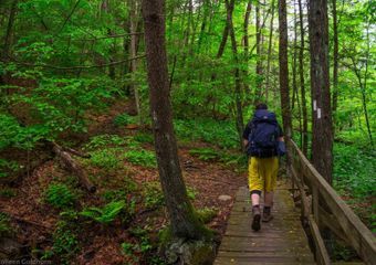
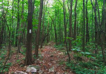
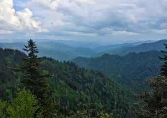
The beautiful state of Georgia is often celebrated on the trail as the first state for northbound thru hikers, and the finish line for southbounders. Full of rugged and steep terrain, hiking throughout the state is often challenging, but hikers are rewarded with mountain views that seem to stretch on forever.
Over half of the trail through Georgia is set in federally designated wilderness. So, although you won’t find many peach trees, you will see tons of animals and sweeping mountain vistas. With 78.2 miles of the Appalachian Trail within it’s state borders, Georgia as plenty of trail for both long distance backpackers, and day hikers alike.
With a few more weeks of warm weather left, it’s time to grab a buddy, and check out these day hikes along the Appalachian Trail in Georgia:
1. Springer Mountain

Total Distance: 2 miles (with longer options available)
About the Hike:
For a full day of tough hiking, there are few sections of the AT in Georgia better than Springer Mountain. Not only will you get the satisfaction of climbing up this 3780 foot mountain, but you will get to see the southernmost blaze on the trail, read the very first hiker logbook on the trail for northbound hikers, and get a great view of the Georgia mountains. Depending on which route you take, you will pass the breathtaking Amicalola Falls, which are the largest waterfalls in the state of Georgia standing at 726 feet high.
The Details:
There are multiple options when it comes to hiking Springer Mountain. This is a decent climb, so choose one that is within your physical abilities: Option 1) 2 miles: Park at the large parking lot on USFS 42 and hike southbound for 1 mile to the summit of Springer Mountain. Retrace your steps back to your car. Option 2) 9.8 miles: Park one car at Amicalola Falls State Park and another at the large lot on USFS 42. Start your hike at Amicalola and follow the blue blazed approach trail northbound for 8.8 miles to the summit. After reaching the summit, continue following the AT north for another 1 mile to reach your car. Option 3) 17.6 miles: For a full day of climbing, hike the Springer Mountain approach trail. Starting at Amicalola Falls, hike northbound for 8.8 miles until you reach the summit of Springer. Retrace your steps back down the mountain and to your car.

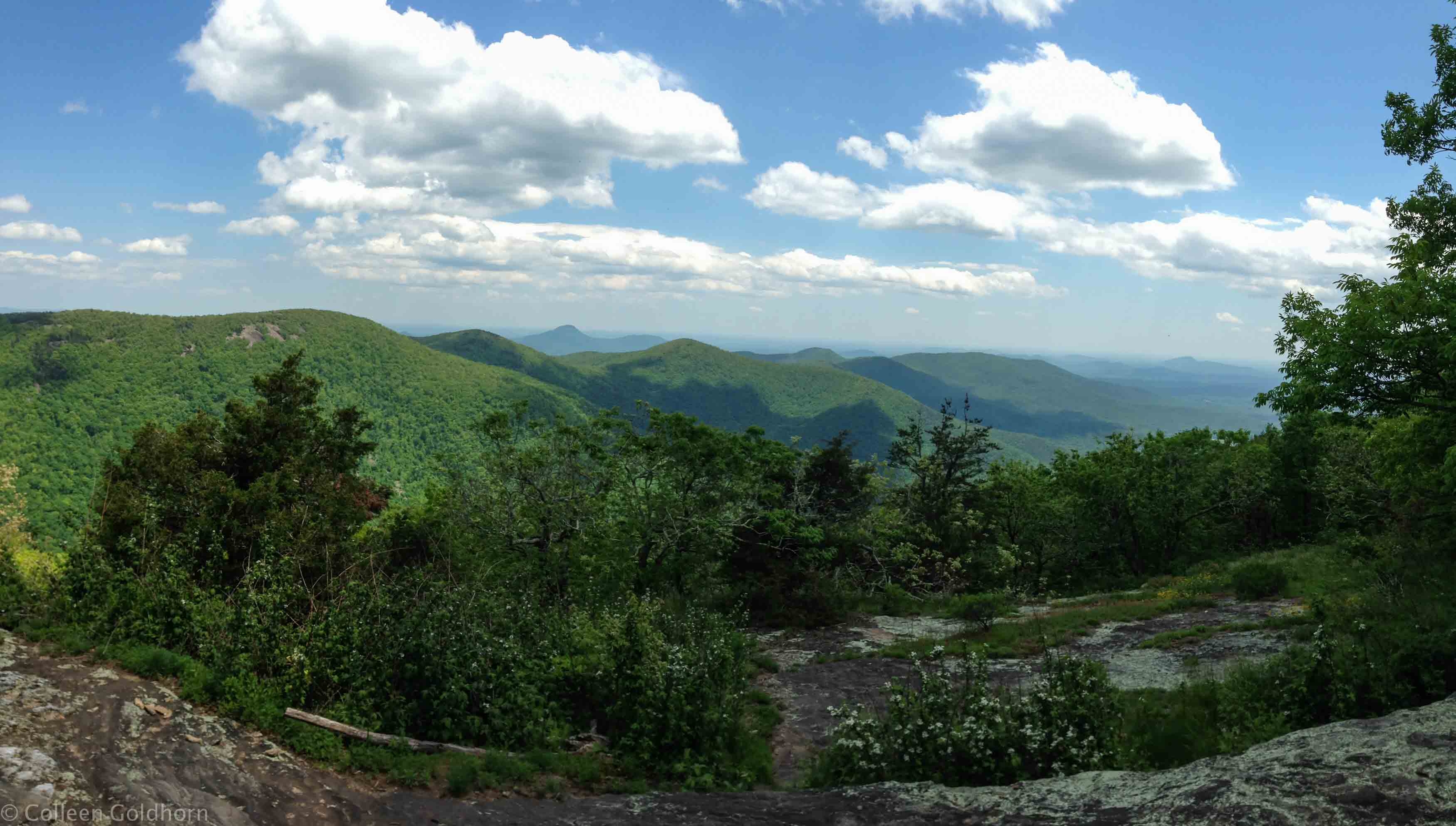
2. Blood Mountain

Total Distance: 4.8 miles (with longer option available)
About the Hike:
Being the tallest mountain on Georgia’s section of the trail at 4442 feet high, there is a lot of anticipation for northbound thru hikers as they approach the climb up to Blood Mountain. This is a challenging hike which gains a steady 1300 feet over very steep and rocky terrain. There is a historic stone shelter located at the top of the mountain with was built by the Civilian Conservation Corps in 1934. In addition, the views from the top are unbelievable, which is why there are are often many people at the summit. Go early, or during the week to have the mountain all to yourself!
The Details:
Option 1) 4.8 miles: Park at the trail head in Neels Gap, and climb straight up for 2.4 miles until you reach the summit. After taking in the views, retrace your steps back to your car. Option 2) 10.8 miles: Park one car at Woody Gap, and another at Neels Gap. Starting at Woody Gap, hike 8.4 miles to the summit of Blood Mountain. There are a few additional view points that you will pass on the way to the top. Continue on the AT northbound past Blood Mountain back down to your car at Woody Gap.
3. Ramrock Mountain

Total Distance: 3 miles
About the Hike:
Ramrock Mountain offers beautiful views of Hawk, Sassafras, and Justus Mountains, as well as the surrounding Georgia forests. Due to a smaller climb and more level elevation, this hike is slightly less challenging than others on the AT in Georgia. This makes it a great introductory hike for those interested in getting out on the AT more often. The shady viewpoint from the top is perfect for spreading out and having a snack before heading back down to your car.
The Details:
Park your car at Woody Gap and follow the AT southbound for 1.5 miles. After hanging out at the top for a bit, retrace your steps and hike back to your car.
4. Cow Rock Mountain
Total Distance: 2 miles (with longer options available)
About the Hike:
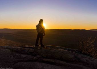
The open ledges and slabs of rock on the summit of Cowrock Mountain offer breathtaking views of the Wildcat Mountain Range. On your way up either side of the mountain there are additional viewpoints throughout the hike. If taking one of the longer routes, you will be climbing over 3 mountains and enjoy additional views as you hike to the summit of Cowrock. The close proximity to the parking lot in Tesnatee Gap also makes this hike great to climb up and watch sunrise or sunset (just remember a headlamp)!
The Details:
Option 1) 2 miles: Park at Tesnatee Gap. Follow the AT southbound for 1 mile up to Cowrock Mountain. When finished at the top, retrace your steps for 1 mile back to your car. Option 2) 6.1 miles: park one car at Neels Gap, and a second at Tesnatee Gap. Starting from Neels Gap, hike 5.1 miles to the summit of Cowrock Mountain. After taking in the views, continue northbound on the AT for 1 mile to your car at Tesnatee Gap. Option 3) 10.2 miles: Park at Neels Gap, and follow the AT northbound for 5.1 miles to Cowrock Mountain, and then retrace back to your car. This option has 3 mountains which you will need to climb both on the way there and on the way back. Although this option is challenging, the multiple viewpoints throughout the hike make it worth it.
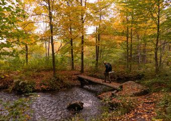
5. Long Creek Falls

Total Distance: 1.8 miles
About the Hike:
Set on a soft trail surrounded by Rhododendron bushes, Long Creek Falls is a great spot to take a dip on a warm Georgia summer day. With plenty of places to sit and relax both above and below the falls, it makes for the perfect place to sit back and cool off. The falls can go dry if there isn’t a ton of rain in the summer, so go in the springtime or after a large amount of rain to really see these falls rage.
The Details:
Park at “Three Forks” on Forest Service Road 58, then follow the AT northbound for .9 miles until you intersect the Benton Macaye Trail. Follow this trail .1 mile down until you reach the falls. After cooling off, retrace your steps back to Three Forks.
6. Tray Mountain

Total Distance: 1.6 miles (with longer options available)
About the Hike:
Standing at 4398 feet high, Tray Mountain is just barely shorter than it’s more famous neighbor, Blood Mountain. Don’t let it’s slightly shorter size fool you though, the climb up Tray is steep and relentless. It’s worth it though as the views from the top are incredible. A large portion of the mountain is covered by brush which can block the views as it grows in during the summer months, but there is a rocky outcrop on the top where hikers can get a clear view at miles of mountains below. If going in the winter, you can easily see over the brush and have fantastic views all over the mountain, however beware of freezing temperatures, winds, and snow during the colder months of the year.
The Details:
Option 1) 1.6 miles: Park at Tray Gap, and climb a very steep .8 miles up to the summit. After taking in the views, retrace your steps .8 miles back down. Option 2) 5.2 miles: For a longer hike, park at Indian Grave Gap, which is 2.6 miles from the summit. Hike to the top, and then retrace your steps back down.
Did I miss your favorite spot along the AT in Georgia? Let me know where I forgot to add in the comments below!

Related:

This website contains affiliate links, which means The Trek may receive a percentage of any product or service you purchase using the links in the articles or advertisements. The buyer pays the same price as they would otherwise, and your purchase helps to support The Trek's ongoing goal to serve you quality backpacking advice and information. Thanks for your support!
To learn more, please visit the About This Site page.

Comments 5
Great article, definitely agree with all your picks! My 8 yr old son and I hiked the Georgia section in July, our favorites were Long Creek Falls and CowRock Mountain. We were fogged in on our summit of Blood Mountain and didn’t get to enjoy the view from there. Thanks for writing!
My favorite is Jarrards gap. I go up slaughter creek trail to the top of blood mountain and come back down via Jarrards gap. I think it’s around 8 miles. The long hike recommended up to cow rock is not too far but the trail from that side is difficult (ankle breaker).
Hello, Colleen! I am really fond of your essential blog post you have shared with us! Reading it was so exceptionally interesting for me! I will be waiting for the next pst to be published. http://paper-writing.services/
Through hiking the AT. Was wondering how to go about getting over to Mount Mitchell so I could hike the tallest mountain East of the Mississippi. Where would one get off the AT and how would you get there and back to the AT again?
Next time you hike to Cowrock Mountain, check out a little secret spot called Story Time Rock. If you walk down the face of Cowrock, to your right you will see a small side trail. It is unmarked but not difficult to follow. It leads to one of the best kept secrets in the North Georgia mountains. View is astounding. I love Cowrock. But I can’t go there without visiting Story Time as well.