 ">
">
The GREAT Smokey Mountains
For years I have heard about the Smokies section of the Appalachian Trail. As we approached this section I realized I didn’t know what made that section so different from everything else we were hiking. I had heard you either love that segment or hate it. I spent a handful of weekends hiking in the Smokies last summer (including 3 trips to Mt. Leconte) so it wasn’t like I’m not familiar with the terrain. I was nervous and excited to experience that area in the context of a thru-hike.
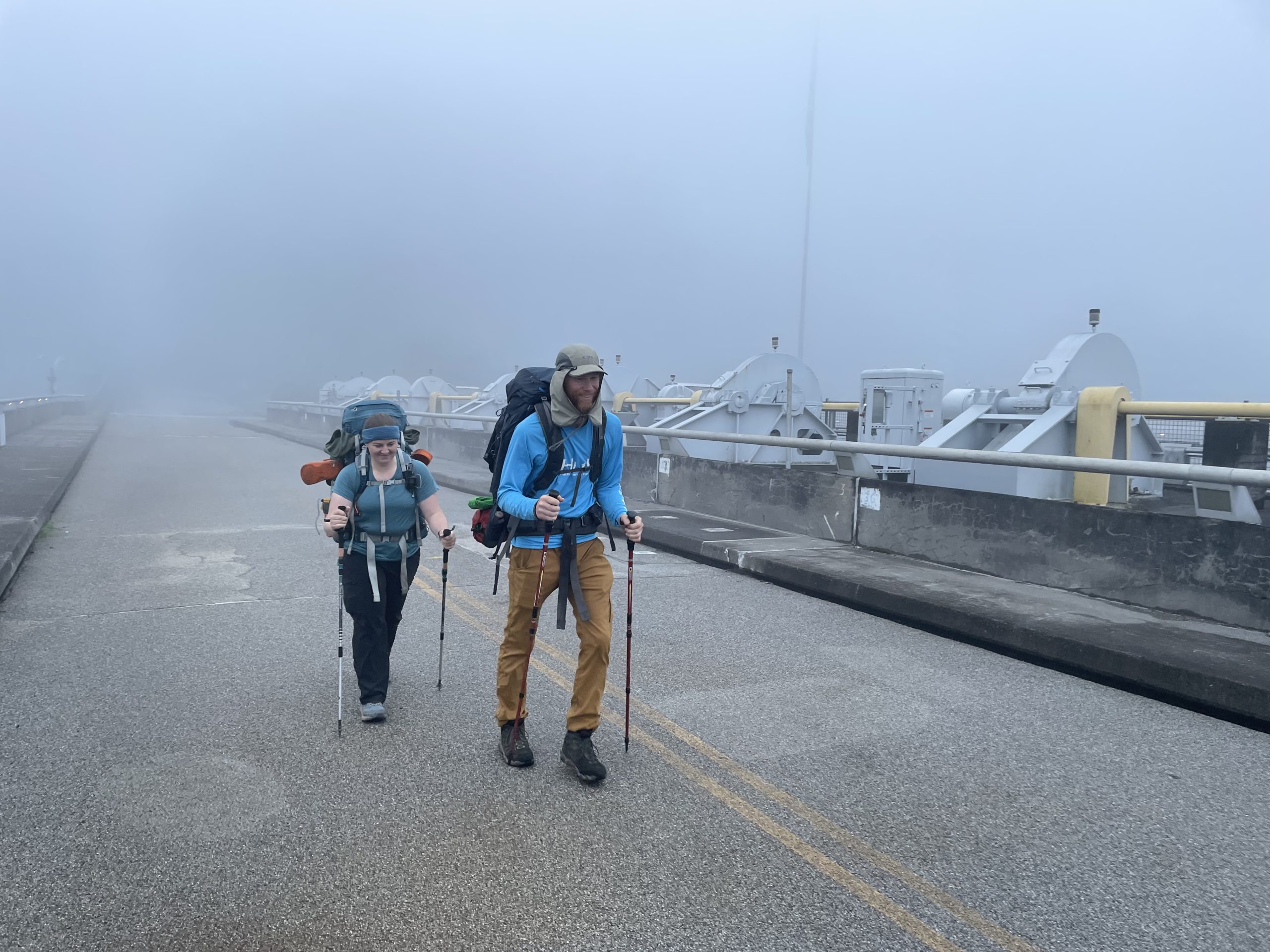
Walking across Fontana Dam
Day 18: 4,890 ft ascent, 14.9 miles
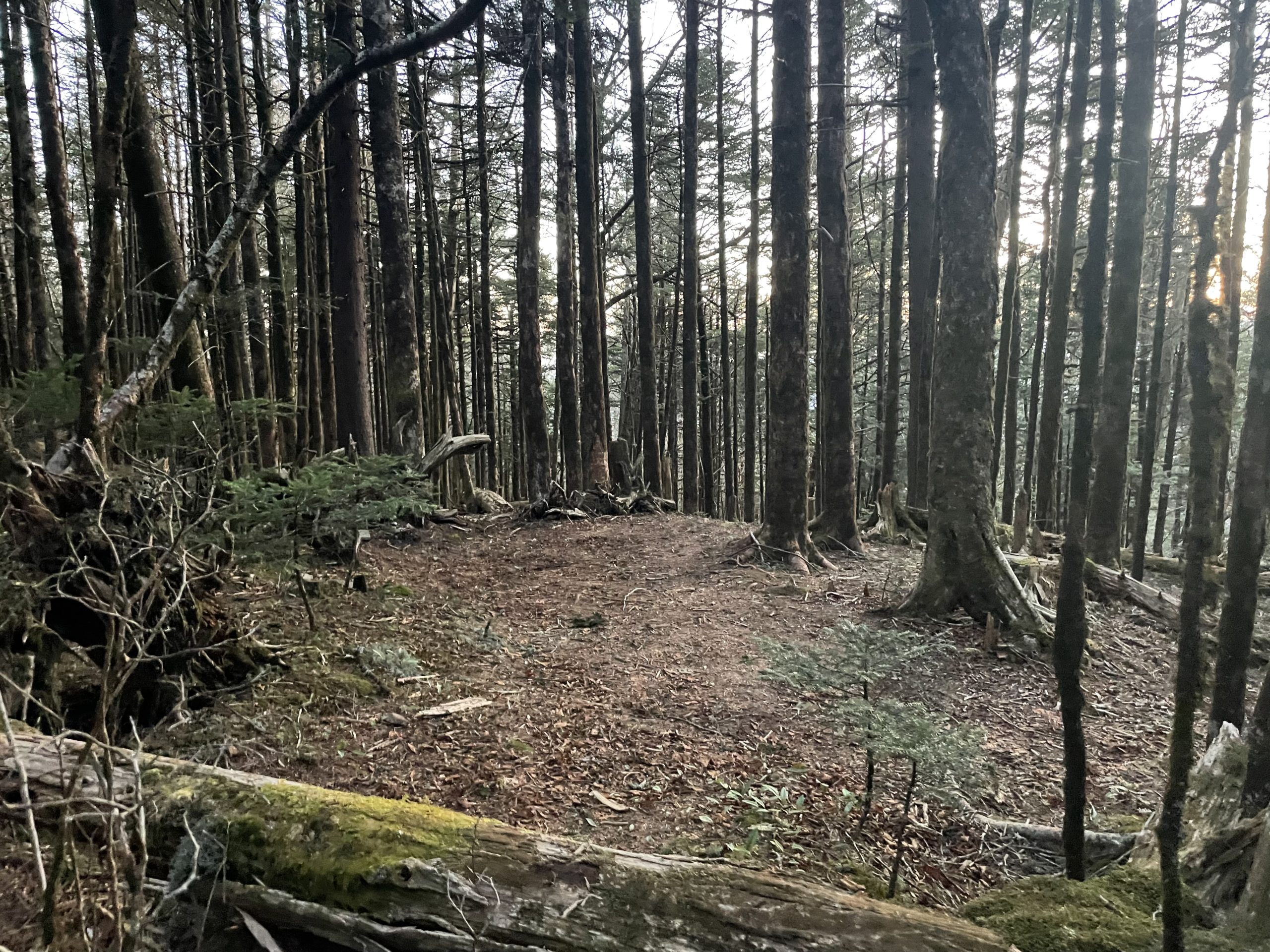
Day one of the Great Smokey Mountains National Park!
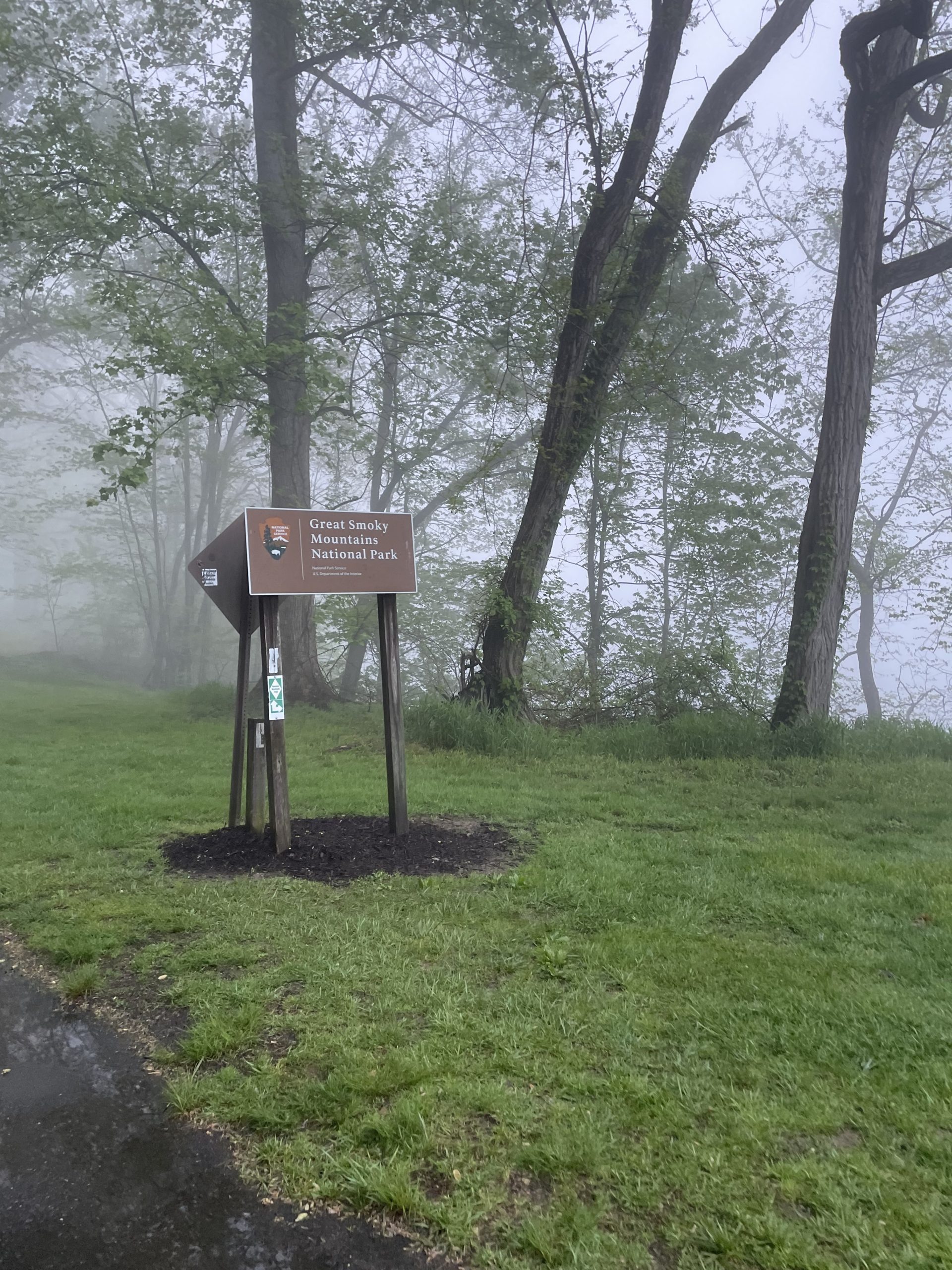
National Park boundary
We started the morning walking across Fontana Dam before we put our permits in the box to start this segment. We all had to purchase $40 thru hiker permits for this segment of the trail. You put half of your permit paper in the box at the entrance to the park and the other half in a box at the exit.
I had heard before that the climb out of Fontana Dam and into the park was brutal. I keep finding that when I’m mentally prepared for a climb to be tough, I cruise right on up and it’s not as bad as I had anticipated. Not that it’s not hard, I’m just mentally prepared for the hard which makes it seem easy.
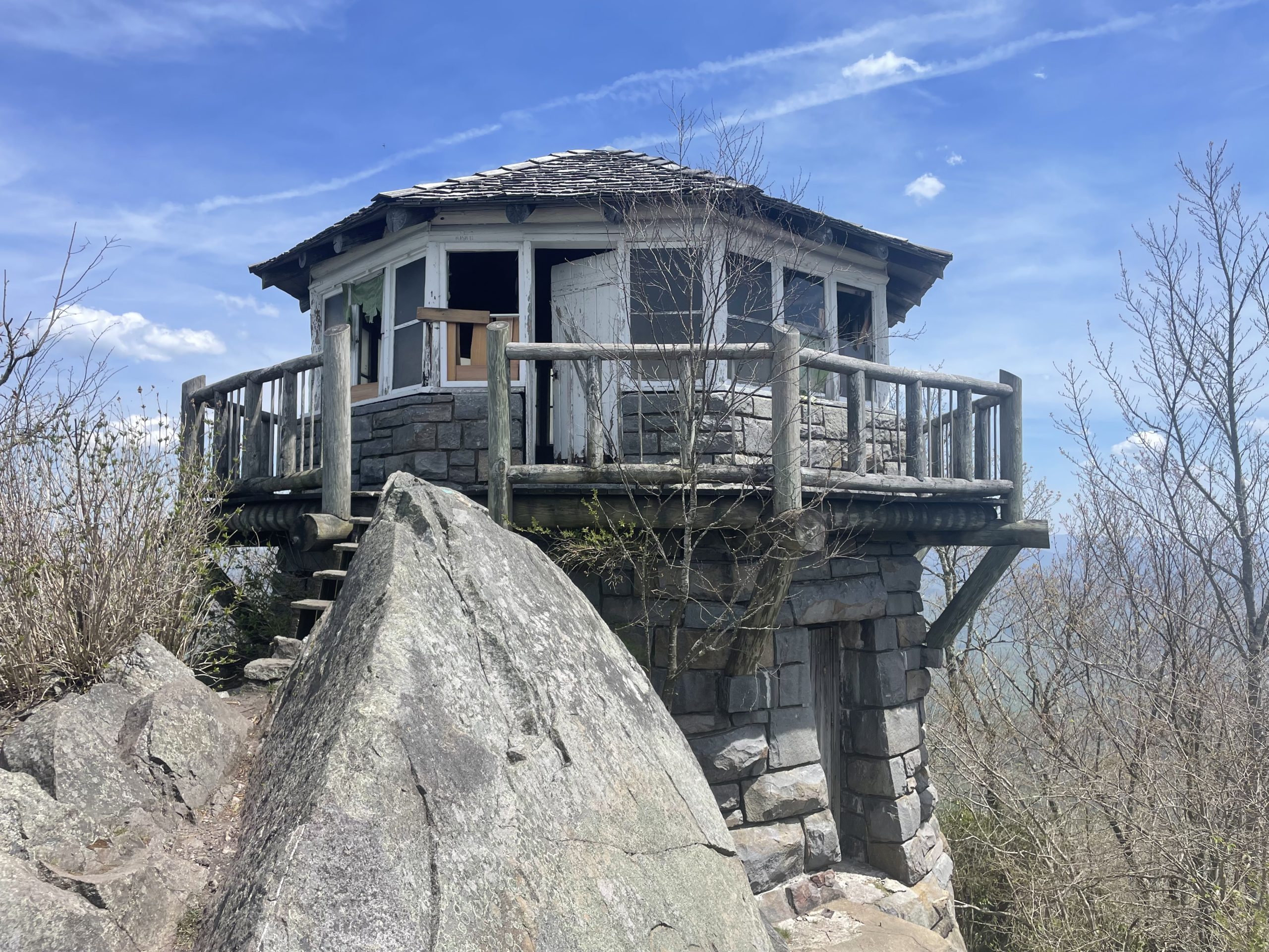
We kept a good pace up the first 2,000 feet of climbing. We took a side trail up to a fire tower and were rewarded with incredible views!

Fire tower!
Although we had only planned to go 12 miles, we pushed on another 3 because we all felt good on fresh legs and the weather was perfect. There was afternoon rain in the forecast for the next day so we wanted to make hay while the sun was shining.
In the park, we are only allowed to camp at shelters. Along most of the trail you’re allowed to set up camp wherever you want. Our group prefers solitude and more often than not we stay at stealth locations that aren’t mapped. This means for the next week we have to really watch our maps and leapfrog from shelter to shelter when deciding to push on for the day.
The views only got better the higher we got!
Day 19: 2,810 ft ascent, 9.1 miles
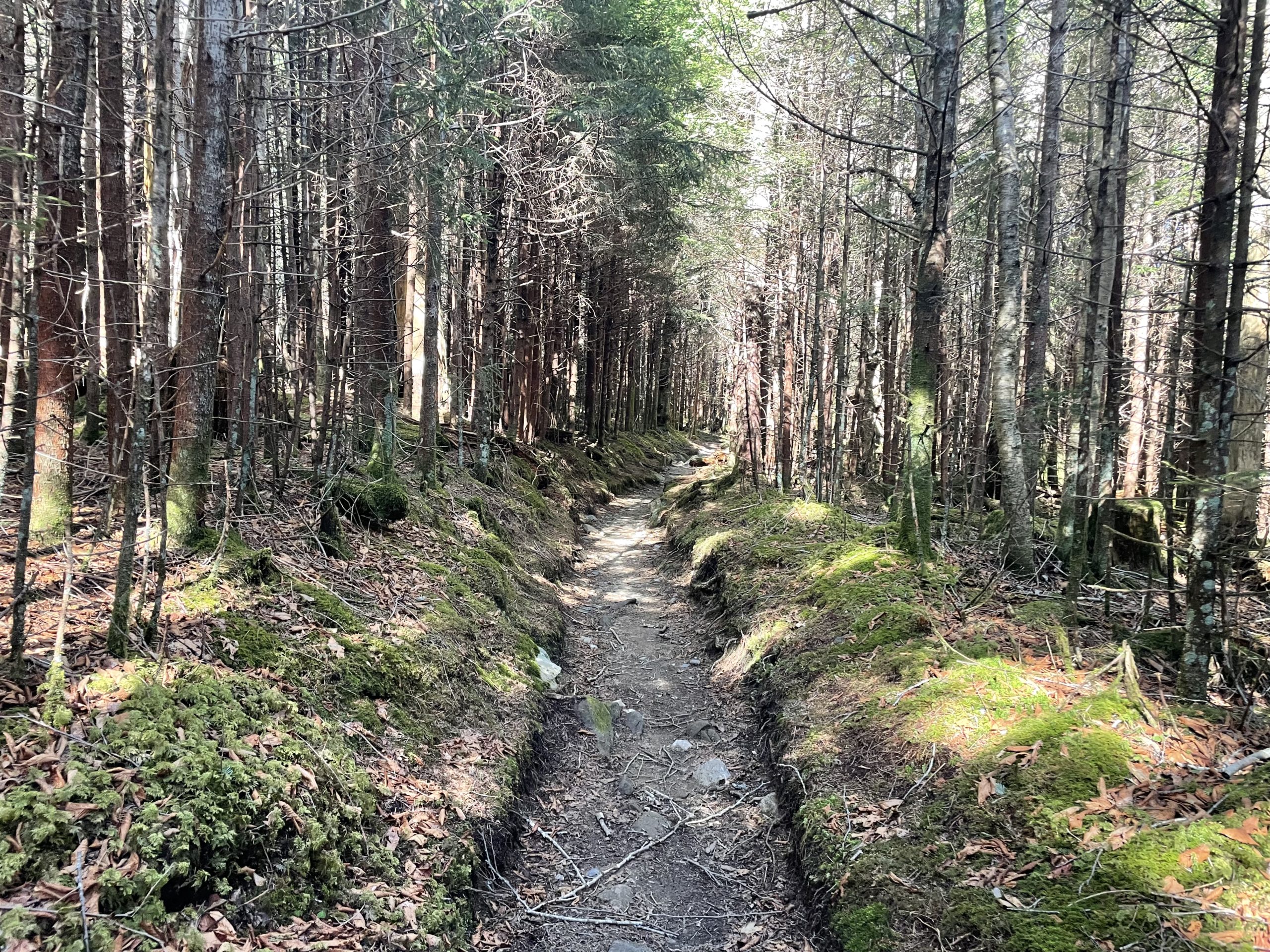
It was raining when our alarms went off. We had already planned to sleep in if that were ever the case when we get up. The rain let up after a few hours. We were able to pack up with only wet tents and head out of camp around 8:30.

Leaving camp
We had two options for the day: go 9 miles as we had tentatively scheduled or push on for 15. With rain forecast from noon to 4 we decided to make a push to get 9 miles as quickly as we could so we could hopefully minimize any hiking in the rain.

Hiking with our ‘packas’, our rain coats that cover our packs too!
It was a grind. Where the day before felt easy, every step today was hard. It was cloudy and we didn’t want to stop to rest. I wasn’t ready for the climbs and they got to me. I was done by the time we hit the shelter at 9 miles. We got set up, got our water, and started preparing our late lunch.
Soon it started raining. I was sitting dry and warm in my tent in my sleeping quilt. Although the day had been mentally tough, it was worth the grind to stay dry. We had a relaxing afternoon and evening recovering from the push of the day and mentally preparing for another big day tomorrow.
Day 20: 3,970 ft ascent, 13.3 miles
We woke up in tent city. Many people had moved in after we had set up. I counted 20 tents in the area, including our three. We knew we had a big day ahead of us up to Clingman’s Dome, which is the highest point in Tennessee, the highest point on the entire trail, and mile 200! We took off at 6:30am ready to go.

Tent city
We made it to the summit around 12:45 and marched right to the top of the observation tower with our packs on. The wind was whipping all around us and we quickly took pictures and headed down to the visitors center. My dad and Erik were low on food and wanted to see if there was anything available they could get as snacks before the next day. Erik got a chocolate bar that he split with me- a wonderful unexpected treat!

200 miles down
I remember making the climb from the visitors center to the observation tower in the past and having to stop multiple times because I was wheezing and had to catch my breath. This time I zoomed right on up the trail with my pack on even though we had already hiked 10 miles and climbed over 3,500 feet for the day!

Clingman’s Dome
We found a spot out of the wind for lunch. We hadn’t seen many hikers that day, but one passed us as we were eating. He cheerily walked up with a smile and then asked us if we wanted any magic mushrooms. We declined and he practically skipped away. All of us were in a little shock asking each other if that had really just happened.

You never know if the privy will be fancy like this. It could be little more than a hole in the ground and maybe a wall or two.
As we set up camp that night it was cold and kept getting colder. By the time I got into my sleeping quilt I was shivering and had all of my clothes on before the sun had even gone down! We had noticed when it gets cold before sunset we know we’re in for a cold night.

Day 21: 1,680 ft ascent, 7.9 miles
It was the coldest morning yet when we woke up. Nobody wanted to get out of our warm spots. We knew we had a short day to get our resupply. Erik’s mom was going to meet us with groceries we had already purchased at our last grocery stop. Our original plan was to get groceries and be on our way, but unfortunately we had to make other plans.
To protect our food from bears at night, we use a two-layer system: we have an Ursack outer layer and an opsak inner layer. Think of the Ursack like a really thick storage bag and the opsak is an odor-proof ziplock bag. We haven’t seen any bears to date with this system. We met someone on the trail only using the Ursack and a bear destroyed his food. The double layer seems important.
Erik ripped his opsak the day we entered the smokies. No big deal, he can put his food in mine. Next thing I know mine ends up ripped as he’s putting his food into it. Now two ripped opsaks. Mine wasn’t as bad, so we duct-taped it. While in the smokies we were required to hang our food from cables at the shelters anyways, but we knew we needed new ones soon for when we were back out of the park.
When we met Erik’s mom, we asked her to take us into Gaitlinburg so we could replace our opsaks and get some spares. After we struck out at a few places, we ended up at the REI in Pigeon Forge. Shout out to that store, they were extremely thru-hiker friendly!

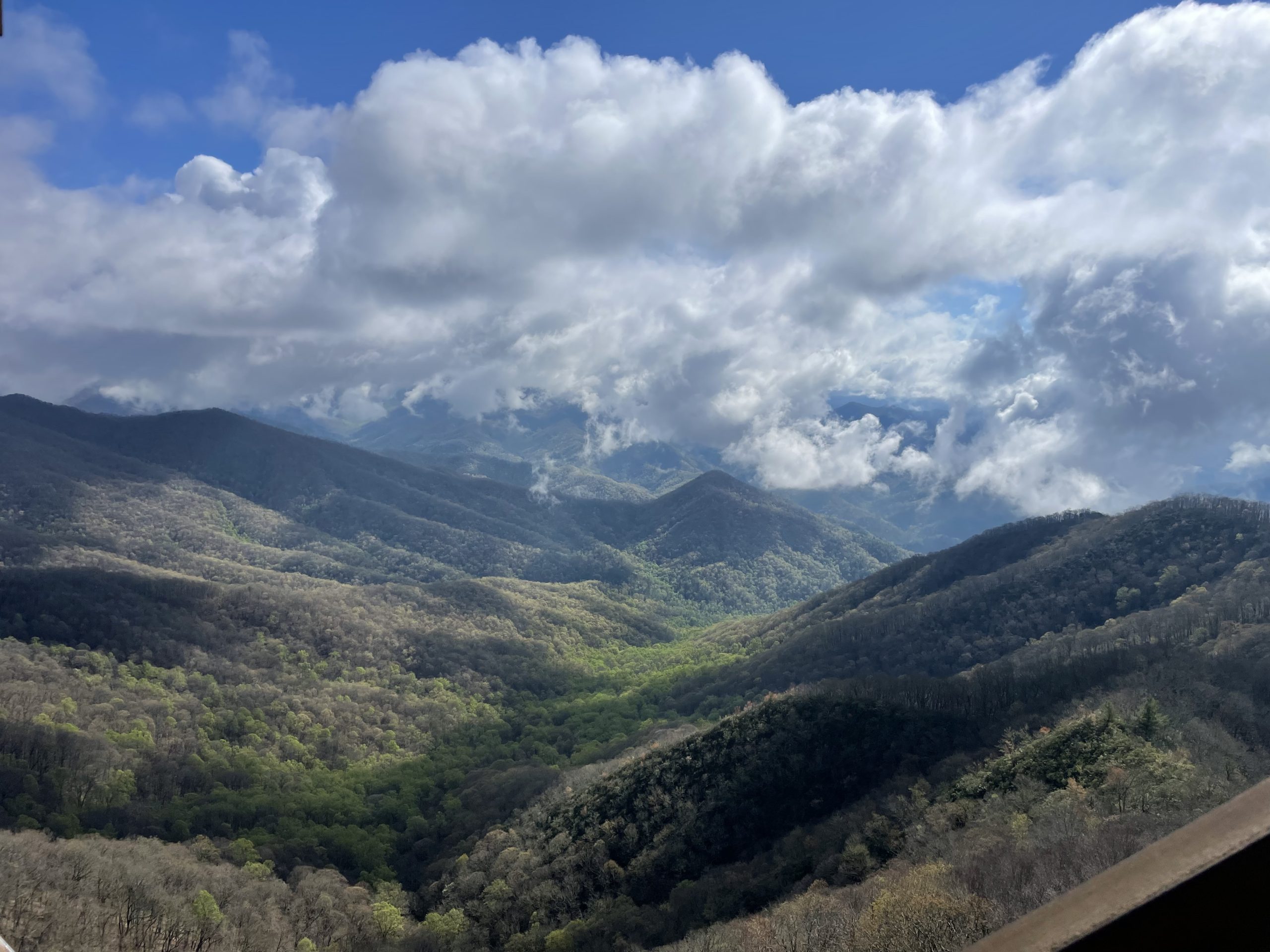
Clingman’s Dome view
We ate lunch and then headed back up to Clingman’s Dome. We loaded up our packs with our food and ate some cake while Erik’s mom walked to the summit. It wasn’t nearly as cold as it had been the day before, but felt just as windy.
After we said our goodbyes back at Newfound Gap, we hiked a little bit further to our next tent city for the evening. We will all be happy when we can find more private campsites away from the shelters again.
Our real estate for the evening.
Day 22: 3,330 ft ascent, 12.7 miles
Last summer my dad and I did a 16-mile hike in the Smokies. We went to Charlie’s Bunion and it was so crowded we didn’t stop to take in the view. This trip was different. This time we got there just after sunrise and had the entire area to ourselves for the 30 minutes we sat there eating breakfast. The weather was perfect and the views were spectacular. It was a special moment, one of my favorite on the trail so far.
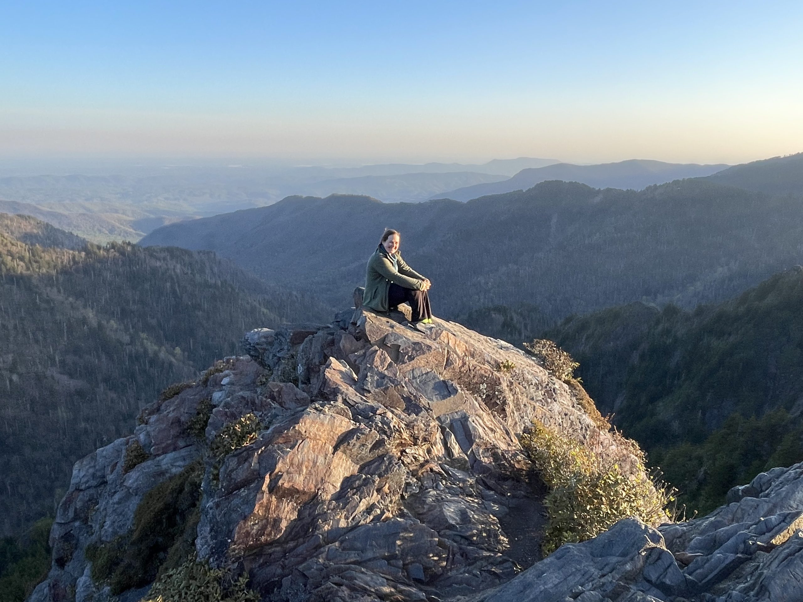
Charlie’s Bunion
We knew going into the day that water was going to be hard to come by, but I still got too little at the first water source. When we got to camp later that day I was so dehydrated I was struggling to swallow. It’s hard to balance water on the trail because it is so heavy. You want enough not to run out but as little weight added as possible. Today I lost that game.
Day 23: 2,130 ft ascent (6,618 ft decent), 17.2 miles
Last day in the Smokies! We saw there was some rain and cold weather coming in, so we made some plans for a few days off after the Smokies. To get there though we had to make a push downhill for our longest day yet!
Even though we had a long day planned, we still made time for the 1.2-mile round trip side trail to Mt. Cammerer Tower. It was worth the time, we were there on an incredible day and the tower was really neat! The tower is visible from interstate 40. I haven’t driven the interstate through there often, but I’m sure for the rest of my life I’ll be able to look up and find the tower on the hill as I drive through and remember how beautiful this day was.
As we neared our pickup point off the trail, a trail runner came up behind us. We had run into a few earlier that day who were running from Davenport Gap to Clingman’s Dome (wow!), so my dad asked this guy where he started. His answer: “Springer Mountain five days ago.” We were on day 23. He was on day 5. Gerrit Van Ommering is attempting to break the record for the fastest attempt to finish the trail. I looked him up later and figured out who he was. He was very unassuming on the trail and we wished him good luck as he ran off past us.
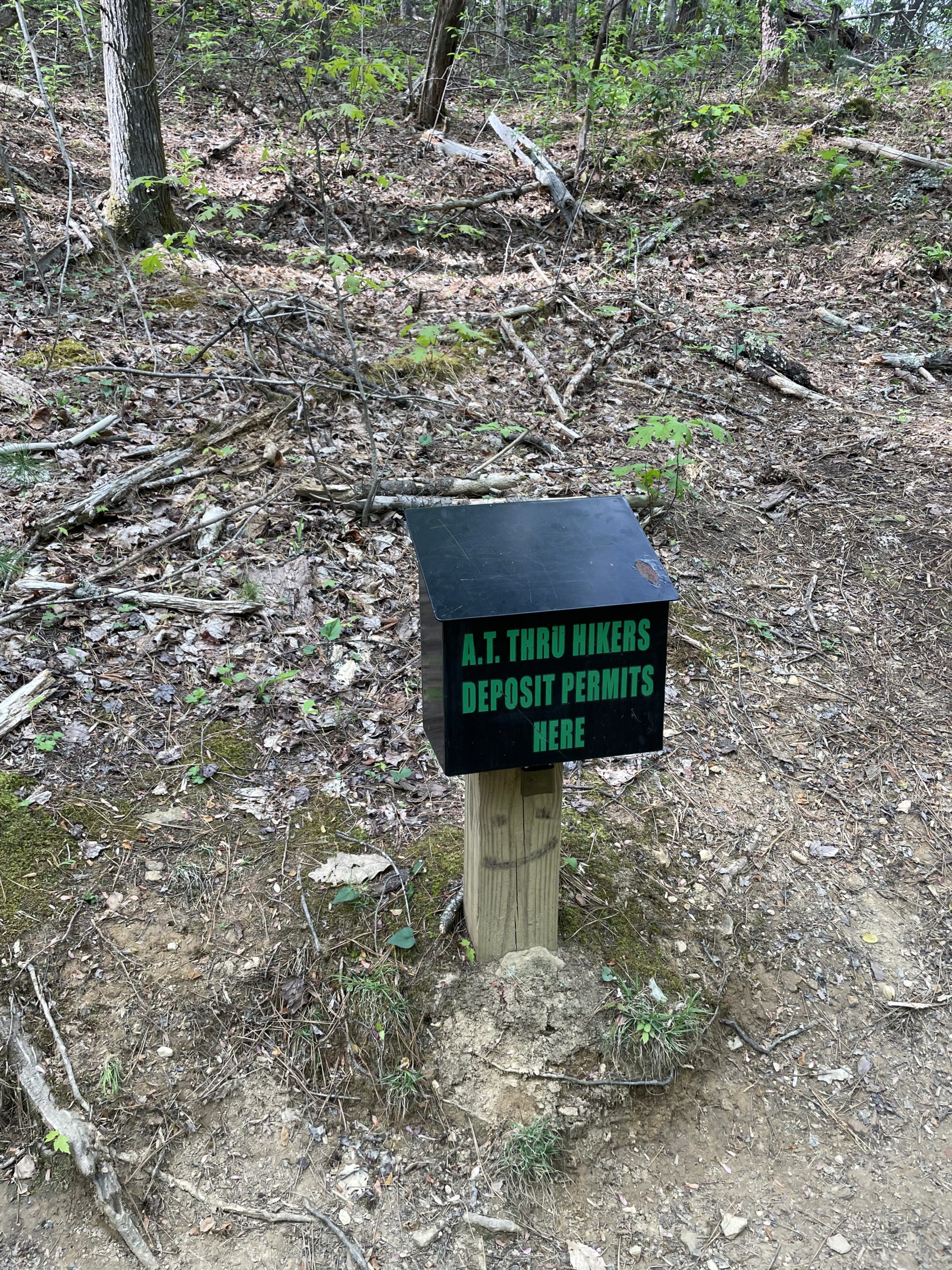
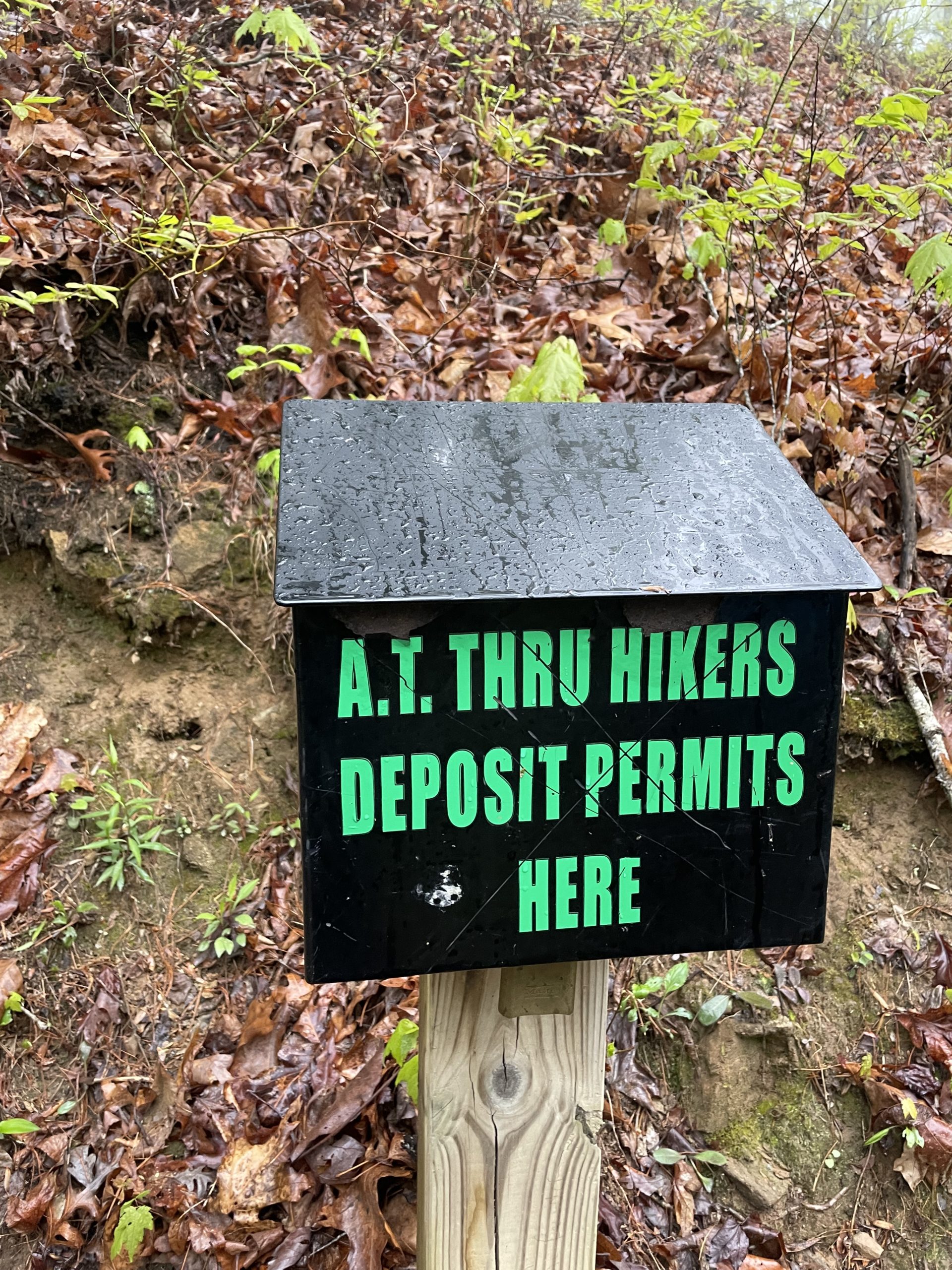
Permit box on the north side of the park signifying we made it through!
Thoughts on the Smokies
1. After finishing this segment, I think I figured out one of the big reasons people love it or hate it. The weather is more extreme than anywhere else we had been on the trail to date. We got lucky with very little rain during our stint and night temperatures only in the 20s (we think).
2. The terrain of the Smokies is unlike anything else we had seen. The moss-covered forest gave off a very different vibe.
3. The only bears we saw were from the backseat of a car on our town day. I’m not afraid of hiking in black bear country, but I’m also not upset to not have any encounters.
4. This section was my favorite so far for views. It felt like my legs are finally ready to take me up mountains (most days). I can spend more time enjoying the views instead of catching my breath.

This website contains affiliate links, which means The Trek may receive a percentage of any product or service you purchase using the links in the articles or advertisements. The buyer pays the same price as they would otherwise, and your purchase helps to support The Trek's ongoing goal to serve you quality backpacking advice and information. Thanks for your support!
To learn more, please visit the About This Site page.

Comments 2
It’s on my bucket list
Nice blog, intend to follow when I can. What I would like to see on blogs is a date the blog starts and stops (for that issue of blog, that is).
Date and such tells me what you are feeling when hiking and when sleep is in order.
thanks!