 ">
">
PCT Week 19: Autumn has arrived in Oregon
It’s getting wet and cold while we are hiking the section between Government Camp and Bend. Autumn finally arrived. It’s definitely more unpleasant to be outside now but outstanding views of Mount Jefferson, other volcanoes, and the endless black lava fields are a great reward.
PCT Day 108: Reunited with Squiggles
Highway 26 (mile 2087.5) to Little Crater Lake (mile 2079.8)
12.7km (7.9mi) / 2:45h / elevation gain of 164m (538ft)
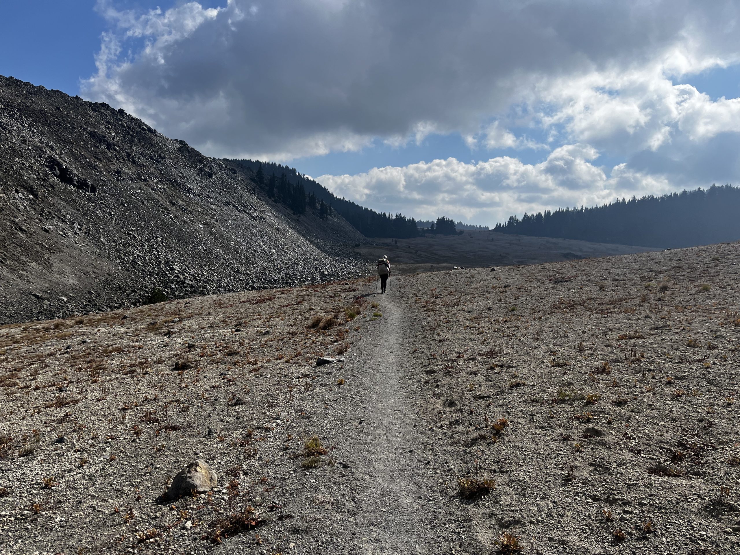
The night wasn’t as cold as expected, it was actually pleasant. We have a huge as maple donut for breakfast and to be outside of the sleeping bag is really cold.

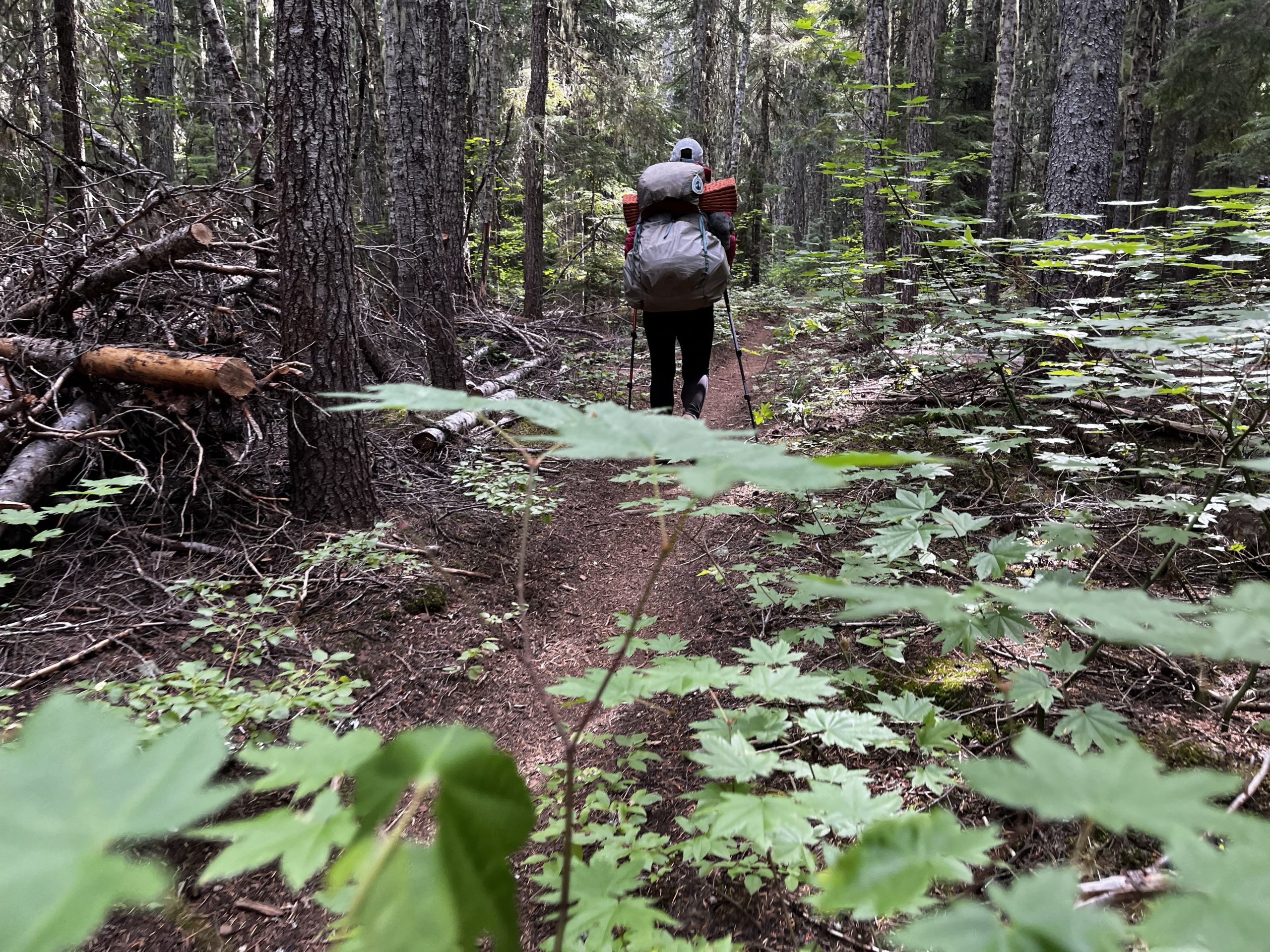
We wait for Squiggles to arrive in the afternoon, hanging out in the common room of the Ski Club, not too keen to go outside in the cold. I don’t feel very good today, so I’m not very mad about the break. As soon as Squiggles arrives we go for some sandwiches before we get an easy hitch back to the trailhead. The walk is easy as it’s mostly flat. In the beginning, we would have a nice view of Mount Hood but it’s hiding in the clouds. The rest of the way goes through the forest until we hit the junction to the short side trail to Little Crater Lake. It has unbelievably crystal clear water with a beautiful azure tint. That’s our campsite for tonight.

PCT Day 109: Cold and wet
Little Crater Lake (mile 2079.8) to mile 2055.6
39km (24.3mi) / 8:15h / elevation gain of 1,023m (3,356ft)
Today is a rather unspectacular day. There is fog in the trees in the morning and it’s cold. We get to Timothy Lake, where we can’t even see the other side of the lake because of the fog.

We are making a good pace today, as it’s really easy. The ascents are very gentle and almost not notable. The forest is very beautiful with all that moss that covers the trees.

The springs today are on short side trails and we take these opportunities for a break.
We meet the first other southbounder with his two dogs. As this was the Lionshead closure for a long time, people come back to hike the skipped section. Squiggles gets stung by a bee out of nowhere, super strange.
We decide to go further than planned. That’s a good feeling as we covered the distance we were once used to. It gives me hope in finishing as much as we can of the trail before we have to call it because of winter.

It starts raining in the end, I don’t want to stop to put on my rain jacket. But actually, the bigger problem is my leggings that get wet from the grass and the bushes that grow over the trail. I hate getting wet and I hate to pitch the tent in the rain. I easily become frustrated when it takes longer because I just want to get inside where it’s dry and warm. It keeps raining and I’m cooking in the vestibule of the tent, which causes lots of condensation. It’s dripping from the walls and I have to wipe it off.
Also, my left foot started to bother me again. It was very good the last days from Cascade Locks but then it started hurting again.
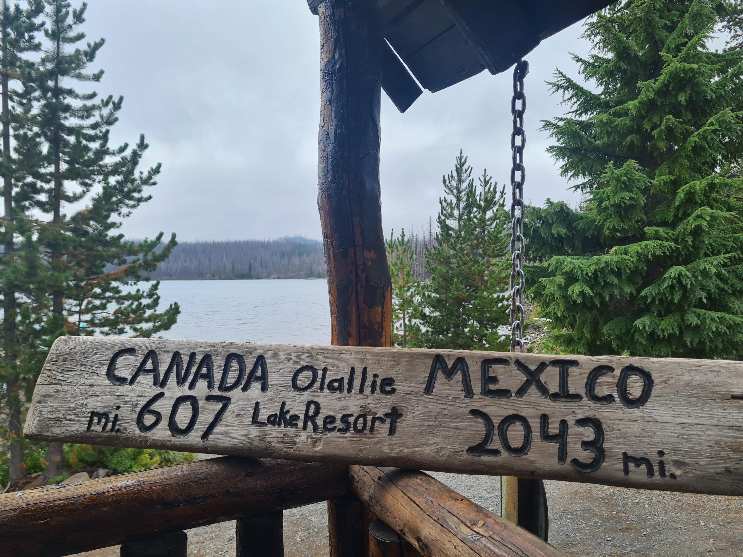
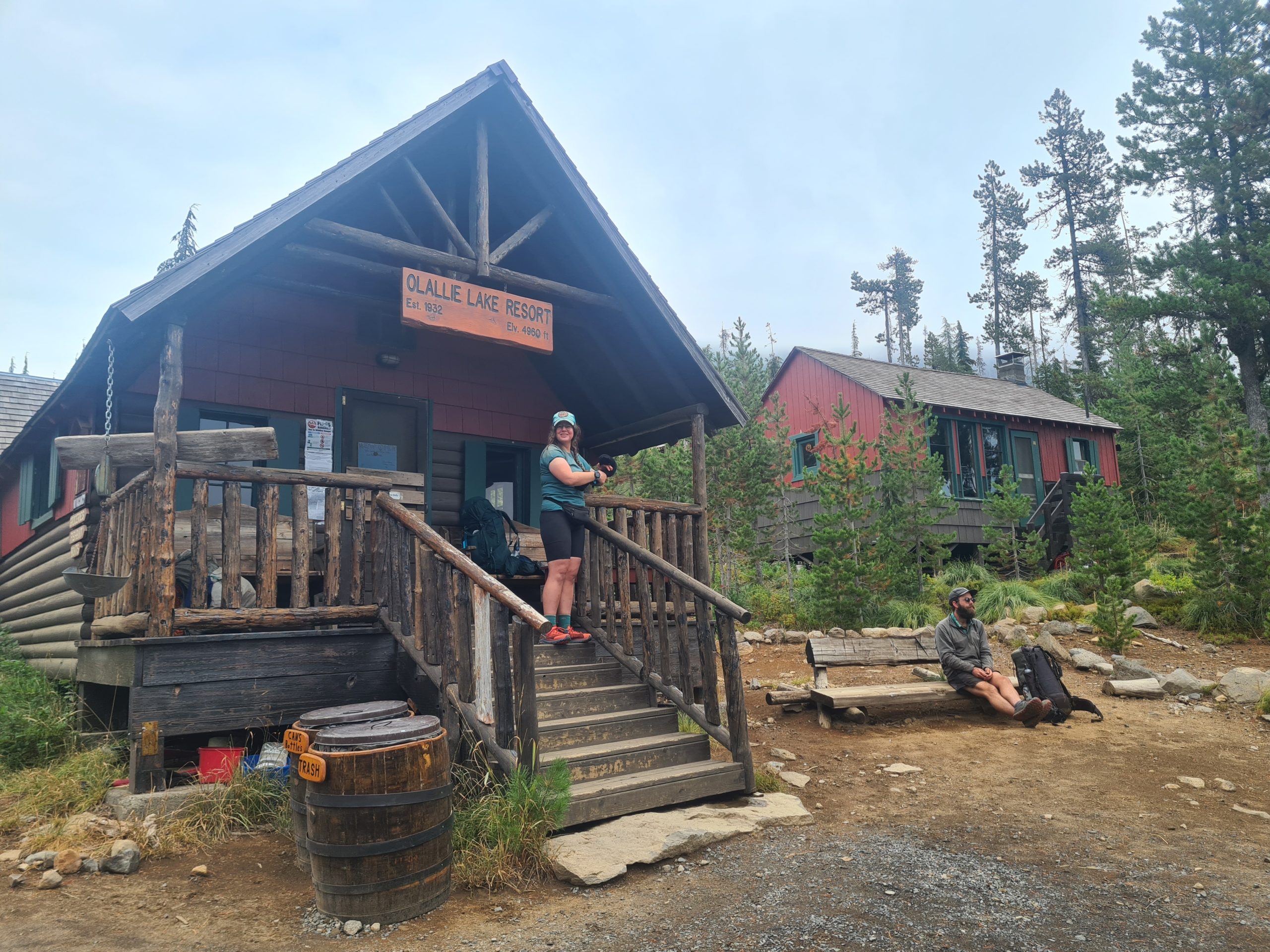
PCT Day 110: Resupply at Olallie Lake
mile 2055.6 to mile 2037.5
29.6km (18.5mi) / 6:45h / elevation gain of 980m (3,215ft)
It’s cold and wet in the morning. Squiggles even wakes up in a puddle and everything in her tent got wet. She doesn’t have it easy since she’s back out here. We go by Jude Lake and reach the burn section where we will be in for a while.

For lunch, we make it to Olallie Lake Resort, where we resupply for the next 4 days. It’s a surprisingly good resupply for such a small store in the middle of nowhere and prices are not too crazy. There is even hot tea which comes at the right time. There are some short moments of sunshine where it’s nice but apart from this, it’s just cold. But the lady at the store tells us that it’s gonna be nice from tomorrow on. I’m looking forward to that.
We put our stuff everywhere to dry it a little bit. Fortunately, my stuff didn’t get very wet but Squiggles woke up in a puddle in her tent in the middle of the night. Not very pleasant. For lunch, we make some chili cans from the store, just because it’s something different from the usual pasta-ramen-mashed-potatoes. There is supposed to be a nice view of Mount Jefferson behind the lake, but not today. We can only admire the view on a postcard.
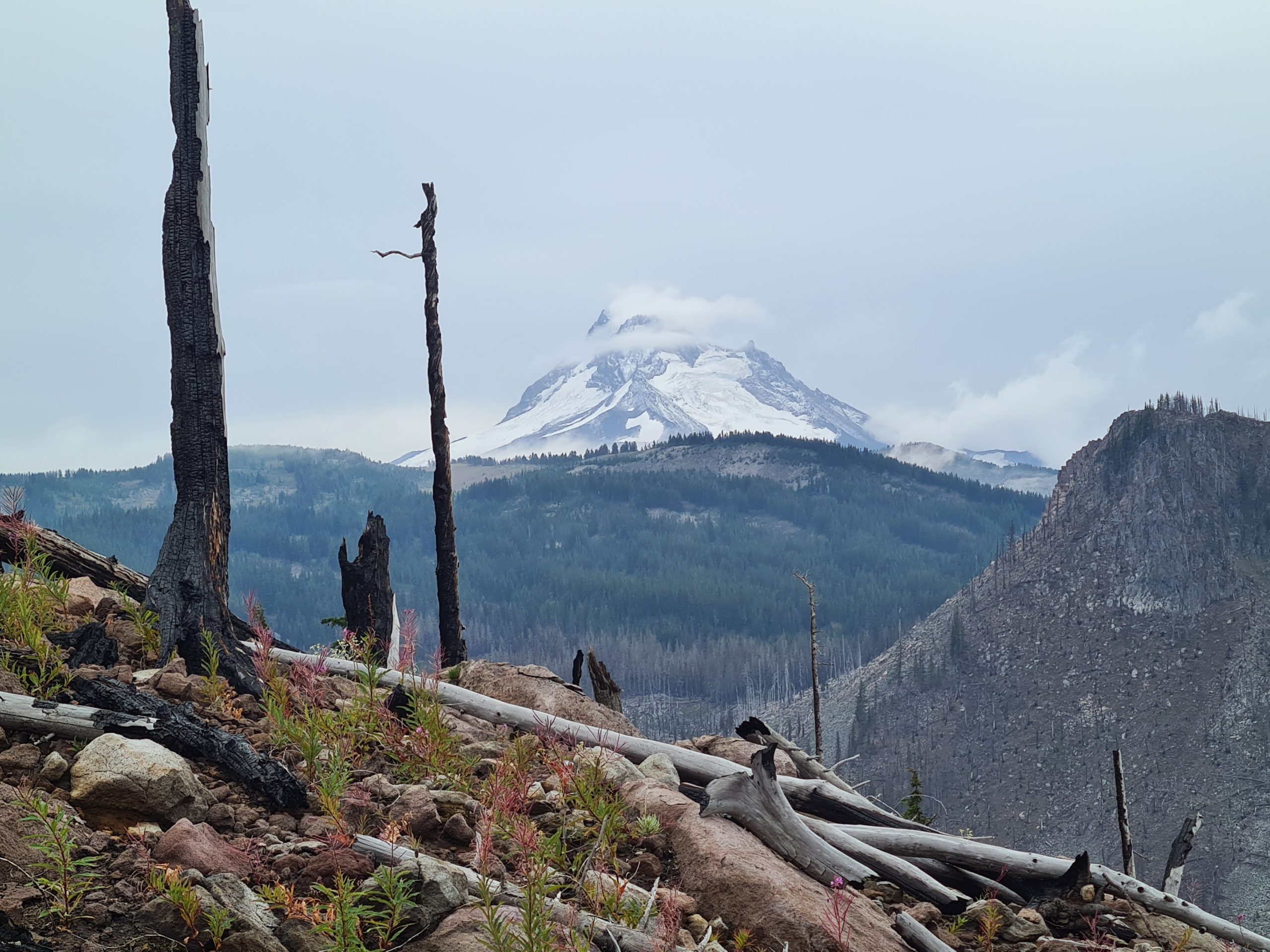
We stay for quite a while so it’s clear that we will not make a lot of miles for the rest of the day. We continue through the burn area and stop by a lake for some water. Then the sky begins to clear a little bit and we can see Mount Jefferson in the distance with tons of ice at its slopes.
After a last climb, we reach the campsite, not far from the top. There is a little pond to get water from. The sky shows bluer and bluer now and we have a nice view from the cliffs where we pitch our tents. But tonight is supposed to be very cold, just 1°C / 34° F. We are also quite high up at 1,954m (6,412 ft).

PCT Day 111: Mount Jefferson
mile 2037.5 to mile 2019.1
30.4km (19mi) / 7:15h / elevation gain of 964m (3,162ft)
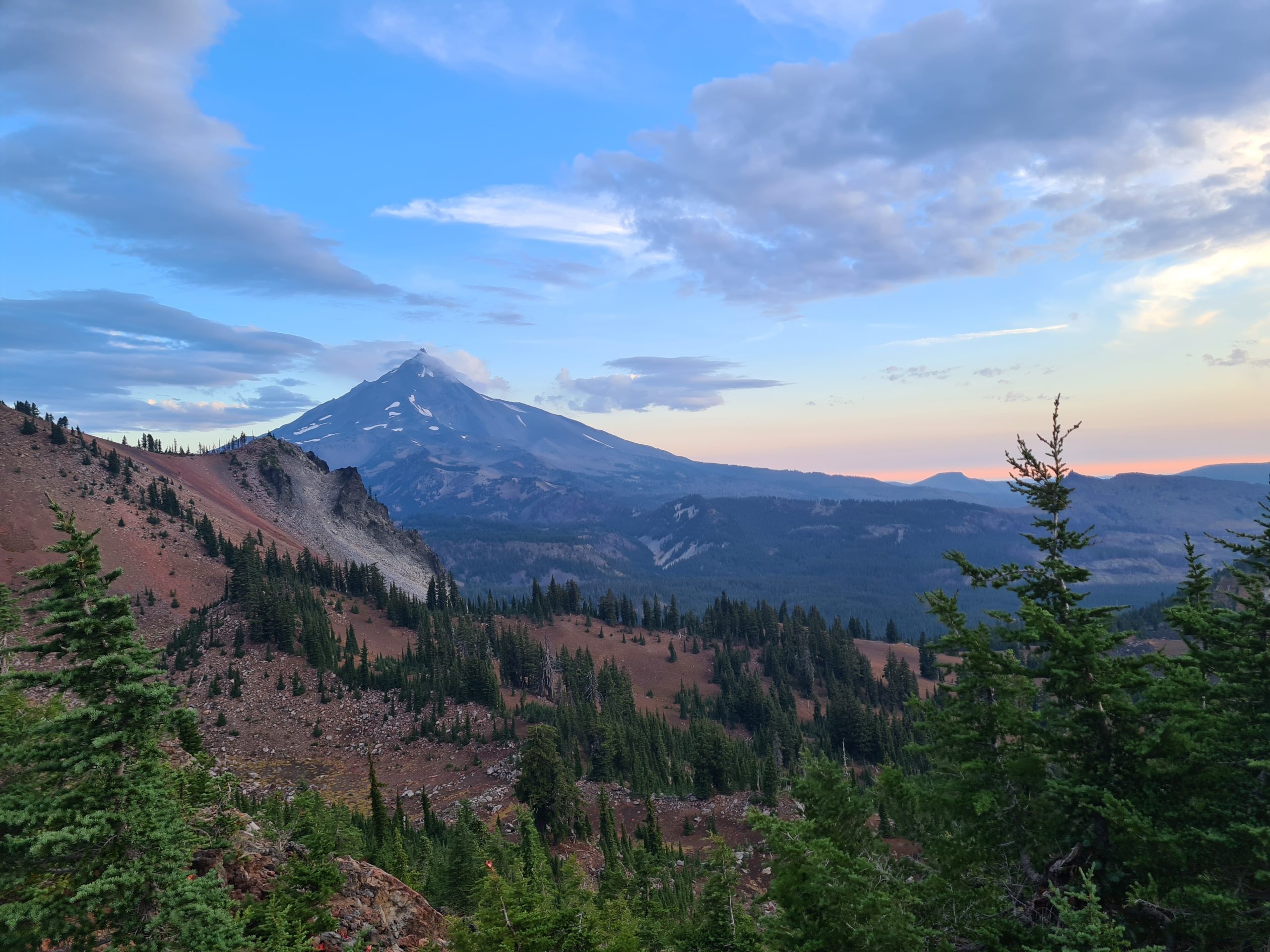
The night really was cold but the morning greets us with clear skies. It looks like it’s gonna be a perfect day. As soon as the sun is up it’s already much warmer than the last couple of days. I can finally hike in shorts and without my fleece again. We start the hike with a steeper-than-usual ascent to the highest point where we have a great view of Mount Jefferson and some shimmering lakes beneath us. We have to sit down to admire this for a while.

The trail leads us mostly downhill for many miles, passing some streams. We do a lunch break by Milk Creek. It’s hard to believe but the sun here is so strong that it’s almost too hot. Crazy what a difference the sun makes.

We tackle the last climb for today where we have some nice views of Mount Jefferson again, this time from the other side, and our tentsite on a cliff has one too.
PCT Day 112: Trail Magic
mile 2019.1 to Big Lake Youth Camp (off mile 1997.1)
36.8km (23mi) / 8:15h / elevation gain of 688m (2,257ft)
After midnight the wind suddenly picked up and after 3am it got so windy that the tent is shaking and flapping. In the night I have to get out to tighten the tent guy lines. It’s unbelievably loud but with earplugs, I’m able to catch some sleep. The good thing is that we get out of camp fairly early today.

I start hiking fast to get out of the cold wind. The trail goes gently up and down and on the left side of the mountain, it’s so windy that it pushes me off the trail, luckily to the mountainside. We reach Rockpile Lake where we get some water. It’s nice without the wind down here. That’s actually the place where we wanted to camp last night but didn’t make it that far. This would have been much nicer. But at least the view was great. The trail goes through a burn section where we get the next water at a pond.

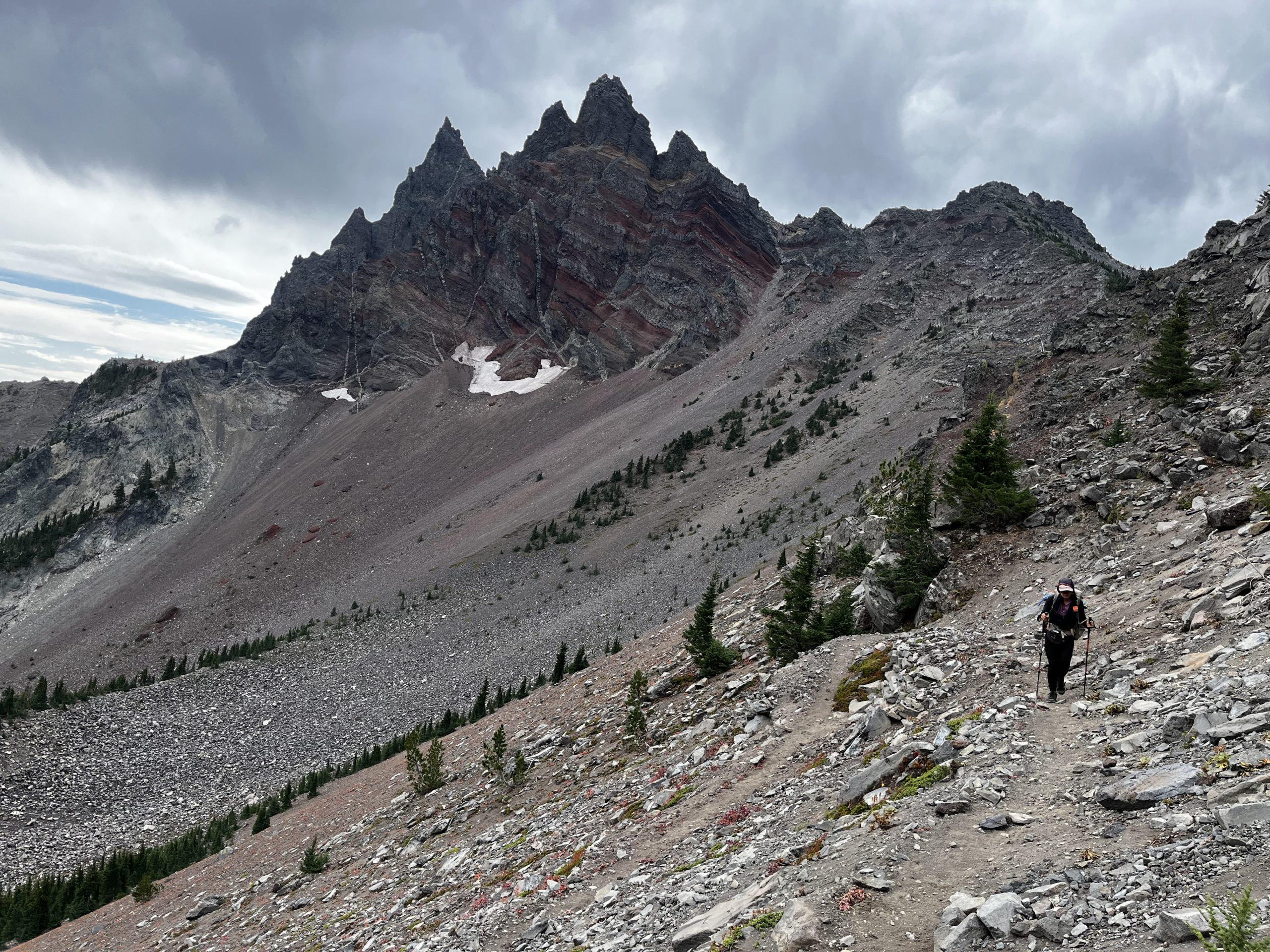
Then the trail climbs up in switchbacks to a rugged mountain called Three Fingered Jack which we started seeing in the distance yesterday and now we are here. It’s very windy again. We reach a little pass and head over to the other side where we have a lunch break. We can’t do it very long as it’s getting cold. This is the second time now that I pull out my sleeping bag at lunch and the first one was just a couple of days ago. Hard to believe that we were hot at lunch yesterday and could walk in shorts again. I’m wondering if that was the last time I went in shorts.
Shortly after lunch, we see a large group of mountain goats at the side of the mountain. They look so much different from the ones in the Alps. Much taller, bulkier with white fur and big square heads. Now it’s all downhill through another burn section until we hit the road. Here, Squiggles gets off. She had foot pain and didn’t feel that well in general so she calls it quits here. A trail angel called Nibbles picks her up here and gives us some trail magic. Ice cream and sodas. It’s actually too cold for ice cream but how are you gonna say no to that? Oh, and we meet Gandalf, an older guy with a white beard, who just finished Oregon and celebrating it by smoking some weed. He’s such a character.

Nibbles tells us that the weather will get warmer again soon and that we might have like two weeks of Indian summer left when we should make it to Crater Lake where the highest elevations are done. It’s just 200km from here excluding the 50-mile fire closure ahead, so it’s very doable. That gives me hope that we can finish Oregon. The border is still closed, so it looks like we continue through Oregon and reconnect where we left off, making it at least a continuous line.
It got freezing while we were sitting there so Nibbles lets us warm up a bit in his car with full heating before we continue. From here we walk about an hour through the flat forest to the Big Lake Youth Camp. They have a hut for PCT hikers there where they have laundry, showers, a kitchen, and a big common room. It’s nice and warm in here. You are not allowed to sleep in here and have to find a camping spot off their property.
We go out and find near the lake and then go back to the hut to take a shower and cook dinner that we make from stuff out of a hiker box. There are quite a lot of resupply boxes still here at the end of the season. I guess a lot of people just never picked theirs up. Such a pity, to see all the boxes with the good stuff in them that nobody will make use of. It’s much warmer down here and no wind, too. It should be a pleasant night.
PCT Day 113: Through the Lava fields
Big Lake Youth Camp (off mile 1997.1) to mile 1974.8
34km (21.2mi) / 8:50h / elevation gain of 1,307m (4,288ft)
It starts raining in the morning and announces how the rest of the day will be. We make a quick stop by the hiker hut at the Youth Camp and it’s already late when we start the trail. There is a long water carry today but as it’s cold we don’t need that much water. This is the nice part of hiking in cooler temperatures. We are hiking through the burn section into a giant lava field. We are hiking around rocky Mount Washington and some other volcanic peaks. On the horizon are the icy slopes of the Sisters.

The walk through the lava is slow but the landscape is otherworldly beautiful. Then we go into a little forest and it’s strange to see the green trees next to the barren landscape of black lava rocks. The contrast of colors today is also amazing. There is the green of the trees, the black of the lava, the bright red of changing leaves, and the yellow of the changing ferns. It’s raining on us a few times but it’s not raining cats and dogs. Mostly it’s more of a drizzle with some short heavier showers in between. On our lunch break there even is a little bit of sun. I’m making a warm meal for lunch for the first time and that feels so good.


Shortly before the road, there is a little water cache where I fill up a bit. We hit the road and more lava fields. There is so much lava as far as our eyes can see. The next climb leads us up to a lake which is the first water source in 15 miles. We take a short break under the cover of a tree as it’s raining again. We try to make it as far as we can today, so we don’t have too much left to get into town tomorrow.

The next climb leads through more lava and on a clear day this would be very beautiful. But it’s stunning anyway, maybe just not that much in the pictures. Then we can suddenly see a red blurry sun going down behind the clouds, with some long white clouds in the valley around the mountains. What an awesome moment. Who thought that we were gonna have a sunset today? We are going down through that jagged basalt canyon in switchbacks.

We reach the campsite just as it gets dark. It didn’t really look like you could camp somewhere here as it’s all just lava but a little bit further there is a forest where we find a nice covered place for tonight. It’s the darkest night, it’s pitch black and totally silent except for some raindrops.
PCT Day 114: Summer is back
mile 1974.8 to fire closure (mile 1960.9) and down to Devil’s Lake Trailhead
28.4km (17.7mi) / 6:15h / elevation gain of 572m (1,876ft)
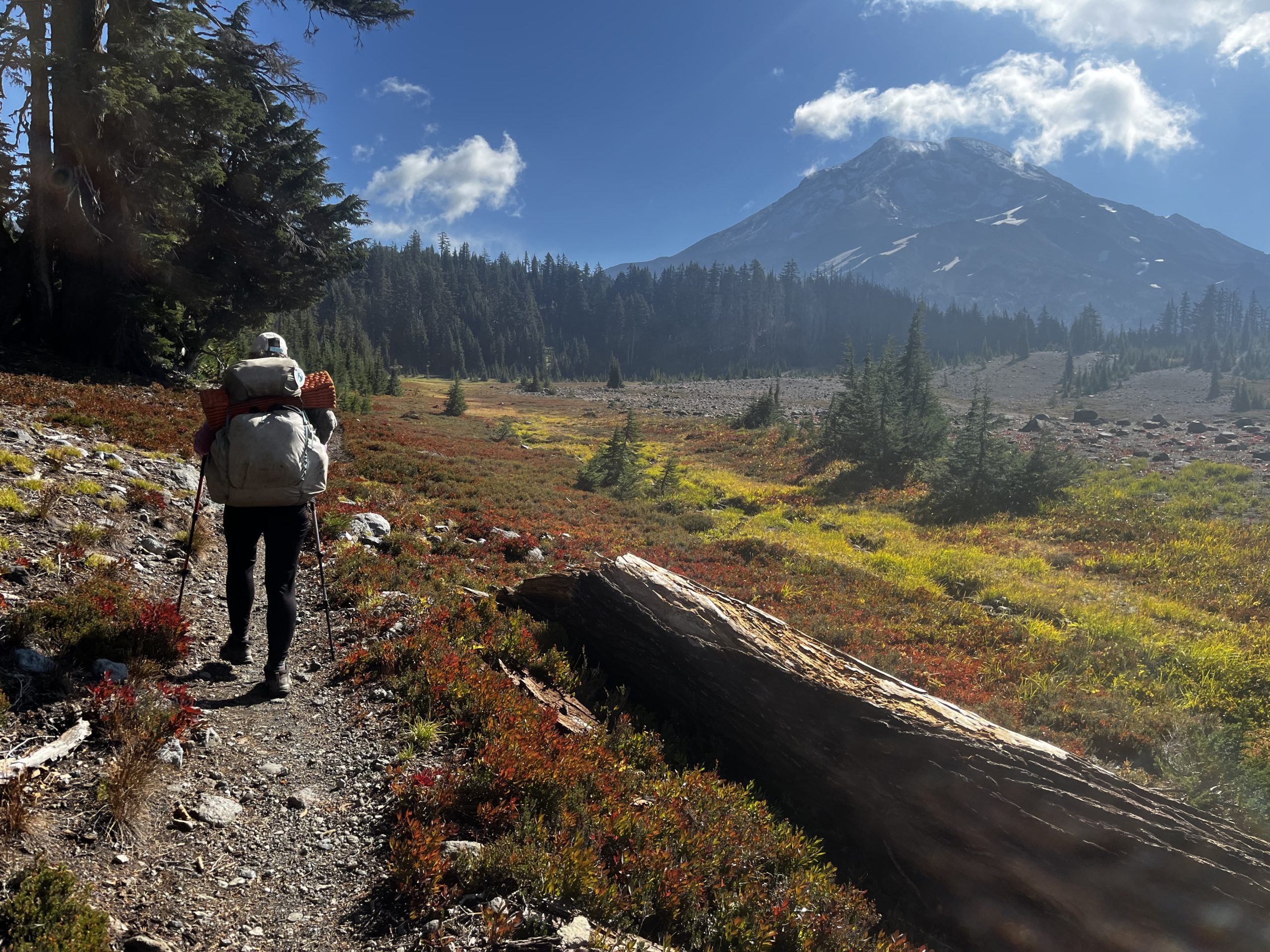
Today we finally have sunshine and significantly warmer weather ahead. We try to leave early, so we can reach the road to town early enough to get into town. We get some nice views of the three Sister peaks, one with fresh snow from last night.
The trail leads us to the Obsidian Limited Entry Area where a lot of Obsidian rocks are scattered around in the forest. These black shiny rocks are amazing and the highlight of this little area are the Obsidian Falls.

Once we get out of the forest we reach a little pond with a nice reflection of South Sister, the highest of the Three Sister peaks. From here the trail continues through an open plain with the mountains towering above.
We reach the closure of the Cedar Creek Fire and a side trail leads us down to Devil’s Lake Trailhead where we hit the road. It’s not very busy, but the third car stops and takes us to Bend where we will spend a zero day which is quite a big town with all the amenities you could think of.


This website contains affiliate links, which means The Trek may receive a percentage of any product or service you purchase using the links in the articles or advertisements. The buyer pays the same price as they would otherwise, and your purchase helps to support The Trek's ongoing goal to serve you quality backpacking advice and information. Thanks for your support!
To learn more, please visit the About This Site page.

Comments 1
Absolutely AMAZING photos, thank you so very much for sharing your adventure!! I’m a thru-hiker who’s laid up this year after some knee surgeries, so it’s really great to follow your blog.