 ">
">
Favorite Sections on the Appalachian Trail
Hello again! It’s time for our fourth and final installment of our series from the 2016 Thru-Hiker Poll Results. These are the sections thru-hikers voted as their favorites on the Appalachian Trail. In true thru-hiker fashion, many of the Most Difficult sections overlapped with these ones, and there were many more votes for favorite sections than Least Favorite. Moral of this story? Thru-hikers are a positive bunch who enjoy the gnarliest sections of the trail.
Starting with the best!
1) Roan Highlands, NC/TN Border

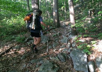
Image via.
Distance
Technically only 5 miles, but we stretched it to 10 miles, which gets you to Overmountain Shelter
Location and Mileage
NOBO: Around Ash Gap at 375 to Overmountain Shelter at 384.5
SOBO: Begin at Overmountain Shelter at 1805, end at Ash Gap at 1814.5.
What makes this section so great
Some of the most open hiking in the southern AT, beautiful rolling climbs.
More Info
For the southern part of the AT, this is what “above treeline” looks like. The rolling balds are majestic, and the views are sweeping. Sometimes called Roan Mountain, the Roan Highlands are actually a five-mile stretch of rolling, grassy hills. Don’t miss Overmountain Shelter, a giant classic red barn with amazing views of the surrounding mountains and balds.
Best Part
The epic views from Jane Bald, staying in Overmountain Shelter and enjoying the views from the porch.
2) Baxter State Park, Maine

Distance
From Baxter State Park to the summit of Katahdin is 14.6 miles. SOBOs have to ascend Katahdin and NOBOs have to descend for 5.2 off-trail miles, totaling 19.8.
Location and Mileage
NOBO: Baxter State Park boundary (mile 2175.2) to the summit of Mt. Katahdin (mile 2189.8)
SOBO: Summit of Katahdin (mile 0) to the Baxter State Park boundary (mile 14.6)
What makes this section so great
Baxter State Park is an easy jaunt and Katahdin is, well, Katahdin.
More Info
Baxter State Park is a lovely wooded trek past scenic ponds, culminating at Katahdin Stream Campground and the fabled hike up Katahdin. Whether NOBO or SOBO, this section flies by, so be sure to enjoy it. Be aware of the permit system in place for Baxter State Park this year, outlined here.
Best Part
Summiting Katahdin!
**Also listed as one of the hardest sections on the AT
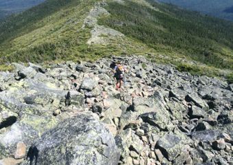
3) White Mountains, NH

Franconia Ridge on a particularly glorious day.
Distance
Just over 100 miles long
Location and Mileage
NOBO: Start of the Whites section is generally considered Mt. Moosilauke (mile 1792), ending at the town of Gorham (mile 1891).
SOBO: Begins after Gorham, NH (mile 298.3) and finishes at the far side of Moosilauke (mile 397.8).
What makes this section so great
Stunning views, intense climbs, the AMC Huts, epic majesty all around
More Info:
Deservingly so, the White Mountains are one of the most popular section of the AT. The terrain is incredible, the climbs are epic and they actually result in open summits! This section is very difficult but worth every quad-crushing ascent and knee-jarring descent. It’s easy to ignore the pain as you hit the alpine zone, which smells like a Christmas tree farm and looks like something from a fantasy world. As hikers crest treeline, they’re treated to expansive views in all directions. Watch out for the weather though- Mt. Washington is known for having quite literally the worst weather in the world (thanks to a perfect intersection of storm tracks) and the weather can turn brutal quickly throughout the entirety of the Presidential Traverse.
Best Part
Franconia Ridge is a majestic traverse that will make you feel like you’re on a pilgrimage to drop a ring off in a volcano. Summiting Mt. Washington is a rite of passage, just don’t get blown off the summit from insanely high winds.
**Also listed as one of the hardest sections on the AT
4) Southern Maine

More Mahoosuc Notch fun
Distance
Just over 100 miles long… exact end point can be a matter of opinion
Location and Mileage
NOBO: Begins at NH/Maine border at 1908, ends at north side of Little Bigelow Mountain at 2016.9
SOBO: Begins at Little Bigelow Mountain at 172.9, ends at NH/Maine border at 281.8
What makes this section so great
It’s extremely challenging, but you won’t be bored. Trails are rocky and rooty, Mahoosuc Notch is like a jungle gym, and the peaks are beautiful—especially towards the end of the region.
More Info
Southern Maine is one of the hardest parts of the AT, but since thru-hikers appreciate the tough stuff, this section is also epically fun to hike. Hikers can move an average of 1.5 miles per hour for an entire day depending on weather and trail conditions. The trail is full of rocks and roots, and you can go hours without taking a normal step. We included the Bigelow Range in our survey, which gets hikers out of the gnarly woods and up above treeline… probably a big part of why this section was one of the favorites.
Best Part
Mahoosuc Notch, the Bigelow Range
**Also listed as one of the hardest sections on the AT
5) 100-Mile Wilderness, Maine

Distance
100 miles
Location and Mileage
NOBO: Enter “The 100” after Monson, Maine at mile 2075.3. Reach Baxter State Park at mile 2175.2.
SOBO: Exit BSP at mile 14.6, and reach the other end of the 100-Mile Wilderness at Monson, mile 114.5
What makes this section so great
Peaceful wooded trails, amazing views of remote lakes, ponds for swimming.
More Info
The 100-Mile Wilderness is a popular section hike for scout groups and rather intense family outings. The 100 is like southern Maine’s sweet cousin—miles of serene, wooded trails with a fraction of the roots and rocks of the southern part of the state. The peaks are still gorgeous, though worlds easier than the White Mountains a few hundred miles ago. If you’re not passing ponds or cruising over sparkling streams, you’re breaking treeline and glimpsing Mt. Katahdin in the distance. This section is remote, but you’ll still pass dirt roads and parking areas leading to camps and vacation homes. SOBOs might hit The 100 at the peak of black fly season, which means they’ll probably like it slightly less.
Best Part
Cloud Pond is a bit off trail, but worth staying at NOBO 2,094. Catch Katahdin from Whitecap at mile 2,118, and again at Nesuntabunt at mile 2,153.
**Also listed as one of the easiest sections on the AT
6) Roanoke Region (McAfee Knob / Dragons Tooth, VA)

Distance
For our survey, this region is just about 30 miles.
Location and Mileage
NOBO: Starting on the lovely Brush Mountain at mile 690, and ending right past Tinker Cliffs at 718
SOBO: Tinker Cliffs begin at 1,472, and Brush Mountain is at mile 1,499.
What makes this section so great
Some of Virginia’s best features in less than 30 miles. Dragon’s Tooth, McAfee Knob, and Tinker Cliffs
More Info
Backpacking can be monotonous, but hikers will have some distractions through this section. First up is Dragon’s Tooth, 1/10th of a mile off the trail. Ditch your packs and climb up the knobby formation to get incredible views of the surrounding valleys. It’s a rocky trail area, so watch your step on the way out. McAfee Knob is one of the most photographed features on the entire trail; hit it at sunrise or sunset for an extra special photo. The bonus to this touristy area is a very well maintained trail leading to the outlook. You’ll know once you’re on it, because it does not in any way resemble the past 10 miles of your hike. On the way out of this section, the AT traverses along the edge of Tinker Cliffs, a beautiful flat section with incredible views looking over the valley and back towards McAfee Knob.
Best Part
Climbing Dragon’s Tooth, McAfee Knob photo op, and the view from Tinker Cliffs.
7) Vermont

I honestly cannot remember where in Vermont this is, so if someone recognizes it, please let me know!
Distance
150 miles
Location and Mileage
NOBO: Enter Vermont at 1,596 (southern end of the Long Trail), and cross out at 1,747
SOBO: Cross into Vermont at 443, and out at the southern end of the Long Trail at 593
What makes this section so great
Follows Long Trail for the first part, lots of new people to meet. Beautiful peaks and lush greenery.
More Info
Vermont is the first of the Final Three, and for NOBOs, it feels like the end is near. The first section is mostly through trees, and is reasonably mellow. The peaks in the northern part of this section are glorious. Most thru-hikers will be hitting them in mid-summer, which means peak greenery. For SOBOs, Vermont is their first “easy” state… at least compared to Maine and New Hampshire. Thru-hikers will be sharing shelters with Long Trail hikers, and meeting new people is always fun. Vermont is a common intersection point for NOBOs and SOBOS to meet each other, which means this section of trail is full of people and excitement.
Best Part
Stratton Mountain and the sweet old fire tower, Killington has a restaurant at the summit which is awesome.
Related

This website contains affiliate links, which means The Trek may receive a percentage of any product or service you purchase using the links in the articles or advertisements. The buyer pays the same price as they would otherwise, and your purchase helps to support The Trek's ongoing goal to serve you quality backpacking advice and information. Thanks for your support!
To learn more, please visit the About This Site page.

Comments 5
You can’t forget about The Homeplace in that VA stretch!
I love reading all about the AT . I would love to some day attempt it when I retire. Just deathly afraid of SNAKES?.
In Vermont that is mount tabor. Vermont is beautiful. Nice list!
I was very surprised the Mt Rogers area of Grayson Highland state park Virginia did not not make this list.
I am from Washington/Oregon and have hiked the PCT Mt Hood to Stevens Pass in Trip hikes as time has allowed over the years working my way north. Have now moved to the DC area. Any suggestions for adventurous ~100 mile hikes along the AT open beginning in April. Looking in the VA, MD, Southern PA area.
Thanks,
Phil