 ">
">
Massachusetts
Day 47 – Laurel Ridge Campsite to Great Barrington
The Berkshires conjures up images of summer camps, glacial lakes, and mountain air. Indeed, our first morning in the Berkshire mountains started out with cool, damp air, and it followed us all the way to Great Barrington. As we hiked along the ridge, we could plainly see our immediate surroundings. But everything else, including lookouts from lofty Mount Everett, was cloaked in a combination of fog and wildfire haze.

Making our way down the challenging north side of Mount Everett was a bit slow and treacherous. As we approached the road crossing at the bottom, a local hiker greeted us and invited us to his carful of trail magic. How lucky, because we were down to about a half a baggie of trail mix.

Meanwhile we knew that Trig was getting off the trail for good at mile 500, and learned from our trail magician that he had passed through about 45 minutes before us. We hoped to catch up with him to get a chance to say goodbye.
After snacking on bananas, muffins, and Gatorade, we set out on the last five miles of the day, which passed through forests and farms. We were warned that this section would be very buggy, but fortunately the cool air minimized that. Somewhere along the way we passed our 500th mile. But we never caught up with Trig.


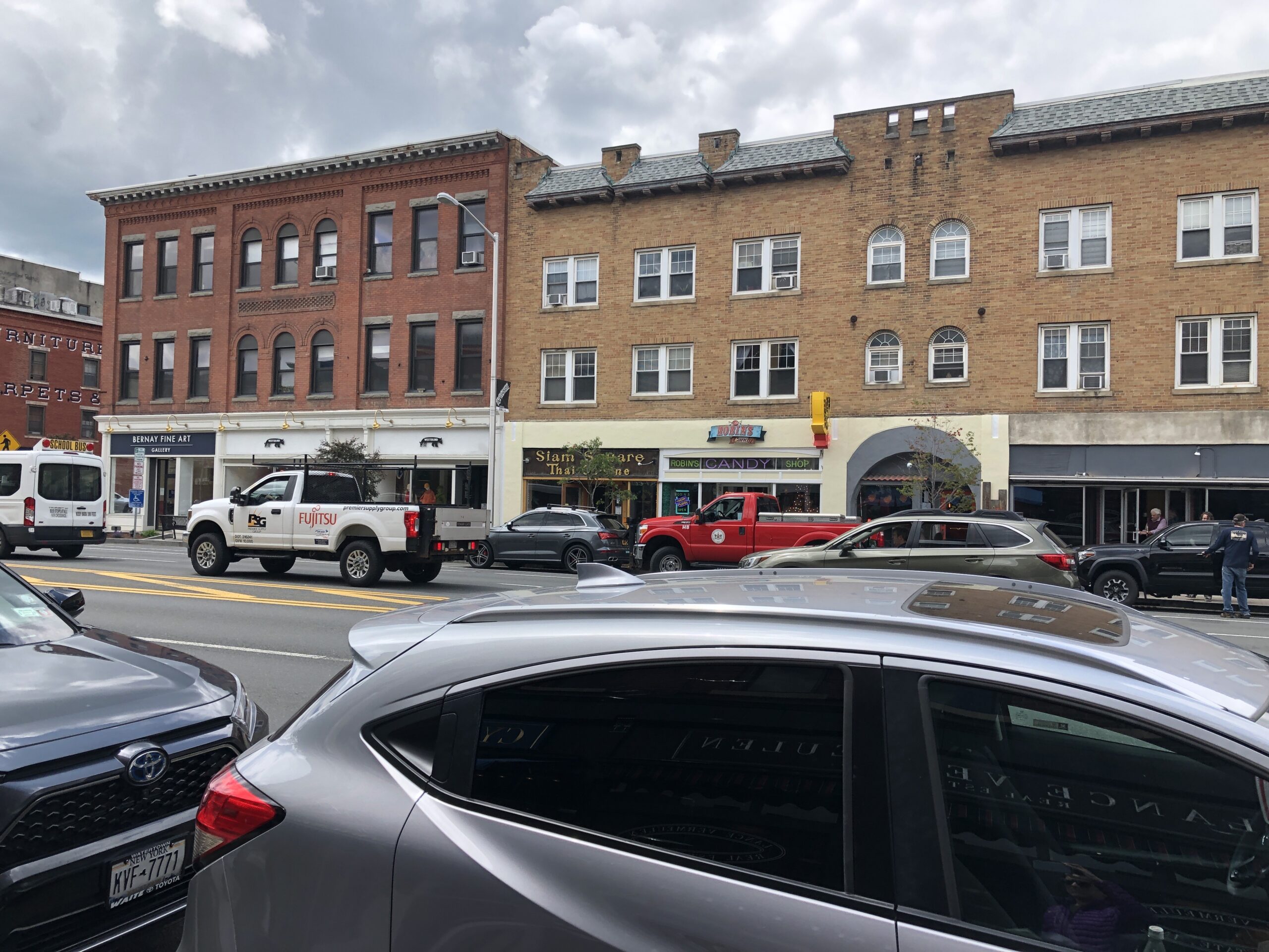
We arrived in Great Barrington with plenty of time to get cleaned up, do laundry, and walk around the downtown. It was a beautiful, vibrant place, with a resort-like feel that made it a pleasure to walk around.
Day 48 – Zero Day in Great Barrington

We enjoyed our time in Great Barrington, eating, shopping, and people watching. Then we had serious work to do. Planning the next leg of our trip, to Bennington, VT, took some effort. Since food weight can easily double our packs’ base weight, we’ve been trying to reduce the quantity we carry in favor of buying it along the way whenever possible. Once we mapped the next several days out with this in mind, we bought groceries and packed things up.
Day 49 – Great Barrington to Shaker Campsite
Today was a long day, both in terms of hours and miles. Ten hours and 18 miles all told. We would’ve stopped 4.5 miles sooner at a shelter, but according to the comments on Far Out, the shelter was buggy and did not have a good water source. And we didn’t want to invest the half mile walking down to the shelter to confirm or deny this report.
The best part about the long day was knowing we had only 10.5 miles to the AMC cabin on Upper Goose Pond tomorrow, meaning more time to swim, canoe, and enjoy the cabin amenities.
Day 50 – Shaker Campsite to Upper Goose Pond Cabin
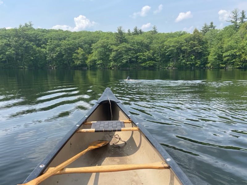
Upper Goose Pond was the perfect place to stay. After checking into the cabin, we stowed our things in the bunk room. I decided to check out the hiker box, and to my amazement found a pair of goggles. As the saying goes, “the trail provides”. I was skeptical that these no-name goggles would work, but headed for the pond with them in hand. Kevin quickly got in and out of the water. Then he paddled the canoe alongside me as I swam out to a tiny island and back. The water was a bit colder than I expected, but still felt great. And the goggles did not leak. These things made for a great day.


Later it occurred to me that today was the Sunday before Father’s Day, always the date of the annual Great Chesapeake Bay Bridge Swim. I have very fond memories of that swim, and while I didn’t swim 4.4 miles today, it wasn’t nothing.
Day 51 – Upper Goose Pond Cabin to The Cookie Lady
Not surprisingly, the cabin at Upper Goose Pond was popular with thru-hikers. After all, what’s not to like about a place to swim, canoe, socialize on a porch, and enjoy a free pancake breakfast? But this morning I learned there are two kinds of hikers: those who make their own breakfast in order to be on the trail before 7:00, and those who are happy to push their start time off in order to eat free pancakes at 7:30. Today we were squarely in the second category.

We arrived at the Cookie Lady’s place around 3:00. The establishment defies description, but I will try to outline how it works.

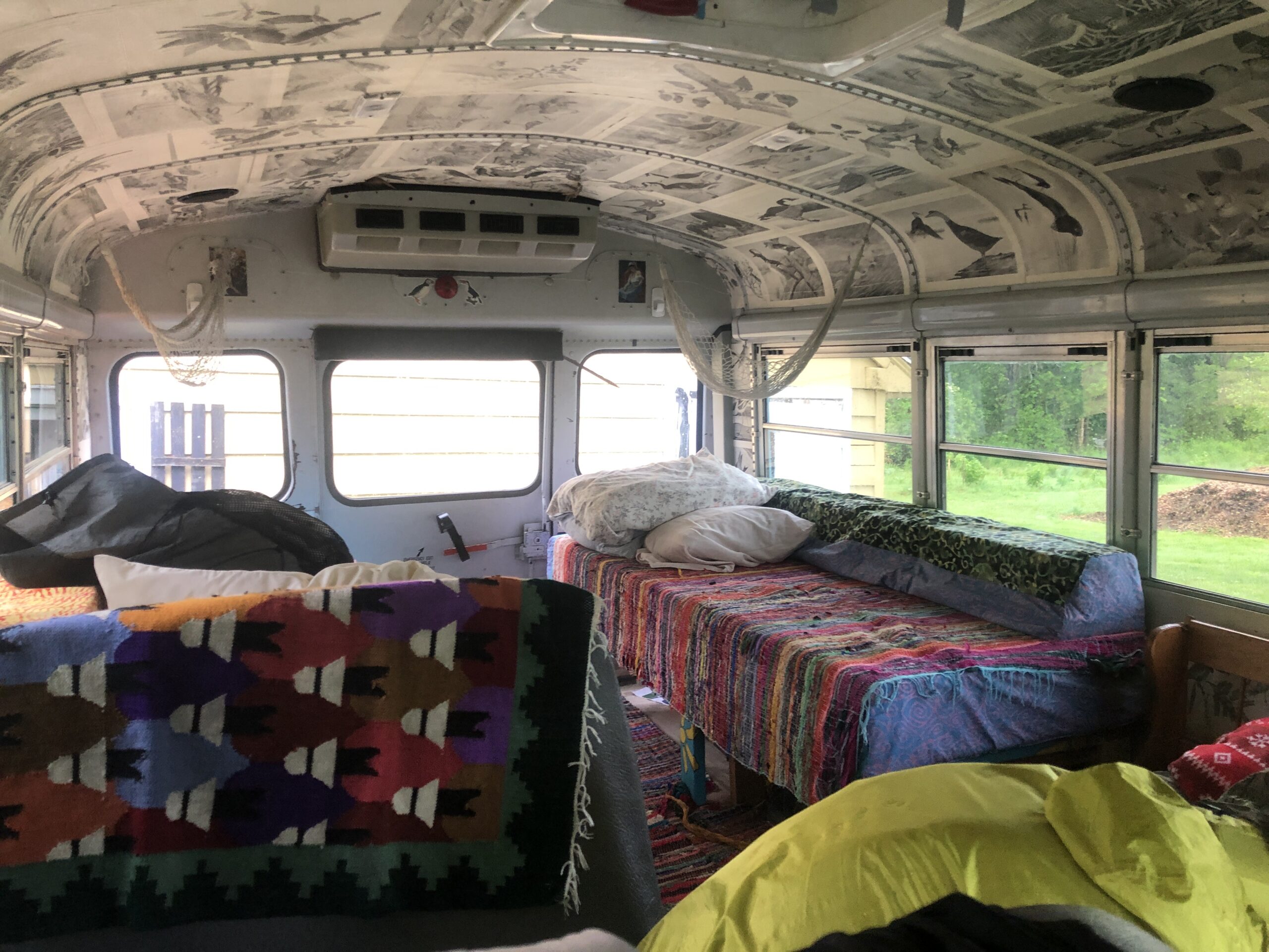
Imagine walking up to a 20-acre blueberry farm with a picnic table out front, and on it sits a box full of homemade chocolate chip cookies. Then picture someone comes out to greet you with a cold glass of lemonade. After chatting a bit you’re offered a space to tent in the yard or, since it’s going to rain that night, the use of a converted school bus camper for two.

Additionally, you may charge your devices and use the water spigot. Now imagine being offered dinner in exchange for pulling weeds that grow up inside the middle of the blueberry bushes. You agree to the task, get some brief instructions, and clear weeds for about an hour. Then, after a quick dip in a nearby lake, followed by a clean up, you sit down to ham and cheese crepes with homemade salsa, chips, and more cookies.

Then you chat on the porch with the owners until you realize you need to get ready for bed.

Accommodations like this are not uncommon along the AT, and are usually donation based. They are a big part of what makes this hike more than just a hike, but an opportunity to connect with people in a way that is outside the norm of conventional interactions.
Day 52 – The Cookie Lady to Crystal Mountain Campsite
Staying in the converted bus allowed us to dodge yet another night of rain. It was a spacious and glassy old school bus which felt more like a little cabin, complete with homemade wallpaper depicting birds across the entire ceiling.
But not everything was going so smartly. We did a very stupid thing yesterday. We lost our CNOC water collecting bag. I surmised that we left it hanging from a tree where we last filtered water, about 3.5 miles back. When I asked other hikers who later showed up at the Cookie Lady’s, each one said “yeah, I saw that hanging there”. But no one picked it up and carried it forward. I attempted to arrange for a hiker one day behind me to pick it up and meet us somewhere, but the logistics weren’t easy. Then, as we were leaving Cookie Lady’s place this morning, a hiker named Kilroy strolled in. He looked around and asked me where the cookies were. I showed him, then inquired “where did you sleep last night?” He responded, “at the previous shelter.” I felt obliged to ask if he’d seen a CNOC bag hanging from a tree near the stream. He nodded, chuckled, and said “I’ve got it right here. And I’m thinking of changing my trail name to ‘Lost and Found’ because this is the fourth item I’ve reunited with its owner.” I was overwhelmed with relief and gratitude. Kilroy ate his cookie and hiked on.
Day 53 – Crystal Mountain Campsite to Bascom Lodge, Mount Greylock
The day started out early, with a mid-morning break in the Berkshire village of Cheshire. Here we got a light resupply at the Dollar General and Kevin ate a second breakfast at the Dunkin’ Donuts.

We left Cheshire and set out for our last and highest spot in Massachusetts, Mount Greylock. Our goal was to arrive at Bascom lodge before the heavy rain forecast for the afternoon. We made the eight-mile, 2,500 foot climb up to the summit in four hours, with little time for rest, while thunder rumbled off and on. Fortunately, we walked through the big door and into the historic Bascom Lodge just before the rain and hail burst from the sky. Nothing but the lodge, the adjacent Veterans War Memorial Tower, and miles of dense white sky could be seen from the summit.


Many a cold and soggy hiker emerged into the lodge as the afternoon carried on. Before long though, most everyone was clean, fed, and sitting around a big fireplace. Only a few waited for the rain to diminish before heading back out, down the north slope, and on to the next shelter.

Day 54 – Bascom Lodge to Old Seth Warner Shelter, VT
Bascom Lodge served breakfast at 8:00, delaying our start, but also giving the weather a chance to clear up. Out into the mist we headed, stepping down, down, down through a rocky trail that flowed with water. The sky cleared up as we reached the bottom. Then we walked through the little town of Greylock on the Hoosic River.


After crossing the river, we ascended another hill and entered Vermont.

This website contains affiliate links, which means The Trek may receive a percentage of any product or service you purchase using the links in the articles or advertisements. The buyer pays the same price as they would otherwise, and your purchase helps to support The Trek's ongoing goal to serve you quality backpacking advice and information. Thanks for your support!
To learn more, please visit the About This Site page.

Comments 2