 ">
">
Vermont
Day 55 – Old Seth Warner Shelter to Route 9
Hoot-hooot-hoot called a barred owl last night, welcoming us to Vermont while we drifted off to sleep in our tent.
The Green Mountain State already feels worlds away from Massachusetts. There are far fewer towns and road crossings, and a lot less cell service. It is largely rural and remote. The air holds the scent of fir trees and, after the recent heavy rain, the ground consists of equal parts mud, roots, rocks, and water. Vermont is also known for its black flies and mosquitoes, especially between Mother’s Day and Father’s Day. We hope we will avoid the worst of them, but have already found the need for head nets and Picaridan.

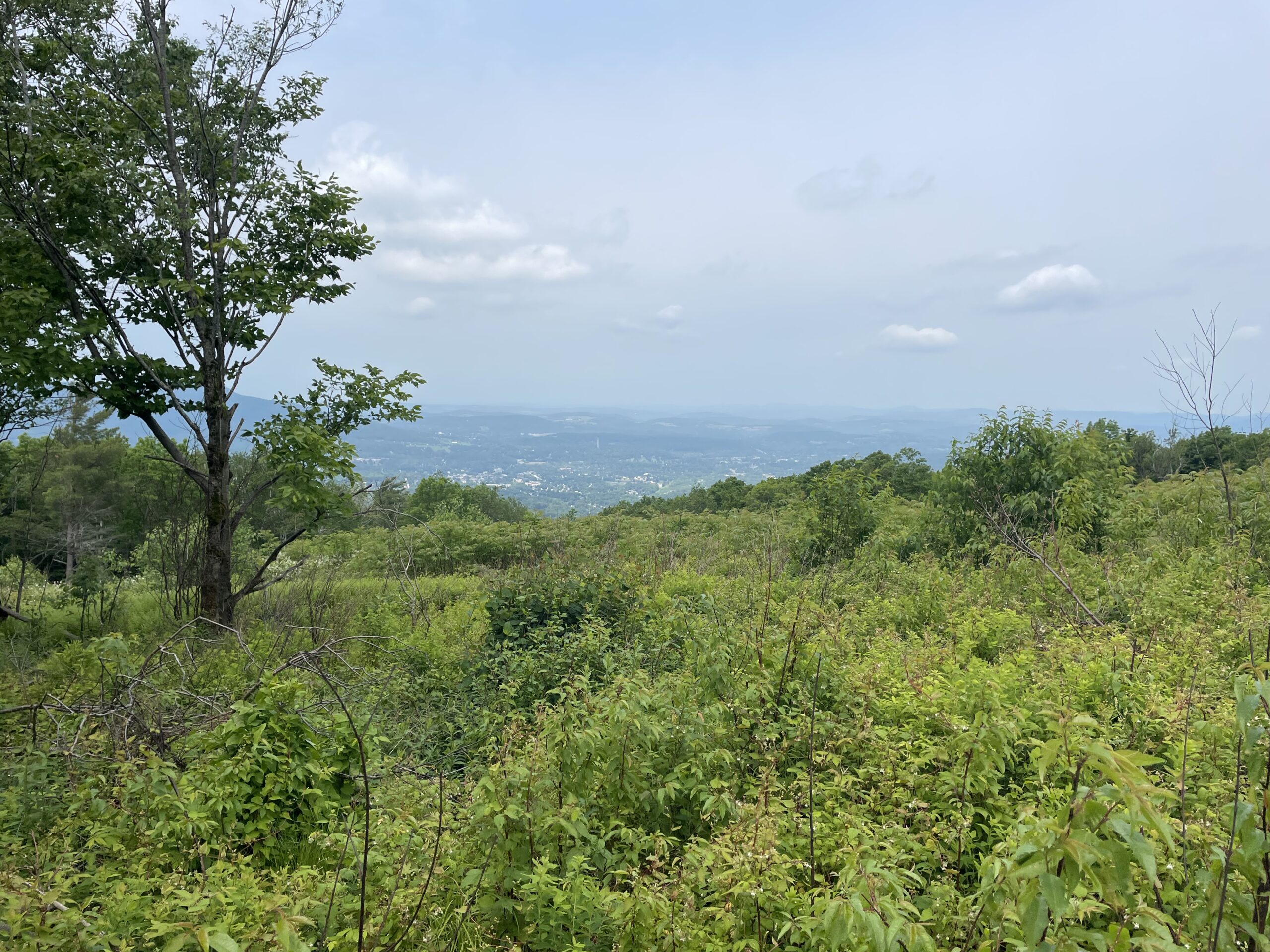
We made our way up and over our first point, Harmon Hill, which offered a majestic view of Bennington below and the eastern Adirondack mountains beyond.
Then we descended what seemed like an unending winding staircase of rock upon rock all the way down to Route 9. Upon crossing the road we encountered not one, but two extravagant spreads of trail magic. As if suddenly crashing a tailgate party, we sampled everything from apple cider donuts to potato chips, hummus, pineapple, and more. The timing couldn’t have been more perfect. Fifteen minutes later our motel host picked us up and we headed to Bennington for a zero day.
Day 56 – Bennington, VT – Zero Day
Up close, Bennington was not as charming as it appeared from above. A town of just over 15,000, it is Vermont’s sixth biggest population center. It boasted a Main Street with some commerce, and several notable historic buildings. But the grocery stores and other shopping was scattered on the highway outside of town. We took a local shuttle bus to buy groceries. The driver kindly dropped us off at our hotel, even though it was not on his route.


When we returned it rained heavily, but not before we sprayed our clothes with permethrin. Once again, we were glad to be in a hotel.
Day 57 – Route 9 to Kid Gore Shelter
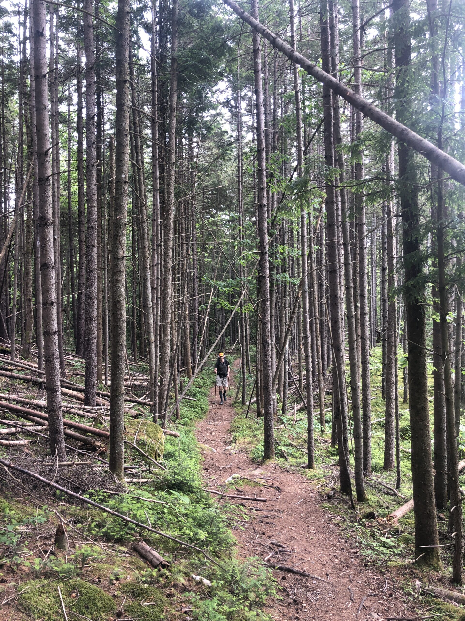
Today’s hike went through the Glastenbury Forest and then climbed Glastenbury Mountain. The route was a tangle of mud, rocks, and roots. Flush with rain, streams gushed through the trails. We couldn’t help but deliberate, if even for a few moments, before each muddy quagmire in a feeble attempt to avoid ankle-high submersion. Even still, our feet had no chance of staying dry. The air was cold, even colder at the higher altitudes. But at least the rain was now done. And our feet always dried out as we walked through the less soggy sections.

We arrived at the shelter, known for its sunrise view, around 5:00 with plenty of time to relax. We reconnected with Reset and No Joke, whom we had met the day before at our hotel in Bennington. It had been several weeks since we made a fire and, given the temperature, it seemed like a good evening to make one. We did not have fire starter, or even olive oil, but I recalled that I had some plantain chips from the previous trail magic. They had just enough oil in them, and when combined with a few pages ripped from No Joke’s paperback, we managed to get the damp wood going. I was glad to use the chips up because they really didn’t taste good in the first place.


Day 58 – Kid Gore Shelter to Stratton Pond Shelter
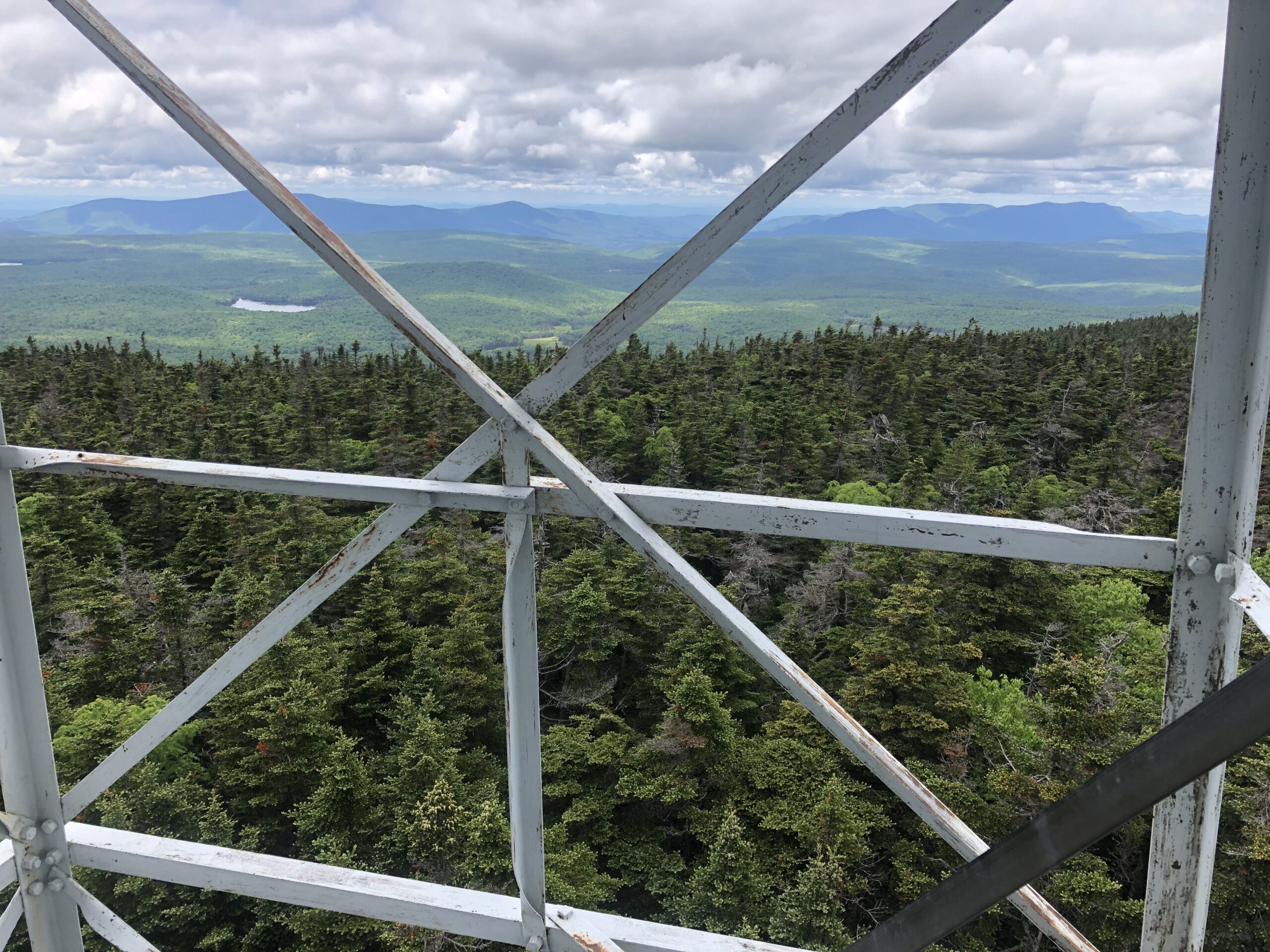
Before we could enjoy Stratton Pond, we had to climb Stratton Mountain. It was a 1,700-foot climb over four miles to a peak just under 4,000 feet. The top is marked with a fire tower, which we climbed up for 360-degree views that took in New York, Massachusetts, New Hampshire, and Vermont. Fortunately, the skies were clear enough to reveal this expanse.

After descending its western side, we arrived at Stratton Pond Shelter. The sun was shining and the pond was surprisingly not icy. We swam amongst the loons, got cleaned up, then made dinner in the shelter with Reset and No Joke.

Day 59 – Stratton Pond Shelter to Manchester Center
Today was a short hike that was supposed to be an easy 10.5 miles downhill to Route 11/30. We had arranged a ride into nearby Manchester Center with Sargent Pepper, who was spending a few days there with his wife.
The morning was mostly uneventful, but the weather was getting hot and the hike sneaked in a couple of steep and rugged climbs along with a few challenging stream crossings before finally meeting the road. I was spent and ready to be at our hostel.
But before that could happen, we had to eat lunch and buy groceries for the next four-day leg. Ramen and tuna? Instant potatoes and tuna? Maybe a different flavor of pop tarts? The choices have become stultifying.
More uplifting was Manchester Center, a beautiful town in a dramatic green mountain setting. It had a cohesive and vibrant Main Street that successfully combined new buildings and services with the old part of town, even including grocery stores. We got the feeling it was a well cared for place.
Once at the Green Mountain House Hostel, we soaked up the beautiful setting and the wonderful amenities. We reconnected with Ringo, who we had met coming out of Bascom Lodge several days ago.


We got to talking about New Hampshire and started comparing itineraries for the future section through the White Mountains. Everyone has some anxiety about The Whites. It is the least hospitable and most challenging part of the AT, with parts that can slow a hiker down to almost one mile an hour. Some of it is above the tree line and does not lend itself to “decide as you go” tenting. Instead, hikers stay in lodges, called “huts,” with bunk rooms. The huts are run by the AMC, include dinner and breakfast, and even though they are a bit pricey, the reservations fill up. We really wanted to reserve a few nights in the huts. At the same time, bad weather can upend precisely laid out hiking plans. Thus, it can be hard to know just how much to plan ahead. But plan ahead we did, mapping out our course through New Hampshire and reserving four huts.

Day 60 – Manchester Center to Griffith Lake Tentsite
After a delicious breakfast of eggs, bacon, and strawberries, our host dropped us back off at the trail head. The weather was a perfect cool temperature with partly sunny skies. From there we hiked up Bromley Mountain, which is part of a ski resort. Fortunately, the trail did not climb up a black diamond course. At the top we had magnificent views in all directions.


Today’s destination was Griffith Lake, another great place to swim. We set our tent up on a platform near a mother and her daughter, Julia, who were out for an overnight backpacking hike. An eight-year-old fountain of enthusiasm, Julia liked to do things like sing songs that she made up, take requests for cartwheels, attempt to catch little fish with her hands, and generally entertain her new neighbors. She was not tethered to a device, and her mom gave her a pretty long leash. I felt like the year was 1972, when I too would have been eight.

Down at the lake we saw that our tent neighbors did not have a good way to filter water, so we offered to filter water for them. Soon after, we were playing in the water together, cooking and eating dinner together, then playing a long and eventful game of Uno. Eventually Julia won, and then asked us how old we are. We told her and then we all went to bed.
Day 61 – Griffith Lake Tentsite to Bully Brook Tentsite
Due to a few days without rain, the mud has significantly dried up. It is still mud, but not the kind that wants to hold on to your shoe. Instead, it is soft and feels a bit like walking on a memory foam mattress. That is when it’s not interrupted by roots and rocks.

Even without rain, there is an abundance of water almost everywhere we look and listen. From glacial ponds, to waterfalls, to ground trickles, finding water is not an issue.
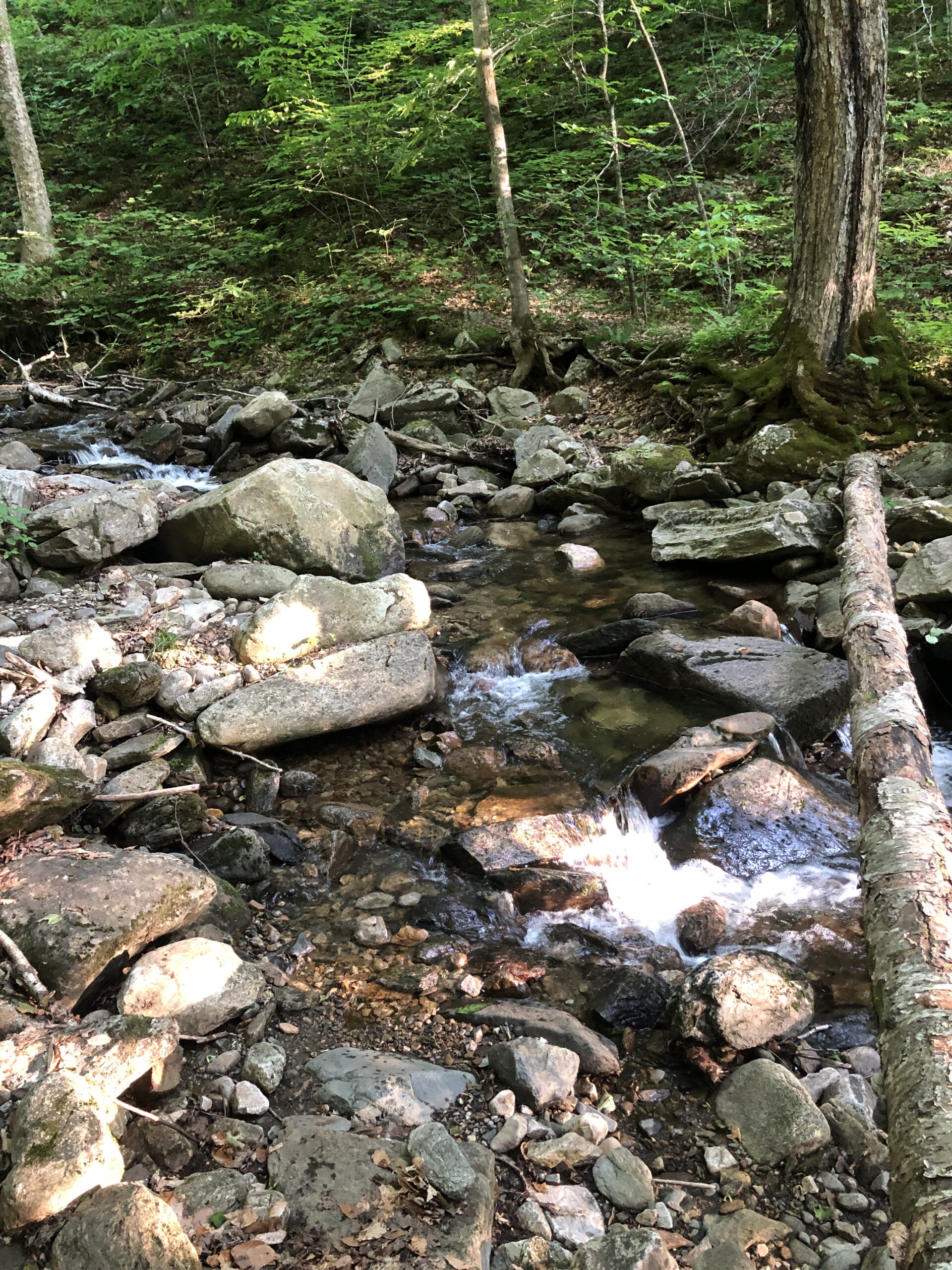
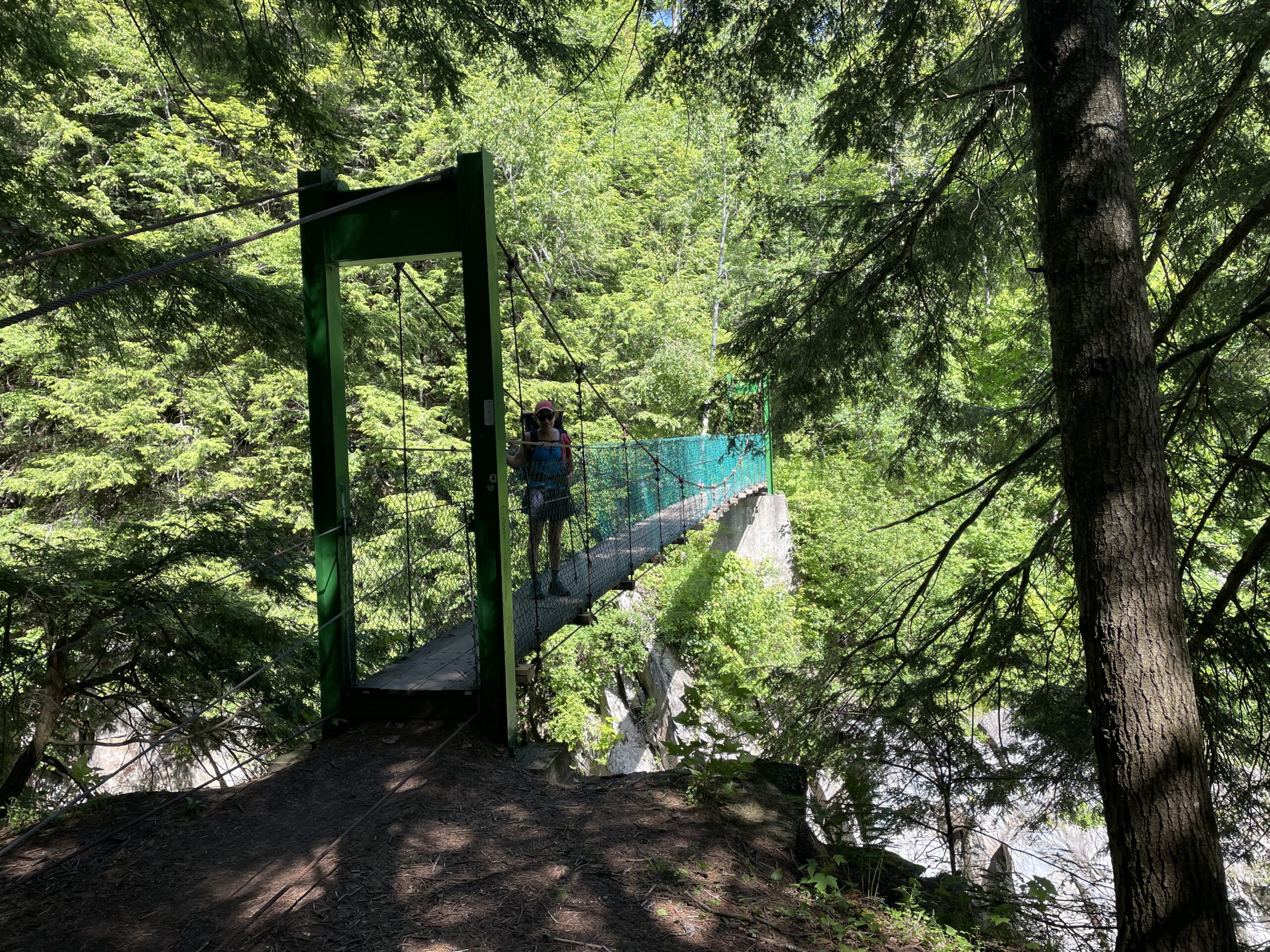
Most stream crossings are accomplished via rocks or logs, but the bigger ones are crossed by wood bridges. We walked across a beautiful suspension bridge today as well as along idyllic Little Rock Pond. We also walked through White Rocks Junction, an intriguing rock garden that seemed to be the product of many years and many hands.


Vermont also has the most attractive, functional, and well-built shelters we have seen so far. Many are constructed with heavy timber using traditional mortise and tenon joints with wood pegs. They are covered with ribbed metal roofs. Little Rock Pond Shelter was an especially nice design, with roughly one half of the space devoted to bunks and the other half organized around a table with wrap-around seating.


The day ended at a tent site alongside a rapidly flowing stream with waterfalls.
Day 62 – Bully Brook Tentsite to Governor Clement Shelter
We got a very early start today, but could not beat the heat and humidity. At multiple streams we attempted to cool off one limb at a time, including neck and head, with the help of a bandana. Clarendon Gorge was the most dramatic stream, with large white boulders in a ravine that was too deep to access. A narrow suspension bridge carried us over it to a nearly straight uphill rock climb on the other side.
A farm stand became our device charging station as well as a mini resupply spot for tonight’s dinner and tomorrow’s breakfast. This resulted in one of the most unusual trail dinners – an arugula salad mixed with wine and garlic salami, topped with maple syrup. It was almost a gourmet meal, except that we ate it with spoons.
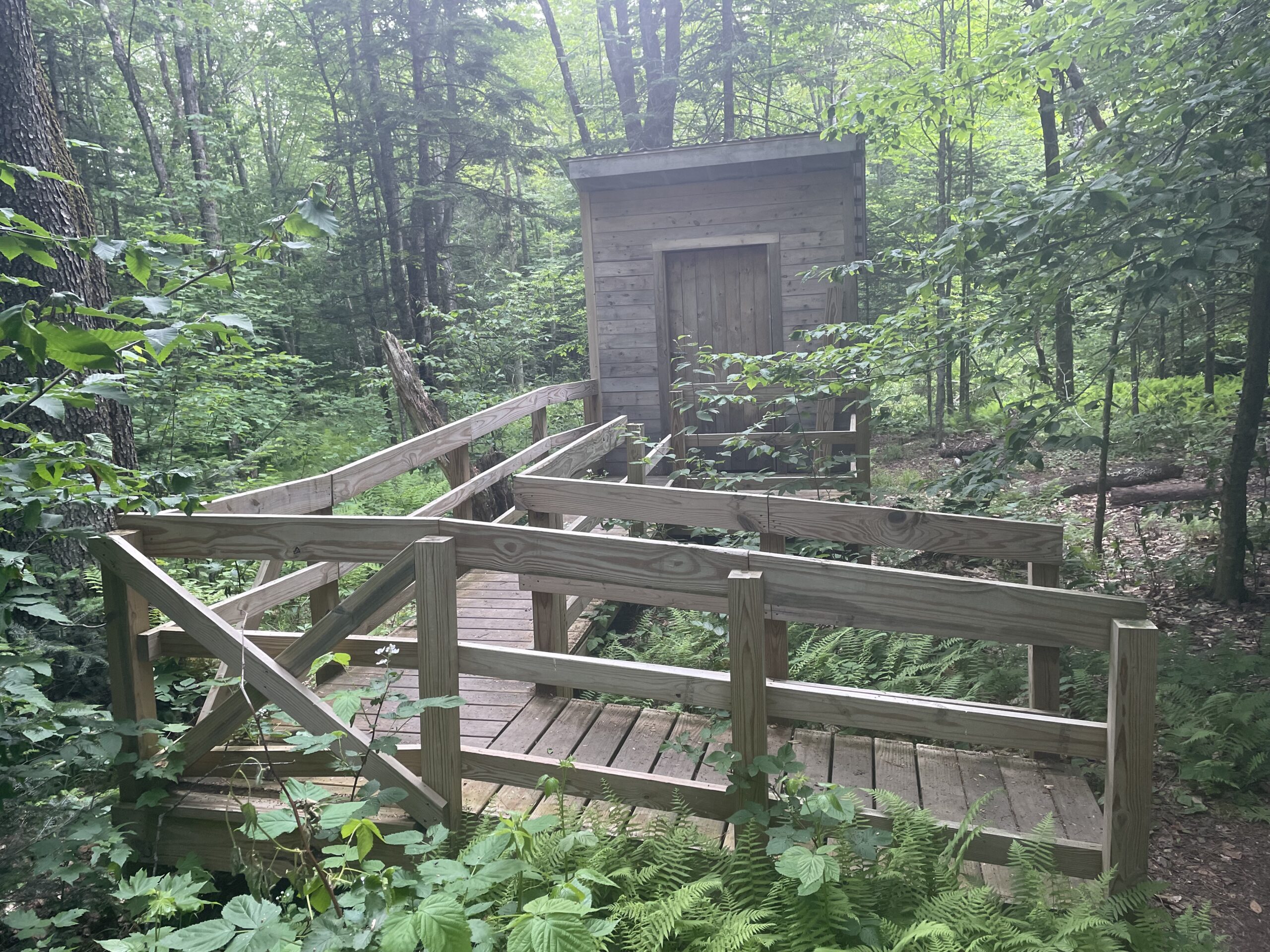
Our destination was the Governor Clement Shelter. It was positioned part way up the slope to Killington Mountain, Vermont’s second highest peak. It had a brand new handicap accessible privy, which was the source of bewilderment and humor. This actually wasn’t the first one of its kind that we’ve seen. I can just picture the builder scratching his head in confusion.
Four of us stayed in the shelter instead of tenting since the forecast called for overnight rain. One rafter was already occupied by a nest of birds that had marked the floor below with droppings. No one set up underneath them, but one late arrival hiker slept on the ground under the porch roof.
Soon enough, several other hikers joined us, including Sargent Pepper. He had just gotten a cortisone injection in his knee in nearby Rutland, and mentioned that Root was getting a shot, too. Then he mentioned that Short Rib broke her ankle and had to get off the trail. Meanwhile I learned that Sugarfoot was also off the trail due to his concussion. I tucked in uneasily with anxiety about the potential for injury given the upcoming increasingly difficult terrain.
Tomorrow we would continue our climb up and over Killington, most likely in the rain.

Day 63 – Governor Clement Shelter to Inn at Long Trail
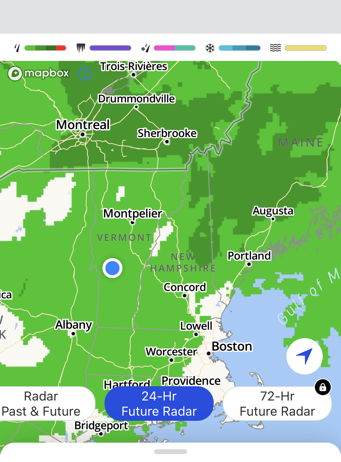
By 5:15 a.m. we were hiking uphill and it was already humid. It did not in fact rain very much at all last night. Nonetheless, the radar indicated a large green and orange blob moving toward us. It was bound to downpour at some point.
The climb was relatively gradual and easy. Several large, impassable trees blocked the path and sent us on a mini bushwhacking expedition. Once on top there was no view, so we had a snack and continued downward. By 9:15 it began to rain and by 11:00 we arrived at the Inn at Long Trail. We were wet, but not sopping.
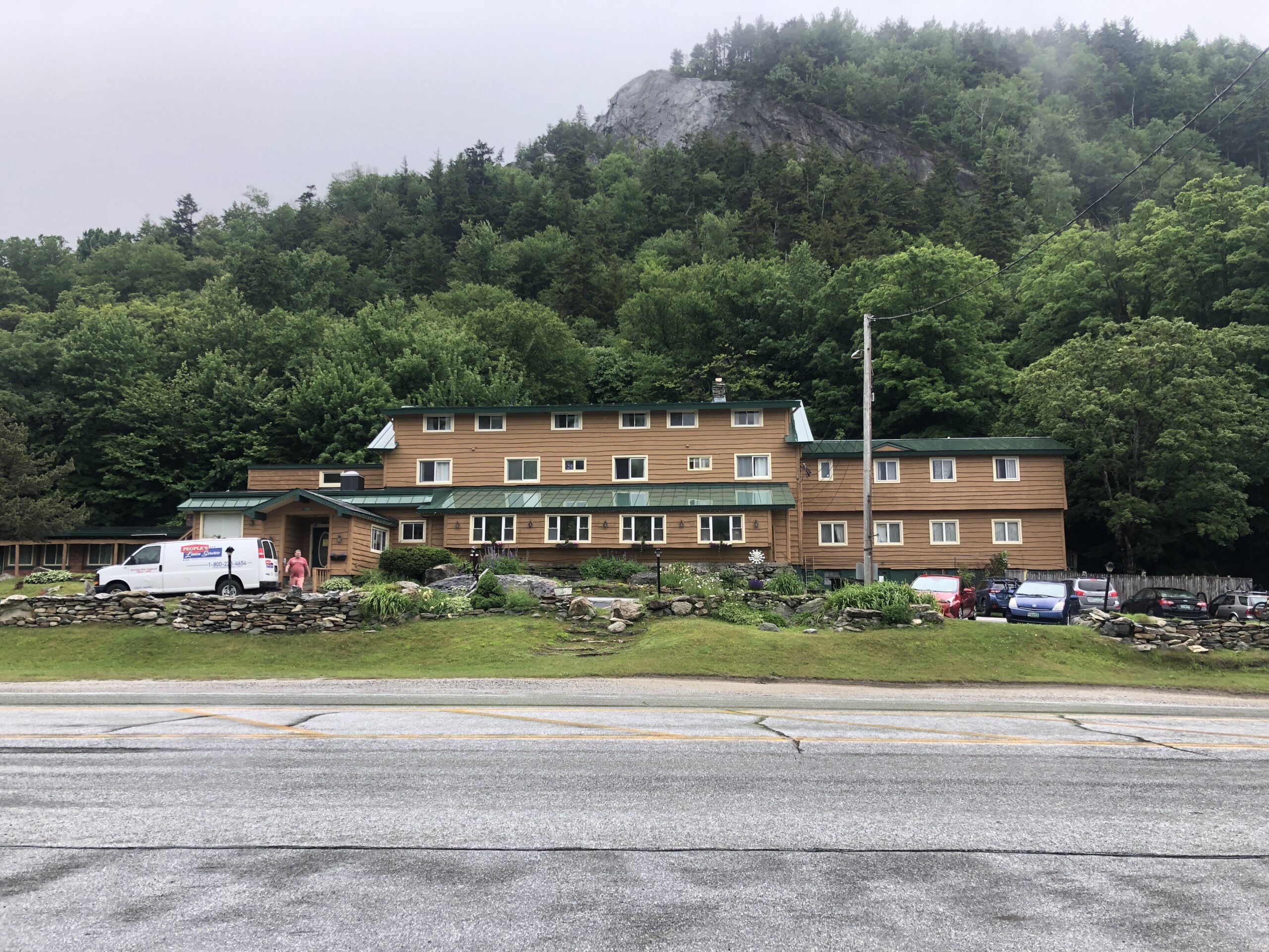
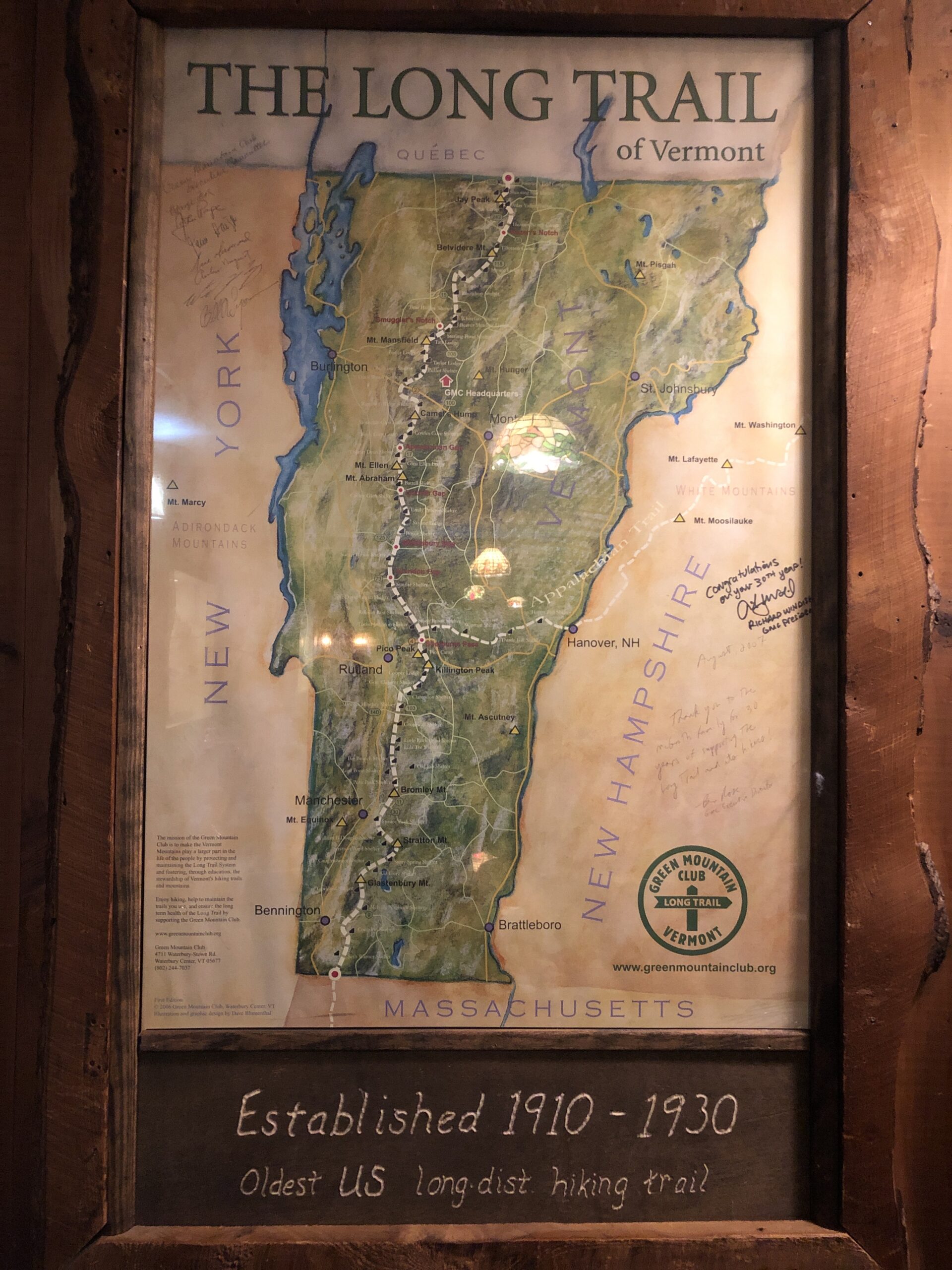
Vermont’s Long Trail runs north-south from North Adams, MA to the Canadian border. The AT follows the Long Trail for the first 100 miles. The Inn at Long Trail is positioned in the Shelbourn pass, where the AT and Vermont’s Long Trail diverge.
Later at the inn’s pub we recognized a trio of completely drenched and weary hikers who straggled in carrying a large box of trail magic Dunkin’ Donuts. They were kind enough to share a couple with us. We returned to our room and watched it downpour for hours. Once again, our timing for indoor lodging was very lucky. But our luck was running out as the next several days looked like nothing but rain and thunderstorms.

Day 64 – Inn at Long Trail – Zero Day
After having carefully mapped out the next 18 days of the hike, including making reservations at four huts in New Hampshire’s White Mountains, we were confronted with a ten-day forecast of rain and thunderstorms. Do we press on because, after all, hiking in the rain is just part of it, and we don’t want to delay our progress? Or do we insert a couple of zero days to postpone Mount Moosilauke, the first challenging 4K peak? We don’t anticipate being at that point until a week from today, and by then things could greatly improve.
In the meantime, we took the bus into Rutland where we bought a few days’ worth of food and went to lunch. We ate at the Yellow Deli, a place I had read about as being run by a cult. The atmosphere was so inviting and the food was so good that it was easy to overlook the back story. Later on the bus ride home Kevin read about the organization in greater detail and suddenly our lunch didn’t sit so well.

Day 65 – Inn at Long Trail to Lookout Shelter
The AT diverged from the north-bound Long Trail by heading east toward the Connecticut River, which divides Vermont from New Hampshire. In so doing, it cut across several rows of hills. All day was nothing but up and down, like a roller coaster. The total elevation gain was almost 5,000 feet. The humidity was almost 100%. The rain that was forecast for midday did not fall till about 5:30. At that point we still had almost two miles to go.
Today had proved to be our most difficult day in Vermont, so it was a great relief to arrive at the Lookout Shelter. We shared it with six other equally relieved hikers, but it was so spacious that it could have held twice as many.

Lookout Shelter is unusual. It is a privately owned enclosed cabin. It has a door, windows with screens, a loft, and a lookout platform on the roof. It does not, however, have water. This required us to carry 6L up from the closest stream prior to it, which was 2.5 miles downhill. It was worth it, though. I always like my CNOC bag shower.
 The next morning the others commented on last night’s thunder and lightning storm. Fortunately, we slept through it. We did not climb the lookout tower because there was no view other than a dome of white sky.

Day 66 – Lookout Shelter to Thistle Hill Shelter
“We have seven peaks and six valleys today,” I announced this morning. We knew the hike would be similar to the day before, but with less overall elevation gain. What we didn’t know was just how much and how hard it would rain. At first the rain was generally manageable because we were in the forest. It stopped long enough for us to eat part of our lunch on a bench with a beautiful view. Then suddenly it started pouring again. We scrambled to put everything back in our packs and head into the woods. It rained even harder just when the trail exited the woods traversed long stretches across open fields of tall wet grass and soggy, muddy ground. All we could do is continue.

We arrived at Thistle Hill Shelter around 3:30 and within minutes the rain exploded to three times its intensity and did not let up for almost two hours. We were soggy, but actually felt lucky to have avoided this last big downpour. We hung our belongings up on every available nail and peg so they could pretend to dry. Then we waited for the rain to stop so we could ironically collect water to filter.


We had enough cell service to see that these heavy rains were going to continue for another ten days. This threatened to derail our carefully planned schedule.
Day 67 – Thistle Hill Shelter to Hanover, NH
Yesterday evening, I was reading a description of an upcoming section when I came across the acronym PUD. I hadn’t heard this term before and couldn’t figure it out. I asked my new friend Bad Bats, a former first grade teacher. She replied, “PUD, oh that means Pointless Ups and Downs.” Well, I thought to myself, it’s interesting that there is an agreed upon term for it all.
The last three days of Vermont, from Rutland to the NH line had been 45 miles of PUDS. Much of New York before Harriman State Park was filled with PUDS in the form of rock piles. Parts of New Jersey were peppered with them, too.
Of course, there are a lot of PUDS in life in general, so it’s not surprising that the AT would be full of them, too. I anticipate that NH will have a higher percentage of rewarding summits than most states.

We entered NH at around 1:30 where we strolled down its swanky Main Street and headed straight for our free through-hiker donuts at Lou’s Diner. After that we enjoyed free pizza and sodas at Ramundos. Shortly after we arrived at our hostel, the sound of thunder filled the air and more heavy rain fell from the sky for hours and hours.


This website contains affiliate links, which means The Trek may receive a percentage of any product or service you purchase using the links in the articles or advertisements. The buyer pays the same price as they would otherwise, and your purchase helps to support The Trek's ongoing goal to serve you quality backpacking advice and information. Thanks for your support!
To learn more, please visit the About This Site page.

Comments 1
Hope your coming days are a little drier!