New Hampshire – to Gorham
Day 68 – Hanover to Moose Mountain Shelter
Clean, dry, and refreshed, we were ready for the most difficult state on the AT, New Hampshire. We exited Hanover by 9:00 and hiked a relatively easy route that gently climbed up to Moose Mountain. An entire day without rain felt like a luxury, even though the trail itself was a constant reminder of just how much rain fell in the past few days. Our feet were nearly always wet. But at least we hadn’t had any bad falls or accidents.
We learned about a few more fellow hikers who have decided to call it quits, because of the weather, injuries, or both. Given the long-range rainy forecast, we decided to monitor the weather in 3 to 4 day chunks and modify our plans as needed.

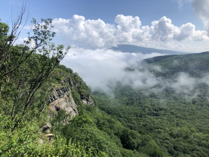
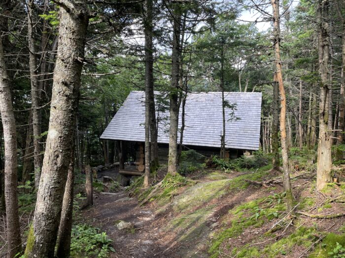
Moose Mountain had a great view and the nearby shelter did, too. It was a good place to celebrate our 32nd wedding anniversary with dinner sandwiches we purchased that morning in Hanover. Tomorrow would be an extra hard and long day. It was best not to think about it too much now.
Day 69 – Moose Mountain Shelter to Jacob’s Brook
The fog burned off as we walked along the ridge of Moose Mountain, revealing the surrounding mountains and valleys. We had a day of big climbs and descents, made harder by hot and muggy air. Streams and ground water flowed intensely, making much of the trail a liquid obstacle course.
Highlights of today’s hike were Lambert Ridge and Smarts Mountain. A fire tower on Smarts Mountain provided vast views of spruce covered mountains and valleys that extended indefinitely in all directions.
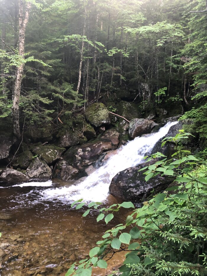
By the time we got to Jacob’s Brook we were very hot, sweaty, and tired. We found a good stealth tent site and then soaked in a pool of cold water below the waterfall.
Day 70 – Jacob’s Brook to Hikers Welcome Hostel
Today we climbed Mount Cube, with its quartzite ledges and quartzite bits mixed throughout the trail. We quickly learned which rocks to trust and which to avoid at all cost. Setting foot on even a small patch of polished gray or white quartzite resulted in a quick trip to the ground.
The top was a dramatic rock and krummholz landscape, where stunted, wind blown trees struggle to survive. We saw little else in the cloak of dense white clouds.
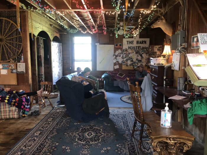
On our way down we ran into O.G. and Boston, surprisingly heading south. They were doing a slack pack from the nearby Barn Door hostel. This meant that even though they are northbound hikers, they got a shuttle north to Kinsman Notch in order to hike south over Mount Moosilauke back to their hostel. This is a popular thing for hikers to do, although we have yet to try it. We were happy to reconnect after seeing very few through-hikers today, and also to see that O.G.’s nose healed entirely and without scars.
Day 71 – Hikers Welcome Hostel
4795 foot Mount Moosilauke is famous for its north face which follows a steep, mile-long chain of cascades, water slides, and plunges, collectively known as the Beaver Brook Cascades. This slope is considered dangerous in the downhill/northbound direction, especially when wet. The forecast called for light rain in the morning and heavy rain in the afternoon. We preferred to be climbing up along the Cascades in the morning rather than down it in the afternoon, so we got a shuttle in order to hike Mt Mousilauke southbound. Thus we officially joined the “shuttle north to slack-pack south” community, something we would have previously avoided.
Many trails are constructed with varying degrees of stone steps, wood blocks, and steel rebar ladder rungs. But this trail was truly an impressive work of engineering and art. I could not find anything explaining its history, who constructed it, and how it was built. I could only imagine a group of brawny men essentially figuring it out on site, dragging and assembling rocks, carrying up wood, steel, and tools, and working it out as they went.
Once we emerged above the tree line, the atmosphere turned spooky in the cold and misty air. Massive cairns stood out like lighthouses in the fog, marking the summit trail in an otherwise open alpine landscape. There were no views, but it was dramatic nonetheless.
As we headed down Mount Moosilauke, the rain increased substantially. Because the ground doesn’t drain well, water gathers and ponds. Muddy sections were the size of large wading pools, with few if any way to get across them. We arrived at the bottom in about 6 hours, and could see and hear the road. But first we had to cross a 25 foot wide stream. Somehow there was no bridge or even stepping stones to traverse it. We saw no reason to spend time figuring out an alternative route and instead walked directly through the fast moving water. This did have the effect of cleaning the mud from our socks and shoes before arriving at the hostel.
Day 72 – Hikers Welcome Hostel to The Notch Hostel – Zero Day
The day began with a torrent of rain and then suddenly cleared up during our 30 minute shuttle to The Notch Hostel for our zero day. Our shuttle driver was excited and pulled off the road to point out the Franconia Ridge with Mount Washington looming in the background. It turned out that we didn’t really need a zero day since we got plenty of downtime after completing yesterday’s hike by 2:30. Nonetheless, we had a few packages arriving at The Notch and had a reservation in place. We arrived before 8:00 am and got the lay of the land. Then we mostly just idled.
It was kind of painful to spend the beautiful, partly sunny, rainless day at a hostel with little to do except laundry and a resupply. It was especially painful since we had to head out tomorrow in what looked to be another day of rain and thunder.
Day 73 – The Notch Hostel to Eliza Brook Shelter
Weather patterns shifted, postponing today’s thunderstorms till around 3:00. This meant we started our hike dry. We climbed up to the Kinsman ridge, then followed it to Mount Wolf. The trail was grueling in both up and down directions. A continuous jumble of slippery roots, rocks, mud, and water made for a slow and challenging journey. Ironically, the slipperiest surfaces were the wood planks laid over boggy sections. As I walked across one, my feet suddenly flew out in front of me as though I had stepped on to an icy sidewalk. Fortunately I landed directly on my back, cushioned by my pack.
We arrived at the well-crafted Eliza Brook Shelter by 1:00 and ate lunch. It was too early to stop for the day. We debated continuing another 2 very steep and technical miles up and over the twin 4K peaks of Mount Kinsman, followed by 2 more miles down to the next shelter. Another lunchtime hiker, Skittles, joined us at the shelter. She was mulling the same plan. After studying the elevations and commenting how humbling NH was, decided to plow forward.
But we were hesitant to climb further, only to emerge on an exposed top in time for the 3:00 thunderstorm. We also liked the fact that we were currently dry, and wanted to stay that way. So we decided to stay put. By 3:00, thunder rumbled off and on for a few hours. At the same time, the sun came out. We could only wonder what Skittles experienced on top of the Kinsmans.
Day 74 – Eliza Brook Shelter to Liberty Springs Campsite
Last night was July 4th, but we had no celebration and heard no fireworks. Instead the sound of thunder closed in on us and played for hours. At times it sounded like piles of rubble being dragged across the roof. Fortunately we were snug in a shelter.
Today’s forecast was excellent, and we got a very early start to tackle one of the most technical climbs in the Whites. The trail up to the Kinsmans was very slow going. Very little if any ground was covered by walking. Most of it was rock climbing, often assisted by using trees and roots as handholds. Each step moved us a tiny bit closer to the top. The sky cleared up over the course of the morning and when we reached the top we could see the dramatic Franconia Ridge, tomorrow’s destination.
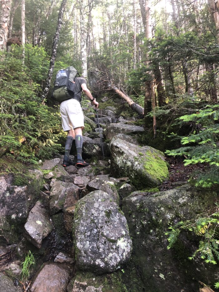 The descent was almost as difficult, but eased up about halfway down where the picturesque Lonesome Lake sat in a crinkle on the mountain side. We popped into the eight-sided Lonesome Lake Hut for a much needed break. No one was there but the cook, who offered us a sizable portion of free leftover breakfast. Cold oatmeal with brown sugar and maple sausage hit the spot.
Lonesome Lake in its spectacular setting was a tempting place to stay and swim. But we had to make our way down to the Franconia Notch, where I-93 passes through the mountains, and back up the opposite side to the campsite at the base of the Franconia Ridge.
Day 75 – Liberty Springs Campsite to Galehead Hut
Liberty Springs Campsite is positioned at the base of the famous Franconia Ridge, and as such is a very popular spot. We won the weather lottery today and were treated to spectacular views in all directions along the winding ridge. Lots of northbound, southbound, and day hikers congregated along its many view points in an impromptu open air celebration. It was hard to leave it behind, but we were motivated go forward, up and over Mt Garfield, to get to our first White Mountain hut.
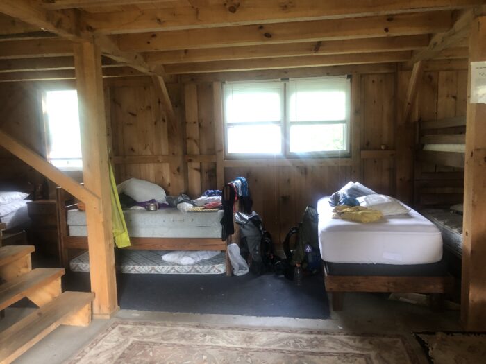
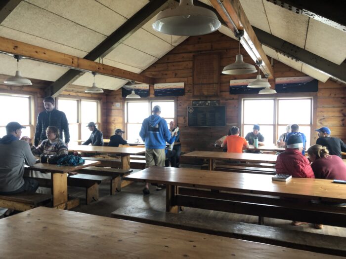
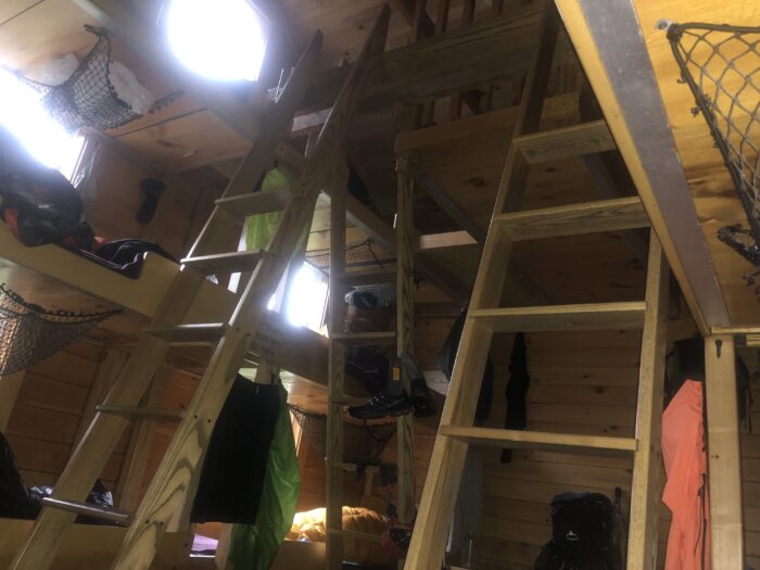
 Galehead Hut sat on a ridge part way up South Twin Mountain. Its long front porch looked out into a bowl, where it captured cool breezes. The main room was a double height volume, with games, books, maps, and long dining tables. Facilities included bunk rooms, bathrooms with composting toilets, and running water, but no electricity. This is typical for the AMC huts. The huts are run by a “croo” of 3-4 young adults. The croo cooks, cleans, serves meals, entertains the guests, and provides general assistance. They also hike in the fresh food and hike out the garbage. All the heavy items are brought in or out by helicopter.
Dinner was served family style. We had a great time meeting mostly short term hikers as we ate soup, lasagna, salad, and lemon cake.
Day 76 – Galehead Hut to Ethan Pond Shelter
I got very little sleep last night due to an extra loud and constant snorer in our bunk room. Even after blowing up my sleep pad and relocating to the common room, the night was a mostly lost cause. This is always a risk when staying in a bunk facility, although it has been surprisingly quiet so far in the hiker hostel bunk rooms. To add to my headache, I discovered that I somehow lost my third pair of sunglasses.
The day began with a hearty breakfast, which came in handy for our morning summit of South Twin Mountain and Mt Guyot, both treeless 4K peaks with impressive views. Then we made a long descent to Zealand Falls and stopped at the nearby Zealand Falls Hut for lunch and rest.
The afternoon forecast called for thunderstorms, which announced themselves as we made our way down to Ethan Pond Shelter. We made it just in time to watch the rain cascade off the shelter roof. The pond was especially beautiful, but unfortunately we couldn’t go for a swim.
Day 77 – Ethan Pond Shelter to AMC Highland Center
After an uncharacteristically short and easy walk, we arrived at the famous Crawford Notch on Route 302. Since there was no cell service, our plan was to hitch a ride up the road to the AMC Highland Center. We had been told this road was the hardest hitch spot in New Hampshire. No sooner had we set foot in the parking lot than a kind woman pulled up in her car with watermelon and drinks. Then she gave our new friend Spice and us a ride to the Highland Center. The trail has provided again, in this case instantly. We arrived by 9:30 am.
Once at the center I purchased new sunglasses. The clerk then shared 2 hiker boxes with us. Four of us rummaged through them and found a variety of new and useful things. It always feels like a combination of Halloween and Christmas when we hit a good hiker box. Then we ate lunch outside and enjoyed the beautiful weather. It was effectively a zero day.
We were halfway through the White Mountains in terms of miles, but not in terms of work. Tomorrow we were headed into the Presidential Range, and the weather did not look good.
Day 78 – AMC Highland Center to Lakes of the Clouds Hut
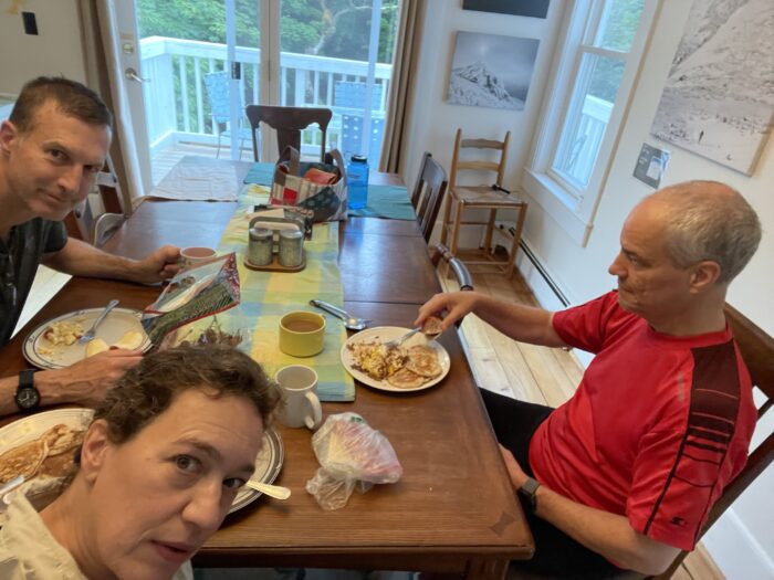
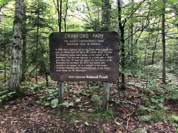
We ate our best breakfast on the whole trail today, especially enjoying superb apple fritters. After packing up we stood for 30 long minutes on the road below the entrance to the Highland Center, trying to hitch a ride back to the trailhead 3.4 miles down the road. It was 7:30 on a Sunday morning. Several cars pulled over, but not to pick us up. Instead they were pulling over to park at a nearby trailhead. We knew we had a long day ahead that might be interrupted by afternoon thunderstorms. After debating the options, we opted to forego the hitch and instead take the Crawford Trail directly from the Highland Center back up to the AT. This meant skipping the Webster Cliff Trail, which we had already hiked in 2017 and remembered to be quite challenging. In some ways it was a relief not to repeat it, but it was also a disappointment.
Hot and very humid weather created a tropical rain forest atmosphere, but the rain held off.
After reconnecting with the AT, we stopped at Mitzpah Spring Hut for a break. I waited at the hut while Kevin backtracked 1.6 mi to summit Mt Jackson. It was a small gesture to make up a portion of the Webster Cliff trail that we cut off.
We then continued upward to the alpine ridge trail, where the air was cool and crisp. The clouds rolled in and out, concealing and revealing views that looked like gigantic landscape paintings.
By 3:00 we arrived at Lakes of the Clouds Hut, at elevation 5031 in the saddle between Mt Washington and Mt Monroe. It serves as a base for hiking up Mt Washington as well as the other peaks in the Presidential Range, and is therefore a very popular spot. While these high-altitude huts look like charming shingle-clad lodges from the outside, their insides reveal welded steel frames. They wouldn’t sustain the snow and wind loads otherwise. We took a mini swim in one of the cold lakes, then relaxed with the guests before dinner.
Day 79 – Lakes of the Clouds Hut to Madison Spring Hut
I woke to the sound of wind and rain pelting the windows of our bunk room. The weather was grim, and the forecast delivered after breakfast was grimmer: heavy rain, 35 mph winds, gusts up to 60 mph, and possible lightning after noon. “I just can’t imagine going out in this weather”, commented one guest. The fact was, everyone had to go out into this weather unless they planned to stay another night, or even two, in the hut.
It wouldn’t be pleasant for anyone, least of all the guests who come up to the unpredictable and potentially dangerous White Mountains for a little hiking adventure. Most of the guests at the hut made plans to bail out by taking one of the quickest “exit” trails down to the Cog Railroad base, where someone would pick them up in a car. We didn’t have a good bail out option, other than to backtrack to Mitzpah Springs. But that didn’t seem like a good idea. So we decided to press on toward Mt Washington.
Two of the seven thru-hikers had already departed by 6:30. We departed around 8:00, followed shortly by the other three. Our original plan was to hike north on the AT to the Osgood Tentsite, at the base of Mt Madison and well below the tree line. But we knew we couldn’t make it that far, and that we didn’t want to tent in a downpour anyway.
Under good conditions this alpine stretch, which includes Mt Washington, Mt Jefferson, and Mt Adams, is rocky and challenging. With the relentless wind and rain, and the slippery lichen-covered rocky trail, it was dangerous and scary. The ground was saturated, with water flowing over our feet in many areas. Our pace was slow in these miserable conditions. Each time we crossed paths with a southbound hiker, I thought they were crazy. Of course, I also wondered about my own judgment.
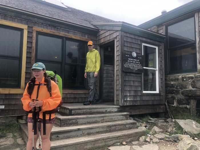
At 2:00 we finally made it to Madison Spring Hut, positioned right before the climb up Mt Madison. The value of four walls and a roof in a high-altitude storm cannot be overstated. Because it was not safe to continue, we stopped for the day and adjusted our lodging schedule. Fortunately they had bunks available due to multiple cancellations.
The contents of our packs were dry, so I could change into dry clothes. Kevin had only one set of clothes, though, which dried as he wore them. The rain came down even harder before three of our friends made it to the hut. Everyone was relieved to be indoors.
That evening we learned that many parts of the northeast were flooded after weeks of heavy rain. Tomorrow’s route to Pinkham Notch was steep and slippery, and crossed several swollen streams. Uncertain if we should proceed, we considered taking an exit trail from the hut down to Route 2 to find a hostel for a few days until conditions improved. This would postpone our progress.
Day 80 – Madison Spring Hut to Pinkham Notch
The day began with more rain, clouds, and very high winds. But there was good news. By 11:00 conditions were supposed to significantly improve. Working with tiny bits of intermittent cell service, we all studied the weather from every angle. We also pored over trail maps looking for alternative routes. We determined that the prescribed route over Mt Madison and down the ridge line to Pinkham Notch was, in fact, the best route. Then around 10:00 the sky magically cleared up and the sun came out. Everyone joyfully stepped outside to enjoy the now beautiful, albeit very windy, day.
The climb up and over Mt Madison involved a lot of bouldering. The wind was blowing hard, but the rocks were dry and no longer slippery, reducing the fear factor by a few notches. We took in massive views looking back across the Presidential Range, and down into the valley where the Androscoggin River winds past Gorham. The veil was lifted.
Then we made our way down below the tree line and eventually to Pinkham Notch. One rapidly flowing and very full stream presented a crossing challenge, but we held on to the branches of a fallen tree that lay across it and managed to get everyone across safely.
We arrived at Joe Dodge Lodge in the Pinkham Notch very tired and just in time for dinner. Getting such a late start made for a long day, but we were glad the weather eventually cooperated and that we decided to stay the course.
Day 81 – Pinkham Notch to Carter Notch
As if climbing up and over Mt Madison weren’t enough, today’s job was to climb up Wildcat Mountain. This climb is rumored to be the steepest climb on the AT. After reading the comments about it on Far Out, I was inclined to extend breakfast by another 20 minutes. But the weather was perfect and we knew we had to move forward.
The first mile was easy enough, following along some of the Ellis River and winding past Lost Pond. Then the trail took a left turn and became the standard straight up rock climb that is typical for NH. Except it was actually a well designed, fun climb. It felt more like an amusement park adventure when compared to the grueling task of ascending the Kinsmans. Even better, no rain fell from above, no water flowed over our feet, no heavy wind pushed us sideways, and the rocks were dry. It was an adventurous climb with fantastic views.

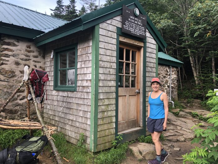
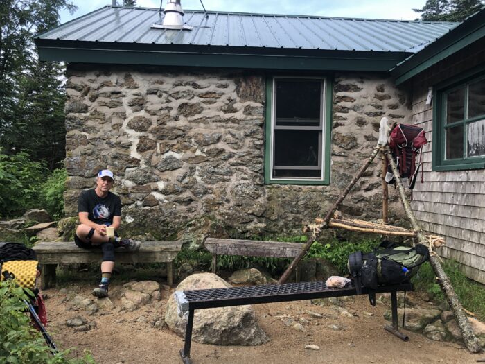
 Then we dropped down into Carter Notch. This descent was made relatively easy by the “staircase” trail design. We had planned to tent on the slope about 1/2 mile past the notch, but first stopped into Carter Notch Hut for water and a break. A few minutes later the hut host offered us a work-for-stay. I asked what my job would be and she replied, “probably cleaning the stove top”. I promptly noted that I knew how to clean a stove top and we sealed the deal. As work-for-stay hikers, we got free meals and lodging in exchange for work. We did have to wait to eat our dinner until after the paying guests ate.
Upon settling into our bunks, we unexpectedly ran into Sargent Pepper. He had been two days ahead of us, but he had a bad fall before Pinkham Notch and took a couple of days to recuperate. We were glad he wasn’t injured and that he felt good enough to tackle Wildcat Mountain today.
Then I went for a swim in the coldest pond yet. My arms were twitching, but it felt good for a short while.
Day 82 – Carter Notch to Imp Campsite
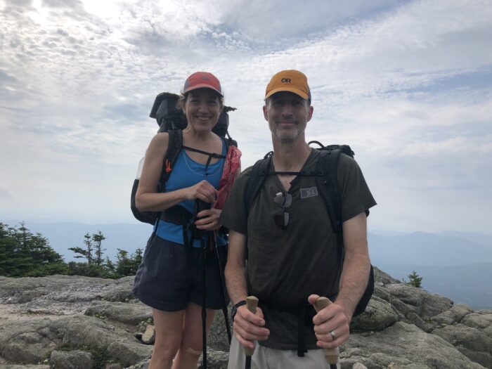
The trail from Carter Notch went straight up to the Carter Range to Carter Dome. Then we dropped slightly down to the rocky summit of Mount Hight, an arm of Carter Dome. From here we had 360 degree views of the eastern White Mountains, including a stunning view of the Presidential Range. We could also see some of the Mahoosucs in Maine.
After this we did a tricky descent that required more calculation than most. It was almost like playing the game Twister. Right hand on blue, left foot on yellow. The difficulty of hiking in the Whites isn’t over till it’s over. That would be tomorrow, after we climbed over Mt Moriah and then made our way to Route 2. We greatly looked forward to it.
We arrived at Imp Shelter by 1:00 and stopped early for the day. More rain was predicted, both for the evening and the next day.
Something bit my eyelid and the back of my neck the day before, and both spots continued to swell throughout today. I took an antihistamine and went to bed early.
Day 83 – Imp Campsite to US Route 2/ Gorham
At 9:30 last night, otherwise known as the middle of the night, five or six hikers came into the shelter. Their tarp-camping setup failed in the wind and heavy downpour. Fortunately they settled in quickly and everyone got back to sleep.
We got a very early start because, once again, afternoon thunderstorms were predicted. And we were anxious to get to Gorham for lodging, laundry, and food. Unfortunately the local hostel was booked, as were most of the hotels. But the hostel let us tent in their yard while still having access to all their services. It was less than ideal, but we made it work.
Day 84 – US Route 2/ Gorham – Zero Day
Thunder rumbled and lightning flickered throughout the night, but no storm ensued. It was a hot night outside, but apparently it was not much better for those in the bunk house.
We spent the day studying how to tackle the next the 10 days. We had about a day left in New Hampshire. Then Maine would begin with a bang. Its second day covers the Mahoosuc Notch, a gigantic mile long boulder field followed by the Mahoosuc Arm, another very steep climb of 1,500 feet in one mile. We definitely did not want to do this section in the rain.
Tomorrow’s forecast looked bleak, with 100% chance of thunderstorms throughout the day and almost 2” of rain. Starting out in that sounded like a bad idea. Wednesday’s forecast looked better, making it a good candidate for doing the Mahoosuc Notch. Delaying our start with a double zero weekend in Gorham started to make sense. Fortunately two indoor spots opened up for tomorrow night.
Day 85 – US Route 2/ Gorham – Zero Day
We got up early enough to take the tent down and move everything indoors before the big rain started.
This morning’s projects included replacing our trekking poles’ carbide tips. One of mine had fallen off, and the other one was worn down. Both of Kevin’s were worn down. They had gripped a lot of rocks. We sourced four good carbide tips from a pile of discarded poles in the hiker box. Paul, our hostel host, had grip-lock wrenches that we used to pull off the bad tips. The new tips came from different poles, but they each fit their new pole well and were a close enough match each other.
We reconnected with Ringo, who we last saw in Vermont. He had skipped parts of NH due to the poor weather, and now decided to call off the rest of his hike. The prospect of continuing into Maine, with its many fast, high-water stream crossings, and no relief from the rain, spelled exit for him.
This website contains affiliate links, which means The Trek may receive a percentage of any product or service you purchase using the links in the articles or advertisements. The buyer pays the same price as they would otherwise, and your purchase helps to support The Trek's ongoing goal to serve you quality backpacking advice and information. Thanks for your support!
To learn more, please visit the About This Site page.

 ">
">






















Comments 5
Great recap. The weather has been absolute crap and it was great reading about your challenges on trails I know well, some of which I’d never touch in those conditions!
Can’t believe I have not found this EXCELLENT vlog before. Now I have and I subscribed. So well written and interesting I can’t get over it. All the best to you both on you most excellent adventure and odyssey. Thanks guys.
Yikes!!!! Hang in there. Here’s to sunshine ahead.
Keep the news coming! I’m watching your braver-than-me and impressive progress and hoping I’ll be reading about receding stream levels soon. Maybe Katahdin will be in my September forecast. Good luck and continue to enjoy it.
This all sounds so intense. I just finally was able to read this since I no longer get the notices and had to back track. I cannot believe the amount of rain you all have had to endure, and hope that it has since dried out. It will be all down from here (with some uphills)!
Good luck.